Cost of Drone Filming Per Hour UK: 2026 Pricing Guide

What if the cheapest drone quote you receive is actually the most expensive risk your project can take? It’s a critical question in a niche but increasingly diverse market. When you’re trying to budget, the vast difference in quotes can be confusing, making it difficult to understand what’s included and, more importantly, if the operator is fully compliant with Civil Aviation Authority (CAA) regulations. Many businesses find themselves navigating opaque pricing structures, unsure of the true value they are receiving.

This guide provides the transparency you need. We’ll demystify the cost of drone filming per hour uk for 2026, breaking down how factors like pilot certification, specialist equipment, and essential commercial liability insurance shape the final price. Our goal is to give you the confidence to assess quotes effectively, ensuring you invest in a professional service that guarantees both safety and breath-taking results. From understanding the value of a CAA GVC certified pilot to distinguishing between raw footage and a fully edited production, you’ll finish this article with a clear framework for budgeting your next aerial project with complete peace of mind.

Key Takeaways

  • Learn the 2026 baseline for drone filming rates, including typical day rates and why a minimum booking period is standard for professional, CAA-certified pilots.
  • The final cost of drone filming per hour uk is shaped by critical factors like pilot qualifications and the specific drone technology required for your project.
  • Discover why hourly rates can be misleading by understanding the essential ‘hidden’ costs, such as mandatory pre-flight risk assessments and post-production editing.
  • Compare the cost-effectiveness of professional drone services against traditional methods for tasks like roof inspections to see the potential for significant savings.

Understanding the Average Cost of Drone Filming Per Hour in the UK (2026)

Determining the true cost of drone filming per hour uk requires looking beyond a simple hourly figure. For 2026, the market baseline for a fully certified and insured professional pilot sits between £150 and £250 per hour, with full-day rates typically ranging from £600 to £1,200. These prices reflect not just the time the drone is in the air, but the comprehensive professional service that ensures safety, legality, and high-quality results. This includes pre-flight risk assessments, airspace checks, travel, and the use of high-end commercial equipment.

To better understand the factors that build up to these final costs, this short video provides an excellent overview of the UK commercial drone market.

Most professional operators enforce a “minimum 2-hour booking” policy. This industry standard exists because a significant portion of any job involves non-flight tasks. The pilot must travel to the site, conduct a thorough on-site survey, prepare the equipment, and complete pre-flight safety checks required by the Civil Aviation Authority (CAA). A one-hour flight can easily demand three hours of total professional time, making bookings under two hours financially unviable for a legitimate business.

Hourly Rates vs. Half-Day and Full-Day Packages

While an hourly rate is a useful benchmark, package deals offer superior value for planned projects. A half-day rate (typically 4 hours on-site) is often the sweet spot for residential and commercial property marketing, allowing sufficient time to capture multiple angles, lighting conditions, and detailed shots without rush. For larger-scale operations, such as construction site monitoring or event coverage, a full-day rate (8 hours) is the most cost-effective solution. It secures the pilot’s availability for the entire day, enabling them to capture key project milestones as they happen. The base rate is the foundational cost for engaging a professional, CAA-certified pilot with commercial liability insurance for any project.

The Price of Experience: Pricing Tiers in 2026

The UK drone market operates on distinct tiers, and the price directly reflects the level of qualification, equipment, and risk management involved. Understanding these tiers is crucial for protecting your project and ensuring legal compliance.

  • Entry-level / Hobbyist (The “£50/hr” Trap): Operators advertising extremely low rates often lack the mandatory CAA certifications and, critically, commercial liability insurance. Hiring an uncertified pilot for a commercial project is illegal in the UK and places all legal liability directly on you, the client.
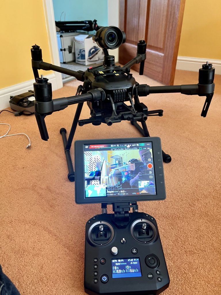
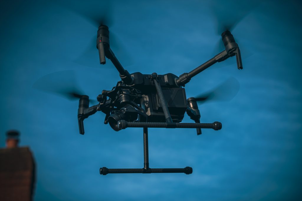
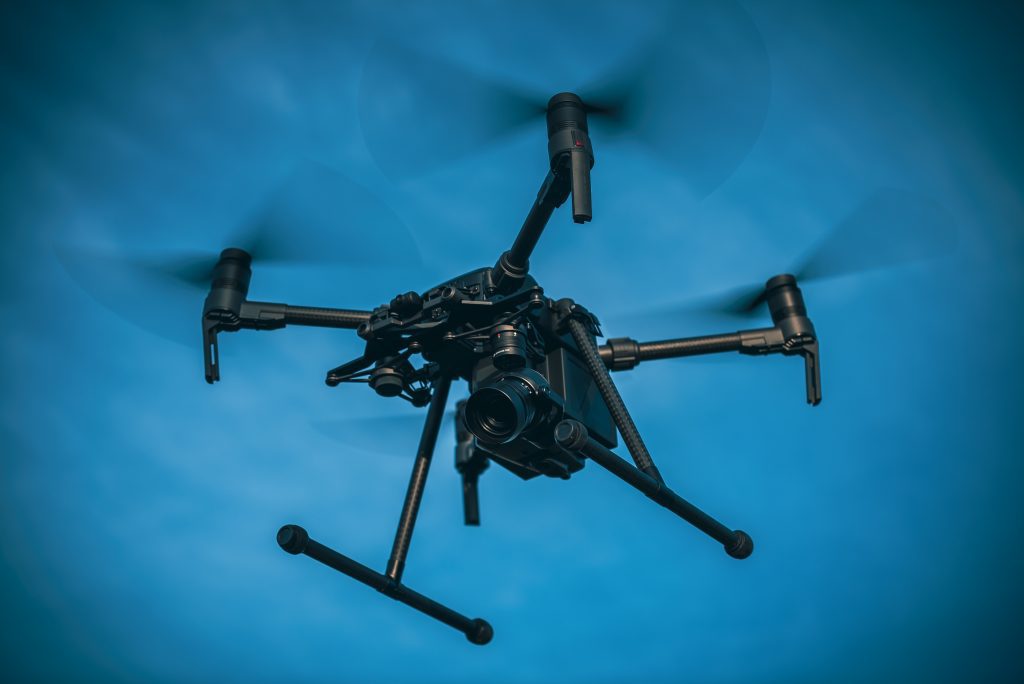
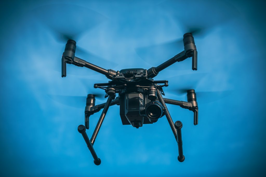
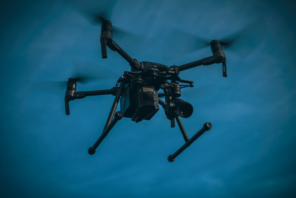
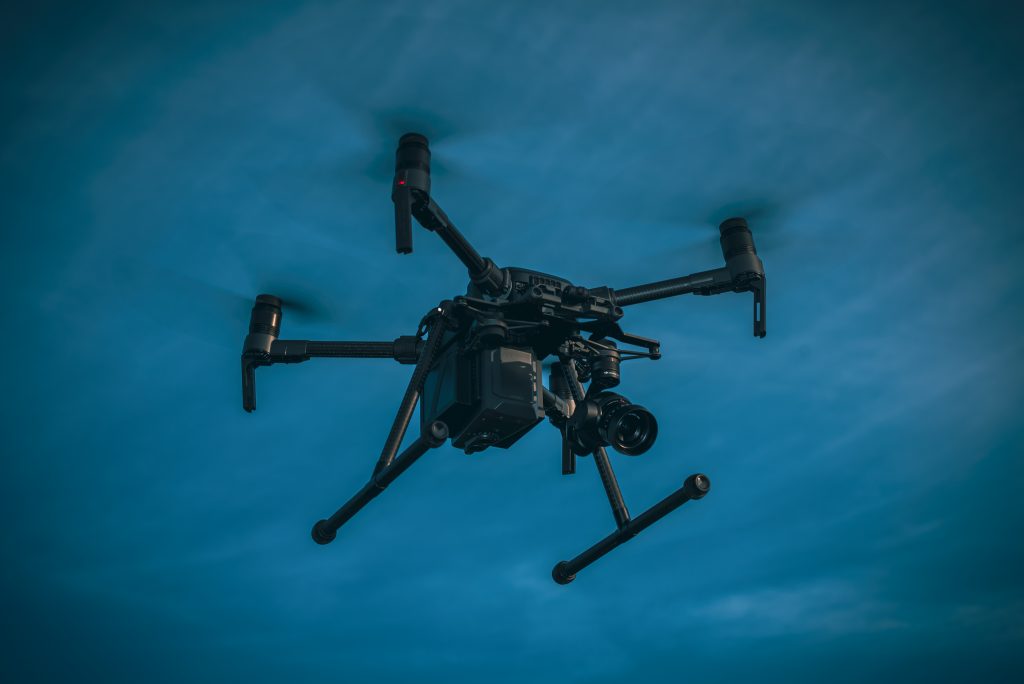
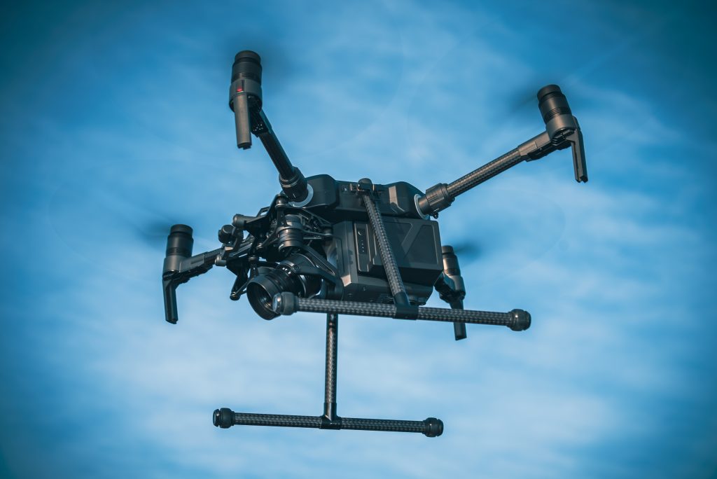
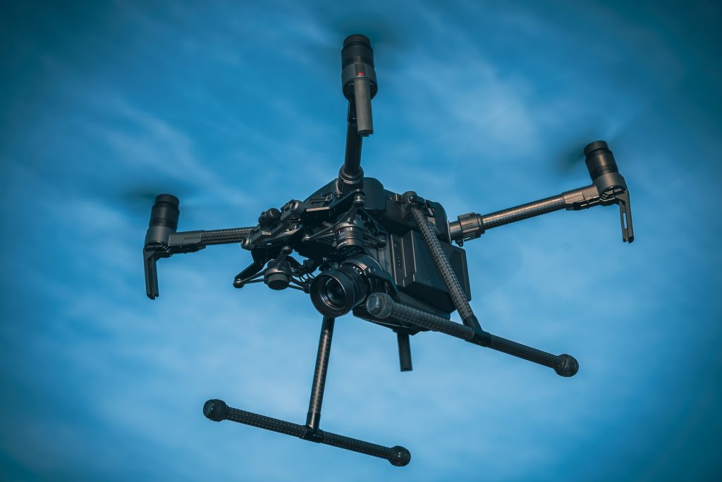
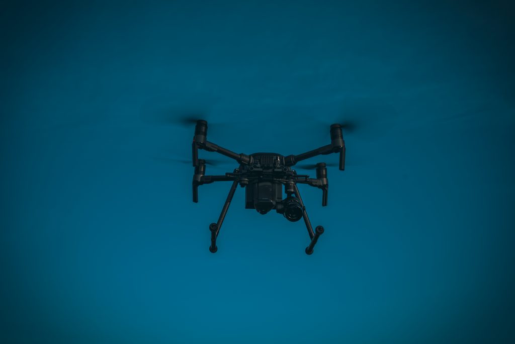
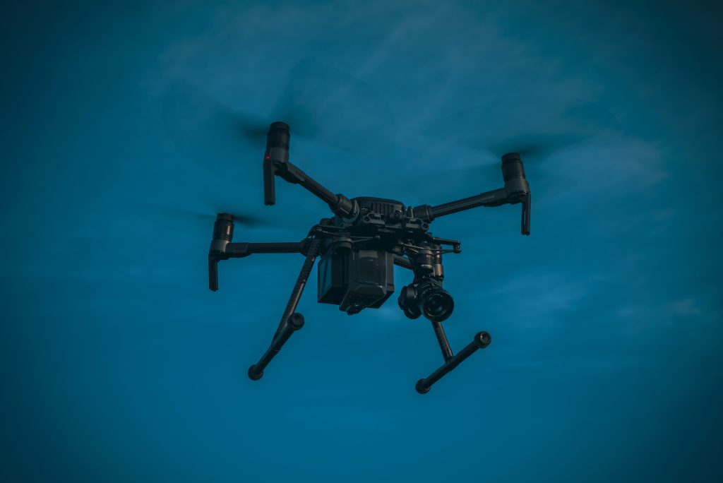
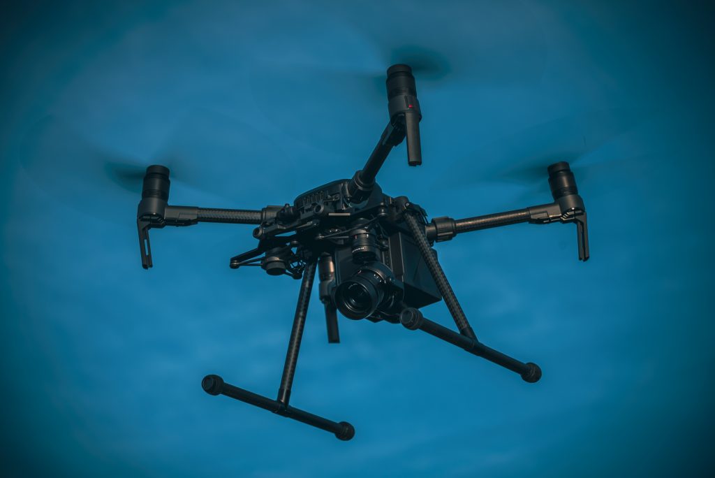
  • Mid-tier Professional: This is the standard for most marketing and property filming. These pilots hold a CAA General Visual Line of Sight Certificate (GVC), operate professional-grade equipment like DJI Enterprise drones capable of 4K HDR video, and carry at least £1 million in public liability insurance. They are experts in operating a sophisticated unmanned aerial vehicle (UAV) safely and effectively for commercial purposes.
  • Enterprise-tier Specialist: This tier commands the highest rates due to highly specialised skills and equipment. It includes services like thermal imaging for building inspections, photogrammetry for 3D modelling, and complex operations in restricted airspace (FRZs). These missions require advanced qualifications and technology, reflecting a much higher operational cost.

5 Critical Factors That Influence Your Drone Filming Quote

An hourly rate for drone filming is never just a simple number. It’s a calculated figure reflecting a complex mix of risk, expertise, and technology. A quote for flying over an open field will look vastly different from one for a central Birmingham construction site. Understanding the key variables is essential for budgeting accurately and appreciating the value delivered. The overall cost of drone filming per hour uk is directly tied to the operational demands of your specific project.

Regulatory Compliance and CAA GVC Certification

The single most significant factor in professional pricing is legal compliance. A pilot holding a CAA-approved GVC (General Visual Line of Sight Certificate) has invested over £1,000 in initial training and examination, plus ongoing fees to maintain their qualification. This certification isn’t just a piece of paper; it’s your assurance that the operator is competent, safety-conscious, and legally permitted to conduct commercial operations. This cost is fundamentally built into any professional’s rate. Furthermore, complex flights require detailed risk assessments, pre-flight surveys, and sometimes the submission of a NOTAM (Notice to Airmen) to alert other aircraft. This administrative work is billable time that ensures a safe, legal flight. Hiring an uncertified operator to save money is a false economy; under UK law, the client commissioning the work can also be held liable and face significant fines for any illegal drone activity.

Advanced Equipment and Data Quality

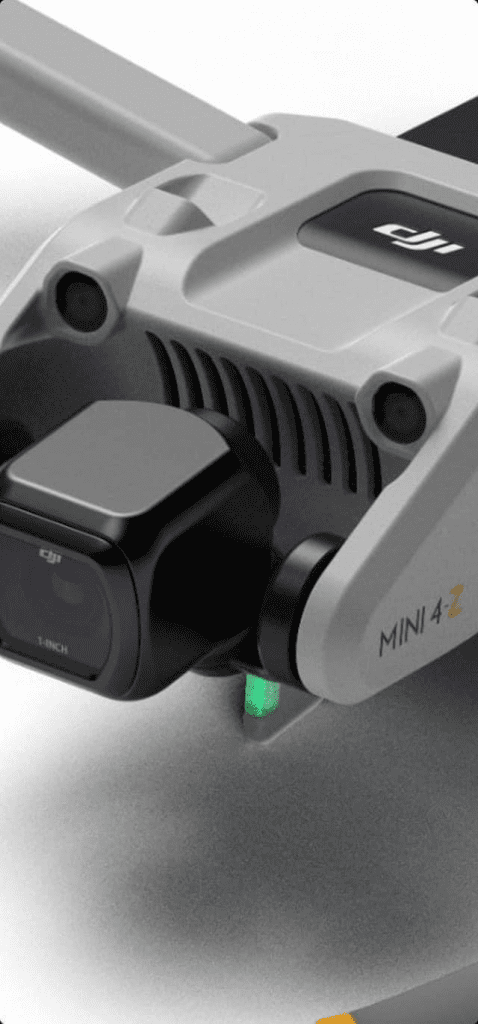
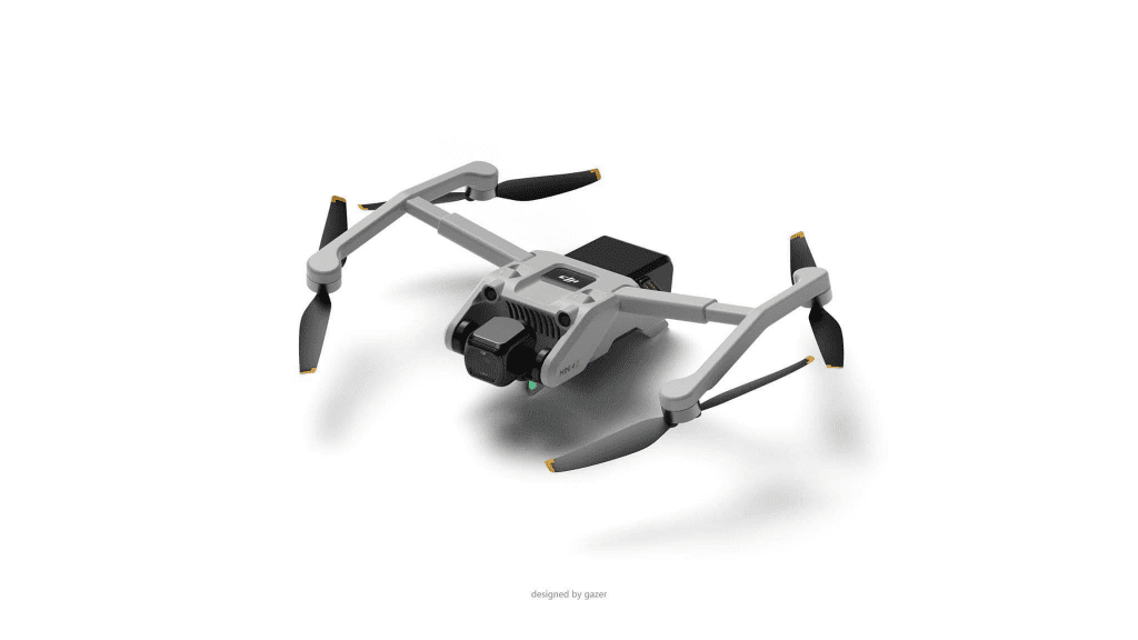
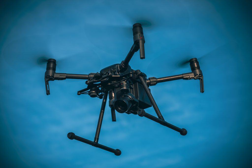
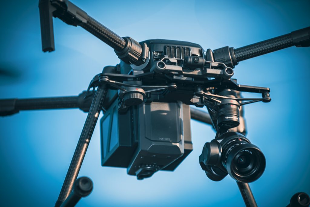
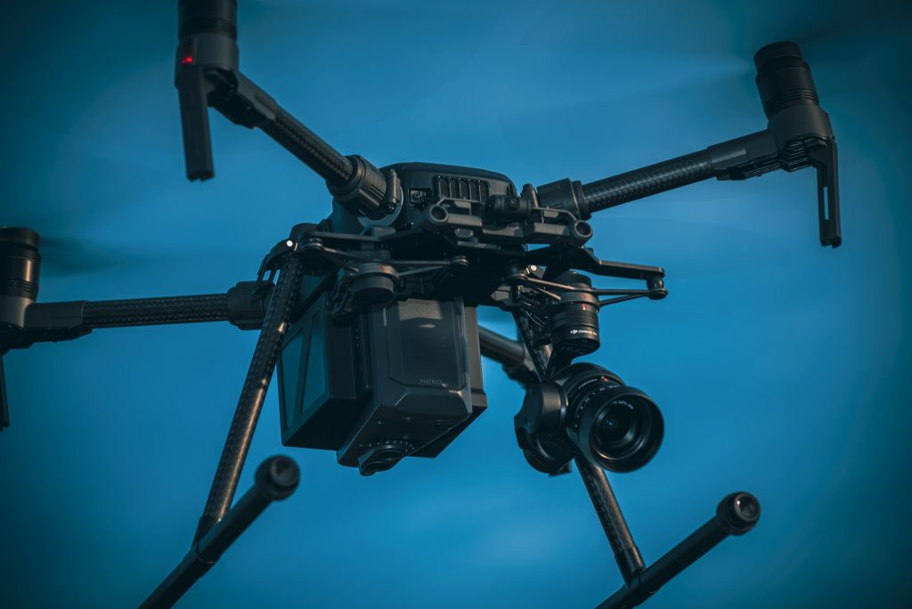
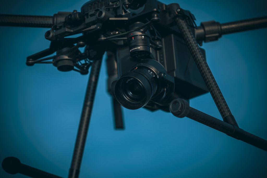
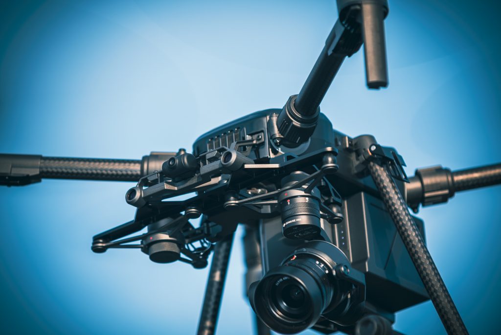
The drone itself plays a huge role. There’s a world of difference between consumer-grade video and the 4K HDR cinematic footage captured by a professional platform like the DJI Mavic 3 Pro. For highly technical jobs, we utilise DJI Enterprise drones, which are designed for high-precision data gathering like photogrammetry or thermal imaging. The capital investment is substantial:

  • Cinematic Drone Kit (DJI Mavic 3 Pro): Approx. £3,500 with multiple batteries and accessories.
  • Enterprise Drone Kit (DJI Matrice 350 RTK): Can exceed £15,000 with specialist payloads.

Professionals also carry full redundancy. This means arriving on-site with at least two aircraft, multiple controllers, and over eight batteries. This backup system guarantees that an equipment failure won’t derail your project, but it doubles the initial hardware investment that must be factored into the pricing.

The complexity of the airspace is a major price driver. A flight over rural farmland is straightforward. A flight in a congested city centre or a “Restricted Area” near an airport is an entirely different operation. These locations require meticulous planning, potential liaison with Air Traffic Control (NATS), and advanced authorisations from the Civil Aviation Authority (CAA). Every commercial flight must strictly follow the UK’s Drone and Model Aircraft Code, but urban environments introduce layers of risk and permissions that add hours of expert planning to the job. For projects requiring this level of technical precision, our team’s expertise in complex airspace ensures compliant and successful outcomes.

Finally, robust insurance is non-negotiable. While the legal minimum for commercial drone insurance is £1 million, most corporate clients and construction sites mandate a higher level of coverage. We carry £5 million in commercial liability insurance as standard. This provides added peace of mind for everyone involved, especially on high-value industrial or commercial properties. The annual premium for this level of coverage is a significant business expense that is necessarily reflected in the final quote you receive.

The ‘Hidden’ Costs of Drone Filming: Why Hourly Rates Can Be Deceptive

When evaluating the cost of drone filming per hour uk, it’s easy to focus solely on the time the drone is in the air. This is a common oversight. A professional, CAA GVC Certified operator invests significant time and resources before and after every flight. These essential activities are rarely itemised in a simple hourly rate but are fundamental to delivering a safe, legal, and high-quality final product. Understanding these components provides a transparent view of the true investment required for professional aerial cinematography.

The Importance of Pre-Flight Planning and Risk Assessment

For every hour of flight, a minimum of one to two hours of desk-based preparation is required. This isn’t optional; it’s a legal mandate for commercial operators. This process involves detailed risk assessments, checking for airspace restrictions, temporary flight notifications (NOTAMs), and ensuring full compliance with the Civil Aviation Authority’s regulations, as outlined in The Drone and Model Aircraft Code. For clients like commercial property developers, an on-site survey is non-negotiable. This allows our pilots to identify potential hazards, establish safe take-off and landing zones, and plan precise flight paths to capture the required data efficiently. Professional drone filming begins on the ground, with meticulous planning that ensures every flight is both legal and efficient.

Post-Production and Final Delivery Fees

Capturing the footage is only half the job. The raw 4K HDR files from our drones require expert handling in post-production to become a polished, usable asset. A reliable industry estimate is a 2:1 editing ratio; for every one hour of filming, you should budget for at least two hours of editing. This covers data management, clip selection, assembly, colour correction, and grading. For more complex projects, this cost can increase with additional requirements:

  • Licensed Music: Sourcing and licensing a suitable audio track typically costs between £50 and £150 per track for commercial use.
  • Motion Graphics: Adding branded titles, callouts, or animated logos requires specialist skills and can add £200+ to the project cost.
  • Virtual Tour Creation: Stitching 360-degree aerial photographs into a seamless interactive tour is a highly technical process, often demanding a 3:1 or 4:1 editing-to-filming ratio.

Beyond the creative process, consider the practicalities of travel and data management. For projects outside the West Midlands, travel is billed at a standard £0.45 per mile. Operations in central London will also incur the £15 Congestion Charge and any ULEZ fees. For multi-day shoots across the UK, subsistence and accommodation costs, typically around £120 per night, are factored into the final quote. Finally, delivering the enormous data files (an hour of 4K footage can easily exceed 100GB) requires secure, high-speed cloud services or the dispatch of an encrypted hard drive, both of which represent a final, tangible cost in the delivery of your project.

Drone Filming vs. Traditional Methods: A Cost-Benefit Analysis

Analysing the cost of drone filming per hour uk in isolation misses the bigger picture. The true value emerges when you compare it directly to the operational expenses, timelines, and safety risks of traditional methods. For many industries, drones don’t just offer a marginal saving; they represent a fundamental shift in how projects are planned, executed, and budgeted, delivering a comprehensive return on investment that goes far beyond the hourly rate.

Drones vs. Scaffolding and Masted Photography

For property surveys, the financial case is compelling. A week of scaffolding can cost a business over £2,000 and cause major site disruption. In contrast, a two-hour drone inspection delivers higher-quality, actionable data on the same day for a fraction of that cost. This method eliminates the significant safety risks of working at height, providing an immediate and crucial safety ROI for building and facilities managers across the UK.

The “Safety ROI” is a critical, though often un-costed, benefit. By keeping personnel on the ground, you drastically reduce the potential for falls, which remain a leading cause of workplace injury. This proactive approach to safety can positively impact insurance premiums and demonstrates a commitment to modern, compliant operational standards. Furthermore, the speed of data collection is transformative. A drone using photogrammetry can survey a 20-hectare site in a few hours, a task that would take a traditional ground crew 3-4 days to complete.

Drones vs. Helicopter Filming for Large-Scale Projects

In cinematic production, the price gap is immense. A chartered helicopter with a pilot and camera operator can exceed £5,000 per hour. A professional, CAA GVC Certified drone crew offers far greater creative flexibility for between £500 and £1,500 for a half or full day’s work. Drones uniquely achieve the “low and slow” cinematic shots close to subjects, a feat impossible for a helicopter, delivering superior creative value alongside dramatic cost savings.

This isn’t just about saving money; it’s about achieving a better result. Helicopters are blunt instruments, restricted by altitude and safety limitations that make intimate, dynamic shots impossible. Drones are precision tools. They can track a vehicle along a winding road, rise slowly to reveal a landscape, or orbit a historic building from just metres away. This capability provides directors and marketing teams with a creative toolkit that was previously unavailable, allowing for more engaging and visually stunning storytelling.

Ultimately, professional drone services offer a multi-faceted value proposition. They reduce direct costs, compress project timelines, enhance worker safety, and deliver superior quality data and visuals. The technology has moved beyond being a novelty to become an essential tool for cost-conscious and safety-focused businesses. To see how our aerial data-gathering can provide a clear ROI on your next project, request a detailed quote for your aerial inspection needs.

Investing in Quality: How Impact Aerial Delivers Value Beyond the Hourly Rate

While many clients understandably focus on the base cost of drone filming per hour uk, the true value of a professional aerial service extends far beyond a simple timesheet. A cheaper hourly rate often conceals risks, inexperience, and a lack of strategic insight. At Impact Aerial, we operate on a principle of total value, combining technical expertise with a consultant’s mindset to solve your business challenges from the air. We aren’t just pilots for hire; we are your partners in data acquisition and visual storytelling.

Our approach is built on delivering “Added Peace of Mind.” This begins with our specialist expertise within Birmingham and the West Midlands, where our deep local knowledge allows for efficient and compliant operations. It extends to our transparent, bespoke quoting process, meticulously designed to eliminate the “bill shock” that can occur with ambiguous hourly billing. We don’t just fly a drone; we consult with you to understand your objectives and deliver a fixed-price solution that achieves them.

Safety-First Operations and Professional Affiliations

Our commitment to operational safety is absolute and non-negotiable. Every Impact Aerial pilot is CAA GVC Certified, a qualification that permits us to conduct more complex operations in challenging environments, far beyond the capabilities of basic licence holders. We are also vetted members of the Drone Safe Register, providing you with third-party assurance of our professionalism and compliance. This foundation of safety is supported by our investment in the latest DJI Enterprise technology, ensuring maximum reliability and data accuracy for every flight. For highly technical projects, this level of precision is critical, as detailed in our Drone Property Surveys. For added peace of mind, every project is protected by our standard £5 million commercial liability insurance.

Bespoke Quotes for Birmingham and Nationwide Projects

We believe a quote should be a clear and comprehensive proposal, not a vague estimate. Our process is designed for clarity and confidence:

  • Consultation: We start by discussing your project’s goals to understand the problem you need to solve or the story you want to tell.
  • Site Assessment: We conduct a thorough desk-based or on-site assessment to analyse airspace, identify risks, and plan logistical requirements.
  • Fixed Price Proposal: You receive a detailed, all-inclusive quote with no hidden fees. This is the final price.

For projects beyond the West Midlands, our nationwide capability is priced with the same transparency. Travel and logistics are calculated upfront, typically using a standard 45p per mile rate, and any accommodation costs are agreed upon in advance. This ensures your budget is respected, whether your project is in central Birmingham or the Scottish Highlands. Ready to see how professional aerial data can benefit your business?

Request a bespoke drone filming quote from Impact Aerial today.

Secure Your Project’s Vision with a Transparent Drone Filming Quote

Looking ahead to 2026, the cost of drone filming per hour uk is clearly more than a simple rate. It’s a comprehensive investment influenced by project complexity, location, and the level of technical expertise required. The most critical takeaway is that a low hourly price can hide risks and extra fees, whereas a professional quote encompasses safety, planning, and superior equipment. This is where true value lies, delivering a significant return on investment compared to many traditional methods.

At Impact Aerial, we provide that professional clarity. As specialists serving Birmingham and the West Midlands, our CAA GVC Certified pilots are fully insured with £5m in commercial liability, giving you complete peace of mind. We don’t just quote a price; we build a partnership to ensure your project’s success. Ready to move from estimates to a concrete plan for your aerial project?

Get a Professional Quote for Your Drone Project and let’s capture the breath-taking perspectives your vision deserves.

Frequently Asked Questions About Drone Filming Costs

Is drone filming cheaper than traditional photography?

Yes, drone filming is significantly more cost-effective than traditional aerial photography methods. Hiring a helicopter or light aircraft can cost upwards of £1,500 per hour, excluding crew and equipment. In contrast, a professional drone service provides comparable, and often superior, dynamic perspectives for a fraction of that price. This makes high-quality aerial footage accessible for projects with budgets that previously couldn’t accommodate manned aircraft operations, delivering exceptional value.

Do I need to pay for a drone license when hiring a pilot?

No, you don’t pay directly for a pilot’s license; this cost is an operational expense covered within their professional fees. When you hire a CAA GVC Certified pilot, you’re paying for their proven expertise, insurance, and regulatory compliance. It is the pilot’s legal responsibility to maintain their qualifications. For your peace of mind, always verify your chosen operator holds a valid GVC and has adequate commercial liability insurance before any work commences.

How much does it cost to film a commercial property in the UK?

The cost to film a standard commercial property in the UK typically starts from £350 to £500 for a basic package. This price point generally includes a 2-3 hour on-site session, capturing a set of high-resolution photos and 4K video clips. More complex projects, such as those in congested city centres or requiring advanced photogrammetry, will incur higher costs due to the extensive pre-flight planning and risk assessments mandated by the CAA.

What happens if the weather is bad on the day of the shoot?

If adverse weather conditions make it unsafe to fly, the shoot will be rescheduled for the next suitable day at no additional cost. Professional drone operators cannot operate legally or safely in high winds (typically above 22 mph) or any form of precipitation. Reputable providers will have a clear weather contingency in their terms. We monitor forecasts 48-72 hours in advance and will always liaise directly with you to find an alternative date.

Is post-production editing included in the hourly drone rate?

No, post-production and video editing are specialist services that are not included in the standard hourly flying rate. The hourly fee covers the on-site flight operation, risk assessment, and the delivery of raw, unedited digital footage. Editing services, such as colour grading, adding branding, and producing a finished video, are quoted separately. This allows you the flexibility to handle post-production in-house or to commission a fully tailored video package.

Do drone pilots charge for travel time in the UK?

Yes, the majority of professional drone pilots in the UK charge for travel, usually for any project located beyond a 25-30 mile radius from their operating base. This is often billed at a standard mileage rate, such as 45p per mile, in line with HMRC guidelines. For jobs requiring extensive travel or overnight stays, a fixed fee or day rate may be applied to cover the pilot’s time. Always ensure travel costs are clarified in your initial quote.

Why do prices for drone filming vary so much between companies?

Prices vary primarily based on a provider’s certification, insurance level, equipment quality, and operational experience. A fully insured, CAA GVC Certified operator using a £10,000 DJI Enterprise drone will necessarily charge more than a hobbyist. The cost of drone filming per hour uk providers quote reflects their investment in professional training, high-end equipment, and comprehensive liability insurance, often up to £10 million. A significantly lower price can indicate a lack of legal authorisation or adequate insurance.

What is the average day rate for a CAA GVC certified drone pilot in 2026?

In 2026, the average day rate for a CAA GVC certified drone pilot in the UK is projected to be between £600 and £950. A typical day rate includes up to 8 hours on-site, all necessary pre-flight planning, risk assessments, and the handover of raw 4K footage. The final price within this range depends on the project’s complexity, the specific drone and sensor payload required, and the operational location, reflecting the pilot’s professional expertise and overheads.

How to Choose a Drone Survey Company: The Professional UK Guide for 2026

A 2024 survey from the Chartered Institution of Civil Engineering Surveyors revealed a stark reality: nearly 30% of UK project managers reported receiving drone survey data that was unusable for BIM or CAD integration, leading to significant project delays and rework. It’s a common frustration in this rapidly evolving industry. You recognise the immense potential of UAVs to deliver cost-effective data and eliminate the risks of manual inspections, yet the market is saturated with operators who prioritise “pretty pictures” over precision.

This 2026 guide cuts through the noise. We will provide the definitive framework for how to choose a drone survey company in the UK, equipping you to master the technical, legal, and commercial criteria required for a successful partnership. From verifying CAA GVC certifications and public liability insurance to interrogating a provider’s data processing workflow, you’ll gain the confidence to secure a partner who delivers high-precision results and complete regulatory peace of mind.

Key Takeaways

  • Understand the non-negotiable UK legal standards, including CAA Operational Authorisation and GVC certification, to ensure your project is fully compliant and avoids regulatory risk.
  • Discover why the drone’s sensor technology is more critical than the drone model itself for delivering the high-precision data required for professional construction and property surveys.
  • Master how to choose a drone survey company with a clear vetting framework, learning which key documents and case studies you must request to verify their competence.
  • Learn to distinguish between basic aerial photography and professional-grade geospatial data to prevent costly project errors that can lead to million-pound mistakes.

Beyond the “Toy” Perception: Why Choosing the Right Drone Survey Partner Matters in 2026

The perception of drones has shifted dramatically. What were once considered high-end toys are now indispensable industrial tools, crucial for gathering high-accuracy geospatial data. By 2026, the UK market for commercial drone services is projected to be worth over £45 billion, yet a critical gap is widening between qualified, enterprise-level operators and hobbyists offering commercial services. The distinction isn’t just about equipment; it’s about a fundamental understanding of data integrity. Choosing a partner based on the lowest price often exposes a project to million-pound errors, costly rework, and significant legal liability. This is why understanding how to choose a drone survey company is no longer a minor procurement decision, it’s a critical risk management strategy.

For a deeper insight into the professional drone services market, the following video provides a valuable overview:

The commercial stakes are incredibly high. In construction, a topographical survey with just a 5cm vertical error can lead to incorrect earthworks calculations, costing a project upwards of £150,000 in unforeseen spoil removal and material costs. In property management, a roof survey that misses subtle water ingress due to poor thermal data can result in structural damage costing tens of thousands to remediate. A “cheap” survey isn’t a saving; it’s a deferred cost with interest. True professional service providers understand that the deliverable isn’t a collection of images, but verified, actionable data that project managers and engineers can trust implicitly.

Data Precision vs. Visual Quality

A stunning 4K video of a building façade is excellent for marketing but is functionally useless for a structural engineer assessing masonry integrity. A professional survey prioritises data that is spatially accurate. This is achieved using survey-grade techniques like establishing Ground Control Points (GCPs) to ensure the resulting 3D model or orthomosaic map has a verified accuracy of 20-30mm. This is the difference between an “inspection” (a visual check) and a “survey” (a quantifiable measurement).

The Risk of the “Dave with a Drone” Approach

Utilising an uncertified, uninsured internal staff member or a local hobbyist introduces unacceptable risk. A single safety incident, such as a drone failure over a live construction site, can trigger an immediate Health and Safety Executive (HSE) investigation, halting all site operations for weeks. The decision on how to choose a drone survey company must factor in this liability. A professional operator, fully certified by the CAA with a GVC (General VLOS Certificate), treats their Unmanned Aerial Vehicle (UAV) as a piece of industrial machinery. They operate with comprehensive flight plans, risk assessments, and commercial liability insurance, providing you with essential peace of mind.

Beyond high-resolution cameras and advanced flight capabilities, the most critical factor in your selection process is legal compliance. An uncertified or underinsured operator doesn’t just represent a risk; they represent a direct liability to your business, your site, and your reputation. The UK’s drone industry is strictly regulated by the Civil Aviation Authority (CAA) for a reason: safety. Understanding these legal benchmarks is central to how to choose a drone survey company that protects your project from start to finish.

The regulatory landscape for commercial drone operations in the UK transitioned after 31 December 2020, moving from the old PfCO (Permission for Commercial Operation) system to a new framework. Today, the professional standard is the Operational Authorisation, which is granted by the CAA to operators who demonstrate the highest levels of safety and competence. This isn’t just paperwork. It’s the non-negotiable passport for any commercial drone work in the United Kingdom.

Decoding Pilot Certifications

A pilot’s qualifications are the bedrock of a safe and successful survey. The key certification to look for is the General Visual Line of Sight Certificate (GVC). This proves the pilot has passed both a theoretical examination and a practical flight test, demonstrating a thorough understanding of air law, risk mitigation, and emergency procedures. This authorisation is granted only after a pilot proves their competence and understanding of the rules laid out in the official CAA guidance, The Drone and Model Aircraft Code. A professional operator must also maintain a detailed Operations Manual, which is a comprehensive document outlining their specific procedures for every type of flight. Don’t hesitate to ask about it; a compliant company will be proud to discuss its commitment to safety.

Insurance: More Than Just a Policy Number

For commercial drone surveys, standard insurance policies are wholly insufficient. Professional operators must hold a specialist aviation insurance policy that is compliant with regulation EC 785/2004. This is not optional. For most commercial, industrial, and construction sites in the UK, a minimum of £5 million in public liability coverage is a mandatory prerequisite for granting site access. This level of cover provides essential peace of mind, protecting your business, assets, and personnel from third-party claims in the unlikely event of an incident. Before the first prop spins, you must verify the drone company’s insurance. Always request to see a current and valid copy of their insurance certificate; it should clearly state the coverage level and confirm compliance with EC 785/2004.

Finally, consider data protection. A drone survey is an act of data-gathering, and as such, it must comply with UK GDPR. A professional company will have clear policies for handling, processing, and storing the data collected, ensuring privacy is respected and legal obligations are met. This level of due diligence is what separates professional operators from potential liabilities, a key factor when you’re learning how to choose a drone survey company. Our team is always transparent about our credentials, and you can review our CAA certification and insurance details at any time for complete reassurance.

Sensors Over Specs: Matching Drone Technology to Your Project Outcomes

It’s a common mistake to focus on the drone itself. While the aerial platform is important, the real value of a survey lies in the data captured by its payload, the sensor. A top-tier drone carrying the wrong sensor for the job will deliver poor results. The critical question isn’t “What drone do you fly?” but “What sensor will you use to achieve my project’s goals?” Professional operators build their fleet around the data required, which is why leading industrial-grade drone technology has become the de facto standard for industrial-grade work since 2022. This hardware isn’t just about performance; its reliability is essential for operating safely under stringent UK Civil Aviation Authority regulations.

Understanding the technology is a vital part of learning how to choose a drone survey company. Your provider must be a consultant, guiding you to the most effective data-gathering tool for your specific outcome, whether you need centimetre-accurate topographical data or a detailed thermal inspection.

Photogrammetry vs. LiDAR: Which Do You Need?

Photogrammetry creates 3D models by stitching together hundreds or thousands of high-resolution overlapping photographs. It excels at capturing visual detail and colour, making it the ideal choice for creating realistic 3D models of buildings, monitoring construction progress, or producing high-resolution orthomosaic maps of hardscapes and open terrain. It is a highly cost-effective method for many survey applications.

LiDAR (Light Detection and Ranging), however, is the gold standard for projects requiring extreme accuracy and the ability to penetrate vegetation. Instead of photos, a LiDAR sensor fires millions of laser pulses to measure the distance to the ground, creating a dense “point cloud” of elevation data. This is the only reliable aerial method for mapping true ground topography beneath a tree canopy. While a LiDAR survey for a 5-hectare site might cost £1,500-£2,000 more than photogrammetry, it eliminates weeks of hazardous ground-based work, delivering a superior return on investment for forestry, flood-risk, and complex terrain projects.

Thermal Imaging and Specialized Sensors

Beyond mapping, specialised sensors unlock powerful new insights for asset management and environmental analysis. A competent survey company will have access to a range of payloads, including:

  • Radiometric Thermal Cameras: Essential for PV solar farm surveys, these sensors can identify individual cell-level defects, inverter faults, and connection issues invisible to the naked eye. A single day of aerial thermal scanning can assess over 50 MW of solar assets.
  • Multi-spectral Sensors: Used in agriculture and environmental management, these sensors capture light in non-visible spectrums to assess crop health (NDVI), water quality, and land classification with remarkable precision.
  • High-Zoom Inspection Cameras: Advanced multi-sensor payloads combine thermal and visual sensors with powerful zoom lenses, allowing for safe and detailed inspection of wind turbines, chimneys, and roofing from a standoff distance of over 75 metres.

Ultimately, the raw data from any of these sensors is only half the story. The final, crucial step is post-production. A professional survey provider doesn’t just deliver a folder of images or a raw point cloud. They process this complex data into actionable insights: fully-rendered 3D models, classified point clouds compatible with Autodesk, or detailed inspection reports. The quality of their software and analytical skill is just as important as the quality of their drone.

The Vetting Framework: 5 Critical Questions and 3 Red Flags to Watch For

Once you have a shortlist of potential drone survey providers, the real evaluation begins. Moving beyond their website claims requires a structured vetting process. Asking the right questions not only reveals a company’s technical competence but also its commitment to safety and regulatory compliance. This framework is central to understanding how to choose a drone survey company that protects your project, your budget, and your reputation.

Arm yourself with these five critical questions before making a final decision:

  • 1. “May I see a copy of your CAA Operational Authorisation?” This is the single most important question. Any legal commercial drone operator in the UK must be authorised by the Civil Aviation Authority (CAA) and hold valid commercial liability insurance. Their pilots should hold a GVC (General Visual Line of Sight Certificate). A refusal or hesitation to provide this is an immediate disqualification.
  • 2. “Can you share a case study from a recent construction [or property/solar] project?” A portfolio of cinematic aerial shots is not the same as a technical survey. You need to see evidence of their work in your specific sector. Look for detailed outputs like annotated orthomosaic maps, volumetric calculations for stockpiles, or thermal inspections of solar arrays, not just pretty pictures.
  • 3. “How will you deliver the final data?” A professional firm won’t just send you a Dropbox link with 50 GB of raw images. They should provide access to a dedicated data platform where you can view, measure, and analyse the outputs. Ask about file formats like .LAS (for point clouds) or GeoTIFFs and their compatibility with your existing software (e.g., AutoCAD, BIM).
  • 4. “What does your pre-flight risk assessment process involve?” Safety isn’t just a box-ticking exercise. A competent operator will describe a detailed process involving site surveys, airspace checks (for proximity to airports or restricted zones), and the creation of a thorough Risk Assessment and Method Statement (RAMS). This demonstrates a proactive safety culture.
  • 5. “Why is your quote priced this way?” The cheapest quote often carries the highest risk. A low price can signal a lack of adequate insurance (we carry £10 million in public liability for peace of mind), the use of substandard equipment, or rushed post-processing. A professional quote accounts for meticulous planning, top-tier technology, and the expertise needed to produce survey-grade data.

The “Cowboy Operator” Red Flags

Unprofessional operators can jeopardise your project’s timeline and safety. Watch for these clear warning signs. A lack of CAA GVC certification or commercial insurance is a non-starter. Using consumer-grade drones like a DJI Mini for an industrial survey signals a lack of understanding of the required data quality; their small sensors and lack of RTK receivers cannot deliver the centimetre-level accuracy needed. Finally, be wary of vague answers about data accuracy or Ground Control Points (GCPs). Without GCPs, a survey’s accuracy can be off by metres, rendering it useless for any serious engineering or planning.

The Importance of Post-Production

Raw drone footage is simply a collection of images and data points. Its true value is unlocked in post-production. A reputable survey company invests heavily in processing software and analytical expertise. You should expect detailed, actionable reports with clear annotations, not just a photo gallery. For property and construction clients, ask if they can produce immersive 3D virtual tours. These models are invaluable for tracking site progress, conducting remote inspections, and marketing properties with a unique, data-rich perspective.

A professional drone survey company will welcome this level of scrutiny. To see how our processes stand up to these questions, we invite you to request a sample survey report and a copy of our CAA Authorisation.

The Impact Aerial Standard: Precision Data with Absolute Peace of Mind

After evaluating experience, technology, compliance, and insurance, the final step is seeing how a provider brings it all together. At Impact Aerial, we don’t just meet the criteria; we set the standard. Our entire operation is built to provide UK property and construction clients with technically superior data, delivered through a process that guarantees complete professional security.

We combine the industry-leading power of DJI Enterprise drones with the rigorous operational discipline of our CAA GVC certified pilots. This isn’t just about having the best equipment; it’s about having the proven expertise to deploy it safely and effectively, even in complex or restricted airspace. Our meticulous “Consultation-to-Post-Production” workflow ensures every project is managed with precision. From the initial site assessment and risk analysis to data acquisition and the delivery of actionable 2D maps or 3D models, we provide a seamless, end-to-end service tailored to your project’s specific goals.

Our strategic base in Birmingham gives us a unique advantage. We possess intricate knowledge of the West Midlands’ development landscape while maintaining the logistical capability for nationwide UK coverage. This blend of local insight and national reach ensures we are both responsive and scalable. Underpinning every flight is our £5m commercial liability insurance. For our clients, this is the cornerstone of our service. For added peace of mind, it confirms that you are partnering with a serious, professional operator who prioritises risk management above all else. This level of security is a critical factor in how to choose a drone survey company you can trust.

Case Study: Maximising ROI in Solar and Property

Our approach delivers tangible results. For a recent solar farm client, our thermal drone inspection methodology identified faulty panels with 99% accuracy and reduced traditional survey costs by 40%. The benefits extend beyond data; our 4K HDR cinematic output serves a dual purpose, providing detailed survey imagery that can be repurposed for high-impact marketing materials. This capability is essential for navigating and documenting complex urban environments, from construction sites in Birmingham to historic building surveys in London.

Get Started with a Professional Consultation

Initiating a project with us is straightforward. To help us provide an accurate and timely quote, please include the project address or What3Words location, a brief overview of your objectives, and your required deliverables in your initial enquiry. Our typical timeline, from this first contact to the final delivery of your processed data, is between 5 to 10 working days, depending on project complexity and weather conditions. We believe transparency and a proven track record are the ultimate answers when asking how to choose a drone survey company.

Ready to see the difference a professional, compliant, and fully-insured drone survey partner can make? Contact Impact Aerial for a compliant drone survey quote today.

Your Next Step: Securing Precision Data with a Vetted Partner

Choosing a drone survey partner in 2026 is a critical business decision, moving far beyond the perception of drones as mere gadgets. The right choice is foundational to your project’s success. As this guide has shown, your vetting process must prioritise non-negotiable legal standards, like current CAA GVC certification, and ensure the proposed sensor technology is precisely matched to your required outcomes, not just the latest model on the market.

Ultimately, knowing how to choose a drone survey company means investing in data integrity and operational safety. At Impact Aerial, we provide this with absolute peace of mind. Our professional services are guaranteed by our team of fully CAA GVC Certified pilots, underwritten by a £5m Commercial Liability Insurance policy, and executed with our cutting-edge DJI Enterprise 4K HDR fleet.

Ready to build your project on a foundation of accuracy and reliability? Book a Professional Drone Survey Consultation with Impact Aerial today and let’s discuss how our expertise can elevate your results.

Frequently Asked Questions

Do I need a license to hire a drone survey company in the UK?

No, as the client, you don’t need a license. However, the responsibility falls on you to ensure the company you hire is legally certified. A professional drone operator must hold a valid Operational Authorisation issued by the Civil Aviation Authority (CAA). Their pilots should be qualified with a General Visual Line of Sight Certificate (GVC), which is the standard for commercial operations in the UK. Always ask to see their documentation before work begins.

How much does a professional drone survey cost in 2026?

A professional drone survey in 2026 typically costs between £450 for a basic roof inspection and can exceed £2,500 for large-scale topographical land surveys. The final price depends on the project’s complexity, the size of the survey area, and the required data outputs, such as 2D orthomosaics or 3D point clouds. It’s essential to request a detailed quote that outlines all deliverables and post-processing services included in the cost.

What is the difference between a GVC and an A2 CofC for drone pilots?

The GVC (General Visual Line of Sight Certificate) is the UK’s primary commercial drone qualification, allowing pilots to operate in more complex environments and apply for an Operational Authorisation from the CAA. The A2 CofC (A2 Certificate of Competency) is for lower-risk operations with stricter limits on flying near people. For professional survey work, it’s critical to confirm your provider’s pilots hold a GVC, as this demonstrates a higher level of training and operational competence.

Can drones fly in rain or high winds for a survey?

No, conducting a professional drone survey in rain or high winds is not feasible. Most commercial survey drones are not waterproof, and rain on the camera lens will ruin the data. Wind speeds exceeding 25 mph can compromise the drone’s stability, leading to blurred imagery and inaccurate data. A reputable operator will always reschedule a flight if the weather conditions as forecast by the Met Office are unsuitable, ensuring both safety and data quality.

How accurate is drone surveying compared to traditional land surveying?

Drone surveying is highly accurate, achieving absolute accuracy of 20-50mm when using Ground Control Points (GCPs), which is comparable to traditional methods for most applications. While a total station might be more precise for single-point measurements, a drone captures millions of data points, creating a far richer and more comprehensive dataset. For large sites, this makes it a significantly faster and more cost-effective method for producing detailed topographical maps and 3D models.

What insurance should a drone survey company have?

A drone survey company must carry specialist commercial drone insurance compliant with regulation EC785/2004. This policy must include Public Liability Insurance, with a minimum coverage of £1 million, although most professional firms carry £5 million to £10 million. For your added peace of mind, always request to see a valid copy of their insurance certificate before any operations commence on your site. This is a non-negotiable part of your due diligence.

How long does it take to get the data back from a drone survey?

You can typically expect your processed drone survey data within 3 to 5 working days. The exact turnaround time depends on the project’s scale; a simple set of inspection photos might be delivered in 24 hours. In contrast, processing thousands of images into a complex 3D model or a detailed topographical survey requires extensive computer processing and expert analysis. Your provider should give you a clear delivery timeline in their initial proposal.

Do drone survey companies need permission to fly over my neighbour’s property?

Legally, a drone company doesn’t need a neighbour’s permission to operate in the airspace above their property, as the CAA governs UK airspace. However, privacy laws must be respected. A professional operator will plan their flight path to minimise overflight of adjacent properties and will often manage communication with neighbours as part of their pre-flight planning. Knowing how to choose a drone survey company that operates courteously and professionally is key to a successful project.

Drone Roof Inspection Report Sample: What a Professional Survey Includes

What if the most valuable part of a drone roof inspection isn’t the drone, but the data it produces? It’s easy to be impressed by the high-resolution cameras and advanced flight capabilities of modern commercial drones. But for property managers and building surveyors, the real value lies in the final deliverable: a clear, comprehensive report that translates raw aerial data into actionable maintenance insights, saving thousands of pounds by avoiding the high costs and safety risks of traditional scaffolding.

This is precisely why understanding a professional drone roof inspection report sample is so critical for making informed decisions. This guide will walk you through the essential components of a top-quality survey, providing the clarity and confidence you need to commission work from a fully qualified, CAA GVC Certified operator. We will explore everything from orthomosaic mapping and thermal data analysis to detailed defect annotation, ensuring you can turn your next aerial survey into a powerful asset for proactive property management.

Key Takeaways

  • Learn to identify the most critical sections of a professional report, from the high-level executive summary to the detailed visual defect map.
  • Understand the legal standards a professional drone roof inspection report sample must meet, including CAA GVC compliance, to ensure its validity.
  • Discover how to leverage high-resolution, timestamped aerial data to streamline insurance claims and support planned maintenance schedules.
  • Recognise the difference between basic aerial photos and actionable survey data gathered using specialised DJI Enterprise drone technology.

What is a Drone Roof Inspection Report and Why Is a Sample Important?

A drone roof inspection report is a comprehensive digital document that details the structural condition of a roof using high-resolution aerial data. It represents a significant evolution from traditional surveying methods, which often required expensive scaffolding, cherry pickers, and high-risk roof walks. The industry’s shift towards these “contactless” inspections, accelerated since 2020, prioritises safety and efficiency, delivering precise data without a single person setting foot on the roof. This commitment to safety and modern data-gathering is governed by strict CAA protocols in the UK, which fit within a complex framework of international drone regulations that professional operators must master.

To see the clear advantages of using a drone for initial roof assessments, this short video provides an excellent overview:

The final deliverable is what truly separates a professional survey from an amateur flight. Anyone can fly a drone and send you a folder of images. This is nothing more than a “photo dump.” A structured surveying report, however, is an analytical tool. It organises the data, annotates defects, provides measurements, and offers actionable insights. For this reason, reviewing a drone roof inspection report sample is the only reliable method to verify a pilot’s technical capability and data processing expertise. It gives you, the client, total confidence in the quality and utility of the final product.

The Evolution of Roof Surveying in 2026

The technology underpinning these reports is advancing rapidly. Today’s commercial drones, equipped with 4K HDR sensors, capture such detailed imagery that physical roof walks for initial assessments are becoming obsolete. AI-driven software is now commonly integrated into the reporting process, automatically detecting and categorising potential issues like missing tiles, water pooling, or vegetation growth. This reduces the risk of human error and ensures a consistent standard of analysis. Critically, the speed of delivery is a key performance metric; a comprehensive report can now be delivered to your inbox within 24-48 hours of the flight, a process that once took over a week.

Key Metrics to Look for in a Report Sample

When you scrutinise a sample report, you aren’t just looking at pretty pictures. You are assessing the provider’s attention to detail and professional standards. For your peace of mind, focus on these critical components:

  • Image Clarity at 100% Zoom: The provider must supply original, high-resolution files. You should be able to zoom in to 100% and clearly identify hairline cracks in tiles, degradation in mortar, or failing lead flashing. If the image becomes pixelated, the data isn’t fit for purpose.
  • GPS Metadata: Every photograph must be geolocated. This embedded GPS data (EXIF) allows contractors to pinpoint the exact location of a defect, saving time and eliminating ambiguity during repair work. A professional report will often include an interactive map with clickable, geolocated photo points.
  • An Executive Summary: A quality report always begins with a one-page executive summary. This section is written for non-technical stakeholders like property managers or board members, summarising the roof’s overall condition, highlighting critical defects, and recommending next steps in plain English.

Anatomy of a Professional Drone Roof Survey: A Section-by-Section Breakdown

A professional drone inspection delivers far more than a simple folder of aerial photographs. It’s a structured, data-rich asset designed for decisive action by asset managers, surveyors, and property owners. Each section builds upon the last to provide a complete picture of the roof’s condition, moving from a high-level overview to granular, evidence-based detail. A top-quality drone roof inspection report sample will always contain four critical components: an executive summary, a defect map, high-resolution imagery, and often, thermal data.

Let’s break down what you should expect to see in each part of the report.

  • Executive Summary: This is the first page and arguably the most important for time-pressed decision-makers. It provides a concise, top-level assessment of the roof’s overall health. Crucially, it immediately flags any urgent “red-flag” issues that require immediate attention, such as visible water ingress, major structural damage, or safety hazards. Think of it as the 30-second brief that dictates immediate priorities.
  • The Defect Map (Orthomosaic): This is a high-resolution, top-down map of the entire roof area. Each identified defect is digitally tagged and numbered on this map, providing an exact geographical reference for every issue. This visual index allows you to understand the spatial relationship between different defects and plan repairs with pinpoint accuracy.
  • High-Resolution Imagery: This section contains the raw evidence. It’s a catalogue of detailed, close-up photographs and video clips of every defect identified on the map. Expect crystal-clear images of cracked tiles, failing flashing, blocked gutters, and deteriorating chimney stacks. Each image is cross-referenced with its tag on the orthomosaic map for easy navigation.
  • Thermal Data (Optional): For flat roofs or buildings where insulation performance is critical, thermal imaging provides an invaluable layer of data. Using a radiometric thermal camera, the drone can detect temperature differences across the roof surface that are invisible to the naked eye. These anomalies can pinpoint subsurface moisture retention or significant insulation gaps, identifying problems long before they become visible failures.

The Importance of the Orthomosaic Map

The orthomosaic map is created using a process called photogrammetry, where hundreds of overlapping aerial images are stitched together and geometrically corrected using specialised software. This meticulous data-gathering process must align with strict CAA GVC Compliance Standards to ensure accuracy and safety. The result isn’t just a picture; it’s a scaled map from which you can take precise measurements for area, distance, and pitch without ever setting foot on the roof, drastically improving safety and efficiency for quoting repairs.

Defect Categorisation and Risk Scoring

To make the data useful, every identified issue is categorised using a clear, intuitive traffic light system: Red (Urgent), Amber (Monitor), and Green (Sound). This allows facilities managers to instantly prioritise their maintenance budget, allocating funds to fix the critical Red issues first while scheduling the Amber items for future works. To understand how these detailed data points translate into tangible cost savings, explore our comprehensive survey services. Defect categorisation is the core of actionable surveying.

Technical Standards: Why Your Report Must Be CAA GVC Compliant

A drone roof inspection report is more than a collection of high-resolution images. It’s a technical document whose value is directly tied to the standards under which it was created. When you review a professional drone roof inspection report sample, you’re seeing the output of a highly regulated process. The accuracy, legality, and ultimate usefulness of your report depend entirely on three pillars: the operator’s legal certification, the quality of the equipment, and the robustness of their insurance.

In the UK, any drone flight conducted for commercial purposes, including roof inspections, legally requires the operator to hold a General Visual Line of Sight Certificate (GVC) issued by the Civil Aviation Authority (CAA). This isn’t just red tape. A GVC qualification proves the pilot has undergone rigorous training and examination on flight safety, risk assessment, and operational planning. A report from an uncertified pilot isn’t just unprofessional; it’s generated from an unlawful flight and may be deemed invalid for official purposes like insurance claims or legal disputes.

Superior Equipment for Accurate Data Capture

The quality of data capture is determined by the tool for the job. We utilise professional-grade inspection drones, which are built specifically for industrial inspections and differ significantly from consumer models. These advanced platforms feature mechanical shutters that prevent the motion blur and “jello” effect common with electronic shutters, ensuring every image is crisp and dimensionally accurate for analysis. Advanced zoom capabilities allow for detailed inspection of high-risk areas like damaged chimney stacks or fragile tiles from a safe standoff distance, protecting your property and our equipment. Crucially, their enhanced wind resistance (rated up to 27 mph) ensures stable, reliable flight and clear data capture, even in the unpredictable West Midlands climate.

Insurance and Peace of Mind

A professional drone report is backed by comprehensive insurance, providing a critical safety net for you and your property. Insurers are increasingly savvy and will often reject reports from uncertified or under-insured hobbyists. As the Insurance Information Institute notes, the use of Drones in Insurance Claims is predicated on safe, professional, and verifiable data collection. Before any flight, you should always ask to see the operator’s GVC certificate and their proof of commercial liability insurance. A professional will provide this without hesitation. The industry benchmark for coverage is £5 million, a figure that provides complete peace of mind. Our Commercial Drone Insurance policy meets this professional standard, ensuring every operation is fully protected.

Finally, data security is paramount. Your property’s data, from flight plans to high-resolution imagery, is handled with strict confidentiality. We use encrypted transfer methods and secure, UK-based storage solutions compliant with GDPR, ensuring your sensitive information remains protected throughout the reporting process. This combination of legal compliance, superior technology, and comprehensive insurance is what makes a professional drone roof inspection report sample a genuinely valuable asset for property management.

Practical Applications: Using Your Drone Report for Insurance and Maintenance

A professional drone roof inspection report is more than just a collection of high-resolution images. It’s a powerful data-driven asset that transforms how you manage your property, from validating insurance claims to planning long-term capital expenditure. The granular detail captured by our CAA GVC certified pilots provides objective, actionable intelligence that saves you time, reduces costs, and mitigates risk.

By leveraging this data, you shift from a reactive maintenance model to a proactive, predictive one. Instead of waiting for a leak to damage inventory or disrupt operations, you can monitor the rate of material degradation year-on-year. The orthomosaic maps and 3D models generated can be integrated directly into Building Information Modelling (BIM) workflows, allowing architects and facility managers to update digital twins with precise, real-world condition data. This historical record is invaluable for long-term asset management.

Winning the Insurance Argument

When you need to make a claim, your insurer will appoint a loss adjuster whose job is to scrutinise the damage. A drone report provides irrefutable, timestamped evidence. Geotagged images of specific tile damage or failed flashing prevent disputes over the extent of a storm’s impact, which can stop a £30,000 claim from being unfairly reduced. Furthermore, conducting an annual inspection gives you a clear “pre-loss” condition report, which can accelerate a claim’s approval by weeks. For hidden issues, our thermal imaging cameras detect moisture trapped beneath the roof surface, proving water ingress that is completely invisible to the naked eye and ensuring your claim covers the full extent of the damage.

Contractor Management

Providing every potential contractor with an identical, detailed report eliminates guesswork and standardises the quoting process. Vague requests are replaced with an exact scope of work, detailing specific defect locations and measurements. This process deters inflated “cowboy” quotes and ensures you are comparing like-for-like proposals. It also enhances site safety, complying with the Work at Height Regulations 2005 by reducing the need for contractors to conduct their own high-risk preliminary surveys. Once repairs are finished, a follow-up drone flight acts as the ultimate sign-off document, verifying the quality of work against the initial report.

A detailed drone roof inspection report sample from previous years becomes an invaluable asset for long-term capital planning. It allows you to track wear and tear, budget accurately for future works, and demonstrate due diligence to all stakeholders.

  • Streamline Insurance Claims: Use geotagged, high-resolution imagery as undeniable proof of damage.
  • Obtain Accurate Quotes: Provide contractors with a precise scope of work to receive comparable, fair bids.
  • Enhance Safety Compliance: Reduce the need for personnel to work at height during the initial survey phase.
  • Track Asset Condition: Compare annual reports to monitor degradation and plan capital expenditure effectively.

Stop relying on estimates and assumptions to manage your most critical asset. Transform your facility management from reactive to predictive. Request a consultation to see how our detailed reports can protect your property.

Get Your Professional Drone Roof Inspection from Impact Aerial

Viewing a template is one thing; receiving a detailed, actionable report tailored specifically to your asset is another. At Impact Aerial, we understand that every roof has its own history and challenges. That’s why our approach to reporting, for clients in Birmingham and across the UK, is entirely bespoke. We move beyond generic templates to deliver data-rich dossiers that directly address your objectives, whether for dilapidation schedules, insurance assessments, or preventative maintenance planning.

Our commitment to precision starts with our equipment. We operate a fleet of the latest DJI Enterprise commercial drones, ensuring every survey is conducted with leading technology. This isn’t just about capturing high-resolution images; it’s about deploying specialised payloads like thermal radiometric sensors to detect hidden moisture ingress or high-zoom cameras to inspect chimney stacks and fixings without compromising safety. This level of technical capability guarantees the data we gather is comprehensive, accurate, and forms the bedrock of a reliable report.

A survey is only as valuable as the solutions it enables. We see our role as supporting property professionals through the entire process, from initial data capture to final decision-making. The report we deliver is designed for clarity and action, providing chartered surveyors, facilities managers, and building consultants with the clear evidence they need to:

  • Accurately budget for repairs and maintenance.
  • Validate insurance claims with irrefutable visual proof.
  • Mitigate risks by identifying potential failures before they occur.
  • Streamline project management with precise topographical data.

We translate complex aerial data into a straightforward, strategic asset for your business.

Why Impact Aerial Stands Out

Our pilots are not just drone operators; they are CAA GVC Certified professionals with years of commercial surveying experience, specifically within the UK’s niche but increasingly diverse property market. This specialisation means we understand the unique demands of your industry. Our operations are underpinned by rigorous safety standards and comprehensive commercial liability insurance, providing you with added peace of mind from project start to finish.

Request Your Custom Quote

Based in Birmingham with a nationwide reach, our team is ready to demonstrate the power of professional aerial surveying. We invite you to experience the breath-taking end results that showcase never-before-seen angles and deliver critical insights. Contact Impact Aerial for a sample report and bespoke quote today to begin the conversation about your property.

Ready to see the full picture? The next step is simple. Reach out to our team to discuss your specific requirements. We can provide a complete PDF drone roof inspection report sample that showcases the full depth of our analysis or schedule a no-obligation site assessment to provide you with a detailed, fixed-price quotation. Let us show you how high-quality aerial data can protect your assets and inform your strategy.

Empower Your Maintenance Strategy with a Professional Report

Understanding the anatomy of a drone roof survey is the first step toward proactive asset management. A professional report delivers far more than aerial images; it provides structured, actionable data that is essential for planning preventative maintenance and substantiating insurance claims. For any operation in the UK, adhering to technical standards isn’t optional. A CAA GVC compliant survey ensures the data-gathering process is not only effective but also fully legal and safe.

Don’t leave your property’s integrity to chance. At Impact Aerial, our professional services provide the detailed insights you need. Our operations are conducted by CAA GVC Certified pilots and are backed by £5m in commercial liability insurance for your complete peace of mind. Utilising a state-of-the-art DJI Enterprise fleet, we deliver the high-quality data you’ve learned about. To see the level of detail we provide, we invite you to review our comprehensive drone roof inspection report sample.

See the difference expert data can make. Request a Professional Drone Roof Survey Sample from Impact Aerial today and take decisive action to protect your investment.

Frequently Asked Questions

Is a drone roof inspection as accurate as a manual survey?

Yes, in many cases, a drone inspection is more accurate and comprehensive than a manual survey. Our drones capture high-resolution 4K video and detailed 20-megapixel photographs, creating a complete and verifiable digital record of the roof’s condition. This data allows for close-up examination of every tile, gutter, and chimney stack without the physical risks or potential for human error associated with manual inspections at height. The level of detail is exceptional.

Can drones detect leaks that are not visible to the naked eye?

Yes, when equipped with specialist sensors, drones can identify potential leaks before they become major problems. By using thermal imaging cameras, our drones can detect temperature anomalies across the roof’s surface. These differences in temperature often indicate trapped moisture beneath the surface, a primary indicator of a leak’s source that is completely invisible to the naked eye. This allows for proactive repairs, saving significant costs on future water damage.

How much does a drone roof inspection report cost in the UK?

A standard drone roof inspection for a residential property in the UK typically costs between £250 and £600. The final price depends on the size and complexity of the building, the level of detail required in the report, and whether advanced services like thermal imaging or 3D modelling are included. We provide a detailed, fixed-price quotation before any work begins, ensuring complete transparency with no hidden fees.

Will my insurance company accept a drone roof survey report?

Yes, the vast majority of UK insurance companies and loss adjusters now accept, and often prefer, drone survey reports. They provide indisputable, time-stamped visual evidence that is crucial for processing claims, assessing storm damage, or for underwriting purposes. A professional report from a CAA GVC Certified operator ensures the data is captured safely and is reliable, making the entire claims process smoother and more efficient for all parties involved.

What happens if the drone crashes during the roof inspection?

While extremely unlikely, we are fully prepared for any eventuality. As a professional, CAA GVC Certified operator, Impact Aerial holds comprehensive commercial liability insurance that specifically covers our flight operations up to £5 million. For your added peace of mind, any accidental damage to your property is fully covered. We adhere to strict pre-flight risk assessments and operational safety procedures on every project to minimise all potential risks.

How long does it take to receive the final drone inspection report?

You can expect to receive your comprehensive report within 2 to 4 business days following the on-site inspection. The flight itself is efficient, often completed in under 90 minutes. The subsequent time is dedicated to meticulously processing the high-resolution imagery, analysing the data for defects, annotating key findings, and compiling the detailed written report that you can act upon. We’ll provide a precise timeline when you book our services.

Do I need to be present during the drone roof survey?

No, it’s not necessary for you to be present for the duration of the survey. Our primary requirement is safe and legal access to the exterior of your property so our pilot can establish a secure take-off and landing area. We can arrange all access details with you beforehand. This allows you to continue with your day without interruption while our certified team completes the data capture efficiently and safely.

Can drones inspect roofs in high-wind or rainy conditions?

No, we do not operate our drones in rain or high winds for critical safety and data quality reasons. Flying in rain can damage sensitive electronics and obscure the camera lens, compromising the accuracy of the report. We operate within strict CAA guidelines and our own operational limits, which typically restrict flights in winds exceeding 22 mph. We constantly monitor the forecast and will reschedule at no extra cost if conditions are unsuitable.

Best Drone for Property Photography 2026: The Professional’s Guide

Buying the wrong drone for your property business could cost you more than just the hardware; it could cost you thousands in CAA fines and invalidate your commercial liability insurance. It’s a common and expensive pitfall for professionals eager to capture those breathtaking, high-level perspectives that can accelerate a sale. You’re right to believe that high-quality aerial imagery is no longer a luxury but a necessity in a competitive market, but achieving it legally and safely is a complex challenge.

This guide is designed to provide complete operational clarity. We’ll identify the best drone for property photography 2026, breaking down the top models that deliver stunning 4K HDR results without an enterprise-level price tag of over £10,000. More importantly, we’ll demystify the operational requirements, from CAA compliance to insurance, ensuring your investment generates top-quality assets and total peace of mind, not legal headaches.

Key Takeaways

  • Understand the key specifications that make models like the DJI Mavic 4 Pro the best drone for property photography 2026, and learn why dual-lens systems are a game-changer.
  • Navigate the complexities of UK aviation law by clarifying the essential CAA GVC (General Visual Line of Sight Certificate) requirements for professional property marketing.
  • Calculate the true return on investment by weighing the purchase price against the often-overlooked costs of professional training, software, and ongoing maintenance.
  • Discover why the hardware is only half the battle and learn how professional post-production transforms raw footage into compelling, high-impact marketing assets.

The State of Property Photography in 2026: Why Quality Matters

The landscape of UK property marketing has been irreversibly altered by drone technology. What was once a luxury for multi-million-pound estates is now a fundamental expectation across the market. Today’s prospective buyers, conditioned by high-definition content in every aspect of their digital lives, no longer see professional aerial photography as a novelty. In 2026, its absence is often perceived as a sign of an incomplete or poorly managed listing.

To understand the cinematic potential and technical considerations involved, the following guide offers valuable insights into modern real estate videography:

This shift is backed by compelling data. A 2025 market analysis by Zoopla indicated that UK property listings incorporating professional aerial video see a 43% higher click-through rate from initial searches. More importantly, these properties experience an average reduction in ‘time on market’ of up to 22%. The reason is simple: aerial views provide an unparalleled sense of scale, context, and desirability that ground-level shots cannot replicate. They immediately answer buyers’ key questions about a property’s boundaries, garden size, orientation, and relationship to its neighbours.

This elevated standard is driven by advancements in sensor technology. The 1/2.3-inch sensors common in consumer drones just a few years ago are now obsolete for high-end work. The best drone for property photography 2026 will feature at least a 1-inch or Micro Four Thirds sensor. These larger sensors capture far more light and data, producing images with the wide dynamic range needed to show detail in both the bright sky and the shadowed eaves of a building simultaneously, eliminating the amateurish, washed-out look of older equipment.

Visual Standards for 2026 Real Estate

The standard has shifted decisively. 4K High Dynamic Range (HDR) video is now the absolute baseline for online listings, while 8K still photography is essential for premium print marketing and for allowing digital users to zoom into details without image degradation. Submitting grainy or poorly composed drone shots for a property valued over £750,000 can actively damage the brand of the estate agent and the perceived value of the listing itself. A skilled pilot doesn’t just capture a building; they tell its story, revealing its context within the neighbourhood. This practice is a sophisticated evolution from the early history of aerial photography, now focused on creating a compelling lifestyle narrative that sells not just a house, but a location.

This principle of storytelling through imagery is a hallmark of all high-end photography. The powerful portraiture from studios like Wow Photography, for example, excels at capturing the unique character of its subjects—a skill that translates directly to conveying the distinct personality of a home.

Commercial vs. Residential Requirements

While residential photography focuses on emotional appeal, commercial property requirements are far more data-driven. A commercial developer, construction firm, or facilities manager requires actionable intelligence, not just a pretty picture for a brochure. This is where professional drone services diverge into technical operations, moving from marketing into ‘Data Collection Surveys’. These CAA-regulated flights use specialised payloads and software for:

  • Photogrammetry Surveys: Creating centimetre-accurate 3D models of sites and structures for planning.
  • Topographical Mapping: Generating detailed land contour maps for development and architectural design.
  • Construction Progress Monitoring: Providing key stakeholders with verifiable visual data on project milestones.

Top 3 Drones for Property Photography: 2026 Technical Breakdown

Selecting the optimal drone for property photography is no longer about simply getting a camera in the air. For 2026, the decision hinges on the specific application, from residential marketing to complex commercial surveys. The market leader, DJI, offers a tiered range of professional aircraft, each engineered for distinct outcomes. Understanding the technical differences is paramount to delivering top-quality, legally compliant aerial imagery that provides a genuine return on investment.

Here we provide a technical breakdown of the three models that define the professional landscape, helping you identify the best drone for property photography 2026 for your specific commercial needs.

The Premium Choice: DJI Mavic 4 Pro

For high-end residential property marketing, the DJI Mavic 4 Pro remains the gold standard. Its primary advantage is the Hasselblad camera system, built around a Micro Four Thirds (MFT) sensor. This larger sensor captures significantly more light and data than the 1-inch sensors found in prosumer models, resulting in superior dynamic range and low-light performance. This is critical for capturing those coveted “golden hour” shots with deep, rich colours and minimal noise. The ability to shoot in 10-bit D-Log M provides immense flexibility in post-production, allowing for precise colour grading to match a client’s branding.

Its compact, sub-900g airframe and advanced omnidirectional obstacle avoidance make it perfect for navigating the tight confines of urban property shoots. Operating in congested areas, such as the dense residential streets of Birmingham and the West Midlands, demands not only pilot skill but also strict adherence to UK drone regulations, and the Mavic 4 Pro’s safety features provide an essential layer of risk mitigation.

  • Pros: Unmatched image quality in its class, exceptional low-light capability, and excellent portability for rapid deployment.
  • Cons: Lacks a mechanical shutter, making it less suitable for high-precision photogrammetry work where geometric accuracy is vital.

The Versatile Contender: DJI Air 3S

The DJI Air 3S carves out its niche with a powerful dual-lens system that is a genuine game-changer for creative property shots. While its main wide-angle camera features a capable 1/1.3-inch sensor, the inclusion of a 3x medium telephoto lens (a 70mm equivalent) unlocks the power of lens compression. This effect subtly flattens the perspective, making properties appear more majestic and allowing features like landscaped gardens or swimming pools to be framed without the wide-angle distortion that can plague single-lens drones. For agents looking to create a more cinematic and visually compelling portfolio, the Air 3S offers creative flexibility that was previously only available on much larger, more expensive platforms.

The Commercial Workhorse: DJI Mavic 3 Enterprise (M3E)

When the mission shifts from marketing to data-gathering, the DJI Mavic 3 Enterprise is the essential tool. Its key differentiator is a wide-angle camera equipped with a mechanical shutter. This is non-negotiable for professional survey work, as it eliminates the rolling shutter distortion that can corrupt data, ensuring every photograph is geometrically precise for creating crisp, blur-free orthomosaic maps and 3D models.

Furthermore, the M3E’s compatibility with an RTK (Real-Time Kinematic) module provides centimetre-level positioning accuracy. This is the standard required for professional land surveying, boundary mapping, and construction progress monitoring. For more advanced applications, the M3T variant includes a 640×512 resolution thermal camera, ideal for conducting building heat-loss inspections and identifying roof moisture ingress. Understanding which tool is right for your project is key, and our professional commercial drone services are tailored to these specific, data-critical needs.

UK Drone Regulations & Safety: The ‘Hidden’ Cost of 2026 Compliance

Selecting the hardware is only the first step. The true cost and value of professional aerial imaging are rooted in legal compliance and operational safety. For property professionals, overlooking these factors introduces significant financial and reputational risk. The impressive capabilities of the best drone for property photography 2026 are rendered useless, and even dangerous, without a certified pilot operating within the strict framework set by the UK’s Civil Aviation Authority (CAA).

Hiring an uncertified pilot simply to save a few hundred pounds is a high-risk gamble. In the event of an incident, the liability can fall directly on the commissioning business, leading to potential fines that, under the Air Navigation Order 2016, can be unlimited. This section unpacks the non-negotiable legal and insurance requirements that define professional drone services in the UK.

Navigating the Civil Aviation Authority (CAA)

Since the major regulatory overhaul on 31st December 2020, UK drone operations fall into distinct categories. The ‘Open’ category is for low-risk, recreational flights away from people. Commercial property photography, especially in urban areas, almost always falls into the ‘Specific’ category. This category requires the drone operator to hold an Operational Authorisation from the CAA, for which the General Visual Line of Sight Certificate (GVC) is the standard qualification. This certification, which replaced the older PfCO, proves a pilot has the theoretical knowledge and practical skill to operate safely, manage risk, and understand complex aviation principles. For operations in congested areas like central Birmingham or the dense urban centres of the West Midlands, a GVC isn’t just a recommendation; it’s a fundamental requirement for legal flight.

Insurance and Risk Management

A professional pilot’s commitment to safety extends far beyond their qualifications. Before a drone even leaves its case, a meticulous process of risk management begins. This is a key differentiator that hobbyist insurance simply doesn’t cover. Standard recreational policies are not valid for any form of commercial work, or ‘for valuable consideration’.

  • Commercial Liability: The industry standard for professional operators is a minimum of £5 million in commercial liability insurance, compliant with regulation EC785/2004. Always ask to see a current certificate.
  • Pre-Flight Risk Assessment: A certified pilot will conduct a detailed site survey and risk assessment, identifying potential hazards like air traffic, public footpaths, power lines, and data privacy concerns. This isn’t just paperwork; it’s a strategic plan to ensure a safe and successful shoot.
  • Brand Protection: An incident with an uninsured or uncertified pilot can cause irreparable damage to your brand. For added peace of mind, partnering with a fully compliant operator demonstrates due diligence and protects your business from legal entanglements and negative press. The expanding scope of commercial drone applications from simple photography to complex data-gathering makes this professional oversight more critical than ever.

Ultimately, the investment in a GVC-certified and properly insured drone pilot is an investment in certainty. It ensures your property marketing is not only visually stunning but also legally sound and professionally executed.

Buy vs. Hire: Calculating the ROI of Professional Drone Services

For many estate agencies, the question isn’t if they should use aerial imagery, but how. The temptation to purchase a drone in-house is strong, but a simple cost comparison between hardware and a day rate is dangerously misleading. A true Return on Investment (ROI) calculation reveals the extensive hidden costs and operational burdens of an in-house programme. The decision to buy or hire directly impacts your time, legal compliance, and the final quality of your property listings.

An in-house pilot doesn’t just fly a drone. They become a dedicated aviation manager, video editor, and legal compliance officer. Outsourcing to a professional service liberates your team from these roles, saving, on average, over 20 hours of non-core work per property. This includes pre-flight risk assessments, airspace checks, travel, on-site capture, data processing, and professional-grade editing. That’s time your agents can reinvest directly into sales and client management.

The Real Cost of In-House Drone Operations

The initial investment for what’s considered the best drone for property photography 2026 can range from £2,000 to over £10,000 for a commercial-grade system. For those looking to purchase, online retailers like DroneHundred offer a range of professional models. This capital expenditure is just the entry fee. The ongoing operational costs quickly eclipse the initial purchase price, creating a significant financial drain that a simple service fee avoids. A comprehensive breakdown includes:

  • Training & Certification: A commercial operator in the UK must hold a CAA-issued General Visual Line of Sight Certificate (GVC). The initial training and exam costs approximately £1,000, with ongoing professional development required to stay current with evolving 2026 regulations.
  • Commercial Insurance: Public Liability Insurance compliant with EC 785/2004 is a legal requirement for commercial drone work. Policies for new operators typically start at £750 per annum.
  • Software Subscriptions: Professional output demands professional tools. Monthly subscriptions for software like Adobe Creative Cloud for video editing (£51.98/month) and Pix4D for 3D mapping (£280/month) are standard.
  • Maintenance & Depreciation: A commercial drone depreciates rapidly. A £5,000 drone today may be worth less than £2,500 in 24 months. Factoring in battery replacements (£170 each) and potential repairs adds hundreds more to the annual cost.

The Professional Advantage

Partnering with a certified drone services provider offers far more than just aerial footage; it provides operational excellence and guaranteed quality control. A pilot with a CAA GVC isn’t just a hobbyist. They are a trained aviator, capable of conducting detailed risk assessments and securing permissions to fly in congested areas or near flight restriction zones, unlocking perspectives an untrained operator legally cannot achieve.

This expertise extends beyond the flight itself. Professional services deliver reliability. We handle all project management, from monitoring weather patterns with advanced forecasting tools to ensure optimal lighting, to managing all CAA-required documentation for full legal compliance. For added peace of mind, this process ensures every listing, whether it’s a single home in Birmingham or a portfolio of properties across the UK, is captured and produced to the exact same high-quality brand standard. You don’t just hire a pilot; you gain access to a full team of post-production experts who transform raw data into breath-taking, cinematic property tours. To ensure your listings benefit from this professional edge and achieve maximum market impact, contact our team for a professional consultation.

Elevating the Results: Beyond the Raw Drone Footage

Capturing high-resolution images and 4K video is only the first step. The true value in professional aerial property marketing is unlocked in post-production, where raw data is transformed into compelling assets. A top-tier drone provides the potential, but it’s the expert handling of that footage and data that delivers a tangible return on investment. The best drone for property photography 2026 isn’t just about the hardware; it’s about the entire ecosystem of services that turns aerial captures into breath-taking, actionable results.

At Impact Aerial, our process is meticulously designed to maximise the potential of every flight. From initial consultation and CAA-compliant flight planning to the final polished edit, we provide an end-to-end professional service. We understand that turning raw footage into a high-quality marketing film or a precise technical survey requires a distinct set of skills that goes far beyond piloting the drone itself.

Cinematic Editing for Property

The difference between raw drone footage and a finished property film is stark. Raw video, often shot in a flat colour profile to retain maximum data, can appear dull and uninviting. Our professional post-production process involves several critical stages to create a polished, engaging asset:

  • Colour Grading and Correction: We meticulously adjust colours to ensure the property looks its absolute best, making lawns appear lush and skies a vibrant blue. For shoots on overcast days, a common reality in the UK, we can perform professional sky replacements to present the property in its most appealing light.
  • Branding and Information: We integrate your company branding, logos, and contact details directly into the video. By adding a professionally licensed music track and clear call-to-actions, we transform a simple fly-over into a powerful marketing tool that actively generates leads.

Looking ahead to 2026, optimising for social media is non-negotiable. With over 70% of property searches starting on mobile devices, vertical video is essential. We re-frame our 4K footage for platforms like Instagram Reels and TikTok, creating dynamic, fast-paced edits in a 9:16 aspect ratio that are proven to hold viewer attention and increase share rates by up to 25%.

Technical Data and Virtual Tours

Beyond marketing, the data-gathering capabilities of modern drones offer immense value. We use advanced photogrammetry techniques to create assets that give potential buyers and investors unparalleled insight into a property before they ever set foot on site. This includes integrating high-resolution aerial shots into 3D virtual tours like Matterport, allowing a user to seamlessly transition from a “dollhouse” overview of the entire property and its grounds directly into an internal walk-through.

For commercial clients, this data becomes a critical tool for surveying and inspection, delivering significant cost savings. Our services include:

  • Roof and Building Inspections: Safely identify structural issues, water ingress, or damage without the cost and risk of scaffolding, reducing inspection costs by an average of 60%.
  • Thermal Assessments: Using specialised thermal sensors, we can pinpoint areas of heat loss in a building’s envelope, providing data that can lead to energy efficiency improvements saving a business thousands of pounds annually.
  • Large-Scale Surveys: We conduct detailed surveys for large sites, including commercial developments and PV Solar Farms, providing accurate data for planning and maintenance.

Leveraging the full spectrum of aerial capabilities, from cinematic video to precise technical data, is what separates an amateur operator from a professional partner. To discover how our comprehensive services can benefit your property portfolio, contact Impact Aerial for a professional property consultation.

Elevate Your 2026 Property Listings with Professional Aerial Imagery

Choosing the right aerial strategy for your properties in 2026 goes far beyond picking a drone from a list. It’s about understanding that superior image quality, strict adherence to UK drone regulations, and a positive return on investment are all interconnected. While owning the equipment seems appealing, the hidden costs of CAA compliance, insurance, and maintenance can easily surpass £2,000 per year. Navigating these complexities is crucial to successfully leveraging the best drone for property photography 2026.

Instead of managing the hardware and legalities yourself, partner with a trusted specialist. At Impact Aerial, our CAA GVC Certified pilots provide complete peace of mind with £5m in commercial liability insurance. As the leading specialists in Birmingham and the West Midlands, we deliver not just raw footage, but a full suite of services including expert post-production and immersive virtual tours. Let us handle the technical details so you can focus on selling.

Ready to make your listings stand out from the competition? Book Your Professional Property Drone Shoot with Impact Aerial and see the difference true expertise makes.

Frequently Asked Questions

Do I need a license to take drone photos of my own property listings in the UK?

Yes, you do. If you’re using drone photos for any commercial purpose, including marketing your own property listing, it’s considered ‘material consideration’ by the UK’s Civil Aviation Authority (CAA). This requires the operator to hold a relevant qualification, such as an A2 Certificate of Competency (A2 CofC) or a General Visual Line of Sight Certificate (GVC), and to have appropriate commercial insurance. Operating without these can result in significant legal penalties.

What is the best drone for real estate photography in 2026?

The best drone for real estate photography in 2026 is one that offers a superior camera sensor and robust flight stability, such as the DJI Mavic 3 Pro. Its triple-camera system provides exceptional versatility for capturing wide establishing shots and detailed telephoto images. For professionals seeking the best drone for property photography 2026 with a focus on value, the DJI Air 3’s dual-camera system also delivers professional-grade 48MP photos and stable 4K video, making it a leading contender.

How much does a professional drone property shoot cost in the UK?

A professional drone property shoot in the UK typically costs between £250 and £600. The final price is determined by the property’s size, location, and the required deliverables. A standard package for a residential property, including 10-15 high-resolution stills, will be at the lower end of that range. Larger commercial sites or projects requiring 4K video with extensive editing will naturally command a higher fee, often exceeding £500 due to the increased operational complexity.

Can drones fly in rain or high winds for property surveys?

No, professional drones cannot be operated safely in rain or high winds. Most commercial drones are not waterproof, and moisture can cause catastrophic failure to the electronic systems. Furthermore, CAA operational guidelines and manufacturer limits restrict flight in high winds, typically above 22 mph. To ensure flight stability, client safety, and the acquisition of high-quality data, all professional drone operations are rescheduled if adverse weather conditions are present.

What insurance does a drone pilot need for commercial work?

For any commercial work in the UK, a drone pilot must hold a specialist insurance policy that is compliant with regulation EC 785/2004. This policy must include public liability insurance, with the industry standard being a minimum coverage of £1 million. For added peace of mind, most reputable professional services carry higher indemnity levels, often between £5 million and £10 million, especially when operating on sensitive or large-scale commercial sites. Always ask to see a current insurance certificate.

How long does a typical drone property shoot take?

A typical drone shoot for a standard residential property takes approximately 60 to 90 minutes on-site. This time includes conducting essential pre-flight risk assessments and safety checks, followed by 20-40 minutes of active flight to capture all the required imagery. Larger commercial properties or rural estates can require 2-3 hours on-site to ensure full coverage. This timeframe does not include the off-site post-production time needed for photo and video editing.

What is the difference between a 4K and 8K drone for property?

The key difference is video resolution; an 8K drone captures four times the number of pixels as a 4K drone, offering far greater detail. This allows for significant cropping or digital zooming during post-production without a noticeable loss in quality. However, for over 95% of property marketing applications, 4K resolution provides an optimal balance of high-quality visuals and manageable file sizes. It’s perfectly suited for online property portals, websites, and social media.

Is it better to buy a DJI Mini or a Mavic for real estate?

For professional real estate photography, a DJI Mavic series drone is definitively the better choice over a DJI Mini. While the Mini is an excellent sub-250g drone, the Mavic series (like the Mavic 3) features significantly larger camera sensors, providing superior dynamic range and low-light performance. Mavics also offer better wind resistance and more advanced flight modes, which are critical for achieving the high-quality, stable, and safe results required in a commercial environment.

Drone Construction Site Monitoring: The 2026 Guide to Project Oversight

In the demanding landscape of UK construction, relying on traditional, manual site inspections is becoming increasingly inefficient and hazardous. The inherent safety risks, costly delays, and potential for stakeholder disputes arising from inaccurate progress reports can compromise even the most well-managed project. This is where the transformative capabilities of professional drone construction site monitoring provide a definitive advantage, offering a safer, faster, and remarkably more precise method for project oversight.

However, successfully integrating this technology requires more than simply launching a drone. It demands a thorough understanding of current UK aviation law, data processing for accurate 3D models and BIM integration, and strategic implementation. This comprehensive 2026 guide is engineered to provide you with that mastery. We will navigate the critical technical, regulatory, and strategic aspects, giving you the confidence to achieve real-time visual updates and full regulatory peace of mind on every project.

Key Takeaways

  • Understand how drone data has evolved from simple progress photos to fully integrated data streams for enhanced project transparency.
  • Discover the critical differences between the old PfCO and current CAA GVC standard to avoid the significant liabilities of hiring uncertified pilots.
  • Learn when to use high-resolution aerial photos for visual updates versus when to deploy 3D photogrammetry for precise surveying and data analysis.
  • Implement a strategic flight schedule for your drone construction site monitoring by aligning missions with key project milestones to maximise return on investment.

The Evolution of Drone Construction Site Monitoring in 2026

In 2026, the term drone construction site monitoring has evolved far beyond its origins of capturing simple aerial progress photos. It now represents the integration of high-fidelity data streams into the core of project management. The modern approach involves deploying sophisticated unmanned aerial vehicles (UAVs) to create a dynamic, data-rich overview of a site’s entire lifecycle. This shift from periodic reactive site visits to proactive, data-driven oversight has reached a tipping point in the UK construction sector, driven by demands for greater efficiency, stringent safety compliance, and indisputable project documentation.

To see how this technology is being applied for critical tasks like safety inspections, watch this insightful video:

This “drone-first” methodology is no longer a niche advantage but a competitive necessity. The ability to generate a high-resolution visual audit trail using 4K High Dynamic Range (HDR) imagery provides project managers, stakeholders, and insurers with an unambiguous record of progress and quality. In the event of disputes or litigation, this clear, time-stamped evidence proves invaluable, protecting contractors from unsubstantiated claims and providing clarity for insurance purposes.

From Visual Progress to Digital Assets

The crucial distinction in 2026 lies between “taking photos” and “creating digital assets.” A simple photograph shows a moment in time, but a drone-captured dataset is a geotagged, measurable digital asset. These assets form a permanent record, crucial for documenting sub-surface works like foundations and utility installations before they are covered. This historical data provides an irrefutable timeline, preventing costly disputes and delays during the final “snagging” phase by offering clear evidence of what was completed, when, and to what standard.

The 2026 Technology Stack: DJI Enterprise and Beyond

The hardware enabling this revolution is more robust than ever. Professional services rely on platforms like DJI Enterprise drones, which offer exceptional stability in the often-challenging high-wind conditions of UK construction sites. For documentation, 4K HDR is now the minimum acceptable standard, ensuring every detail is captured with the clarity required for technical analysis and legal review. This data feeds directly into a project’s Digital Twin, which is a virtual, live, 1:1 replica of the physical construction site, updated with real-time drone data for unparalleled project management.

Regulatory Compliance and Safety: The CAA GVC Standard

In the high-stakes environment of a construction site, cutting corners on aerial data acquisition is a risk no firm can afford. Hiring an uncertified or under-insured drone pilot is not just a breach of regulations; it’s a massive liability that can jeopardise project timelines, budgets, and site safety. For any modern drone construction site monitoring programme, understanding the UK’s stringent aviation laws is the first step toward successful and secure implementation. Project managers must be aware that the legal landscape has evolved, with the Civil Aviation Authority (CAA) now mandating a higher standard of pilot competence.

Understanding CAA GVC Certification

The General Visual Line of Sight Certificate (GVC) is the professional standard required for most commercial drone operations in the UK, superseding the older PfCO qualification. This certification is not a simple formality; it confirms a pilot has passed rigorous theoretical exams and a practical flight assessment, proving their competence in managing operations safely. This training is critical on a dynamic construction site, enabling pilots to conduct thorough risk assessments and plan flights that safely navigate airspace near active tower cranes, heavy machinery, and personnel. This adherence to the official CAA operational guidance provides the essential peace of mind that comes from using a fully vetted and compliant operator.

Insurance and Liability on Active Sites

Standard public liability insurance is wholly insufficient for commercial drone operations. A professional drone services provider must hold specialist EC 785/2004 compliant commercial liability insurance. For work on major construction projects, particularly in congested areas like the West Midlands, a policy of at least £5 million is the industry standard. You can verify a pilot’s credentials and insurance status through trusted directories like the Drone Safe Register. At Impact Aerial, we streamline this process by liaising directly with your Site Manager, providing a complete safety pack with our certification, insurance, and site-specific risk assessment before any flight operations begin.

Visual Progress vs. Precision Data: Choosing Your Depth

Effective drone construction site monitoring delivers two distinct, yet complementary, types of output: high-impact visual documentation and survey-grade precision data. Understanding the difference is crucial for unlocking the full potential of aerial intelligence on your project. The choice is not about which is better, but which is right for your immediate objective, whether that’s engaging stakeholders or informing critical engineering decisions.

The Power of High-Resolution Progress Photos

For many project managers, the primary value lies in consistent, high-quality visual updates. Weekly or bi-weekly aerial overflights provide an unparalleled bird’s-eye-view, perfect for investor reports and client meetings. Crisp 4K video footage is invaluable for planning site logistics, tracking plant movement, and enhancing safety briefings. Furthermore, this compelling visual record serves as a powerful marketing asset, showcasing your capabilities for future project bids and tenders.

Technical Data: Photogrammetry and Volumetrics

When precision is paramount, simple photography evolves into sophisticated data gathering. Photogrammetry is the science of turning hundreds of overlapping aerial photos into measurable, geographically accurate 2D maps (orthomosaics) and 3D models. This process, a core component of many Drone applications in construction, allows for a level of insight far beyond the human eye. Key applications include:

  • Volumetric Calculations: Accurately measure stockpile volumes of aggregate or earthworks in minutes, achieving accuracy levels often exceeding 98-99% compared to traditional methods.
  • Topographic Surveys: Generate detailed topographic data during pre-planning and excavation stages to ensure site work aligns perfectly with design specifications.

Beyond standard imaging, specialised sensors provide deeper analysis. Thermal imaging cameras can detect heat loss from a building envelope, identify water ingress on a flat roof, or flag malfunctioning equipment. The ultimate goal is integration; all this data, from 3D point clouds to thermal maps, can be seamlessly imported into your existing BIM (Building Information Modelling) workflows. This allows for direct as-built versus as-designed comparisons, catching costly deviations early and ensuring the project remains on track, on time, and on budget.

Establishing a Site Monitoring Schedule for Maximum ROI

To truly leverage the power of drone technology in construction, a reactive approach is insufficient. A structured, proactive schedule for drone construction site monitoring is essential for maximising your return on investment. The optimal frequency depends entirely on project complexity, timelines, and stakeholder requirements, transforming raw data into actionable intelligence that drives efficiency and mitigates risk.

Setting the Monitoring Frequency

Aligning flight missions with your project’s pace ensures you capture meaningful progress and identify issues before they escalate. At Impact Aerial, our professional services are tailored to your specific needs, but a typical framework includes:

  • Weekly Flights: The gold standard for fast-paced vertical construction, such as commercial high-rises or complex industrial facilities. This high frequency allows for granular progress tracking against the schedule, early detection of deviations from plans, and accurate stockpile management.
  • Monthly Overviews: Ideal for long-term infrastructure projects like new road layouts or large-scale housing developments. These flights provide a comprehensive “big picture” overview, perfect for client updates and validating major phase completions.
  • Ad-Hoc Inspections: Deployed rapidly in response to specific events. This includes post-storm inspections to assess damage, verifying the completion of critical works like foundation pouring before sign-off, or investigating a site incident with indisputable visual evidence.

Data Distribution and Stakeholder Access

The high-quality data gathered is only effective when it reaches the right people in a usable format. We facilitate seamless collaboration by distributing data via secure, cloud-based platforms. This allows remote architects to interact with detailed 3D models and engineers to overlay CAD drawings onto up-to-date orthomosaic maps. For non-technical stakeholders, we produce clear, “investor-ready” PDF reports that visually communicate progress against key milestones. For a deeper dive into the data outputs, see The Ultimate Guide to Commercial Drone Surveys.

Calculating the Cost-Offset vs. Traditional Man-Hours

A professional drone survey programme delivers significant and demonstrable cost savings. A traditional land surveyor may require a full day on-site, costing upwards of £600, to capture a limited number of data points. In contrast, a CAA GVC Certified drone pilot can survey an entire site in a fraction of the time, drastically reducing billable man-hours and minimising safety risks associated with personnel navigating an active site. This efficiency not only cuts direct survey costs but also prevents expensive rework by identifying discrepancies between as-built conditions and design plans weeks earlier than traditional methods, providing you with added peace of mind.

Why Impact Aerial is the UK Partner for Site Monitoring

Choosing the right partner for your project oversight is critical. While many operators can fly a drone, Impact Aerial delivers a comprehensive, end-to-end professional service. Based in Birmingham and the West Midlands, we offer full national UK coverage, combining local expertise with the capacity to manage projects of any scale. We understand that effective drone construction site monitoring is about more than just data; it’s about delivering clear, actionable intelligence and breath-taking end results that serve both engineering precision and marketing impact.

The Impact Aerial difference lies in our commitment to quality at every stage, starting with our equipment. We exclusively operate commercial-grade DJI Enterprise drones. This isn’t just a technical detail—it means superior reliability in challenging site conditions, higher resolution sensors for more accurate data capture, and advanced safety features. For added peace of mind, this investment in leading technology ensures the data we gather is consistently precise, secure, and fit for purpose, whether for photogrammetry or a high-impact promotional film.

Our Process: From Consultation to Delivery

Our methodical process guarantees safety, compliance, and minimal disruption. It begins with a detailed site assessment and managing all regulatory clearances with the CAA. On-site, our GVC certified pilots execute the flight plan with precision. The mission concludes with professional post-production, where raw data is processed into clear, concise reports, 2D maps, or 3D models tailored to your project’s specific requirements.

Tailored Solutions for Property and Infrastructure

Every construction project has unique demands. We create customised data packages to meet the needs of different departments—from weekly progress reports for stakeholders to thermal imaging for building inspectors. For a recent large-scale residential developer in the West Midlands, we provided a dual-purpose solution that tracked build progress for the project managers while supplying the marketing team with compelling visuals. Let us design a package for you. Contact Impact Aerial for a tailored site monitoring quote and discover how our services can benefit your project.

Beyond aerial footage, many developers also leverage their vehicle fleets as mobile marketing assets. For firms looking to enhance their brand visibility on and off the construction site, it’s worthwhile to explore Full Van Wraps as a way to project a professional image across all company vehicles.

Partner with the UK’s Leading Drone Experts for 2026 and Beyond

As we look towards 2026, it’s clear that drone construction site monitoring is no longer an optional extra but a fundamental component of efficient project management. The key to success lies in navigating the evolving regulatory landscape, such as the CAA GVC standard, and strategically choosing between high-resolution visual tracking and precision data to maximise your project’s ROI.

Choosing a fully-certified and insured partner is paramount for compliance and safety. Based in Birmingham with national coverage, Impact Aerial provides that professional assurance. Our pilots are all CAA GVC Certified, and for added peace of mind, every operation is backed by £5m in commercial liability insurance, ensuring your project is in expert hands.

Ready to enhance your project’s safety, efficiency, and data accuracy? Request a Quote for Professional Construction Site Monitoring today and discover how our expert services can elevate your oversight. Let’s build the future of construction, together.

Frequently Asked Questions About Drone Construction Monitoring

Do I need a license to use a drone for construction site monitoring in the UK?

Yes, any drone flight conducted for commercial purposes, including construction monitoring, legally requires the operator to hold current Civil Aviation Authority (CAA) certification. The standard for professional operators is the General VLOS Certificate (GVC). This ensures the pilot is proficient in flight safety, operational procedures, and UK air law. Always verify your provider is CAA-certified and insured before commencing any work on your site.

How much does professional drone construction monitoring cost in 2026?

In 2026, professional drone services for construction sites typically range from £500 to over £1,500 per day. The final cost depends on the project’s complexity, the required data outputs (e.g., 4K video vs. detailed 3D models), and the frequency of the flights. A simple visual progress report will be at the lower end, while a comprehensive topographical survey requiring significant data processing will command a higher fee. Most providers offer bespoke project-based pricing.

Can drones fly in rain or high winds on a construction site?

Most commercial drones are not designed to operate in rain, as moisture can damage sensitive electronics and compromise flight safety. Operations are also typically grounded in high winds, usually above 25 mph, to ensure stable flight and prevent accidents. A professional operator will always prioritise safety and data quality, and will reschedule flights if weather conditions are deemed unsuitable, in line with their operational safety case and risk assessment.

What is the difference between a drone survey and progress monitoring?

A drone survey is a technical, data-gathering exercise focused on high-accuracy measurements. Using photogrammetry, it produces measurable outputs like topographic maps, 3D point clouds, and volumetric calculations for earthworks. In contrast, progress monitoring is primarily a visual tool. It uses high-resolution photos and videos captured from consistent waypoints over time to create a visual record of site development, track milestones, and enhance stakeholder communication.

How long does it take to receive the data after a drone flight?

The turnaround time for data depends entirely on the required deliverables. Standard high-resolution photographs and raw video footage can often be delivered within 24 hours of the flight. However, more complex data sets that require extensive processing, such as orthomosaic maps, detailed 3D models, or topographical surveys, typically require 48 to 72 hours to process, stitch, and quality-check before being delivered to your project team.

Is drone monitoring safe to use around active cranes and personnel?

Yes, when conducted by a qualified and experienced pilot, professional drone construction site monitoring is exceptionally safe. Certified operators are required to complete detailed pre-flight risk assessments and establish clear communication protocols with the site manager. This includes defining flight paths, creating exclusion zones, and scheduling flights during periods of low activity to ensure the complete safety of all personnel, machinery, and active cranes on site.

What insurance coverage should a professional drone pilot have?

A professional drone operator must hold specialist commercial Public Liability Insurance that is compliant with regulation EC 785/2004. For added peace of mind, you should ensure your provider has coverage of at least £5 million, with many leading operators carrying £10 million. This insurance specifically covers aviation-related risks associated with commercial drone operations, protecting your personnel, property, and assets throughout the flight mission.

Can drone data be integrated into BIM software like Revit or AutoCAD?

Absolutely. This is one of the most powerful applications of drone survey data. Outputs such as high-density 3D point clouds (.LAS, .LAZ) and detailed 3D mesh models (.OBJ) are designed for seamless integration into leading BIM and CAD software platforms. This allows architects, engineers, and project managers to overlay as-built data against design plans in programs like Revit or AutoCAD, enabling precise progress verification and clash detection.

Drone Pilot for Hire Near Me: Your 2026 UK Hiring Guide

Searching for a ‘drone pilot for hire near me’ can feel like navigating a minefield of complex regulations and potential risks. With the rise of hobbyist flyers, how can you be certain the operator you choose is not just talented, but fully certified by the CAA, comprehensively insured, and capable of delivering professional results without putting your project or reputation on the line? The stakes are high, and hiring an uncertified pilot could lead to significant legal and financial consequences.

This comprehensive 2026 UK hiring guide is designed to provide you with complete peace of mind. We will demystify the entire process, from understanding what a fair quote in pounds (£) looks like to knowing precisely which questions to ask to verify a pilot’s credentials. Discover how to find, vet, and hire a fully-certified local drone professional, ensuring your project receives the breath-taking, high-quality results it deserves—safely, legally, and with total confidence.

Key Takeaways

  • Learn the critical difference between a hobbyist and a CAA GVC certified professional to ensure your project is safe, legal, and fully insured.
  • Use our essential 7-question checklist to confidently vet any operator before you hire, guaranteeing they meet all UK legal and technical requirements.
  • Understand the key factors that determine professional drone service costs, looking beyond simple flight time to project complexity and risk assessment.
  • Follow a proven framework to find a qualified drone pilot for hire near me, ensuring a smooth process from initial brief to final delivery of high-quality results.

Why You Must Hire a Professional Drone Pilot (Not a Hobbyist)

In 2026, the distinction between an amateur drone flyer and a professional operator is more critical than ever. When you search for a “drone pilot for hire near me,” you are not just looking for someone with a drone; you are seeking a qualified specialist. A professional pilot operates a sophisticated Unmanned Aerial Vehicle (UAV) as a commercial service, adhering to strict legal and safety standards. Hiring an unqualified hobbyist exposes your project to significant risks, including illegal flights, a complete lack of insurance coverage, and poor-quality data or imagery that fails to meet professional standards.

To understand the diverse commercial applications for qualified pilots, this short video provides an excellent overview:

UK Drone Regulations: The Non-Negotiables

In the UK, all commercial drone operations are governed by the Civil Aviation Authority (CAA). A professional drone pilot must hold specific qualifications to operate legally and safely. The two most important credentials to verify are:

  • General Visual Line of Sight Certificate (GVC): This is the current standard CAA qualification required for most commercial drone work in the UK. A GVC demonstrates a pilot has the required knowledge and practical skill to plan and execute drone flights safely, especially in complex or congested areas.
  • Commercial Insurance: For your added peace of mind, a professional operator must have specialist commercial drone insurance. The industry standard is a minimum of £5 million public liability coverage, protecting you, your property, and the public from any potential incidents.

The Value of Local Expertise

Hiring a local professional offers tangible benefits beyond mere convenience. A pilot with deep knowledge of your area, such as Birmingham and the West Midlands, understands the specific local airspace restrictions and terrain challenges. They will also be familiar with the varying permit requirements of different local councils, streamlining the planning process. This local expertise ensures faster deployment for your project and significantly reduces travel costs that would otherwise be added to your final invoice.

The Ultimate Checklist: 7 Questions to Ask Before You Hire

Finding the right professional is the most critical step in your project’s success. When you search for a drone pilot for hire near me, you’ll find numerous options, but not all operators offer the same level of safety, legality, and quality. This checklist provides a robust vetting framework, empowering you to make an informed and confident decision.

Use these seven questions to methodically assess any potential pilot or company. Their answers will reveal their professionalism, compliance, and suitability for your specific needs.

Credentials and Compliance

  1. Can I see your CAA Operational Authorisation and GVC certificate?
    This is the most important question. For any commercial drone work in the UK, the operator must hold a valid Operational Authorisation issued by the Civil Aviation Authority (CAA). The General Visual Line of Sight Certificate (GVC) is the qualification required to obtain this. It proves they are trained in safe flight procedures and understand the rules laid out in The Drone and Model Aircraft Code. An operator without these documents is flying illegally.
  2. Can you provide a copy of your commercial insurance policy?
    For your peace of mind, professional operators must carry specialist commercial drone insurance, including significant public liability cover. This protects you, your property, and the public in the unlikely event of an incident. Standard business insurance does not cover commercial drone operations.
  3. Do you have a portfolio or showreel of similar projects?
    Credentials prove legality, but a portfolio proves capability. Ask to see examples of work that align with your project, whether it’s high-resolution aerial photography, a building survey, or a cinematic video. This is the best indicator of the quality you can expect.

Project Understanding and Equipment

  1. What is your process for risk assessment and flight planning?
    A professional pilot will have a meticulous, documented process. This includes pre-flight site surveys, airspace checks, and a detailed risk assessment method statement (RAMS). This demonstrates a commitment to safety and operational excellence, not just turning up to fly.
  2. What specific drones and cameras will you use for my project?
    Different tasks require different tools. A pilot should be able to justify their equipment choice, from high-resolution 4K cameras for marketing content to thermal sensors for inspections. A one-size-fits-all approach can be a red flag.
  3. How do you handle post-production and deliverables?
    Clarify what you will receive. Will it be raw, unedited footage, or a fully edited video package? For survey work, what format will the data be in? Understanding the end-to-end process ensures there are no surprises and that the final deliverable meets your exact specifications.

Experience and Specialisation

  1. Do you have specific experience in my industry?
    Hiring a drone pilot with experience in your sector—be it construction, commercial property, or events—is a significant advantage. They will understand the unique challenges, terminology, and desired outcomes, leading to a more efficient process and superior results.

Be wary of vague answers, a reluctance to provide documentation, or a low-quality portfolio. A true professional will welcome these questions as an opportunity to demonstrate their expertise and commitment to safety. When you find the right drone pilot for hire near me, you are not just hiring a flyer; you are investing in a data-gathering specialist and a creative partner.

See how Impact Aerial meets every point on this checklist.

Understanding Drone Pilot Hire Costs in the UK

One of the first questions clients ask is, “How much does it cost to hire a drone pilot?” While it’s a crucial question, a professional quote is based on the entire project’s scope and complexity, not just the flight time. A cheap hourly rate often overlooks the critical pre-flight planning and post-production work that ensures a safe, legal, and high-quality outcome. Understanding what goes into a professional quote is key when you’re looking for a drone pilot for hire near me.

What Factors Influence the Price?

A professional operator’s fee is a comprehensive charge covering expertise, equipment, and compliance. The final cost is influenced by several key elements:

  • Pilot’s Day Rate: This reflects the operator’s experience, qualifications (such as a CAA-approved GVC), and specialist skills. A seasoned pilot’s rate covers their significant investment in training, insurance, and adherence to strict commercial drone operator requirements, providing you with essential peace of mind.
  • Equipment Deployed: The hardware required directly impacts cost. A project using a standard 4K drone for property photography will be quoted differently from a structural inspection requiring a high-resolution thermal or zoom camera.
  • Risk & Location: A flight over open rural land involves less complex planning than an operation in a congested urban area like Central London, which requires enhanced risk assessments and potential additional permissions from the CAA or local authorities.
  • Post-Production: Are you looking for raw, unedited footage, or do you require a fully edited promotional video, a detailed inspection report, or a 3D photogrammetry model? The level of data processing and creative editing is a major factor.

Decoding Your Quote: What to Look For

A transparent quote from a reputable drone pilot for hire near me should be itemised, not just a single lump sum. Look for a clear breakdown that includes pre-flight planning, detailed risk assessments (RAMS), travel time, on-site flight operations, and post-production services. It should also explicitly state the deliverables, the number of revisions included, and the usage rights for the final assets.

As a guide for 2026, typical professional rates in the UK are:

  • Half-Day Rate (up to 4 hours on-site): £400 – £750 + VAT
  • Full-Day Rate (up to 8 hours on-site): £700 – £1,500 + VAT

These figures can vary based on the project’s complexity, but they represent a realistic investment in a safe, legally compliant, and high-quality aerial data service.

What to Expect: The Professional Drone Project Workflow

Hiring a drone operator for the first time can seem complex, but a professional service follows a clear, structured process designed for safety, compliance, and outstanding results. This workflow demystifies the operation and gives you complete peace of mind. This meticulous approach is the standard you should expect when searching for a qualified drone pilot for hire near me, ensuring every detail is managed with expert precision.

Phase 1: Discovery and Planning

The project begins not with a flight, but with clear communication. During the Initial Brief, you will articulate your project goals, whether it’s for cinematic property footage or a detailed roof inspection. The operator then conducts a Desktop Survey & Feasibility Check, using specialised software to analyse the location’s airspace, identify potential restrictions (like nearby airports or restricted zones), and ensure the flight is legally and practically possible. Following this, you’ll receive a transparent Quotation & Agreement that formalises the scope of work, deliverables, and costs.

Phase 2: Pre-Flight and On-Site Operations

Safety is the core of any professional drone operation in the UK. Before the flight day, your pilot will prepare a detailed Risk Assessment & Method Statement (RAMS). This crucial document identifies all potential on-site hazards and outlines the exact procedures to mitigate them, ensuring full compliance with CAA regulations. On the day, the pilot conducts a final On-Site Survey to verify conditions. Only when all safety protocols are confirmed does The Flight take place, capturing the required data efficiently and safely.

Phase 3: Post-Production and Delivery

The mission continues after the drone has landed. During Data Processing or Video Editing, the raw aerial captures are transformed into the finished product. This could be editing a stunning 4K video, processing images for a 3D model, or annotating thermal inspection data. You will then have an opportunity for Client Review & Revisions to ensure the final product meets your vision. Once approved, the Final Delivery of your high-resolution assets is made via a secure, easy-to-use download link.

This professional, three-phase workflow is the hallmark of a leading drone service provider like Impact Aerial, guaranteeing that your project is executed to the highest industry standards.

Hiring a Drone Pilot in Birmingham & The West Midlands

After understanding the key criteria for selecting a professional operator, the final step is finding the right local partner. If your search for a “drone pilot for hire near me” has brought you to the West Midlands, you need a team with proven local knowledge and the technical expertise to deliver exceptional results. Impact Aerial is that trusted partner, providing leading professional drone services from our base in Birmingham across the UK.

We specialise in turning complex aerial requirements into clear, actionable data and stunning visual content. Our core services are designed to support a range of commercial needs, including dynamic aerial filming, high-resolution photography, and meticulous commercial surveys for inspections and photogrammetry.

Why Choose Impact Aerial for Your Project?

Our operations are built on the foundations of safety, compliance, and quality. We directly address the crucial hiring criteria for any professional drone service, ensuring you receive a reliable and effective solution from start to finish. For your total peace of mind, we are:

  • Fully CAA GVC Certified & Insured: We operate with the highest level of commercial certification and carry comprehensive public liability insurance, safeguarding your project and property.
  • Experienced Across Key Sectors: With extensive experience in the property, construction, and marketing sectors, we understand the unique data and visual requirements of your industry.
  • Equipped with Superior Technology: Our fleet includes the latest commercial-grade DJI Enterprise drones, capable of capturing breathtaking 4K HDR video and high-resolution survey data.

Your Local Partner for UK-Wide Projects

While we are proud to be the go-to solution for businesses in Birmingham, Solihull, and across the West Midlands, our capabilities extend nationwide. Impact Aerial manages the entire process for you. This includes initial consultation and risk assessment, meticulous flight planning and execution, and professional post-production to deliver results tailored to your brief. Our focus is always on safety, reliability, and providing a seamless client experience.

Whether you require a one-off aerial survey or a long-term partner for ongoing marketing projects, our team is ready to assist. Contact us to discuss how our professional drone services can elevate your next project.

Secure Your Project’s Success: Partner with a Professional Drone Pilot

Navigating the process of hiring a drone pilot in the UK doesn’t have to be complex. As this guide has shown, the key to a successful aerial project lies in choosing a certified professional over a hobbyist. Always verify credentials like CAA GVC certification and adequate commercial liability insurance—these are non-negotiable for ensuring safety, compliance, and top-quality results. When your search for a drone pilot for hire near me begins, prioritising this expertise protects your investment and guarantees a seamless workflow from planning to delivery.

Based in Birmingham and serving clients across the UK, Impact Aerial embodies this professional standard. Our pilots are fully CAA GVC Certified and backed by £5m in commercial liability insurance, providing you with complete peace of mind. Ready to see the difference a true specialist can make for your project? Request a professional quote for your project today.

We look forward to helping you capture the breath-taking perspectives your project deserves.

Frequently Asked Questions

How much does it cost to hire a drone pilot for a day in the UK?

The cost for a professional drone pilot in the UK typically ranges from £350 for a half-day to over £800 for a full day. Prices vary based on the project’s complexity, the type of equipment required (e.g., thermal imaging vs. 4K video), the level of risk involved, and any post-production services like video editing or data processing. Always request a detailed quote that outlines all costs, including pre-flight planning and risk assessments, to ensure full transparency.

Do I need permission to fly a drone over my own property?

While you don’t need specific permission to fly over your own land, all flights must adhere to Civil Aviation Authority (CAA) regulations. A professional commercial operator will conduct a mandatory pre-flight survey and risk assessment for every job. This ensures the flight can be conducted safely, respecting privacy laws and avoiding any restricted airspace that may overlay your property. This meticulous planning is a non-negotiable part of any legal commercial drone operation in the UK.

Can you fly drones in cities like Birmingham or London?

Yes, operating drones in congested urban environments like Birmingham or London is possible but requires a higher level of planning and authorisation. These flights are subject to stricter CAA regulations due to increased risk. A certified pilot with a GVC qualification and an Operational Authorisation from the CAA has the training and procedural knowledge to safely manage these complex operations, which may include obtaining additional permissions from air traffic control or local authorities to ensure public safety.

What happens if the weather is bad on the day of the scheduled flight?

Safety is our paramount concern. We cannot operate drones in unsafe weather conditions such as high winds or persistent rain, as per CAA regulations. Our pilots continuously monitor forecasts leading up to the flight date. If the weather is deemed unsuitable, we will work with you to reschedule the operation for the next available date that is convenient for you. There is typically no additional charge for postponements due to legitimate weather-related safety issues.

How quickly can I get my final photos or video after the flight?

The delivery timeline depends on the project’s requirements. For raw, unedited still photographs and video clips, we can often deliver the files digitally within 24 hours of the flight. If your project requires post-production services, such as video editing, colour grading, or the processing of survey data into 3D models, the standard turnaround time is between three to seven working days. A clear delivery schedule will always be agreed upon before the project commences.

Are your drone pilots fully licensed and insured?

Absolutely. This is a critical factor when you look for a drone pilot for hire near me. Every professional operator must hold a current Operational Authorisation issued by the UK Civil Aviation Authority (CAA), supported by a GVC (General Visual Line of Sight Certificate). For added peace of mind, we also carry comprehensive commercial liability insurance compliant with EC 785/2004. We strongly advise you to always verify these credentials before commissioning any commercial drone work.

What is the difference between aerial photography and a drone survey?

While both use a drone, their objectives are distinct. Aerial photography and videography are creative disciplines focused on capturing high-quality, visually compelling images for marketing, film, or promotional purposes. A drone survey, however, is a technical data-gathering process. It uses specialised sensors and techniques like photogrammetry to capture precise data that can be converted into accurate 2D orthomosaic maps, 3D models, or detailed inspection reports for industries like construction and engineering.

Can a drone be used for roof inspections?

Yes, drones are an ideal tool for conducting safe, efficient, and thorough roof inspections. They eliminate the significant health and safety risks associated with working at height, removing the need for costly scaffolding or ladders. Using high-resolution cameras, a drone can quickly capture detailed imagery to identify damaged tiles, blocked gutters, or structural issues. Thermal cameras can also be used to detect heat loss or water ingress, providing invaluable data for maintenance and insurance purposes.

Professional Post-Production & Video Editing Services UK (2026)

You’ve captured the footage—the raw data is there. But transforming hours of unedited clips into a compelling, professional video that captivates your audience is a different challenge entirely. Many businesses find their raw footage looks flat and unengaging, and often lack the specialist software, technical skills, or time required to do it justice. This is where professional post-production video editing services UK-based companies rely on become an invaluable asset. It’s the critical stage where raw material is meticulously crafted into a powerful narrative that reflects the quality of your brand.

This guide demystifies the entire post-production journey. We will show you how our specialist team transforms your footage into a high-impact cinematic asset, detailing everything from advanced colour grading and sound design to motion graphics and final delivery. We’ll outline our clear, collaborative process, ensuring predictable timelines and costs, so you can move forward with confidence. Discover how to achieve a final video that not only looks breath-taking but actively works to meet your specific marketing and business objectives.

Key Takeaways

  • Learn how modern post-production shapes raw footage into a compelling narrative that aligns with your brand’s strategic goals.
  • Discover the unique technical challenges of editing aerial and drone footage that generalist video editors often overlook.
  • Explore the benefits of choosing integrated post-production video editing services uk that combine expert aerial capture with editing for a seamless workflow.
  • Identify the core components of a professional video edit, from colour grading to sound design, to better articulate your project requirements.

Beyond the Cut: What is Post-Production in 2026?

Post-production is the crucial, transformative stage where raw video footage is meticulously shaped into a compelling final product. Think of it this way: post-production is to video what a master chef is to raw ingredients. It’s where the magic happens—blending technical skill with creative vision to craft a narrative that resonates. Far more than just trimming clips, this process involves colour grading, sound design, motion graphics, and strategic editing to control the story’s pace, mood, and emotional impact. The technical definition of what is post-production covers this entire suite of disciplines, all working in unison to elevate your project from a collection of shots to an authoritative piece of communication.

To better understand this concept, this video provides a detailed overview of the entire process:

From Raw Data to Compelling Story

Raw footage, especially from high-resolution drones, is often visually flat, unstabilised, and lacks inherent narrative context. It is simply data. The post-production process breathes life into this data, building a clear story arc by establishing pacing, rhythm, and focus. Every cut, transition, and colour adjustment is a deliberate choice made to guide the viewer’s attention, build tension or excitement, and evoke a specific, intended response that aligns with your project’s goals.

Why Your Business Needs More Than a Simple Edit

In today’s visually saturated market, the quality of your video content directly reflects your brand’s credibility. A basic edit may convey information, but a professionally polished video builds viewer trust and drives meaningful engagement. Modern UK audiences have exceptionally high standards, conditioned by a constant stream of high-quality content. Leveraging professional post-production video editing services uk ensures your message not only stands out but also positions your brand as an authoritative, detail-oriented leader in its field.

The Core Services: A Breakdown of Our Editing Toolkit

Effective post-production is where raw footage is meticulously transformed into a polished, professional asset. It’s a multi-layered process that combines technical precision with creative vision to ensure your final video not only looks and sounds exceptional but also achieves its strategic business objectives. Our team’s expertise is grounded in the same core disciplines taught in leading UK courses, such as the professional editing and post-production training at Ravensbourne University London, ensuring we employ industry-best practices. As a leading provider of post-production video editing services uk-wide, we offer a comprehensive suite of capabilities.

Below is a detailed breakdown of the core services that form our editing toolkit, outlining both the technical process and the direct business benefit each delivers.

Visual Enhancement: Colour & Graphics

  • Colour Grading: This is the technical process of digitally manipulating the colour and tone of your footage. Business Benefit: We set the precise mood for your video—be it cinematic, corporate, or vibrant—while ensuring strict adherence to your brand guidelines for visual consistency across all marketing channels.
  • Motion Graphics & Titling: We design and integrate animated text, logos, and data visualisations directly into your video. Business Benefit: This adds a layer of professional polish, communicates complex information clearly, and provides powerful calls-to-action, directly guiding viewer engagement and conversion.
  • Visual Effects (VFX): From subtle digital clean-ups to more complex enhancements, VFX refines your footage beyond what was captured in-camera. Business Benefit: We can remove distracting elements, stabilise shaky shots, or add impactful effects to create a flawless and more compelling final product that holds audience attention.

Audio Excellence: Sound Design & Mixing

  • Sound Design: We build a rich, immersive soundscape using bespoke sound effects, foley, and atmospheric audio. Business Benefit: Professional sound design significantly elevates the viewing experience, making your video more engaging and emotionally resonant with your target audience.
  • Audio Mixing & Mastering: This critical step involves balancing dialogue, music, and sound effects to create a clear and cohesive final mix. Business Benefit: We guarantee crystal-clear dialogue and a balanced, broadcast-quality audio track that sounds professional on any device, from mobile phones to conference room sound systems.
  • Music Sourcing: We identify and license the perfect musical track to complement your visuals and message from extensive professional libraries. Business Benefit: The right music reinforces your brand’s identity and evokes the desired emotional response, all while ensuring full copyright compliance for peace of mind.

Why Aerial & Drone Footage Demands Specialist Post-Production

Capturing stunning aerial footage is only half the battle; transforming it into a polished, cinematic final product requires a distinct set of skills that go far beyond standard video editing. Unlike ground-based footage, drone video presents unique challenges related to motion, atmospheric conditions, and camera physics. A generalist editor may not possess the technical understanding to address these nuances, often resulting in footage that feels amateurish or jarring. At Impact Aerial, our expertise is built on a deep understanding of the entire aerial workflow, from flight to final cut, making us a leading provider of specialist post-production video editing services uk.

Mastering Stabilisation and Motion

Even the most advanced drone gimbals can’t eliminate every micro-jitter caused by wind or complex flight manoeuvres. Our technicians meticulously apply software stabilisation tools like Warp Stabilizer to create flawlessly smooth shots. We then elevate the footage by employing advanced techniques such as speed ramping to create dramatic transitions and precise motion control to guide the viewer’s eye. Furthermore, we correct the inherent lens distortion common in wide-angle drone cameras, ensuring straight lines and a natural, professional perspective.

Advanced Colour Correction for Landscapes

One of the greatest challenges in aerial cinematography is managing the extreme dynamic range between a bright sky and the darker ground below. Our colourists are experts in balancing these exposures, using advanced grading techniques, masks, and graduated filters to produce vibrant, natural-looking scenes without sacrificing detail. For projects filmed under imperfect weather conditions, we can perform sky enhancements or replacements, transforming a flat, overcast day into a visually compelling backdrop that complements your subject.

Integrating Ground and Air Footage Seamlessly

Many projects require a combination of aerial and ground-based shots to tell a complete story. A critical part of the professional post-production process is ensuring these different sources blend together cohesively. Our editors are adept at matching the distinct colour profiles and characteristics of various cameras—from DJI drone sensors to professional cinema cameras—to create a consistent visual style. This meticulous attention to detail ensures a seamless viewing experience and a high-quality, unified final video that reflects the professionalism of your brand.

Our Collaborative UK-Based Video Editing Process

At Impact Aerial, we believe that a transparent and structured workflow is fundamental to achieving exceptional results. Our process is designed to be fully collaborative, providing you with clarity and peace of mind at every stage. We have refined our approach to ensure efficiency, incorporate your vital feedback, and deliver a final product that aligns perfectly with your vision. This methodical system is the foundation of the professional post-production video editing services UK businesses trust us to provide.

Step 1: Consultation & Project Scoping

Every successful project begins with a detailed consultation. We work closely with you to establish a comprehensive brief, ensuring we fully understand your objectives, target audience, and key messages. Our team will review your raw footage, discuss the desired creative direction, and advise on the best approach. Following this, we provide a transparent quotation and a detailed project timeline, setting clear expectations from the outset.

Step 2: The First Draft (Assembly & Rough Cut)

With a clear brief in place, our skilled UK-based editors get to work. This foundational stage involves meticulously reviewing all footage and assembling the best takes into a cohesive narrative. We then share a watermarked first draft, or ‘rough cut’, for your review. The focus here is on the story, pacing, and overall structure, allowing you to provide critical feedback before we move on to detailed polishing and refinement.

Step 3: Refinement & Polishing

This is where your vision truly comes to life. We meticulously implement your feedback from the rough cut and begin the detailed technical work. This phase typically includes:

  • Colour Grading: Enhancing the footage to create a consistent, professional, and cinematic look.
  • Sound Design & Mixing: Cleaning up audio, adding music, and creating an immersive soundscape.
  • Graphics & Titles: Integrating branding, lower thirds, and motion graphics to reinforce your message.

Our service includes up to two rounds of revisions to ensure you are 100% satisfied with the result. We maintain clear communication throughout this stage, keeping you informed of our progress.

Step 4: Final Delivery & Support

Once you have given final approval, we prepare the master files for delivery. Your video is expertly encoded and exported into all the formats you require, whether it’s high-resolution 4K for your website, optimised versions for social media platforms, or specific codecs for broadcast. All files are delivered via a secure, high-speed download link. Our commitment doesn’t end there; we provide ongoing support for any future requirements or adjustments you may need.

To discuss your project specifics, contact our team today.

Partner with Impact Aerial for End-to-End Video Production

Choosing the right partner for your video project is crucial for achieving exceptional results. At Impact Aerial, we combine state-of-the-art aerial cinematography with comprehensive in-house editing to provide a complete, end-to-end solution. Our integrated approach eliminates the complexities of managing multiple suppliers, ensuring a streamlined process from initial capture to final delivery, all under the guidance of a single, expert team.

The Advantage of an Integrated Service

Our unique strength lies in our unified workflow. Our CAA-certified pilots are not just drone operators; they are filmmakers who shoot with the final edit in mind. This foresight ensures every flight captures the most dynamic, relevant, and high-quality footage, minimising wasted time on-site and maximising the creative potential in the editing suite. This seamless integration is what sets us apart from other providers of post-production video editing services uk.

This cohesive process guarantees that our editors have an innate understanding of the aerial footage they are working with. They know the capabilities of our equipment and the context of each shot, allowing for a more efficient and creatively aligned post-production phase. The result is a faster turnaround, a more consistent final product, and a significant reduction in project management complexity for you.

Your Trusted UK Video Partner

When you partner with Impact Aerial, you are choosing a fully accredited and insured UK-based specialist. Based in Birmingham, we are perfectly positioned to serve clients nationwide, bringing our technical expertise and creative vision to projects across the country. We provide complete assurance and professionalism at every stage.

  • Fully Certified & Compliant: We hold a CAA General Visual Line of Sight Certificate (GVC) and operate with strict adherence to all UK aviation regulations.
  • Comprehensive Insurance: For your added peace of mind, all our operations are covered by £5 million in commercial liability insurance.
  • Technical & Creative Mastery: Our team possesses a rare blend of expertise, mastering both the intricate technology of commercial drones and the timeless art of cinematic storytelling.

Elevate your next project with a partner who understands the complete picture. From breath-taking aerial capture to polished, professional editing, Impact Aerial delivers quality and reliability. Contact us today to discuss your post-production project.

Elevate Your Vision with Expert UK-Based Post-Production

As we’ve explored, professional post-production is the critical stage that transforms raw footage into a compelling narrative. This is especially true for the unique technical demands of aerial and drone footage, where expert colour grading, stabilisation, and editing are essential to achieve a polished, high-impact result. At Impact Aerial, we provide comprehensive post-production video editing services uk clients trust to deliver breath-taking final cuts that align precisely with their project goals.

Our collaborative, UK-based process ensures your vision is understood and executed with meticulous care. As specialists in aerial videography, our team is uniquely positioned to handle the complexities of drone footage. For added peace of mind, all our operations are conducted by fully CAA GVC Certified Pilots and are covered by £5m in commercial liability insurance, guaranteeing a professional and compliant service from initial capture to the final edit.

Don’t let your exceptional footage fall short in the final stage. Partner with a team that has the technical expertise and creative skill to make your project soar. Request a Professional Post-Production Quote today and let’s discuss how we can bring your story to life.

Frequently Asked Questions

How much do post-production video editing services cost in the UK?

The cost for professional post-production video editing services uk is determined by project complexity, video length, and the requirements for graphics or effects. A straightforward edit for a short social media video may start from approximately £250. More involved corporate projects requiring advanced colour grading, motion graphics, and sound design can range from £800 to £3,000+. We provide a detailed, itemised quote after an initial consultation to ensure complete transparency on all costs.

What is the typical turnaround time for a video editing project?

Our standard turnaround for a typical 2-3 minute promotional video is between 5 and 10 working days, commencing from the receipt of all necessary footage and assets. This schedule allows for a meticulous editing process, including the initial cut, colour correction, and audio mixing. While expedited services can be arranged for urgent projects, we always establish a clear delivery date before work begins to manage expectations and ensure a timely, high-quality delivery.

What file formats do you need from me to start editing?

For the highest quality results, we prefer to work with raw or high-resolution source files. We accept most professional formats, including MP4 (H.264/H.265), MOV (Apple ProRes), MXF, and AVI. Please supply footage in the highest available resolution, ideally 4K or at least 1080p Full HD. Providing camera log footage (e.g., D-Log, S-Log) is highly beneficial as it offers maximum flexibility during the professional colour grading process. We can provide a secure link for large file transfers.

Can you edit footage that was not filmed by Impact Aerial?

Yes, absolutely. While we specialise in editing our own high-quality aerial footage, our professional post-production services are available for all types of video content. We frequently edit footage supplied directly by clients, whether it was captured on a smartphone, a professional cinema camera, or by another production company. Our expertise in stabilisation, colour grading, and narrative structure can elevate any source material to produce a polished, professional final video.

How many rounds of revisions are included in your service?

Our standard video editing packages include two full rounds of revisions to ensure the final product aligns perfectly with your vision. Following the delivery of the first draft, you will have the opportunity to provide consolidated feedback for implementation. We then deliver a second version for final review and any minor adjustments. This structured process ensures efficiency and clarity, leading to a final video that you are completely satisfied with. Additional revisions can be arranged for a supplementary fee.

Do you provide licensed music and stock footage?

Yes, we maintain access to extensive libraries of commercially licensed, royalty-free music and high-quality 4K stock footage. Utilising these licensed assets guarantees your final video is free from copyright infringement issues, providing peace of mind for online and commercial use. We can source music tracks and video clips that perfectly match the tone and style of your project, seamlessly integrating them to enhance the overall production value.

What makes editing drone footage different from standard video editing?

Editing drone footage requires a specialised skill set. Key challenges include applying advanced digital stabilisation to ensure smooth, cinematic motion and expert colour grading to manage the wide dynamic range and variable lighting conditions common in aerial shots. Pacing is also critical; our editors skilfully select shots that convey a sense of scale and perspective without disorienting the viewer. Our expertise ensures these technical challenges are handled professionally for a breath-taking end result.

Can you create different versions of a video for social media platforms?

Certainly. We recognise the need to optimise video content for different platforms to maximise engagement. As part of our service, we can reformat your primary video into various aspect ratios. This includes creating square (1:1) versions for Instagram or Facebook feeds, vertical (9:16) cuts for Instagram Reels, TikTok, or YouTube Shorts, and shorter, punchier edits for use in advertising campaigns. This ensures your message is delivered with maximum impact across all channels.

Event Drone Filming UK: The Definitive Guide for 2026

The spectacular aerial footage that can capture the scale and energy of your event is a powerful marketing tool. Yet, navigating the complexities of event drone filming UK, especially around crowds, can feel daunting. How can you be certain you’re hiring a truly professional, fully-licensed operator and not just a hobbyist with a new gadget? And how do you ensure the filming enhances, rather than disrupts, the experience for your attendees?

This definitive 2026 guide is designed to provide complete clarity and peace of mind. We will systematically break down the entire process, offering the expert insight you need to make informed decisions. From understanding the essential Civil Aviation Authority (CAA) regulations and safety procedures to vetting a provider’s credentials and insurance, we cover every critical detail.

By the end of this article, you will have the confidence to commission breathtaking aerial videography that elevates your event, knowing it is being conducted safely, legally, and with the utmost professionalism for a seamless result.

Key Takeaways

  • Understand how aerial footage captures the true scale and atmosphere of your event, creating high-impact content for future promotions.
  • Learn the mandatory CAA regulations and safety protocols required for any legal drone operation to ensure your event is fully compliant.
  • Discover the key criteria for vetting providers, ensuring you select a fully certified and insured partner for your event drone filming uk project.
  • Move beyond generic shots with specific, creative filming ideas tailored to different event types, from music festivals to corporate gatherings.

Why Drone Filming is a Game-Changer for UK Events

In today’s competitive event landscape, standard ground-level videography often fails to capture the full scale and vibrant atmosphere of an occasion. Professional aerial videography, utilising sophisticated Unmanned Aerial Vehicles (UAVs), provides a high-impact solution. For a technical overview of what a drone is, these systems allow certified operators to capture breath-taking perspectives that convey the true energy and scope of your event, from a music festival spread across acres to an intricate corporate gathering in a city centre.

To visualise the cinematic quality that professional drone operation can bring to a project, consider the perspectives in the following UK-based showreel:

This elevated viewpoint is invaluable not just for post-event marketing but also for enhancing the live experience. Integrating aerial shots into live streams or broadcast coverage offers viewers a dynamic and engaging perspective, making them feel part of the action. Furthermore, drone filming is an unparalleled tool for showcasing prestigious venues, highlighting the unique architecture of a country estate or the impressive urban backdrop of a city-based conference.

Going Beyond a Simple ‘Bird’s-Eye View’

Effective event drone filming UK services deliver far more than a static, high-angle shot. A certified pilot uses dynamic flight paths to create a truly cinematic feel. These techniques include smooth orbits around a keynote speaker, dramatic reveals of the crowd and venue, and precise tracking shots that follow performers. This approach to aerial storytelling evokes emotion and elevates the production value of your event content significantly, setting it apart from standard coverage.

The Tangible ROI of Aerial Event Videography

Investing in professional aerial videography provides a measurable return that extends well beyond impressive visuals. The benefits translate directly into key business objectives:

  • Increased Social Media Engagement: Dynamic aerial clips are highly shareable and proven to increase likes, comments, and shares, extending your event’s reach organically.
  • Enhanced Sponsor Value: Providing sponsors with premium-quality aerial footage of their branding in situ offers them high-value marketing assets and strengthens your partnership.
  • Boosted Future Ticket Sales: A professionally produced sizzle reel, rich with cinematic aerial shots, serves as a powerful promotional tool that showcases an exciting, well-managed event, driving demand for future iterations.

Tailoring the Shot: Drone Filming for Different Event Types

A successful aerial video is not a matter of simply launching a drone; it requires a bespoke strategy tailored to the unique dynamics of each occasion. Professional event drone filming UK services recognise that a music festival has vastly different visual and logistical demands compared to a corporate conference. A meticulous approach to planning, risk assessment, and shot selection is paramount to delivering high-quality, impactful results that align with your event’s objectives.

Music Festivals & Large Public Gatherings

The primary goal here is to capture the immense scale and vibrant energy of the event. This involves strategic shots like slow, sweeping panoramic reveals of the entire festival site, dynamic transitions from the main stage to the sea of attendees, and top-down views that illustrate the crowd’s density. Safety is the absolute priority. Our CAA GVC certified pilots often utilise drones with long-lens capabilities to maintain significant, safe distances from crowds while still capturing intimate-feeling shots, strictly adhering to all UK drone safety regulations.

Corporate Events & Brand Activations

For corporate functions, the visual language shifts from energy to elegance and professionalism. The focus is on capturing key branding elements, high-value guest interactions, and the sophistication of the venue. We employ smooth, cinematic camera movements—such as slow-rising jib shots and gentle orbits—to create a polished and prestigious feel. Capturing the venue’s exterior architecture at twilight or showcasing an indoor brand activation (where safe and permissible) provides a comprehensive and compelling narrative for stakeholders and future marketing.

Sporting Events & Races (Marathons, Cycling)

Dynamic action is the centrepiece of sporting events. Filming marathons, triathlons, or cycling races requires extensive pre-planning, including detailed course mapping and pre-programmed GPS flight paths. This allows the drone to safely track lead athletes, follow a peloton along a scenic route, or capture the drama at the start and finish lines. These unique aerial perspectives are invaluable, offering angles that ground-based cameras cannot achieve and providing powerful footage for live commentary, analysis, and promotional highlights.

Event Drone Filming UK: The Definitive Guide for 2026

For any event organiser, the primary concerns surrounding drone use are invariably safety and legality. When you commission professional event drone filming UK, you are not just hiring a pilot with a camera; you are engaging a specialist team committed to a rigorous, non-negotiable safety protocol. This meticulous process is what separates certified professionals from unqualified operators, providing you with complete peace of mind.

Understanding this anatomy is crucial. It demonstrates a commitment to the safety of your guests, staff, and property, ensuring the entire operation is conducted seamlessly and within the strict confines of UK law.

Step 1: Understanding CAA Regulations

The UK’s airspace is governed by the Civil Aviation Authority (CAA), which sets stringent rules for flying near people and crowds. For event filming, a standard drone licence is insufficient. A professional operator must hold a specific ‘Operational Authorisation’ from the CAA, which is only granted to pilots who have passed the advanced GVC (General Visual Line of Sight Certificate) qualification. This certification is a legal requirement, proving the operator has the competence to manage complex flights safely. These professional standards go far beyond the basic rules outlined in the UK’s official Drone and Model Aircraft Code, empowering certified pilots to operate safely in ways that are illegal for the general public.

Step 2: Meticulous Pre-Flight Risk Assessment

Before our drones even arrive on-site, a comprehensive risk assessment and method statement (RAMS) is created. This foundational document is a core part of our professional service and meticulously details every potential hazard and mitigation strategy. Key factors we analyse include:

  • Airspace Analysis: Checking for flight restrictions, proximity to airports, and any temporary no-fly zones.
  • On-Site Obstacles: Identifying potential hazards such as power lines, trees, temporary structures, and lighting rigs.
  • Weather Contingencies: Planning for wind, rain, and changing light conditions to ensure safe operation.
  • Crowd Management: Assessing crowd density, flow, and establishing clear, safe flight paths away from congested areas.

Step 3: On-Site Coordination & Communication

On the day of the event, safety management becomes a live, dynamic process. The operation begins with a mandatory on-site safety briefing with your event managers and key staff. We establish clear communication protocols, often using two-way radios, to ensure our flight team is in constant contact with your ground team. Cordons are used to create sterile take-off and landing zones, while dedicated spotters continuously monitor the drone and surrounding environment. This robust on-the-day coordination ensures that our filming is not only safe but also minimally disruptive, integrating seamlessly into your event’s schedule.

How to Choose Your UK Event Drone Filming Partner

Selecting the right professional partner is the single most important decision you’ll make for your project. The quality of the final footage and, crucially, the safety of your guests and staff depend on this choice. A credible operator will not only deliver breathtaking aerial shots but will also provide complete peace of mind through a meticulous and compliant process. Use this framework to vet potential suppliers and ensure you hire a true professional for your event drone filming UK needs.

Checklist: Non-Negotiable Qualifications

Before discussing creative concepts, you must verify a company’s legal and professional credentials. Do not proceed without confirming the following, as they are legal requirements for commercial drone operations in the UK:

  • Valid CAA Operational Authorisation: Ask to see their certificate from the Civil Aviation Authority (CAA). This is the official permit allowing them to conduct commercial drone flights.
  • Pilot’s GVC Qualification: Ensure their pilots hold a current General Visual Line of Sight Certificate (GVC). This is the modern standard for professional drone pilots, replacing the old PfCO.
  • Adequate Commercial Insurance: For your protection, they must hold specialist commercial drone insurance. A minimum of £5 million in public liability coverage is the industry standard for event work.

Evaluating Their Portfolio and Experience

Once legal compliance is established, assess their creative and technical capabilities. A company’s showreel should do more than just impress; it should demonstrate specific expertise relevant to your event. Look for examples of filming at events similar to yours—a music festival requires a different skillset than a corporate golf day. Scrutinise the footage for cinematic quality: are the movements smooth and deliberate? Is the composition professional? Reading case studies or testimonials from past event clients can provide invaluable insight into their reliability and the quality of their service.

Assessing Their Professional Process

The initial conversations you have with a potential drone company are very revealing. A truly professional operator will prioritise safety and logistics above all else. They should ask detailed questions about your venue, the schedule, potential hazards, and your specific objectives. Expect them to provide a clear proposal that includes details of their pre-flight survey and risk assessment process. If a company immediately jumps to discussing spectacular shots without first addressing the operational and safety planning, it should be considered a significant red flag. A partner who meets these rigorous criteria, like the certified team at Impact Aerial, is dedicated to ensuring a safe, compliant, and successful outcome for your event.

Why Choose Impact Aerial for Your UK Event

Throughout this guide, we’ve outlined the critical factors for successful event drone filming in the UK: stringent safety protocols, legal compliance, and the technical expertise to capture high-quality, cinematic footage. Impact Aerial is not just another provider; we are the embodiment of these principles, offering a professional service designed to elevate your event while ensuring complete operational integrity.

When you choose a partner for your project, you are entrusting them with the safety of your guests and the reputation of your event. We are a team of meticulous, technologically adept specialists committed to delivering breath-taking results without compromise.

Our Commitment to Safety and Compliance

Our operational standards are built on a foundation of safety and regulatory adherence. We provide clients with the reassurance that every flight is conducted professionally and legally. This non-negotiable commitment includes:

  • Full Certification: We are fully CAA GVC Certified and hold a valid Operational Authorisation, demonstrating our competence and permission to operate commercially across the UK.
  • Comprehensive Insurance: For your complete peace of mind, we hold £5 million in commercial liability insurance, covering all aspects of our operations.
  • Meticulous Planning: Every project, regardless of scale, begins with a comprehensive risk assessment and detailed flight planning to mitigate all potential hazards.

Professional Equipment and Cinematic Quality

Stunning aerial footage is a combination of pilot skill and superior technology. We invest in industry-leading equipment to ensure the final product exceeds your expectations. Our experience in event drone filming UK wide, from corporate conferences to large public festivals, is backed by our full-service production capabilities. We utilise commercial-grade DJI Enterprise drones equipped with 4K HDR cameras to capture dynamic, crystal-clear visuals. From pre-production planning and on-site filming to post-production editing, our team manages the entire creative process to deliver a polished, impactful final video.

Begin Your Project with Confidence

Based in Birmingham, Impact Aerial is perfectly positioned to serve events across the West Midlands and nationwide. We pride ourselves on seamless integration with your team, acting as a professional and discreet extension of your own event staff. Our mission is to make the entire process straightforward and reliable, allowing you to focus on your event while we capture its best moments from a unique perspective. Ready to see what’s possible? Contact us today to discuss your event filming requirements.

Elevate Your 2026 Event: Partner with a UK Drone Filming Specialist

As we’ve explored, incorporating aerial footage is a powerful tool for capturing the scale and energy of any occasion, from festivals to corporate gatherings. The key to success, however, lies not just in creative vision but in meticulous planning and adherence to CAA regulations. When considering event drone filming uk, choosing a certified and experienced operator is paramount for both safety and achieving breath-taking results.

At Impact Aerial, we provide this essential peace of mind. As CAA GVC Certified and fully insured specialists, we combine technical expertise with creative flair to deliver high-quality 4K aerial videography. Based in Birmingham, we are strategically positioned to serve clients across the entire UK, ensuring your project is handled with the utmost professionalism.

Ready to showcase your event from a stunning new perspective? Request a professional quote for your event drone filming project. Let’s work together to make your 2026 event truly unforgettable.

Frequently Asked Questions About Event Drone Filming

Can you legally fly a drone over a crowd at an event in the UK?

Flying directly over crowds is highly restricted by the Civil Aviation Authority (CAA) for safety reasons. However, a fully qualified operator with the correct Operational Authorisation and a suitable, safety-assessed drone may be permitted to fly closer to people. This always requires a meticulous pre-flight risk assessment and a detailed operational plan. The key is to hire a certified professional who can navigate these complex regulations to ensure a safe and legally compliant flight at your event.

How much does event drone filming cost in the UK?

The cost for professional event drone filming varies based on project complexity. A half-day service typically starts from £400-£600, while full-day rates can range from £700 to over £1,200. Factors influencing the final price include the event’s location, the level of risk involved, the need for a single or dual-operator crew, and any specific airspace permissions required. Always request a detailed quote based on your unique event requirements for an accurate figure.

What happens if the weather is bad on the day of the event?

Safety is our paramount concern. We cannot operate drones in rain or high winds, as dictated by CAA regulations and to protect our equipment. Our pilots continuously monitor weather forecasts leading up to the event. If the conditions are deemed unsafe for flight, we will immediately discuss contingency plans with you. This typically involves rescheduling the flight for an alternative date or following the cancellation/postponement terms outlined in our service agreement for your peace of mind.

How far in advance do I need to book a drone filming service for an event?

We recommend booking as far in advance as possible, ideally 2-3 months for large or complex events. This lead time is crucial for conducting thorough site surveys, completing detailed risk assessments, and obtaining any necessary authorisations from local authorities or Air Traffic Control. For smaller, less complex events, a notice period of 2-4 weeks may be sufficient. Early booking ensures pilot availability and allows for meticulous planning to guarantee a smooth operation.

What qualifications should I look for in a UK drone pilot?

A professional UK drone pilot must hold a valid General Visual Line of Sight Certificate (GVC) and their company must have a current Operational Authorisation issued by the CAA. It is also a legal requirement for them to hold comprehensive commercial liability insurance. Do not hesitate to ask for copies of these documents. A reputable operator will readily provide this information, confirming their professional standing and commitment to safe, legal operations.

Will the drone be noisy or distracting for my event attendees?

Modern commercial drones are engineered to be as quiet as possible, producing a low-frequency hum that is often unnoticeable amidst the ambient sound of an event. Our professional pilots are highly skilled in planning flight paths that are discreet and minimise any potential disturbance to your guests. The goal of our event drone filming UK services is to capture breath-taking footage that enhances the event, not to become a distraction from it.

What kind of footage will I receive after the event?

Typically, clients receive all the raw, unedited high-resolution footage, usually in 4K or higher, via a secure digital download link. This provides your own editing team with the maximum creative flexibility. We also offer comprehensive post-production services as an optional extra. This can include colour grading, editing, adding music and graphics, and delivering a fully polished promotional video that is ready to be shared across your marketing channels.

Virtual Tour for Commercial Property: The Ultimate UK Guide (2026)

In the highly competitive UK commercial property market, standing out is more challenging than ever. Time-consuming physical viewings with unqualified prospects can drain resources, while attracting high-calibre tenants from across the country-or internationally-presents a significant logistical hurdle. This is where a professionally executed virtual tour for commercial property becomes an indispensable marketing asset, transforming how you connect with potential clients and showcasing your asset with the top-quality presentation it deserves.

Far more than a simple video walkthrough, this technology offers an immersive, data-rich experience that pre-qualifies leads before they even step foot on-site. In this definitive 2026 UK guide, we demystify the process and technology behind professional virtual tours. Discover how to commission a high-impact tour that not only attracts serious, decision-ready tenants but also helps you lease your property faster and deliver a clear, measurable return on your investment.

Key Takeaways

  • Discover how modern 3D technology creates an interactive digital twin of your asset, a marketing tool far more powerful than basic 360° photos.
  • A professional virtual tour for commercial property is a strategic investment that increases qualified enquiries and helps secure higher-quality tenants faster.
  • Utilise a simple pre-shoot checklist to prepare your property correctly, ensuring you receive the highest quality results from your provider.
  • Understand why choosing a CAA-certified professional in the UK is critical for ensuring your virtual tour is both effective and legally compliant.

What is a Commercial Property Virtual Tour (And Why It’s More Than a Gadget)

In today’s competitive commercial real estate market, a virtual tour for commercial property is no longer a novelty; it is a critical marketing and data-gathering tool. Far beyond a simple slideshow of 360° photos, a modern virtual tour is an interactive and dimensionally accurate digital twin of a physical space. This technology has evolved significantly, allowing potential tenants, buyers, and investors to explore a property from anywhere in the world, at any time. By capturing comprehensive spatial data, these tours offer an immersive experience that traditional photography or video walkthroughs simply cannot replicate. For a foundational understanding of the concept, it’s helpful to know what is a virtual tour and the technology that enables it.

To see this powerful technology in action, watch this short video demonstration:

The key differentiator is user control. While a video dictates a linear path, a virtual tour empowers the user to navigate the space freely, zoom in on details, and understand the layout in a way that feels like being there in person. This transforms your listing into an ‘always-on’ 24/7 open house, pre-qualifying leads and saving valuable time for both agents and serious prospects by allowing for detailed remote viewings.

Types of Commercial Spaces That Benefit Most

Virtually any commercial property can be enhanced with a virtual tour, but certain types see an exceptional return on investment:

  • Office Spaces: Showcase the flow between desks, meeting rooms, and breakout areas. Highlight key amenities and the quality of natural light to attract premium tenants.
  • Industrial & Warehouse Units: Accurately demonstrate the scale of the space, including critical metrics like ceiling height, bay door dimensions, and logistical access points for vehicles.
  • Retail Premises: Allow potential tenants to visualise customer flow, assess frontage, and plan their fit-out. This helps them see the unit’s potential before committing to a physical viewing.

Key Terminology You Need to Know

Understanding the language of virtual tours helps in commissioning the right professional service. 3D Digital Twin refers to the high-fidelity, data-rich model created, which is far superior to a photo gallery as it contains measurable spatial information. This is often created using technology from Matterport, a leading platform known for its high-quality cameras and seamless software. A standout feature is the Dollhouse View, a unique 3D perspective that shows the entire property with the roof removed, giving an unparalleled understanding of the complete layout at a glance.

The Technology Behind a High-Impact Virtual Tour

The effectiveness of a virtual tour for commercial property is directly tied to the quality of the technology used for its creation. The difference between a basic slideshow and a powerful sales tool lies in the data-gathering equipment. High-resolution imagery and dimensionally accurate measurements are not just features; they are foundational elements that build trust and allow potential buyers or tenants to make informed decisions remotely. In fact, recent academic research from Harvard Business School has quantified the impact of virtual tours on property sales, demonstrating a clear link between high-quality 3D tours and improved market performance.

Feature Matterport Pro2/Pro3 360° DSLR Drone Capture
Best Use Interior 3D “dollhouse” model & walkthroughs High-quality panoramic images Exterior context, site overview & ‘fly-ins’
Data Type 3D mesh, point cloud, HDR imagery High-resolution panoramic photos 4K video, high-res photos, photogrammetry data
Accuracy High (within 1% for measurements) Visual only, no measurement data High for mapping, not for interior measurements
User Experience Fully immersive, self-guided walkthrough Static, point-to-point navigation Cinematic video, interactive aerial maps

Ground-Based Capture: Inside the Property

Leading platforms like Matterport use specialised cameras that conduct a 360-degree scan at multiple points within a property. These devices combine high-dynamic-range (HDR) photography with infrared sensors to map a space in three dimensions. The infrared data builds an accurate 3D model, or “digital twin,” enabling features like the interactive dollhouse view and precise measurement tools. While this technology is advanced, it captures exactly what it sees; professional staging and lighting remain critical to ensure the property is presented in its best possible light.

Aerial Integration: The Drone’s-Eye View

A commercial property’s value is intrinsically linked to its location. Integrating aerial drone footage provides this crucial context that ground-based cameras cannot. Drones create compelling ‘fly-in’ introductions, showcasing the entire site, its boundaries, parking facilities, and proximity to key transport links and local amenities. Crucially, all commercial drone work in the UK must be conducted by CAA GVC Certified pilots. This is a legal requirement ensuring all operations are conducted safely and professionally, providing you with complete peace of mind.

Virtual Tour for Commercial Property: The Ultimate UK Guide (2026)

Calculating the ROI: How Virtual Tours Drive Commercial Lettings & Sales

Viewing a virtual tour for commercial property as an investment, rather than a cost, is the first step to understanding its significant financial impact. This is not about aesthetics; it is a strategic business tool designed to generate a measurable return. Industry data consistently shows that property listings with immersive 3D tours receive substantially more online engagement. This heightened interest is crucial, but the real value lies in its ability to refine your sales funnel, saving quantifiable time and resources.

By providing a comprehensive digital walkthrough, you immediately broaden your market, breaking down geographical barriers to attract national and international clients. This remote accessibility is a game-changer, a point reinforced by publications like Forbes on the impact of virtual reality, which highlights how the technology revolutionises the way buyers interact with properties. The tour acts as a 24/7 open house, qualifying leads before you ever schedule a physical viewing.

Time and Cost Savings for Agents and Landlords

The operational cost of a single, unproductive viewing is often underestimated. Consider an agent’s time, travel expenses, and preparation, which can easily total £50-£75 per appointment. A virtual tour for commercial property acts as a powerful pre-qualification filter, drastically reducing these wasted expenditures. It ensures that your team’s valuable time is spent only on serious, well-informed contenders who have already determined the property meets their core requirements. The benefits are direct and cumulative:

  • Reduced Wasted Viewings: Eliminates site visits from prospects whose needs (e.g., layout, size) do not match the space.
  • Lower Operational Costs: Minimises expenditure on staff hours and travel for appointments that won’t convert.
  • Accelerated Deal Flow: By focusing efforts on high-intent clients, the timeline from initial enquiry to a signed contract is significantly shortened.

Benefits for Prospective Tenants and Buyers

From the client’s perspective, the advantages are centred on convenience and confidence. A virtual tour allows them to explore multiple properties in detail from their own office, enabling them to create an accurate shortlist far more efficiently than traditional methods would allow. This modern approach empowers them with the data they need to make informed decisions. High-fidelity tours often include integrated measurement tools, allowing businesses to pre-plan office layouts or warehouse logistics, confirming the space’s suitability before committing to a visit. This transparency builds a foundation of trust and ensures that when a physical viewing does occur, the client arrives with a high degree of intent to lease or purchase.

How to Commission a Virtual Tour: A Checklist for Property Professionals

Securing a high-quality virtual tour for commercial property requires more than just booking a photographer. A methodical approach ensures the final asset aligns perfectly with your marketing objectives and delivers a tangible return on investment. Follow this five-step checklist to commission a professional tour that attracts the right tenants and shortens your leasing cycle.

Start by defining a clear objective. Are you aiming to reduce vacant periods, attract a specific high-value tenant, or simply pre-qualify viewers to save time on physical site visits? Your goal will inform the entire process, from the style of the tour to the key features you choose to highlight.

Choosing the Right Provider: Key Questions to Ask

Your choice of provider is the most critical decision. A specialist in commercial property will understand how to showcase space, scale, and facilities effectively. Before committing, ask these essential questions:

  • Do you have specific experience with commercial properties like mine (e.g., industrial units, office blocks, retail spaces)?
  • Can you provide a portfolio of previous work and client testimonials?
  • Are your drone pilots CAA GVC certified, and do you hold comprehensive commercial liability insurance? For added peace of mind, this is non-negotiable.
  • What is your process from the initial booking to the final delivery of all assets?

A professional operator, like Impact Aerial, will readily supply this information, demonstrating their commitment to safety, quality, and regulatory compliance.

Preparing the Space for the Scan

To achieve a top-quality result, the property must be prepared meticulously. A clean, decluttered space allows prospective tenants to visualise their own operations within the premises. Ensure the property is vacant during the scan to avoid interruptions and guarantee a seamless final tour. Pay attention to lighting, opening all blinds and ensuring all internal lights are functional to present the space in the best possible way. For warehouses, ensure clear gangways; for offices, tidy desks and manage cables; for retail, ensure displays are neat and floors are immaculate.

Finally, discuss deliverables and plan your marketing integration. Confirm exactly what you will receive-the tour link, high-resolution still images, 2D/3D floor plans, and any aerial drone footage. Plan precisely how you will embed the virtual tour on your website and leading UK commercial property portals like Rightmove and CoStar to maximise its reach and impact from day one.

The Impact Aerial Process: Professional, Compliant, and Effective

Creating a high-impact virtual tour for commercial property requires more than just advanced equipment; it demands a meticulous, professional, and fully compliant process. As a UK-based specialist, Impact Aerial provides an end-to-end service designed to deliver a powerful marketing asset that is both visually stunning and legally sound. Our process seamlessly integrates ground-based Matterport scanning with expert aerial drone capture to present your property from every crucial angle.

We understand that every project is unique. Our approach begins with a detailed consultation to understand your specific marketing objectives and the key features of your property. This ensures the final product is not just a 3D model, but a strategic tool built to attract qualified buyers and tenants. For your complete peace of mind, all aerial operations are conducted by CAA GVC certified pilots and are covered by £5m in commercial liability insurance.

Our End-to-End Service

We manage every stage of the project to ensure a seamless experience and a top-quality result. Our proven workflow includes:

  • Initial Consultation & Scoping: We collaborate with you to define project goals, identify key selling points, and plan the on-site capture to maximise efficiency and impact.
  • On-Site Data Capture: Our certified pilots utilise state-of-the-art Matterport Pro3 cameras for flawless interior scanning and high-performance drones for breath-taking, high-resolution aerial views.
  • Professional Post-Production: The captured data is expertly processed to create a fluid, intuitive, and high-quality virtual tour, complete with branding and informational tags.
  • Comprehensive Asset Delivery: You receive a complete package of marketing assets, including an easily embeddable tour link, accurate schematic floor plans, and a gallery of high-resolution still photographs.

Why Professional Execution Matters

Choosing a certified professional protects your investment and guarantees a superior outcome. Our expertise in creating a virtual tour for commercial property ensures we can effectively capture complex spaces, from vast industrial warehouses to multi-floor office buildings, with precision and clarity. Crucially, we guarantee full legal compliance for all aerial work, protecting you and your business from liability.

Our focus is on creating a strategic marketing asset that drives results. We combine technical skill with a deep understanding of commercial real estate marketing to produce a tour that not only showcases your property but actively helps to close deals faster. See the difference that a professional, compliant, and effective approach can make. Request a professional quote for your commercial property today.

Elevate Your Portfolio: The Future of Commercial Property Marketing

As we’ve explored, the right technology is no longer a novelty but a strategic necessity in a competitive UK market. A professionally produced virtual tour for commercial property delivers a clear return on investment, accelerating the lettings cycle and engaging qualified buyers from anywhere in the world. The key to unlocking these benefits lies in a meticulous, professional approach from commissioning to final delivery.

Choosing a partner to create these critical assets requires trust and assurance. At Impact Aerial, our CAA GVC Certified pilots operate with full transparency, backed by £5m in commercial liability insurance for your complete peace of mind. Our extensive experience spans the UK’s diverse office, industrial, and retail sectors, ensuring we understand the unique demands of your property and deliver top-quality results.

Ready to give your portfolio the competitive edge it deserves? Contact Impact Aerial to discuss your commercial property virtual tour needs. Let’s create an immersive experience that drives results.

Frequently Asked Questions

How much does a virtual tour for a commercial property cost in the UK?

The cost for a virtual tour for commercial property in the UK typically starts from around £250 for smaller units and can exceed £1,000 for large, complex industrial or office spaces. Pricing is influenced by the property’s square footage, the number of scan points required for a seamless experience, and its location. We provide a detailed, transparent quote based on a thorough assessment of your specific requirements to ensure you receive the most accurate and competitive pricing for our professional services.

How long does it take to create a virtual tour?

The on-site scanning process is highly efficient. A typical commercial unit of up to 5,000 sq ft can often be captured in 2-4 hours, while larger properties may take a full day. Post-production, which involves processing the data and building the digital model, is usually completed within 24-48 hours. We deliver the final, high-quality virtual tour promptly, allowing you to begin marketing your property without delay and secure viewings from qualified leads.

Can you create a virtual tour for a property that is currently tenanted or furnished?

Absolutely. We can conduct scans in tenanted or furnished commercial properties. For the best results, we recommend the space is decluttered and presented in a clean, professional manner before our arrival. We work efficiently and discreetly to minimise disruption to any current occupants. Clear communication with tenants beforehand is key to ensuring a smooth and successful capture process, resulting in a high-quality tour that accurately represents the space to prospective clients.

Is Matterport the only technology used for virtual tours?

While Matterport is the industry-leading platform, known for its immersive 3D “dollhouse” views and measurement tools, it is not the only technology available. Other systems like iGUIDE or custom 360° photography solutions exist. However, we primarily utilise Matterport due to its superior user experience, data accuracy, and broad compatibility with property portals. This ensures we deliver a top-quality, reliable, and highly functional asset for your commercial property marketing.

How can I add the virtual tour to property portals like Rightmove Commercial or Zoopla?

We provide you with a simple web link and an embed code for your completed virtual tour. Most major UK commercial property portals, including Rightmove Commercial, Zoopla, and EG Propertylink, have a dedicated field in their listing management system specifically for virtual tours. You or your agent simply copy and paste the provided link into this field. The portal will then automatically display the tour within your property listing for prospective clients to explore.

What is the difference between a virtual tour and a simple video walkthrough?

A video walkthrough is a linear, passive viewing experience directed by the videographer; the viewer cannot control the path or perspective. In contrast, a virtual tour is fully interactive. Users can navigate the space at their own pace, look in any direction, and often use features like measurement tools or view floor plans. This self-directed exploration provides a far more engaging and informative experience, allowing for a deeper understanding of the property’s layout and potential.

Do I need a virtual tour for a smaller commercial unit or just large ones?

Virtual tours are highly effective for commercial units of all sizes. For smaller spaces like retail units or small offices, a tour can effectively showcase the layout and potential, helping clients visualise their business in situ. It qualifies leads by allowing them to assess a property remotely, saving valuable time for both you and the prospective tenant or buyer. A professional tour signals a high-quality listing, regardless of its square footage, and helps it stand out in a competitive market.

Can you extract high-quality still photos from a Matterport virtual tour?

Yes, one of the significant advantages of the Matterport system is the ability to extract high-resolution, 4K still photographs directly from the captured 3D data. These “snapshots” can be taken from any angle within the tour, providing a comprehensive set of marketing images. This is a highly efficient and cost-effective way to generate a full suite of professional photographs for your property brochure and online listings, in addition to the immersive tour itself.

Agricultural Drone Survey UK: The Complete Guide to Precision Farming

For many UK farm managers, the leap into precision agriculture can feel daunting. You understand the potential of drone technology, but questions surrounding the true return on investment, the complexity of the data, and the cost of a professional agricultural drone survey uk can create significant hesitation. Traditional methods of walking the fields are familiar, but in an increasingly competitive market, they often lack the speed and accuracy required to maximise operational efficiency and drive profitability.

This comprehensive guide is designed to provide clarity and confidence. We will demystify the data, demonstrating precisely how aerial intelligence translates into tangible benefits: reduced expenditure on fertilisers and pesticides, early identification of crop stress, and ultimately, a measurable increase in your yield. Furthermore, we will outline the key factors to consider when commissioning a survey, ensuring you partner with a qualified, CAA-certified operator who can deliver the critical insights you need for smarter, more profitable farming. Prepare to transform your farm’s potential from the ground up.

Key Takeaways

  • Understand how drone surveys move beyond simple photos, using specialised sensors to capture actionable data on crop health, soil conditions, and water stress.
  • Identify key applications where an agricultural drone survey uk can directly reduce input costs, improve yield predictions, and enhance farm management.
  • Learn how to calculate the return on investment (ROI), turning precise aerial data into significant cost savings and increased profitability for your operation.
  • Discover why choosing a CAA certified and insured drone provider is essential for ensuring safety, legal compliance, and the quality of your survey data.

What is an Agricultural Drone Survey? (Beyond Just Aerial Photos)

An agricultural drone survey is far more than just capturing aerial photographs of your land. It is a highly specialised data-gathering operation central to modern Precision agriculture. Instead of simple images, our CAA GVC Certified pilots use drones equipped with advanced sensors to collect vast amounts of specific, measurable data about your crops and soil. This professional service transforms raw information into a powerful tool for optimising farm management, increasing yields, and reducing operational costs.

To see this technology in action, the following video provides a clear example of a UK-based drone survey during a wheat harvest.

Traditionally, assessing crop health involved time-consuming field walking or relying on expensive, often low-resolution satellite imagery. An agricultural drone survey uk operators provide offers a superior alternative, delivering data with unparalleled speed, accuracy, and granularity. This allows for targeted interventions, saving resources and boosting yields by identifying issues before they become visible to the naked eye.

The Technology: Understanding Drone Sensors for Farming

Our commercial drones are equipped with a range of sensors, each designed to capture different types of critical farm data:

  • RGB Sensors: These high-resolution cameras produce detailed visual maps, ideal for plant counting, assessing crop emergence, and identifying visible damage or weed patches.
  • Multispectral Sensors: By capturing light from frequencies beyond human vision, these sensors reveal crucial information about plant health, water stress, and nitrogen levels.
  • Thermal Sensors: These detect temperature variations across your fields, helping to monitor irrigation system performance, identify soil moisture inconsistencies, and even locate livestock.

The Output: Translating Data into Actionable Insights

The raw data collected during a survey is processed into clear, practical reports that empower your farm management decisions:

  • Orthomosaic Maps: A geometrically corrected, high-resolution aerial map of your entire farm, stitched together from hundreds or thousands of individual images.
  • NDVI Maps: Normalised Difference Vegetation Index maps use multispectral data to create a simple, colour-coded guide to crop health, highlighting areas of vigorous growth versus those under stress.
  • Variable Rate Application (VRA) Maps: These data-driven maps integrate directly with your farm machinery to enable precision application of fertilisers and pesticides exactly where needed, reducing waste and environmental impact.

Key Applications: How Drone Surveys Revolutionise UK Farming

Beyond a simple bird’s-eye view, professional drone surveys provide granular, actionable data that empowers UK farmers to make more informed, cost-effective decisions. By deploying specialised sensors, our CAA-certified operators can identify challenges and opportunities invisible to the naked eye, transforming farm management from reactive to proactive and unlocking significant operational efficiencies.

Crop Health and Yield Optimisation

Using advanced multispectral sensors, we generate detailed vegetation health maps (e.g., NDVI) to detect the early signs of crop stress. This allows for timely intervention against pests, diseases, and nutrient deficiencies weeks before they become visually apparent. This precise data-gathering is crucial for:

  • Early Problem Detection: Spotting issues like potato blight or nutrient stress in wheat, allowing for targeted treatment that saves costs and protects crop value.
  • Stand Assessment: Performing accurate plant counts and identifying gaps in establishment for crops like maize or sugar beet, providing clear data for replanting strategies.
  • Yield Forecasting: Monitoring crop growth throughout the season to create reliable yield potential models, aiding in logistics and sales planning.

Resource Management and Cost Reduction

An effective agricultural drone survey uk is a powerful tool for optimising inputs and reducing waste. By mapping variability across your fields, you can move to a precision-based approach that saves money and minimises environmental impact. Key applications include:

  • Precision Fertiliser Application: Creating variable-rate application (VRA) maps that direct spreaders to apply nutrients only where they are needed, potentially saving hundreds of pounds per field.
  • Irrigation Efficiency: Utilising thermal cameras to quickly identify leaks, blockages, or uneven distribution in irrigation systems, conserving water and reducing energy costs.
  • Targeted Weed Control: Identifying weed hotspots to enable precise spot-spraying, drastically reducing herbicide usage and cost compared to blanket applications.

Land and Infrastructure Management

Drones provide an unparalleled ability to map and monitor your entire holding quickly and safely. This high-resolution aerial data is invaluable for strategic planning, maintenance, and compliance.

  • Boundary and Acreage Mapping: Using photogrammetry to create high-accuracy maps, verifying field boundaries and calculating precise acreage for planning or environmental stewardship scheme claims.
  • Infrastructure Inspection: Safely monitoring the condition of drainage ditches, fences, tracks, and farm building roofs, allowing for proactive maintenance before minor issues become costly problems.
  • Damage Assessment: Rapidly and safely surveying fields after a storm or flood to accurately assess the extent of damage for insurance claims and recovery planning.

The Survey Process: From Initial Consultation to Final Report

Embarking on your first agricultural drone survey is a structured, collaborative process designed to deliver actionable insights with maximum efficiency. We handle the technical complexities, allowing you to focus on your farm’s operational needs. For your peace of mind, every stage is conducted by CAA GVC certified professionals who prioritise safety and data accuracy above all else.

Step 1 & 2: Consultation and Flight Planning

The process begins with a detailed consultation to define your objectives. Are you looking to identify areas of water stress, monitor crop emergence, or assess pest damage? Understanding your goals allows us to plan the mission effectively. We then conduct thorough pre-flight checks, risk assessments, and ensure full compliance with Civil Aviation Authority (CAA) regulations. The flight is scheduled around key factors like weather conditions and the specific growth stage of your crops to ensure optimal data quality.

Step 3: On-Site Data Capture

On the day of the survey, our certified pilot will arrive on-site and establish a safe operational area. Using advanced multi-spectral sensors, the drone flies pre-programmed, automated flight paths over the designated fields. This ensures consistent, overlapping imagery essential for high-quality data. For tasks requiring centimetre-level precision, we establish Ground Control Points (GCPs), which act as fixed reference markers to guarantee the highest possible geographic accuracy for your maps.

Step 4: Data Processing and Analysis

Following the flight, the raw data is transferred to our powerful processing software. Thousands of individual images are meticulously stitched together using a technique called photogrammetry to create a single, high-resolution orthomosaic map of your field. From this, we generate critical analytical layers and health indices, such as:

  • NDVI (Normalised Difference Vegetation Index): A colour-coded map highlighting variations in plant health and vigour.
  • Digital Surface Models (DSMs): To analyse topography and water flow.
  • Stand Counts: To assess crop emergence and population density.

The final deliverables for your agricultural drone survey uk are provided in a clear, usable format, typically including a comprehensive PDF report and data files like GeoTIFF, Shapefile, or KMZ for integration with your existing farm management software.

Calculating the ROI: Is a Drone Survey a Worthwhile Investment?

The primary consideration for any new farm technology is its return on investment. While there is an upfront cost to a professional drone survey, viewing it as an operational expense is a mistake. Instead, it should be seen as a strategic investment in precision agriculture-one that provides actionable data to significantly reduce input costs, mitigate risks, and increase overall profitability.

The value of an agricultural drone survey uk is not in the images themselves, but in the data-driven decisions they enable. By moving from estimation to evidence-based management, you can optimise resources and proactively address issues before they impact your bottom line.

Quantifying Cost Savings

Precise data-gathering directly translates into operational efficiency and reduced expenditure. Rather than treating an entire field uniformly, you can allocate resources exactly where they are needed. Tangible savings include:

  • Reduced Input Costs: Using multispectral data to create variable rate application maps can reduce fertiliser and pesticide usage by 15-20%, saving thousands of pounds across a large acreage.
  • Lower Labour Costs: Automated aerial scouting drastically reduces the man-hours required for manual crop walking, freeing up valuable time for other critical farm operations.
  • Early Issue Detection: Identifying a single irrigation leak or drainage failure early can prevent costly water loss and localised crop damage, saving far more than the cost of the survey itself.

Quantifying Yield Increases

Beyond saving money, drone intelligence actively boosts your farm’s output. Early and accurate identification of crop stress allows for swift intervention, turning potential losses into gains. Key benefits include:

  • Targeted Nutrient Application: NDVI maps clearly highlight areas of nutrient deficiency invisible to the naked eye. Addressing these specific zones ensures optimal plant health and can lead to significant yield improvements.
  • Proactive Pest & Disease Management: Spotting the early signs of an infestation or disease outbreak allows for targeted treatment, preventing widespread crop failure and protecting your overall harvest.
  • Long-Term Soil Health: Historical data from regular surveys helps build a comprehensive understanding of your land, enabling better long-term soil management strategies for sustained productivity.

When you compare the modest investment in a survey to the potential financial loss from a single undetected issue like blight or drainage failure, the ROI becomes clear. For professional analysis of your agricultural land, explore the data-gathering services offered by our CAA GVC Certified team.

Choosing a Provider in the UK: Why Certification and Experience Matter

When commissioning an agricultural drone survey in the UK, the provider you choose is as critical as the technology itself. The market includes both hobbyists and certified professionals, and the difference impacts not only the quality of your data but also your legal and financial liability. Hiring an unqualified or uninsured operator exposes your farm to significant risks, from inaccurate results to legal penalties in the event of an accident. Professionalism and compliance are the foundation of reliable, actionable data.

To ensure you receive top-quality service and legally compliant operations, it’s vital to vet any potential provider thoroughly. Use the following points as a checklist to make an informed decision.

Non-Negotiable Credentials

Any professional drone service you consider must hold these essential qualifications as a minimum standard. Never proceed without verifying them.

  • CAA GVC Certification: The General Visual Line of Sight Certificate (GVC) is a legal requirement from the Civil Aviation Authority (CAA) for most commercial drone operations in the UK. This certification proves the operator has undergone rigorous training and assessment in flight safety, planning, and air law.
  • Commercial Drone Insurance: A reputable provider will hold specialist commercial liability insurance, typically with a minimum cover of £5 million. For added peace of mind, this protects your property, livestock, and staff.
  • A Detailed Agricultural Portfolio: Ask to see examples of previous farm surveys. A provider with a strong portfolio can demonstrate their experience in capturing and processing the specific types of data you need, from crop health assessments to elevation mapping.

Beyond the Basics: What Defines a True Expert

While certification and insurance are essential, a true specialist offers far more than just a license to fly. An expert partner understands the agricultural sector and how to turn aerial data into a tangible asset for your business.

  • Expertise in Agricultural Data Analysis: The best providers are not just pilots; they are data specialists who understand how to interpret NDVI, VARI, and other vegetation indices to provide actionable insights for crop management.
  • Commercial-Grade Equipment: An expert will use advanced commercial drones equipped with high-resolution multispectral and RGB sensors specifically designed for precision agriculture.
  • Software and FMS Compatibility: A key question to ask is whether the provider can deliver survey outputs in formats (e.g., GeoTIFF, Shapefile) compatible with your existing Farm Management Software (FMS), allowing for seamless integration into your variable rate application plans.

Investing in a properly qualified and experienced operator ensures your agricultural drone survey uk delivers a genuine return on investment through accurate, reliable, and legally compliant data. Trust your survey to our certified and insured professionals.

Harnessing Data for a More Productive Harvest

As we’ve explored, the benefits of precision agriculture are no longer a distant future-they are an accessible reality for UK farms. From optimising irrigation and nutrient application to identifying crop stress before it impacts your yield, a professional agricultural drone survey uk provides the critical, data-driven insights needed to maximise efficiency and profitability. The key to unlocking this potential lies not just in the technology, but in the expertise of the operator.

Choosing a professional provider is paramount for safety, compliance, and data quality. At Impact Aerial, we deliver more than just images; we provide actionable intelligence. Our pilots are fully CAA GVC Certified experts in multispectral and thermal data analysis. For your complete peace of mind, all operations are backed by £5m in commercial liability insurance, ensuring a service that is both compliant and reliable.

Ready to transform your agricultural operations? Get a quote for a professional agricultural drone survey today and take the first step towards a more sustainable and profitable future for your farm.

Frequently Asked Questions

How much does an agricultural drone survey cost in the UK?

The cost of an agricultural drone survey in the UK is tailored to the specific requirements of your farm. Pricing depends on factors such as the total acreage (hectares) to be covered, the type of data required (e.g., multispectral NDVI vs. high-resolution RGB), and the complexity of the final report. As a guide, prices for a professional survey can start from approximately £350 for smaller holdings, with comprehensive projects for larger estates being quoted on an individual basis to ensure value and precision.

What is the difference between drone surveys and satellite imagery for farming?

The primary differences are data resolution and operational flexibility. Drones fly at lower altitudes, capturing ultra-high-resolution imagery that can identify issues at the individual plant level. Importantly, drone flights are not hindered by cloud cover and can be deployed on demand. Satellite imagery covers vast areas but offers much lower resolution and is dependent on fixed schedules and clear weather, which can delay the delivery of time-sensitive data for critical farm management decisions.

How quickly will I receive the data and reports after the drone flight?

Our professional data-gathering process is designed for efficiency. Following the completion of the on-site flight, you can typically expect to receive the initial raw imagery within 24 hours. The fully processed data, including detailed outputs like crop health maps, plant counts, and analytical reports, is generally delivered within 2 to 4 business days. This allows you to gain actionable insights quickly and make timely interventions to optimise your crop health and yield.

Can agricultural drones operate in bad weather like wind or rain?

As a safety-conscious, CAA GVC Certified operator, we adhere to strict operational limits. Our commercial drones can operate effectively in moderate winds, typically up to 22 mph. However, we do not fly in rain or high winds. This is to guarantee the safety of the operation and, crucially, to ensure the integrity of the sensor data, as moisture can affect readings. For added peace of mind, all flights are meticulously planned around suitable weather forecasts.

What time of year is best to conduct a drone survey for my crops?

The optimal timing for an agricultural drone survey UK depends entirely on your objective. Early-season flights are excellent for assessing crop establishment and generating accurate plant counts. Mid-season surveys are vital for identifying areas of stress, disease, or nutrient deficiency when corrective action is most effective. Later in the season, data can be used to inform yield predictions and plan for harvest logistics. We can advise on a schedule that aligns with your specific crop cycle.

Can drones be used for spraying pesticides or fertilisers in the UK?

While the technology exists, the use of drones for the aerial application of pesticides or fertilisers is highly restricted in the UK. It requires specific, complex permissions from the Civil Aviation Authority (CAA) and the Health and Safety Executive (HSE), which are not commonly granted for general agricultural use. Our professional services are focused on providing high-quality data-gathering and analysis to support precision agriculture, ensuring full compliance with current UK regulations.

Thermal Imaging Drone Services: A UK Business Guide

What hidden problems are lurking within your commercial property, costing your business thousands in unseen energy loss or potential structural failures? Traditional inspection methods are often slow, expensive, and place personnel in high-risk situations, frequently without providing a complete and accurate picture. For UK businesses seeking a more effective approach to asset management, professional thermal imaging drone services provide a definitive, data-driven solution that is safer, faster, and more precise.

This advanced technology allows us to see what the naked eye cannot, identifying everything from water ingress and insulation gaps to faulty solar panels and electrical hotspots from a safe distance. In this comprehensive guide, we explore how employing a CAA-certified drone operator for thermal inspections can uncover critical issues early, improve site safety, and deliver significant cost savings on your maintenance programmes. Discover how to get the clear, actionable reports you need to protect your investments, justify repairs, and optimise operational performance.

Key Takeaways

  • Identify how thermal data pinpoints costly defects like water ingress, insulation gaps, and faulty solar panels before they escalate into major expenses.
  • Learn how professional thermal imaging drone services translate invisible heat signatures into clear data, enabling proactive asset management and maintenance.
  • Discover the methodical process involved, from an initial site assessment to the delivery of an actionable thermographic report for informed decision-making.
  • Understand why CAA certification and proven expertise are non-negotiable when hiring a drone provider in the UK to ensure operational safety and data accuracy.

What is Thermal Drone Imaging & How Does It Work?

In simple terms, where a standard camera sees visible light, a thermal imaging camera sees heat. Every object with a temperature above absolute zero emits invisible infrared radiation, creating a unique heat signature. Our professional thermal imaging drone services utilise advanced sensors to capture this thermal energy, translating it into a visual image where different colours represent different temperatures. This allows us to identify and analyse anomalies, defects, and inefficiencies that are completely invisible to the naked eye.

To better understand how this technology is deployed in the field, this short video provides an excellent overview:

The Science of Thermography Simplified

At its core, thermography is the practice of measuring surface temperature variations. Different materials absorb and radiate heat at different rates; for instance, moisture trapped within a flat roof will retain heat differently than the surrounding dry materials, creating a clear thermal contrast. Our drones are equipped with sophisticated radiometric sensors, which capture precise temperature data for every single pixel of the image. For a deeper dive into the technical aspects of how thermal imaging cameras work, this resource offers a comprehensive explanation. The final output is essentially a detailed heat map, providing a clear and actionable visualisation of thermal performance.

Why Drones are a Game-Changer for Inspections

Pairing thermal technology with a drone platform fundamentally transforms traditional inspection methods, which are often slow, costly, and inherently dangerous. By taking a sophisticated aerial perspective, we deliver comprehensive data while overcoming major logistical and safety hurdles. The key advantages include:

  • Enhanced Safety: We inspect high-risk assets like steep roofs, solar panels, and electrical substations from a safe distance, eliminating the need for personnel to work at height and mitigating on-site risk.
  • Unmatched Speed & Efficiency: A large commercial roof or solar farm that could take a team days to inspect on foot can be surveyed in just a few hours, significantly reducing asset downtime and operational disruption.
  • Superior Data Quality: Drones capture high-resolution, georeferenced thermal data from optimal angles, ensuring a complete and consistent overview that is simply unachievable from the ground.
  • Significant Cost Savings: Our services remove the need for expensive scaffolding, cherry pickers (MEWPs), or cranes, saving you not only direct hire costs but also the associated project delays and complex planning.

Key Industrial Applications for Thermal Drone Services

Modern thermal imaging drones are far more than just cameras; they are powerful, non-invasive diagnostic tools that provide critical data for asset management and predictive maintenance across a multitude of UK sectors. By detecting minute temperature differences invisible to the naked eye, our professional thermal imaging drone services identify potential failures, energy inefficiencies, and structural defects before they escalate into costly problems. The technology has proven its value across a vast range of industrial applications of thermal drones, transforming reactive repairs into proactive, data-driven maintenance strategies that deliver a significant return on investment.

Building Envelope & Roof Inspections

For facility managers and surveyors, identifying the root cause of energy loss or water ingress is paramount. Thermal inspections provide definitive, actionable evidence of building performance issues without the need for expensive scaffolding or disruptive access. This data-gathering is crucial for protecting asset value and reducing operational expenditure.

  • Detect Hidden Moisture: Pinpoint water ingress and trapped moisture within flat roof systems, a common source of premature failure and structural damage costing thousands of pounds in repairs.
  • Identify Heat Loss: Visualise thermal inefficiencies caused by failing insulation, faulty window seals, or poor construction, allowing for targeted retrofitting to lower energy bills.
  • Find Structural Faults: Locate thermal bridging and air leaks that compromise a building’s structural integrity and energy performance.
  • Validate Repairs & Claims: Provide clear, thermal evidence to support insurance claims or to verify that repair work has been completed to the required standard.

Solar Farm & Renewable Energy Audits

Maximising the output of renewable energy assets is key to their financial viability. Our aerial thermal audits offer a rapid and highly effective method for inspecting entire solar farms, identifying underperforming components that directly impact energy generation and revenue. Inspections are conducted safely and efficiently without any operational downtime.

  • Locate Defective Panels: Quickly identify faulty cells, diodes, or string connection issues that manifest as hotspots or cold spots, reducing overall plant efficiency.
  • Maximise Energy Output: By creating a precise “punch list” of defects, we enable maintenance teams to perform targeted repairs, restoring the solar farm to its peak generation capacity.
  • Protect Your Investment: Regular thermal inspections are a critical component of preventative maintenance, extending the operational life of the asset and safeguarding your ROI.

Utilities & Infrastructure Monitoring

Maintaining the safety and reliability of the UK’s utility networks is a critical task. Our thermal imaging drone services provide a safe and efficient solution for inspecting high-voltage or difficult-to-access infrastructure, helping to prevent failures, reduce service interruptions, and enhance public safety.

  • Inspect High-Voltage Components: Identify overheating components on power lines, transformers, and substations, which are clear indicators of an impending failure.
  • Monitor Pipelines & Networks: Assess energy pipelines and district heating networks for leaks or insulation weaknesses that result in significant energy and financial loss.
  • Enhance Predictive Maintenance: The accurate thermal data we provide allows utility operators to move from costly reactive repairs to a more efficient, predictive maintenance schedule.

The Process: From Initial Brief to Actionable Report

Delivering professional thermal imaging drone services is a meticulous, multi-stage process designed to ensure safety, accuracy, and actionable results. We believe in complete transparency, providing clients with a clear understanding of each step. This structured approach guarantees that every project is executed to the highest standards, transforming complex aerial data into clear, valuable intelligence for your business.

Step 1: Consultation & Project Scoping

Our process begins with a detailed consultation to fully understand your objectives. We don’t just fly a drone; we partner with you to solve a specific problem. This initial phase involves gathering critical information about the site or asset, defining the desired outcomes-such as locating water ingress, inspecting solar farm efficiency, or assessing building heat loss-and providing an initial assessment of feasibility. You will then receive a clear, comprehensive quotation based on the defined project scope.

Step 2: Flight Planning & Safety

Safety and compliance are paramount in all our operations. Before any flight, our team conducts thorough pre-flight surveys and produces a detailed risk assessment. Every mission is planned to adhere strictly to UK Civil Aviation Authority regulations, which includes securing necessary permissions and checking all airspace restrictions. We calculate optimal flight paths for complete data capture and carefully consider environmental conditions, as factors like solar radiation, wind, and ambient temperature are critical for collecting accurate thermal data.

Step 3: Data Capture & Analysis

With a robust plan in place, our CAA GVC certified pilots execute the survey using enterprise-grade drones equipped with high-resolution radiometric thermal and visual (RGB) sensors. Capturing both data types simultaneously provides essential context, allowing for precise identification of anomalies. Post-flight, the imagery is processed using specialised thermography software where our qualified analysts meticulously examine heat patterns, measure temperature differentials, and pinpoint specific issues with a high degree of accuracy.

Step 4: Reporting & Deliverables

The final stage is transforming raw data into a clear, actionable report. We compile a comprehensive document that includes high-resolution thermal and visual images, which are clearly annotated to highlight our findings. Each identified anomaly is detailed with its precise location, a severity classification, and our expert recommendations for maintenance, repair, or further investigation. For added peace of mind and usability, we can also provide all raw data files and interactive thermal maps as required by your project.

Choosing a Provider: Why UK Certification & Expertise Matter

When procuring professional thermal imaging drone services, the provider you choose is as critical as the technology itself. Entrusting your assets to an unqualified operator not only risks poor data quality but also exposes your business to significant legal and financial liabilities. True expertise is demonstrated through certified compliance, investment in enterprise-grade equipment, and the proven ability to translate thermal data into actionable intelligence.

CAA GVC Certification: The Non-Negotiable Standard

In the UK, all commercial drone operations are regulated by the Civil Aviation Authority (CAA). The current professional standard is the General Visual Line of Sight Certificate (GVC), which ensures a pilot is thoroughly trained in air law, safety procedures, and operational planning. Operating without this certification is illegal. For your added peace of mind, a reputable provider must also hold valid commercial liability insurance, with a minimum coverage of £5 million, to protect all parties involved.

The Right Equipment for the Job

Not all drones are created equal. Professional thermal inspections demand enterprise-level aircraft equipped with high-resolution radiometric thermal sensors. These sophisticated tools capture precise temperature data, which is essential for accurate analysis. Furthermore, the use of dual-camera systems, capturing both thermal and standard RGB visual data simultaneously, provides critical context. This allows our specialists to pinpoint the exact location of a thermal anomaly on a physical structure, from a faulty solar panel to a point of heat loss on a roof.

Beyond the Pilot: The Importance of a Thermographer

Flying the drone is only the first step; the real value lies in the expert interpretation of the thermal data. A certified pilot gets the drone in the right position, but a skilled thermographer understands what the data reveals. This requires industry-specific knowledge to distinguish meaningful anomalies from false positives caused by reflections or other environmental factors. The final deliverable should not be a folder of raw images, but a comprehensive report that provides clear, actionable insights to inform your maintenance, repair, or strategic decisions.

At Impact Aerial, we pride ourselves on a foundation of certified expertise and technological excellence. We are fully CAA GVC certified, insured, and equipped with the industry’s leading thermal imaging technology. Verify our credentials and see why clients trust Impact Aerial.

Partner with Certified Experts for Your Thermal Imaging Needs

As this guide has demonstrated, thermal drone technology is a powerful, non-invasive tool that provides UK businesses with critical, data-driven insights. From identifying heat loss in buildings and detecting moisture ingress to inspecting solar farm efficiency, the applications deliver a clear return on investment. The key to unlocking this value, however, lies in choosing the right partner. Ensuring your provider is fully certified and experienced is paramount for safe, compliant operations and, most importantly, for transforming thermal data into an actionable, high-quality report.

At Impact Aerial, we provide professional thermal imaging drone services built on a foundation of safety, precision, and expertise. Our pilots are CAA GVC Certified and fully insured, giving you complete peace of mind. As specialists in property, construction, and solar surveys, we serve clients in Birmingham, the West Midlands, and across the UK. Ready to see your assets in a new light? Request a professional thermal survey quote from our certified pilots and take the first step towards safer, smarter inspections.

Frequently Asked Questions

How much do thermal imaging drone services cost in the UK?

The cost of thermal imaging drone services in the UK is dependent on the project’s complexity, the size of the survey area, and the required data outputs. A standard half-day operation for a straightforward building inspection typically starts from around £450. For larger sites or more complex requirements, such as detailed reporting and analysis, we provide a bespoke quotation following an initial consultation to ensure our services align perfectly with your objectives and budget.

Is thermal imaging accurate for detecting building or roof leaks?

Yes, thermal imaging is an exceptionally accurate and efficient method for identifying potential building and roof leaks. The technology works by detecting the subtle temperature differences caused by trapped moisture or water ingress within a structure. This non-invasive technique allows our certified thermographers to pinpoint problem areas that are completely invisible to the naked eye, enabling targeted and cost-effective repairs before significant damage occurs.

Can you conduct thermal drone surveys in any weather condition?

For optimal data quality and operational safety, thermal surveys are best conducted in specific weather conditions. Ideal conditions are typically cool, overcast, and dry with low wind speeds. Rain can interfere with the sensor’s accuracy and poses a risk to the equipment, while strong, direct sunlight can cause solar loading on surfaces which can mask the thermal anomalies we are looking to identify. We meticulously plan all flights around suitable weather forecasts.

What is the difference between a thermal drone and a regular drone with a 4K camera?

A regular drone with a 4K camera captures high-resolution images in the visible light spectrum, essentially what we see with our own eyes. A thermal drone, however, is equipped with a specialised radiometric sensor that detects infrared radiation, or heat. This allows it to create a visual map of temperature differences across a surface, revealing issues like heat loss, electrical faults, or moisture ingress that are impossible to see with a standard camera.

How quickly can I get the results after a thermal drone survey?

An initial overview of the findings can often be discussed on-site immediately after the flight. You can typically expect to receive a comprehensive report, including fully processed thermal and visual images along with our analysis, within 48 to 72 hours of the survey’s completion. For more extensive projects requiring detailed data processing, we will confirm a specific delivery timeline with you before commencing any work.

Are thermal drone services safe and fully insured?

Absolutely. Safety is paramount in all our operations. Our pilots are fully CAA GVC Certified and adhere to stringent operational procedures, including detailed pre-flight risk assessments for every mission. For added peace of mind, all our professional services are covered by extensive commercial liability insurance. We are committed to upholding the highest industry safety standards, ensuring the complete protection of your assets, our team, and the public.

Drone Inspection for Insurance Claims UK: A Complete Guide

Lengthy delays, prohibitive costs, and the inherent risks of working at height have long defined traditional property damage assessments. For insurers and loss adjusters, these challenges often lead to protracted negotiations and dissatisfied policyholders. However, a technological evolution is providing a definitive solution. The strategic use of drone inspection for insurance claims uk is rapidly setting a new professional standard, offering a safer, faster, and more comprehensive method for accurate data-gathering.

In this complete guide, we detail how CAA-certified drone operations provide the undeniable evidence needed to accelerate UK insurance claims. You will discover how this leading technology improves safety, delivers unparalleled accuracy for faster settlements, and provides the peace of mind that comes from a meticulous and compliant assessment. We explore how high-resolution aerial data captures a complete view of even the most inaccessible structures, empowering you to validate claims with confidence and improve overall efficiency.

Key Takeaways

  • Understand how drones reduce the risks, costs, and timescales associated with traditional inspection methods like scaffolding and cherry pickers.
  • Discover the range of property damage drones can assess, from storm-damaged roofs to hidden water ingress identified with thermal imaging.
  • Learn what high-resolution data to expect from a professional drone inspection for insurance claims uk, providing undeniable evidence to accelerate settlements.
  • Recognise the critical importance of selecting a CAA-certified and insured drone operator to ensure your evidence is compliant and admissible.

Why Drones are Revolutionising the UK Insurance Claims Process

The traditional approach to property damage assessment for insurance claims has long been fraught with challenges. Methods involving scaffolding, cherry pickers, and manual inspections are not only slow and expensive but also expose personnel to significant risks, particularly when working at height. This conventional process often leads to delays, inflated costs, and incomplete data, creating friction for both insurers and policyholders.

The advent of the commercial Unmanned Aerial Vehicle (UAV), or drone, has provided a transformative solution. By leveraging this technology, the landscape of drone inspection for insurance claims in the UK is rapidly evolving, introducing unprecedented levels of safety, speed, and accuracy to the entire claims lifecycle. Drones provide a complete, objective, and high-resolution record of a property’s condition, leading to more accurate assessments and fewer disputes.

To see this technology in action, the video below provides a clear overview of how drones are utilised in claims inspections:

Safety: Eliminating the Risk of Working at Height

Safety is the most significant advantage. With a drone, an inspector remains safely on the ground while the UAV captures detailed imagery from every angle. This methodology completely removes the dangers associated with ladders, scaffolding, and navigating unstable surfaces like damaged roofs. It allows for the safe assessment of structurally compromised buildings without endangering personnel, ensuring full compliance with the UK’s Health and Safety Executive (HSE) work-at-height regulations.

Speed and Efficiency: From Days to Hours

Time is critical in the claims process. A professional drone team can often be deployed within 24-48 hours, surveying a large or complex site in a matter of hours instead of days. This rapid data-gathering eliminates the logistical delays and costs of arranging expensive access equipment. Crucially, the high-resolution images and video can be reviewed by loss adjusters almost instantly, accelerating the entire claim cycle and improving policyholder satisfaction.

Cost-Effectiveness: Reducing Inspection Overheads

The financial benefits are substantial. By avoiding the need for scaffolding or cherry picker hire, which can cost thousands of pounds (£), drones drastically cut inspection overheads. The comprehensive initial data capture minimises the need for multiple site visits and prevents costly supplementary claims arising from missed details. For commercial policyholders, this speed and efficiency also translate to a significant reduction in business interruption costs, allowing operations to resume much faster.

The Drone Inspection Process: A Step-by-Step Guide for Adjusters

To deliver consistent, compliant, and actionable results, a meticulously planned workflow is essential. Our process for drone inspection for insurance claims uk is designed for seamless integration into your existing claims handling procedures. It is built on a foundation of close collaboration between our certified pilots and your claims handlers, ensuring the objectives of the inspection are met with precision. Every step is methodically documented, creating a clear and defensible audit trail for every claim.

Step 1: Initial Consultation & Pre-Flight Planning

The success of any mission begins with thorough preparation. This initial phase involves a detailed consultation to understand the specific claim, property location, and data objectives. Our pre-flight diligence includes:

  • Conducting desktop surveys of the site to identify potential hazards and access points.
  • Performing comprehensive airspace checks and creating a detailed risk assessment.
  • Confirming full compliance with all CAA regulations, including Civil Aviation Authority insurance requirements, and securing any necessary permissions.
  • Establishing a clear operational brief that outlines the exact imagery and data required to assess the claim.

Step 2: On-Site Deployment & Data Capture

Once on-site, our CAA GVC Certified pilot establishes a secure flight zone to ensure public and property safety. The drone is then deployed using systematic, pre-planned flight paths to guarantee 100% coverage of the roof, building envelope, or wider area of interest. We capture a comprehensive range of evidence, including high-resolution photographs, detailed 4K video, and, where required, thermal imaging data to detect moisture or heat loss. For added convenience, a secure live feed can be provided, allowing adjusters to view the inspection in real-time from their office.

Step 3: Data Processing & Evidence Delivery

Following the flight, the raw data is securely transferred to our processing team. Here, the imagery is organised, analysed, and collated into a professional, easy-to-understand format. We create detailed inspection reports complete with annotated images highlighting specific areas of damage or concern, providing clear evidence to support your assessment. All finalised reports, images, and video files are delivered securely via a dedicated cloud-based portal, giving you and your team instant access to the complete evidence package.

See how our professional process can streamline your claims assessment and reduce operational risk. Contact Us Today.

Key Applications: What Types of Insurance Damage Can Drones Assess?

The versatility of Unmanned Aerial Vehicles (UAVs) makes them an indispensable data-gathering tool for a wide range of property claims. Equipped with high-resolution cameras and specialised sensors, such as thermal imaging, drones can reveal damage that is invisible to the naked eye. This capability is particularly crucial for assessing large-scale incidents like widespread storm damage or flooding, providing clear, impartial evidence for both residential and commercial property claims. The comprehensive data captured during a professional drone inspection for insurance claims in the UK ensures that loss adjusters and policyholders have a complete and accurate picture of the situation.

Storm, Hail, and Roof Damage

Following severe weather, gaining a rapid and safe overview of roof damage is paramount. Drones eliminate the need for costly scaffolding or dangerous manual inspections, especially on large, complex, or fragile roof structures. They provide a complete, high-resolution record of the damage from every necessary angle.

  • Rapid Identification: Quickly pinpoint missing or damaged tiles, compromised flashing, and potential water ingress points.
  • Comprehensive Documentation: Capture the full extent of damage across all roof elevations and hard-to-reach areas.
  • Precise Measurements: Generate accurate data using photogrammetry, enabling precise repair estimates and material orders.
  • Safety Compliance: Assess damage without physical contact, mitigating risks to personnel and preventing further damage to the property.

Fire Damage Assessment

The aftermath of a fire presents significant safety risks. Drones offer a safe and efficient method for assessing the structural integrity of a building from a secure distance. The deployment of thermal cameras is a critical component, allowing operators to identify lingering hotspots that could pose a reignition risk.

  • Structural Overview: Safely evaluate the stability of walls, roofs, and support beams without sending personnel into a hazardous environment.
  • Hotspot Detection: Utilise thermal imaging to locate residual heat sources within the structure, ensuring the site is completely safe.
  • Impact Mapping: Provide a clear, top-down view of the fire’s path and overall impact on the property.
  • Liability Evidence: Document any damage to adjacent properties, providing crucial evidence for liability claims.

Flood and Water Damage

For large-scale flooding events, drones provide an unmatched ability to quickly map the full extent of the affected area. Beyond the visible water levels, thermal imaging technology is essential for non-destructive moisture detection, tracing the path of water ingress and identifying hidden dampness within the building’s envelope that could lead to long-term issues.

  • Widespread Area Mapping: Efficiently survey entire estates or commercial parks to document the scope of flooding.
  • Hidden Moisture Detection: Use thermal cameras to identify water trapped in walls and flat roofs without intrusive methods.
  • Water Ingress Tracing: Follow the path of water from its source, providing a clear understanding of how the damage occurred.
  • Progress Monitoring: Monitor the drying-out process with subsequent flights, ensuring the property is fully remediated.

The Deliverables: What Actionable Evidence Will You Receive?

The primary objective of a drone inspection is to replace ambiguity with certainty. We provide a comprehensive suite of data-driven deliverables designed to give all stakeholders—from loss adjusters and surveyors to the policyholder—a clear, irrefutable, and actionable view of the property’s condition. All data is presented in a professional, easy-to-understand format, with every image geolocated and time-stamped to ensure its integrity as evidence.

When you commission a drone inspection for insurance claims UK, you are investing in a definitive record that accelerates decision-making and supports a fair, transparent assessment process.

High-Resolution Photography and 4K Video

Our core deliverable is a complete visual record captured with cutting-edge equipment. You will receive crystal-clear, high-resolution photographs that allow you to zoom in and scrutinise specific defects like cracked tiles, damaged flashing, or structural weaknesses. Key areas of concern are highlighted with clear annotations. This is complemented by smooth, stable 4K video footage, which provides essential context and a virtual walk-through of the entire affected area, establishing a baseline of the property’s post-incident state.

Detailed Inspection Reports

All visual data is synthesised into a comprehensive PDF report, structured for clarity and efficiency. This document serves as the central piece of evidence for the claim, containing an executive summary for quick review by claims managers and a detailed breakdown of all findings. Key features include:

  • A catalogue of all identified damage points, each with corresponding annotated images.
  • Clear, objective language suitable for submission as official claim evidence.
  • A logical flow that tells the story of the damage from a bird’s-eye view down to specific details.

Thermal Imaging and 3D Models (Optional)

For more complex claims, our advanced data-gathering capabilities provide unparalleled insight. Thermal imaging can reveal issues invisible to the naked eye, such as hidden water leaks beneath a flat roof, insulation gaps causing energy loss, or potential electrical faults. Furthermore, we can generate orthomosaic maps and interactive 3D models, allowing for precise measurements and virtual site navigation long after the inspection is complete. These advanced deliverables ensure no detail is overlooked. To learn more about how our data packages can support your claim, contact our team of experts.

How to Choose a Drone Service Provider for Insurance Claims in the UK

Selecting a partner for a drone inspection for insurance claims in the UK is a critical decision. Not all drone operators possess the necessary qualifications, experience, or understanding of the insurance sector’s stringent requirements. Choosing an unqualified provider can lead to significant problems, including the collection of inadmissible evidence, breaches of aviation law, and serious liability issues for all parties involved. Professionalism, regulatory compliance, and comprehensive insurance are therefore non-negotiable criteria.

When vetting a potential partner, it is essential to look beyond impressive showreels and focus on the foundational pillars of a professional service. You need a specialist who understands the data-gathering and reporting needs specific to loss adjusters, surveyors, and insurance assessors.

Essential Compliance: CAA GVC Certification

The UK standard for commercial drone operations is the General Visual Line of Sight Certificate (GVC), issued under the authority of the Civil Aviation Authority (CAA). This certification proves the operator and their company have been rigorously assessed on safety protocols, flight planning, and operational competence. Engaging a GVC-certified pilot ensures all flights are conducted legally and professionally, safeguarding your claim’s integrity. Always ask to see a copy of the company’s CAA Operational Authorisation before work commences.

Adequate Insurance Coverage

For added peace of mind, verify that the drone operator holds specialist commercial drone liability insurance. Standard business insurance policies do not cover aviation activities. The industry standard for comprehensive protection is a minimum of £5 million in public liability coverage. This ensures that you, your client, and any third parties are fully protected in the unlikely event of an incident. Do not hesitate to ask for a copy of their insurance certificate.

Experience and Equipment

A provider’s experience and technology directly impact the quality of the data you receive. Ask for case studies or examples of previous insurance inspection work they have completed. An experienced operator will understand the nuances of capturing evidence of storm damage, fire, or structural failure. Furthermore, ensure they use professional-grade drones, such as the DJI Enterprise series, and possess the correct sensors for the job, including high-resolution RGB cameras and thermal imaging payloads for detecting water ingress or heat-related damage.

At Impact Aerial, we are fully certified and insured to provide leading drone inspection for insurance claims UK services. Our team is equipped with the latest technology and has a proven track record of delivering precise, actionable data to the insurance industry. Learn about our credentials and discover how we can support your claims process.

Streamline Your Claims Process with Expert Drone Inspections

As we have explored, the adoption of drone technology is no longer a future concept but a present-day necessity for efficient and accurate claims assessment. By providing rapid, safe access to difficult-to-reach areas and generating high-resolution, objective data, drones significantly reduce assessment times and mitigate risks for adjusters. For any insurance professional looking to gain a competitive edge, leveraging a professional drone inspection for insurance claims uk is the definitive next step towards faster, more accurate settlements.

At Impact Aerial, we provide a fully managed, professional service designed to meet the rigorous demands of the insurance industry. Our pilots are CAA GVC Certified and fully insured, offering you complete peace of mind. With rapid UK-wide deployment, we deliver the high-resolution evidence you need to validate claims and achieve faster, fairer settlements for your clients. Request a professional drone inspection for your next claim. Embrace the future of claims assessment and enhance your operational efficiency today.

Frequently Asked Questions

How much does a drone inspection for an insurance claim cost in the UK?

The cost of a drone inspection is determined by the complexity and location of the site. A standard residential roof inspection typically starts from £350 – £500. For more complex commercial properties or extensive damage assessment, we provide a bespoke quotation based on the required data outputs, risk assessment, and operational time. We ensure transparent pricing that reflects the high-quality, actionable data you receive, providing exceptional value for loss adjusters and insurance professionals across the UK.

Can drones fly in rain or high winds?

For safety and data quality reasons, commercial drones cannot operate in rain. Water ingress can cause critical system failure. Operations are also restricted by wind speed, with most of our enterprise drones having a maximum tolerance of around 22 mph. As professional CAA GVC certified operators, we conduct rigorous pre-flight weather checks to ensure every mission is conducted safely and within the manufacturer’s operational limits, guaranteeing the integrity of both the equipment and the collected data.

What are the privacy implications of using drones for property inspections?

We take privacy extremely seriously and operate in full compliance with UK GDPR and CAA regulations. Our flight planning is meticulous, designed to capture only the subject property and minimise any inadvertent data collection from neighbouring areas. Where necessary, we will inform adjacent properties of the planned flight. Our focus is solely on the data-gathering objective for the claim, ensuring all operations are conducted ethically and with the utmost respect for personal privacy, providing complete peace of mind.

How quickly can you deploy a drone pilot to a site?

We pride ourselves on a rapid response capability. For urgent claims, a certified pilot can often be deployed within 24-48 hours. This is subject to the completion of essential pre-deployment checks, including a desktop site survey, risk assessment, and verification of airspace restrictions. This methodical approach ensures that every deployment is not only fast but also fully compliant with CAA safety standards, allowing for efficient and safe data collection when it matters most.

Is the data collected by drones secure?

Absolutely. Data security is a cornerstone of our professional services. All imagery and data are captured on encrypted SD cards. The data is then transferred via secure, encrypted channels to our servers for processing and delivery to you. Access to the final report and raw data is restricted to authorised personnel via a secure client portal. We adhere to strict data protection protocols to ensure the confidentiality and integrity of all claim-related information from capture to delivery.

Do you need the policyholder’s permission to conduct a drone survey?

Yes, permission from the policyholder or the legal landowner/occupier is essential before we can conduct a survey. Our standard procedure involves coordinating with all relevant parties to schedule a suitable time for the inspection. This ensures our pilot has legal permission to be on the property for take-off and landing. This transparent and collaborative approach is a key part of our professional commitment and ensures all operations are conducted legally and with full cooperation.

What areas of the UK do you cover for insurance claim inspections?

We provide a comprehensive national service. Through our network of highly skilled, CAA GVC certified pilots, we can facilitate a professional drone inspection for insurance claims UK-wide, from Cornwall to the Scottish Highlands. This extensive coverage ensures that no matter where the property is located, we can deploy a qualified local expert quickly and efficiently. Our centralised management system guarantees a consistent, high-quality service and data output for all our insurance industry clients across the country.

UAV Survey for Planning Permission: A Developer’s Guide

Navigating the planning permission process is one of the most significant hurdles for any UK developer. A submission built on incomplete or outdated site data can lead to costly delays, requests for more information, and even outright rejection from the local planning authority. Traditional ground surveys, while essential, are often slow, expensive, and can miss the crucial wider context of a site. This is where a professional uav survey for planning permission provides a decisive advantage, delivering high-resolution, accurate data that traditional methods simply cannot match.

This developer’s guide will demystify the process and demonstrate how advanced aerial data-gathering can transform your application. You will discover how the detailed topographic models, crystal-clear imagery, and comprehensive site overviews from a fully insured, CAA GVC Certified operator provide the critical evidence you need. Learn how to strengthen your planning application, reduce pre-planning phase timelines, and submit a robust, visually compelling case that significantly increases your chances of gaining a first-time approval.

Key Takeaways

  • Understand how professional drone surveys provide a significant speed and cost-efficiency advantage over traditional surveying methods for development projects.
  • Discover the specific, survey-grade data deliverables-such as high-resolution orthomosaics and 3D point clouds-that architects and planning authorities require.
  • Learn how to integrate the precise data from a uav survey for planning permission directly into your reports to provide irrefutable evidence for your design proposals.
  • Identify the essential CAA certifications and operational authorisations a UK drone operator must hold to ensure your survey data is legally compliant and professionally executed.

Why Use a UAV Survey for Your Planning Application?

Securing planning permission is a critical, often complex, stage of any development project. A successful application hinges on providing clear, accurate, and comprehensive information to the local planning authority. Traditionally, this involved extensive and costly ground-based surveys. Today, a professional uav survey for planning permission offers a decisive advantage, transforming how you present your project and communicate its impact.

This modern approach leverages advanced drone technology to create detailed site models and high-resolution imagery, providing a level of clarity that planning committees value. To see how this data is captured, this short video provides an excellent overview:

Speed and Cost-Effectiveness

Traditional land surveys can be a significant bottleneck, requiring teams of surveyors on-site for days or even weeks. A UAV survey dramatically reduces this timeframe, capturing data for large or complex sites in a matter of hours. This efficiency translates directly into lower labour costs and a faster path to submitting your application, accelerating your entire project timeline and potentially saving thousands of pounds in preliminary expenses.

Unmatched Data Richness and Context

A key limitation of ground-based methods is their inability to capture the full context of a site. Our UAVs collect vast amounts of data, producing not only centimetre-accurate topographical maps but also high-resolution aerial imagery of the entire site and its surroundings. By using sophisticated photogrammetric survey techniques, we create a detailed digital twin of your site. This ‘bird’s-eye view’ is invaluable for planning officers, allowing them to instantly understand the proposal in relation to neighbouring properties, access routes, and local topography.

Enhanced Safety and Accessibility

Site safety is paramount. A uav survey for planning permission mitigates significant risks by removing the need for personnel to access hazardous or difficult-to-reach areas on foot. This includes surveying unstable ground, steep embankments, fragile rooftops, or active industrial sites without disruption or danger. Our CAA GVC certified pilots can operate safely and efficiently, gathering essential data while minimising risk and ensuring full compliance with health and safety regulations, providing you with added peace of mind.

Key Data Deliverables from a Drone Survey for Planners

To secure a successful planning application, architects and local authorities require precise, verifiable data, not just illustrative photographs. A professional uav survey for planning permission delivers a suite of survey-grade outputs that form the digital foundation of your entire project. This data is captured by CAA-certified pilots operating in strict accordance with UK drone regulations, ensuring it is both accurate and admissible. These deliverables allow you to visualise, measure, and plan your development with an unparalleled level of detail and confidence before breaking ground.

High-Resolution Orthomosaic Maps

An orthomosaic map is a single, geometrically corrected aerial image of your entire site, created by stitching together hundreds or thousands of high-resolution photos. Unlike a standard photograph, it is map-accurate, meaning every pixel is in its true geographic position. This allows architects and planners to perform precise measurements of distances, areas, and perimeters directly from the image. Its primary uses include:

  • Initial site layout and feasibility studies.
  • Accurate boundary confirmation against existing land registry plans.
  • Overlaying architectural drawings (e.g., DWG files) to visualise the proposed development in situ and identify potential conflicts with existing features.

Topographical Surveys (DTM & DSM)

Understanding the site’s elevation and contours is fundamental to almost every aspect of planning. A UAV survey produces two critical topographical models. A Digital Terrain Model (DTM) maps the bare-earth surface, stripping away all buildings and vegetation, which is vital for accurate drainage design and flood risk assessments. A Digital Surface Model (DSM) includes these surface features, providing a complete picture of the site as it currently exists. This data is crucial for cut-and-fill calculations, sightline analysis, and creating the foundational CAD drawings for the project.

3D Point Clouds and Digital Twins

The most comprehensive deliverable is the 3D point cloud-a dense collection of millions of data points that create a precise, photorealistic 3D model of your site and its surroundings. This “digital twin” can be navigated, measured, and analysed from any angle, offering profound insight into the existing environment. This model integrates seamlessly with Building Information Modelling (BIM) and CAD software, allowing for advanced design work and clash detection. For planning committees and stakeholders, it provides an invaluable tool to fully understand the scale, massing, and visual impact of the proposed development.

How UAV Data Directly Strengthens Planning Application Documents

A successful planning application is built on a foundation of irrefutable evidence. While the benefits of a UAV survey are clear in theory, its true value is realised when the data is directly applied to the required paperwork. This high-resolution data allows you to provide verifiable proof for your design choices, proactively address potential objections from planning officers, and demonstrate an exceptionally thorough and professional approach from the outset.

Informing the Design and Access Statement

This critical document explains the rationale behind your proposal, and UAV data provides the visual and contextual evidence to support your narrative. High-quality aerial photographs and 3D models allow you to:

  • Justify the proposed scale and massing by showing it in context with the surrounding built environment.
  • Clearly illustrate how the design relates to neighbouring properties, boundaries, and the wider landscape.
  • Demonstrate proposed access routes and their impact on the public realm with real-world clarity.
  • Provide an accurate visual baseline for any required Landscape and Visual Impact Assessments (LVIA).

Creating Accurate Site and Block Plans

The precision of your submitted plans is non-negotiable. The data from a professional uav survey for planning permission provides the definitive, centimetre-accurate base map upon which all architectural drawings are built. This ensures that every element-from topographical features and existing structures to precise boundary lines-is correctly represented. Submitting plans based on this level of accuracy to the planning portal significantly reduces the risk of validation errors and costly delays caused by requests for further information.

Supporting Environmental and Arboricultural Reports

Modern planning applications place a heavy emphasis on environmental considerations. A UAV survey delivers the crucial baseline data needed for specialist consultants to produce robust reports. This includes accurately mapping tree locations, canopy spreads, and root protection areas for arboricultural assessments. Furthermore, the survey can identify watercourses, assess potential flood plains, and provide the foundational data for complex ecological surveys and Biodiversity Net Gain (BNG) calculations.

Ensure your application is backed by expert data.

Choosing a Compliant UK Drone Survey Provider: A Checklist

Securing accurate data for your planning application depends entirely on the quality of your chosen provider. The UK drone market includes many operators, but not all are qualified or equipped to perform the high-precision, survey-grade work required for architectural and construction projects. Using an uncertified or uninsured operator not only yields poor data but also exposes your project to significant legal and financial risks. This checklist will help you verify a provider’s credentials and ensure they are a suitable partner.

Essential CAA Certification and Permissions

In the UK, all commercial drone operations are regulated by the Civil Aviation Authority (CAA). It is a legal requirement for any professional drone pilot to hold current certification. Before engaging a provider, you must verify they have:

  • A General Visual Line of Sight Certificate (GVC), which proves the pilot has the required competency and safety knowledge.
  • A valid Operational Authorisation issued by the CAA, which permits them to fly commercially.

These documents are non-negotiable. Always ask for copies for your records to ensure your project is fully compliant.

Adequate Commercial Insurance

For your protection and for added peace of mind, confirm your provider holds specialist commercial drone insurance, not a standard hobbyist policy. Look for a public liability coverage of at least £5 million. This insurance protects you, your site, and the public in the unlikely event of an incident. Request to see their insurance certificate before any work commences on your property.

Professional-Grade Equipment and Software

The accuracy of a uav survey for planning permission is determined by the technology used. Hobby-grade drones are unsuitable for this task. A professional surveyor will use enterprise-level equipment and processes, including:

  • Survey-Grade Drones: Professional models equipped with high-resolution sensors, designed for precise data capture.
  • Advanced Processing Software: Photogrammetry software like Pix4D or Agisoft Metashape is essential for creating accurate 3D models and orthomosaic maps.
  • Ground Control Points (GCPs): A reputable provider will use accurately measured GCPs to georeference the aerial data, ensuring centimetre-level precision that planning authorities and architects require.

Proven Industry Experience

Finally, look for a provider with a portfolio of work in the property, construction, or architectural sectors. A specialist survey company understands the specific outputs needed for planning applications, such as topographical surveys, 3D point clouds, and detailed elevation models. Ask for case studies or references from similar projects to confirm their expertise. An experienced operator will be a valuable partner in your project, not just a service provider.

Impact Aerial is a fully certified and insured commercial drone operator with extensive experience in delivering survey-grade data for development projects. See our credentials and why we are a trusted partner.

Elevate Your Planning Application with a Professional UAV Survey

In today’s competitive development landscape, the quality of your supporting data can be the deciding factor between approval and rejection. As we’ve explored, UAV surveys deliver unparalleled topographic accuracy and rich contextual imagery, directly strengthening planning documents and satisfying council requirements. Choosing a compliant, expert provider is therefore crucial to leveraging this technology effectively and ensuring your data is both reliable and admissible.

Ultimately, a professional uav survey for planning permission is a strategic investment in the success of your project. At Impact Aerial, we are specialists in property and construction surveys, using survey-grade DJI Enterprise drones to deliver the precise data you need. As a CAA GVC Certified and fully insured operator, we provide the technical expertise and regulatory peace of mind your development deserves.

Ready to build a robust, data-driven application that stands out? Get a precise quote for your planning permission survey. Take the first step towards securing your project’s approval with confidence.

Frequently Asked Questions About UAV Surveys for Planning

How accurate is a UAV survey for planning purposes?

Our UAV surveys are exceptionally accurate, achieving survey-grade precision suitable for all planning and architectural requirements. By utilising advanced drones equipped with RTK (Real-Time Kinematic) or PPK (Post-Processed Kinematic) GPS technology, combined with a network of Ground Control Points (GCPs), we consistently deliver data with an absolute accuracy of 20-40mm. This high-resolution, georeferenced data ensures your plans are based on a precise digital representation of the site, minimising risks and costly errors.

Is data from a drone survey accepted by UK local planning authorities?

Yes, absolutely. High-quality data from a professional UAV survey is widely accepted and often preferred by local planning authorities across the UK. The key is ensuring the data is captured and processed to recognised industry standards by a qualified and insured operator. The detailed topographical maps, 3D models, and high-resolution imagery we produce provide planners with a comprehensive and unambiguous view of the site and its context, which can significantly streamline the application process.

How much does a UAV survey for a planning application cost?

The cost of a UAV survey for a planning application is project-specific and depends on several key factors. A survey for a small, straightforward site typically starts from around £650. The final price is influenced by the size and complexity of the area, the required deliverables (e.g., 2D topographical plan vs. a detailed 3D point cloud), and the site’s location and any associated airspace restrictions. We provide a detailed, no-obligation quotation tailored to your exact project needs.

How long does the entire drone survey process take from flight to data delivery?

The entire process is efficient and designed to meet project deadlines. The initial pre-flight planning, including risk assessments and airspace checks, takes 1-2 days. The on-site data capture is typically completed within a few hours to a single day. Following the flight, data processing and quality assurance to produce the final deliverables, such as CAD-ready files or 3D models, usually takes between 3 to 7 working days, depending on the complexity of the data set.

Can drone surveys be conducted in any weather or location?

Operations are dependent on suitable weather conditions. We cannot fly in rain, strong winds (typically above 22 mph), or fog for safety and data quality reasons. Regarding location, as CAA GVC Certified operators, we are qualified to operate in most environments, including congested urban areas. However, flights near airports or other restricted zones require specific authorisations. Our professional services include managing all necessary pre-flight checks and permissions to ensure a safe and compliant operation.

What information do I need to provide to the drone survey company?

To provide an accurate quotation and conduct a successful survey, we require a few key details. Please provide the site location, ideally with a clear boundary file (such as a KML or site plan). We also need to know the specific outputs you require for your planning application (e.g., topographical survey, 3D model, orthophoto). Finally, please inform us of any known site access restrictions or potential hazards we should be aware of before our arrival.

Real Estate Drone Video Services: The Ultimate Guide for Agents

In today’s crowded UK property market, standard ground-level photography is no longer enough to capture the attention of discerning buyers. If you find your listings struggle to convey the true scale of a property, its impressive grounds, or its valuable context within the neighbourhood, it’s time for a new perspective. This is where professional real estate drone video services provide a decisive advantage, transforming your marketing strategy and helping you stand out. This guide is designed specifically for agents who are ready to elevate their listings, attract more qualified viewers, and ultimately, sell properties faster and for a higher price.

However, we understand that commissioning aerial work can seem daunting. Concerns over Civil Aviation Authority (CAA) regulations, operational safety, and the challenge of finding a genuinely certified and insured operator are perfectly valid. We are here to provide complete clarity. In this ultimate guide, we will demystify the process, showing you exactly how to leverage breath-taking aerial footage to create modern, compelling marketing. You will learn how to confidently hire a reliable partner and unlock the power to showcase a property in a way that ground-based shots simply cannot match.

Key Takeaways

  • Elevate your property listings beyond standard photography to captivate potential buyers and significantly increase online engagement.
  • Understand the essential aerial shots that showcase a property’s best features, from its unique setting to its full scale and layout.
  • Learn how to properly vet professional real estate drone video services by checking for crucial credentials like CAA certification and comprehensive insurance.
  • Reframe aerial videography as a strategic marketing investment designed to secure a faster sale and achieve a higher final asking price.

Why Drone Video is Essential for Modern Real Estate Marketing

In today’s competitive property market, static photographs are no longer enough to capture the attention of discerning buyers. Professional real estate drone video services offer a dynamic and immersive way to present a property, moving beyond flat images to create a compelling narrative. The data is clear: property listings that include video content can generate over 400% more enquiries than those without. This dramatic increase in engagement highlights a fundamental shift in how buyers want to experience potential new homes online.

To see the power of aerial cinematography in action, consider these essential shots for any property listing:

The core advantage of using a professional unmanned aerial vehicle (UAV) is its ability to capture unique perspectives that are impossible with ground-level photography. This technology provides a bird’s-eye view, revealing the full story of a property and its place within the wider environment, offering a level of insight that standard photography simply cannot match.

Showcasing Property Scale and Context

Aerial footage excels at conveying the true scale and layout of a property. For large estates, homes with extensive gardens, or plots of land, a drone can effortlessly capture the entire scope in a single, elegant shot. This perspective clearly defines property boundaries and illustrates the property’s valuable proximity to local amenities such as parks, coastlines, schools, and transport links, providing crucial context for potential buyers.

Creating an Emotional Connection with Buyers

More than just a tour, a well-produced drone video tells a story. Cinematic sweeps and graceful shots evoke a feeling and a lifestyle, helping buyers to form an immediate emotional connection. This “wow factor” builds excitement and allows viewers to envision themselves living in the home, making your listing far more memorable than the competition’s. It transforms a simple viewing into an inspiring experience.

Gaining a Competitive Edge Online

Listings enhanced with high-quality video consistently perform better on major UK property portals like Rightmove and Zoopla. The engaging content is also highly shareable, making it a powerful asset for social media marketing campaigns. By integrating professional drone videography, your agency positions itself as a modern, tech-forward leader, demonstrating a commitment to providing the highest quality marketing for your clients.

The Key Drone Video Shots That Sell Properties

A high-impact property video is far more than arbitrary aerial footage; it is a meticulously planned visual narrative. A professional shot list is crucial for success, ensuring every flight path has a purpose. The goal of professional real estate drone video services is to combine distinct shots that, together, tell a compelling story about a property, its features, and its place in the world. While every property is unique, a core set of proven aerial shots forms the foundation of a video that captures attention and drives buyer interest.

A skilled, CAA-certified pilot will assess your listing and recommend a bespoke shot list, but understanding these key techniques reveals the immense value aerial videography brings to your marketing.

Cinematic Approach and Reveal Shots

First impressions are paramount. A cinematic reveal shot builds anticipation and establishes a premium feel from the outset. This technique involves flying the drone towards the property from a distance, or revealing it from behind a natural feature like a line of trees or a hill. This creates a dramatic unveiling that immediately positions the home as a significant and desirable listing, setting a high-end, professional tone for the entire video.

The 360-Degree Orbit

The 360-degree orbit is an essential component for providing a complete and comprehensive overview of the property. By smoothly circling the home, this shot showcases the building’s exterior from every angle, along with its immediate surroundings. It is the most effective way to highlight key features such as manicured gardens, swimming pools, patios, and the overall layout of the grounds. This shot gives potential buyers a true sense of the property’s scale and context.

Top-Down and Boundary Views

For providing pure, unadulterated information, the top-down shot is unparalleled. This “bird’s-eye” perspective acts like a dynamic map, clearly showing the plot size, shape, and precise property boundaries. It is exceptionally useful for highlighting the condition of the roof, the location of solar panels, or the scale of extensions and outbuildings. This data-rich view offers buyers clarity and confidence in what is included in the sale, answering key questions visually.

Neighbourhood and Amenity Fly-Overs

You aren’t just selling a house; you’re selling a location and a lifestyle. Fly-over shots are instrumental in this. A professional operator can trace the route to a nearby park, the local high street, or the closest train station, demonstrating connectivity and convenience. This technique showcases the quality of the surrounding neighbourhood and its amenities, adding immense value by helping buyers envision their life there. Executing these flights requires a deep understanding of aviation law, similar to the strict FAA regulations for commercial drone pilots in the US, ensuring all operations are conducted safely and legally within the community.

The Professional Process: From Consultation to Final Video

Engaging professional real estate drone video services should be a seamless, fully-managed experience. Our goal is to remove the complexity, handling all technical, regulatory, and creative aspects on your behalf. This meticulous, three-stage process ensures we deliver a top-quality, compelling video that elevates your property listing with minimal effort required from you, providing complete peace of mind from start to finish.

Step 1: Pre-Production and Planning

Every successful project begins with a detailed plan. We start with an initial consultation to understand your marketing objectives and identify the property’s most compelling features. Our team then conducts a thorough site assessment, including all necessary airspace checks and risk assessments to ensure a safe and legally compliant operation. We work collaboratively with you to create a detailed shot list, a crucial step that aligns with industry best practices for drone video and guarantees the final product meets your strategic goals.

Step 2: On-Site Filming Day

On filming day, our CAA GVC Certified pilot arrives on-site and conducts comprehensive pre-flight safety checks. We operate with maximum efficiency to capture all planned shots using our fleet of professional-grade 4K drones, ensuring minimal disruption to the property. Every flight is conducted in strict accordance with CAA regulations for commercial operations. This rigorous adherence to safety and legal standards is non-negotiable and fundamental to the professional service we provide, ensuring a smooth and secure filming process.

Step 3: Post-Production and Editing

This is where the raw footage is transformed into a powerful marketing asset. Our editing team professionally colour-grades the clips to achieve a rich, cinematic look that makes your property stand out. We then integrate licensed, royalty-free music, your agency’s branding, and any essential text overlays. The final cut is meticulously edited to create a compelling narrative that not only showcases the property but also evokes an emotional connection with potential buyers. See how our process works. Get in touch with Impact Aerial.

How to Choose a Real Estate Drone Video Service: A Checklist

In the rapidly growing market of aerial property marketing, it is crucial to understand that not all drone operators are created equal. Engaging an uncertified or uninsured pilot exposes you, your client, and your reputation to significant legal and financial risk. Vetting your provider is not just a recommendation; it is an essential step in professional due diligence. Using a structured checklist ensures you partner with a credible, safe, and legal operator who can deliver the high-quality results your listings deserve.

Verify CAA Certification and Commercial Insurance

This is the most critical, non-negotiable step. In the UK, any commercial drone operation requires the pilot to hold a valid General Visual Line of Sight Certificate (GVC), issued and regulated by the Civil Aviation Authority (CAA). Furthermore, they must hold specialist commercial drone liability insurance, with a minimum cover of £5 million being the industry standard. For your complete peace of mind, always ask to see copies of these documents before any work commences.

Review Their Portfolio and Equipment

A provider’s portfolio is a direct reflection of their skill and quality. Look for a strong collection of previous real estate video work, paying close attention to the technical execution. Is the footage smooth and stable, or is it shaky? Is the editing, colour grading, and music professional and suited to high-value property marketing? A professional operator will use commercial-grade drones from reputable manufacturers, not consumer-level toys, ensuring superior image quality and operational reliability.

Assess Their Professionalism and Communication

The best real estate drone video services operate as professional partners, not just pilots. Their professionalism should be evident from the very first interaction. A credible operator will be:

  • Responsive and Clear: They answer your queries promptly and explain the process, including any potential limitations, in clear terms.
  • Transparent in Quoting: You should receive a detailed quote or statement of work outlining exactly what is included, from on-site flight time to post-production edits.
  • Process-Driven: They will discuss the need for pre-flight site surveys and risk assessments to ensure a safe and compliant flight.

A professional will guide you through the entire process, ensuring a seamless experience and a breath-taking final product. At Impact Aerial, we are committed to upholding the highest standards of safety, quality, and professionalism on every project.

Maximising the ROI of Your Drone Video Investment

Viewing professional aerial videography as a marketing expense is a common mistake. In reality, it is a strategic investment designed to deliver a significant return. The ultimate goal of commissioning real estate drone video services is not simply to have an impressive video; it is to secure a faster sale at a better price. To achieve this, the final video asset should be leveraged across every available marketing channel-from property portals and your agency website to social media campaigns and email newsletters.

Impact on Listing Performance

A professionally produced drone video can dramatically increase online engagement. Listings featuring high-quality video consistently attract more clicks and hold viewer attention for longer periods. This immersive preview helps to pre-qualify prospective buyers, giving them a genuine feel for the property’s scale, layout, and setting. This ensures that physical viewings are with more serious, better-informed parties, which can directly contribute to reducing a property’s time on the market.

Justifying a Premium Asking Price

High-end marketing materials signal a high-value property. Cinematic aerial footage immediately elevates a listing, justifying a premium asking price by showcasing features that static photos cannot fully capture-such as the scale of the garden, the quality of the roof, or the property’s proximity to local amenities. This superior presentation attracts more discerning buyers who associate quality marketing with a quality home and are willing to pay accordingly.

Building Your Personal and Agency Brand

Utilising advanced marketing tools like drone videography does more than sell a single home; it builds your reputation as a leading agent. It serves as a clear demonstration to potential vendors that you invest in the best technology to achieve optimal results for your clients. This commitment to excellence helps you win more high-value listings in the future and clearly differentiates your agency from competitors relying on basic photography.

The strategic application of real estate drone video services is a proven method for enhancing listing performance and strengthening your professional brand. Elevate your listings and deliver exceptional results for your clients. Book your drone video service today.

Elevate Your Listings and Secure More Sales

In today’s competitive property market, drone video has transitioned from a novelty to a necessity. As we’ve explored, incorporating dynamic aerial perspectives is a powerful way to showcase a property’s full context, attract serious buyers, and ultimately accelerate sales. The key to success lies in a strategic approach, from identifying the most impactful shots to choosing a provider who understands how to maximise your return on investment.

By investing in professional real estate drone video services, you are investing directly in the perceived value of your listings and the strength of your brand. For agents across Birmingham and the West Midlands seeking a reliable partner, Impact Aerial offers complete peace of mind. Our pilots are CAA GVC Certified and fully insured, delivering top-quality, high-resolution 4K HDR video that makes every listing stand out.

Ready to transform your property marketing and achieve breath-taking results? Request a Professional Drone Video Consultation Today and discover how to make a lasting impression on potential buyers.

Frequently Asked Questions

How much do real estate drone video services cost in the UK?

The cost for professional real estate drone video services in the UK typically ranges from £300 to £800+, depending on several factors. The final price is influenced by the property’s size, the complexity of the flight plan, and the specific post-production requirements such as motion graphics or colour grading. We provide a detailed, itemised quote after an initial consultation to ensure our services are perfectly tailored to your project’s scope and budget, with no hidden fees.

Are there legal restrictions for flying drones over residential properties?

Yes, all commercial drone operations in the UK are strictly regulated by the Civil Aviation Authority (CAA) to ensure safety and privacy. As a CAA GVC Certified operator, we conduct thorough pre-flight risk assessments for every project. This ensures we adhere to all regulations, including maintaining legal distances from uninvolved people and properties. Choosing a certified professional provides you with the peace of mind that all operations are conducted legally, safely, and with full commercial liability insurance.

How long does it take to receive the final edited property video?

Our standard turnaround time for a fully edited and colour-graded property video is typically between 3 to 5 business days following the shoot. This timeframe allows our team to meticulously select the best footage and produce a high-quality video that showcases your property’s key features. Projects with more complex editing requirements, such as advanced graphics or multiple revisions, may require additional time, which will be clearly communicated in our project proposal.

What happens if the weather is bad on the day of the shoot?

Client and public safety is our highest priority, and we do not operate our drones in unsafe weather conditions such as high winds or rain. We continuously monitor the forecast in the days leading up to the scheduled shoot. If the weather is deemed unsuitable for a safe and legal flight, we will contact you to reschedule for the next available date that works for you, at no additional charge. This ensures we can capture top-quality footage without compromise.

Do I or the homeowner need to be present during the drone filming?

It is not a requirement for the estate agent or homeowner to be present during the filming process. We conduct a detailed pre-flight briefing to understand your exact requirements and the key features of the property you wish to highlight. As long as our pilot has safe and legal access to the exterior of the property and its grounds, we can complete the entire operation efficiently and independently, saving you valuable time while delivering breath-taking results.

Is drone video suitable for all types of properties?

Aerial video is exceptionally effective for most properties, particularly those with significant land, unique architectural designs, or scenic surroundings that cannot be fully appreciated from the ground. Even urban apartments with stunning views can benefit. Before any project, we perform a detailed site survey to assess the location and surrounding airspace for any restrictions, such as proximity to airports. This ensures that a safe, legal, and impactful operation is viable for your specific property.

Drone Survey vs Traditional Survey Cost: A Complete UK Breakdown

Choosing the right surveying method for your UK project often comes down to one critical question: is the new technology a sound investment? When evaluating the drone survey vs traditional survey cost, the initial quotes can be deceptive. A lower price from a traditional team might seem like the obvious choice, but does it factor in the hidden costs of longer timelines, increased on-site risks, and potential data gaps? Conversely, the advanced capabilities of a drone survey can appear more expensive upfront, making it difficult to build a clear business case for your stakeholders.

This in-depth analysis is designed to provide clarity. We will move beyond surface-level figures to deliver a complete UK breakdown, comparing not just the price in pounds sterling but the true value delivered by each method. We’ll examine how factors like speed, safety, and data quality create a comprehensive picture of your return on investment. By the end of this guide, you will have the evidence-based understanding needed to confidently choose the most cost-effective solution for your project and justify your decision with professional, data-driven insights.

Key Takeaways

  • Grasp the key components of traditional survey pricing, from labour-intensive fieldwork to equipment hire, to establish a clear cost baseline for your project.
  • Analyse the complete drone survey vs traditional survey cost breakdown, with scenario-based examples to help you accurately forecast your project’s budget in the UK.
  • Discover how the speed, enhanced safety, and superior data quality of drone surveys deliver a significant return on investment that extends far beyond the initial quote.
  • Learn to identify a cost-effective and compliant provider by understanding the essential CAA certifications and insurance required for any professional UK drone operator.

Understanding the Cost Structure of Traditional Surveys

To accurately evaluate the drone survey vs traditional survey cost, it is essential to first establish a baseline by understanding the financial components of conventional land surveying. For decades, these methods have been the industry standard, relying on meticulous, ground-based measurements. However, this precision comes at a price, driven by factors that make it a labour-intensive and time-consuming process. Unlike modern aerial surveys that leverage advanced photogrammetry techniques to capture vast areas quickly, traditional approaches are inherently linear and ground-focused.

To see a direct comparison of the outputs from both methods, the following video provides a clear visual breakdown:

Labour and Personnel Costs

The primary driver of cost in a traditional survey is personnel. A typical project requires a qualified lead surveyor and at least one or two assistants on-site. Their billable hours encompass not just the data collection itself but also travel to and from the site, initial setup, and equipment tear-down. For projects located in remote areas or locations with difficult access, these labour costs can escalate significantly due to increased travel time and potential overnight expenses, with day rates for a survey team often starting from £700-£1,200 or more.

Equipment and Logistics

Conventional surveying relies on highly specialised and expensive equipment. Instruments such as total stations, GNSS/GPS rovers, and 3D laser scanners represent a significant capital investment, often costing tens of thousands of pounds. The maintenance, calibration, and insurance for this gear are factored into the overall project price. Furthermore, the logistics of securely transporting this sensitive equipment and the survey team to the site add another layer of complexity and cost, particularly for large-scale projects where physical obstructions can cause delays.

Time on Site

One of the most significant factors influencing the overall drone survey vs traditional survey cost is the time required on site. With traditional methods, data is collected point-by-point in a sequential process that can take multiple days or even weeks for extensive or complex terrains. Each additional day on site directly translates to higher costs for both labour and equipment hire. This slower pace not only inflates the survey budget but can also create bottlenecks, delaying subsequent phases of a construction or development project.

Analysing the Cost Components of a Professional Drone Survey

Understanding the final quote for a drone survey requires looking beyond simple flight time. Unlike traditional surveying, where costs are heavily weighted towards on-site labour hours and heavy equipment mobilisation, the drone survey model shifts the investment towards technology, specialist expertise, and sophisticated data processing. This fundamental difference is key to evaluating the drone survey vs traditional survey cost and appreciating the value delivered.

A professional quote is a comprehensive breakdown of the technology and skills required to capture precise, actionable data safely and legally. Below, we detail the core components that influence the final price.

Technology and Equipment

The initial investment in professional-grade equipment is substantial. We utilise leading commercial drones, engineered for reliability and data accuracy. The cost is further influenced by the payload; specialised sensors for tasks like LiDAR (Light Detection and Ranging), thermal imaging, or high-resolution photogrammetry represent a significant capital outlay. However, this technology allows for rapid mobilisation with minimal ground disruption, a stark contrast to the logistics of traditional survey teams.

Operational and Pilot Fees

Drone survey projects are typically priced on a fixed project fee or a day rate, which reflects the complexity and duration of the on-site data capture. This fee is not just for a pilot; it covers the services of a highly skilled, CAA GVC Certified operator responsible for meticulous mission planning, risk assessments, and safe flight execution. For your complete peace of mind, this cost component also includes comprehensive commercial liability insurance, often covering up to £5 million, a non-negotiable aspect of any professional operation.

Data Processing and Deliverables

The work is far from over when the drone lands. The raw data captured during the flight is then processed using powerful photogrammetry software to transform thousands of images into precise, measurable outputs. The complexity of these final deliverables is a primary factor in the overall drone survey vs traditional survey cost. The more intricate the data required, the more processing time is involved. Common deliverables include:

  • Orthomosaics: High-resolution, geographically corrected aerial maps.
  • 3D Point Clouds: Dense collections of data points to create detailed 3D representations of a site.
  • Digital Surface Models (DSM) & Digital Terrain Models (DTM): Accurate models of a site’s surface and bare-earth elevation.
  • Detailed Inspection Reports: Annotated imagery and analysis for infrastructure or building assessments.

Head-to-Head Cost Comparison: Scenario-Based Analysis

To move beyond general figures, a scenario-based analysis provides the clearest picture of the drone survey vs traditional survey cost. We will examine three common projects within the UK construction and property management sectors, highlighting the tangible savings in both project timelines and budget expenditure. The following table offers a high-level overview before we delve into specifics.

Factor Traditional Survey Drone Survey
Time On-Site Multiple days to weeks Hours to 1-2 days
Personnel Required Team of 2-3 surveyors Single CAA GVC Certified pilot
Primary Costs Labour, specialised ground equipment Pilot time, data processing
Safety & Risk Moderate to high (terrain, working at height) Significantly lower, mitigates on-site risk
Data Deliverables 2D plans, discrete data points High-res orthomosaics, 3D models, point clouds

Scenario 1: 10-Acre Construction Site Topographic Survey

A traditional ground team would typically require 2-3 days on-site, using total stations and GPS rovers. The labour-intensive nature of this work could result in a cost upwards of £2,500. Conversely, a single drone pilot can capture more comprehensive data for the same site in just a few hours. This rapid data-gathering, costing between £800 – £1,200, provides project managers with actionable topographic data by the next business day, accelerating critical planning decisions.

Scenario 2: Commercial Warehouse Roof Inspection

Traditionally, inspecting a large commercial roof necessitates costly access solutions like scaffolding or Mobile Elevating Work Platforms (MEWPs), which can cost thousands of pounds alone. Add the significant health and safety risks of working at height, increased insurance premiums, and a multi-day timeline. A drone survey eliminates these factors entirely. An inspection can be completed in a single day for a fraction of the cost (£600 – £1,000), with zero risk to personnel and minimal disruption to business operations.

Scenario 3: 50-Acre Land Survey for Development

For large-scale land development, the cost disparity becomes even more pronounced. A ground-based survey could take a team several weeks, leading to labour costs exceeding £10,000 and the potential for data gaps in inaccessible areas. A professional drone survey can cover the entire 50-acre site in 1-2 days of fieldwork. The result is a complete, high-resolution dataset that forms a valuable ‘digital twin’ of the property for a cost typically in the range of £2,500 – £4,500, representing a major saving in operational efficiency.

Beyond the Price Tag: The Hidden ROI of Drone Surveys

When evaluating the drone survey vs traditional survey cost, it’s a common mistake to focus solely on the initial invoice. A forward-thinking project manager understands that the true financial impact is measured in overall project efficiency, risk mitigation, and the quality of decision-making. Drone surveying is not just a line-item expense; it is a strategic investment that delivers a significant return on investment (ROI) through secondary benefits that traditional methods simply cannot match.

By shifting the perspective from a simple cost comparison to a value analysis, the advantages of modern aerial data-gathering become exceptionally clear.

Accelerated Project Timelines

Time is money in any construction, development, or land management project. Drones can survey vast or complex sites in a fraction of the time required for a ground crew, often reducing data collection from weeks to a single day. This rapid turnaround means that planning, design, and construction phases can commence far sooner, directly reducing labour costs, equipment hire, and site holding fees. Furthermore, regular progress monitoring with drones provides stakeholders with timely, verifiable updates, ensuring projects stay on track and on budget.

Drastically Improved Safety

The safety benefits of drone surveying translate directly into financial savings. By removing the need for personnel to work in hazardous environments, you fundamentally reduce project risk. This includes:

  • Eliminating work at height on unstable roofs or structures.
  • Avoiding access to dangerous terrain like steep embankments or quarries.
  • Minimising time spent near live traffic or heavy machinery.

This proactive approach to safety not only protects your team but also reduces liability, mitigates the risk of costly project shutdowns due to accidents, and can contribute to lower insurance premiums for your project.

Richer Data for Better Decisions

While a traditional survey provides a series of precise points, a drone survey captures millions of data points using photogrammetry, creating a comprehensive and highly detailed digital twin of your site. This wealth of information significantly de-risks a project by reducing the chance of costly errors and rework. With high-resolution orthomosaic maps, 3D models, and accurate volumetric calculations at your fingertips, you can make more informed decisions on everything from earthworks and drainage planning to resource allocation and asset management.

Ultimately, the discussion of drone survey vs traditional survey cost is incomplete without factoring in these powerful ROI drivers. Investing in high-quality aerial data is an investment in a safer, faster, and more profitable project outcome. To see how our professional drone services can enhance your next project, contact Impact Aerial today.

How to Choose a Cost-Effective and Compliant Drone Survey Provider

When evaluating the drone survey vs traditional survey cost, it’s tempting to select the lowest quote. However, true value lies in securing accurate, reliable data while ensuring complete legal compliance and safety. A cheap service from an unqualified operator can introduce significant risks, delays, and liabilities to your project. Choosing a professional drone survey provider is not just a purchase; it’s an investment in quality and peace of mind.

To protect your project and ensure you receive high-quality results, use the following criteria to vet any potential provider. A reputable company will welcome these questions and provide clear, verifiable answers.

Verify CAA GVC Certification and Permissions

In the UK, commercial drone operations are regulated by the Civil Aviation Authority (CAA). Any professional pilot must hold a General Visual Line of Sight Certificate (GVC) and have valid Operational Authorisation from the CAA. This is a non-negotiable legal requirement. This certification proves the operator is trained, competent in flight planning, and adheres to strict safety protocols, protecting your site, your staff, and the public from the risks of unqualified pilots.

Confirm Adequate Commercial Liability Insurance

Professional drone operators must carry specialist commercial liability insurance. For added peace of mind, ask for a copy of their insurance certificate and ensure it provides adequate cover for your project, typically at least £5 million. This protects your assets and provides a crucial safety net in the unlikely event of an incident. At Impact Aerial, we provide our insurance documentation without hesitation, demonstrating our commitment to professional and responsible operations.

Assess Industry Experience and Equipment

A low price may reflect outdated equipment or a lack of specific expertise. Enquire about the drones and sensors they intend to use for your survey-are they fit for purpose? More importantly, ask for evidence of their experience in your sector. A provider with a strong portfolio of construction, property, or infrastructure projects will understand the specific data-gathering requirements and potential challenges. Their proven track record is a key indicator of the quality you can expect.

View our portfolio of professional survey projects.

The Final Verdict: Balancing Cost and Value in Modern Surveying

The debate over drone survey vs traditional survey cost reveals a clear evolution in the UK surveying industry. While traditional methods remain viable for certain tasks, drone technology consistently delivers a more efficient, safer, and often more affordable solution, particularly for large or complex sites. The true value, however, extends far beyond the initial quote; the high-resolution data, rapid turnaround times, and significant reduction in on-site risks provide a compelling return on investment that older methods struggle to match.

Choosing the right partner is paramount to realising these benefits. At Impact Aerial, we provide professional survey solutions meticulously tailored to the Construction, Property, and Building sectors. As a fully insured and CAA GVC Certified operator utilising commercial-grade DJI Enterprise drones, we deliver precise, compliant, and actionable data you can trust. For added peace of mind, our expertise ensures your project adheres to the highest standards of safety and quality.

Request a professional drone survey quote for your project today and discover how our advanced aerial data can enhance your project’s efficiency and profitability. Make the informed choice for a smarter, safer future.

Frequently Asked Questions

Is a drone survey always cheaper than a traditional survey?

While not always the case for very small, straightforward plots, a drone survey is typically more cost-effective for larger or complex sites. The primary savings come from reduced time on-site, smaller survey teams, and eliminating the need for expensive equipment like scaffolding. When evaluating the drone survey vs traditional survey cost, the rapid data acquisition and enhanced safety on difficult-to-access sites often deliver significant financial and operational advantages for most commercial projects.

How much does a typical drone roof survey cost in the UK?

In the UK, a drone roof survey for a standard residential property typically costs between £250 and £450. For larger, more complex commercial or industrial buildings, the price can range from £500 to over £1,500. The final cost is determined by the building’s size, the complexity of the roof structure, and the specific deliverables required, such as thermal imaging analysis or a detailed condition report. Always request a detailed quote for your specific project.

Are there any hidden costs I should be aware of with drone surveys?

A professional, CAA GVC Certified operator should provide an all-inclusive quote to ensure there are no surprises. Potential additional costs to clarify upfront can include advanced data processing for 3D models, significant travel to remote locations, or obtaining non-standard flight permissions in restricted airspace. For added peace of mind, ensure all deliverables and potential variables are clearly outlined in the initial proposal to avoid unexpected fees upon project completion.

How does the accuracy of a drone survey affect its overall value?

The accuracy of a drone survey is fundamental to its value. High-precision data, often achieving centimetre-level accuracy with RTK/PPK technology and Ground Control Points, ensures the outputs are reliable for critical applications like construction planning and design verification. A less accurate survey might be cheaper initially, but its data is unsuitable for professional decision-making, ultimately offering poor value and potentially leading to costly project errors. High-quality data-gathering is a direct investment in project certainty.

Can drone surveys be used for legally binding boundary surveys?

In the UK, while a drone produces exceptionally accurate topographical maps and visual evidence of boundaries, it is a data-gathering tool. For a boundary survey to be legally binding and registered with HM Land Registry, the final plans must be prepared and certified by a RICS Chartered Land Surveyor. Professional drone operators often work in conjunction with chartered surveyors, providing the high-quality aerial data that informs their expert legal determination and sign-off.

Does bad weather impact the cost of a drone survey?

Yes, adverse weather directly impacts drone operations and can affect scheduling and cost. For safety and data quality, drones cannot fly in high winds, heavy rain, or fog, which can lead to postponements. While a professional provider will have contingency plans, there could be standby fees if a team is already on-site and unable to work. It is crucial to discuss weather contingency policies with your operator before the project begins to avoid any unexpected charges.

How to Conduct a Safe Roof Inspection Without Scaffolding

The spiralling costs, significant operational disruption, and inherent dangers of working at height make traditional roof inspections a major challenge for property managers and surveyors across the UK. Erecting scaffolding is not only a slow and expensive process, but it also introduces considerable Health and Safety Executive (HSE) compliance burdens. For many, finding a way to conduct a safe roof inspection without scaffolding has become a critical priority for both budget management and operational safety, moving beyond logistical headaches to a fundamental requirement for modern asset management.

Fortunately, a transformative, fully-compliant solution exists. In this article, we provide a comprehensive guide to how modern, CAA-certified drone technology delivers a superior alternative. You will discover how professional aerial survey services can eliminate the need for costly scaffolding, drastically reduce project timelines, and provide you with high-resolution, actionable data for precise maintenance planning. We will demonstrate how you can achieve a more thorough inspection with minimal disruption to your tenants or business operations, all while ensuring full compliance and providing complete peace of mind.

Key Takeaways

  • Understand why traditional methods like scaffolding introduce unnecessary project risks, delays, and significant costs compared to modern drone technology.
  • A safe roof inspection without scaffolding delivers high-resolution, actionable data to inform critical maintenance decisions, often in a fraction of the time.
  • Learn the structured, professional process behind a drone-based roof survey, from initial planning and risk assessment to on-site data capture and analysis.
  • Discover the essential CAA regulations and criteria for selecting a qualified and insured drone operator in the UK to ensure your project is both legally compliant and safe.

The Problem with Scaffolding: Why Traditional Roof Inspections Are Risky and Inefficient

Proactive roof maintenance is a non-negotiable aspect of protecting any commercial or residential property’s value. For decades, the standard approach involved manual surveys conducted from ladders or extensive scaffolding structures. While necessary, these traditional methods are fraught with risks, high costs, and logistical complexities. Today, modern technology offers a far superior alternative, establishing a safe roof inspection without scaffolding as the new industry benchmark for efficiency and data quality.

To see how this modern approach works in practice, consider this simple example of a drone-based check:

Unpacking the Safety Risks of Working at Height

Working at height remains one of the leading causes of workplace fatalities and major injuries. In the UK, the Health and Safety Executive (HSE) enforces the Work at Height Regulations 2005 to mitigate these dangers, but the inherent risks of slips, trips, and falls from scaffolding or ladders can never be eliminated. Furthermore, there is a constant danger of dropped tools or materials posing a significant threat to people and property below. An accident not only has devastating human consequences but also leads to severe liability issues and drastically increased insurance premiums.

The True Cost of Scaffolding: More Than Just Metal Poles

The financial outlay for scaffolding goes far beyond the daily hire rate. The true cost is an accumulation of direct and indirect expenses that can quickly escalate. These include:

  • Direct Costs: The fees for scaffold design, erection, dismantling, and weekly hire, plus the cost of any required council permits.
  • Indirect Costs: Significant operational disruption for businesses, project delays waiting for assembly, and potential lost revenue.
  • Damage and Complexity: Scaffolding can cause cosmetic damage to a building’s facade, pathways, or landscaping. For properties with complex roof shapes or listed status, these costs increase exponentially.

Logistical Headaches and Incomplete Data

Arranging scaffolding is a time-consuming process that creates numerous logistical challenges, including site security vulnerabilities from the new, unauthorised access points it creates. Critically, the data gathered from a manual inspection can be incomplete. Human error, combined with restricted access to hard-to-reach areas, often results in missed defects. This contrasts sharply with the comprehensive data-gathering seen in modern drone inspection applications. Manual reports are also subjective and difficult to replicate, making accurate year-on-year condition comparisons almost impossible.

Drone Technology: The Modern Solution for Scaffold-Free Roof Inspections

In the pursuit of a truly safe roof inspection without scaffolding, Unmanned Aerial Vehicles (UAVs), or drones, have emerged as the definitive modern solution. These are not consumer toys; commercial-grade drones are sophisticated data-gathering tools equipped with high-specification sensors and built-in safety features. Their deployment by a certified pilot revolutionises the inspection process, delivering unparalleled benefits across three key areas: safety, efficiency, and data quality. However, it is crucial to remember that the technology is only as effective as the CAA GVC Certified professional operating it.

Eliminating Working at Height for Unmatched Safety

The foremost advantage of using drones is the complete removal of personnel from dangerous heights. The pilot operates the UAV from the safety of the ground, mitigating the primary risk associated with traditional inspections. This method aligns perfectly with the HSE’s core principle of avoiding work at height wherever possible. Drones can access structurally-sensitive areas, such as fragile skylights or steep, unstable pitches, without any physical contact, providing comprehensive data without endangering a surveyor. This ground-based approach is a significant step towards eliminating workplace fatalities associated with falls, while also reducing liability and insurance premiums for building owners.

Drastic Reductions in Time and Cost

The efficiency gains offered by drone inspections are substantial. Where erecting scaffolding can take several days and cause significant disruption, a comprehensive drone survey is often completed in just a few hours. For example, a large commercial warehouse roof that would traditionally require a week of costly preparation can be thoroughly documented in a single morning. This minimal disruption is invaluable for active businesses and tenanted properties. Consequently, the financial savings are significant, with clients often seeing a cost reduction of 50-70% compared to the combined expense of scaffolding hire, labour, and permits.

Superior Data Quality with High-Resolution and Thermal Imaging

Drone technology provides a level of detail that is often impossible to achieve from scaffolding. The data captured is not only safer to acquire but is also demonstrably superior. Key data-gathering capabilities include:

  • High-Resolution Visuals: 4K cameras capture crystal-clear imagery, allowing for the identification of even minor defects like cracked tiles, degraded sealant, or blocked gutters.
  • Thermal Imaging: An infrared camera payload can detect anomalies invisible to the naked eye, such as trapped moisture beneath a flat roof membrane or areas of significant heat loss, pinpointing insulation failures.
  • Measurable Models: Using a technique called photogrammetry, the collected images can be processed to create dimensionally accurate 2D maps and 3D models of the entire roof structure for precise analysis and record-keeping.

Furthermore, pre-planned flight paths can be repeated with centimetre-level accuracy, enabling reliable condition monitoring and tracking of deterioration over time.

The Drone Roof Inspection Process: What to Expect from Start to Finish

Understanding the process behind a professional drone survey demystifies the service and highlights its value as a structured, data-driven project. Far from simply flying a drone over a building, a commercial aerial survey is a meticulous operation designed to deliver a safe roof inspection without scaffolding, providing actionable insights for facility managers and property owners. This structured approach is part of how modern aerial technologies revolutionize building inspections, transforming a complex task into a manageable, data-driven project. The process is typically broken down into three distinct phases.

Phase 1: Pre-Flight Planning and Risk Assessment

This foundational stage ensures all operations are safe, compliant, and tailored to your specific objectives. It is the most critical part of delivering a successful and safe roof inspection without scaffolding.

  • Initial Consultation: We begin by discussing your project goals, the specifics of the site, and the key data you need, whether it’s identifying water ingress, checking for damaged tiles, or assessing HVAC unit conditions.
  • Desktop Survey: Our team conducts a detailed off-site review, checking UK airspace regulations (using tools like Drone Assist), identifying potential ground hazards, and assessing the surrounding environment.
  • Flight Plan & RAMS: A comprehensive flight plan is created, alongside a detailed Risk Assessment and Method Statement (RAMS). This document outlines all procedures and safety protocols for client approval.
  • Scheduling: A suitable date is scheduled, taking into account weather forecasts, site access, and any operational requirements of your facility to minimise disruption.

Phase 2: On-Site Operations and Data Capture

With planning complete, the on-site phase is executed with precision and a primary focus on safety. A CAA-certified pilot arrives and conducts a series of pre-flight checks on the equipment and the immediate environment. A secure take-off and landing zone is established, and all relevant on-site personnel are briefed. The pilot then executes the pre-programmed automated flight paths to ensure comprehensive, overlapping coverage, supplemented by manual flights to capture specific areas of interest in high detail. Depending on the brief, this will include capturing both high-resolution visual (RGB) imagery and thermal data to identify hidden issues like moisture retention or heat loss.

Phase 3: Data Processing and Reporting

Once the flight is complete, the captured raw data is securely transferred and backed up. This data is then processed using specialised photogrammetry software to create detailed, measurable outputs such as high-resolution orthomosaic maps and 3D models of your roof. Our experts analyse these outputs to pinpoint defects, anomalies, and potential maintenance issues. The final deliverable is a comprehensive inspection report, complete with annotated images, clear descriptions of findings, and actionable recommendations, presented in an easy-to-understand format for your maintenance teams and stakeholders.

Beyond a Simple PDF: Actionable Data Deliverables from a Drone Survey

The true value of a professional drone survey lies not in a simple folder of photographs, but in the quality and usability of the data captured. A modern, safe roof inspection without scaffolding delivers a suite of actionable intelligence that transforms reactive repairs into proactive asset management. This detailed data provides a complete, verifiable record of your roof’s condition, empowering you to make informed, budget-conscious maintenance decisions with confidence.

High-Resolution Orthomosaic Maps

An orthomosaic map is a single, geometrically-corrected, high-resolution image stitched together from hundreds or thousands of individual photographs. It provides a complete, top-down, map-like view of your entire roof structure. This powerful tool allows for precise measurements of lengths and areas, and enables us to pinpoint the exact location of every defect, from cracked tiles to pooling water, forming the foundation of a comprehensive, annotated report.

Interactive 3D Models

Using a process called photogrammetry, we create a detailed and accurate 3D model of your entire building. This isn’t just a visual gimmick; it’s a powerful diagnostic tool. Clients can digitally navigate, zoom, and rotate the model on their own computer, inspecting complex geometry like chimneys, parapet walls, and skylights from any conceivable angle. This level of detail is invaluable for planning complex repairs or new installations, such as solar panels or HVAC units.

Annotated Reports and Thermal Maps

The culmination of our data-gathering is a clear, concise, and actionable report. We deliver more than just raw data; we provide analysis. Key findings are presented in a comprehensive PDF document where:

  • Defects are clearly annotated on high-resolution images, with descriptions and precise locations noted.
  • Thermal maps (where applicable) highlight temperature anomalies, clearly indicating potential water ingress, saturated insulation, or heat loss invisible to the naked eye.
  • Recommendations are provided, giving your maintenance teams or contractors a clear brief to work from.

This final document transforms a complex survey into a straightforward plan of action. To understand the level of detail we provide, you can see examples of our detailed reports. Contact Impact Aerial for a demonstration.

How to Choose a Compliant and Professional Drone Operator in the UK

Choosing a drone service provider is more than just finding someone with a drone; it’s about entrusting the safety and security of your property to a qualified professional. The UK’s commercial drone industry is highly regulated by the Civil Aviation Authority (CAA) to ensure public safety. Hiring a non-compliant operator not only exposes you to significant legal and financial risk but also compromises the quality and reliability of the inspection data. To ensure you commission a truly safe roof inspection without scaffolding, every potential operator must meet the following non-negotiable criteria.

Verify CAA Certification and Permissions

The Civil Aviation Authority (CAA) is the UK’s aviation regulator, and all commercial drone operations fall under its jurisdiction. A professional operator must hold a General Visual Line of Sight Certificate (GVC) and be able to present their official CAA Operational Authorisation document. This is not just a piece of paper; it is proof that the pilot is trained, competent, and legally permitted to fly commercially. Engaging an uncertified operator is a serious liability.

Confirm Adequate Commercial Insurance

Standard public liability insurance does not cover commercial drone flights. Your chosen operator must hold specialist aviation insurance that is compliant with regulation EC785/2004. For added peace of mind, we recommend a minimum public liability coverage of £5 million. This protects you, your property, and the public in the unlikely event of an incident. Always ask to see a current insurance certificate before any work commences.

Review Their Experience and Equipment

A proven track record is essential. Ask to see a portfolio of previous roof inspection projects, particularly in commercial or industrial settings similar to your own. A professional operator will use enterprise-grade equipment, including advanced drones specifically designed for commercial applications, which offer superior reliability and high-resolution imaging capabilities. Furthermore, they will have robust pre-flight safety procedures, risk assessments, and backup equipment to ensure the mission is completed safely and efficiently.

At Impact Aerial, we consider these standards the baseline for professional service. By prioritising compliance, insurance, and experience, you ensure your project is not only effective but also conducted with the highest degree of safety and professionalism.

The Future of Roof Inspections: Safe, Swift, and Scaffold-Free

The era of relying on costly, disruptive, and high-risk scaffolding for roof assessments is drawing to a close. As we’ve explored, drone technology provides a vastly superior alternative, delivering comprehensive, high-resolution data quickly and without putting personnel at risk. The key to unlocking these benefits lies in partnering with a qualified professional who understands the technical and regulatory landscape. Ultimately, a safe roof inspection without scaffolding is not just possible-it’s the new professional standard for proactive property management.

When you’re ready to embrace this modern approach, ensure you choose a partner with proven expertise. At Impact Aerial, we provide professional services backed by decades of commercial surveying experience. For your complete peace of mind, our operators are fully CAA GVC Certified and insured, utilising professional DJI Enterprise drones for top-quality data gathering. Don’t leave your asset’s integrity to chance.

Discover how our meticulous, compliant, and technologically advanced services can benefit your project. Request a professional quote for your scaffold-free roof inspection today and take the first step towards a more efficient and secure approach to your building maintenance.

Frequently Asked Questions

Is a drone roof inspection legally compliant in the UK?

Absolutely. A professional drone roof inspection is fully compliant with UK law, provided it is conducted by a commercially licensed operator holding a valid CAA GVC (General Visual Line of Sight Certificate). This certification ensures the pilot operates to the highest safety standards and possesses the required knowledge of UK airspace regulations. For added peace of mind, always verify your provider’s credentials and commercial liability insurance before commencing any work, ensuring a legally sound and secure operation.

What happens if the weather is bad on the scheduled inspection day?

Safety is our paramount concern. Commercial drones cannot be operated safely in adverse weather conditions such as high winds or heavy rain. If the weather is unsuitable on the scheduled day, we will proactively contact you to reschedule the inspection for the next available date with a suitable forecast. This is a standard professional practice, and there is no additional charge for weather-related postponements. Our priority is to gather high-quality data without compromising safety or asset integrity.

How accurate are the measurements taken from a drone survey?

Drone survey measurements are exceptionally accurate, often achieving precision to within 2-5 centimetres. By utilising advanced data-gathering techniques like photogrammetry, we create detailed 3D models and orthomosaic maps of your roof. These digital assets allow for precise measurements of lengths, areas, and volumes, providing engineers and surveyors with reliable data for assessments and planning. This level of accuracy is critical for detailed condition reports and accurate cost estimations for repairs.

Can a drone inspect every part of a complex roof?

Drones offer unparalleled access to complex roof structures, including intricate gables, steep pitches, and difficult-to-reach valleys that are hazardous for manual inspection. Our high-resolution cameras and manoeuvrable aircraft can capture detailed imagery of almost every external surface. While extremely confined spaces or internal voids may require alternative methods, a drone provides a far more comprehensive overview than can be achieved from the ground, making it an ideal solution for a safe roof inspection without scaffolding.

How much does a professional drone roof inspection cost compared to scaffolding?

A professional drone inspection offers substantial cost savings. While erecting scaffolding for a typical commercial building can cost several thousand pounds (£2,000 – £10,000+) and take days to assemble, a comprehensive drone survey is often completed in hours for a fraction of that price, typically starting from a few hundred pounds. This makes a drone-based inspection not only faster and less disruptive but also a significantly more cost-effective solution for routine maintenance and initial damage assessment.

Are drone inspections noisy or disruptive for building occupants?

Drone inspections are designed to be minimally disruptive. The commercial drones we operate produce a low level of noise, comparable to a household appliance, and are typically flying at a height where they are barely noticeable from inside the building. The entire data-gathering process is usually completed within a few hours, a stark contrast to the prolonged noise, visual intrusion, and access restrictions associated with erecting and dismantling scaffolding, ensuring business operations can continue as normal.

Transforming Construction: The Top Benefits of Drone Surveys

In the high-stakes world of UK construction, managing project timelines, controlling budgets, and ensuring site safety are paramount. Traditional surveying methods, often slow, labour-intensive, and prone to inaccuracies, can exacerbate these challenges, leading to costly rework and difficult conversations with stakeholders. Fortunately, a technological evolution is providing a powerful solution. By understanding the significant benefits of drone surveys for construction, project managers can gain an unprecedented level of control and insight over their sites from start to finish.

This article explores how leveraging professional, CAA-certified drone services transforms modern site management. We will detail how this advanced data-gathering technology dramatically improves topographical accuracy, enhances on-site safety protocols by reducing the need for personnel in hazardous areas, and streamlines communication with stakeholders through clear, visual data. Discover how to mitigate risks, reduce project costs, and deliver your projects with greater efficiency and confidence, giving you a decisive competitive edge in a demanding market.

Key Takeaways

  • Understand how high-resolution drone data creates a precise digital foundation for your project, surpassing the accuracy of traditional manual surveys.
  • Discover how reducing on-site survey time with drones can accelerate project timelines and deliver significant cost savings from start to finish.
  • Learn how to dramatically improve site safety and comply with UK HSE regulations by using drones to survey hazardous or difficult-to-access areas.
  • See how compelling aerial imagery and data can streamline project management and provide clear, easily understood updates for all stakeholders.
  • The full benefits of drone surveys for construction are only realised through professional execution, avoiding the significant safety and regulatory risks of a DIY approach.

Enhanced Accuracy & Data Quality: Building on a Foundation of Precision

In modern construction, precision is not a luxury; it is a fundamental requirement. Traditional ground-based surveying methods, while established, are often time-consuming, labour-intensive, and susceptible to human error. One of the primary benefits of drone surveys for construction is the ability to transcend these limitations. By utilising advanced photogrammetry techniques, our drones capture millions of data points in a single flight, creating a comprehensive and meticulously detailed digital twin of your entire site.

This high-resolution data provides an objective, verifiable record with centimetre-level accuracy, far surpassing the detail achievable through manual measurements. This foundation of reliable data eliminates the guesswork and inconsistencies that can plague a project’s early stages, allowing for more confident and informed decisions from the outset.

To better understand how this technology is transforming site analysis, watch this helpful video:

High-Resolution Topographic Surveys

Our drone surveys generate detailed topographic models and digital elevation models (DEMs) significantly faster than traditional ground crews. This rapid data-gathering allows your team to identify potential site challenges, such as complex grading or drainage issues, long before they become costly problems. With this precise terrain data, you can accurately calculate cut and fill volumes for earthworks, optimising material management and reducing the need for expensive, time-consuming pre-construction rework.

3D Models and BIM Integration

Visualisation is key to effective project management. We transform aerial data into photorealistic 3D point clouds and mesh models, offering an unparalleled view of your site. These models serve as a real-world canvas onto which you can overlay Building Information Modelling (BIM) designs. This process is one of the most powerful drone applications in construction, as it allows for early clash detection, ensuring that architectural and engineering plans perfectly align with actual site conditions before a single foundation is poured.

As-Built Verification vs. Design

Throughout the construction lifecycle, our drones provide an ongoing, accurate record of progress. By regularly flying the site, we can continuously compare the as-built reality against the original design files. This verification process catches deviations and errors early, when they are far simpler and cheaper to rectify. This service provides stakeholders with indisputable, time-stamped visual evidence of work completed to specification, creating a perfect final record of the project upon completion.

Significant Time & Cost Savings Across the Project Lifecycle

In the UK construction industry, where margins are tight and timelines are critical, efficiency is paramount. One of the most compelling benefits of drone surveys for construction is the direct and substantial impact on your project’s bottom line. By leveraging advanced aerial data-gathering, you can compress timelines, reduce operational expenditure, and mitigate financial risks from the initial site assessment through to final handover.

Reduced Labour and Equipment Costs

Traditional surveying methods are notoriously time-consuming and labour-intensive. A drone, operated by a single CAA GVC certified pilot, can accomplish in hours what a ground-based team might take days or even weeks to complete. This rapid data acquisition translates into immediate, tangible savings:

  • Vast Site Coverage: Survey hundreds of acres in a single day, drastically cutting down on man-hours.
  • Minimised Equipment Hire: Reduce the need for expensive ground survey equipment, mobile elevated work platforms (MEWPs), or scaffolding for at-height inspections.
  • Optimised Workforce: Re-deploy your skilled surveyors and engineers from manual data collection to higher-value analysis and decision-making tasks.
  • Lower Insurance Premiums: By reducing the need for personnel to work at height or in hazardous areas, you inherently create a safer site, which can contribute to lower liability insurance costs.

Preventing Rework with Proactive Monitoring

Costly rework is a primary cause of budget overruns and project delays. Drone surveys provide a high-resolution visual timeline, allowing project managers to compare as-built progress against design plans (e.g., BIM models) with unparalleled accuracy. Regular flights help identify deviations early, when they are minor and inexpensive to rectify. This proactive approach, supported by extensive research into drone technology in construction, allows you to spot issues with foundations, structural installations, or cladding alignment immediately, preventing small errors from escalating into major financial burdens later in the project.

Optimising Resource and Stockpile Management

Effective management of materials and equipment is crucial for maintaining project momentum. Drones equipped with photogrammetry software can calculate the volume of stockpiles-such as soil, sand, or aggregate-with incredible speed and precision. This accurate, up-to-date inventory data prevents costly over-ordering or disruptive shortages. Furthermore, aerial overviews provide a clear picture of site logistics, helping you track equipment placement and ensure subcontractors are utilising materials efficiently, ensuring your investment is being managed correctly on the ground.

Ultimately, the cumulative effect of these efficiencies provides a powerful return on investment, making professional drone surveys an indispensable tool for modern, cost-conscious construction projects.

Dramatically Improved Site Safety and Risk Management

On any construction site, the safety of personnel is the highest priority. One of the most significant benefits of drone surveys for construction is the profound improvement in site safety and proactive risk management. By deploying Unmanned Aerial Vehicles (UAVs), project managers can gather critical data without exposing team members to unnecessary hazards, ensuring a safer, more compliant, and secure working environment from project inception to completion.

Eliminating Unnecessary Work at Height

Working at height remains a leading cause of serious injury in the construction industry. Our professional drone services directly mitigate this risk, helping you maintain full compliance with the UK’s Health and Safety Executive (HSE) work-at-height regulations. Instead of erecting costly scaffolding or hiring mobile elevated work platforms (MEWPs), our CAA GVC certified pilots conduct meticulous inspections of rooftops, facades, and scaffolding from the safety of the ground. This approach not only avoids the inherent dangers of manual access but also gathers more comprehensive data without disrupting site operations.

Monitoring Hazardous or Inaccessible Areas

Construction sites often contain areas that are inherently dangerous, such as deep excavations, unstable ground, or stockpiles. Drones provide an invaluable remote vantage point to monitor these zones safely and effectively. This is particularly crucial for assessing post-incident damage (e.g., after a storm or fire) before sending in response crews. This capability to perform remote data-gathering is just one example of how drones mitigate risk, as explored in this detailed academic overview of drone applications across all project phases. By using drones, you gain a clear view of the entire site, including hard-to-reach perimeters, without direct human exposure.

Enhancing Site Security and Logistics

Effective risk management extends beyond physical safety to include site security and operational logistics. Drone surveys offer a powerful, modern solution for this. Key applications include:

  • Security Patrols: Conduct regular, automated aerial patrols to monitor for theft or vandalism, document site security measures, and identify vulnerabilities.
  • Logistical Oversight: Monitor traffic flow and material deliveries from above to improve site logistics, reduce the risk of on-site collisions, and enhance overall efficiency.
  • Emergency Response: Provide a critical aerial overview during an emergency situation, helping to coordinate response teams and assess the situation safely.

By integrating drone technology, you create a documented, transparent, and fundamentally safer site for everyone involved.

Streamlined Project Management and Stakeholder Communication

Effective communication is the cornerstone of any successful construction project. However, translating complex site data into clear, understandable updates for diverse stakeholders-from on-site teams to off-site investors-is a persistent challenge. Traditional methods relying on lengthy written reports and static 2D plans often fail to convey the true status of a project. This is where the communication-focused benefits of drone surveys for construction truly shine, transforming abstract data into a universal visual language.

By leveraging high-resolution aerial data, project managers can bridge communication gaps, foster collaboration, and provide a level of transparency that was previously impossible. This creates a single source of truth that aligns all parties, from the ground crew to the boardroom.

Effective Visual Progress Reporting

Replace ambiguous reports with definitive visual evidence. Drone surveys allow you to capture a complete snapshot of your site at regular intervals, creating a powerful narrative of your project’s evolution. Instead of describing progress, you can show it with unparalleled clarity and impact through assets such as:

  • Weekly Orthomosaic Maps: High-resolution, georeferenced aerial maps that can be overlaid to precisely track progress and changes over time.
  • Compelling Time-Lapse Videos: Document the entire construction lifecycle from a consistent aerial perspective, creating a powerful visual story for stakeholders and marketing.
  • Interactive 3D Models: Allow stakeholders to virtually explore the site, take measurements, and understand complex spatial relationships far more intuitively than with 2D drawings.

Furthermore, these images and models can be easily annotated to highlight key achievements, flag areas of concern, or clarify instructions for on-site teams, ensuring everyone is on the same page.

Subcontractor Verification and Accountability

One of the most valuable benefits of drone surveys for construction is the ability to create an objective and irrefutable visual record of all site activities. This time-stamped data provides an impartial tool for managing subcontractors and ensuring accountability. Use drone-captured data to independently verify that work has been completed to the agreed standard and timeline. Precise photogrammetry allows you to measure exact quantities of earth moved or materials installed, ensuring payment applications are accurate and fair. In the event of a dispute, this visual evidence serves as a definitive record, often resolving disagreements quickly and without costly legal intervention.

Engaging Clients and Investors

For clients and investors, seeing is believing. Professional aerial imagery provides a compelling ‘bird’s-eye view’ of their investment, building confidence and keeping them engaged throughout the project lifecycle. These high-quality visuals demonstrate a commitment to technological innovation and efficient project management, reflecting positively on your entire operation. The data is not just for internal review; it doubles as a powerful asset for marketing, public relations, and future project bids. Showcase your project with our professional aerial filming.

How to Realise These Benefits: Choosing a Professional Drone Partner

The significant cost savings, improved safety, and enhanced data accuracy discussed throughout this article are not automatic. To truly unlock the full benefits of drone surveys for construction, professional execution is paramount. Attempting to manage drone operations in-house without specialist training presents considerable risks, from breaching complex CAA airspace regulations to potential on-site accidents. A professional drone partner removes this burden, managing the advanced technology, ensuring full legal compliance, and processing raw data into actionable insights. This allows you to focus on what you do best: managing your construction project, not becoming a drone expert.

CAA Certification and Commercial Insurance

When vetting a provider, non-negotiable credentials are a valid Civil Aviation Authority (CAA) General Visual Line of Sight Certificate (GVC) and comprehensive commercial liability insurance. The industry standard is a minimum of £5 million in coverage. This isn’t just paperwork; it’s your assurance that the operator is legally compliant, fully understands UK airspace rules, and has implemented robust safety procedures. For your added peace of mind, these certifications protect your project, your site, and your reputation from liability.

Understanding the Data and Deliverables

A professional service delivers far more than just aerial photographs. The real value lies in the processed, survey-grade data that integrates directly into your project workflows. Before commissioning a survey, discuss your specific requirements. Do you need:

  • High-resolution orthomosaic maps for site overviews?
  • Detailed point clouds for topographic analysis?
  • Accurate 3D models for BIM integration?

Ensure the provider can supply data in formats compatible with your existing software, such as AutoCAD or Revit. Always ask to see sample reports to verify the quality and clarity of their final deliverables.

Experience in the UK Construction Sector

Choosing a drone partner with a proven track record in the construction industry is critical. A specialist provider understands the unique terminology, timelines, and challenges of a live construction site. They can anticipate needs and provide data that is immediately relevant to site managers, quantity surveyors, and project stakeholders. Review their portfolio for examples of similar construction projects, and consider a provider with local knowledge of areas like Birmingham and the West Midlands. This local expertise is invaluable for maximising the benefits of drone surveys for construction and ensuring a responsive service. To ensure you achieve the highest quality results, contact a certified drone specialist to discuss your project’s specific needs.

Harnessing Aerial Intelligence for Superior Construction Outcomes

The evidence is clear: the integration of drone technology is no longer a future concept but a present-day necessity for competitive construction firms. By providing unparalleled data accuracy, dramatically reducing project timelines and costs, and fundamentally enhancing site safety, the tangible benefits of drone surveys for construction are transforming how projects are planned, managed, and delivered from the ground up.

However, unlocking these advantages requires a partner with proven expertise and a commitment to regulatory compliance. At Impact Aerial, our team of fully CAA GVC Certified and insured pilots brings extensive experience from across the UK construction and property sectors. We deliver the high-resolution 4K data your project demands, giving you complete peace of mind that your survey is both precise and legally compliant.

Take the next step in elevating your project’s potential. Get a professional drone survey quote for your construction project.

Frequently Asked Questions

How much does a drone survey for a construction site cost?

The cost of a professional drone survey is project-dependent, typically ranging from £400 to over £1,500 for a single site visit in the UK. Pricing is influenced by the size and complexity of the construction site, the required data outputs, and the level of accuracy needed. Factors such as the number of Ground Control Points (GCPs) and the processing time for detailed 3D models will be included in a final quote. We provide a bespoke quotation after a detailed consultation to ensure value.

What is the difference between a drone survey and traditional land surveying?

Traditional surveying captures individual data points from the ground, which is a time-consuming and often hazardous process. A drone survey uses photogrammetry to capture thousands of images, creating a comprehensive digital twin of the entire site in a fraction of the time. This enhanced speed, safety, and data richness are key benefits of drone surveys for construction, providing a complete visual record and more detailed topographic data than ground-based methods alone can offer efficiently.

How quickly can I receive the data and reports after a drone flight?

The on-site data capture is completed rapidly, often within a few hours. Following the flight, initial processed data, such as a high-resolution site overview, can typically be delivered within 24 to 48 hours. The final delivery of survey-grade outputs like detailed 3D models, point clouds, and topographic reports will depend on the project’s complexity but is generally completed within 3 to 5 business days. We always provide a clear delivery timeline as part of our project proposal.

Are drone surveys accurate enough for detailed engineering and planning?

Absolutely. When conducted by certified professionals using survey-grade equipment, drone surveys achieve exceptional accuracy. By utilising RTK/PPK-enabled drones and strategically placed Ground Control Points (GCPs), we can deliver data with a relative accuracy of down to 2-5cm. This level of precision is more than sufficient for detailed engineering design, earthworks calculations, site planning, and as-built verification, ensuring your project decisions are based on reliable, high-quality information.

What kind of data and file formats will I receive from a construction survey?

You will receive a comprehensive set of data compatible with industry-standard CAD and GIS software. Common deliverables include high-resolution orthomosaic maps (GeoTIFF), 3D point clouds (.LAS, .LAZ), Digital Surface and Terrain Models (DSM/DTM), and 3D textured mesh models (.OBJ). We also provide detailed PDF reports for stockpile volume calculations or progress monitoring. We consult with you beforehand to ensure the final outputs match your specific project requirements and software workflows.

Do I need to worry about UK drone laws and regulations?

No, you do not. For your complete peace of mind, all operational and legal responsibilities are handled by us. As a CAA GVC Certified operator, Impact Aerial conducts thorough pre-flight risk assessments and ensures full compliance with all UK Civil Aviation Authority regulations for every mission. Our professional services include managing all necessary permissions and flight plans, allowing you to focus on your project while we safely and legally handle the data gathering from the air.

How Much Does a Drone Roof Survey Cost in the UK? (2026 Pricing Guide)

If you’re asking, “how much for a drone roof survey in the UK?”, you’re taking a crucial first step in modern property maintenance. However, navigating quotes can be confusing, with the fear of hidden costs or commissioning an unqualified operator being a genuine concern for property owners and managers. Without a clear understanding of the pricing structure, budgeting effectively becomes a significant challenge, leaving you unsure of what a professional, compliant service truly entails and what deliverables you should expect for your investment.

This comprehensive 2026 pricing guide is designed to provide clarity and peace of mind. We will deliver a detailed breakdown of the costs involved, explaining the key factors that influence the final price-from property size and complexity to the level of data analysis required. Furthermore, we will outline exactly what you should expect in a quote from a fully qualified, CAA GVC Certified operator. By the end of this article, you will have the confidence to budget accurately and commission a service that delivers a safe, efficient, and highly detailed report on your roof’s condition.

Key Takeaways

  • Expect to pay between £250 and £750 for a professional drone roof survey, with the final price depending on your property’s specific requirements.
  • Understand the key variables that determine your final quote, including roof size, complexity, and site accessibility.
  • Discover what a comprehensive service includes, from initial risk assessments and CAA-compliant flight planning to detailed data analysis and a final inspection report.
  • Before asking how much for a drone roof survey, learn why choosing a fully certified and insured operator is crucial for safety, legality, and your peace of mind.

Average Drone Roof Survey Costs in the UK: A Price Breakdown

When asking how much for a drone roof survey, the answer typically falls within the range of £250 to £750 for most residential and small commercial properties in the UK. This price represents a significant saving compared to traditional methods like scaffolding or cherry pickers. However, this is a guideline, and the final cost is determined by several key factors, including the size and complexity of the roof, the type of data required, and the location of the property.

To see how this advanced technology is transforming property inspections, the video below demonstrates an autonomous drone survey in action.

To provide a clearer picture, costs can be broken down based on property type. Most professional operators provide a fixed project fee rather than an hourly rate. This ensures transparency and covers all aspects of the service, from pre-flight risk assessments and CAA-compliant flight planning to the operation of the unmanned aerial vehicle (UAV) and post-flight data processing.

Standard Residential Properties (e.g., Terraced, Semi-Detached)

For a standard home, you can expect to pay between £250 and £400. This price typically includes a comprehensive visual inspection captured through high-resolution still photographs of all roof elevations and features. It is the perfect solution for annual condition checks, post-storm damage assessments, or as part of a pre-purchase survey, assuming the property has straightforward site access and a roof of average complexity.

Large or Complex Residential Properties (e.g., Detached, Mansions)

The cost for larger or more intricate properties, such as large detached houses or period homes with multiple dormers, valleys, and chimney stacks, generally ranges from £400 to £600. The higher price accounts for the increased roof area, which requires longer flight times and the capture of significantly more data. These packages often include 4K video fly-throughs to provide a more dynamic and detailed overview of the roof’s condition.

Commercial and Industrial Buildings (e.g., Warehouses, Offices)

Surveys for commercial and industrial buildings start from £500 and can exceed £1,200, depending on the project’s scale. The price is influenced by the sheer size of the roof, operational complexity, and the specific data required, such as thermal imaging for heat loss analysis. These projects involve more extensive pre-flight planning, detailed risk assessments to ensure site safety, and often conclude with in-depth reports tailored for asset management and maintenance planning.

Key Factors That Influence Your Drone Roof Survey Quote

When clients ask how much for a drone roof survey, the answer is rarely a single, fixed price. A professional operator provides a bespoke quote because every property presents a unique set of challenges and requirements. This detailed assessment ensures a safe, compliant, and effective survey tailored to your specific needs. Understanding the key variables below will clarify what goes into a comprehensive quote.

Property Size and Roof Complexity

The physical characteristics of your roof are the primary cost driver. A large industrial warehouse roof naturally requires longer flight times and more extensive data-gathering than a small residential property. Furthermore, complexity plays a crucial role. A simple, flat roof is surveyed far quicker than a complex structure with multiple gables, dormers, chimneys, and steep pitches, which demand more intricate flight planning and advanced piloting skills to capture all necessary angles safely.

Type of Data and Imagery Required

The level of detail you need directly impacts the price. A survey’s cost will vary depending on the technology and data processing involved. The most common options include:

  • Standard High-Resolution Photos: This forms the baseline for most visual inspections, providing clear, detailed still images of the roof’s condition.
  • 4K Video: Ideal for dynamic inspections, such as checking gutter flow or capturing specific damage from multiple perspectives. This adds to the editing and production time.
  • Thermal Imaging: Using a specialised thermal camera, this service detects heat loss, trapped moisture, or water ingress invisible to the naked eye. The equipment and analysis are more expensive.
  • 3D Modelling & Photogrammetry: This advanced service stitches hundreds of images together to create a precise, measurable 3D model of your property, requiring significant processing power and specialist software.

Location and Airspace Restrictions

Your property’s location influences operational planning and associated costs. Travel time and mileage for the operator to reach the site are typically factored into the quote. More importantly, operating safely in congested urban areas or near sensitive locations requires more complex pre-flight planning and risk assessments to comply with UK Civil Aviation Authority (CAA) regulations. Proximity to airports, prisons, or other restricted zones may necessitate special permissions, adding an administrative layer to the project.

The Deliverables: Report and Analysis

Finally, what you receive after the flight is a key part of the cost. A simple transfer of raw image and video files is the most basic option. However, the real value often comes from a professionally prepared report. A detailed PDF document featuring annotated photographs highlighting defects, categorising issues by severity, and providing expert recommendations from a qualified surveyor will naturally command a higher price but delivers far greater insight for maintenance and repair decisions.

What’s Included in a Professional Survey? More Than Just Photos

When asking how much for a drone roof survey, it’s crucial to understand that you are investing in a comprehensive data-gathering service, not just a few aerial snapshots. The difference between a certified commercial operator and an uninsured hobbyist is vast, impacting safety, legality, and the quality of the final deliverable. A professional fee covers an end-to-end process designed to provide actionable insights while ensuring complete regulatory compliance and peace of mind.

Here’s a breakdown of the professional service you receive for the price.

Pre-Flight Planning and Risk Assessment

Before a drone even leaves its case, a significant amount of meticulous planning takes place. This is a non-negotiable part of any legal commercial operation in the UK. It includes thorough airspace checks for Flight Restriction Zones (FRZs) near airports or sensitive sites, a detailed on-site risk assessment to ensure public safety, and contingency planning for changing weather. All professional pilots must adhere to the official UK drone regulations, which mandate these safety-critical procedures.

The On-Site Survey by a Certified Pilot

On the day of the survey, the operation is conducted by a pilot holding a CAA-approved General Visual Line of Sight Certificate (GVC) and carrying comprehensive commercial liability insurance. We utilise advanced, professional-grade drones specifically engineered for detailed inspection work, equipped with high-resolution cameras and sensors. The flight is not random; it follows a systematic pattern to capture high-resolution imagery of every part of the roof, ensuring 100% coverage and no missed defects while adhering to strict safety protocols.

Data Processing and The Final Report

The pilot’s work on-site is only half the job. Afterwards, hundreds of high-resolution images are meticulously sorted, processed, and analysed by our team. The final deliverable isn’t just a folder of photos; it’s a detailed PDF report that highlights and annotates specific areas of concern-from cracked tiles and damaged flashing to blocked gutters and potential water ingress points. All digital assets are then delivered securely via a dedicated cloud platform for you to review and share with contractors.

See examples of our detailed survey reports. Request a Sample.

Drone vs. Traditional Surveys: A Cost-Benefit Analysis

When clients ask how much for a drone roof survey, the answer reveals its true value when compared to traditional, manual inspection methods. The initial quote for a drone survey is not just a cost, but an investment in efficiency, safety, and superior data. Looking beyond the price tag shows that modern aerial surveys deliver substantial savings and mitigate significant risks.

Eliminating Scaffolding and Cherry Picker Costs

One of the most significant expenses in a traditional roof inspection is access equipment. The hire of scaffolding for even a standard residential property can cost upwards of £900 per week, and this figure rises sharply for larger or more complex commercial buildings. Add to this the potential need for permits to erect scaffolding over public footpaths, and the costs and administrative burden quickly escalate. A drone survey completely removes these substantial expenses from your budget.

Huge Savings in Time and Labour

Time is a critical resource. A manual roof survey can take a full day or longer, causing significant disruption to your home or business operations. In contrast, a comprehensive drone survey is typically completed in just one to two hours. This efficiency translates directly into lower labour costs and minimal interruption. Furthermore, the rapid delivery of high-resolution data allows for faster decision-making, enabling you to schedule necessary repairs without delay and prevent minor issues from becoming major problems.

The Unseen Value: Safety and Insurance

The most important benefit of a drone survey cannot be measured in pounds and pence: safety. Traditional methods inherently involve working at height, which remains a leading cause of serious injury in the UK. By keeping personnel safely on the ground, drones eliminate this risk entirely. This not only protects individuals but also reduces your liability as the property owner.

Professional, CAA GVC Certified operators like Impact Aerial carry specialist commercial liability insurance for all operations. This provides an essential layer of protection and, for added peace of mind, ensures every survey is conducted with the highest standards of regulatory compliance and professionalism.

Why Cheaper Isn’t Better: The Risks of Unlicensed Drone Operators

When asking how much for a drone roof survey, it can be tempting to opt for the cheapest quote available. However, an unusually low price is often a significant red flag, indicating the operator may be cutting corners on legal, safety, and quality standards. Choosing an unqualified individual not only jeopardises the quality of your survey but can also expose you to serious financial and legal liabilities. A professional survey is an investment in accurate data and operational safety, not just a set of photographs.

Legal and Insurance Nightmares

In the UK, it is illegal to operate a drone commercially without an Operational Authorisation from the Civil Aviation Authority (CAA). A hobbyist pilot flying for payment is breaking the law. Furthermore, their personal or hobbyist insurance will be void during commercial activity. If an accident occurs-causing damage to your property, a neighbour’s property, or worse, injuring a person-you, the client who hired the illegal operator, could be held liable for all associated costs. This is a risk no property owner should be willing to take.

Subpar Data and Incomplete Results

Beyond the legal dangers, an amateur pilot lacks the specific training required for systematic, survey-grade data capture. A professional survey involves methodical flight paths and precise camera angles to ensure complete coverage and high-resolution, overlapping imagery suitable for analysis. A hobbyist with a consumer-grade drone is likely to provide a disorganised folder of images that are blurry, poorly angled, or incomplete. This leaves you with unusable data instead of the actionable, detailed report you need to make informed maintenance decisions.

What to Ask For: Hiring a True Professional

To protect your investment and property, you must vet any potential drone survey provider. Empower yourself by requesting to see these essential documents before committing to a service:

  • Their CAA Operational Authorisation: This proves they are legally permitted to fly commercially in the UK. The current standard is the General VLOS Certificate (GVC).
  • Proof of Commercial Liability Insurance: Ensure they hold a valid policy with a minimum of £1 million in coverage. This protects you in the event of an accident.
  • A Portfolio of Previous Work: A reputable operator will be proud to show you examples of past roof surveys and inspection reports.

At Impact Aerial, we are fully certified with a CAA GVC Operational Authorisation and carry comprehensive commercial liability insurance for your complete peace of mind. We provide detailed, high-quality reports you can rely on. Get a free quote today and ensure your roof survey is done right.

The Smart Investment: Securing a Professional Drone Roof Survey

As we’ve explored, the answer to how much for a drone roof survey in the UK is influenced by your property’s size, complexity, and the level of data required. However, the key takeaway is that a professional survey is a strategic investment, not just a cost. It provides a safer, faster, and more detailed alternative to traditional methods, delivering actionable insights that can save you significant time and money on future repairs. Crucially, opting for a fully qualified operator is essential to guarantee legal compliance and the quality of your results.

At Impact Aerial, we provide the clarity and peace of mind you need. As CAA GVC Certified and fully insured experts, we serve clients in Birmingham, the West Midlands, and across the UK with leading high-resolution and thermal data capture. Ready to protect your asset with precision data? Request a Free, No-Obligation Quote for Your Drone Roof Survey today and make an informed decision for your property’s future.

Frequently Asked Questions

How long does a drone roof survey typically take on-site?

A standard residential property survey typically takes between 1 to 2 hours on-site. This timeframe includes our comprehensive pre-flight safety checks, risk assessments, and the data-gathering flight itself. For larger or more complex commercial buildings, the on-site time may extend to 3-4 hours to ensure all roof elevations and features are captured with high precision. Our CAA GVC certified pilots conduct all operations efficiently while adhering to strict safety protocols.

Do I need to be at the property during the drone survey?

While your presence is not mandatory, you are welcome to observe from a safe distance. Our primary requirement is clear and safe access to the property’s perimeter for take-off and landing. Our pilots are fully insured and CAA GVC certified, operating autonomously to capture all necessary data. For added peace of mind, we conduct a pre-flight briefing to outline the operational plan and can provide a post-flight summary upon completion if you are available.

What kind of final report will I receive after the survey?

You will receive a comprehensive digital report package. This includes a secure link to a gallery of high-resolution still images and, if requested, 4K video footage of your roof. The core deliverable is a detailed PDF report containing annotated photographs that pinpoint specific areas of concern, such as damaged tiles, compromised flashing, or blocked gutters. This provides a clear, actionable overview of your roof’s condition for maintenance or repair purposes.

Can you conduct a drone survey in any weather conditions?

Safety and data quality are our primary concerns, so we cannot operate in all weather conditions. In line with CAA regulations, we do not fly in heavy rain, high winds (typically above 20-25 mph), or fog. These conditions compromise the safety of the flight and the clarity of the captured imagery. We constantly monitor forecasts and will liaise with you to reschedule for the next suitable day at no extra cost if conditions are deemed unsafe.

Are drone roof surveys accurate enough for insurance claims?

Yes, our high-resolution imagery provides clear, impartial, and date-stamped evidence that is widely accepted by UK insurance companies and loss adjusters. The data captured eliminates ambiguity and provides an accurate record of a roof’s condition, which is invaluable for validating claims. The answer to how much for a drone roof survey is often far less than the cost of a disputed claim, making it a sound investment for providing indisputable evidence.

What’s the difference between a visual and a thermal drone survey?

A visual survey uses a standard high-resolution camera to identify physical defects like cracked tiles, damaged chimney stacks, or blocked guttering. A thermal survey uses a specialised radiometric camera to detect heat differences across the roof’s surface. This is exceptionally effective for identifying problems invisible to the naked eye, such as water ingress beneath the membrane, heat loss due to poor insulation, or moisture trapped within a flat roof structure.