Drone Photography for Construction Disputes: A Guide to Forensic Evidence

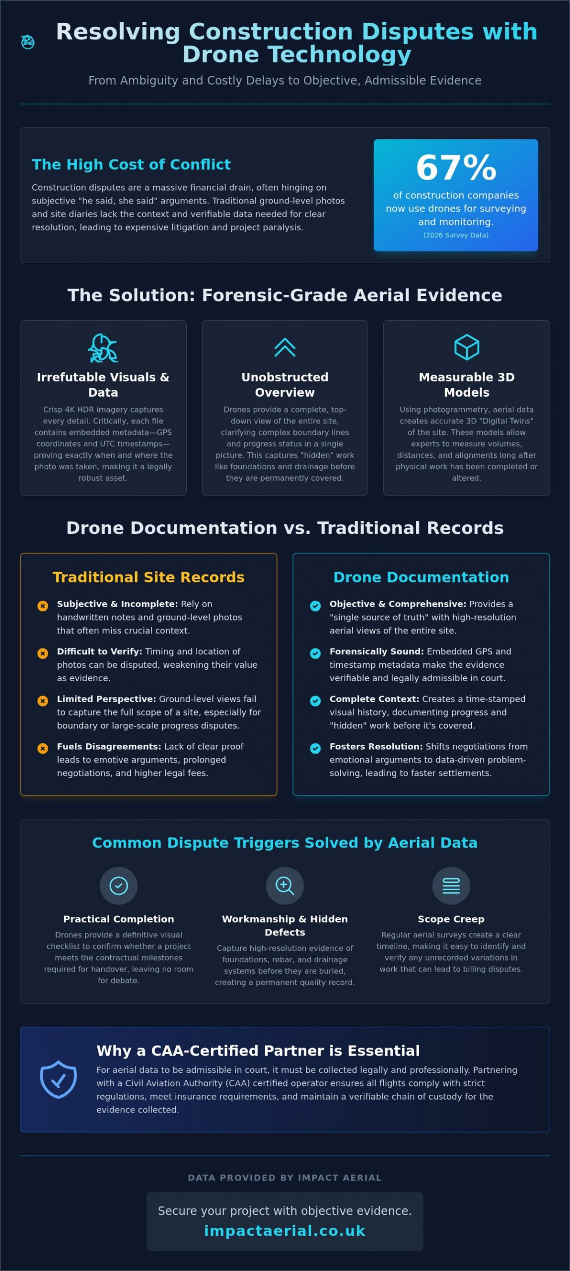
A 2026 survey revealed that 67% of construction companies now use drones for site surveying and progress monitoring, signaling a major shift toward data-driven project management. When a project grinds to a halt due to a disagreement over work quality or a boundary line, the resulting litigation costs often dwarf the original dispute. Utilizing professional drone photography for construction disputes provides a definitive, high-fidelity visual record that removes ambiguity from the conversation.

Our meticulous approach extends to our geographic reach. Based in the West Midlands, we leverage our central location to provide comprehensive nationwide coverage across the UK. This allows us to maintain a consistent standard of forensic data collection for clients with multiple sites, ensuring that the methodology used to resolve a dispute in Birmingham is identical to one in London or Manchester. For developers managing properties in the United States, professional teams like Palm Beach Drone Pros provide similarly high standards of aerial data collection throughout South Florida.

It’s incredibly difficult to prove the status of a site once concrete has been poured or scaffolding is removed, and we understand how stressful these emotive arguments can become for all parties involved. This guide demonstrates how to secure objective proof of work to resolve conflicts efficiently through mediation. You’ll learn how high-accuracy aerial data aligns with Land Registry records and why professional forensic imagery is now the gold standard for protecting your business from costly legal delays.

Key Takeaways

  • Understand how professional drone photography for construction disputes provides forensic-grade evidence that is superior to traditional, ground-level site notes.
  • Learn the importance of 4K HDR imagery and embedded metadata in proving the exact “when” and “where” of site activities for legal admissibility.
  • Discover how consistent construction site monitoring captures critical “hidden” work, such as foundations and drainage, before they are permanently covered.
  • Identify why partnering with a CAA-certified operator is essential for ensuring aerial data meets the strict regulatory and insurance standards required in court.
  • Compare the efficiency of aerial surveys against traditional methods to gain an unobstructed, comprehensive view of complex site boundaries and progress.

The Cost of Conflict: Why Construction Disputes Need Objective Visual Evidence

Construction disputes represent a massive financial drain on the UK industry. When disagreements arise, they often hinge on subjective interpretations of site progress or quality. Traditional site diaries and ground-level photos often lack the necessary context to satisfy a court or mediator. This is where professional drone photography for construction disputes becomes a critical asset. By utilizing advanced aerial photography techniques, stakeholders can secure a comprehensive, time-stamped visual record that serves as a single source of truth.

These high-fidelity records transition from basic progress monitoring into forensic documentation. This shift is essential for Construction Dispute Resolution (CDR) because it provides the granular detail needed to verify structural integrity or site boundaries without relying on memory or incomplete paperwork. Our approach emphasizes precision and technical compliance, ensuring that every frame captured is a reliable asset for your legal or management team.

To better understand how aerial tools provide precise site data, watch this helpful video:

A 2026 survey indicated that 67% of construction companies now use drones for site surveying and progress monitoring. This widespread adoption is driven by the need to avoid the “He said, She said” trap. For example, a contractor might claim a foundation was poured to specification, while the client disagrees. Once that work is buried, resolving the issue becomes a matter of expensive legal debate. High-accuracy drone photography for construction disputes eliminates this ambiguity. It reduces legal billable hours by providing experts with clear evidence, often leading to faster settlements before a case reaches litigation.

Common Triggers for Construction Disputes in the UK

Disputes in the UK often stem from three specific areas where visual clarity is paramount:

  • Practical Completion: Disagreements over whether a project has reached the contractual milestone required for handover.
  • Workmanship and Hidden Defects: Issues with structural elements that are no longer visible to the naked eye after the build progresses.
  • Scope Creep: Unrecorded variations in work that lead to unexpected billing or timeline delays.

The Psychology of Objective Evidence

High-resolution imagery does more than just provide data; it changes the tone of the negotiation. When all parties look at the same high-fidelity map or 4K photo, emotive arguments tend to fade. It establishes a “common operating picture” for stakeholders and mediators alike. This shift from an adversarial stance to a data-driven resolution allows projects to move forward with minimal friction. It ensures site boundaries and work quality are documented with clinical precision, providing the psychological comfort that comes from having an indisputable record.

Forensic Aerial Photography: How Drones Capture Admissible Evidence

Capturing a high-resolution image is only the first step in creating a legally robust record. For drone photography for construction disputes to hold weight in a courtroom or mediation room, it must meet strict forensic standards. This involves preserving a meticulous chain of custody from the moment the sensor captures data to the point it’s presented as evidence. Every digital file contains embedded metadata, including precise GPS coordinates and UTC time stamps, which eliminates any doubt regarding the authenticity or timing of the visual record.

Advanced techniques like Lidar and photogrammetry allow for the creation of 3D “Digital Twins” of a site. These models are far more than visual aids; they’re measurable environments where experts can verify volumes, distances, and structural alignments long after the site has changed. As highlighted in a systematic review on UAVs in claim management, this level of data-centric documentation is vital for resolving complex claims related to delays and site conditions. When data is handled with this degree of technical care, it becomes a powerful tool for de-escalating conflict and proving “hidden” flaws before they’re buried under new layers of construction.

High-Resolution Imagery vs. Consumer Drones

Forensic clarity requires DJI Enterprise-grade hardware rather than standard consumer models. A larger sensor and 4K HDR capability are essential for identifying micro-cracks or subtle material defects that a lower-quality camera would miss. Thermal imaging also plays a role in identifying “invisible” disputes. It can pinpoint water ingress behind facades or heat loss in structural elements, providing objective proof of workmanship issues that ground-level inspections often overlook.

Geospatial Accuracy and Boundary Mapping

Boundary disputes often become emotive and divisive because they lack a common, objective reference point. We solve this by using GPS-tagged data to overlay site images directly onto official Land Registry maps. RTK (Real-Time Kinematic) positioning provides the centimetre-level accuracy required to ensure that aerial maps align perfectly with official Land Registry records. This technical precision is what makes drone photography for construction disputes an indispensable asset for surveyors and legal professionals. If you need this level of forensic detail for your project, our drone commercial property surveys deliver the accuracy required to protect your interests.

Drone Photography for Construction Disputes: A Guide to Forensic Evidence

Drone Documentation vs. Traditional Site Records: A Comparative Analysis

Traditional site records often rely on ground-level photography and manual site diaries, which are frequently prone to obstruction and human error. When deploying drone photography for construction disputes, the contrast in data quality and efficiency is stark. Surveying a 10-hectare site manually can take days of exhaustive site walks; an enterprise drone completes the same task in minutes. This speed doesn’t just save time. It ensures that the visual record is a precise snapshot of a specific moment, preventing the “data drift” that occurs when manual surveys are spread across several days.

The perspective provided by a “God’s eye view” offers a comprehensive understanding that ground cameras simply cannot replicate. While a ground-level photo might show a specific defect, it often lacks the surrounding context necessary to prove how that defect impacts the wider project. Consistent, time-stamped progress intervals allow legal teams to rewind the clock. They can see exactly how a site evolved, providing a level of transparency that traditional records lack. This chronological clarity is often the deciding factor in resolving claims related to project delays or sequencing errors.

Data Depth and Context

Ground-level photos frequently miss the “big picture” of site logistics, such as the placement of heavy machinery or the flow of materials. Aerial data allows experts to zoom into specific snagging list items while maintaining a wide geographic context. This dual-layer approach provides a much higher cost-per-data-point value than traditional surveyors. Research indicates that drone usage can lead to a 55% cost reduction for infrastructure inspections compared to traditional methods. This makes it a financially sound choice for firms looking to tighten their dispute resolution processes.

Safety and Risk Mitigation

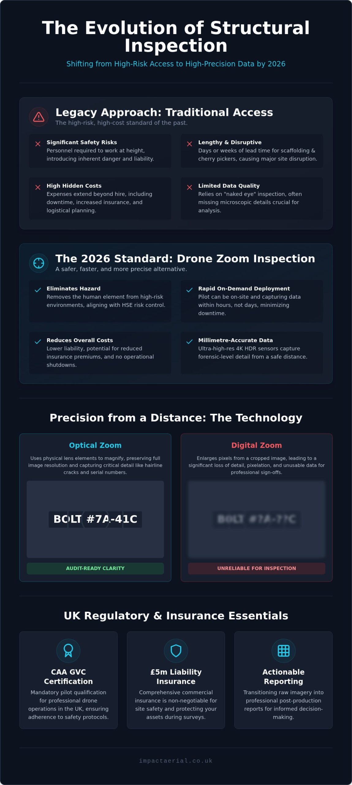
Safety is a cornerstone of professional site management, especially during an active dispute where tensions may be high. Using drones reduces the need for personnel to conduct “at height” inspections or enter hazardous, unreachable areas of a site. Capturing data remotely minimizes the requirement for expensive scaffolding or specialized access equipment just to verify a claim. The impact of professional drone surveys on site-wide safety protocols is significant. By removing human inspectors from high-risk environments, contractors often benefit from lower insurance premiums and a reduced likelihood of secondary health and safety disputes. This meticulous approach to data collection provides psychological comfort to all stakeholders, knowing that the evidence is gathered without compromising site safety.

Implementing Drone Data in Mediation, Boundary Disputes, and Litigation

Deploying professional drone photography for construction disputes follows a structured lifecycle, moving from preventative site records to forensic presentation in legal settings. This methodical approach ensures that data is not just captured, but is technically robust enough to withstand scrutiny by RICS surveyors, mediators, or high-court judges. By integrating aerial data early, project managers can resolve disagreements before they escalate into full-scale litigation.

The implementation process typically follows four critical steps:

  • Step 1: Pre-construction Baselines. We establish a definitive “before” state of the site and its boundaries. This aerial benchmark prevents future arguments regarding pre-existing damage to neighboring properties or site conditions.
  • Step 2: Periodic Progress Monitoring. Regular flights document “hidden” work, such as the placement of steel reinforcement or drainage systems. Capturing these elements before they’re buried under concrete is essential for proving compliance with building standards.
  • Step 3: Evidence Pack Preparation. We compile high-fidelity imagery and metadata into structured evidence packs. These are designed for immediate use by legal teams and expert witnesses during mediation.
  • Step 4: Courtroom Presentation. In complex cases, we present 3D models and orthomosaics that allow a judge to virtually “walk” the site. This provides a level of clarity that static, ground-level photos can’t match.

Resolving Boundary Disputes with Land Registry Overlays

Boundary arguments are often the most emotive and divisive issues in property law. We resolve these by matching current high-resolution aerial imagery with historical Land Registry title plans. This process identifies “boundary drift” caused by the gradual movement of hedges, fences, or unauthorized new builds. Using drone data as a neutral third-party record provides mediators with an indisputable foundation for settlement, often saving parties thousands in protracted legal fees. If your project requires this level of oversight, our construction site monitoring services provide the continuous data stream needed to protect your boundaries.

Proving Delays and Liquidated Damages

Proving why a project fell behind schedule is notoriously difficult without objective records. We use time-stamped aerial data to verify subcontractor presence and actual site progress against the master schedule. This documentation is vital for supporting Extension of Time (EOT) claims or defending against liquidated damages. When a contractor claims weather-related delays, our records provide the visual proof of site conditions on those specific dates. This shift toward data-driven resolution ensures that financial settlements are based on forensic facts rather than anecdotal site diaries.

Securing Your Project: Why CAA-Certified Drone Partners are Essential

The admissibility of drone photography for construction disputes depends entirely on the legality of the operation. Hiring an uncertified pilot creates a significant risk that your evidence will be dismissed in court or mediation. If a pilot fails to adhere to UK Civil Aviation Authority (CAA) regulations, the data they capture is often viewed as illegally obtained, rendering it useless for forensic purposes. Professional operators ensure that every flight is conducted within the law, providing the psychological comfort that your evidence is beyond reproach.

As of 2026, UK regulations require anyone operating a drone over 100g to hold a valid Flyer ID and Operator ID, with the latter requiring an annual fee of £12.34. For complex construction environments, a General Visual Line of Sight Certificate (GVC) is the industry standard. This certification proves the pilot has the technical training to manage high-risk sites safely and legally. Furthermore, professional partners maintain £5m commercial liability insurance as a baseline. This level of coverage is essential for construction projects, protecting all stakeholders from the financial fallout of unforeseen operational incidents.

Our meticulous approach extends to our geographic reach. Based in the West Midlands, we leverage our central location to provide comprehensive nationwide coverage across the UK. This allows us to maintain a consistent standard of forensic data collection for clients with multiple sites, ensuring that the methodology used to resolve a dispute in Birmingham is identical to one in London or Manchester.

Compliance and Legal Robustness

A valid UK drone license is more than a regulatory hurdle; it’s your guarantee that data is gathered ethically and legally. Every professional operation is underpinned by detailed Risk Assessment and Method Statements (RAMS), which are critical for site safety and insurance compliance. We also handle the complexities of GDPR and privacy laws. By ensuring that aerial data collection doesn’t infringe on the rights of neighboring properties, we prevent the creation of new legal liabilities that could complicate an existing dispute.

Why Impact Aerial for Construction Disputes?

We combine technical expertise in drone photography with a deep understanding of the property and commercial sectors. Our team manages the entire project lifecycle, from the initial consultation and flight planning to high-end post-production services. This end-to-end management ensures that the “digital truth” we provide is accurate, high-fidelity, and ready for use in any legal framework. Don’t leave your project’s resolution to chance with amateur data. Protect your project and resolve disputes with Impact Aerial today.

Resolving Site Disagreements with Forensic Precision

The shift toward data-centric resolution is no longer a luxury; it’s a necessity for modern construction management. High-fidelity visual evidence provides the “digital truth” needed to move past subjective site arguments and costly delays. Professional drone photography for construction disputes transforms complex site data into admissible forensic assets, ensuring that project timelines and workmanship are documented with clinical accuracy. By establishing a clear visual record, you don’t just win arguments; you prevent them from escalating in the first place.

Impact Aerial provides the technical expertise and regulatory compliance required for these sensitive cases. Our team of CAA GVC Certified Pilots utilizes advanced 4K HDR and Lidar capabilities to capture every detail with centimetre-level precision. We’re Birmingham-based with full UK-wide coverage and carry £5m commercial liability insurance to provide complete operational security. Whether you’re facing a boundary disagreement or a complex structural claim, we deliver the objective data you need to reach a resolution.

Request a Forensic Drone Survey Quote from Impact Aerial and secure the objective proof required to protect your project’s future. We’re here to help you move forward with confidence.

Frequently Asked Questions

Is drone photography admissible as evidence in a UK court?

Yes, aerial imagery is admissible provided it meets strict legal and technical standards. The data must be captured by a CAA-certified pilot who maintains a clear chain of custody and adheres to all safety regulations. Metadata such as embedded GPS coordinates and UTC time stamps are vital for verifying the authenticity and timing of the records in a legal setting.

How much does drone photography for a construction dispute cost?

Costs for these services vary significantly based on the site’s geographic size and the complexity of the data required. Factors such as the number of flight hours, the need for specialized sensors like Lidar, and the depth of post-production analysis all influence the final investment. We recommend requesting a bespoke quote to ensure the survey meets the specific forensic requirements of your case.

What is the difference between a standard photo and a forensic drone survey?

A standard photo is a simple visual snapshot, but a forensic drone survey provides measurable geospatial data. Forensic surveys use photogrammetry or Lidar to create 3D models with centimetre-level accuracy. This allows experts to verify precise volumes, distances, and structural alignments that a ground-level or non-specialized photo simply cannot provide.

Can drones help with boundary disputes involving the Land Registry?

Yes, drones are highly effective for resolving boundary issues by overlaying current high-resolution imagery onto official Land Registry title plans. This process identifies “boundary drift” caused by the movement of fences or hedges over time. It provides a neutral, objective record that helps mediators and legal teams settle disagreements based on technical facts rather than anecdotal claims.

Do I need my neighbour’s permission to use a drone for a boundary dispute?

You don’t always need explicit permission for the flight itself, but you must comply with privacy and trespass laws. Professional pilots follow strict CAA flight path regulations and data protection protocols to ensure the survey is legal. Ensuring that the drone photography for construction disputes is conducted ethically prevents the risk of the evidence being dismissed due to privacy violations.

What certifications should a drone pilot have for construction site work?

A professional pilot must hold a valid Flyer ID and Operator ID, along with a General Visual Line of Sight Certificate (GVC) for complex site operations. These qualifications prove the pilot is trained in meticulous risk assessment and safety management. It is also essential to verify they carry professional commercial liability insurance to protect all stakeholders during the operation.

Can drones identify structural defects that are invisible from the ground?

Yes, drones equipped with thermal sensors or high-zoom 4K cameras can pinpoint issues that ground inspections miss. Thermal imaging is particularly useful for identifying water ingress or heat loss behind building facades. Using drone photography for construction disputes allows you to document micro-cracks and material defects in hard-to-reach areas, providing proof of workmanship flaws before they lead to structural failure.

How quickly can I get drone evidence for an ongoing construction dispute?

Data collection is often completed in a single day once site permissions and safety assessments are finalized. The delivery of the final evidence pack depends on the complexity of the 3D modelling or post-production required. Most professional firms provide a structured timeline, ensuring that high-fidelity visual records are ready for use in mediation or litigation as quickly as possible.

UAV Topographic Survey UK: The Complete Professional Guide for 2026

Traditional ground surveys often take five times longer than aerial alternatives, frequently leaving UK project managers waiting weeks for critical site data. You likely agree that stalling a development due to slow data turnaround or safety risks on hazardous terrain is an avoidable drain on your budget. It’s a common bottleneck that impacts both your bottom line and your delivery schedule, especially when high-precision results are non-negotiable.

By commissioning a professional uav topographic survey uk, you can secure centimetre-level accuracy and full CAA compliance while reducing site time by up to 75%. This guide explains how GVC certified pilots use high-resolution photogrammetry to deliver precision 2D and 3D data for added peace of mind. We’ll examine the 2026 regulatory landscape, cost-saving workflows, and the technical specifications required to ensure your site data collection is both safe and meticulous. You’ll discover how to leverage the latest professional UAV technology to get your project moving faster without sacrificing the quality your stakeholders expect.

Key Takeaways

  • Understand how the shift to high-precision aerial mapping provides a more efficient, high-resolution alternative to traditional ground-based surveying methods.
  • Master the technical distinctions between photogrammetry and aerial LiDAR to ensure your site data achieves centimetre-level accuracy using DJI Enterprise hardware.
  • Navigate the 2026 regulatory landscape by ensuring every uav topographic survey uk is conducted by a CAA GVC certified pilot for total legal compliance.
  • Learn how to transform raw aerial data into professional, actionable deliverables including ortho-mosaic maps, Digital Terrain Models (DTM), and CAD-ready files.
  • Discover why professional-grade insurance and technical expertise are vital for providing the peace of mind required on complex UK construction and development sites.

What is a UAV Topographic Survey and Why is it Essential in 2026?

A Unmanned Aerial Vehicle (UAV) topographic survey is a high-precision aerial mapping method that uses drones to capture detailed data on land features, elevations, and man-made structures. This technology has fundamentally changed how we understand terrain. It has moved the industry away from slow, manual “boots on the ground” methods toward an “eye in the sky” approach. Since the January 2025 update to Civil Aviation Authority (CAA) flight regulations, the barriers to deploying advanced uav topographic survey uk services have dropped. This has made 2026 the definitive tipping point for drone adoption across the UK construction and civil engineering sectors.

Adopting this aerial methodology isn’t just about following a trend; it’s about survival in a competitive market. Large-scale projects now demand the kind of rapid data turnaround that traditional methods simply can’t provide. Recent industry reports indicate that 82% of Tier 1 UK contractors now mandate drone-based site assessments before any ground is broken. This shift ensures that every stakeholder, from the site manager to the lead architect, works from the same high-resolution digital twin.

To better understand how this technology functions in a real-world environment, watch this helpful video:

The Core Purpose of Topographic Mapping

The primary goal is to capture every natural and artificial feature on a site with precise X, Y, and Z coordinates. This data is vital during the earliest stages of the RIBA Plan of Work, specifically Stages 1 and 2, where site feasibility is determined. A topographic survey is a comprehensive digital blueprint of a site’s physical terrain and features that serves as the single source of truth for design teams, preventing 12% of total project costs from being wasted on avoidable design errors. By establishing a centimetre-accurate baseline, developers can calculate earthwork volumes and drainage requirements with total confidence.

UAV vs. Traditional Ground Surveys

The advantages of using a uav topographic survey uk over traditional total station methods are measurable and significant. We focus on three key areas:

  • Speed: A professional drone team can survey a 50-hectare site in approximately 3 hours. A traditional ground crew would require at least 4 days to cover the same area to a similar level of detail.
  • Safety: Drones eliminate the need for surveyors to physically traverse hazardous environments. This includes unstable 30-degree quarry faces, active railway corridors, or contaminated brownfield sites.
  • Data Density: While a surveyor with a total station might capture 500 individual points in a day, a UAV captures millions of points. This results in a 400% increase in data density, providing a much smoother and more accurate digital terrain model.

Various sectors are now reaping these rewards. Property developers use this data to optimise housing layouts on complex hillsides. In the quarrying industry, managers use drone surveys to calculate the volume of 200,000-tonne stockpiles in minutes. Infrastructure projects, such as the ongoing motorway improvements in the West Midlands, rely on these surveys to monitor progress without closing lanes. Even environmental agencies have adopted the technology to track 15cm of annual coastal erosion along the Norfolk coastline, providing “peace of mind” through consistent, repeatable data gathering.

The Technology Behind Centimetre-Level Accuracy

Precision in a uav topographic survey uk relies on the synergy between high-end airframes and advanced spatial sensors. We utilise DJI Enterprise drones, specifically the Matrice 350 RTK and the Mavic 3 Enterprise, which are engineered for stability in the UK’s unpredictable wind conditions. These platforms carry 45-megapixel full-frame sensors capable of capturing data at a Ground Sampling Distance (GSD) of less than 0.8cm per pixel. High-resolution optics are essential; they ensure that every pixel represents a precise coordinate on the earth’s surface, eliminating the blur that plagues consumer-grade hardware.

Photogrammetry vs. LiDAR: Choosing the Right Tool

Selecting the correct sensor is a technical decision based on the site’s physical characteristics. Photogrammetry remains the primary choice for creating high-resolution 3D textured meshes and detailed visual maps. It relies on 80% image overlap to triangulate points in space. However, its main limitation is vegetation. If a site is covered in dense scrub or woodland, photogrammetry only maps the top of the leaves. Adhering to the NatureScot UAV Data Guidance ensures that our data capture meets the rigorous standards required for UK environmental and topographic reporting.

  • Photogrammetry: Best for open sites and visual inspections. It’s cost-effective and provides realistic 3D visualisations.
  • LiDAR: Essential for “seeing through” vegetation. It uses active laser pulses (often 480,000 per second) to find gaps in the canopy and hit the bare earth below.
  • Cost and Conditions: LiDAR equipment is significantly more expensive, often increasing project costs by 40% compared to photogrammetry, but it functions in low-light conditions where cameras fail.

The Importance of RTK and GNSS Corrections

Consumer-grade GPS is never sufficient for professional work. Standard drones often have a horizontal error margin of 3 to 5 metres, which is unacceptable for construction or boundary disputes. We solve this using Real-Time Kinematic (RTK) positioning. The drone maintains a constant data link with a base station or a virtual reference network (VRS) via the mobile internet. This connection corrects satellite signal errors caused by atmospheric interference in real-time. It’s how we achieve sub-5cm absolute accuracy across an entire site.

In areas with poor mobile signal, we employ Post-Processed Kinematic (PPK) workflows. The drone logs raw satellite data during the flight, which we then process against a static base station back at the office. This ensures that even in remote Highland glens or deep valleys, the spatial integrity of the uav topographic survey uk remains uncompromised. For projects requiring this level of precision, you can view our full range of survey capabilities to see how we apply this technology.

Ground Control Points (GCPs) remain vital in 2026. Even with the best RTK systems, we place physical markers on the ground and measure them with a separate GNSS rover. These points act as a “sanity check” for the drone’s data. They provide the absolute “truth” for the coordinate system, ensuring the digital map aligns perfectly with existing Ordnance Survey benchmarks. This meticulous approach provides our clients with the peace of mind that their site data is legally and technically robust.

Drone technology moves fast; the UK Civil Aviation Authority (CAA) keeps pace through strict frameworks. For any uav topographic survey uk, compliance isn’t just a box to tick. It’s the foundation of site safety and data integrity. By 1st January 2026, the full transition to the General Visual Line of Sight Certificate (GVC) will be complete, replacing older legacy permissions. This shift ensures every commercial pilot operates under a standardised, rigorous safety protocol designed for complex environments. Impact Aerial has already adopted these standards to provide a future-proof service for our clients.

Project managers must demand a CAA-certified operator for every site. Hiring an uncertified pilot risks more than just a fine. It can halt an entire multi-million pound development if a safety breach occurs. Professional operators provide a level of oversight that protects the client, the public, and the project timeline. We’ve seen a 40% increase in site managers requesting full certification logs before any drone takes flight, reflecting a growing industry focus on legal accountability.

CAA GVC Certification Explained

The GVC is the essential qualification for ‘Specific Category’ operations. It’s what allows Impact Aerial to fly in built-up areas or near people with reduced separation distances. This certification proves a pilot has passed stringent theory exams and a practical flight assessment. The 2026 deadline means that by January of that year, every pilot you hire for a topographic survey must hold a GVC to operate drones weighing over 250g in the Specific Category. To verify a pilot’s credentials, use this checklist:

  • Request their CAA-issued Flyer ID and Operator ID.
  • Ask for a copy of their GVC certificate and check the expiry date.
  • Ensure they have a valid PDRA-01 (Pre-Defined Risk Assessment) or an Operational Authorisation.
  • Verify their Operations Manual is updated to current 2024 standards.

Risk Management and Insurance

Hiring a drone pilot with hobbyist insurance is a massive liability. These policies usually exclude commercial activity or high-risk environments like active construction sites. We carry £5m commercial liability insurance as a minimum. This coverage is compliant with EC Regulation 785/2004, providing added peace of mind for high-value UK projects. It ensures that in the unlikely event of an incident, the financial and legal interests of the project stakeholders are fully protected. We don’t just fly; we manage risk.

Managing airspace is another critical “behind the scenes” task. If your site is within a Flight Restricted Zone (FRZ) near an airport like Heathrow or Birmingham, we don’t just hope for the best. We secure formal permission from Air Traffic Control (ATC) and file a NOTAM (Notice to Airmen) if required. Every uav topographic survey uk mission we conduct is preceded by a site-specific RAMS (Risk Assessment and Method Statement). This document outlines every potential hazard, from overhead power lines to local wildlife, and details our mitigation strategies. We complete these assessments at least 72 hours before arriving on-site. This meticulous planning is why we remain a leader in a niche but increasingly diverse market, delivering results that are as safe as they are precise.

Actionable Deliverables: From Raw Data to CAD and BIM

A professional uav topographic survey uk produces more than just high-resolution imagery. It generates a comprehensive suite of data-rich assets that drive decision-making across the construction and engineering lifecycle. At Impact Aerial, we transform raw sensor data into centimetre-accurate models. We use photogrammetry and LiDAR to ensure every pixel is georeferenced, providing a reliable foundation for site planning and legal documentation.

  • Ortho-mosaic Maps: These are high-resolution, 2D maps created by stitching together thousands of nadir images. Unlike a standard photograph, an ortho-mosaic is geometrically corrected for lens distortion and topographic relief. This allows for accurate measurements of distance and area directly on the map. We typically deliver these with a Ground Sampling Distance (GSD) of 1cm to 3cm per pixel.
  • Digital Terrain Models (DTM) and Digital Elevation Models (DEM): A DEM represents the earth’s surface including all objects on it. However, for civil engineering, the DTM is often more valuable. Our processing software filters out vegetation, vehicles, and temporary structures to reveal the bare earth. This is essential for 2024 drainage designs and flood risk assessments required by local authorities.
  • 3D Point Clouds: These consist of millions of individual data points, each with its own X, Y, and Z coordinate. Point clouds provide the geometric skeleton for modern Building Information Modelling (BIM). They allow architects to “walk through” a site digitally before a single brick is laid.
  • Volumetric Analysis: For earthworks and quarrying, we provide precise calculations for stockpiles and excavations. Drone-based volumetrics are now 98.5% accurate compared to traditional base-and-rover methods, while being 75% faster to complete.

Integrating Drone Data into CAD Workflows

Modern engineering relies on interoperability. We ensure our data integrates directly with industry-standard software like AutoCAD, Civil 3D, and Revit. We generate .DXF and .DWG files from aerial data to provide surveyors with usable 2D contour drawings. By thinning dense point clouds into manageable vector formats, we prevent software lag while maintaining sub-50mm precision. This workflow allows your team to begin design work within 48 hours of our site visit, significantly reducing the typical two-week lead time associated with ground-based surveys.

Digital Twins and Stakeholder Engagement

We create immersive “Digital Twins” using 3D textured meshes. These models serve as a living record of the site. High-quality visual data improves communication with investors and local councils by providing a clear, interactive view of project impact. There is a natural crossover here between technical survey data and cinematic progress filming. While the engineers use the point clouds for structural analysis, the marketing and management teams use the textured meshes for site inductions and stakeholder presentations. This dual-purpose data provides exceptional value for money on complex UK developments.

For high-precision data that integrates directly with your existing software, explore our professional survey deliverables today.

Why Impact Aerial is the UK’s Trusted UAV Survey Partner

Choosing a provider for a uav topographic survey uk requires a partner that balances technical surveying precision with high-end data capture. Impact Aerial bridges the gap between raw data collection and actionable project intelligence. Our team operates from a central base in Birmingham, allowing us to deploy commercial-grade DJI Enterprise equipment to any site across the United Kingdom within hours. We don’t just fly drones; we provide a technical consultancy that ensures the data we deliver integrates perfectly with your existing CAD or BIM workflows.

Safety and compliance sit at the heart of our operations. Every pilot at Impact Aerial is CAA GVC certified, reflecting the latest UK civil aviation standards that replaced the older PfCO system. This certification, combined with our £5 million commercial liability insurance, provides the “peace of mind” our clients expect when operating in complex environments. We utilise the DJI Matrice 350 RTK and Mavic 3 Enterprise fleets, which allow for centimetre-level accuracy without the constant need for manual ground control points, saving up to 40% of time on-site compared to traditional methods.

  • Technical Precision: Sub-50mm accuracy levels suitable for architectural planning and civil engineering.
  • Equipment: Deployment of high-resolution 45MP full-frame sensors and RTK-enabled flight controllers.
  • UK-Wide Reach: Rapid deployment from our West Midlands hub to construction sites, quarries, and rural estates.
  • Consultative Delivery: We provide data in formats you actually use, including .DXF, .DWG, and high-density point clouds.

The Impact Aerial Difference

Our approach is defined by meticulous attention to detail and a deep understanding of the property, construction, and building services sectors. Since 2017, we’ve focused on delivering more than just a bird’s-eye view. We understand the specific pressures of a 150-unit housing development or a complex roof inspection. Our expertise extends beyond topography into comprehensive Drone Property Surveys, where we identify structural anomalies that ground-based teams might miss. We treat every project as a unique challenge, tailoring our flight paths and sensor settings to the specific contours and obstacles of your site.

Get Started with Your UAV Topographic Survey

The process begins with a detailed consultation where we assess your site’s specific requirements and airspace constraints. We handle all necessary CAA notifications and risk assessments internally, ensuring your project remains compliant with UK law. Once the flight is complete, our data processing team uses advanced photogrammetry software to transform thousands of images into a single, cohesive 3D model or 2D orthomosaic map. Most clients receive their processed data within 72 hours of the flight, allowing for rapid decision-making and project progression.

If you need a uav topographic survey uk that delivers high-accuracy results alongside professional service, our team is ready to assist. We provide transparent, fixed-fee quotes based on your site’s acreage and the specific deliverables you require. Don’t settle for “off-the-shelf” drone photography when your project demands engineering-grade data and a safety-first culture.

Ready to elevate your project data? Contact Impact Aerial for a Professional Drone Survey Quote today to discuss your site requirements with our Birmingham-based expert team.

Future-Proof Your Development with High-Precision Aerial Data

Transitioning to a uav topographic survey uk in 2026 offers more than just rapid data collection. It provides the centimetre-level precision necessary for complex CAD and BIM workflows, ensuring your site plans are accurate from the start. Impact Aerial bridges the gap between raw data and actionable insights using our commercial-grade DJI Enterprise fleet. We prioritise your project’s safety and legal standing by deploying only CAA GVC Certified pilots, backed by £5m commercial liability insurance for added peace of mind.

Operating from our Birmingham hub, we provide comprehensive national coverage to support developers and engineers across the country. Our methodical approach ensures every deliverable meets the highest industry standards. It’s time to elevate your site intelligence with a partner who understands the rigours of modern UK regulations and precision engineering. We’re ready to help you streamline your workflow today.

Request a Professional UAV Topographic Survey Quote

We look forward to helping you achieve unparalleled accuracy on your next project.

Frequently Asked Questions

How accurate is a UAV topographic survey in the UK?

A professional uav topographic survey uk provides high-precision data with a relative accuracy of +/- 20mm to 50mm. We achieve these tolerances by using RTK (Real-Time Kinematic) enabled drones and strategically placed Ground Control Points (GCPs). This level of detail ensures that site levels and features meet the RICS (Royal Institution of Chartered Surveyors) standards required for construction and engineering projects across the West Midlands and beyond.

Do I need to notify the CAA before a drone survey on my site?

You don’t need to notify the Civil Aviation Authority (CAA) yourself because our GVC certified pilots manage all regulatory compliance. We operate under specific UK Open or Specific Category rules, which include conducting thorough risk assessments and checking for Flight Restriction Zones (FRZs). If your site falls within an FRZ, such as near Birmingham Airport, we coordinate directly with Air Traffic Control to secure the necessary flight permits for your peace of mind.

What is the typical cost of a UAV topographic survey in the UK?

Costs for a drone survey typically range from £650 for a small 2-hectare site to over £2,500 for complex 50-hectare developments. Prices reflect the site’s complexity, the required level of detail, and the final data processing time. For a standard commercial plot in the UK, you can expect to pay between £800 and £1,200, which covers the flight operations, data-gathering, and the delivery of a fully rectified orthomosaic map.

Can drones conduct topographic surveys in wooded or overgrown areas?

Standard photogrammetry cannot penetrate dense canopy, but we use LiDAR (Light Detection and Ranging) sensors to map wooded or overgrown areas. LiDAR pulses can filter through gaps in vegetation to reach the ground, allowing us to create a Digital Terrain Model (DTM) even in 100% obscured conditions. This technology captures up to 2 million points per second, ensuring we deliver accurate ground levels where traditional visual cameras would fail.

How long does it take to receive the final survey data?

You’ll typically receive your final data within 3 to 5 working days after the flight is completed. While the on-site data-gathering for a 10-hectare site often takes less than 4 hours, the subsequent photogrammetry processing and quality assurance checks require significant computing time. We prioritise precision over speed to ensure every coordinate is verified against our ground-based survey equipment before the final files are released.

What insurance should a professional drone survey company have?

A professional operator must hold specialist commercial liability insurance that is fully compliant with EC 785/2004 regulations. We maintain a minimum of £5 million in public liability cover for every project, providing you with absolute peace of mind during site operations. It’s vital to check that your provider’s policy specifically covers aerial surveying rather than just aerial photography to ensure full protection against technical errors or site incidents.

Is a drone survey better than a traditional land survey?

A uav topographic survey uk is up to 5 times faster than traditional total station methods and captures millions more data points. While traditional surveys are excellent for individual boundary points, drones provide a complete, high-resolution visual record of the entire site. This comprehensive data-gathering approach reduces the risk of missed features and allows for 3D volumetric analysis that isn’t possible with standard land survey techniques.

What file formats will I receive for my CAD or BIM software?

We deliver data in industry-standard formats that integrate seamlessly with AutoCAD, Revit, and other BIM platforms. You’ll receive .DWG or .DXF files for 2D and 3D line work, .LAS or .LAZ files for point clouds, and high-resolution .TIF files for orthomosaic maps. These outputs ensure your engineering team can immediately use the survey data for site planning, drainage design, or volume calculations without needing additional conversion software.