Drone Photography for Insurance Documentation: The 2026 Professional Guide

Did you know that utilizing professional drone photography for insurance documentation can accelerate claim processing by 43%? In a sector where time often dictates the scale of a loss, waiting weeks for a manual adjuster to climb a ladder is no longer the industry standard. You’re likely tired of the friction caused by subjective damage assessments and the inherent safety risks of traditional roof inspections. It’s frustrating when a legitimate claim is stalled by disputes over whether a defect is recent storm damage or simple wear and tear.

This guide demonstrates how high-resolution aerial data provides the undeniable evidence needed to secure faster settlements and eliminate inspection risks. We’ll explore the 2026 CAA regulatory requirements, including the new 100g registration threshold and mandatory Remote ID, while detailing how technical photogrammetry turns a visual survey into a forensic record. You’ll learn how to leverage these professional services to ensure every asset condition is documented with total precision, providing added peace of mind for both the insurer and the policyholder.

Key Takeaways

  • Discover how high-resolution aerial data streamlines claim processing by up to 43% compared to traditional manual inspection methods.
  • Learn the technical standards required for admissibility, including essential EXIF metadata and GPS-referencing for forensic accuracy.
  • Understand the strategic value of drone photography for insurance documentation in establishing pre-loss baselines and capturing immediate post-loss evidence.
  • Identify why CAA GVC certification and EC 785/2004 compliant insurance are non-negotiable for legally sound data gathering in 2026.
  • Explore how utilizing a professional fleet of DJI Enterprise drones provides the precision needed for complex commercial property inspections.

The Shift to Aerial Data: Why Drones are Essential for Insurance in 2026

By May 2026, the insurance industry has largely moved beyond the limitations of manual adjusters. Traditional methods rely on human observation, which is inherently prone to error and often provides incomplete coverage of large or complex structures. We define drone photography for insurance documentation as a forensic data-gathering tool rather than a creative pursuit. This shift ensures that every pixel serves as objective, timestamped proof that stands up to scrutiny during a claim. It turns a subjective argument into a factual discussion.

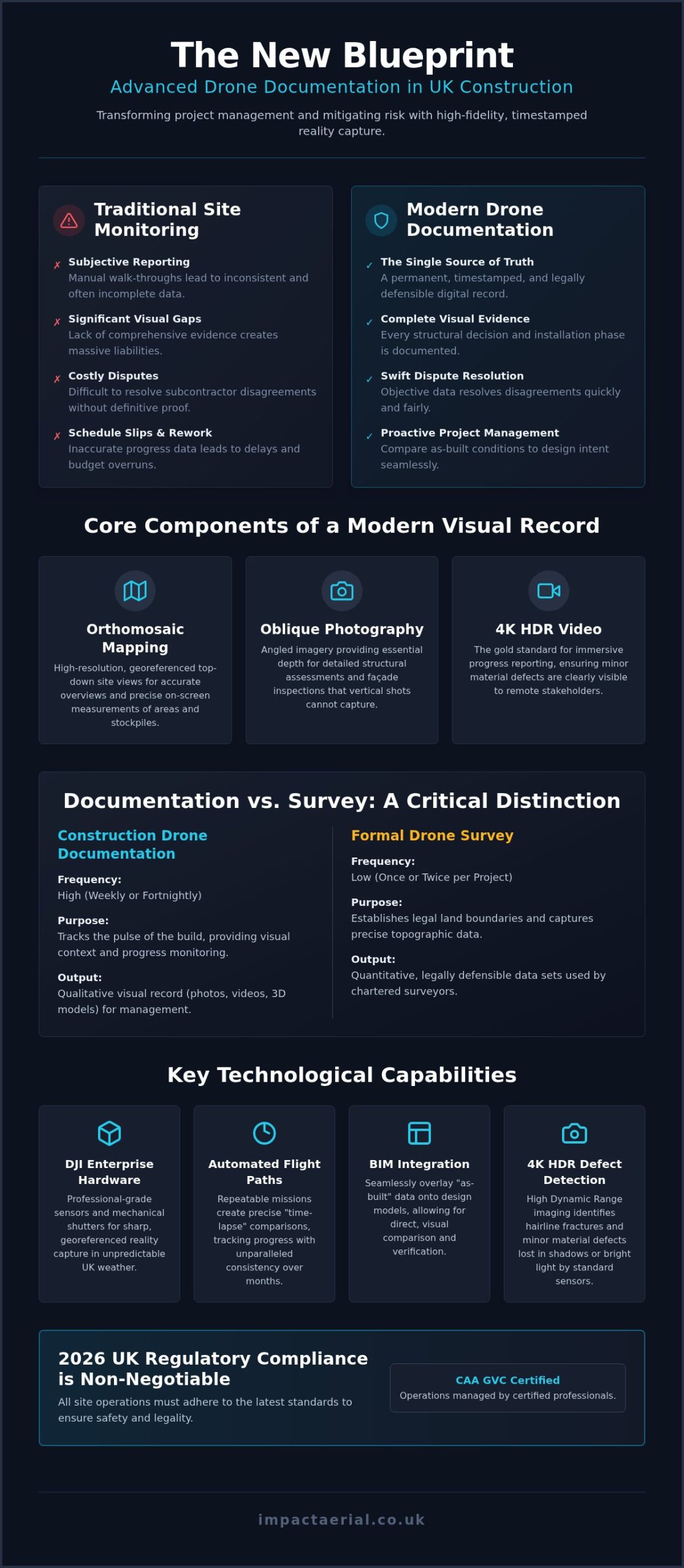
Utilizing our fleet of DJI Enterprise drones, we capture 4K HDR imagery that reveals breath-taking detail. These high-resolution files allow adjusters to zoom in on micro-fissures in masonry or subtle hairline cracks in roofing tiles that are invisible to the naked eye. This level of precision provides added peace of mind for property owners and stakeholders during the stressful aftermath of an incident. It’s about providing a definitive record that leaves no room for doubt.

To better understand the efficiency of these aerial workflows, watch this helpful video:

Eliminating Safety Risks and Access Issues

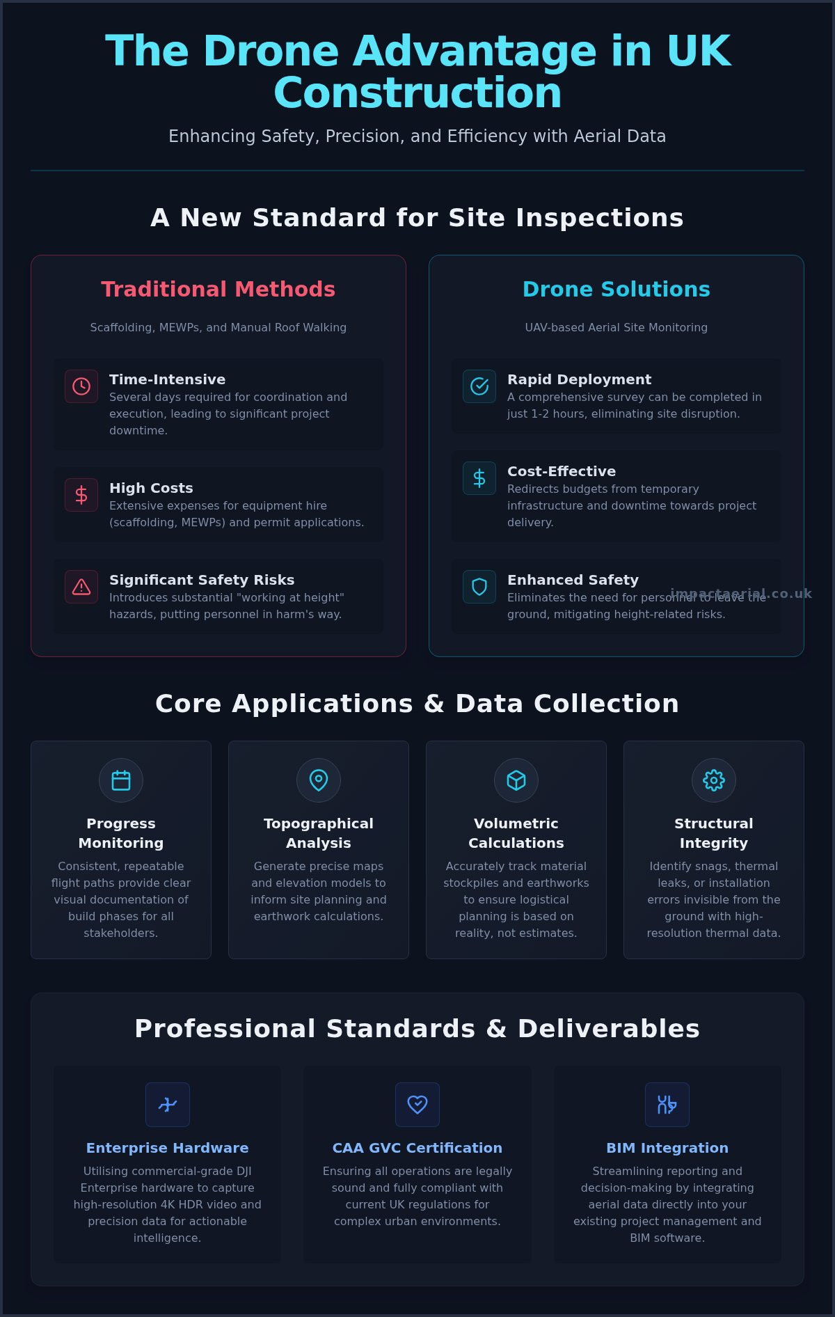
Traditional high-level roof inspections require expensive scaffolding or cherry pickers. These methods are slow and introduce significant liability to a site. Drones eliminate these requirements by accessing dangerous or unstable structures post-fire or post-flood without putting personnel at risk. By removing the need for physical climbing, drone technology fundamentally reduces risks associated with the Work at Height Regulations (WAHR). Professional operators must remain compliant with evolving international drone regulations to ensure the resulting data is legally admissible and safety-compliant.

The Speed of Digital Evidence Gathering

Speed is critical when responding to UK weather events, such as the severe wind incidents frequently seen across Birmingham and the West Midlands. A single flight session can capture 100% of a building’s envelope, including hard-to-reach gables and valleys. This comprehensive data set allows for a rapid desk-side review by loss adjusters, often reducing processing times by 43%. Our drone services ensure that evidence is captured before temporary repairs, such as tarpaulin covers, obscure the primary damage. Digital delivery means the entire claim cycle moves faster, from the initial site visit to the final settlement.

Technical Admissibility: What Insurers Require from Drone Imagery

For an insurer to accept aerial data, the files must be more than just clear images; they must be forensic records. High-quality drone photography for insurance documentation relies on embedded EXIF metadata. This data includes the exact date, time, and altitude for every frame captured. Without these verifiable markers, an image is merely a picture without context. In a legal or insurance dispute, these timestamps prove the condition of the asset at a specific moment, preventing claims that damage occurred after the inspection date.

Repeatable flight paths represent another vital technical requirement. By using automated waypoint missions, we can return to the exact same spatial coordinates months or years later. This allows adjusters to compare “before and after” imagery from identical angles and altitudes. This consistency is essential for tracking the progression of structural issues or verifying that repairs were completed to the required standard. While UK operators adhere to CAA standards, those operating in the US must follow FAA Part 107 regulations to ensure their data remains legally sound and admissible in international claims.

Geotagging and Spatial Accuracy

By embedding precise GPS coordinates into every frame, we create an undeniable link between the digital image and the physical location of the asset. This level of spatial accuracy is critical on large commercial sites where identifying a specific roof leak among dozens of identical units is difficult. Our team utilizes DJI Enterprise technology to maintain centimetre-level precision during data collection. This ensures that every defect found is mapped accurately, allowing for seamless integration with existing property management software. If you require this level of forensic detail, our professional drone services provide the technical rigour necessary for complex claims.

Visual Fidelity and Zoom Capabilities

Commercial-grade sensors are non-negotiable for professional evidence gathering. We utilize high-resolution sensors that allow adjusters to identify missing granules on shingles or hairline cracks in masonry from a safe distance. Standard resolution often blurs these fine details, leading to inconclusive reports. High Dynamic Range (HDR) is critical for documenting never-before-seen angles in dark structural recesses, such as under eaves or within charred internal voids. This technology ensures that details in both deep shadows and bright highlights are preserved, providing drone photography for insurance documentation that captures the full extent of the damage without loss of clarity.

Strategic Documentation: Pre-Loss Baselines vs. Post-Loss Claims

Proving the exact moment damage occurred is one of the most difficult challenges in any claim. Without a documented baseline, insurers may attribute structural defects to pre-existing wear and tear rather than a specific event. This is where strategic drone photography for insurance documentation becomes a critical asset for property managers and developers across the UK. By maintaining a chronological record of an asset’s condition, you move from a position of defense to one of undeniable evidence.

Timing is everything. Capturing high-resolution data immediately after a loss event ensures the adjuster sees the raw damage before temporary repairs, such as tarpaulins or emergency boarding, obscure the site. This proactive approach eliminates ambiguity and streamlines the entire settlement process. Understanding the broader context of drone use in the insurance industry reveals that carriers are increasingly favoring policyholders who provide high-quality, professional aerial data over those relying on ground-based snapshots.

The Pre-Loss Baseline Strategy

Establishing a “gold standard” record of your property is the most effective way to mitigate future risk. We recommend conducting annual drone property surveys to create a digital twin of your assets. This digital record serves as a benchmark for long-term structural monitoring, allowing you to track subtle changes in roof health or masonry over time. Proactive documentation often aids in reducing insurance premiums by demonstrating a commitment to meticulous maintenance and risk management. For commercial property developers, this data provides added peace of mind, ensuring that any future claims are backed by a verifiable history of the building’s envelope.

Post-Event Damage Assessment

When a storm hits the West Midlands or other parts of the UK, the damage is rarely uniform. High-velocity winds can cause localized wind uplift, while hail impact might only affect specific elevations. Our drone photography for insurance documentation captures a comprehensive bird’s eye view of the entire site, revealing devastation that is often invisible from the ground. We use advanced photogrammetry to calculate the exact square footage of damaged areas, providing adjusters with precise metrics for material replacement costs. This level of forensic detail prevents disputes over the scale of the loss and ensures your settlement reflects the true cost of restoration. Digital delivery of this data allows for a rapid desk-side review, which is a primary reason why drone-assisted claims are processed 43% faster than traditional manual inspections.

Compliance & Liability: Ensuring Your Drone Data is Legally Sound

Data gathered through drone photography for insurance documentation is only as valuable as its legal admissibility. If an operator fails to meet the stringent UK Civil Aviation Authority (CAA) standards, an insurer has every right to reject the evidence entirely. This is a significant risk when hiring uncertified hobbyists. These individuals often lack the necessary operational authorizations and commercial insurance required to fly in complex environments. In a niche but increasingly diverse market, the distinction between a professional service and a casual flyer is defined by their adherence to the law.

The danger of using uncertified pilots extends beyond simple data rejection. If a drone incident occurs on your site, the lack of professional-grade insurance can leave property managers personally liable for third-party damages. Statistics from 2024 show that 97% of commercial clients now mandate proof of valid insurance and certification before any flight operations begin. Ensuring your pilot is fully vetted is the only way to protect your business interests during a claim.

The Importance of CAA GVC Certification

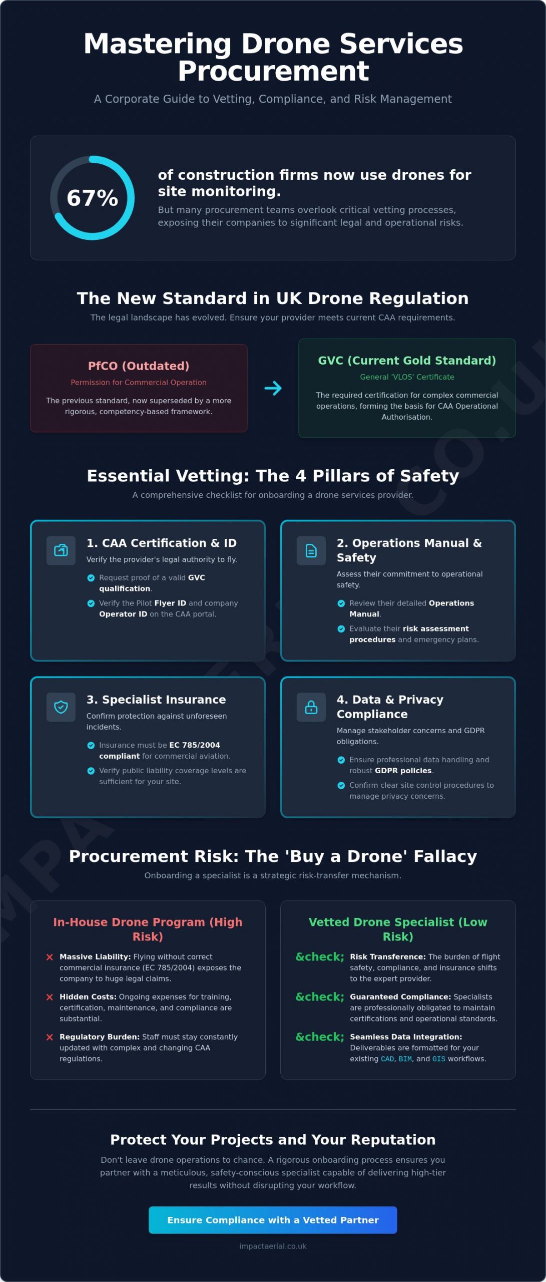
The General Visual Line of Sight Certificate (GVC) is the professional benchmark in 2026. This certification replaced the older PfCO and ensures that pilots are trained in the latest safety protocols and risk assessments. Certified operators must stay current with the January 1, 2026, regulations, which lowered the registration threshold to 100g and made Remote ID mandatory for all new drones. By working with a pilot who holds a valid UK drone license, you ensure that every flight is logged and conducted within a strict safety framework. This meticulous record-keeping is essential for proving the validity of your data to an insurance adjuster.

Commercial Liability and Professional Indemnity

For added peace of mind, Impact Aerial maintains £5m in commercial liability insurance. This level of coverage is essential when operating high-precision drones on high-value commercial sites or near public infrastructure. Professional operators must carry EC 785/2004 compliant insurance to ensure that all stakeholders are protected. Before commissioning a survey, always ask for a copy of the operator’s insurance certificate and their CAA operator ID. Our affiliations with the Drone Safe Register and ARPAS-UK serve as a non-verbal signature of our commitment to industry standards and reliability.

Data protection is equally vital. Handling high-resolution drone photography for insurance documentation requires strict adherence to GDPR, especially when capturing imagery near third-party properties or public spaces. We ensure that any identifiable data not relevant to the claim is redacted or handled securely. This comprehensive approach to compliance ensures your documentation is both technically superior and legally bulletproof. Contact our CAA GVC Certified team to secure a compliant aerial survey for your next claim.

Impact Aerial: Expert Insurance Documentation in the UK

Impact Aerial operates as a specialized technical consultant within a niche but increasingly diverse market. We recognize that drone photography for insurance documentation requires more than just a pilot; it demands a forensic mindset and a deep understanding of structural data. Our meticulous approach to drone services ensures that property developers, building services, and insurers receive data that is both technically superior and legally sound. From the initial consultation to the final delivery of post-production reports, we manage every detail of the evidence-gathering process.

Our safety-first culture is the foundation of our reputation. We don’t just claim to be safe; we demonstrate it through our CAA GVC Certification and rigorous adherence to the 2026 UK drone regulations. By maintaining a fleet of the latest DJI Enterprise drones, we provide our clients with the reassurance that their assets are being documented by the best technology available. This commitment to precision turns a complex claims process into a manageable, data-driven workflow, providing added peace of mind for all stakeholders involved.

Commercial-Grade Technology

The quality of your evidence depends entirely on the sensors used during the flight. We utilize 4K HDR sensors to capture breath-taking detail, ensuring that even the smallest structural defects are visible in high-contrast environments. For subsurface damage detection, our thermal imaging capabilities reveal heat signatures that indicate moisture ingress or insulation failure behind facades. The precision of our survey drone fleet allows us to generate customized reporting formats. These reports are specifically tailored for the technical requirements of insurance adjusters and structural engineers, featuring GPS-tagged imagery and annotated damage maps that leave no room for misinterpretation.

Your Trusted West Midlands Partner

While we serve the entire UK, our regional expertise in Birmingham and the West Midlands allows us to respond rapidly to local loss events. We understand the specific architectural challenges and weather patterns of the region, from industrial complexes in the Black Country to modern commercial developments in the city centre. This local knowledge, combined with our national reach, makes us a leading partner for comprehensive asset documentation. If you require undeniable evidence for an active claim or wish to establish a pre-loss baseline for your property portfolio, you can Request a Quote through our website. We remain dedicated to providing top-quality results that combine technological innovation with absolute regulatory compliance.

Secure Your Claims with Forensic Aerial Data

The integration of aerial technology into the insurance lifecycle has transformed how we document asset condition. By moving away from manual inspections, you reduce safety risks and capture data that is 43% faster to process than traditional methods. High-resolution drone photography for insurance documentation serves as a forensic record, providing the undeniable evidence needed to settle disputes over wear and tear. It’s no longer just about taking photos; it’s about gathering objective data that stands up to scrutiny.

Maintaining compliance with the latest 2026 CAA regulations ensures your data remains legally sound and admissible. Professional operators provide the technical rigour that hobbyists can’t match, particularly when handling complex commercial property surveys. Our team combines regional expertise in the West Midlands with a national reach, ensuring every flight is backed by meticulous risk assessments. Secure your property’s evidence, contact Impact Aerial for a professional insurance documentation quote today. With our CAA GVC Certified pilots, £5m commercial liability insurance, and a fleet of DJI Enterprise 4K HDR drones, we provide the precision you need for total peace of mind. You can trust our experts to protect your interests through every stage of the claim.

Frequently Asked Questions

Is drone photography admissible in UK insurance claims?

Yes, drone photography for insurance documentation is fully admissible in the UK provided it is captured by a CAA GVC Certified pilot. For the data to be legally sound, it must include forensic EXIF metadata such as date, time, and precise GPS coordinates. 2024 industry data indicates that this objective evidence helps process claims 43% faster than traditional manual methods by removing subjective disputes.

How much does a drone survey for insurance cost in the UK?

In 2026, drone roof inspections for insurance claims typically cost between $0.15 and $0.45 per square foot. This is significantly more cost-effective than manual inspections, which can range from $0.75 to $1.25 per square foot due to scaffolding and labour requirements. Adding thermal imaging capabilities for subsurface damage detection generally adds between $0.08 and $0.15 per square foot to the total survey cost.

What certifications should a drone pilot have for insurance work?

A professional pilot must hold a General Visual Line of Sight Certificate (GVC) and a valid CAA Operator ID, which carries an annual fee of £12.34 as of May 2026. They must also ensure compliance with the 100g registration threshold that took effect on January 1, 2026. These credentials prove the operator is trained in the latest safety protocols and understands mandatory Remote ID broadcast requirements.

Can drones detect internal water damage or just external roof issues?

Drones equipped with thermal sensors can detect subsurface moisture and internal water ingress by identifying temperature anomalies in the building envelope. While standard 4K HDR sensors are perfect for external issues like hairline cracks or slipped tiles, thermal data enhances underwriting accuracy by 40% to 60%. This allows adjusters to see trapped moisture that hasn’t yet manifested as visible internal staining.

Do I need to inform my neighbors if a drone is documenting my building?

You aren’t strictly required by law to obtain neighbor consent for a legal flight, but you must comply with GDPR and privacy regulations regarding data storage. Professional operators use meticulous flight paths to ensure third-party properties aren’t the focus of the drone photography for insurance documentation. Since January 1, 2026, all new drones utilize Remote ID, which provides public transparency regarding the drone’s identity and position.

How long does it take to receive the drone documentation report?

Most digital documentation reports are delivered within 24 to 72 hours following the flight session. This rapid turnaround is essential for responding to storm events in the West Midlands where evidence must be captured before temporary repairs begin. The speed of digital delivery is the primary reason why drone-assisted claims move through the settlement cycle 43% faster than those relying on ground-based adjusters.

What happens if a drone crashes during an insurance inspection?

Professional operators carry EC 785/2004 compliant insurance to handle any incidents, providing total protection for the property owner. Impact Aerial maintains £5m in commercial liability insurance for added peace of mind on high-value sites. A 2025 report showed that one in seven commercial drone incidents lead to third-party claims, making professional-grade insurance a non-negotiable requirement for any commercial contract.

Can drones be used for pre-loss risk assessments to lower premiums?

Yes, establishing a “gold standard” pre-loss baseline can enhance underwriting accuracy by up to 60%. By providing insurers with high-resolution evidence of a well-maintained roof or structure, property owners can often negotiate more favourable premiums. This proactive documentation eliminates disputes over pre-existing wear and tear, ensuring that any future claim settlements are based on the actual damage sustained during a specific event.

Drone Survey Deliverables Explained: A Complete Guide for UK Professionals (2026)

A high-resolution aerial photograph is not a survey; it is a liability if it lacks the georeferenced precision required for engineering-grade decisions. You likely agree that while drones capture stunning visuals, the real value lies in the technical data behind the pixels. Many UK project managers still face the frustration of receiving imagery that looks impressive but won’t align with their existing AutoCAD or BIM workflows. This gap between expectation and reality usually comes from a lack of clarity regarding the specific outputs a professional operator must provide.

In this guide, we provide drone survey deliverables explained to bridge the gap between raw aerial data and actionable project success. You’ll learn how to distinguish between orthomosaics, point clouds, and digital terrain models, ensuring your next hire delivers files compatible with Revit or Civil 3D. We also outline the essential CAA GVC certifications and commercial insurance requirements that provide peace of mind for site safety. This article offers a clear roadmap for integrating precise 2D and 3D data into your 2026 project planning with absolute confidence.

Key Takeaways

  • Distinguish between qualitative visual inspections and quantitative metric surveys to ensure you are commissioning the correct data set for your specific project needs.
  • Gain full technical clarity with our guide to drone survey deliverables explained, covering everything from 2D orthomosaics to high-density 3D point clouds and digital twins.
  • Unlock actionable business intelligence by learning how to calculate precise earthwork volumes and identify critical infrastructure faults through professional thermal reports.
  • Enhance stakeholder engagement and project planning by utilizing realistic 3D textured models for immersive virtual walkthroughs and site presentations.
  • Ensure operational compliance by understanding why CAA GVC certification and £5m commercial liability insurance are non-negotiable for professional drone surveys in the UK.

Understanding Drone Survey Deliverables: Data vs. Imagery

For UK construction and engineering professionals, drone survey deliverables explained effectively must start with a shift in perspective. You aren’t just paying for aerial photography. While a standard visual inspection is qualitative, providing a visual record of an asset’s condition, a professional drone survey is quantitative. It produces measurable, geo-spatial data sets that function as a digital twin of your site. In 2026, the distinction is clear: imagery is for looking, but data is for measuring.

The most critical factor in any deliverable is accuracy, defined by the Ground Sample Distance (GSD). GSD represents the distance between the centres of two consecutive pixels measured on the ground. A GSD of 1cm means one pixel in your image represents 1cm squared in reality. Impact Aerial prioritises this precision by using CAA GVC certified pilots who understand the technical requirements of data integrity. This certification ensures that every flight adheres to UK safety regulations while maintaining the rigorous standards required for survey-grade results.

To better understand this concept, watch this helpful video:

The Anatomy of a Professional Drone Survey

Professional data capture relies on two primary methods: Photogrammetry and LiDAR. Photogrammetry uses high-resolution overlapping images to triangulate points in space, while LiDAR uses laser pulses to measure distances directly. To achieve sub-centimetre accuracy, we use Ground Control Points (GCPs). These are physical markers on the ground with known coordinates that “pin” the digital map to the real world. A drone survey deliverable is a digital representation of physical assets with survey-grade coordinates.

Software Compatibility and File Formats

Data is only useful if your team can use it. We provide deliverables in industry-standard formats to ensure they work with your existing workflows. Common formats include .TIFF for orthomosaics, .LAS or .LAZ for point clouds, and .OBJ or .DXF for 3D meshes and CAD drawings. These files integrate seamlessly with AutoCAD, Revit, and BIM software. Impact Aerial manages the entire data pipeline to provide clients with added peace of mind, ensuring that the “drone survey deliverables explained” in your project brief are the exact files your surveyors need for immediate analysis.

Essential 2D Deliverables: Orthomosaics and Topographic Maps

Traditional satellite imagery often lacks the granular detail required for modern UK construction and engineering standards. When drone survey deliverables explained are discussed, 2D outputs remain the foundational requirement for most site managers. These deliverables provide a high-resolution, measurable base layer that informs everything from initial planning to final handovers.

Orthomosaic Maps: The New Site Standard

An orthomosaic is a geometrically corrected aerial map. It’s created by stitching together thousands of individual high-resolution images using photogrammetry. Unlike a standard aerial photograph, an orthomosaic is distortion-free. This means you can measure distances, areas, and volumes directly on the map with sub-5cm accuracy. It’s a “true” map that reflects the site’s exact state at a specific moment in time.

UK developers now use these maps to replace outdated satellite views for active site monitoring. They’re indispensable for planning applications and resolving boundary disputes where precision is mandatory. For deeper technical context on how we capture this imagery, see our guide to drone surveys. These maps provide a clear, indisputable record of progress that stakeholders can access remotely.

Topographic Data and Contour Mapping

Topographic surveys translate complex elevation data into readable 2D formats. By using contour lines, we help project managers visualise terrain slope and height variations across the entire site. This data is vital for identifying drainage issues and flood risks early in the project lifecycle. It’s much cheaper to adjust a design in the digital phase than to fix a flooding issue after the concrete is poured.

The efficiency of UAV land surveying is significant. Traditional methods using total stations or GPS rovers often take days to cover a 10-hectare site. A drone can capture the same area in under 30 minutes. The resulting data includes millions of elevation points, providing a far more detailed picture of the terrain than traditional spot levels. These outputs integrate directly into CAD software, allowing engineers to produce site plans in .dwg or .dxf formats with ease.

DSM vs. DTM: Knowing the Difference

Precision in drone survey deliverables explained requires an understanding of two distinct elevation models:

  • Digital Surface Model (DSM): This captures the earth’s surface plus all objects on it. It includes buildings, stockpiles, and vegetation. It’s the standard choice for calculating the volume of a gravel mound or checking for crane clearance.
  • Digital Terrain Model (DTM): This filters out man-made and natural objects to show only the “bare earth” ground surface. Engineers use DTMs for hydrological modelling and earthworks planning because they show the true shape of the land.

If you’re unsure which 2D deliverable fits your specific project requirements, contact our technical team to discuss your site’s objectives.

High-Density 3D Data: Point Clouds and Digital Twins

Drone technology in 2026 has transformed how site data is captured and utilised across the UK construction and engineering sectors. High-density 3D data provides a spatial context that traditional 2D orthomosaics simply cannot match. When professionals look for drone survey deliverables explained, they’re often seeking the ability to interact with a site virtually to perform volumetric calculations or structural analysis. This level of detail allows for a comprehensive understanding of a project’s physical state without the high costs of traditional ground-based surveying methods.

Point Clouds: The Foundation of 3D Modelling

Point clouds are the primary output of professional photogrammetry or LiDAR sensors. They consist of millions of individual data points, each assigned a specific X, Y, and Z coordinate to form a precise 3D coordinate system. A point cloud is the digital skeleton of a physical structure, accurate to within millimetres. This precision is vital for structural health monitoring, as high point density allows engineers to detect minute shifts or surface deformations that might be missed during a manual inspection.

In a virtual environment, these points enable precise distance, area, and height measurements. For a typical UK construction project, having this data on hand reduces the reliance on expensive scaffolding or high-access equipment for initial assessments. It provides a reliable baseline for “as-built” surveys, ensuring that the physical construction aligns perfectly with the original architectural intent.

  • Data Density: Capturing thousands of points per square metre for granular detail.
  • Measurement Accuracy: Extracting vertical and horizontal dimensions with survey-grade precision.
  • Interoperability: Exporting data in .LAS or .E57 formats for use in CAD software.

Digital Twins and Virtual Tours

A digital twin is a 3D textured model that serves as a realistic, high-resolution replica of a physical asset. We create these by “wrapping” high-quality aerial imagery over the point cloud skeleton. These models are essential for stakeholder presentations and commercial property marketing, providing an immersive experience that static photos cannot replicate. For visual-first 3D applications, you can refer to our drone photography guide to see how professional imagery enhances these models.

Integrating these models into Building Information Modelling (BIM) software streamlines the project lifecycle. It allows for seamless data-gathering that informs every stage from design to demolition. Virtual tours also improve site safety by reducing the frequency of site visits, keeping personnel out of hazardous areas while still providing full visibility of the worksite. Using these drone survey deliverables explained here gives project managers peace of mind, knowing they’re working with objective, repeatable, and highly detailed data sets.

Actionable Insights: Volumetrics and Thermal Reports

The true value of drone survey deliverables explained lies in their ability to transform raw pixels into precise, actionable business intelligence. While visual maps provide context, technical reports provide the data required for financial forecasting and risk management. In the UK construction and energy sectors, these deliverables have become the standard for maintaining tight project timelines and ensuring safety compliance.

Volumetric Analysis for Construction and Mining

Drones calculate cut-and-fill volumes with up to 99% accuracy, a figure supported by 2024 industry benchmarks comparing photogrammetry to traditional ground based surveys. Instead of sending a surveyor to climb over unstable stockpiles with a GPS rover, a drone captures thousands of data points in a single flight. This significantly reduces the physical risk to personnel while providing a comprehensive digital surface model (DSM).

  • Monthly Commercial Valuations: Quantity surveyors use volumetric data to verify subcontractor claims and manage budgets with precision.
  • Logistics Planning: Accurate excavation data allows site managers to coordinate the exact number of haulage vehicles needed, reducing fuel costs and carbon emissions.
  • Safety Compliance: Removing the need for manual measurements on active sites minimizes the risk of accidents involving heavy machinery or falls from height.

Specialist Thermal and Solar Surveys

For the UK’s renewable energy sector, thermal deliverables are essential for maintaining ROI on large scale PV solar farms. High quality thermal data requires professional grade equipment. Our team utilizes DJI Enterprise drones equipped with radiometric sensors to identify thermal anomalies that are invisible to the naked eye. These reports typically include a thermal orthomosaic and a detailed list of defects, such as “string” failures or individual failing cells.

The precision of these reports allows asset managers to target maintenance exactly where it is needed. Identifying a single faulty inverter or a bypass diode failure can prevent a significant drop in energy yield. In many cases, early detection through drone thermography can improve farm output by 15% compared to sites using manual spot-checking methods. Beyond solar, these thermal deliverables are used for building heat loss surveys, helping property developers meet strict UK energy efficiency standards.

High resolution imagery and annotated defect maps also redefine roof inspections. Rather than spending thousands of pounds on scaffolding or cherry pickers for a preliminary look, a drone provides a 4K view of every tile, gutter, and flashing. For land management, we provide NDVI (Normalized Difference Vegetation Index) data. This allows estate managers to monitor plant health and soil moisture levels across hundreds of acres in a single afternoon.

Secure the data you need for your next project. Contact Impact Aerial for professional drone survey services today.

Choosing a Professional Partner for Drone Data Collection

Selecting a competent provider is the final, most critical step in the process. Having drone survey deliverables explained is useful, but the quality of those outputs depends entirely on the operator’s technical proficiency and legal compliance. In the United Kingdom, the Civil Aviation Authority (CAA) General Visual Line of Sight Certificate (GVC) is a non-negotiable requirement for commercial drone surveys. This certification ensures the pilot has undergone rigorous training in airspace law and flight safety. Choosing an uncertified operator doesn’t just risk poor data quality; it can lead to heavy fines and the invalidation of your project’s insurance policies.

For added peace of mind, Impact Aerial maintains £5m in commercial liability insurance. This high level of indemnity is often a mandatory entry requirement for Tier 1 construction sites, infrastructure projects, and high-value commercial assets. It demonstrates a level of professional maturity that smaller, hobbyist-led operations cannot match. Beyond insurance, you should evaluate a partner based on their post-production capabilities. Capturing raw data is only half the job. A professional partner must have the computing power and software expertise to process thousands of 4K images into accurate 3D models or centimetre-perfect orthomosaics.

Our approach to safety planning is meticulous. We produce site-specific Risk Assessments and Method Statements (RAMS) for every deployment. This technical rigour ensures that data collection occurs without compromising the safety of your personnel or the public. We handle the complexities of UK airspace notifications and local authority permissions, allowing your team to focus on the project at hand.

The Impact Aerial Quality Standard

We use the latest DJI Enterprise commercial drones to ensure your data is captured with 4K High Dynamic Range (HDR) precision. This technology allows us to maintain high contrast and detail even in the flat lighting conditions common across the UK. Being Birmingham-based gives us a strategic advantage for rapid deployment to projects across the West Midlands and the rest of the country. Our commitment to transparency is absolute. You can read our UK drone license guide to see exactly how we maintain compliance with 2026 CAA regulations.

Next Steps: From Consultation to Deliverables

Our workflow is structured to provide clarity from day one. We start with a consultation to define your specific requirements, followed by comprehensive site RAMS. Once the data capture is complete, we process the files for secure, cloud-based delivery. This ensures your team can access high-resolution assets from any location. If you’re ready to integrate professional aerial data into your workflow, contact Impact Aerial for a professional drone survey quote today. We provide the technical expertise and regulatory assurance needed to turn aerial perspectives into valuable business intelligence.

Maximise Project Accuracy with High-Resolution Aerial Insights

Success in the 2026 UK construction and surveying landscape depends on moving beyond simple imagery. Having drone survey deliverables explained allows your team to leverage high-density 3D point clouds and orthomosaics for precise site planning. These tools provide the actionable data needed for complex volumetric reports and topographic analysis. It’s about turning raw aerial footage into a reliable digital twin that supports every stage of your project’s lifecycle.

Impact Aerial provides the technical expertise required to capture this high-grade data. We utilise DJI Enterprise 4K HDR equipment to ensure every pixel carries value. Our team consists of CAA GVC Certified pilots, and we maintain £5m commercial liability insurance to ensure your site stays protected. We don’t just fly drones; we provide the professional data-gathering services that modern UK industries demand.

Take the next step in digitising your workflow today. Book your professional UK drone survey with Impact Aerial and secure the precision your business needs to lead the market.

Frequently Asked Questions

What file formats are typically provided in a drone survey?

Drone survey deliverables are typically provided in industry-standard formats such as GeoTIFF for orthomosaics and .LAS or .LAZ for 3D point clouds. For CAD integration, you’ll receive .DXF or .DWG files, while 3D meshes are often delivered as .OBJ or .FBX files. These formats ensure seamless integration into existing BIM and GIS workflows used by 95% of UK architectural and engineering firms.

How accurate are drone survey deliverables compared to traditional methods?

When reviewing drone survey deliverables explained for precision, these outputs often achieve 1cm to 3cm relative accuracy when using Ground Control Points (GCPs) or RTK-enabled aircraft. This matches or exceeds traditional total station results for large-scale topographic mapping. While traditional methods remain superior for single-point precision, drones capture millions of data points, providing a 400% increase in data density compared to manual surveying.

Do I need special software to view drone survey data?

You don’t always need expensive software to view your data because we provide web-based viewers for many projects. For detailed analysis, professionals use platforms like AutoCAD, Revit, or ArcGIS. If you’re a first-time user, we offer lightweight PDF reports and browser-based 3D models that require zero installation, making the data accessible to all project stakeholders immediately.

What is the difference between an orthomosaic and a standard aerial photo?

An orthomosaic is a geometrically corrected map composed of hundreds of individual photos, whereas a standard aerial photo is just a single perspective shot. Because the orthomosaic is orthorectified, it has a uniform scale across the entire image. This allows you to measure distances and areas with 99.8% precision, something that’s impossible with a standard, distorted aerial photograph.

How long does it take to receive the deliverables after the drone flight?

Most clients receive their processed data within 48 to 72 hours after the flight is completed. Large-scale projects involving complex 3D rendering or BIM integration can take up to 5 business days. This represents a 70% reduction in lead time compared to traditional land surveys, which often take weeks to process and draft manually.

Can drone survey data be used for legal boundary disputes in the UK?

Drone data serves as powerful evidence in UK boundary disputes, but it must be captured by a CAA GVC certified pilot to ensure legal weight. While the imagery provides clear visual proof, the Land Registry typically requires a RICS-qualified surveyor to sign off on any formal boundary amendments. Since 2021, high-resolution drone maps have been increasingly accepted in UK courts to resolve land use disagreements.

Are drone surveys compliant with UK health and safety regulations?

Every operation we conduct is fully compliant with UK health and safety regulations and CAA GVC standards. We provide a comprehensive Risk Assessment and Method Statement (RAMS) for every site before take-off. Using drones reduces at-height risks by 100% during roof and chimney inspections, directly supporting your legal obligations under the Work at Height Regulations 2005.

What is a point cloud and why do I need one?

A point cloud is a collection of millions of individual data points, each with its own X, Y, and Z coordinates. You need this deliverable to create highly accurate 3D models and digital twins of buildings or terrain. It’s the foundational data used in BIM (Building Information Modelling) to detect structural issues or calculate accurate volume measurements for stockpiles with 99% accuracy.

Drone Survey Return on Investment: The Commercial Case for Aerial Data in 2026

In 2024, a typical UK commercial property manager might spend £12,000 on scaffolding just to inspect a single warehouse roof, only to wait three weeks for a manual report. It’s a frustrating reality. Rising overheads make a high drone survey return on investment more critical than ever as your margins tighten. You’ve likely felt the sting of these costs and the constant anxiety of sending personnel into high-risk, hazardous areas. We understand that your priority is balancing a strict budget with the need for absolute precision and safety across your portfolio.

This article demonstrates how professional aerial data can reduce your operational costs by up to 70% while delivering high-resolution insights that manual methods simply can’t match. By utilising advanced drone technology and CAA GVC certified pilots, you’ll gain millimetre-accurate results without the traditional health and safety headaches. We provide a clear framework to calculate your specific savings and explain why partnering with a compliant UK operator ensures peace of mind for your 2026 commercial strategy.

Key Takeaways

  • Understand the “Efficiency Gap” and how transitioning from manual surveying to aerial data collection can increase your site coverage from 5 to 100 acres per hour.
  • Master a step-by-step framework to calculate your drone survey return on investment by auditing current labour costs and the hidden “Risk Premium” of traditional methods.
  • Identify how to slash operational overheads by up to 70% by eliminating expensive plant hire and scaffolding through CAA-certified aerial inspections.
  • Explore industry-specific ROI strategies for the UK construction, solar, and property sectors to ensure your data-gathering delivers maximum commercial value.
  • Discover why professional DJI Enterprise fleets and meticulous post-production provide the “peace of mind” and data accuracy required for complex UK commercial projects.

The Traditional Method Tax: Why Manual Surveying Costs More in 2026

Traditional surveying methods are rapidly becoming a financial liability for UK construction and property firms. In 2026, the “Traditional Method Tax” refers to the compounding costs of manual labour, plant hire, and extensive health and safety overheads that eat into project margins. A manual ground team typically covers 5 acres per hour. Our CAA GVC Certified pilots achieve 100 acres per hour using Enterprise-grade equipment. This 2,000% increase in efficiency directly influences the drone survey return on investment by slashing site time and removing the need for expensive “at-height” permits or road closures.

The financial drain of manual data collection isn’t just about the hourly rate of a surveyor. It includes the hidden costs of plant hire, such as cherry pickers or scaffolding, which often sit idle during weather delays. By leveraging the science of photogrammetry, we capture thousands of high-resolution data points in a single flight. This digital-first approach eliminates the “Efficiency Gap” that has plagued the industry for decades. For a clearer look at how these savings manifest, watch this breakdown of aerial data value:

Scaffolding vs. Drones: A Direct Cost Comparison

Scaffolding remains one of the largest “sunk costs” in commercial property maintenance. For a standard 500sqm commercial roof inspection in the West Midlands, scaffolding costs typically range between £3,500 and £8,000. This price excludes the 48-hour assembly period and the associated public liability risks. A professional drone inspection, providing 4K HDR imagery, costs approximately £650 and is completed in under 90 minutes. In a recent 2025 case study, a logistics firm reduced its annual inspection budget from £12,400 to just £1,800 by replacing physical access equipment with scheduled drone flights. This 85% reduction in expenditure provides an immediate boost to the drone survey return on investment for asset managers.

The Speed Advantage in Project Timelines

Project bottlenecks often occur when site managers wait for topographical data or structural reports. Traditional surveys can take 14 days to process and deliver. Drones remove this friction. With real-time 4K HDR aerial previews, stakeholders make informed decisions while the pilot is still on-site. Rapid data turnaround is vital in the competitive UK property sector where a three-week delay can result in thousands of pounds in liquidated damages. We’ve seen clients finish a survey in four hours that previously required two weeks of manual plotting. Finishing early isn’t just a convenience; it’s a strategic move that frees up capital and labour for the next phase of the build. This speed ensures that data is a catalyst for progress rather than a reason for a standstill.

The Four Pillars of Drone Survey ROI

Calculating the drone survey return on investment requires looking beyond the initial service invoice. It involves a total cost of ownership analysis that compares traditional manual methods against digital aerial data acquisition. For a typical commercial project in the UK, the financial benefits manifest through four distinct channels: direct expenditure reduction, risk avoidance, data fidelity, and project uptime. These pillars form the foundation of a modern, data-driven construction or maintenance strategy.

Direct cost savings are often the most immediate win for project managers. Traditional roof inspections or topographical surveys frequently necessitate scaffolding or cherry pickers, which can cost between £800 and £3,500 per week depending on the scale. By deploying a professional drone service, these hardware rentals become redundant. Labour hours also plummet; a task that previously required a two-person team three days to complete can now be finished in a single morning. This efficiency allows for more frequent site audits without inflating the budget. You’ll find that the speed of delivery is just as valuable as the reduced headcount.

Operational continuity ensures that your site remains productive. Unlike traditional surveying which might require closing a section of a live motorway or halting a railway line for safety reasons, drones operate overhead without interfering with ground-level activity. This lack of disruption preserves revenue streams that would otherwise be lost during a manual inspection shutdown. It’s a pragmatic approach to asset management that prioritises both safety and the bottom line.

Financial Gains from Enhanced Safety

Safety is a massive financial driver in the British construction industry. Falling from height remains the primary cause of workplace fatalities in the UK, accounting for 40 deaths in the 2022/23 HSE reporting period. A single serious injury can result in HSE fines exceeding £50,000 and legal fees that quickly spiral into six figures. By keeping staff on the ground, companies significantly lower their Work at Height (WAH) risk profile. This proactive stance often leads to lower insurance premiums and higher safety ratings during commercial tenders, giving you a competitive edge when bidding for high-value contracts. If you want to ensure your site meets these rigorous standards, you can book a professional consultation to review your specific requirements.

The Value of Superior Data Quality

High-resolution outputs provide a level of detail that manual notes simply cannot match. Using 4K HDR imagery and thermal sensors creates a definitive “source of truth” for every asset on site. This precision is backed by academic research on drone benefits, which highlights how digital twins and 3D mapping reduce rework costs by identifying structural issues months before they become critical failures.

In the UK construction sector, rework can account for up to 12% of total project costs. Eliminating even a fraction of these errors through accurate photogrammetry ensures the drone survey return on investment remains positive throughout the asset’s lifecycle. Predictive maintenance becomes a reality when you have a chronological record of high-quality aerial data to track wear and tear over time, allowing for targeted repairs rather than expensive, emergency overhauls. This data-first approach provides peace of mind for stakeholders and investors alike.

Industry-Specific ROI: Construction, Solar, and Property

Calculating a precise drone survey return on investment requires looking beyond the initial service fee. It’s about the specific operational bottlenecks we remove in each sector. A property developer in Birmingham has vastly different KPIs than a solar farm manager in Oxfordshire. By deploying specialised equipment like the DJI Matrice 350 RTK equipped with H20T thermal sensors, we provide data that isn’t just visual; it’s financial. The value lies in replacing 40 hours of manual labour with 4 hours of autonomous data capture, while simultaneously reducing the health and safety risks associated with working at height or in hazardous environments.

Solar Farm ROI: Detecting Faults Before They Cost Millions

For large-scale utility sites, the cost of an offline string or a cracked cell is cumulative and silent. Traditional manual string testing for a 50MW site can take a ground team up to 15 days to complete, often leaving the site vulnerable to intermittent faults. Our PV Solar Farm Thermal Surveys use radiometric data to identify “hot spots” and failing diodes in a fraction of that time. A single drone flight can cover the same 50MW site in just two days.

The revenue recovered is substantial. If a single faulty string goes undetected, it can result in a loss of approximately £450 to £600 per month depending on current energy prices. On a site where we identify 15 to 20 such anomalies, the drone survey return on investment is achieved before the final report is even delivered. We provide a prioritised list of defects, allowing maintenance teams to target high-loss areas first, rather than searching for needles in haystacks.

  • 90% reduction in inspection time compared to manual ground testing.
  • Immediate identification of bypass diode failures and PID (Potential Induced Degradation).
  • Zero-contact inspections ensure no accidental damage to panels during the testing process.

Construction and Property: Monitoring Progress and Defects

In the construction sector, drones have transformed the accuracy of earthworks and volume calculations. Traditional surveying methods for stockpiles often involve significant margins of error, sometimes as high as 15%. By using photogrammetry and DJI Enterprise drones, we deliver volumetric data with accuracy levels within 2 to 5 centimetres. This precision prevents contractors from overpaying for material removal or underestimating the fill required for a site, which can save thousands of pounds in a single phase of the project.

For commercial real estate, the ROI shifts towards marketing and maintenance. High-resolution Drone Property Surveys allow for rapid roof and facade inspections without the £2,000 to £5,000 cost of scaffolding or cherry pickers. Furthermore, cinematic 4K aerial filming has become a standard requirement for high-end commercial listings. Data from UK property portals suggests that listings featuring professional aerial perspectives receive up to 30% more engagement than those without. This visibility accelerates the sales cycle, reducing the time a capital-intensive asset sits idle on the market.

Whether it’s verifying a contractor’s progress against a BIM model or capturing breath-taking marketing assets, the data we provide is a tool for risk mitigation. We don’t just fly drones; we provide the evidence needed to make informed, cost-saving decisions. Our CAA GVC certified pilots ensure every operation is compliant, giving you peace of mind that your data gathering is as safe as it is precise.

Calculating Your ROI: A Framework for UK Businesses

Quantifying the drone survey return on investment requires a shift from viewing aerial work as a visual luxury to seeing it as a core financial efficiency tool. UK businesses must evaluate four specific pillars to determine the true value of transitioning from manual methods to professional drone services. This framework ensures that every pound spent on aerial data gathering contributes to the bottom line.

Step 1: Audit your current manual survey and inspection costs. For a standard 5,000 square metre commercial roof in the West Midlands, traditional inspection methods involving scaffolding or cherry pickers often start at £3,500 in equipment hire and labour. These costs don’t include the two to three days of site disruption. A professional drone survey completes this same task in roughly 90 minutes for a fraction of the setup cost. You’ll see an immediate reduction in overheads by eliminating heavy plant hire.

Step 2: Factor in the ‘Risk Premium’. The Health and Safety Executive (HSE) reported 40 fatal falls from height in the UK during the 2022/23 period. Every hour a staff member spends on a ladder or roof increases your liability. By keeping personnel on the ground, you achieve a 100% reduction in “at-height” man-hours. This lowers your risk profile and can lead to more favourable terms with commercial insurers over time.

Step 3: Evaluate the data utility. Manual surveys often result in static, subjective PDF reports that require manual data entry. Digital drone data allows for a 65% reduction in time spent on post-production analysis. Because the data is georeferenced and timestamped, it provides a definitive record that prevents costly disputes between contractors and clients.

Step 4: Account for compliance. Legal fines from the Civil Aviation Authority (CAA) for unauthorised commercial flights can exceed £5,000. Criminal prosecutions for safety breaches can be significantly higher. Ensuring your operator is fully vetted protects your business from these avoidable financial drains.

The ‘Cheap Pilot’ Trap: Why Compliance is an ROI Factor

Hiring an uncertified hobbyist might save £300 on the initial quote, but it creates a massive financial liability. Impact Aerial holds full CAA GVC certification, ensuring we operate within the latest UK legal frameworks. We carry £5m commercial liability insurance as a standard for added peace of mind. This insurance is non-negotiable for ROI protection; without it, a single operational mishap could wipe out your entire project budget and result in heavy legal fees. Professional operators provide the legal safety required to protect your corporate reputation.

Hidden ROI: Post-Production and Data Integration

The real value often emerges after the drone lands. High-quality aerial data integrates directly into existing Building Information Modelling (BIM) workflows and project management software. This allows site managers to spot structural anomalies 20% faster than traditional ground-based photography. Photogrammetry is the process of turning photos into measurable 3D models. These models allow stakeholders to perform accurate volumetric calculations and distance measurements from their desks. Using professional editing and virtual tours creates a high-quality visual narrative that secures stakeholder buy-in and speeds up planning approvals.

Secure your project’s financial future by booking a professional drone survey with our expert team today.

Maximise Your Return with Impact Aerial’s Professional Services

Achieving a positive drone survey return on investment requires more than just owning a quadcopter. It demands a fusion of high-end hardware and technical proficiency. At Impact Aerial, we use a DJI Enterprise fleet, including the Matrice series equipped with RTK (Real-Time Kinematic) modules. Unlike consumer-grade drones that rely on standard GPS with a 3-5 metre margin of error, our enterprise systems deliver 1-3cm horizontal accuracy. This precision prevents costly miscalculations in volume measurements or site boundaries that could otherwise set a project back by thousands of pounds.

Our methodology spans from initial consultation to high-resolution post-production. We don’t just provide raw footage. We process data through advanced photogrammetry software to create detailed 3D models and orthomosaic maps. This technical expertise translates into actionable data. You can measure distances, areas, and volumes directly from your desktop. It reduces the need for site revisits, which often cost upwards of £500 per day in surveyor fees and travel expenses.

Safety is our cornerstone. Every pilot at Impact Aerial is CAA GVC certified. This isn’t just a badge; it’s a rigorous standard that ensures we can operate legally and safely in complex environments. For added peace of mind, we carry £5 million in commercial liability insurance. This level of compliance is why 92% of our commercial clients return for subsequent phases of their projects. We provide a tailored ROI projection for every UK project, showing you exactly where you’ll save on labour, equipment hire, and time.

Bespoke Solutions for Complex Sites

Surveying urban centres like Birmingham or London presents unique challenges, from signal interference to strict airspace restrictions. Our team handles the entire permissions process with the Civil Aviation Authority and local councils. We’ve successfully mapped congested sites where traditional access methods would’ve required expensive scaffolding or road closures costing over £2,000 per day. Contact us today for a professional consultation and a bespoke quote tailored to your site’s specific geography.

Trusted Partner for UK Infrastructure

Commercial property developers and building services firms choose Impact Aerial because reliability is built into our workflow. We understand that a 24-hour delay on a construction site can cost a developer £5,000 in idle plant hire and labour. Our track record proves we deliver high-quality data on time, every time. Industry leaders trust our precision to inform their most critical decisions. If you’re ready to see the difference professional data makes, request a professional drone survey quote from Impact Aerial to start your next project.

Secure Your Competitive Edge with Data-Driven Surveying

Manual surveying in 2026 represents an unnecessary drain on your project budgets. By switching to aerial methods, UK firms typically see a significant reduction in site downtime and a 400% increase in data granularity compared to traditional ground-based checks. Achieving a high drone survey return on investment isn’t just about the initial cost saving; it’s about the long-term value of high-quality photogrammetry and LiDAR data that prevents costly rework on site.

Impact Aerial provides the technical expertise needed to turn these insights into reality. Based in Birmingham with full national coverage, our team uses a specialised DJI Enterprise fleet to deliver precision results for construction, solar, and property sectors. For added peace of mind, we operate with £5m commercial liability insurance and all our pilots are CAA GVC Certified. We don’t just fly drones; we provide a professional data-gathering service that protects your bottom line.

Book your professional UK drone survey with Impact Aerial today

The transition to aerial data is the smartest move your business can make this year.

Frequently Asked Questions

How much can a business save by switching to drone surveys?

Businesses typically reduce their surveying expenditure by 60% to 70% when they transition from traditional ground methods to aerial technology. For instance, a manual survey of a 50-hectare site often requires five days of labour costing roughly £5,000, whereas a drone captures the same data in four hours for approximately £1,500. This efficiency significantly boosts your drone survey return on investment by slashing labour hours and removing the need for expensive scaffolding.

Is a drone survey more accurate than a traditional land survey?

Modern drone surveys achieve a horizontal accuracy of 1cm to 3cm and vertical accuracy of 5cm when using RTK (Real-Time Kinematic) positioning. This level of precision matches total station standards for large-scale topographical maps. While a land surveyor is still vital for setting precise legal boundary pins, drones provide millions of data points across an entire site. This creates a far more detailed digital twin than the few hundred points gathered manually.

What are the legal requirements for commercial drone surveys in the UK?

Commercial operators must hold a valid GVC (General Visual Line of Sight Certificate) or A2 Certificate of Competency issued by the Civil Aviation Authority (CAA). It’s a legal requirement under UK Regulation (EU) 2019/947 to possess an Operational Authorisation for complex commercial flights. We strictly follow Article 174 of the Air Navigation Order, ensuring every mission stays within safety boundaries and below the 400-foot altitude limit to remain fully compliant.

How long does it take to see a return on investment from drone technology?

Most construction and surveying firms realise a full drone survey return on investment within 3 to 6 months. On a standard £2 million earthworks project, early detection of a 2% volumetric error can save £40,000 in haulage costs immediately. Because drones provide rapid data turnaround, project managers identify discrepancies in days rather than weeks, preventing the costly remedial work that frequently causes budget overruns on major UK infrastructure sites.

What happens if I hire a drone pilot without the correct insurance?

Hiring an uninsured pilot exposes your business to total financial liability for third-party property damage or personal injury, which can exceed £5 million in legal claims. Under EC 785/2004 regulations, commercial operators must carry specialist public liability insurance. If an accident occurs, your own corporate insurance will likely be void because you didn’t verify the contractor’s legal compliance. We provide proof of our £10 million commercial cover for added peace of mind.

Can drone surveys be conducted in poor weather conditions?

Our professional DJI Enterprise drones operate safely in sustained winds up to 27mph and carry an IP55 rating for light rain. We don’t fly in heavy precipitation or thick fog because moisture affects optical sensors and compromises data clarity. For the highest quality photogrammetry, we schedule flights during clear windows to ensure your 3D models are free from atmospheric distortion. We monitor Met Office aviation forecasts hourly to guarantee every mission is safe.

How does thermal imaging improve the ROI of solar farm inspections?

Thermal imaging increases solar farm ROI by identifying defective cells that reduce energy output by up to 15% annually. A drone can inspect 4,000 panels in a single hour, a task that takes a ground technician two full days. By pinpointing exact sub-string failures, maintenance teams only replace the faulty components. This targeted approach restores peak generation efficiency and prevents fire risks across a 5MW or 10MW installation without wasting man-hours.

What kind of data deliverables should I expect from a professional survey?

You’ll receive a comprehensive suite of high-quality digital assets including orthomosaic maps with 2cm/pixel resolution and detailed 3D point clouds in .LAS or .OBJ formats. We also provide digital elevation models (DEM) and volumetric reports for precise stock-pile measurements. All data is processed to be compatible with industry-standard CAD and BIM software. This ensures your engineering team can integrate the aerial intelligence directly into existing project workflows without any technical delays.

UAV Survey for Planning Permission: A Developer’s Guide

Navigating the planning permission process is one of the most significant hurdles for any UK developer. A submission built on incomplete or outdated site data can lead to costly delays, requests for more information, and even outright rejection from the local planning authority. Traditional ground surveys, while essential, are often slow, expensive, and can miss the crucial wider context of a site. This is where a professional uav survey for planning permission provides a decisive advantage, delivering high-resolution, accurate data that traditional methods simply cannot match.

This developer’s guide will demystify the process and demonstrate how advanced aerial data-gathering can transform your application. You will discover how the detailed topographic models, crystal-clear imagery, and comprehensive site overviews from a fully insured, CAA GVC Certified operator provide the critical evidence you need. Learn how to strengthen your planning application, reduce pre-planning phase timelines, and submit a robust, visually compelling case that significantly increases your chances of gaining a first-time approval.

Key Takeaways

  • Understand how professional drone surveys provide a significant speed and cost-efficiency advantage over traditional surveying methods for development projects.
  • Discover the specific, survey-grade data deliverables-such as high-resolution orthomosaics and 3D point clouds-that architects and planning authorities require.
  • Learn how to integrate the precise data from a uav survey for planning permission directly into your reports to provide irrefutable evidence for your design proposals.
  • Identify the essential CAA certifications and operational authorisations a UK drone operator must hold to ensure your survey data is legally compliant and professionally executed.

Why Use a UAV Survey for Your Planning Application?

Securing planning permission is a critical, often complex, stage of any development project. A successful application hinges on providing clear, accurate, and comprehensive information to the local planning authority. Traditionally, this involved extensive and costly ground-based surveys. Today, a professional uav survey for planning permission offers a decisive advantage, transforming how you present your project and communicate its impact.

This modern approach leverages advanced drone technology to create detailed site models and high-resolution imagery, providing a level of clarity that planning committees value. To see how this data is captured, this short video provides an excellent overview:

Speed and Cost-Effectiveness

Traditional land surveys can be a significant bottleneck, requiring teams of surveyors on-site for days or even weeks. A UAV survey dramatically reduces this timeframe, capturing data for large or complex sites in a matter of hours. This efficiency translates directly into lower labour costs and a faster path to submitting your application, accelerating your entire project timeline and potentially saving thousands of pounds in preliminary expenses.

Unmatched Data Richness and Context

A key limitation of ground-based methods is their inability to capture the full context of a site. Our UAVs collect vast amounts of data, producing not only centimetre-accurate topographical maps but also high-resolution aerial imagery of the entire site and its surroundings. By using sophisticated photogrammetric survey techniques, we create a detailed digital twin of your site. This ‘bird’s-eye view’ is invaluable for planning officers, allowing them to instantly understand the proposal in relation to neighbouring properties, access routes, and local topography.

Enhanced Safety and Accessibility

Site safety is paramount. A uav survey for planning permission mitigates significant risks by removing the need for personnel to access hazardous or difficult-to-reach areas on foot. This includes surveying unstable ground, steep embankments, fragile rooftops, or active industrial sites without disruption or danger. Our CAA GVC certified pilots can operate safely and efficiently, gathering essential data while minimising risk and ensuring full compliance with health and safety regulations, providing you with added peace of mind.

Key Data Deliverables from a Drone Survey for Planners

To secure a successful planning application, architects and local authorities require precise, verifiable data, not just illustrative photographs. A professional uav survey for planning permission delivers a suite of survey-grade outputs that form the digital foundation of your entire project. This data is captured by CAA-certified pilots operating in strict accordance with UK drone regulations, ensuring it is both accurate and admissible. These deliverables allow you to visualise, measure, and plan your development with an unparalleled level of detail and confidence before breaking ground.

High-Resolution Orthomosaic Maps

An orthomosaic map is a single, geometrically corrected aerial image of your entire site, created by stitching together hundreds or thousands of high-resolution photos. Unlike a standard photograph, it is map-accurate, meaning every pixel is in its true geographic position. This allows architects and planners to perform precise measurements of distances, areas, and perimeters directly from the image. Its primary uses include:

  • Initial site layout and feasibility studies.
  • Accurate boundary confirmation against existing land registry plans.
  • Overlaying architectural drawings (e.g., DWG files) to visualise the proposed development in situ and identify potential conflicts with existing features.

Topographical Surveys (DTM & DSM)

Understanding the site’s elevation and contours is fundamental to almost every aspect of planning. A UAV survey produces two critical topographical models. A Digital Terrain Model (DTM) maps the bare-earth surface, stripping away all buildings and vegetation, which is vital for accurate drainage design and flood risk assessments. A Digital Surface Model (DSM) includes these surface features, providing a complete picture of the site as it currently exists. This data is crucial for cut-and-fill calculations, sightline analysis, and creating the foundational CAD drawings for the project.

3D Point Clouds and Digital Twins

The most comprehensive deliverable is the 3D point cloud-a dense collection of millions of data points that create a precise, photorealistic 3D model of your site and its surroundings. This “digital twin” can be navigated, measured, and analysed from any angle, offering profound insight into the existing environment. This model integrates seamlessly with Building Information Modelling (BIM) and CAD software, allowing for advanced design work and clash detection. For planning committees and stakeholders, it provides an invaluable tool to fully understand the scale, massing, and visual impact of the proposed development.

How UAV Data Directly Strengthens Planning Application Documents

A successful planning application is built on a foundation of irrefutable evidence. While the benefits of a UAV survey are clear in theory, its true value is realised when the data is directly applied to the required paperwork. This high-resolution data allows you to provide verifiable proof for your design choices, proactively address potential objections from planning officers, and demonstrate an exceptionally thorough and professional approach from the outset.

Informing the Design and Access Statement

This critical document explains the rationale behind your proposal, and UAV data provides the visual and contextual evidence to support your narrative. High-quality aerial photographs and 3D models allow you to:

  • Justify the proposed scale and massing by showing it in context with the surrounding built environment.
  • Clearly illustrate how the design relates to neighbouring properties, boundaries, and the wider landscape.
  • Demonstrate proposed access routes and their impact on the public realm with real-world clarity.
  • Provide an accurate visual baseline for any required Landscape and Visual Impact Assessments (LVIA).

Creating Accurate Site and Block Plans

The precision of your submitted plans is non-negotiable. The data from a professional uav survey for planning permission provides the definitive, centimetre-accurate base map upon which all architectural drawings are built. This ensures that every element-from topographical features and existing structures to precise boundary lines-is correctly represented. Submitting plans based on this level of accuracy to the planning portal significantly reduces the risk of validation errors and costly delays caused by requests for further information.

Supporting Environmental and Arboricultural Reports

Modern planning applications place a heavy emphasis on environmental considerations. A UAV survey delivers the crucial baseline data needed for specialist consultants to produce robust reports. This includes accurately mapping tree locations, canopy spreads, and root protection areas for arboricultural assessments. Furthermore, the survey can identify watercourses, assess potential flood plains, and provide the foundational data for complex ecological surveys and Biodiversity Net Gain (BNG) calculations.

Ensure your application is backed by expert data.

Choosing a Compliant UK Drone Survey Provider: A Checklist

Securing accurate data for your planning application depends entirely on the quality of your chosen provider. The UK drone market includes many operators, but not all are qualified or equipped to perform the high-precision, survey-grade work required for architectural and construction projects. Using an uncertified or uninsured operator not only yields poor data but also exposes your project to significant legal and financial risks. This checklist will help you verify a provider’s credentials and ensure they are a suitable partner.

Essential CAA Certification and Permissions

In the UK, all commercial drone operations are regulated by the Civil Aviation Authority (CAA). It is a legal requirement for any professional drone pilot to hold current certification. Before engaging a provider, you must verify they have:

  • A General Visual Line of Sight Certificate (GVC), which proves the pilot has the required competency and safety knowledge.
  • A valid Operational Authorisation issued by the CAA, which permits them to fly commercially.

These documents are non-negotiable. Always ask for copies for your records to ensure your project is fully compliant.

Adequate Commercial Insurance

For your protection and for added peace of mind, confirm your provider holds specialist commercial drone insurance, not a standard hobbyist policy. Look for a public liability coverage of at least £5 million. This insurance protects you, your site, and the public in the unlikely event of an incident. Request to see their insurance certificate before any work commences on your property.

Professional-Grade Equipment and Software

The accuracy of a uav survey for planning permission is determined by the technology used. Hobby-grade drones are unsuitable for this task. A professional surveyor will use enterprise-level equipment and processes, including:

  • Survey-Grade Drones: Professional models equipped with high-resolution sensors, designed for precise data capture.
  • Advanced Processing Software: Photogrammetry software like Pix4D or Agisoft Metashape is essential for creating accurate 3D models and orthomosaic maps.
  • Ground Control Points (GCPs): A reputable provider will use accurately measured GCPs to georeference the aerial data, ensuring centimetre-level precision that planning authorities and architects require.

Proven Industry Experience

Finally, look for a provider with a portfolio of work in the property, construction, or architectural sectors. A specialist survey company understands the specific outputs needed for planning applications, such as topographical surveys, 3D point clouds, and detailed elevation models. Ask for case studies or references from similar projects to confirm their expertise. An experienced operator will be a valuable partner in your project, not just a service provider.

Impact Aerial is a fully certified and insured commercial drone operator with extensive experience in delivering survey-grade data for development projects. See our credentials and why we are a trusted partner.

Elevate Your Planning Application with a Professional UAV Survey

In today’s competitive development landscape, the quality of your supporting data can be the deciding factor between approval and rejection. As we’ve explored, UAV surveys deliver unparalleled topographic accuracy and rich contextual imagery, directly strengthening planning documents and satisfying council requirements. Choosing a compliant, expert provider is therefore crucial to leveraging this technology effectively and ensuring your data is both reliable and admissible.

Ultimately, a professional uav survey for planning permission is a strategic investment in the success of your project. At Impact Aerial, we are specialists in property and construction surveys, using survey-grade DJI Enterprise drones to deliver the precise data you need. As a CAA GVC Certified and fully insured operator, we provide the technical expertise and regulatory peace of mind your development deserves.

Ready to build a robust, data-driven application that stands out? Get a precise quote for your planning permission survey. Take the first step towards securing your project’s approval with confidence.

Frequently Asked Questions About UAV Surveys for Planning

How accurate is a UAV survey for planning purposes?

Our UAV surveys are exceptionally accurate, achieving survey-grade precision suitable for all planning and architectural requirements. By utilising advanced drones equipped with RTK (Real-Time Kinematic) or PPK (Post-Processed Kinematic) GPS technology, combined with a network of Ground Control Points (GCPs), we consistently deliver data with an absolute accuracy of 20-40mm. This high-resolution, georeferenced data ensures your plans are based on a precise digital representation of the site, minimising risks and costly errors.

Is data from a drone survey accepted by UK local planning authorities?

Yes, absolutely. High-quality data from a professional UAV survey is widely accepted and often preferred by local planning authorities across the UK. The key is ensuring the data is captured and processed to recognised industry standards by a qualified and insured operator. The detailed topographical maps, 3D models, and high-resolution imagery we produce provide planners with a comprehensive and unambiguous view of the site and its context, which can significantly streamline the application process.

How much does a UAV survey for a planning application cost?

The cost of a UAV survey for a planning application is project-specific and depends on several key factors. A survey for a small, straightforward site typically starts from around £650. The final price is influenced by the size and complexity of the area, the required deliverables (e.g., 2D topographical plan vs. a detailed 3D point cloud), and the site’s location and any associated airspace restrictions. We provide a detailed, no-obligation quotation tailored to your exact project needs.

How long does the entire drone survey process take from flight to data delivery?

The entire process is efficient and designed to meet project deadlines. The initial pre-flight planning, including risk assessments and airspace checks, takes 1-2 days. The on-site data capture is typically completed within a few hours to a single day. Following the flight, data processing and quality assurance to produce the final deliverables, such as CAD-ready files or 3D models, usually takes between 3 to 7 working days, depending on the complexity of the data set.

Can drone surveys be conducted in any weather or location?

Operations are dependent on suitable weather conditions. We cannot fly in rain, strong winds (typically above 22 mph), or fog for safety and data quality reasons. Regarding location, as CAA GVC Certified operators, we are qualified to operate in most environments, including congested urban areas. However, flights near airports or other restricted zones require specific authorisations. Our professional services include managing all necessary pre-flight checks and permissions to ensure a safe and compliant operation.

What information do I need to provide to the drone survey company?

To provide an accurate quotation and conduct a successful survey, we require a few key details. Please provide the site location, ideally with a clear boundary file (such as a KML or site plan). We also need to know the specific outputs you require for your planning application (e.g., topographical survey, 3D model, orthophoto). Finally, please inform us of any known site access restrictions or potential hazards we should be aware of before our arrival.

Drone Survey Accuracy Standards: A UK Professional’s Guide

For UK professionals in construction, engineering, and land management, the question is no longer if drones can be used for surveying, but how to guarantee the data meets rigorous professional criteria. Navigating the complex world of drone survey accuracy standards is the critical first step, yet it’s an area often clouded by technical jargon and inconsistent operator claims. This uncertainty can lead to costly errors and project delays, leaving you unsure if your investment in aerial data is genuinely reliable.

This definitive guide is designed to provide clarity and peace of mind. We will demystify the essential metrics, from Ground Sample Distance (GSD) to Root Mean Square Error (RMSE), and explain the technologies like RTK and PPK that separate hobbyist results from professional, survey-grade data. By the end, you will understand the key standards and be equipped to confidently specify project requirements, choose a qualified CAA-certified operator, and make critical decisions based on precise and verifiable aerial intelligence.

Key Takeaways

  • Understand the critical difference between relative and absolute accuracy to correctly specify the data requirements for your project from the outset.
  • Learn how technologies like RTK, PPK, and Ground Control Points (GCPs) are the essential components for achieving verifiable, survey-grade precision.
  • Mastering key operational factors, from flight planning to weather conditions, is fundamental to meeting professional drone survey accuracy standards on every project.
  • Ensure your projects are compliant by aligning your drone survey outputs with established UK benchmarks, including guidance from RICS and PAS 128 specifications.

Foundations of Accuracy: Key Concepts in Drone Surveying

In a geospatial context, ‘accuracy’ is a precise, technical term. It moves beyond the subjective quality of a clear image to the objective, measurable precision of the data gathered. For project managers, understanding this distinction is crucial for evaluating the quality and reliability of a drone survey. It ensures that the final outputs-be they 3D models, topographical maps, or volume calculations-are not just visually impressive, but are built on a foundation of verifiable data. This section demystifies the core metrics and language that define professional drone survey accuracy standards.

To better understand these concepts in practice, the following video provides a clear overview of how survey accuracy is proven:

GSD (Ground Sampling Distance): The Building Block of Detail

Ground Sampling Distance is the real-world size represented by a single pixel in your aerial imagery. This value is determined by the drone’s flight altitude and the camera’s sensor and lens specifications. A lower GSD, such as 1cm, means each pixel covers a smaller area, resulting in a sharper, more detailed map. It is important to note that while GSD is fundamental to the resolution of your data and underpins the principles of photogrammetric surveys, it does not in itself guarantee positional accuracy.

Relative vs. Absolute Accuracy: The Critical Distinction

This is a critical concept in surveying. Relative accuracy means that measurements within the dataset are correct in relation to each other. For example, a survey could produce a perfectly proportioned floorplan of a building, with all wall lengths and angles correct. Absolute accuracy, however, means the entire dataset is correctly positioned on the Earth’s surface. Using our example, this would mean that the perfectly rendered floorplan is also placed in the correct location on a global coordinate system like the OS National Grid.

Understanding RMSE (Root Mean Square Error)

Root Mean Square Error is the industry-standard metric used to quantify the overall accuracy of a survey dataset. It represents the statistical difference between the coordinates of measured points and their ‘true’ known coordinates, established by ground control points. A lower RMSE value signifies higher accuracy. This is typically reported in three dimensions, giving you a clear, quantifiable measure of data quality:

  • X Error (Easting)
  • Y Error (Northing)
  • Z Error (Elevation)

The Technology Driving Survey-Grade Precision

Achieving centimetre-level accuracy with a drone survey is not accidental; it is the direct result of combining specialist hardware, meticulous flight planning, and robust data processing techniques. While a standard consumer drone can capture impressive images, it lacks the sophisticated systems required for survey-grade data gathering. To meet professional drone survey accuracy standards, operators utilise a suite of integrated technologies. These systems work in concert to elevate a drone from a simple aerial camera into a powerful geospatial tool, a principle detailed in the official Earth observation and aerial survey standards from the Royal Institution of Chartered Surveyors (RICS).

Photogrammetry vs. LiDAR: Choosing the Right Sensor

The primary data capture is performed by one of two sensor types. Photogrammetry is the science of creating highly detailed 3D models and maps from hundreds or thousands of overlapping 2D photographs. It is exceptionally effective for creating visually rich orthomosaic maps and digital surface models. In contrast, LiDAR (Light Detection and Ranging) uses a laser scanner to fire rapid pulses of light, directly measuring distances to create a point cloud. Its key advantage is the ability to penetrate vegetation, making it the superior choice for accurately mapping ground topography in wooded or overgrown areas.

RTK and PPK: The Game-Changers for GNSS Positioning

A drone’s standard GNSS (Global Navigation Satellite System, which includes GPS) receiver has an inherent positioning error of several metres. To correct this, professional survey drones are equipped with either RTK or PPK systems.

  • RTK (Real-Time Kinematic) uses a fixed ground base station to transmit live positioning corrections to the drone during flight, refining location data to within 1-2 centimetres.
  • PPK (Post-Processed Kinematic) records satellite and drone data separately, which is then corrected against base station data after the flight.

Both technologies dramatically improve positional accuracy and significantly reduce the number of Ground Control Points required on site.

Ground Control Points (GCPs) and Checkpoints: The Ultimate Verification

Even with RTK or PPK, physical ground-truthing is essential for guaranteeing absolute accuracy. Ground Control Points (GCPs) are clearly marked targets placed across the survey area with their precise coordinates measured by a survey-grade GNSS rover. This data is used during processing to anchor the entire drone dataset to the real world. In addition, Checkpoints-which are identical to GCPs but are not used in the initial processing-serve as an independent means of verifying the final accuracy of the model. A professional survey report will always detail the GCPs used and the final accuracy results measured against these independent checkpoints.

Factors That Influence Drone Survey Data Quality

Achieving centimetre-level accuracy with a drone survey is not an automated process; it is the result of meticulous planning and professional control over numerous variables. Understanding these factors helps clients appreciate the technical skill required to produce survey-grade data and allows for better project planning to meet stringent drone survey accuracy standards. A professional pilot actively manages these elements to ensure the final deliverables are reliable and precise.

Flight Planning and Execution

The foundation of any reliable survey is a comprehensive flight plan. This mission-critical phase dictates the quality of the raw data captured. Key considerations include:

  • Image Overlap: A high overlap, typically 70-80% both frontally and sideways, is crucial. This redundancy ensures photogrammetry software has sufficient common points between images to accurately reconstruct the 3D model.
  • Flight Altitude: This determines the Ground Sample Distance (GSD)-the real-world size of one pixel in an image. A lower altitude yields a smaller GSD and higher detail but takes longer to cover an area. We balance this to meet project specifications efficiently.
  • Flight Pattern: For flat, open land, a consistent grid pattern is effective. However, for complex sites with vertical structures or significant elevation changes, a crosshatch pattern (flying the grid twice, perpendicular to the first flight) is essential to minimise data gaps and building lean.

Throughout the flight, maintaining a consistent speed and fixed camera settings (aperture, ISO, shutter speed) is vital to prevent data inconsistencies that can compromise the final model.

Environmental and Site Conditions

A professional operator must assess and mitigate real-world site conditions. Weather is a primary concern; high winds can affect the drone’s stability and cause image blur, while poor or inconsistent light from fast-moving clouds can degrade image quality. Beyond the weather, site-specific features like dense vegetation can obscure the true ground level, while reflective surfaces such as water, glass, or wet asphalt can create errors and holes in the 3D data.

Equipment and Sensor Quality

The quality of the final data is fundamentally linked to the quality of the equipment. Consumer-grade drones are not built for the demands of professional surveying. For reliable and repeatable results that meet UK drone survey accuracy standards, professional-grade equipment is non-negotiable.

  • Professional Drones: Platforms must offer superior stability, flight endurance, and often RTK/PPK capabilities for centimetre-level georeferencing.
  • Camera Sensor: A larger sensor with a mechanical shutter produces far better results. Mechanical shutters prevent the ‘rolling shutter’ distortion common in consumer drones, which is critical for creating accurate orthomosaics and 3D models.
  • Regular Calibration: Ensuring the camera and Inertial Measurement Unit (IMU) are regularly calibrated is a core part of professional operations, guaranteeing the system performs as expected.

For added peace of mind, our CAA-certified pilots use state-of-the-art professional drones, selected by Impact Aerial, to ensure we capture the highest quality data for every project.

UK Industry Standards and Accuracy Benchmarks

While the principles of photogrammetry are universal, their application within the UK construction, engineering, and property sectors is governed by established professional frameworks. Understanding these UK-specific drone survey accuracy standards is crucial for ensuring that the data you receive is not just technically precise, but also legally compliant and fit for purpose within a professional context.

RICS Guidance on Aerial Surveying

The Royal Institution of Chartered Surveyors (RICS) provides an essential professional framework for survey data. Their guidance on aerial surveying using drones emphasises the importance of a clearly defined project specification, transparent methodology, and comprehensive accuracy reporting. RICS standards focus on ensuring the final deliverables are reliable and meet the client’s specific needs, positioning drone-captured data within the same rigorous context as traditional survey outputs.

Applying Accuracy Classes to Your Project

The required level of accuracy is dictated entirely by the project’s goals. A professional operator will tailor the data-gathering process to meet these specific benchmarks. Common examples include:

  • Topographic & As-Built Surveys: For site plans, design, and verification, an absolute accuracy of 2-5cm is the typical industry requirement. This demands the use of a robust GCP network.
  • Volumetric Calculations: When measuring stockpiles or earthworks, high relative accuracy is the priority. The focus is on ensuring the internal consistency of the 3D model to produce reliable volume reports, often to within 1-2% of traditional measurements.
  • Visual & Thermal Inspections: For asset condition reports, absolute positional accuracy is less critical than the Ground Sample Distance (GSD). A low GSD ensures high-resolution imagery where fine details like cracks or defects are clearly visible.

The Role of CAA Certification in Ensuring Quality

Technical skill must be paired with proven regulatory compliance. In the UK, any commercial drone operation is legally required to be conducted by a pilot holding a valid certification from the Civil Aviation Authority (CAA), such as the GVC (General VLOS Certificate). This certification is a non-negotiable standard that demonstrates a pilot’s operational competence, safety awareness, and understanding of UK airspace regulations. Working with a CAA-certified operator provides peace of mind that your survey is being conducted legally, safely, and professionally. To discuss how our fully certified services can meet your project’s accuracy needs, please contact our team of experts.

Partnering for Precision: Your Next Steps in Drone Surveying

Navigating the complexities of drone surveying in the UK requires a firm grasp of the principles that define data quality, from understanding Ground Sample Distance (GSD) to appreciating the transformative impact of RTK technology. Ultimately, adhering to professional drone survey accuracy standards is not merely a technical exercise; it is the fundamental requirement for delivering reliable, actionable data that project stakeholders can trust. The difference between acceptable and exceptional results lies in the combination of advanced equipment, meticulous planning, and certified operational expertise.

At Impact Aerial, we provide this exacting level of service for projects across the UK. Our CAA GVC Certified and fully insured pilots leverage professional DJI Enterprise drones with RTK capabilities, bringing extensive experience from demanding construction, property, and infrastructure sectors. Ensure your project’s success with verifiable, survey-grade data. Contact Impact Aerial for a consultation. Let us provide the precision and peace of mind your critical projects deserve.

Frequently Asked Questions About Drone Survey Accuracy

What is a realistic accuracy I can expect from a professional drone survey?

For a professionally executed drone survey utilising RTK/PPK technology and a robust network of Ground Control Points (GCPs), you can realistically expect accuracies in the range of 1-3cm horizontally and 2-5cm vertically. This level of precision is well within the tolerances required for most topographical mapping, construction progress monitoring, and volumetric calculation tasks. The final accuracy is always dependent on the project specification, equipment used, and the methodology applied by the certified drone operator.

Is a drone survey as accurate as traditional ground-based surveying methods?

Yes, for many applications, a high-quality drone survey can achieve accuracy comparable to traditional ground-based methods like GPS rovers or Total Stations. For large-scale topographical surveys, drone photogrammetry is often more efficient while delivering similar centimetre-level results. However, for specific high-precision tasks, such as establishing primary site control or deformation monitoring, traditional survey techniques remain the benchmark. The key is choosing the right tool for the specific project requirements.

If a drone has RTK/PPK, are Ground Control Points still necessary?

While RTK/PPK technology significantly improves the positional accuracy of the drone’s camera, we strongly advocate for the use of Ground Control Points (GCPs) as an essential quality assurance measure. GCPs provide an independent ground-truth reference that verifies the absolute accuracy of the final dataset. For projects where precision is critical and data must be defensible, using a combination of RTK/PPK and GCPs is the professional standard and ensures the highest level of confidence.

How can I verify the accuracy of the drone survey data I receive?

The most direct method is to review the comprehensive survey report provided by your drone services provider. This document should detail the Root Mean Square Error (RMSE) calculated from the Ground Control Points and independent Check Points. For added peace of mind, you can use a GPS rover to check the coordinates of several distinct features (e.g., manhole covers, building corners) on-site and compare them directly against the coordinates in the delivered 3D model or orthophoto.

What key information should be included in a drone survey accuracy report?

A professional accuracy report should be transparent and detailed, adhering to recognised drone survey accuracy standards. Key information must include the coordinate system used (e.g., OSGB36), the number and distribution of GCPs and Check Points, and a clear table showing the Root Mean Square Error (RMSE) for the X, Y, and Z axes. It should also contain a summary statement confirming the final achieved accuracy and its fitness for the intended purpose of the survey data.

Does the accuracy of a drone survey affect its cost?

Yes, the required level of accuracy is a significant factor in the overall cost of a drone survey. Achieving higher, centimetre-level accuracy necessitates more extensive fieldwork, including the placement and measurement of multiple Ground Control Points by a surveyor. It also requires more sophisticated RTK/PPK-enabled drones and longer data processing times. A survey for visual progress monitoring will cost considerably less than one required for precise as-built verification, with prices potentially varying by hundreds of pounds (£).