Convincing Management to Adopt Drone Technology: A Strategic Business Case

By 2026, the global commercial drone market has reached a value of $28.87 billion, yet many UK boards still dismiss these precision instruments as nothing more than high-tech toys. This disconnect makes convincing management to adopt drone technology feel like an uphill struggle against outdated perceptions and valid fears of CAA non-compliance. You already know that manual inspections and traditional site monitoring are often inefficient, but you need a way to translate that technical intuition into a language the board respects. That language is risk mitigation and bottom-line impact.

It’s frustrating when the clear safety benefits of aerial data are overshadowed by concerns about legal repercussions or hidden costs. This article promises to help you build an undeniable business case by shifting the conversation from “buying a drone” to “acquiring precision data.” You’ll learn how to present a structured framework that highlights the 13.9% annual growth in commercial drone adoption while providing the “peace of mind” that comes with professional GVC certification. We will preview the exact evidence of time savings and safety improvements you need to secure approval in this niche but increasingly diverse market.

Key Takeaways

  • Shift the internal dialogue from hardware to high-quality results by anchoring your proposal on the three core pillars of cost efficiency, improved site safety, and superior data quality.
  • Mitigate legal concerns by demonstrating a firm grasp of the UK regulatory landscape, including the critical distinction between CAA GVC certifications and the necessity of commercial liability insurance.
  • Simplify the ROI conversation by comparing the high overheads and learning curves of internal programs against the immediate value of professional services when convincing management to adopt drone technology.
  • Utilize a structured five-step pitch to identify specific operational bottlenecks, such as slow roof surveys or manual inspections, and present drone-assisted workflows as the logical solution.
  • Gain added peace of mind by positioning an expert drone partner as a technical consultant who ensures total compliance while delivering top-quality aerial insights across the UK.

Building the Business Case for Drone Technology in 2026

The year 2026 marks a definitive tipping point for the UK industry. With the global commercial drone market now valued at $28.87 billion, the transition toward digital-first site management is no longer a futuristic concept; it’s a present-day requirement. When convincing management to adopt drone technology, you must frame the conversation around three non-negotiable pillars: cost efficiency, operational safety, and data precision. Moving away from manual methods isn’t just about innovation. It’s about eliminating the high opportunity cost of traditional surveying, where slow data turnaround and elevated risk profiles can stall project momentum.

A successful business case highlights how professional aerial services provide a level of oversight that manual inspections simply can’t match. By leveraging a vast range of commercial drone applications, businesses can capture high-resolution datasets that inform better decision-making across every department. Whether it’s through thermal imaging or 4K photogrammetry, the goal is to provide the board with a reliable, scalable alternative to expensive scaffolding or hazardous manual roof climbs.

To better understand the strategic value of these services, watch this helpful video regarding the “Drones as a Service” model:

The Shift from ‘Nice-to-Have’ to Industry Standard

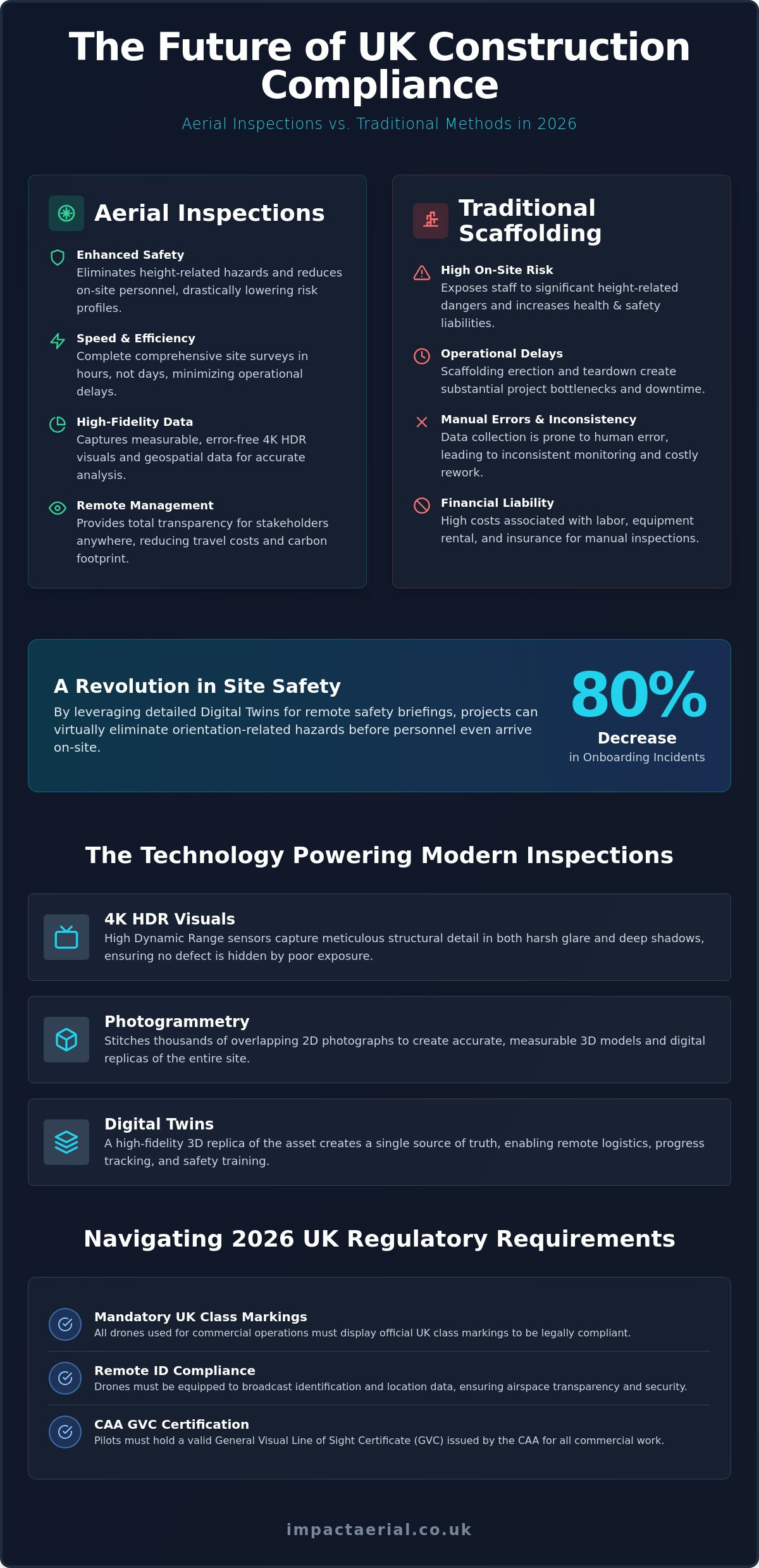
In the current market, your competitors are likely already utilizing drone survey technology to refine their bids and provide more accurate timelines. This shift is driven by the integration of aerial data into Building Information Modelling (BIM) workflows, allowing for a seamless flow of information from the site to the office. Sticking to manual methods creates a data silo that slows down collaboration. Drone adoption serves as a critical competitive advantage for UK construction firms by enabling real-time site oversight and reducing project timelines through automated data capture.

Identifying High-Impact Use Cases for Your Sector

Focusing on specific, high-impact applications helps in convincing management to adopt drone technology by showing immediate utility. Different sectors derive value in unique ways:

  • Construction: Use drones for consistent site monitoring and precise stockpile volume calculations to manage resources effectively.
  • Property: Deploy high-resolution inspections to identify structural issues without the need for plant hire; use cinematic footage for high-end marketing.
  • Solar: Conduct PV solar farm thermal surveys to identify failing cells and optimize the ROI of renewable assets.

By identifying these specific needs, you present a case built on tangible evidence rather than abstract technical potential. This methodical approach ensures the board sees drones as the professional tools they’ve become.

Addressing Management’s #1 Concern: Risk and Compliance

Management’s hesitation often stems from a fear of the unknown, specifically regarding legal liability and site safety. When convincing management to adopt drone technology, you must address these concerns with concrete facts about the UK regulatory framework. The Civil Aviation Authority (CAA) has moved beyond the old PfCO system to a more robust structure involving the General Visual Line of Sight Certificate (GVC) and the A2 Certificate of Competency (A2 CofC). For commercial operations in congested areas or complex airspace, a GVC is the gold standard. It demonstrates a pilot’s ability to operate under strict safety cases that protect your business from litigation.

Operating without these credentials isn’t just a minor oversight; it’s a significant legal risk. In February 2026, international regulatory bodies updated enforcement policies, with civil penalties for unauthorized operations reaching up to $75,000 per violation. While these specific figures stem from FAA drone regulations in the US, they signal a global trend toward stricter enforcement that the UK’s CAA mirrors. Professional drone services provide added peace of mind by carrying £5m in commercial liability insurance, ensuring your business is protected against any unforeseen incidents. If you’re looking for a compliant partner, a professional aerial consultation can help clarify your specific site requirements.

Data privacy is another critical factor that boards prioritize. Every flight must be legally sound and GDPR compliant. A professional partner ensures that all data collection, from photogrammetry to thermal imaging, respects privacy laws and site-specific restrictions. This methodical approach to compliance turns a perceived risk into a controlled, professional workflow.

Why CAA GVC Certification is Non-Negotiable

There’s a vast difference between a hobbyist and a professional drone license holder. Certified pilots are legal requirements for commercial work, not just a preference. These experts are trained to manage complex UK airspace, including Beyond Visual Line of Sight (BVLOS) operations and flights in congested urban environments like Birmingham. This technical proficiency ensures every mission is executed with precision while adhering to the latest safety protocols.

Reducing On-Site Accidents through Aerial Surveys

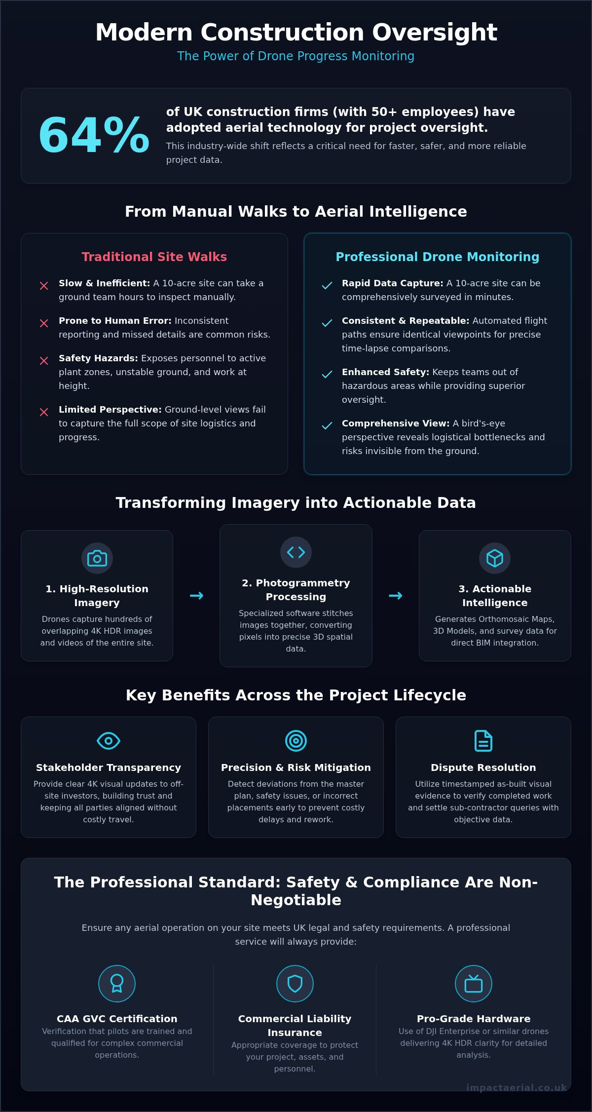
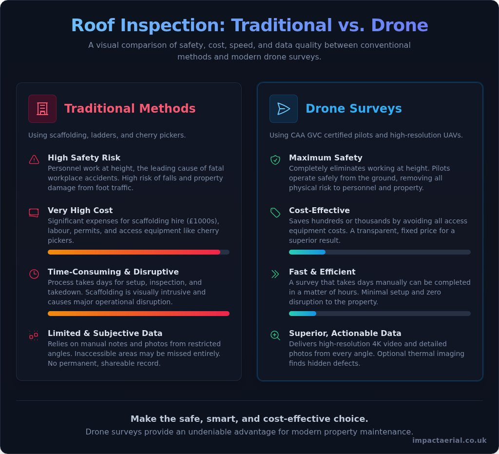
Safety is the most compelling argument for drone adoption. Manual roof inspections often require scaffolding, cherry pickers, or ladders, all of which increase the risk of falls from height. Drones replace these hazardous methods with high-resolution aerial sensors. By integrating drones into construction site monitoring, firms can eliminate 100% of the initial physical risk associated with height-based assessments. This proactive approach significantly improves safety protocols and reduces the likelihood of on-site accidents.

The ROI Analysis: Make vs. Buy (Professional Services)

Deciding between building an in-house flight department or outsourcing to a specialist is a critical crossroads in convincing management to adopt drone technology. While the idea of owning hardware is appealing, the financial reality of an internal program often involves significant hidden costs that can erode your projected ROI. Business leaders who successfully integrate this technology understand that the value lies in the data gathered, not the ownership of the aircraft. When focusing on the final deliverable, many firms find a more positive ROI from drones by partnering with established experts rather than managing the logistical burden of a private fleet.

The speed of delivery is another factor where professional services consistently outperform internal teams. A specialized provider arrives on-site with a refined workflow, whereas an internal pilot must balance drone operations with their primary job roles. This internal learning curve can delay critical site insights by weeks or even months. By contrast, a professional service offers a fixed-cost model with guaranteed post-production results, ensuring that the board sees high-quality data without the unpredictability of an experimental in-house project.

Hidden Costs of an Internal Drone Department

Initial capital expenditure (CAPEX) for commercial-grade hardware is substantial. In 2026, a high-spec inspection drone can cost between $10,000 and $90,000, and that doesn’t include specialized sensors like LiDAR or thermal cameras, which can add another $30,000 to the bill. Beyond the hardware, your business must account for:

  • Annual CAA GVC certification and pilot currency training.
  • Specialized commercial insurance and public liability coverage.
  • Software licenses for photogrammetry and data analysis.
  • The 35.53% CAGR of the market, which risks making your hardware obsolete within 24 months.

The Benefits of Outsourcing to Professional Drone Services

Hiring established Drone Services provides immediate access to high-end 4K HDR sensors and thermal imaging without the upfront CAPEX. You gain the flexibility to scale operations across multiple sites simultaneously, a task that would require a massive internal team to replicate. Hiring a professional service provider allows a firm to bypass the £90,000 capital investment required for top-tier inspection drones while ensuring immediate access to GVC-certified expertise. This “Drone-as-a-Service” model ensures that your business stays at the cutting edge of a niche but increasingly diverse market without the risk of equipment depreciation or regulatory non-compliance.

How to Build Your Pitch: 5 Steps to Convince Leadership

Securing board-level buy-in requires a shift from technical enthusiasm to strategic problem-solving. When convincing management to adopt drone technology, your pitch must be rooted in operational reality. You aren’t just asking for a new tool; you’re proposing a more efficient way to manage assets and mitigate risk. By following a structured five-step framework, you can transform a “niche” request into a critical business objective that aligns with the board’s focus on safety and ROI.

  1. Identify a Specific Bottleneck: Pinpoint a recurring delay, such as the three days typically required to coordinate scaffolding for a roof survey.
  2. Contrast the Workflows: Present a direct comparison showing how traditional manual methods take 48 hours of labor while a drone-assisted survey takes two hours.
  3. Lead with Compliance: Open the risk discussion by highlighting the “peace of mind” provided by CAA GVC certified pilots and £5m commercial liability insurance.
  4. Showcase High-Quality Visuals: Use 4K HDR examples to demonstrate how superior data leads to faster, more accurate maintenance decisions.
  5. Propose a Low-Risk Pilot: Suggest a single-site trial to prove the concept with minimal initial capital commitment.

Gathering Your Evidence

Success depends on the quality of your data. Start by auditing your current safety logs for near-misses related to working at height. These statistics provide a powerful emotional and financial hook. You should also look at marketing potential; using an aerial filming drone can produce breath-taking cinematic video that elevates your brand’s market position. This dual-purpose utility makes the investment even more attractive to stakeholders who prioritize both operations and growth.

Handling Common Management Objections

Expect pushback on cost and legality. Address “It’s too expensive” by showing that the cost of a professional service is significantly lower than the £90,000 required for top-tier hardware and internal training. If they ask “Is it legal?”, provide clear CAA documentation and explain how outsourcing to a technical consultant removes the regulatory burden from your firm. This methodical approach demonstrates that you’ve considered every angle of the operation. To get started with your pilot project data, you can book a professional drone consultation today.

Partnering for Success: Integrating Impact Aerial

Successfully convincing management to adopt drone technology often rests on the strength of your chosen implementation partner. Impact Aerial doesn’t just offer pilots; we act as technical consultants who integrate seamlessly into your existing workflows. Based in Birmingham and the West Midlands, our central location allows for rapid, UK-wide deployment to construction sites and commercial properties. This accessibility ensures that your firm can respond to site requirements with the agility that modern site management demands. We provide the expertise needed to navigate the niche but increasingly diverse market of aerial data collection.

Our approach centers on providing a “peace of mind” guarantee. This means every flight is conducted by a CAA GVC Certified professional who understands the nuances of the 2026 regulatory environment. We handle the complexities of risk assessments and airspace authorizations so your team can focus on the results. By choosing a specialist partner, you eliminate the need for the £90,000 capital investment in hardware and the ongoing burden of internal pilot training. We provide the latest 4K High Dynamic Range (HDR) DJI Enterprise commercial drones to ensure your data is of the highest possible quality.

From Raw Data to Actionable Insights

Management needs more than just raw video files; they require data that informs their next board report or engineering decision. We specialize in transforming raw aerial captures into actionable insights through professional post-production services. Whether you require precise photogrammetry for volume calculations or high-resolution imagery for Building Services inspections, our output is tailored to your specific software environment. We ensure drone data integrates directly into your existing project management tools, providing a unified view for both marketing teams and engineering departments. This methodical data-gathering process ensures that every stakeholder receives the specific information they need to advance the project.

Why Impact Aerial is the Trusted Choice

Our track record with UK property developers and construction leaders is built on a foundation of meticulous compliance and technical proficiency. We understand that reliability is a primary requirement for any board-level decision. By maintaining a fleet of top-quality drones and providing comprehensive data analysis, we eliminate the technical barriers that often stall drone adoption. Our commitment to industry standards is reinforced by our active affiliations with organizations like ARPAS and the Drone Safe Register, providing an external layer of validation for your business case. Contact Impact Aerial to start your pilot project today and see how professional aerial services can transform your operational efficiency.

Securing a Competitive Advantage Through Aerial Intelligence

The transition from manual site inspections to digital-first oversight is no longer a luxury for UK firms. By 2026, the global commercial drone market’s valuation of $28.87 billion proves that industry leaders have already embraced this shift. Convincing management to adopt drone technology requires a clear focus on the safety benefits of eliminating working-at-height risks and the financial logic of the “Drone-as-a-Service” model. You’ve seen how professional data collection reduces project timelines and removes the $90,000 capital expenditure barrier associated with top-tier hardware.

Partnering with a specialist provides the technical precision and regulatory compliance your board demands. Impact Aerial delivers added peace of mind through our CAA GVC Certified pilots and £5m commercial liability insurance. Our fleet of the latest DJI Enterprise 4K HDR drones ensures that your data is accurate, actionable, and legally sound. Take the first step toward transforming your operational efficiency by choosing a partner that prioritizes safety and quality.

Request a Professional Drone Service Quote from Impact Aerial Today and lead your firm into a more efficient, data-driven future.

Frequently Asked Questions

Is convincing management to adopt drone technology actually cost-effective?

Yes, adopting drone technology is highly cost-effective when you consider the reduction in manual labor and equipment hire. By utilizing a “Drone-as-a-Service” model, your firm avoids the significant capital investment required for high-end sensors and specialized training. This shift allows for more frequent site oversight without the recurring costs of scaffolding or heavy machinery, which often results in a faster project completion rate.

What are the biggest risks management worries about with drones?

The primary concerns for leadership are usually legal liability and operational safety. Management often fears the repercussions of unauthorized flights, especially following the February 2026 updates to global enforcement policies that increased penalties for non-compliance. Partnering with a certified specialist mitigates these risks by ensuring every operation follows strict CAA safety protocols and is backed by robust commercial insurance.

Do we need our own drone license if we hire a professional service?

No, your business doesn’t need an internal license when you hire a professional provider. The drone service company holds the necessary CAA GVC or A2 CofC certifications and takes full responsibility for the flight planning and legal compliance. This arrangement simplifies the process of convincing management to adopt drone technology because it removes the regulatory burden from your internal team.

How much liability insurance should a drone company have in the UK?

A professional drone operator in the UK should carry at least £5 million in commercial liability insurance. This level of coverage is the industry standard for commercial property and construction sites; it provides the necessary peace of mind for your board of directors. It ensures that your firm is fully protected against any unforeseen incidents during data-gathering missions.

Can drones really replace traditional surveying methods?

Drones don’t necessarily replace surveyors; instead, they act as a force multiplier for traditional teams. Aerial photogrammetry and LiDAR sensors can capture site data up to 50% faster than ground-based manual methods. This speed allows surveyors to focus on data analysis and decision-making rather than spending days on physical measurements in hazardous environments.

What kind of ROI can we expect from professional aerial filming?

Professional aerial filming delivers a measurable boost to marketing engagement and brand authority. Industry data from early 2026 suggests that high-quality cinematic video can increase click-through rates on commercial property listings by up to 30%. This visual impact helps secure investors and tenants more quickly, directly contributing to the project’s overall profitability.

How do we ensure drone data is GDPR compliant?

Professional operators ensure GDPR compliance by following strict data protection workflows during and after the flight. This includes blurring identifiable faces or vehicle registration marks in the post-production phase and storing all high-resolution files on secure, encrypted servers. These meticulous data-handling procedures ensure that your aerial surveys meet all UK privacy regulations.

What happens if the weather is bad on the day of the shoot?

Safety is the non-negotiable priority, so flights are postponed if wind speeds or precipitation exceed safe operating limits. Most professional service agreements include a “weather day” clause that allows for rescheduling at no additional cost to the client. This methodical approach ensures that the final 4K HDR deliverables aren’t compromised by poor environmental conditions.

What is an Aerial? A Comprehensive Guide to Modern Technology in 2026

The traditional TV aerial is no longer the primary gateway to modern media or data; instead, a new era of high-altitude intelligence has taken its place. In 2026, the distinction between a rooftop antenna and a professional drone service involves more than just hardware. It’s about managing a complex world of UK regulations, from the 100g weight threshold for registration to the strict 10-year planning rules for masts and antennas.

We understand that this niche but increasingly diverse market can be difficult to understand, especially when safety and professional standards are your top priority. This guide promises to help you distinguish between basic consumer tools and professional drone services, covering everything from the £12.34 annual Operator ID fee to the impact of the Media Act 2024. We provide a structured overview of modern aerial solutions to ensure your project is data-rich, legally compliant, and executed with the technical precision that provides true peace of mind.

Key Takeaways

  • Understand how the term ‘aerial’ has transitioned from a stationary rooftop antenna to a dynamic category of mobile data-gathering and professional drone services.
  • Learn to mitigate modern signal challenges, such as 5G interference, by choosing the appropriate high-gain hardware for your specific geographic area.
  • Evaluate the significant cost and safety benefits of replacing traditional scaffolding or fixed masts with rapid-deployment drone surveys for building inspections.
  • Recognise the critical importance of CAA GVC certification and the industry-standard £5m liability insurance when vetting a professional operator in the UK.
  • Gain the technical insights required to secure high-resolution imagery and breath-taking cinematic content while ensuring full compliance with 2026 UK drone laws.

Defining ‘Aerial’: From TV Antennas to Drone Technology

The term aerial has undergone a profound transformation in the UK market. For decades, it referred exclusively to passive reception hardware installed on domestic and commercial rooftops. In 2026, the definition has expanded. It now encompasses a sophisticated service category where data is actively harvested from the sky rather than just received. This shift from a stationary noun to a mobile service represents a leap in how we interact with technology and the built environment.

For property owners and commercial developers, understanding this distinction is vital. A passive system focuses on signal strength for broadcasting, whereas an active platform provides high-definition visual intelligence. Choosing the right solution depends on whether your goal is media consumption or high-level data gathering. This choice impacts everything from your compliance with the Levelling-up and Regeneration Act 2023 to the overall safety of your site operations. We provide the technical expertise to help you make an informed decision for your project.

To better understand the technical components involved in traditional signal hardware, watch this helpful video:

Traditional Aerials: Signal Reception

Most UK homes still rely on Yagi-Uda or Log-periodic antennas for digital terrestrial television. These devices operate by focusing radio waves onto a central element to deliver clear broadcast signals. To maintain performance, these systems require rigid masts and brackets to ensure a direct line-of-sight to the nearest transmitter. However, in dense urban environments like Birmingham or London, signal multipath interference and physical obstructions often limit the effectiveness of these static installations. Under the Levelling-up and Regeneration Act 2023, property owners must also be aware that the planning permission exemption period for these masts has increased from four to ten years. Proper installation of F-connectors and high-quality coaxial cabling remains essential to prevent signal loss in these challenging settings.

Modern Aerial Platforms: UAVs and Drones

The most significant evolution in this sector is the rise of the Unmanned Aerial Vehicle (UAV). Unlike a fixed antenna, a UAV is a mobile platform capable of positioning high-specification sensors exactly where they are needed. Drones have effectively replaced the need for static masts in many commercial applications, such as topographical surveys and roof inspections. Our fleet utilizes the latest 4K High Dynamic Range (HDR) DJI Enterprise drones, including the Mavic 4 Pro and DJI Air 3S, to capture perspectives that were previously impossible to reach. This technology has revolutionised property management, allowing for detailed inspections without the cost and risk of scaffolding. By moving the data collection point from the roof to the sky, we provide a more comprehensive view of structural health and site progress with total technical precision.

Traditional Aerial Systems: TV, Radio, and Communication Masts

Traditional hardware remains the backbone of UK communications infrastructure, even as we transition toward mobile platforms. In 2026, the primary challenge for any fixed aerial installation is the proliferation of 5G signals. The 700MHz frequency band, now heavily used for mobile data, frequently bleeds into the frequencies used by digital terrestrial television. This requires the integration of high-rejection filters to maintain picture stability. For commercial property developers, a standard installation no longer suffices. High-gain antennas are essential in fringe reception areas to pull in a usable signal, whereas omni-directional models are reserved for high-signal urban zones where multi-path interference is less of a concern.

Commercial Integrated Reception Systems (IRS) have become the gold standard for apartment blocks and office complexes. These systems combine signals from a single high-quality array and distribute them to hundreds of points. This eliminates the “forest of antennas” on rooftops, which is a significant aesthetic and maintenance advantage. Regular maintenance of these roof-mounted masts is non-negotiable. British weather, particularly high winds and salt air in coastal regions, causes mechanical fatigue in brackets and oxidisation in coaxial cabling. If you’re managing a large-scale project, our professional services ensure these systems are installed and maintained to the highest industry standards.

Optimising Signal Strength in the UK

Correct alignment with local transmitters like Sutton Coldfield or Crystal Palace is the first step in a professional installation. We use spectrum analysers to ensure the signal-to-noise ratio remains within the 25dB to 35dB range for optimal digital performance. Amplifiers should be used sparingly. Over-amplifying a poor signal only increases noise, leading to pixelation or total signal loss. Weatherproofing is equally critical. We utilise self-amalgamating tape and UV-stable cabling to prevent water ingress, which is the leading cause of system failure in the UK.

Specialised Communication Aerials

The modern rooftop now hosts more than just TV hardware. Specialised DAB and FM arrays are required for professional-grade radio reception in commercial studios. Additionally, the rise of smart buildings has introduced LoRaWAN and IoT (Internet of Things) aerial solutions. These low-power, wide-area network antennas allow building managers to collect data from thousands of sensors simultaneously. While our current focus remains on terrestrial infrastructure, our broader expertise in data-gathering is informed by international standards, including FAA commercial drone regulations, ensuring a holistic approach to technology. Integrated arrays that combine satellite, terrestrial, and data-gathering hardware are now the preferred choice for forward-thinking developers.

The Evolution of Aerial Platforms: Why Drones are Replacing Masts

While traditional masts serve a vital purpose for signal reception, the modern aerial platform is no longer bolted to a chimney stack. For developers and property managers, the shift toward mobile data capture represents a significant cost-benefit victory. Fixed masts require permanent installation, planning considerations, and long-term maintenance. In contrast, a rapid-deployment drone survey provides a dynamic solution that can be launched in minutes. This transition isn’t just about convenience; it’s a strategic move that reduces the financial burden of site inspections by as much as 60% in many commercial cases.

Safety remains our primary driver for replacing static masts with drone technology. Traditional inspections often involve working at height on ladders or expensive scaffolding, which introduces significant risk to personnel. By using a professional drone service, you keep your team’s feet firmly on the ground while the aircraft handles the high-altitude work. Furthermore, the data density provided by a drone is incomparable. A fixed mast or rooftop camera offers a single, static perspective. A drone-captured aerial view provides ten times the detail, allowing us to zoom into specific structural defects or survey large-scale sites with millimetre precision.

Comparing Fixed and Mobile Aerial Solutions

The time savings associated with mobile platforms are substantial. Installing a commercial-grade mast can take several hours and requires physical access to the roof. A drone flight can be completed in under twenty minutes, overcoming physical obstacles like tall trees or neighbouring buildings that would otherwise block a fixed sensor. Drone-based aerial inspections deliver a superior return on investment by cutting operational costs by up to 70% compared to traditional scaffolding or cherry picker hire.

The Role of DJI Enterprise Technology

Our fleet relies on DJI Enterprise technology to deliver the high-quality results our clients expect. These aircraft are equipped with 4K HDR cameras and thermal sensors, changing the way we approach data-gathering for heat loss surveys and structural analysis. The precision of photogrammetry allows us to create detailed 3D models of construction sites, providing a level of monitoring that fixed masts simply cannot match. While we operate under strict UK CAA guidelines, the global shift toward these platforms is mirrored in the Federal Aviation Administration (FAA) drone regulations, which highlight the increasing reliance on UAS for critical infrastructure. Using professional-grade equipment isn’t just about the image; it’s a requirement for maintaining the commercial liability insurance that provides our clients with total peace of mind.

Commercial Aerial Services: Data Collection, Filming, and Surveys

Commercial aerial services have matured into a cornerstone of industrial efficiency. As of May 2026, the UK drone market is projected to grow at a compound annual rate of 10.18%, reaching a valuation of USD 2.7 billion by 2034. This growth is driven by the demand for high-precision data that informs multi-million pound decisions. For construction site monitoring, we provide a bird’s-eye view that tracks progress against architectural plans. This level of oversight ensures safety protocols are followed and helps developers avoid costly delays through real-time site intelligence.

Thermal surveys represent another high-ROI application. For PV Solar Farm operators, identifying a single failing cell via heat-signature detection can prevent systemic inefficiencies. We use radiometric thermal sensors to pinpoint these issues from the air. This allows for targeted maintenance that keeps energy production at its peak without the need for manual ground-based testing across hundreds of acres. It’s a faster, safer, and more accurate way to protect renewable energy investments.

Aerial Photography and Videography

Cinematic content is essential for modern property marketing. We capture unique perspectives for commercial developers that showcase the scale and context of a project in ways ground-level photography cannot. Delivering professional assets requires more than just a flight; our post-production process ensures every 4K HDR frame is colour-graded and optimised for high-impact advertising. You can learn more about aerial filming drone capabilities to see how we produce these breath-taking end results.

Technical Aerial Surveys and Inspections

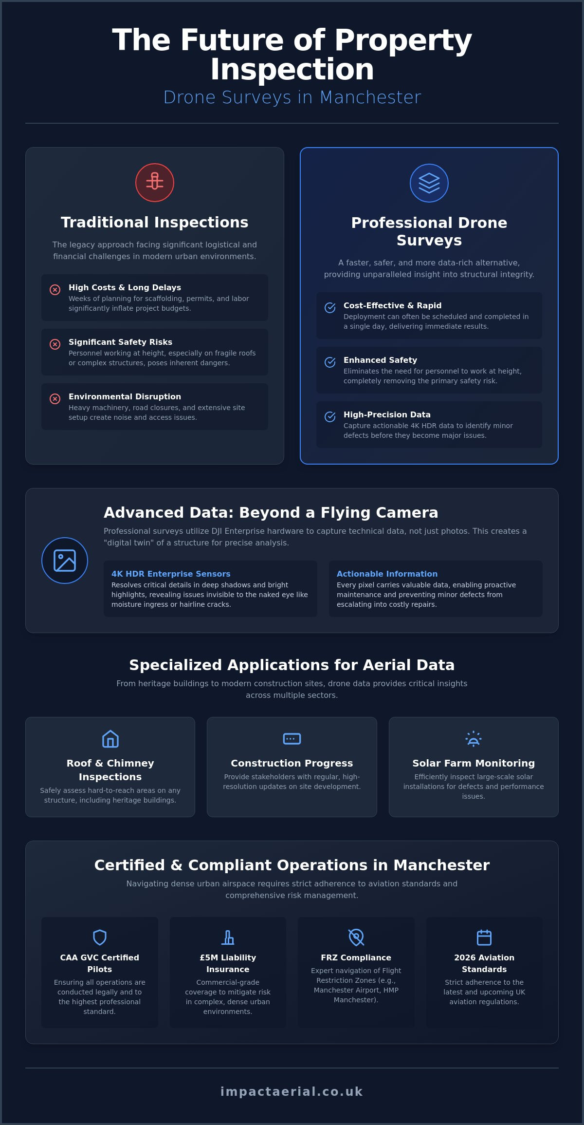
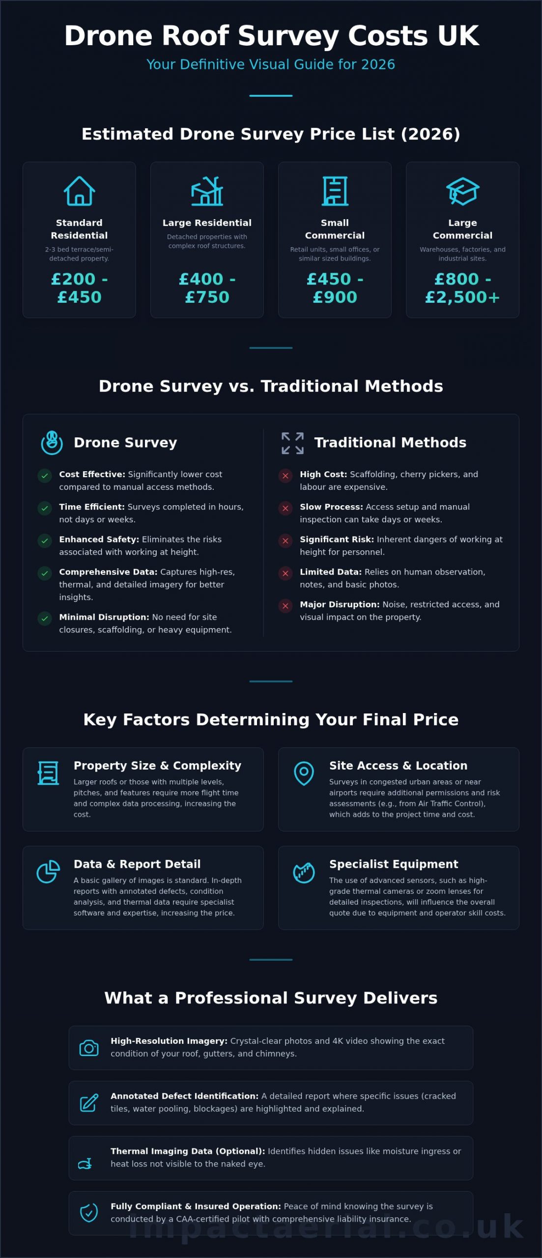
Safety and speed are the primary benefits of our technical inspection services. A traditional roof survey often requires days of preparation and significant expense for scaffolding. We complete the same task in a few hours using high-resolution imagery to identify structural issues like water ingress or masonry cracks. This data-gathering is also the foundation for creating digital twins and 3D virtual tours, which are increasingly used in building management. Our what is a survey drone guide provides a deep dive into the technical specifications required for these precision tasks.

If you’re ready to integrate these advanced technologies into your next project, our professional aerial services provide the technical precision and peace of mind your business requires.

Hiring a Professional Aerial Specialist in the UK

Hiring a professional aerial specialist involves strict adherence to UK Civil Aviation Authority (CAA) standards. Since January 1, 2026, the regulatory landscape has tightened significantly. Any drone weighing 100g or more now requires registration, and all new hardware must carry a UK class mark (UK0 to UK6). For commercial projects, a hobbyist flyer is a liability. We hold the CAA GVC Certification, which is the legal prerequisite for complex commercial operations in the UK. This qualification demonstrates that we possess the technical knowledge and flight competence to operate safely in a niche but increasingly diverse market.

For added peace of mind, we carry £5m in commercial liability insurance. This is the industry standard for working on construction sites, infrastructure projects, and commercial properties. When vetting a pilot, you should always verify their credentials via the Drone Safe Register or ARPAS-UK. These affiliations confirm the operator is vetted, insured, and current with 2026 legislation. Choosing a specialist based in Birmingham and the West Midlands offers distinct advantages for local projects. We understand the specific airspace restrictions and geographic challenges of the region, ensuring smoother logistics and faster deployment for your site.

Compliance and Safety Standards

The transition from the old PfCO (Permission for Commercial Operation) to the current GVC (General Visual Line of Sight Certificate) was a major shift in UK law. It ensures that every pilot understands the latest safety protocols, including the mandatory use of green flashing lights for night flying and Remote ID broadcasting for UK-classed drones. Before any aircraft takes off, we conduct exhaustive risk assessments and flight planning to mitigate potential hazards. For more details, see our UK drone license compliance guide.

Requesting an Aerial Quote

Securing an accurate price for aerial services depends on a clear project scope. A cinematic filming session for a property developer requires different equipment and planning than a high-precision technical survey using photogrammetry. When preparing your brief, specify the location, the desired data resolution, and any specific site hazards. This allows us to provide a methodical, structured quote that reflects the technical requirements of your project. We recommend Contacting Impact Aerial for a professional consultation to discuss how our technical precision can benefit your specific project.

Securing the Future of Your High-Altitude Projects

The evolution of technology has redefined the concept of an aerial platform. We’ve moved beyond simple signal reception to a landscape where high-specification data collection is the industry standard. Whether you’re managing a commercial property development or conducting a technical roof inspection, the key to success lies in choosing a partner that prioritises both precision and legal compliance. It’s no longer just about seeing the site; it’s about gathering actionable intelligence that protects your investment and informs your long-term strategy.

Our team provides the expertise needed to navigate the complexities of 2026 UK aviation rules. With a fleet of 4K HDR DJI Enterprise drones and CAA GVC Certified pilots, we ensure your project is executed with the highest technical standards. For added peace of mind, we back every operation with £5m commercial liability insurance. This combination of advanced hardware and rigorous safety protocols allows us to deliver results that are both legally compliant and technically superior. We’re ready to help you capture the data required to move your project forward with total confidence.

Book Your Professional UK Drone Service Today

Frequently Asked Questions

Do I need a license to use an aerial drone for my business in the UK?

Yes, you must have a valid Operator ID and the pilot must hold a CAA GVC (General Visual Line of Sight) Certificate for commercial work. As of January 1, 2026, any drone weighing 100g or more with a camera requires registration with the Civil Aviation Authority. We maintain all necessary certifications to ensure your project remains fully compliant with UK aviation law.

What is the difference between a TV aerial and a drone survey?

A TV aerial is a stationary device designed to receive broadcast signals from a transmitter for media consumption. In contrast, a drone survey is an active data-gathering service that uses mobile sensors to capture high-definition imagery and structural data. While the former is a piece of hardware, the latter is a professional aerial service providing technical intelligence.

How much does a professional aerial filming shoot cost in 2026?

Professional filming rates in the UK typically range from £250 to £600 for a half-day session. For a full day of cinematic production, prices generally fall between £500 and £1,100 based on industry data from May 2026. These rates cover the pilot’s expertise, high-specification DJI Enterprise equipment, and the necessary safety planning for your specific site.

Can a drone aerial survey detect roof leaks or thermal loss?

Yes, drone surveys equipped with radiometric thermal sensors can accurately identify heat signatures and moisture ingress. This technology allows us to detect insulation gaps or flat roof leaks that are invisible to the naked eye. By pinpointing these defects early, property owners can implement targeted repairs and significantly improve the energy efficiency of their buildings.

What are the CAA regulations for flying drones in congested urban areas like Birmingham?

Operating in congested areas like Birmingham requires strict adherence to CAA rules which prohibit flying over crowds of people. Our pilots maintain direct visual line of sight at all times and follow the latest UK class marking requirements (UK1 to UK6) introduced in early 2026. We conduct thorough risk assessments before every flight to ensure the safety of the public and nearby infrastructure.

How high can a commercial aerial drone fly for photography?

The legal height limit for a commercial drone in the UK is 120 metres, which is approximately 400 feet, above the ground. This altitude is sufficient for capturing wide-angle property views and detailed topographical data. Flying above this limit requires specific permission from the CAA to ensure the safety of manned aircraft in the vicinity.

Do I need insurance to hire an aerial photographer?

Yes, you should only hire an operator who holds EC785/2004 compliant commercial liability insurance. We maintain £5m in coverage to provide our clients with total peace of mind during complex site operations. This insurance protects your business against unforeseen risks and is a key indicator of a professional, vetted specialist.

How long does it take to get the results from an aerial survey?

Raw imagery is often available within 24 hours of the flight. More complex data sets, such as processed photogrammetry models or detailed roof inspection reports, typically take between 48 and 72 hours to complete. This timeline ensures our technical team has sufficient time to perform the meticulous post-production required for high-quality professional assets.

UAV Topographic Survey UK: The Complete Professional Guide for 2026

Traditional ground surveys often take five times longer than aerial alternatives, frequently leaving UK project managers waiting weeks for critical site data. You likely agree that stalling a development due to slow data turnaround or safety risks on hazardous terrain is an avoidable drain on your budget. It’s a common bottleneck that impacts both your bottom line and your delivery schedule, especially when high-precision results are non-negotiable.

By commissioning a professional uav topographic survey uk, you can secure centimetre-level accuracy and full CAA compliance while reducing site time by up to 75%. This guide explains how GVC certified pilots use high-resolution photogrammetry to deliver precision 2D and 3D data for added peace of mind. We’ll examine the 2026 regulatory landscape, cost-saving workflows, and the technical specifications required to ensure your site data collection is both safe and meticulous. You’ll discover how to leverage the latest professional UAV technology to get your project moving faster without sacrificing the quality your stakeholders expect.

Key Takeaways

  • Understand how the shift to high-precision aerial mapping provides a more efficient, high-resolution alternative to traditional ground-based surveying methods.
  • Master the technical distinctions between photogrammetry and aerial LiDAR to ensure your site data achieves centimetre-level accuracy using DJI Enterprise hardware.
  • Navigate the 2026 regulatory landscape by ensuring every uav topographic survey uk is conducted by a CAA GVC certified pilot for total legal compliance.
  • Learn how to transform raw aerial data into professional, actionable deliverables including ortho-mosaic maps, Digital Terrain Models (DTM), and CAD-ready files.
  • Discover why professional-grade insurance and technical expertise are vital for providing the peace of mind required on complex UK construction and development sites.

What is a UAV Topographic Survey and Why is it Essential in 2026?

A Unmanned Aerial Vehicle (UAV) topographic survey is a high-precision aerial mapping method that uses drones to capture detailed data on land features, elevations, and man-made structures. This technology has fundamentally changed how we understand terrain. It has moved the industry away from slow, manual “boots on the ground” methods toward an “eye in the sky” approach. Since the January 2025 update to Civil Aviation Authority (CAA) flight regulations, the barriers to deploying advanced uav topographic survey uk services have dropped. This has made 2026 the definitive tipping point for drone adoption across the UK construction and civil engineering sectors.

Adopting this aerial methodology isn’t just about following a trend; it’s about survival in a competitive market. Large-scale projects now demand the kind of rapid data turnaround that traditional methods simply can’t provide. Recent industry reports indicate that 82% of Tier 1 UK contractors now mandate drone-based site assessments before any ground is broken. This shift ensures that every stakeholder, from the site manager to the lead architect, works from the same high-resolution digital twin.

To better understand how this technology functions in a real-world environment, watch this helpful video:

The Core Purpose of Topographic Mapping

The primary goal is to capture every natural and artificial feature on a site with precise X, Y, and Z coordinates. This data is vital during the earliest stages of the RIBA Plan of Work, specifically Stages 1 and 2, where site feasibility is determined. A topographic survey is a comprehensive digital blueprint of a site’s physical terrain and features that serves as the single source of truth for design teams, preventing 12% of total project costs from being wasted on avoidable design errors. By establishing a centimetre-accurate baseline, developers can calculate earthwork volumes and drainage requirements with total confidence.

UAV vs. Traditional Ground Surveys

The advantages of using a uav topographic survey uk over traditional total station methods are measurable and significant. We focus on three key areas:

  • Speed: A professional drone team can survey a 50-hectare site in approximately 3 hours. A traditional ground crew would require at least 4 days to cover the same area to a similar level of detail.
  • Safety: Drones eliminate the need for surveyors to physically traverse hazardous environments. This includes unstable 30-degree quarry faces, active railway corridors, or contaminated brownfield sites.
  • Data Density: While a surveyor with a total station might capture 500 individual points in a day, a UAV captures millions of points. This results in a 400% increase in data density, providing a much smoother and more accurate digital terrain model.

Various sectors are now reaping these rewards. Property developers use this data to optimise housing layouts on complex hillsides. In the quarrying industry, managers use drone surveys to calculate the volume of 200,000-tonne stockpiles in minutes. Infrastructure projects, such as the ongoing motorway improvements in the West Midlands, rely on these surveys to monitor progress without closing lanes. Even environmental agencies have adopted the technology to track 15cm of annual coastal erosion along the Norfolk coastline, providing “peace of mind” through consistent, repeatable data gathering.

The Technology Behind Centimetre-Level Accuracy

Precision in a uav topographic survey uk relies on the synergy between high-end airframes and advanced spatial sensors. We utilise DJI Enterprise drones, specifically the Matrice 350 RTK and the Mavic 3 Enterprise, which are engineered for stability in the UK’s unpredictable wind conditions. These platforms carry 45-megapixel full-frame sensors capable of capturing data at a Ground Sampling Distance (GSD) of less than 0.8cm per pixel. High-resolution optics are essential; they ensure that every pixel represents a precise coordinate on the earth’s surface, eliminating the blur that plagues consumer-grade hardware.

Photogrammetry vs. LiDAR: Choosing the Right Tool

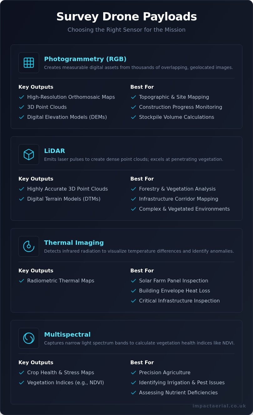
Selecting the correct sensor is a technical decision based on the site’s physical characteristics. Photogrammetry remains the primary choice for creating high-resolution 3D textured meshes and detailed visual maps. It relies on 80% image overlap to triangulate points in space. However, its main limitation is vegetation. If a site is covered in dense scrub or woodland, photogrammetry only maps the top of the leaves. Adhering to the NatureScot UAV Data Guidance ensures that our data capture meets the rigorous standards required for UK environmental and topographic reporting.

  • Photogrammetry: Best for open sites and visual inspections. It’s cost-effective and provides realistic 3D visualisations.
  • LiDAR: Essential for “seeing through” vegetation. It uses active laser pulses (often 480,000 per second) to find gaps in the canopy and hit the bare earth below.
  • Cost and Conditions: LiDAR equipment is significantly more expensive, often increasing project costs by 40% compared to photogrammetry, but it functions in low-light conditions where cameras fail.

The Importance of RTK and GNSS Corrections

Consumer-grade GPS is never sufficient for professional work. Standard drones often have a horizontal error margin of 3 to 5 metres, which is unacceptable for construction or boundary disputes. We solve this using Real-Time Kinematic (RTK) positioning. The drone maintains a constant data link with a base station or a virtual reference network (VRS) via the mobile internet. This connection corrects satellite signal errors caused by atmospheric interference in real-time. It’s how we achieve sub-5cm absolute accuracy across an entire site.

In areas with poor mobile signal, we employ Post-Processed Kinematic (PPK) workflows. The drone logs raw satellite data during the flight, which we then process against a static base station back at the office. This ensures that even in remote Highland glens or deep valleys, the spatial integrity of the uav topographic survey uk remains uncompromised. For projects requiring this level of precision, you can view our full range of survey capabilities to see how we apply this technology.

Ground Control Points (GCPs) remain vital in 2026. Even with the best RTK systems, we place physical markers on the ground and measure them with a separate GNSS rover. These points act as a “sanity check” for the drone’s data. They provide the absolute “truth” for the coordinate system, ensuring the digital map aligns perfectly with existing Ordnance Survey benchmarks. This meticulous approach provides our clients with the peace of mind that their site data is legally and technically robust.

Drone technology moves fast; the UK Civil Aviation Authority (CAA) keeps pace through strict frameworks. For any uav topographic survey uk, compliance isn’t just a box to tick. It’s the foundation of site safety and data integrity. By 1st January 2026, the full transition to the General Visual Line of Sight Certificate (GVC) will be complete, replacing older legacy permissions. This shift ensures every commercial pilot operates under a standardised, rigorous safety protocol designed for complex environments. Impact Aerial has already adopted these standards to provide a future-proof service for our clients.

Project managers must demand a CAA-certified operator for every site. Hiring an uncertified pilot risks more than just a fine. It can halt an entire multi-million pound development if a safety breach occurs. Professional operators provide a level of oversight that protects the client, the public, and the project timeline. We’ve seen a 40% increase in site managers requesting full certification logs before any drone takes flight, reflecting a growing industry focus on legal accountability.

CAA GVC Certification Explained

The GVC is the essential qualification for ‘Specific Category’ operations. It’s what allows Impact Aerial to fly in built-up areas or near people with reduced separation distances. This certification proves a pilot has passed stringent theory exams and a practical flight assessment. The 2026 deadline means that by January of that year, every pilot you hire for a topographic survey must hold a GVC to operate drones weighing over 250g in the Specific Category. To verify a pilot’s credentials, use this checklist:

  • Request their CAA-issued Flyer ID and Operator ID.
  • Ask for a copy of their GVC certificate and check the expiry date.
  • Ensure they have a valid PDRA-01 (Pre-Defined Risk Assessment) or an Operational Authorisation.
  • Verify their Operations Manual is updated to current 2024 standards.

Risk Management and Insurance

Hiring a drone pilot with hobbyist insurance is a massive liability. These policies usually exclude commercial activity or high-risk environments like active construction sites. We carry £5m commercial liability insurance as a minimum. This coverage is compliant with EC Regulation 785/2004, providing added peace of mind for high-value UK projects. It ensures that in the unlikely event of an incident, the financial and legal interests of the project stakeholders are fully protected. We don’t just fly; we manage risk.

Managing airspace is another critical “behind the scenes” task. If your site is within a Flight Restricted Zone (FRZ) near an airport like Heathrow or Birmingham, we don’t just hope for the best. We secure formal permission from Air Traffic Control (ATC) and file a NOTAM (Notice to Airmen) if required. Every uav topographic survey uk mission we conduct is preceded by a site-specific RAMS (Risk Assessment and Method Statement). This document outlines every potential hazard, from overhead power lines to local wildlife, and details our mitigation strategies. We complete these assessments at least 72 hours before arriving on-site. This meticulous planning is why we remain a leader in a niche but increasingly diverse market, delivering results that are as safe as they are precise.

Actionable Deliverables: From Raw Data to CAD and BIM

A professional uav topographic survey uk produces more than just high-resolution imagery. It generates a comprehensive suite of data-rich assets that drive decision-making across the construction and engineering lifecycle. At Impact Aerial, we transform raw sensor data into centimetre-accurate models. We use photogrammetry and LiDAR to ensure every pixel is georeferenced, providing a reliable foundation for site planning and legal documentation.

  • Ortho-mosaic Maps: These are high-resolution, 2D maps created by stitching together thousands of nadir images. Unlike a standard photograph, an ortho-mosaic is geometrically corrected for lens distortion and topographic relief. This allows for accurate measurements of distance and area directly on the map. We typically deliver these with a Ground Sampling Distance (GSD) of 1cm to 3cm per pixel.
  • Digital Terrain Models (DTM) and Digital Elevation Models (DEM): A DEM represents the earth’s surface including all objects on it. However, for civil engineering, the DTM is often more valuable. Our processing software filters out vegetation, vehicles, and temporary structures to reveal the bare earth. This is essential for 2024 drainage designs and flood risk assessments required by local authorities.
  • 3D Point Clouds: These consist of millions of individual data points, each with its own X, Y, and Z coordinate. Point clouds provide the geometric skeleton for modern Building Information Modelling (BIM). They allow architects to “walk through” a site digitally before a single brick is laid.
  • Volumetric Analysis: For earthworks and quarrying, we provide precise calculations for stockpiles and excavations. Drone-based volumetrics are now 98.5% accurate compared to traditional base-and-rover methods, while being 75% faster to complete.

Integrating Drone Data into CAD Workflows

Modern engineering relies on interoperability. We ensure our data integrates directly with industry-standard software like AutoCAD, Civil 3D, and Revit. We generate .DXF and .DWG files from aerial data to provide surveyors with usable 2D contour drawings. By thinning dense point clouds into manageable vector formats, we prevent software lag while maintaining sub-50mm precision. This workflow allows your team to begin design work within 48 hours of our site visit, significantly reducing the typical two-week lead time associated with ground-based surveys.

Digital Twins and Stakeholder Engagement

We create immersive “Digital Twins” using 3D textured meshes. These models serve as a living record of the site. High-quality visual data improves communication with investors and local councils by providing a clear, interactive view of project impact. There is a natural crossover here between technical survey data and cinematic progress filming. While the engineers use the point clouds for structural analysis, the marketing and management teams use the textured meshes for site inductions and stakeholder presentations. This dual-purpose data provides exceptional value for money on complex UK developments.

For high-precision data that integrates directly with your existing software, explore our professional survey deliverables today.

Why Impact Aerial is the UK’s Trusted UAV Survey Partner

Choosing a provider for a uav topographic survey uk requires a partner that balances technical surveying precision with high-end data capture. Impact Aerial bridges the gap between raw data collection and actionable project intelligence. Our team operates from a central base in Birmingham, allowing us to deploy commercial-grade DJI Enterprise equipment to any site across the United Kingdom within hours. We don’t just fly drones; we provide a technical consultancy that ensures the data we deliver integrates perfectly with your existing CAD or BIM workflows.

Safety and compliance sit at the heart of our operations. Every pilot at Impact Aerial is CAA GVC certified, reflecting the latest UK civil aviation standards that replaced the older PfCO system. This certification, combined with our £5 million commercial liability insurance, provides the “peace of mind” our clients expect when operating in complex environments. We utilise the DJI Matrice 350 RTK and Mavic 3 Enterprise fleets, which allow for centimetre-level accuracy without the constant need for manual ground control points, saving up to 40% of time on-site compared to traditional methods.

  • Technical Precision: Sub-50mm accuracy levels suitable for architectural planning and civil engineering.
  • Equipment: Deployment of high-resolution 45MP full-frame sensors and RTK-enabled flight controllers.
  • UK-Wide Reach: Rapid deployment from our West Midlands hub to construction sites, quarries, and rural estates.
  • Consultative Delivery: We provide data in formats you actually use, including .DXF, .DWG, and high-density point clouds.

The Impact Aerial Difference

Our approach is defined by meticulous attention to detail and a deep understanding of the property, construction, and building services sectors. Since 2017, we’ve focused on delivering more than just a bird’s-eye view. We understand the specific pressures of a 150-unit housing development or a complex roof inspection. Our expertise extends beyond topography into comprehensive Drone Property Surveys, where we identify structural anomalies that ground-based teams might miss. We treat every project as a unique challenge, tailoring our flight paths and sensor settings to the specific contours and obstacles of your site.

Get Started with Your UAV Topographic Survey

The process begins with a detailed consultation where we assess your site’s specific requirements and airspace constraints. We handle all necessary CAA notifications and risk assessments internally, ensuring your project remains compliant with UK law. Once the flight is complete, our data processing team uses advanced photogrammetry software to transform thousands of images into a single, cohesive 3D model or 2D orthomosaic map. Most clients receive their processed data within 72 hours of the flight, allowing for rapid decision-making and project progression.

If you need a uav topographic survey uk that delivers high-accuracy results alongside professional service, our team is ready to assist. We provide transparent, fixed-fee quotes based on your site’s acreage and the specific deliverables you require. Don’t settle for “off-the-shelf” drone photography when your project demands engineering-grade data and a safety-first culture.

Ready to elevate your project data? Contact Impact Aerial for a Professional Drone Survey Quote today to discuss your site requirements with our Birmingham-based expert team.

Future-Proof Your Development with High-Precision Aerial Data

Transitioning to a uav topographic survey uk in 2026 offers more than just rapid data collection. It provides the centimetre-level precision necessary for complex CAD and BIM workflows, ensuring your site plans are accurate from the start. Impact Aerial bridges the gap between raw data and actionable insights using our commercial-grade DJI Enterprise fleet. We prioritise your project’s safety and legal standing by deploying only CAA GVC Certified pilots, backed by £5m commercial liability insurance for added peace of mind.

Operating from our Birmingham hub, we provide comprehensive national coverage to support developers and engineers across the country. Our methodical approach ensures every deliverable meets the highest industry standards. It’s time to elevate your site intelligence with a partner who understands the rigours of modern UK regulations and precision engineering. We’re ready to help you streamline your workflow today.

Request a Professional UAV Topographic Survey Quote

We look forward to helping you achieve unparalleled accuracy on your next project.

Frequently Asked Questions

How accurate is a UAV topographic survey in the UK?

A professional uav topographic survey uk provides high-precision data with a relative accuracy of +/- 20mm to 50mm. We achieve these tolerances by using RTK (Real-Time Kinematic) enabled drones and strategically placed Ground Control Points (GCPs). This level of detail ensures that site levels and features meet the RICS (Royal Institution of Chartered Surveyors) standards required for construction and engineering projects across the West Midlands and beyond.

Do I need to notify the CAA before a drone survey on my site?

You don’t need to notify the Civil Aviation Authority (CAA) yourself because our GVC certified pilots manage all regulatory compliance. We operate under specific UK Open or Specific Category rules, which include conducting thorough risk assessments and checking for Flight Restriction Zones (FRZs). If your site falls within an FRZ, such as near Birmingham Airport, we coordinate directly with Air Traffic Control to secure the necessary flight permits for your peace of mind.

What is the typical cost of a UAV topographic survey in the UK?

Costs for a drone survey typically range from £650 for a small 2-hectare site to over £2,500 for complex 50-hectare developments. Prices reflect the site’s complexity, the required level of detail, and the final data processing time. For a standard commercial plot in the UK, you can expect to pay between £800 and £1,200, which covers the flight operations, data-gathering, and the delivery of a fully rectified orthomosaic map.

Can drones conduct topographic surveys in wooded or overgrown areas?

Standard photogrammetry cannot penetrate dense canopy, but we use LiDAR (Light Detection and Ranging) sensors to map wooded or overgrown areas. LiDAR pulses can filter through gaps in vegetation to reach the ground, allowing us to create a Digital Terrain Model (DTM) even in 100% obscured conditions. This technology captures up to 2 million points per second, ensuring we deliver accurate ground levels where traditional visual cameras would fail.

How long does it take to receive the final survey data?

You’ll typically receive your final data within 3 to 5 working days after the flight is completed. While the on-site data-gathering for a 10-hectare site often takes less than 4 hours, the subsequent photogrammetry processing and quality assurance checks require significant computing time. We prioritise precision over speed to ensure every coordinate is verified against our ground-based survey equipment before the final files are released.

What insurance should a professional drone survey company have?

A professional operator must hold specialist commercial liability insurance that is fully compliant with EC 785/2004 regulations. We maintain a minimum of £5 million in public liability cover for every project, providing you with absolute peace of mind during site operations. It’s vital to check that your provider’s policy specifically covers aerial surveying rather than just aerial photography to ensure full protection against technical errors or site incidents.

Is a drone survey better than a traditional land survey?

A uav topographic survey uk is up to 5 times faster than traditional total station methods and captures millions more data points. While traditional surveys are excellent for individual boundary points, drones provide a complete, high-resolution visual record of the entire site. This comprehensive data-gathering approach reduces the risk of missed features and allows for 3D volumetric analysis that isn’t possible with standard land survey techniques.

What file formats will I receive for my CAD or BIM software?

We deliver data in industry-standard formats that integrate seamlessly with AutoCAD, Revit, and other BIM platforms. You’ll receive .DWG or .DXF files for 2D and 3D line work, .LAS or .LAZ files for point clouds, and high-resolution .TIF files for orthomosaic maps. These outputs ensure your engineering team can immediately use the survey data for site planning, drainage design, or volume calculations without needing additional conversion software.