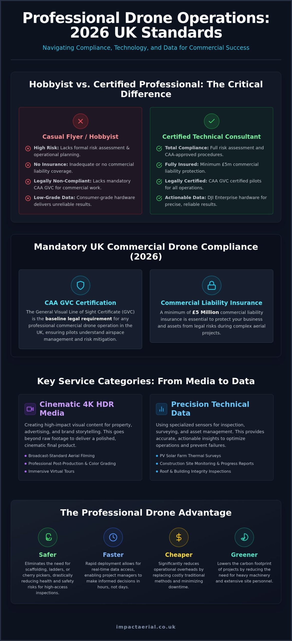
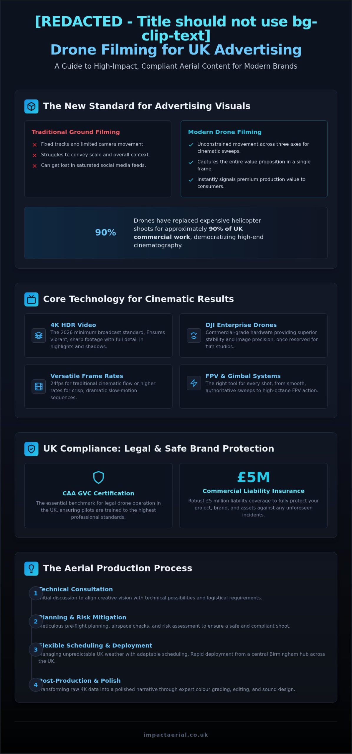
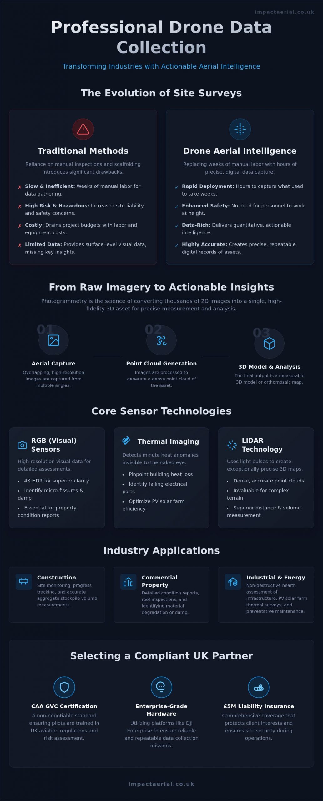
Aerial Photography Birmingham: Elevate Your Project 2026

As Birmingham’s skyline reaches new heights with projects like the 155-meter One Eastside tower, the view from the ground no longer tells the full story of your development’s progress. You likely recognize that capturing the scale of these “supertall” structures requires more than just a standard camera; it demands precision and absolute compliance with the 2026 UK drone regulations. Relying on uncertified operators isn’t just a risk to your marketing quality, it’s a liability you can’t afford in a dense urban environment.

This article demonstrates how professional aerial photography services Birmingham can transform your project through high-resolution 4K HDR visuals and a meticulous, safety-first approach. We’ll explore how CAA GVC certified pilots and DJI Enterprise technology ensure your marketing assets and construction monitoring remain both stunning and fully compliant with the latest Remote ID and night-flying requirements. You’ll discover how to leverage £5m commercial liability insurance and expert post-production to secure a zero-incident safety record while obtaining elite visual data for the West Midlands’ most ambitious developments, from the Beorma Quarter to the HS2 Curzon Street Station terminus.

Key Takeaways

  • Learn why Birmingham’s vertical expansion, including landmark projects like One Eastside, makes aerial perspectives essential for modern property marketing and urban planning.
  • Discover how utilizing 4K HDR DJI Enterprise technology provides the stability and visual clarity needed to showcase large-scale developments in dense urban environments.
  • Understand the critical role of CAA GVC certification and £5m liability insurance when selecting aerial photography services Birmingham to ensure full regulatory compliance.
  • Explore how construction site monitoring and commercial surveys provide accurate, high-resolution data for tracking project milestones from the ground up.
  • Gain insights into the benefits of partnering with local West Midlands specialists who offer end-to-end support from initial flight planning to final post-production editing.

Birmingham’s Skyline Evolution: The Role of Aerial Photography in 2026

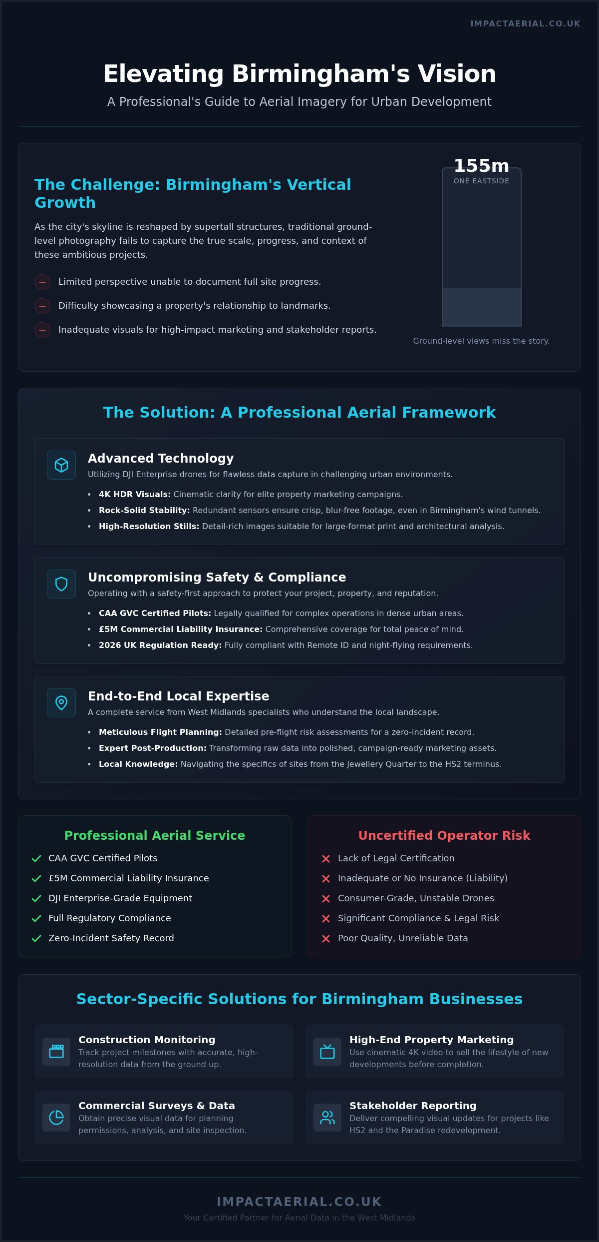
Birmingham is undergoing a radical vertical transformation. Driven by the ambitious “Big City Plan,” the skyline is being reshaped by supertall structures like the 155-metre One Eastside residential tower, which stands as a testament to the city’s regeneration. In 2026, these developments represent more than just architectural milestones; they’re complex engineering feats that require precise documentation. Traditional ground-level photography often fails to capture the sheer scale of these sites. This is why professional aerial photography services Birmingham have become an operational necessity, providing the elevation needed to document progress that’s simply invisible from the street.

The transition from using drones as a novelty marketing tool to an essential piece of project documentation is now complete. While the history of aerial photography began with rudimentary cameras on balloons, today’s DJI Enterprise drones offer a level of stability and technical precision that was previously impossible in dense urban wind tunnels. Impact Aerial supports this evolution by providing high-resolution data that serves as a single source of truth for project managers, ensuring that every phase of the West Midlands’ growth is recorded with clinical accuracy.

To better understand the operational environment and visual potential of drones in the West Midlands, watch this helpful video:

Capturing the Big City Plan

Visualising the transformation of Curzon Street Station and the surrounding HS2 developments requires a comprehensive perspective. We provide developers with a bird’s eye view that’s vital for stakeholder meetings and planning permissions. For high-density residential projects, a drone can illustrate how a building interacts with its environment, showing proximity to transport links and public spaces. This aerial context is indispensable for projects like the Paradise redevelopment, where multiple phases must be coordinated within a tight city-centre footprint.

Marketing Birmingham’s New Landmarks

Selling the lifestyle of new developments in the Jewellery Quarter or the Beorma Quarter requires more than just floor plans. Birmingham agencies now view 4K HDR video as the gold standard for high-end marketing. It captures the intricate architectural details of landmarks like Grand Central while placing new developments within the city’s vibrant heart. Impact Aerial’s cinematic perspectives help potential investors see the finished vision long before the final brick is laid, using commercial-grade hardware to produce assets that are ready for immediate campaign deployment.

Professional Drone Photography Services: Technical Excellence in the West Midlands

Delivering professional aerial photography services Birmingham requires more than just a drone; it requires a mobile data-capture platform. Birmingham’s city centre is notorious for wind tunnels created by high-rise clusters like the Paradise redevelopment. Consumer-grade drones often struggle with stability in these conditions, leading to motion blur or inconsistent framing. We utilise DJI Enterprise drones specifically for their advanced propulsion systems and redundant sensors, which maintain rock-solid stability even in challenging West Midlands weather. This hardware choice isn’t just about safety; it’s about the precision of the data we collect for your project.

Our operations are strictly aligned with UK drone safety regulations, ensuring that every flight is planned with meticulous attention to detail. This technical discipline extends to the resolution of our outputs. For large-format print and billboard marketing, standard digital stills aren’t sufficient. We provide ultra-high-resolution stills that maintain clarity even when scaled for massive site hoardings or corporate displays. This level of detail is essential for developers who need to present their vision with absolute clarity to stakeholders and potential investors.

Enterprise-Grade Drone Technology

DJI Enterprise models provide a level of data precision that consumer drones can’t match, particularly regarding GPS accuracy and sensor reliability. In the often-overcast light of the West Midlands, high-dynamic-range (HDR) sensors are essential for capturing detail in both deep shadows and bright highlights simultaneously. 4K HDR aerial filming is the industry standard for 2026 clarity, providing a visual depth that standard 4K simply cannot reproduce. This technology ensures that every architectural nuance of your Birmingham project is visible, regardless of the time of day or lighting conditions.

Post-Production and Final Delivery

Providing high-tier aerial photography services Birmingham involves managing every technical variable, from the initial flight plan to the final pixel. The capture is only the first stage of our full project management approach. Our post-production team handles the colour grading and editing to create cinematic reels that are ready for immediate use. We deliver assets in various formats, including:

  • High-bitrate 4K HDR video for corporate presentations and TV advertising.
  • Optimised social media clips for Instagram and LinkedIn campaigns.
  • Uncompressed high-res stills for billboards and site hoardings.

For a deeper look at how these visuals are created, read our comprehensive drone photography guide. If you’re ready to showcase your development’s progress, our team provides professional aerial filming and photography to ensure your project stands out.

Aerial Photography Birmingham: Elevate Your Project 2026

Safety and Compliance: Navigating Birmingham’s Airspace

Birmingham’s urban environment presents a dense network of obstacles, from the high-traffic corridors around Birmingham New Street to the strictly controlled airspace surrounding the international airport. Operating a drone here isn’t just about getting the shot; it’s about meticulous risk mitigation. Every flight we conduct follows the UK’s official Drone and Model Aircraft Code, ensuring that safety remains the primary objective. For commercial projects in the West Midlands, ignoring these protocols can lead to heavy fines and significant legal liabilities for both the operator and the client. Professional aerial photography services Birmingham require a deep understanding of these local restrictions to ensure every mission is legally sound.

Why GVC Certification is Non-Negotiable

As of 2026, the General Visual Line of Sight Certificate (GVC) is the essential standard for any pilot operating in the Specific Category, which covers most urban commercial missions. While some operators may still reference older PfCO standards, the GVC is the current benchmark for competency in congested areas. Our pilots have undergone rigorous assessments to prove their expertise in emergency procedures and airspace management. This qualification is a core requirement for a valid uk drone license for commercial work, providing the legal framework needed to fly near buildings and people that would otherwise be off-limits.

Privacy and GDPR compliance are equally critical when flying in high-density residential areas like the Jewellery Quarter or the newly developed Perry Barr. We employ strict data-handling protocols, including flight path planning that avoids residential windows and post-production techniques such as pixel blurring for sensitive information. This meticulous approach ensures your project documentation doesn’t inadvertently breach privacy laws or cause local friction.

The Value of £5m Liability Insurance

Corporate sites in Birmingham, particularly those involving major infrastructure or high-value real estate, require robust financial protection. Standard consumer insurance often falls short, providing limited coverage that doesn’t account for the specific complexities of a commercial construction site. We carry £5m commercial liability insurance as a standard provision. This high level of indemnity isn’t just a number; it’s a reassurance to your stakeholders that every potential risk, however unlikely, has been fully accounted for.

Our safety-first operational philosophy means we won’t fly if the conditions aren’t right. Whether it’s unpredictable wind speeds around the city’s “supertall” towers or potential GPS interference near heavy rail infrastructure, our pilots make informed decisions based on safety rather than just the project schedule. This reliability is why leading developers choose our aerial photography services Birmingham to protect their reputation and their site assets.

Sector-Specific Solutions for Birmingham Businesses

Birmingham’s diverse economy requires tailored aerial solutions. From the massive logistics hubs near the M6 to the retail density of the Bullring, our aerial photography services Birmingham provide the specific visual data needed for different commercial objectives. We don’t just capture images; we deliver sector-specific intelligence that helps project managers and marketing directors make informed decisions. Whether your focus is on the “Big City Plan” developments or infrastructure maintenance, our approach is always dictated by your specific project requirements.

Construction Site Monitoring and Progress

Construction projects in the West Midlands move at a rapid pace. We provide regular flight schedules that turn complex builds into manageable time-lapse documentation. This isn’t just for marketing; it allows project managers to track progress against milestones with high-resolution precision. By conducting remote inspections of roofs and high-level structures, we significantly reduce the need for scaffolding and risky manual checks. This improves site safety and lowers operational costs across the board. For a full breakdown of these capabilities, see our drone survey guide.

Property and Advertising Excellence

Marketing high-end real estate in Birmingham’s creative districts like Digbeth requires a specific aesthetic. We use DJI Enterprise drones to capture the “vibe” of these areas, providing unique perspectives for corporate advertising campaigns that ground-level cameras can’t achieve. Our 4K HDR visuals are designed for immediate use in professional listings, ensuring that office and retail spaces are presented with the prestige they deserve. Our virtual tour creation service provides an immersive marketing experience, allowing potential tenants to explore Birmingham’s new office developments from anywhere in the world. This is particularly effective for large-scale projects like the Beorma Quarter, where high-resolution 360-degree views can accelerate the leasing process.

Beyond visuals, we support the region’s green energy transition through specialised technical services. Our PV Solar Farm Thermal Surveys use calibrated sensors to detect cell defects that are invisible to the naked eye, ensuring maximum efficiency for renewable energy assets. This data-centric approach extends to infrastructure assessments, where we provide high-resolution mapping for Birmingham’s expanding transport network and HS2-related works. If your business needs accurate data or cinematic marketing assets, our team provides professional drone commercial property surveys and filming to elevate your next project.

Partnering with Impact Aerial: Your Local Birmingham Experts

Choosing the right partner for aerial photography services Birmingham involves more than just comparing technical specifications. It requires a specialist who understands the intricate geography of the West Midlands, from the restricted zones near Birmingham International Airport to the high-density construction sites in the city centre. We don’t just provide imagery; we offer a comprehensive technical partnership that manages every risk and captures every detail. Our local expertise ensures that we anticipate flight challenges before they impact your schedule, allowing for a seamless integration of drone data into your existing workflows.

The Impact Aerial Difference

Local knowledge is vital when navigating Birmingham’s unique flight restrictions. Our pilots are deeply familiar with the specific requirements for operating near major infrastructure like the M6 Spaghetti Junction and the city’s expanding rail networks. We combine this geographic intuition with enterprise-grade DJI technology to ensure that every mission is executed with clinical precision. Unlike many operators who simply deliver raw files, we provide a full post-production service. This means you receive marketing-ready assets that have been professionally colour-graded and edited to meet high-tier corporate standards.

Our £5m commercial liability insurance serves as a cornerstone of our professional reliability, providing stakeholders with total peace of mind during complex urban operations. This level of indemnity, combined with our CAA GVC certifications, reflects our deep commitment to quality and regulatory compliance. We maintain a meticulous approach to every project, ensuring that safety protocols are never compromised for the sake of a shot. This disciplined methodology is why leading firms across the West Midlands trust us to document their most significant developments.

Start Your Project Today

Beginning your aerial project with us is a straightforward, methodical process designed to provide maximum value from the initial consultation. We start by understanding your specific objectives, whether you require high-resolution progress monitoring for a construction site or cinematic 4K HDR footage for a high-end property listing. Our team then conducts a thorough site assessment and flight feasibility study, ensuring all regulatory permissions are secured well in advance of the shoot date.

During your first consultation, we’ll discuss the technical requirements of your project and provide a bespoke quote tailored to your needs. We believe in transparency and clear communication, guiding you through the operational plan so you know exactly what to expect on-site. Once the flight is complete, our post-production experts work to deliver your final assets in the formats best suited for your marketing or data analysis needs. If you’re ready to elevate your project with industry-leading visuals, Contact Impact Aerial for professional drone services today to discuss your requirements with our Birmingham-based team.

Future-Proofing Your Birmingham Development with Professional Aerial Insights

Birmingham’s transformation into a hub of supertall architecture and complex infrastructure requires a sophisticated approach to site documentation and marketing. As we’ve explored, the combination of DJI Enterprise 4K HDR technology and CAA GVC certified pilots is a fundamental requirement for operating safely within the city’s dense urban corridors. By prioritizing technical excellence and strict regulatory adherence, you ensure that your project’s visual assets are both stunning and fully compliant with current standards.

Securing a partner with deep West Midlands knowledge and £5m commercial liability insurance protects your site’s integrity. It delivers elite data for construction monitoring or property advertising. Investing in professional aerial photography services Birmingham allows you to capture the full scale of the city’s regeneration with absolute precision. Whether you’re documenting the foundations of a new residential tower or launching a high-impact marketing campaign, the right aerial perspective provides the clarity needed for commercial success.

Request a Professional Aerial Photography Quote for Birmingham to begin your consultation. We look forward to helping you elevate your next project.

Frequently Asked Questions

Do I need special permission for drone photography in Birmingham city centre?

Yes, operating within Birmingham’s dense urban centre often requires specific airspace permissions, especially when flying near the airport’s flight restriction zone or major rail infrastructure. Our team handles all necessary coordination with the Civil Aviation Authority and local air traffic control to ensure legal compliance. We perform detailed pre-flight site assessments to identify any temporary flight restrictions, ensuring your project proceeds without legal interruptions or safety risks.

What happens if it rains on the day of my aerial shoot?

Safety is our primary operational priority, so we don’t fly in active rain or high winds that exceed the technical limits of our DJI Enterprise drones. If the West Midlands weather proves unsuitable on your scheduled date, we simply move the shoot to the next available clear-weather window at no additional cost. We monitor specialized aviation forecasts 48 hours in advance to keep you updated on any potential scheduling adjustments.

How much does professional aerial photography in Birmingham cost?

The cost for professional aerial photography services Birmingham depends entirely on the specific requirements of your project, such as the location’s airspace complexity and the required flight duration. Factors like the type of data capture needed and the extent of post-production editing also influence the final quote. We provide bespoke pricing for every client to ensure you only pay for the specific expertise and equipment required for your Birmingham-based development.

Are your pilots CAA GVC certified for commercial work?

Every pilot at Impact Aerial holds the General Visual Line of Sight Certificate (GVC) issued by the Civil Aviation Authority. This certification is the modern industry standard for conducting commercial drone operations in congested urban environments like Birmingham. It demonstrates that our pilots have undergone rigorous practical and theoretical assessments, ensuring they possess the technical expertise required to manage complex flight paths while maintaining absolute safety and regulatory compliance.

Can you provide drone surveys for construction sites in the West Midlands?

We provide comprehensive construction site monitoring and data collection surveys across the entire West Midlands region. Our DJI Enterprise drones capture high-resolution 4K HDR visuals that allow project managers to track progress from foundations to completion with extreme precision. These surveys are essential for remote roof inspections and structural assessments, providing a safer and more cost-effective alternative to traditional scaffolding or manual site checks for large-scale developments.

How long does it take to receive the final edited photos and videos?

We typically deliver initial raw data or proofs within 24 to 48 hours of completing the flight. For projects requiring full post-production, such as cinematic marketing reels or colour-graded 4K HDR video, the final delivery usually occurs within five to seven working days. This timeline allows our editing team to meticulously process your assets, ensuring they meet the high-tier quality standards required for corporate presentations or advertising campaigns.

What is the benefit of £5m drone insurance for my project?

Carrying £5m commercial liability insurance provides essential financial protection and psychological comfort for your business and stakeholders. In the high-stakes environment of Birmingham’s urban construction and commercial sectors, this level of indemnity is often a mandatory requirement for site access. It ensures that your project is fully protected against unforeseen incidents, reflecting our commitment to professional reliability and a safety-first operational philosophy that standard consumer-grade insurance cannot match.

Do you offer post-production and colour grading for drone filming?

Our service includes comprehensive post-production and professional colour grading to ensure your aerial photography services Birmingham result in marketing-ready assets. We use advanced editing software to enhance the visual depth of our 4K HDR footage, tailoring the final look to match your brand’s specific aesthetic. Whether you need cinematic promotional videos for Digbeth developments or high-resolution stills for site hoardings, we manage the entire creative process from capture to final delivery.

Drone Zoom Inspection Services UK: High-Resolution Asset Analysis in 2026

Traditional scaffolding and cherry pickers are no longer the gold standard for structural surveys; they are often an unnecessary financial and safety burden. As we move through 2026, the industry is shifting toward precision stand-off tools that deliver microscopic detail without the proximity risk of traditional flights. Utilizing professional drone zoom inspection services UK wide allows asset managers to capture millimetre-accurate data from a safe distance. This approach eliminates the need for personnel to work at height while providing a level of visual clarity that was previously impossible from the ground.

It’s understandable if you’re skeptical about whether a remote camera can truly replace a physical hands-on inspection. You need to see hairline cracks, corroded bolts, or faded serial numbers to make informed maintenance decisions. This article explores how advanced DJI Enterprise hardware and CAA GVC certified pilots provide ultra-high-resolution inspection data that meets strict regulatory standards. We’ll preview the latest 2026 compliance requirements, the cost-saving benefits of reduced downtime, and how high-resolution zoom technology ensures your asset reporting remains fully insured and audit-ready.

Key Takeaways

  • Learn how high-magnification optical sensors allow for detailed structural analysis without the risks associated with close-proximity flights or manual access.
  • Discover how professional drone zoom inspection services UK wide provide millimetre-accurate visual data for identifying hairline cracks and serial numbers on critical infrastructure.
  • Understand the specific advantages of zoom-led surveys for high-rise facade inspections and complex utility monitoring in the property and construction sectors.
  • Identify the essential regulatory requirements for 2026, including the necessity of CAA GVC certification and comprehensive £5m commercial liability insurance for site safety.
  • Explore the transition from raw aerial imagery to actionable reporting through professional post-production and consultative project management.

The Evolution of Industrial Asset Inspection in the UK

Industrial asset management has undergone a fundamental shift in how we approach structural integrity. For decades, inspecting high-rise facades or critical infrastructure meant weeks of logistical planning for scaffolding or rope access. By 2026, the reliance on these cumbersome methods has diminished as Unmanned Aerial Vehicles (UAVs) have reached a new level of operational maturity. 2026 represents a turning point where drone autonomy and sensor resolution have converged. Automated flight paths and AI-assisted zoom now allow for repeatable, high-precision data capture that was previously impossible. Professional drone zoom inspection services UK wide now offer a safer, more efficient alternative that meets the rigorous demands of modern engineering sign-offs.

Why Traditional Access is Becoming Obsolete

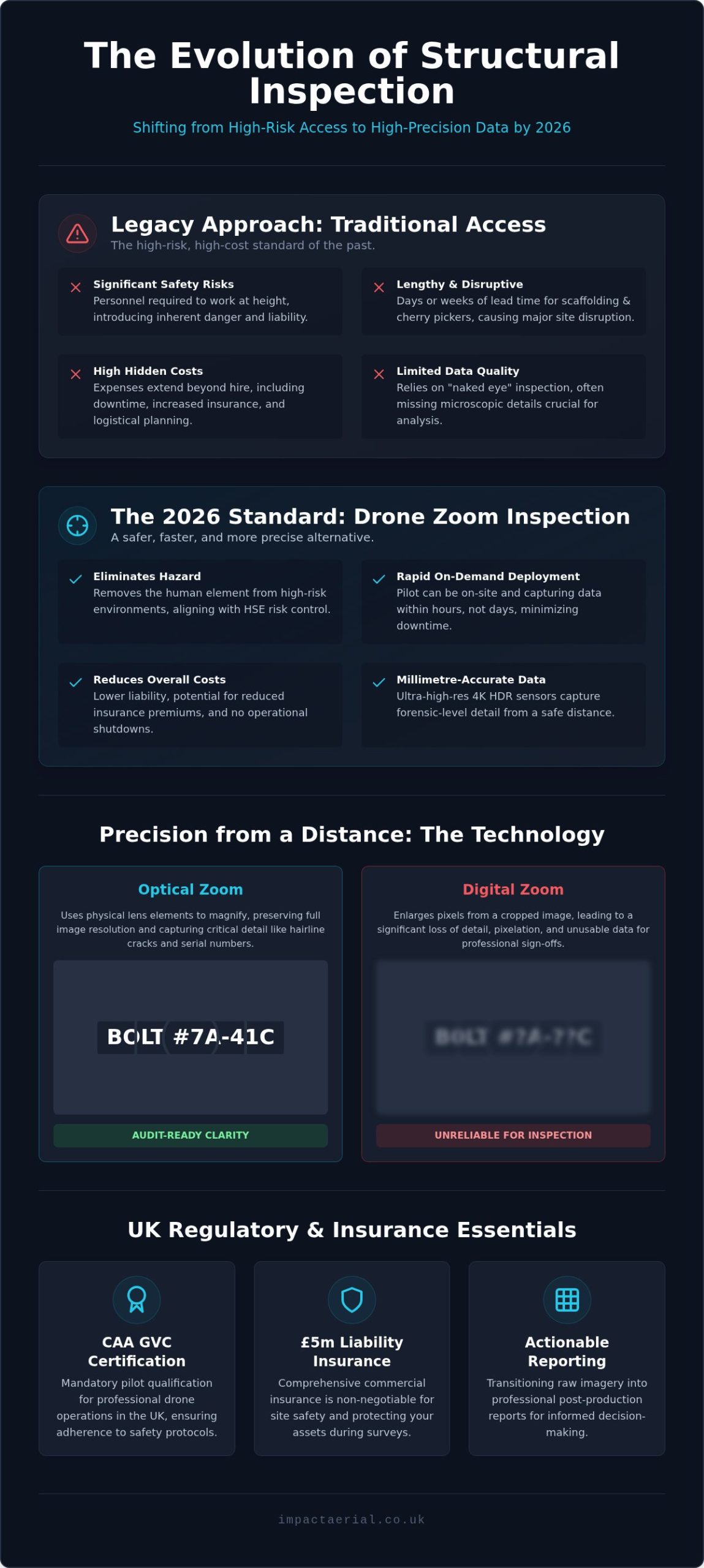
Traditional access methods involve heavy hidden costs that extend far beyond the initial hire quote. Scaffolding requires lengthy lead times, creates significant site disruption, and introduces the inherent risks of working at height. The UK Health and Safety Executive (HSE) prioritizes the elimination of hazards through its hierarchy of risk control. Drones fulfill this requirement by removing the human element from high-risk environments entirely. This transition lowers liability and can reduce insurance premiums for site owners. Deployment is now on-demand. Instead of waiting days for a cherry picker, a CAA GVC certified pilot can be on-site capturing data within hours. This agility reduces inspection downtime, allowing for a rapid response to suspected structural failures or routine maintenance checks without halting site operations.

The Role of High-Resolution Imagery in Modern Surveying

Modern surveying has moved beyond standard photography into the era of forensic-level data. The adoption of 4K HDR sensors on DJI Enterprise hardware allows for structural sign-offs that are as reliable as a physical “hands-on” inspection. These sensors capture microscopic details, such as hairline cracks or corroded fasteners, from a safe stand-off distance. This high-resolution output isn’t just a standalone file. It’s a vital component of digital twins and Building Information Modelling (BIM) models. In 2026, the integration of aerial data into these digital platforms allows for sophisticated predictive maintenance. Using drone zoom inspection services UK ensures that every pixel provides a clear, audit-ready trail of an asset’s condition. This data-centric approach provides a level of precision that traditional “naked eye” inspections simply cannot match, especially when dealing with hard-to-reach areas of a property or construction site.

Understanding Drone Zoom Technology: Precision from a Distance

Drone zoom technology is a specialized field within aerial surveying that prioritizes stand-off capabilities. This method utilizes high-magnification optical sensors to capture minute details from a distance, rather than flying the aircraft within centimeters of an asset. This Safe Distance principle is critical when inspecting sensitive infrastructure like live telecommunications towers or fragile historic masonry where proximity introduces unnecessary turbulence or collision risk. Professional drone zoom inspection services UK providers use these advanced optics to maintain a secure flight path while delivering millimetre-accurate visual data.

Maintaining a steady shot at high magnification is a significant technical challenge. Professional-grade gimbals use three-axis stabilization to counteract wind gusts and vibration, ensuring that even at maximum zoom, the image remains rock-steady. Without this mechanical precision, high-magnification shots would be too blurred for professional reporting. Using commercial-grade DJI Enterprise drones ensures that every frame of your survey is usable data for your structural engineers.

Optical vs. Digital Zoom for Inspections

For structural sign-offs, the distinction between optical and digital zoom is vital. Digital zoom essentially crops and enlarges an image, which often leads to pixelation and the loss of critical detail like hairline cracks. Optical zoom uses the physical movement of lens elements to increase magnification, maintaining full 4K resolution at significant distances. In the context of the UK’s Drone and Model Aircraft Code, stand-off distance refers to the safety buffer maintained between the aircraft and an object to ensure operational safety while complying with legal separation requirements. High-quality optical sensors ensure that even at 30x magnification, the imagery remains sharp enough for forensic engineering analysis.

Hardware Focus: DJI Enterprise Capabilities

The deployment of DJI Enterprise hardware has redefined the possibilities of portable zoom inspections. The DJI Mavic 3 Enterprise series, for example, offers a 56x hybrid zoom capability that allows pilots to identify defects from over 50 meters away. For more complex utility and solar assets, the DJI Matrice 30T provides dual-sensor capabilities, combining a 16x optical zoom with high-resolution thermal imaging. This allows for the simultaneous detection of structural cracks and thermal anomalies like hot spots in PV panels. These drones also feature integrated laser range finders, which are essential for repeatability. By recording the exact distance and coordinates of a defect, surveyors can return months later to monitor the same point for signs of degradation. If you’re managing a large portfolio of assets, our drone commercial property surveys provide the technical precision needed for long-term monitoring.

Drone Zoom Inspection Services UK: High-Resolution Asset Analysis in 2026

Key Applications: Where Zoom Inspections Deliver Maximum Value

High-magnification sensors have transformed how we assess vertical and high-value assets. In high-rise facade inspections, drone zoom inspection services UK wide allow for the identification of loose masonry and seal failures that are invisible to the naked eye. This forensic level of detail is equally critical for infrastructure monitoring. Bridges, pylons, and cell towers require regular structural checks to ensure public safety and operational continuity. By using optical zoom, we can verify the condition of rivets, bolts, and insulators without needing to climb or power down high-voltage equipment.

Solar farm maintenance is another area where high-resolution zoom provides a significant competitive edge. While thermal imaging identifies heat signatures, visual zoom is necessary to spot physical micro-cracks or debris on PV panels that could lead to long-term degradation. All operations are conducted in strict accordance with UK Civil Aviation Authority (CAA) regulations, ensuring that data collection is both legal and safe. This meticulous approach to data capture ensures that every survey meets the high standards required for engineering sign-offs and long-term asset management.

Commercial Property & Roof Surveys

Roof inspections often present the highest risk and cost for property managers. Using high-resolution zoom, we can identify “dead” gutters, blocked drainage points, and minor roof leaks without the need for risky roof walking. This provides insurance-grade documentation that is essential for property transactions and dilapidation claims. Our comprehensive drone property surveys bridge the gap between raw aerial imagery and professional structural reporting, giving stakeholders the clarity needed for capital expenditure planning. It’s a reliable way to get eyes on an asset without the setup time of traditional access.

Construction Site Monitoring & Safety

On active construction sites, verifying the integrity of welds and fixings at height is a constant challenge. High-magnification drones allow for real-time verification of structural integrity during the build phase. This capability significantly reduces the need for site-wide shutdowns or the deployment of heavy access machinery. Integrating construction site monitoring into your project management workflow ensures that quality control is maintained without compromising the build schedule. It’s about providing actionable data that keeps the project moving safely and on budget.

Why Safety & Certification are Non-Negotiable in the UK

Operating a drone for industrial purposes is a highly regulated professional service that requires significantly more than basic flight skills. In the complex environments of construction and infrastructure, safety is the primary metric of success. Professional drone zoom inspection services UK providers must adhere to strict operational limits to protect people, property, and the integrity of the data collected. This begins with a thorough understanding of the legal framework and ends with a meticulous approach to every flight, ensuring that all risks are identified and mitigated before the aircraft leaves the ground.

The Importance of CAA GVC Certification

The General Visual Line of Sight Certificate (GVC) is the professional standard for commercial drone pilots in the UK. Unlike hobbyist flyers or those operating under basic authorizations, GVC certified pilots have undergone rigorous theoretical and practical assessments approved by the Civil Aviation Authority. This certification is essential for operating in the “Specific Category,” allowing for complex missions in congested areas or near sensitive infrastructure. Professional pilots are trained to manage complicated airspace, coordinating with Air Traffic Control when working near airports or within restricted city centres. Understanding the nuances of a UK drone license ensures that your project remains fully compliant with 2026 aviation laws, avoiding the heavy fines and legal liabilities associated with unauthorized flights.

Insurance & Risk Mitigation

For any industrial or commercial site, standard public liability insurance is insufficient. Professional drone operators carry specialist commercial UAV insurance that complies with EC 785/2004 requirements. We maintain £5m in commercial liability insurance as a baseline for all UK operations, providing the financial protection necessary for high-value asset inspections. Beyond financial coverage, our risk mitigation strategies include strict hardware failure protocols and pre-flight “fly-away” risk assessments. Impact Aerial provides site managers with the peace of mind that every flight is backed by meticulous planning, comprehensive insurance, and a total commitment to zero-incident operations. This disciplined approach ensures that our presence on your site is a benefit, not a liability.

Data protection is a critical yet often overlooked component of aerial surveying. Handling high-resolution imagery of public spaces or private assets requires strict adherence to GDPR and data privacy laws. We conduct Privacy Impact Assessments for every project, ensuring that any captured identifiable data is handled, stored, and deleted according to legal requirements. If you require a safety-first partner for your next structural survey, book our professional drone services to ensure your project is handled with the highest level of technical and legal expertise.

Partnering with Impact Aerial for Your UK Inspection Projects

Partnering with a specialist for drone zoom inspection services UK ensures that your structural data is captured and managed with technical precision from inception to delivery. Impact Aerial operates as a technical consultant rather than a simple flight agency. We understand that high-resolution imagery is only valuable if it’s actionable, compliant, and integrated into your existing maintenance workflows. Our team handles the entire project lifecycle, providing a seamless transition from raw aerial data to professional engineering reports that stand up to audit and insurance scrutiny.

Our consultative approach begins with a deep understanding of your specific asset requirements. We don’t just provide a pilot; we provide a full project management team that prioritizes safety and data integrity. This meticulousness is what sets us apart in the expanding market for drone zoom inspection services UK. By focusing on high-tier quality and adherence to strict professional standards, we ensure that every pixel of data we deliver serves a clear business purpose for your stakeholders.

The Impact Aerial Workflow

Our methodical approach ensures that every project meets our high standards for safety and precision. We follow a structured three-step process designed to minimize risk and maximize data quality:

  • Step 1: Desktop Feasibility and Airspace Check: Before any hardware is deployed, we conduct a comprehensive analysis of the site. This includes checking for airspace restrictions, identifying ground hazards, and ensuring all operations will be fully compliant with CAA regulations and local bylaws.
  • Step 2: On-site Execution: Using commercial-grade DJI Enterprise hardware, our pilots capture high-magnification optical data from safe stand-off distances. This phase is conducted with minimal site disruption, allowing your operations to continue while we gather forensic-level imagery.
  • Step 3: Data Processing and Secure Delivery: Raw 4K HDR imagery is processed through our professional post-production suite. We turn high-resolution files into organized, actionable reports that highlight specific defects like hairline cracks or corrosion, ensuring your team has the clarity they need for structural sign-offs.

Ready to Elevate Your Inspections?

Based in our Birmingham hub, Impact Aerial is perfectly positioned to serve the West Midlands and provide rapid deployment across the entire UK. Our central location allows us to reach major infrastructure and construction hubs efficiently, ensuring your inspection timelines are met without delay. We offer bespoke quotes tailored to the technical requirements of your asset, whether you manage a single commercial property or a national portfolio of utility sites. Our commitment to reliability and compliance provides the reassurance that your assets are in safe, expert hands. Request a professional drone zoom inspection from Impact Aerial to secure the high-resolution data your project demands.

Securing the Future of Your Industrial Assets

The transition to high-resolution aerial data marks a definitive end to the era of expensive, high-risk manual access. By leveraging drone zoom inspection services UK wide, asset managers can now obtain millimetre-accurate visual data without the logistical burden of scaffolding or site shutdowns. We’ve explored how advanced optical sensors and stabilized gimbals deliver forensic-level clarity from a safe distance; this ensures that your structural sign-offs are backed by undeniable evidence. Compliance remains the cornerstone of professional operations, with 2026 regulations demanding a meticulous approach to airspace and data privacy.

Impact Aerial is ready to support your next project with our team of CAA GVC Certified Pilots, £5m Commercial Liability Insurance, and the latest DJI Enterprise Hardware. We handle everything from desktop feasibility to high-end post-production, turning raw imagery into actionable intelligence. Book a Professional Drone Zoom Inspection with Impact Aerial to ensure your assets are monitored with technical excellence and total regulatory peace of mind. We look forward to helping you elevate your site safety and data precision.

Frequently Asked Questions

What is the maximum zoom range for a professional inspection drone?

Professional inspection drones like the DJI Matrice 30T offer a 16x optical zoom and up to 200x digital magnification. The compact DJI Mavic 3 Enterprise features a 56x hybrid zoom capability. These ranges allow pilots to capture high-resolution data from a safe stand-off distance. Using such advanced hardware ensures that fine details are visible without flying the aircraft dangerously close to sensitive infrastructure or high-voltage equipment.

Can drone zoom inspections identify hairline cracks in concrete?

Yes, drone zoom inspection services UK providers use 4K HDR sensors and high-magnification optical lenses to detect hairline cracks as small as a millimetre. The stability provided by three-axis gimbals on DJI Enterprise hardware ensures that these images are sharp and forensic in quality. This level of detail is essential for structural engineers who need to sign off on the integrity of bridges, facades, or industrial chimneys without manual rope access.

Is a drone inspection legal in a congested UK city centre?

Drone inspections in UK city centres are legal when conducted by CAA GVC certified pilots who adhere to strict safety protocols. These operations require detailed flight planning and risk assessments to manage complex airspace and public safety. Impact Aerial pilots are trained to coordinate with local authorities and Air Traffic Control where necessary. Holding £5m commercial liability insurance is a standard requirement for operating in these high-density urban environments.

How much does a drone zoom inspection service cost in the UK?

The cost of a professional drone survey depends on the project’s complexity, site location, and the specific data requirements. Factors such as the need for specialized sensors, the duration of the flight, and the depth of post-production reporting all influence the final quote. We provide bespoke pricing based on a technical consultation to ensure the service matches your asset’s needs. This tailored approach guarantees you receive the most efficient and cost-effective data collection strategy.

Do I need to be present on-site during the drone inspection?

You don’t need to be present on-site during the inspection. Our pilots handle all aspects of the flight, from the initial airspace check to the final data capture. However, having a site representative available can be beneficial for providing access to specific areas or clarifying survey priorities. We provide full project management and can deliver the final high-resolution reports and imagery through secure digital platforms once the survey and post-production are complete.

What kind of report will I receive after the drone survey?

After a drone zoom inspection services UK survey, you’ll receive a comprehensive data package. This typically includes high-resolution 4K HDR imagery, stabilized video footage, and a detailed inspection report. Our post-production team processes raw data to highlight specific defects or areas of concern. These reports are designed to be actionable for structural engineers and property managers, often integrating directly into digital twins or Building Information Modelling (BIM) systems for long-term tracking.

Can drones perform zoom inspections in wet or windy weather?

Modern enterprise drones like the DJI Matrice 30T have an IP55 rating, which allows them to operate in light rain and dusty conditions. However, high winds can affect the stability of zoom shots and overall flight safety. We monitor weather forecasts closely and will reschedule a flight if conditions exceed the safe operating limits of the aircraft. Prioritizing safety ensures that the data collected is of the highest quality and that the mission remains fully insured.

How does zoom technology improve safety for solar farm inspections?

Zoom technology allows pilots to inspect PV panels from a significant height or distance, removing the risk of the drone colliding with sensitive equipment. By using high-magnification sensors, we can spot physical micro-cracks or debris without flying low over the arrays. This stand-off capability is particularly effective when combined with thermal sensors to identify hot spots. It ensures a comprehensive survey of the solar farm while maintaining a safe operating buffer from the ground and infrastructure.

Drone Surveys: A 2026 Guide for UK Industry

Table of Contents

Last Updated: September 6, 2026

Drone surveys have transformed how construction firms, property developers, and facility managers capture site data, moving beyond ground-level photography to deliver precise measurements and high-resolution imagery from above. A drone survey is the use of an unmanned aerial vehicle equipped with cameras or sensors to collect spatial data, visual records, or thermal information for analysis and decision-making. In this guide from Impact Aerial, a CAA-certified operator with over 20 years in aerial media, we break down what these surveys involve, how to navigate CAA drone regulations UK operators must follow, and what drives drone roof inspection cost. Below, we show you exactly how to evaluate providers and understand the value of professional aerial data collection.

The appeal is obvious when you consider the alternative: traditional methods often require scaffolding, cherry pickers, or manned aircraft, which are slow and expensive. Drone surveys deliver the same data in a fraction of the time, often within a single site visit. But the technology only performs when the pilot understands both the equipment and the legal framework around it. We will cover the main survey types, the regulatory basics, and the practical questions to ask before commissioning any aerial work.

What Do Drone Surveys Involve?

A drone survey involves planning a flight path, deploying a drone with the appropriate sensor, and processing the captured data into a usable deliverable such as an orthomosaic map, a 3D model, or a thermal report. The process begins with a site assessment to identify hazards, confirm airspace restrictions, and determine the ground sampling distance required for your accuracy goals. Pilots then fly a systematic grid pattern to ensure overlapping images or scans cover the entire area of interest.

Most commercial drone surveys rely on photogrammetry or LiDAR. Photogrammetry stitches hundreds of overlapping photographs into a georeferenced 2D map or 3D model, while LiDAR uses laser pulses to measure distances and penetrate vegetation. The choice depends on your terrain and the level of detail required. Ground control points are often placed before the flight to improve positional accuracy, and the entire operation is logged for compliance with the Civil Aviation Authority.

Watch Out
Skipping the pre-flight airspace check is a common mistake. Operating without the correct permissions can lead to fines, grounded projects, and safety incidents on site. Always confirm your provider holds a valid CAA permission before work begins.

Why Use Drone Surveys for Inspections and Mapping?

The core benefit of drone surveys is the combination of speed, safety, and accuracy that traditional methods cannot match. Inspecting a roof, a facade, or a solar farm by foot or scaffold puts workers at height and disrupts operations; a drone completes the same inspection from the ground in under an hour. For mapping, drones capture data across large sites in a single flight, producing outputs that ground teams would take days to measure manually.

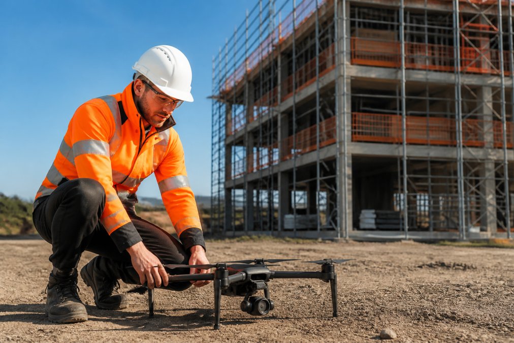
A drone operator in high-visibility clothing launching a commercial quadcopter on a construction site, with a partially built structure and scaffolding visible in the background under bright daylight

The data quality is another deciding factor. High-resolution orthomosaics give project managers an accurate record of progress, while thermal cameras detect defects invisible to the naked eye. This approach also improves safety records by removing the need for personnel to work at height, a key concern under UK health and safety law. For facilities managers, regular aerial inspections create a time-stamped history of asset condition, supporting maintenance planning.

Types of Drone Survey for Construction and Property

Photogrammetry and Orthomosaic Mapping

Photogrammetry is the most widely used drone survey method for construction and property because it produces visually clear, measurable outputs at a reasonable cost. The drone captures hundreds of overlapping images, which software processes into an orthomosaic, a geometrically corrected map accurate to centimetres. Project managers use these maps to monitor earthworks, calculate stockpile volumes, and track site progress against programme.

For property developers, orthomosaic mapping supports marketing and planning applications by providing a complete, current view of the land. The output is easy to share with stakeholders who lack technical GIS skills. The main limitation is that photogrammetry relies on visible light, so it struggles in dense vegetation or low-light conditions. For those cases, LiDAR is the better tool.

LiDAR Scanning for Detailed Terrain Data

LiDAR scanning uses laser pulses to measure the distance between the sensor and the ground, generating millions of precise points that form a 3D point cloud. Unlike photogrammetry, LiDAR can penetrate tree cover to reveal the underlying terrain, making it essential for surveying heavily vegetated sites or conducting corridor mapping for infrastructure. The data produces accurate digital terrain models regardless of lighting conditions.

The trade-off is cost and processing complexity. LiDAR sensors are expensive, and the point cloud data requires specialist software and skills to interpret. For most construction projects, photogrammetry offers sufficient accuracy at a fraction of the price. LiDAR becomes the right choice when vegetation removal is not possible or when the project demands sub-centimetre vertical accuracy across challenging terrain.

Using Aerial Thermal Imaging Surveys for Building Diagnostics

Aerial thermal imaging surveys detect temperature differences across a building envelope, revealing issues such as moisture ingress, missing insulation, and failing electrical connections. A thermal camera mounted on a drone captures infrared radiation, which software converts into a temperature map of the surveyed surface (energy.gov). This non-destructive method identifies defects early, preventing costly repairs and reducing energy waste.

For commercial facility managers, thermal surveys are particularly valuable for flat roof inspections, where water trapped beneath the membrane shows up as a distinct temperature anomaly. Solar farm operators also rely on thermal imaging to locate faulty photovoltaic cells that underperform or overheat. The key to accurate results is flying at the correct time of day, as solar loading and ambient temperature affect the readings. Early morning or evening flights generally produce the clearest thermal contrast.

Contact Us →

Pro Tip
For the most accurate thermal results, schedule surveys for early morning after a cool night. The temperature difference between wet insulation and dry areas is at its maximum, making defects far easier to identify.

Understanding CAA Drone Regulations UK Commercial Operators Must Follow

Commercial drone operations in the UK are governed by the Civil Aviation Authority, and all operators must hold the appropriate permissions before flying. The core requirement is an operational authorisation, which requires passing a theory exam and demonstrating a clear understanding of airspace, safety, and privacy rules (caa.co.uk). Pilots must also hold a valid GVC (General Visual Line of Sight Certificate) qualification to prove their competence.

Beyond the operator permission, every flight must comply with the CAA drone regulations UK covering maximum altitude, visual line of sight, and proximity to people and property. Flights near airports, prisons, or other restricted areas require additional permissions, and operators must maintain a safety case documenting their procedures. Insurance is also a practical requirement; most clients expect proof of at least £5 million in public liability cover before allowing work on site. The CAA publishes detailed guidance on operational requirements that all commercial operators should follow.

Drone Roof Inspection Cost: What Determines the Price?

Drone roof inspection cost varies significantly based on the size and complexity of the roof, the type of survey required, and the accessibility of the site. A straightforward visual inspection of a small commercial roof may take under an hour, while a full thermal survey of a large industrial complex requires more flight time, data processing, and specialist equipment. The accuracy you need also drives the price, as higher-resolution sensors and additional ground control points add to the cost.

The condition of the roof matters more than many clients expect. A roof with multiple levels, parapets, or obstructions requires more careful flight planning and additional passes to capture every angle. The location of the site also affects the price, as travel time and any airspace restrictions near the property are factored into the quote. Rather than comparing headline prices, ask providers what the survey includes: the number of flights, the type of sensor, the deliverables, and the turnaround time. All of these elements influence the final figure.

How to Choose a Drone Survey Provider

Choosing a drone survey provider comes down to verifying three things: certification, insurance, and relevant experience. Confirm that the operator holds a valid CAA permission and that their pilots are GVC qualified, then ask for proof of public liability insurance. The right paperwork protects you from liability if something goes wrong on site, and it demonstrates that the provider takes compliance seriously.

Experience in your specific sector matters just as much as the technical credentials. A provider who has surveyed solar farms understands the flight patterns needed to capture every panel, while one focused on construction knows how to schedule flights around site activity. Ask for examples of previous work and check whether the provider offers post-production and data processing in-house. A common mistake is hiring a pilot who can fly but cannot deliver the processed maps or reports you need. The full package from Impact Aerial’s commercial survey services includes CAA-licensed pilots, a £5m insurance policy, and professional post-production to turn raw data into usable insights.

Survey Type Best For Key Output Typical Use Case
Photogrammetry Site mapping, volume calculations Orthomosaic, 3D model Construction progress tracking
LiDAR Vegetated terrain, corridor mapping 3D point cloud Infrastructure planning
Thermal Imaging Building diagnostics, solar farm checks Temperature map Roof defect identification
Key Takeaway
The best drone survey provider combines technical skill with regulatory compliance. Verify CAA certification, insurance cover, and sector experience before reviewing their portfolio. A provider with all three will deliver accurate, actionable data.

Commissioning a drone survey is a decision about data quality, safety, and regulatory compliance, not just about getting a camera in the air. The right provider turns aerial capture into measurable value, whether that means spotting a roof defect before it becomes a leak or tracking site progress against a construction schedule. Impact Aerial combines CAA GVC Certified operators, a modern fleet of latest 4K, High Dynamic Range (HDR) DJI Enterprise commercial drones, and over 20 years of experience in aerial photography, videography, media production, and marketing to deliver surveys you can act on. Contact Impact Aerial to discuss your project and get a tailored quote.

Frequently Asked Questions

What are the main benefits of using drone surveys for building inspections?

Drone surveys deliver accurate, high-resolution data quickly, often in a fraction of the time ground teams need. They improve safety by removing the need for personnel to work at height or enter hazardous areas. The data captured, including 4K imagery and precise measurements, supports better decision-making for maintenance and progress monitoring. This leads to fewer site disruptions and a safer working environment.

Do I need a CAA licence to operate a drone for commercial surveys?

Yes. Any commercial drone operation must follow CAA drone regulations UK operators are bound by. This requires you to hold a valid GVC (General Visual Line of Sight Certificate). You also need to register as an operator with the CAA and have appropriate insurance. This legal framework ensures all commercial flights are conducted safely and responsibly.

How accurate are drone surveys compared to traditional methods?

Modern drone surveys, using techniques like photogrammetry and LiDAR, deliver centimetre-level accuracy. This makes them highly effective for detailed topographic mapping, volume calculations, and structural inspections. Accuracy depends on factors such as flight planning, ground control points, and the quality of the sensors used. A professional provider will follow strict methodologies to ensure the data meets your project’s specific tolerances.

What data outputs can I expect from a professional drone survey?

You typically receive more than just video footage. Outputs can include high-resolution orthomosaic maps, 3D models, thermal images from aerial thermal imaging surveys, and detailed point clouds from LiDAR. Reports are usually delivered with annotations and measurements relevant to your goals, such as defect location or stockpile volume. The provider should confirm the exact deliverables, formats, and software compatibility before the flight.

Construction Drone Services Birmingham: The 2026 Site Manager’s Guide

By 2026, approximately 64% of UK construction firms with over 50 employees have integrated drones into their daily operations to stay competitive. If you’re managing a major project in the West Midlands, you already know that the traditional costs of scaffolding for simple inspections and the inherent safety risks of manual site surveys are becoming unsustainable. Utilizing professional construction drone services Birmingham is no longer a luxury; it’s a critical safety and compliance infrastructure for the city’s current development surge.

We understand that your primary focus is keeping projects on track while meeting rigorous safety standards. This guide will show you how to leverage drone technology to secure high-resolution progress reports and accurate volumetric data for earthworks without the overhead of manual methods. We’ll preview the essential 2026 regulatory landscape, including mandatory Remote ID and UK class marks, while explaining how CAA GVC certified pilots with £5m commercial liability insurance ensure your site remains fully compliant in complex urban environments.

Key Takeaways

  • Understand how professional construction drone services Birmingham provide high-resolution orthomosaic mapping and real-time monitoring to replace expensive scaffolding and manual inspections.
  • Learn why CAA GVC certification and £5m commercial liability insurance are mandatory for navigating complex urban flight paths and Birmingham Airport (BHX) airspace restrictions.
  • Discover the efficiency gains of UAV technology, which can map a 10-acre site in hours rather than days, providing precise volumetric data for earthworks.
  • Explore the role of DJI Enterprise 4K HDR hardware in delivering precision data that integrates directly with project timelines and site management software.
  • Gain insights into the 2026 Birmingham skyline transformation and how local specialists tailor flight plans to meet specific regional infrastructure requirements.

The Evolution of Construction Drone Services in Birmingham

Construction drone services Birmingham have transitioned from simple aerial photography to a sophisticated data ecosystem. In 2026, the city’s skyline is undergoing a massive transformation. Major infrastructure projects like the Big City Plan and the continued evolution of Curzon Street require a level of oversight that ground-based teams can’t provide alone. Site managers no longer view Unmanned Aerial Vehicles (UAVs) as optional gadgets. They’re essential instruments for precision surveying, reporting, and long-term asset management.

Traditional site monitoring is becoming obsolete in dense urban environments. Manual surveys often involve high costs and safety risks, especially when inspecting vertical structures or sprawling earthworks. By integrating drone applications in construction, project leads capture high-resolution data that traditional scaffolding simply can’t reach. This shift ensures every inch of a Birmingham development is documented with mathematical accuracy, providing a digital twin of the physical site that updates in real-time.

To see how these aerial perspectives are currently supporting major local infrastructure, watch this continuous overflight of the HS2 Birmingham route:

The Role of Drones in Modern Site Management

Drones provide a “single source of truth” for site conditions, which is vital for managing complex relationships with stakeholders and investors. Real-time tracking allows managers to document project timelines with visual evidence that isn’t up for debate. This data-centric approach offers several advantages:

  • Investor Transparency: Share 4K HDR progress videos that prove milestones are met on schedule.
  • Risk Mitigation: Reduce hazardous manual inspections at height, protecting your workforce from unnecessary danger.
  • Data Integration: Overlay drone maps with BIM designs to spot structural discrepancies before they become expensive errors.

Why Local Expertise Matters in the West Midlands

Operating in the West Midlands requires a deep understanding of its specific development zones. From the historic Jewellery Quarter to the industrial sprawl of Digbeth, every site has unique flight constraints and safety protocols. Having a pilot based in the West Midlands allows for rapid deployment of construction drone services Birmingham when weather windows open. Impact Aerial brings this local expertise to every project, combining DJI Enterprise hardware with a meticulous approach to CAA GVC compliance. Our team carries £5m commercial liability insurance as standard, which is a non-negotiable requirement for major construction contracts in central Birmingham. We don’t just fly; we provide a technical consultancy that understands the regional property sector’s demands.

Key Applications: From Site Monitoring to Technical Surveys

Professional construction drone services Birmingham provide a dual benefit by delivering both high-precision engineering data and high-impact marketing assets. In 2026, site managers use these tools to replace fragmented reporting with a unified digital record. Weekly or monthly site monitoring sessions create a chronological visual log, which is essential for settling contractor disputes or documenting progress for insurance purposes. This methodical approach ensures that every phase of the build, from initial groundworks to the final “topping out,” is recorded with consistent accuracy.

Technical surveys have evolved significantly through the use of high-resolution orthomosaic mapping. By capturing hundreds of overlapping images, we create 2D site overviews where every pixel is georeferenced. This allows for precise volumetric analysis of earthworks and stockpile management. Instead of waiting days for manual calculations, managers receive volume data in hours. This efficiency is supported by academic research on construction drones, which highlights how photogrammetry and 3D modeling reduce errors in large-scale infrastructure projects. We also deploy thermal sensors to conduct building fabric inspections and PV solar farm surveys, identifying heat leaks or faulty cells that are invisible to the naked eye.

Aerial Data Collection and Surveying

Capturing survey-grade data requires specialized hardware and a meticulous flight plan. We utilize DJI Enterprise drones to ensure high-precision data capture that integrates seamlessly into existing BIM and CAD workflows. This compatibility allows site engineers to overlay current aerial data onto original designs to detect structural deviations early. By providing a “digital twin” of the West Midlands site, we help teams maintain the rigorous standards required for modern urban development. If you need to verify site conditions against your project timeline, our construction site monitoring services offer a reliable, data-centric solution.

Marketing and Stakeholder Visuals

While the technical data drives the build, 4K HDR cinematic filming drives the business. High-end visuals are vital for investor relations and public consultations. We produce immersive virtual tours that allow potential buyers to explore off-plan properties before the first brick is laid. This level of detail builds confidence and accelerates sales cycles. Many firms now view professional drone photography as a primary tool for stakeholder engagement, turning a complex construction site into a compelling narrative for future residents and commercial tenants.

Construction Drone Services Birmingham: The 2026 Site Manager’s Guide

Safety, Compliance, and Birmingham Airspace Regulations

Operating a drone in an urban environment requires more than technical skill; it demands a deep understanding of the Civil Aviation Authority (CAA) framework. Birmingham’s airspace is particularly complex due to the Flight Restriction Zone (FRZ) surrounding Birmingham Airport (BHX). Any construction drone services Birmingham operating in Sheldon, Solihull, or central development zones must secure specific permissions from Air Traffic Control. Impact Aerial manages these logistics through established protocols, ensuring every flight is authorized and logged before the rotors even spin.

Tier 1 contractors and large-scale developers require a level of professional indemnity and public liability that hobbyists cannot provide. Impact Aerial carries £5m commercial liability insurance as a standard, meeting the rigorous procurement requirements of major West Midlands projects. This insurance, combined with our GVC certification, provides the reassurance that all liabilities are managed. We conduct exhaustive site-specific risk assessments (RAMS) for every deployment, covering everything from local bird populations to nearby power lines and high-rise structures.

Understanding UK Drone Laws in 2026

The regulatory environment has matured significantly. By 2026, the transition from the A2 CofC to the GVC (General Visual Line of Sight Certificate) has become the standard for commercial pilots working on major infrastructure. New hardware now carries mandatory UK class marks, and Remote ID is a legal requirement for almost all commercial flights. Operating in “Congested Areas” like the Birmingham city centre involves strict legal mandates regarding distances from uninvolved people. You can find more detail on these specific requirements in our drone license guide.

Risk Mitigation on Active Construction Sites

Managing an active site involves constant movement, making coordination between the pilot and the site manager essential. We establish clear take-off and landing zones that remain isolated from plant machinery and heavy traffic. Urban environments present unique technical challenges, such as electromagnetic interference from steel-framed buildings. We mitigate this by using enterprise-grade hardware with redundant signal systems. Our flight operations are also dictated by strict weather criteria. We don’t fly if wind gusts exceed 22mph or if precipitation threatens the integrity of the data. This safety-first culture ensures that our presence on your site never adds to your risk register.

Comparing Drone Surveys to Traditional Site Inspections

For decades, site managers across the West Midlands relied on physical access for inspections. Scaffolding, cherry pickers, and rope access teams were the standard. These methods are notoriously slow and carry high operational costs. Utilizing professional construction drone services Birmingham provides a leaner, more agile alternative. A drone can inspect a facade or a high-reach structural element in minutes; scaffolding can take days to erect and dismantle. This transition isn’t just about speed. It’s about the safety ROI. By drastically reducing “Man-at-Risk” hours, projects lower their overall risk profile and insurance liabilities.

Efficiency is the primary differentiator when comparing these methods. Mapping a 10-acre site using traditional surveying techniques often takes a team several days of manual spot checks. An enterprise UAV captures that same area in a matter of hours. The difference in data density is staggering. Traditional surveys might provide a few hundred manual points. Drone-based photogrammetry generates millions of data points. This granular detail allows for more accurate topographical assessments and volumetric calculations than any manual spot-check method could ever achieve.

The ROI of Aerial Site Monitoring

The financial return on drone technology extends well beyond the initial survey day. High-resolution aerial evidence is a definitive tool for dispute resolution. If a subcontractor claims work is complete or a milestone is met, you have dated visual proof to verify the claim immediately. Identifying construction defects early is another significant cost-saver. Spotting a building fabric leak or a structural alignment issue during the early phases prevents expensive rework during the final stages. You can explore more about the drone survey benefits for long-term asset management to see how this data persists throughout the building’s lifecycle.

Integration with Modern Construction Tech

In 2026, drone data is no longer a standalone asset. It integrates directly into your existing digital ecosystem. Scan-to-BIM workflows utilize aerial photogrammetry to create high-fidelity Digital Twins of the site. These models allow remote stakeholders to conduct virtual walkthroughs from any location, reducing the need for frequent site visits. Health and safety audits also gain an objective layer of oversight. Aerial imagery provides a clear record of site cleanliness, material storage, and PPE compliance. It’s an essential component of a transparent, data-driven site management strategy. To see how these surveys can be tailored to your specific project goals, consult with the specialists at Impact Aerial.

Partnering with Impact Aerial for Your Birmingham Project

Choosing the right provider for construction drone services Birmingham involves more than just selecting a pilot. It requires a partner who understands the high-stakes nature of West Midlands development. Our approach is strictly consultation-led. We start by identifying your specific site goals, whether that’s verifying earthworks volumes or creating high-end marketing films for stakeholders. This ensures every flight plan is tailored to deliver maximum value without redundant data capture. We don’t just fly; we act as technical consultants to ensure the data you receive is fit for purpose.

We rely on DJI Enterprise hardware for all our construction deployments. These systems are designed for reliability in demanding urban environments, offering 4K HDR visual clarity and the signal redundancy needed for precise mapping. The work doesn’t end when the drone lands. Our post-production team processes the raw data into actionable reports, georeferenced maps, or professionally edited films ready for investor presentations. This end-to-end service ensures you receive high-tier quality from the initial briefing to the final delivery, backed by the reassurance of our £5m commercial liability insurance.

Our End-to-End Project Management

We manage every aspect of the aerial operation so your site team can stay focused on the build. Our meticulous management process includes:

  • Initial Assessment: We handle all necessary airspace clearances, including formal coordination with Birmingham Airport (BHX) for sites within the Flight Restriction Zone.
  • On-Site Execution: Our pilots are CAA GVC certified and operate with minimal disruption to your ground crews, adhering to strict site-specific RAMS.
  • Secure Delivery: Data is delivered via secure portals in your required formats, ensuring seamless integration with your existing BIM or CAD workflows.

Get a Quote for Your West Midlands Site

Pricing for our services is transparent and project-specific. Several factors influence the final cost, including the total acreage of the site, the frequency of monitoring visits, and the complexity of the local airspace. We offer flexible options, ranging from one-off structural inspections to long-term monitoring contracts that cover the entire project lifecycle. This flexibility allows us to support both niche developments and major infrastructure projects across the region.

If you’re looking for more details on industry standards and what to expect from a specialist operator, read our professional drone services guide. To initiate a survey on your Birmingham site, contact our team to discuss your requirements and receive a tailored quote. We’re ready to provide the precision data and visual oversight your project demands.

Securing Your Project’s Future with Precision Data

The 2026 development landscape in the West Midlands demands a level of data precision and operational safety that traditional methods can’t provide. By integrating construction drone services Birmingham into your project workflow, you replace expensive scaffolding and manual spot checks with high-resolution mapping and real-time monitoring. This transition doesn’t just save time; it provides a definitive digital record that protects your business from disputes and identifies defects before they become costly liabilities.

Partnering with a specialist ensures that your site remains fully compliant with evolving CAA regulations and complex airspace restrictions around Birmingham Airport. Our team brings expert West Midlands knowledge, CAA GVC certified pilots, and £5m public liability insurance to every contract, offering the reliability Tier 1 contractors expect. Whether you need a one-off inspection or a long-term monitoring partner, we provide the technical expertise to keep your project moving forward safely and efficiently.

Ready to transform your site oversight with industry-leading aerial technology? Request a Professional Drone Service Quote for Your Birmingham Project and let’s discuss your specific site goals. We look forward to supporting your next build with the precision it deserves.

Frequently Asked Questions

Do I need special permission to use a drone on my Birmingham construction site?

Yes, you must grant permission as the landowner or site manager, while the pilot manages all regulatory authorizations. For construction drone services Birmingham, this involves checking the CAA’s interactive maps and coordinating with local authorities if the site is in a restricted zone. Professional operators handle the risk assessments and flight notifications, ensuring your project remains compliant with the latest 2026 drone safety standards.

How much do construction drone services cost in Birmingham?

The cost of drone services varies based on the complexity of the site and the specific data outputs required. Factors such as the frequency of site monitoring visits, the need for technical mapping, and the post-production requirements for stakeholder videos all influence the final quote. We provide tailored pricing for both one-off structural inspections and long-term asset management contracts to ensure you only pay for the data you need.

Can drones fly in central Birmingham near the airport?

Drones can operate in central Birmingham and areas near the airport, provided the pilot secures permission from Air Traffic Control (ATC). Sites within the Flight Restriction Zone (FRZ) require formal coordination and a specific flight window. Our GVC certified pilots are experienced in managing these complex logistics, ensuring that your project’s aerial surveys are conducted legally and safely within the busy West Midlands airspace.

What data formats do you provide for construction surveys?

We provide data in various industry-standard formats to ensure seamless integration with your existing workflows. For mapping and surveying, this typically includes:

  • GeoTIFF and orthomosaic maps for 2D overviews
  • OBJ or LAS files for 3D modeling and point clouds
  • High-resolution JPEG images and 4K HDR MP4 video files

These formats are compatible with most major BIM and CAD software platforms used in modern construction.

How quickly can you deploy a drone pilot to a West Midlands site?

Our base in the West Midlands allows for rapid deployment to sites across Birmingham. We can often be on-site within 24 to 48 hours, depending on the complexity of the required airspace clearances. Early consultation is always recommended for sites near the airport or in restricted urban zones; these require additional time for formal authorizations from the Civil Aviation Authority or local ATC.

What happens if the weather is bad on the day of the flight?

Safety is our primary concern, so we don’t operate if the weather conditions exceed our strict safety thresholds. We typically don’t fly in heavy rain or if wind gusts exceed 22mph; this can compromise both safety and data accuracy. If a flight is postponed due to weather, we work closely with your site manager to reschedule the operation for the earliest possible safe window.

Is £5m insurance enough for a major UK construction project?

Yes, £5m commercial liability insurance is the standard requirement for most Tier 1 contractors and major UK construction projects. This level of coverage provides the necessary reassurance for operating in high-density urban environments. It protects all stakeholders against unforeseen incidents and is a non-negotiable proof point for any professional drone operator working on significant regional infrastructure or commercial property developments.

Can drones assist with BREEAM or environmental assessments?

Drones are increasingly used to support environmental assessments and BREEAM certifications. Our thermal surveys identify heat loss through the building fabric, while high-resolution mapping helps document land use and biodiversity metrics. These data-driven insights allow site managers to prove compliance with environmental standards and optimize the energy efficiency of new builds, providing clear evidence for sustainability audits and long-term project reporting.

Drone Topographic Survey UK: The Professional Guide to Aerial Mapping 2026

Did you know that 64% of UK construction firms with 50 or more employees have already integrated aerial technology into their site surveying workflows? It’s a clear signal that the industry is moving away from the limitations of traditional methods. You’ve likely experienced the common frustrations of ground-based surveying: the slow turnaround times, the high costs, and the genuine safety risks involved in sending personnel onto hazardous or uneven terrain. Relying on inconsistent data from uncertified operators can jeopardize your entire project timeline and budget.

This professional guide explores how a precision drone topographic survey UK provides a faster, safer, and more accurate data solution for your 2026 property and construction projects. We’ll show you how to leverage CAA GVC certified expertise and DJI Enterprise hardware to produce high-resolution 3D models and CAD drawings that meet strict RICS standards. From navigating the 2026 CAA registration thresholds to choosing between photogrammetry and LiDAR, you’ll learn how to secure reliable site intelligence while maintaining full regulatory compliance and operational safety.

Key Takeaways

  • Learn the technical distinctions between photogrammetry for high-resolution 3D models and LiDAR for capturing ground-level data through dense vegetation.
  • Discover how to achieve centimetre-level relative and absolute accuracy for your site data using Ground Control Points and RTK technology.
  • Understand the essential regulatory requirements for a drone topographic survey UK, including the necessity of CAA GVC certified pilots and comprehensive liability insurance.
  • Identify why choosing a technical consultant with DJI Enterprise hardware provides superior data quality and safety compared to standard commercial drone operators.

Understanding Drone Topographic Surveys in the UK Construction Sector

A professional drone topographic survey UK is no longer a luxury reserved for high-budget infrastructure projects; it’s a foundational requirement for modern site management. At its core, drone topography involves the systematic capture of georeferenced data points to create a precise digital twin of a landscape. Unlike standard aerial photography, these surveys utilize high-precision sensors to record X, Y, and Z coordinates, allowing for the creation of detailed 3D models and contour maps. This technical approach ensures that every change in elevation and every physical feature is documented with centimetre-level accuracy.

The UK construction industry is currently undergoing a rapid digital transformation, with 64% of firms employing 50 or more people now utilizing drones for site surveys. This shift is largely driven by the principles of Digital Value Engineering (DVE). By integrating aerial data into the early stages of design and planning, project managers can identify potential site constraints before they become costly errors. The efficiency gains are undeniable. Professional aerial methods allow for data collection that is up to 70% faster than traditional ground-based teams. Furthermore, it eliminates the need for surveyors to navigate hazardous terrain or active plant machinery, which significantly reduces the overall health and safety risk profile of a project.

The Evolution of Land Surveying

Land surveying has evolved significantly from the era of total stations and manual GPS rovers. While traditional tools remain essential for specific setting-out tasks, they are often too slow for large-scale site characterisation. Modern aerial survey techniques provide a much denser data set in a fraction of the time. By 2026, the professional landscape has been further refined by the introduction of the UK class marking system (UK0 to UK6) and mandatory Remote ID. These regulatory updates ensure that only compliant, high-spec hardware is used on commercial sites. These advancements mean that the precision of a drone-led survey now consistently meets the RICS global professional standards for measured surveys of land and buildings.

Commercial Applications Across the UK

The versatility of drone mapping makes it applicable across various sectors in the UK. For housing developments, these surveys are vital for land adoption, drainage planning, and ensuring compliance with local planning authorities. In the realm of infrastructure, drones provide essential highways mapping without the need for expensive and disruptive road closures. The quarrying and mining industries also rely heavily on this technology for volumetric analysis. Drones can calculate the exact volume of stockpiles or excavations with high precision, providing data that would be dangerous and time-consuming to gather through manual methods. Whether it’s a small development in the West Midlands or a nationwide infrastructure project, the data remains consistent, reliable, and compliant.

The Technical Edge: LiDAR vs. Photogrammetry for Terrain Mapping

The efficiency of a drone topographic survey UK depends heavily on selecting the correct sensor for your site’s specific environmental conditions. While both photogrammetry and LiDAR generate high-density point clouds, they operate on different principles. Photogrammetry relies on overlapping 4K HDR imagery to triangulate 3D coordinates. LiDAR, conversely, uses active laser pulses to measure distances. Professional operators must evaluate site terrain, vegetation density, and required deliverables before deployment. Adhering to the UK Drone and Model Aircraft Code ensures these technical operations remain safe and compliant within British airspace.

When to Choose Aerial Photogrammetry

Photogrammetry is the industry standard for open construction sites, housing developments, and urban mapping projects where visual clarity is as important as spatial data. By using DJI Enterprise hardware capable of 4K HDR capture, we can produce detailed orthomosaics and textured 3D models. This method is highly cost-effective for sites with clear lines of sight to the ground. It provides a rich visual record that aids in stakeholder communication and site monitoring. If your project requires high-resolution visual documentation alongside centimetre-accurate mapping, photogrammetry is often the optimal choice.

The Power of Aerial LiDAR

Aerial LiDAR (Light Detection and Ranging) is the superior choice for complex environments such as dense woodland or overgrown brownfield sites. Unlike cameras, LiDAR sensors emit laser pulses that can slip through gaps in foliage, reaching the earth’s surface beneath. In the context of UK forestry or overgrown brownfield sites, LiDAR provides the necessary penetration to achieve sub-50mm vertical accuracy by filtering out surface clutter to find the true ground level. This capability allows for the generation of precise Digital Elevation Models (DEM) even in areas where the ground is completely obscured from view.

Processing LiDAR data is typically faster than photogrammetry because the sensor directly records 3D coordinates rather than requiring the intensive image-matching calculations associated with photogrammetry. This speed can be a significant advantage for large-scale infrastructure projects or volumetric analysis in quarries. For projects with challenging terrain, a technical consultation can help determine whether LiDAR’s precision is required for your drone topographic survey UK or if photogrammetry suffices for your specific deliverables.

Drone Topographic Survey UK: The Professional Guide to Aerial Mapping 2026

Accuracy Standards and Deliverables: From Point Clouds to CAD

The value of a professional drone topographic survey UK lies in the bridge between raw aerial data and actionable engineering assets. Achieving centimetre-level relative and absolute accuracy isn’t accidental; it requires a combination of high-end DJI Enterprise hardware and rigorous ground-truthing. We utilize Real-Time Kinematic (RTK) or Post-Processed Kinematic (PPK) technology to ensure the drone’s position is corrected in real-time against a base station. To verify these results, we deploy physical Ground Control Points (GCPs) across the site, which act as fixed anchors for the digital model. This dual-layer approach ensures the final data aligns perfectly with national grid coordinates.

Adhering to the RICS professional standard for aerial surveys is vital for maintaining industry-recognised quality. For high-precision engineering projects, we target Band A accuracy, which typically requires tolerances within ±15mm to ±25mm. This level of precision allows architectural and engineering teams to rely on our data for critical design decisions, from calculating drainage gradients to verifying foundation placements.

Essential Survey Deliverables

Standard outputs from a modern aerial survey go far beyond simple photographs. We provide a suite of georeferenced assets designed for immediate use:

  • Orthomosaic Maps: These are high-resolution, undistorted 2D maps created by stitching thousands of 4K HDR images together. Every pixel contains coordinate data, allowing for accurate measurements of distance and area.
  • 3D Point Clouds: Comprising millions of individual data points, these clouds provide a geometric representation of the entire site, including buildings, stockpiles, and terrain.
  • 2D/3D CAD Drawings: We translate raw point cloud data into structured DWG or DXF files, featuring contour lines and identified site features for use in CAD software.

Data Interoperability and Software

Modern construction workflows increasingly rely on Building Information Modelling (BIM). Our data is formatted for seamless integration with industry-standard tools like AutoCAD and Revit. The raw data from a drone flight is rarely ready for engineering use. High-end post-production editing is essential to remove noise, filter out unwanted objects like moving vehicles, and ensure the point cloud is clear and manageable. This meticulous processing turns massive datasets into lightweight, usable files that can be shared via cloud-based platforms for instant stakeholder collaboration. It ensures that everyone from the site manager to the lead architect is working from a single, accurate source of truth.

Operating a commercial drone in British airspace is strictly governed by the Civil Aviation Authority (CAA). For any drone topographic survey UK, legal compliance is just as critical as technical precision. The regulatory landscape has shifted significantly as of January 1, 2026, with new weight thresholds and class markings (UK0 to UK6) dictating where and how drones can fly. Every pilot we deploy holds a GVC (General Visual Line of Sight Certificate), which is the professional benchmark for operating in the “Specific” category. This qualification allows us to fly more capable, heavier enterprise hardware closer to uninvolved persons than standard “Open” category flyers. For a deeper look at these requirements, you can consult our UK Drone License guide.

Safety on a construction site or industrial facility isn’t a secondary concern. It’s a fundamental part of our operational workflow. Before any mission begins, we conduct a comprehensive site-specific risk assessment. This process identifies potential hazards such as overhead power lines, active plant machinery, and congested areas. By integrating these safety protocols into our flight planning, we ensure that data collection never compromises site personnel or public safety.

The Importance of £5m Commercial Liability Insurance

Major UK construction firms and land developers typically mandate a minimum insurance threshold before allowing a drone operator on site. We maintain £5m commercial liability insurance to meet these rigorous B2B requirements. This coverage protects our clients against unforeseen operational risks and provides the psychological comfort that they’re partnering with a meticulous, well-vetted specialist. Our insurance isn’t just a certificate; it’s a commitment to professional accountability and risk mitigation in high-stakes environments.

Operating in Restricted UK Airspace

Securing flight permissions for urban sites in cities like London or Birmingham requires a sophisticated understanding of restricted airspace. We manage the entire coordination process with local authorities and NATS (National Air Traffic Services) to secure the necessary clearances. Our DJI Enterprise hardware is equipped with advanced safety features like AirSense (ADS-B), which provides our pilots with real-time alerts about nearby crewed aircraft. This technology, combined with our strict adherence to the UK SORA (Specific Operations Risk Assessment) framework, allows us to operate safely even in the most complex environments. If you’re planning a project in a sensitive or restricted area, contact our technical team to discuss how we can secure the necessary flight permissions for your site.

Choosing a Professional Drone Survey Partner in the UK

Selecting a partner for a drone topographic survey UK involves more than just hiring a pilot with a camera. The distinction between a generic ‘drone for hire’ operator and a technical consultant is found in the quality of the final deliverables. A professional consultant understands the nuances of coordinate systems, ground control, and the specific requirements of UK engineering teams. This expertise ensures that the data you receive is a reliable asset rather than a liability. For a broader perspective on selecting a provider, you can explore our Complete Guide to Professional Drone Services.

The hardware used is equally critical. We utilize DJI Enterprise drones, which are specifically engineered for survey-grade precision. These systems feature integrated RTK modules for real-time positioning and 4K HDR sensors for maximum visual clarity. Using consumer-grade hardware for a topographic survey often results in ‘rolling shutter’ distortion, which compromises the accuracy of the 3D model. Our enterprise-level equipment eliminates these errors, providing the stability and data density required for centimetre-accurate mapping.

Impact Aerial’s Methodical Approach

Our process is structured to provide psychological comfort and tangible business benefits. It begins with an initial consultation to define your project-specific data requirements, whether that’s high-density point clouds or detailed contour maps. We then move into meticulous flight planning, accounting for site hazards and regulatory constraints. The final stage involves expert post-production. We don’t just deliver raw imagery; we provide high-tier technical outputs that have been cleaned, georeferenced, and formatted for your existing CAD or BIM workflows. This end-to-end project management ensures that the data is ready for immediate use by your design team.

Nationwide Coverage from a West Midlands Base

While we are proudly based in the West Midlands, our operational reach is nationwide. We regularly serve clients in Birmingham, London, and across the wider UK, bringing local expertise to every site. Our central location allows us to deploy quickly while maintaining the high professional standards our clients expect. We manage every aspect of the project, from the first risk assessment to the final data delivery. This comprehensive service model is designed to reduce project timelines while maintaining full regulatory compliance. If you are looking for a reliable partner to provide precision site data, request a technical consultation for your next project to see how we can support your development goals.

Elevating Your Site Intelligence for 2026

Adopting advanced aerial mapping is no longer just a trend; it’s a strategic necessity for UK construction and property developers who value precision and safety. By integrating a professional drone topographic survey UK into your workflow, you replace slow, hazardous ground surveys with centimetre-accurate 3D data and CAD-ready deliverables. This approach ensures your project benefits from the latest DJI Enterprise technical expertise, turning raw site data into actionable engineering assets that integrate seamlessly with your BIM processes.

Safety and compliance remain at the heart of every mission. Partnering with a specialist team ensures your site is managed by CAA GVC certified pilots backed by £5m commercial liability insurance. This combination of high-tier hardware and meticulous regulatory adherence provides the psychological comfort and technical reliability required for complex UK developments. The right data provides a foundation for success. Contact Impact Aerial for a Professional Drone Survey Consultation to discuss your specific site requirements today. We’re ready to help you streamline your next project with precision aerial mapping.

Frequently Asked Questions

How accurate are drone topographic surveys compared to traditional methods?

A professional drone topographic survey UK achieves centimetre-level accuracy that is fully comparable to traditional ground-based methods. By utilizing RTK-enabled DJI Enterprise hardware and physical Ground Control Points, we meet the rigorous RICS global standards for measured surveys. While traditional total stations are still used for specific setting-out tasks, drones provide a much denser point cloud. This results in a comprehensive digital twin of the entire terrain rather than isolated data points.

What is the typical turnaround time for a drone survey in the UK?

The data collection phase is typically 70% faster than traditional ground methods. For most mid-sized UK construction sites, we can complete the aerial data acquisition within a single working day. The subsequent post-production and technical processing usually take between three to five business days. This depends on the complexity of the required CAD drawings or 3D models. This rapid turnaround helps project managers maintain momentum on tight development schedules.

Do I need to clear the site before a drone topographic survey?

You don’t need to clear the site of all machinery, but a less cluttered environment produces cleaner initial data. Our expert post-production team can filter out “noise” such as moving vehicles or temporary plant equipment from the final deliverables. However, the ground must be visible for the sensors to map the terrain accurately. If specific areas are completely obscured by large stockpiles, the survey will reflect the height of those materials.

Can drones perform topographic surveys in wooded or heavily vegetated areas?

Drones can map vegetated areas effectively if the correct sensor is deployed. While standard photogrammetry is best for open sites, LiDAR sensors emit laser pulses that penetrate through gaps in foliage to reach the ground level. This allows us to generate accurate Digital Elevation Models even under dense tree canopies. For heavily overgrown brownfield sites, we recommend a technical consultation to determine whether LiDAR is the most appropriate solution for your project.

What insurance and certifications should a professional drone surveyor have?

A professional operator must hold a CAA GVC (General Visual Line of Sight Certificate) and significant commercial insurance. At Impact Aerial, our pilots are GVC certified, which is the mandatory benchmark for commercial operations in the UK Specific category. We also maintain £5m in commercial liability insurance. This level of coverage is a standard requirement for major UK construction firms and ensures all stakeholders are protected against unforeseen operational risks.

What file formats will I receive after the drone survey is complete?

We deliver data in several industry-standard formats to ensure seamless integration with your existing software. Most engineering teams receive 2D and 3D CAD drawings in DWG or DXF formats. For BIM workflows, we provide high-density point clouds as LAS or XYZ files. Additionally, georeferenced orthomosaic maps are typically delivered as high-resolution GeoTIFFs. These files are ready for immediate use in AutoCAD, Revit, or other common architectural and GIS tools.

How do weather conditions in the UK affect drone surveying schedules?

UK weather conditions significantly influence flight schedules because drones shouldn’t operate in heavy rain or high winds. Our enterprise hardware is rated for moderate conditions, but we monitor NATS and local meteorological data closely to ensure flight safety. If a scheduled drone topographic survey UK is postponed due to weather, we coordinate with your site team to re-deploy at the earliest safe opportunity. This cautious approach ensures data quality and operational safety.

Are drone surveys legal in congested UK town and city centres?

Drone surveys are perfectly legal in congested town and city centres provided the operator holds the correct CAA permissions. Our GVC certification and operational safety case allow us to fly in these complex urban environments after conducting a rigorous risk assessment. We manage the entire coordination process, including securing permissions from local authorities and NATS for restricted airspace. This ensures your urban development project receives high-resolution data while remaining fully compliant.

Professional Drone Services in the West Midlands: The 2026 Commercial Guide

In 2026, the margin for error in aerial operations has vanished; a single uncertified flight over a congested Birmingham street now carries significant legal and financial risks that many project managers don’t fully realise. As the UK transition to mandatory UK class markings and Remote ID takes full effect, the distinction between a hobbyist with a camera and professional drone services West Midlands companies can legally hire has never been more critical. You likely recognise the immense value of high-resolution 4K HDR data for surveys or marketing, yet the fear of regulatory blowback or safety incidents often stalls ambitious projects.

We’re here to bridge that gap by providing a definitive roadmap for professional UAV operations this year. You’ll learn how to master the complex landscape of 2026 regulations, from the new 100g Flyer ID threshold to the necessity of £5m commercial liability insurance. This guide explores the technical applications that make drone technology a cost-effective alternative to traditional filming, ensuring your next project is both cinematically stunning and meticulously compliant.

Key Takeaways

  • Understand how professional drone services West Midlands providers navigate the complex urban airspace of Birmingham using end-to-end project management.
  • Identify mandatory 2026 safety standards, specifically the CAA GVC and the requirement for Operational Authorisation in congested urban hubs.
  • Explore high-value technical applications, including construction site monitoring, PV solar farm thermal surveys, and high-resolution virtual tour creation.
  • Learn how a structured production workflow manages site permissions and risk assessments to ensure full regulatory compliance on every flight.
  • Discover the logistical benefits of a central West Midlands base for rapid, cost-effective deployment across the United Kingdom.

The Scope of Professional Drone Services in the West Midlands

Professional drone services West Midlands teams provide have transitioned from simple aerial photography into comprehensive data management systems. In 2026, these operations manage the entire lifecycle of visual assets and technical data. A professional provider acts as a strategic consultant, handling the intricate legalities and safety protocols required for complex urban environments like Birmingham city centre. This partnership ensures every mission is compliant with the Civil Aviation Authority (CAA) while meeting specific commercial objectives. It isn’t just about flying; it’s about precision.

Modern aerial operations require a structured workflow that encompasses site-specific risk assessments and meticulous post-production. Whether you’re commissioning a technical survey or a high-end marketing film, the provider manages the “headache-free” logistics so your team can focus on core tasks. By integrating advanced flight planning with high-spec hardware, professional services deliver a level of precision that consumer equipment cannot match.

To see how these aerial systems support regional safety and infrastructure, watch this overview from the West Midlands Fire Service:

The Evolution of UAV Technology for Business

The industry has moved decisively toward DJI Enterprise platforms, which offer the reliability needed for high-stakes commercial work. High-bitrate 4K HDR sensors now provide the clarity required for broadcast-quality cinematography and detailed inspections. FPV (First Person View) technology is also changing how we create immersive commercial tours by allowing drones to move fluidly through tight internal spaces. These tools support a wide range of commercial applications of drones, providing both aesthetic and technical value without the limitations of older hardware.

Economic Benefits for West Midlands Industries

For regional industries, the financial benefits are clear. Using a drone for a property survey is far more efficient than traditional plant hire like scaffolding or cherry pickers. It keeps staff safely on the ground, significantly lowering health and safety risks during infrastructure checks. Construction firms use regular aerial monitoring to maintain an auditable trail of progress for stakeholders. Property developers also gain a competitive edge by showcasing the connectivity and scale of their West Midlands sites from unique perspectives that ground-based assets cannot replicate.

Regulatory Compliance: The 2026 Standard for West Midlands Pilots

Operating a commercial UAV in 2026 requires a sophisticated understanding of the UK’s evolving aviation laws. For any business commissioning drone services West Midlands wide, the legal landscape has shifted towards stricter accountability and clear technical benchmarks. The primary standard for professional pilots is now the CAA GVC (General Visual Line of Sight Certificate). This qualification demonstrates a pilot’s competency in flight safety, emergency procedures, and airspace management, moving beyond the basic flyer IDs used by hobbyists.

Compliance isn’t just about the pilot’s skills; it’s about the specific permissions granted by the regulator. In congested urban environments like Birmingham or Coventry, standard flight rules often aren’t enough. Professional operators must hold an Operational Authorisation from the CAA to fly closer to people and buildings than the “Open Category” allows. This document is a critical safety barrier that ensures urban missions are conducted without endangering the public or local infrastructure.

Navigating CAA GVC and Operational Authorisation

The transition from the old PfCO standards to the current GVC requirements reflects a more rigorous approach to urban flight. Professional pilots manage complex permissions in restricted West Midlands airspace by coordinating with Air Traffic Control and monitoring local restrictions. If you’re unsure which category your project falls into, understanding the requirements for a valid drone license is the first step toward a legal and successful operation.

Risk Assessment and Safety Protocols

Every professional flight begins long before the propellers spin. A meticulous pre-flight process involves site surveys, weather monitoring, and checking NOTAMs (Notices to Air Missions) for temporary airspace restrictions. This technical preparation aligns with the latest Civil Aviation Authority drone guidance, ensuring that data privacy and public safety are never compromised. In high-traffic commercial environments, these protocols are the only way to mitigate risk effectively.

Risk mitigation also extends to financial protection. All commercial drone work in the UK legally requires third-party insurance that complies with EC 785/2004. We maintain £5m commercial liability insurance as a non-negotiable standard. This high level of coverage provides psychological comfort to our clients, ensuring they aren’t exposed to liability should an unforeseen incident occur. When you prioritise these regulatory benchmarks, you ensure your project stays on the right side of the law. If you need assistance verifying the compliance of your next site, our team can help you assess your specific regulatory needs.

Professional Drone Services in the West Midlands: The 2026 Commercial Guide

Commercial Applications: From Marketing to Technical Data

Professional drone services West Midlands teams provide now deliver a sophisticated dual-stream output: high-impact cinematic production and precision technical data. This integration is a cornerstone of the expanding commercial drone use in the UK, where aerial platforms act as both creative assets and critical survey instruments. By utilizing 4K HDR sensors, we capture “hero” shots for brand campaigns while simultaneously providing the high-bitrate footage required for detailed infrastructure assessments. This versatility allows businesses to extract maximum value from a single deployment.

Property and Real Estate Visuals

In the competitive West Midlands commercial market, capturing the scale and connectivity of an estate is vital. Aerial imagery highlights strategic transport links, such as proximity to major motorway networks or regional rail hubs, providing context that ground-based photography lacks. Implementing professional drone photography is a proven method for accelerating commercial enquiries; it allows prospective tenants and investors to grasp the full layout of a development instantly. Beyond static images, we create immersive virtual tours that facilitate remote stakeholder engagement, ensuring that project milestones are visible to decision-makers regardless of their location.

Drones in Construction and Infrastructure

Construction site monitoring has evolved into a mandatory requirement for modern project management. Regular aerial filming provides an auditable visual trail of progress, serving as both a PR tool and essential health and safety documentation. Instead of relying on manual inspections that require scaffolding or cherry pickers, drones allow for the safe assessment of roofs and complex structures. This data-centric approach integrates seamlessly into wider drone survey workflows, where 4K video assets are used to identify structural anomalies or thermal leaks in PV solar farms.

For infrastructure projects, time-lapse aerial filming offers long-term documentation that is invaluable for stakeholder reporting. By capturing consistent perspectives over several months, we provide a clear narrative of the project’s evolution. This level of technical oversight ensures that potential issues are identified early, reducing the risk of costly delays and enhancing the overall ROI of the construction phase. By choosing a partner who understands both the aesthetic and technical requirements, you ensure that your data is both accurate and persuasive.

The End-to-End Production Process: From Brief to Delivery

Hiring drone services West Midlands teams shouldn’t feel like a gamble. A professional operation functions as a technical consultancy, managing every variable from the initial brief to the final export. This process begins with a consultation to define your creative goals and technical requirements while assessing legal feasibility. We don’t just ask what you want to see; we determine what’s legally permissible under 2026 CAA regulations. This meticulous approach ensures that your project is built on a foundation of safety and compliance from day one.

Once feasibility is confirmed, the pre-production phase handles the logistical heavy lifting. This includes managing site permissions, conducting detailed risk assessments, and issuing local authority notifications. For projects in dense urban hubs like Birmingham, we coordinate with local councils and the police to ensure operations in public spaces, such as those near Birmingham New Street, don’t disrupt the community. This “headache-free” management is what separates a professional consultant from a basic operator.

Planning for Success in the West Midlands

Operating in the heart of the UK requires a sophisticated understanding of the local environment. We manage the “weather window” through constant monitoring and contingency planning, ensuring that your project stays on track despite the unpredictable UK climate. Every aerial filming drone deployment follows a site-specific safety brief. This isn’t just a formality; it’s a vital requirement for maintaining our £5m commercial liability coverage and protecting your business from legal exposure. On-site execution is carried out using commercial-grade DJI Enterprise hardware, which provides the reliability and data security that professional projects demand.

Post-Production and Technical Delivery

The value of a professional service is often defined in the editing suite. Raw data is transformed into polished commercial assets through 4K HDR colour grading, sound design, and professional editing. For technical clients, we can add data overlays, branding, and graphics to survey videos, making complex information easy for stakeholders to digest. This ensures that the final product isn’t just a video file, but a functional business tool.

Delivery formats are optimized for your specific needs, whether that’s high-bitrate files for web use or high-resolution presentations for board meetings. Our methodical approach removes the uncertainty from aerial projects, delivering high-tier quality through a structured, compliant workflow. If you’re ready to secure professional assets for your business, you can book a consultation with our West Midlands experts today.

Choosing a West Midlands Partner for UK-Wide Deployment

Selecting the right partner for drone services West Midlands goes beyond simple proximity. While many operators position themselves as local pilots for hire, a professional partner offers a technical consultancy that leverages the West Midlands as a strategic central hub for national operations. This geographic advantage translates into tangible benefits for clients, including reduced travel overheads and a centralised logistics model that ensures consistent data quality across multiple UK project sites. By choosing a provider with a central base, you gain a partner capable of rapid deployment while maintaining a single, authoritative point of contact for complex project management.

Before commissioning any aerial work, conducting thorough due diligence is essential to protect your business from legal liability. You should always verify a provider’s current Operational Authorisation and request up-to-date insurance documents. A professional operation won’t hesitate to provide these credentials. It’s also vital to review their portfolio to ensure they have specific experience in your commercial sector, whether that involves high-end cinematography or technical infrastructure surveys. This verification process ensures that the team on your site possesses the expertise to handle the sophisticated DJI Enterprise hardware required for 2026 standards.

The Strategic Advantage of a Birmingham Hub

A Birmingham-based hub provides a unique logistical edge for national infrastructure and construction projects. We offer rapid response times for construction monitoring and urgent survey requirements that out-of-region providers often struggle to match. Our pilots possess a deep, localized understanding of West Midlands airspace and specific flight restrictions, allowing us to navigate complex urban corridors with precision. For organisations with assets spread across the country, this central location acts as a pivot point. It enables efficient deployment to any corner of the United Kingdom while ensuring that safety protocols and data delivery formats remain uniform across every site.

Impact Aerial: Precision and Compliance

Our operation is built on a commitment to the highest safety standards and meticulously managed risk mitigation. We maintain £5m commercial liability insurance as our baseline standard, providing the reassurance that corporate stakeholders and legal teams demand in 2026. We specialise in bridging the gap between creative vision and technical data requirements, ensuring that every asset we deliver serves a clear business purpose. Our CAA GVC certified pilots are trained to handle the “headache-free” management of site permissions and local authority notifications, removing the regulatory burden from your team.

Taking the next step in your project is straightforward. You can secure professional oversight and high-tier visual assets by booking an initial consultation for drone services in 2026. This technical review will define your creative goals, verify legal feasibility, and ensure your site operations are fully compliant and optimized for maximum ROI. We’re ready to help you master the landscape of professional UAV operations from our central West Midlands hub.

Securing the Future of Your Aerial Projects

Professional drone services West Midlands providers now offer a critical blend of technical precision and regulatory expertise. As we move through 2026, the transition to stricter CAA standards means that hiring uncertified operators is no longer a viable risk for any commercial enterprise. By choosing a partner with a central Birmingham hub, you ensure rapid deployment and consistent quality across your entire UK portfolio. Whether you’re capturing high-resolution marketing assets or conducting complex infrastructure surveys, the right equipment and certification are non-negotiable requirements for success.

Our team utilizes DJI Enterprise 4K HDR equipment and operates with CAA GVC certified pilots to deliver results that meet the highest professional standards. We back every mission with £5m commercial liability insurance, providing the technical reassurance your stakeholders require for urban and industrial operations. You can request a bespoke quote for your West Midlands drone project to begin defining your project’s technical and creative requirements. We look forward to helping you transform your perspective and elevate your commercial data this year.

Frequently Asked Questions

Do I need a special permit for drone filming in Birmingham city centre?

Yes, flying in Birmingham city centre typically requires an Operational Authorisation from the Civil Aviation Authority (CAA) because it is a congested urban area. Professional drone services West Midlands providers handle these complex permissions by liaising with local councils and West Midlands Police. We manage the entire application process, ensuring that flights over high-traffic zones like the Bullring or New Street are conducted legally and safely without disrupting the public.

What is the difference between CAA GVC and A2 CofC certifications?

The CAA GVC (General Visual Line of Sight Certificate) is the mandatory professional standard for complex commercial operations in the Specific category, such as urban filming. In contrast, the A2 CofC is a basic competency for lighter drones in the Open category. For high-stakes projects in the West Midlands, the GVC is preferred as it allows for the Operational Authorisation required to fly commercial-grade hardware closer to people and buildings.

How much does professional drone hire cost in the West Midlands?

Professional drone hire costs vary based on the project’s technical complexity, location, and required outputs. Factors such as the need for specialized thermal sensors for solar farm surveys or high-end post-production for virtual tours will influence the final quote. We provide bespoke pricing tailored to your specific goals, ensuring you receive a transparent breakdown that includes flight planning, regulatory compliance management, and the delivery of high-resolution 4K HDR assets.

Can drones fly in the rain or high winds in the UK?

Flight feasibility depends strictly on the hardware’s technical specifications and safety thresholds. While DJI Enterprise drones offer enhanced stability, we typically don’t fly in heavy rain or winds exceeding 22mph to ensure the safety of the airframe and the quality of the data. Our pilots monitor live weather telemetry and maintain a weather window strategy, providing contingency dates to ensure your project is captured under optimal conditions for visual clarity.

What insurance should a professional drone operator carry?

A professional operator must carry third-party liability insurance that is fully compliant with EC 785/2004 regulations. This is a legal requirement for all drone services West Midlands companies provide. We maintain £5m in commercial liability coverage to protect our clients from unforeseen risks. This high level of insurance is a hallmark of a vetted specialist and provides essential financial reassurance when operating near high-value infrastructure or in busy urban hubs.

How long does a typical aerial video shoot take to complete?

The duration of an aerial shoot depends on the scope of the brief and the size of the site. A standard commercial property survey or marketing session typically takes between two and four hours on-site. More complex projects, such as large-scale construction site monitoring or detailed thermal surveys of solar farms, may require a full day of flight operations to capture all necessary data points and ensure comprehensive coverage for post-production.

Do you provide raw drone footage or only fully edited videos?

We offer both raw 4K HDR footage and fully edited commercial assets depending on your internal requirements. Many clients prefer our end-to-end post-production services, which include professional colour grading, sound design, and the integration of technical data overlays. However, if you have an in-house creative team, we can provide the high-bitrate raw files immediately after the shoot, ensuring you have the flexible source material needed for your own marketing or survey workflows.

Are drones safe for indoor filming in commercial spaces?

Drones are highly effective for indoor filming in large commercial spaces like warehouses, factories, or retail atria. We utilize specialized hardware, including FPV drones with protective prop guards, to navigate tight internal environments safely. This approach is ideal for creating immersive virtual tours that showcase the scale and layout of a facility. Every indoor mission includes a specific internal risk assessment to manage obstacles and ensure the safety of staff and property.

Professional Drone Services in the UK: The 2026 Buyer’s Guide

In 2026, the difference between a hobbyist with a camera and a certified technical consultant isn’t just about the hardware; it’s about the legal and financial security of your entire operation. You likely know that aerial data, such as PV solar farm thermal surveys UK, can radically improve your asset management, yet the fear of CAA non-compliance or receiving low-grade data often stalls the decision to hire. It’s difficult to distinguish between a casual flyer and a specialist who understands the nuances of professional standards and risk mitigation.

This guide ensures you can leverage professional drone technology for cinematic 4K HDR media and precise technical data collection while maintaining total regulatory compliance. We’ll show you how to secure accurate, actionable results through a hassle-free, fully insured flight operation. We’ll break down the latest 2026 UK class markings, the necessity of CAA GVC certification, and the specific DJI Enterprise hardware required to deliver the industry-leading quality your business demands.

Key Takeaways

  • Understand the mandatory legal requirements for 2026, including why CAA GVC certification is the baseline for any professional commercial drone operation in the UK.
  • Learn how to use high-resolution PV solar farm thermal surveys UK to identify anomalies and optimize energy output through accurate, actionable data collection.
  • Discover the operational workflow for construction site monitoring and property surveys that prioritizes site safety and comprehensive risk assessments.
  • Evaluate the benefits of integrating 4K HDR aerial filming with post-production services to create high-impact visual content for the property and advertising sectors.
  • Identify the essential insurance benchmarks, such as £5m commercial liability, required to protect your business from legal risks during complex aerial projects.

The Evolution of Professional Drone Services in the UK

Professional drone services have transitioned from being viewed as high-tech novelties to becoming critical infrastructure tools for UK businesses. Today, an Unmanned aerial vehicle is no longer just a flying camera; it’s a sophisticated data collection platform. These integrated solutions provide a bridge between cinematic media and technical datasets, offering insights that were previously cost-prohibitive or physically impossible to obtain. As we enter 2026, the industry is defined by a “Safer, Faster, Cheaper, Greener” framework. By replacing traditional methods with aerial technology, companies significantly reduce their carbon footprint and operational overheads while improving safety standards across the board.

Under the 2026 regulatory landscape, the Civil Aviation Authority (CAA) has tightened the standards for commercial operators. Simply owning a drone is not enough for complex industrial work. Professional services now require GVC (General Visual Line of Sight Certificate) certified pilots who understand the nuances of risk assessment and airspace management. This ensures that every flight is not only productive but fully compliant and insured, providing the reassurance that your business is protected from legal liability.

The Business Case for Aerial Integration

The most immediate benefit of drone adoption is the mitigation of health and safety risks. By utilizing drones for roof inspections or tall structure assessments, you eliminate the need for scaffolding, cherry pickers, or ladders. This doesn’t just save money; it protects your workforce. Rapid deployment allows for real-time data access, meaning project managers can make informed decisions in hours rather than days. We provide unique perspectives that ground-based teams simply cannot replicate, ensuring every angle of a site is documented with 4K HDR precision.

Commercial Applications Across UK Industries

UK industries are increasingly reliant on these specialized services to maintain a competitive edge. In property and real estate, high-impact visuals are standard for marketing, while construction firms use drones for site monitoring and structural integrity checks. The renewable energy sector has seen a significant shift toward data-driven maintenance. Specialized PV solar farm thermal surveys UK are now a requirement for efficient asset management. These surveys use high-resolution thermal sensors to detect cell defects or “hot spots” that are invisible to the naked eye. By identifying these issues early, operators can prevent failures and maximize energy yield across the grid. This technical approach transforms a simple flight into a vital maintenance strategy.

From Cinematic Media to Technical Data: Key Service Categories

Professional drone operations in 2026 are categorized by their output: either high-fidelity creative content or precision technical data. While hobbyists might focus on a single shot, a professional operator integrates hardware like DJI Enterprise drones to deliver multi-layered results. This includes everything from immersive virtual tours for commercial galleries to specialized industrial inspections. The shift toward data-centric services means that aerial platforms are now essential for maintaining large-scale infrastructure and high-value property assets.

Professional Aerial Videography and Post-Production

High-quality marketing requires more than raw footage. Using an aerial filming drone with 4K HDR sensors ensures every frame meets broadcast standards. The true value lies in the post-production phase. Professional editing turns raw clips into a cinematic brand story through expert color grading and pacing. This is essential for property developers and agencies who need to showcase the scale and quality of their projects with total clarity.

Precision Drone Surveying and Data Collection

Data-centric applications have revolutionized building maintenance and infrastructure management. A professional drone survey allows for comprehensive roof and building inspections without the safety risks or costs associated with high-access equipment like scaffolding or cherry pickers. For the renewable energy sector, this technology is indispensable. Implementing PV solar farm thermal surveys UK allows operators to identify defective cells or bypass diode failures that compromise energy output.

According to guidelines on PV system maintenance, early detection of thermal anomalies is critical for maximizing the lifecycle and ROI of solar assets. These specialized PV solar farm thermal surveys UK use radiometric sensors to provide precise temperature data across thousands of panels in a single flight. This technical consultancy approach ensures that maintenance teams can target specific repairs rather than conducting manual, time-consuming inspections across the entire site. If you’re looking to protect your infrastructure investments, it’s wise to consult with a technical drone specialist to discuss your specific data requirements.

Beyond technical data, immersive virtual tours offer an interactive experience by combining aerial perspectives with ground-based content. This holistic approach is particularly effective for large-scale commercial real estate and tourist attractions. It allows potential clients or visitors to explore a site remotely with a level of detail that traditional photography cannot match. By integrating these diverse service categories, businesses can secure both the marketing assets and the technical data they need to thrive in a competitive market.

Professional Drone Services in the UK: The 2026 Buyer’s Guide

Understanding Compliance: Why CAA GVC Certification and Insurance Matter

Compliance is the non-negotiable foundation of any professional drone operation. By 2026, the UK Civil Aviation Authority (CAA) drone regulations have evolved to include mandatory Remote ID broadcasting for most commercial-grade aircraft. Any pilot conducting work for “valuable consideration” must hold a valid drone license. This ensures the operator has passed the necessary competency tests and is registered with the CAA. For technical applications like PV solar farm thermal surveys UK, operating without these credentials isn’t just a safety risk; it’s a significant legal liability for the client. Professional operators act as technical consultants, managing the complex paperwork and site-specific risk assessments so you don’t have to.

GVC vs. A2 CofC: What Clients Need to Know

It’s vital to distinguish between the A2 Certificate of Competency (A2 CofC) and the General Visual Line of Sight Certificate (GVC). While the A2 CofC is suitable for lightweight drones in open spaces, the GVC is the gold standard for industrial work. It requires a pilot to maintain a detailed Operations Manual and secure a PDRA01 Operational Authorisation from the CAA, which currently carries an annual fee of £524. This certification allows for much greater flexibility, especially for projects in congested areas or when using heavy DJI Enterprise hardware. Verifying these credentials before the first flight protects your project from being grounded by local authorities or failing a safety audit.

Insurance and Liability in Professional Operations

Risk mitigation extends beyond pilot skill to include robust financial protection. Hobbyist insurance policies are insufficient for commercial risks. Professional operators carry specialist liability cover that meets the requirements of EC 785/2004. While some freelancers carry minimal cover, £5m commercial liability insurance is the standard for reputable UK firms serving the construction and energy sectors. This level of insurance is essential when performing PV solar farm thermal surveys UK, where drones fly in close proximity to high-value assets. It covers third-party injury and property damage, ensuring that your business is fully insulated from financial loss. This meticulous approach to safety and regulation is what separates a professional service from a casual operator.

Planning Your Project: The Workflow of a Professional Drone Operation

A successful drone mission is built on a foundation of methodical planning and technical precision. It isn’t merely about launching an aircraft; it’s a structured workflow designed to deliver specific business outcomes. The process begins with an initial consultation where we define your project goals, required deliverables, and any site-specific constraints. For example, executing PV solar farm thermal surveys UK requires a different flight profile compared to a cinematic marketing shoot. We establish the technical parameters early to ensure the data collected is both accurate and actionable for your maintenance teams.

The Importance of Pre-Flight Risk Assessment

Meticulous pre-flight planning is the hallmark of a professional operator and a core requirement for CAA compliance. Before arriving on-site, we conduct a comprehensive site survey and risk assessment to identify potential hazards like overhead power lines, tall structures, or public access points. We also manage the complex task of checking airspace restrictions via NOTAMs (Notices to Air Missions). If your site is within a Flight Restriction Zone (FRZ) near an airport, we secure the necessary permissions from Air Traffic Control well in advance. Weather monitoring is equally critical; we track wind speeds and precipitation levels to ensure the operation can proceed safely without compromising the quality of the 4K HDR visuals or radiometric data.

On-site execution is handled by GVC certified pilots using specialized DJI Enterprise hardware. This equipment is designed for industrial reliability, allowing us to capture high-resolution imagery and precise thermal data even in challenging environments. This phase is characterized by a “safety-first” approach, where the pilot-in-command maintains constant situational awareness to protect your assets and personnel throughout the flight duration.

Post-Production and Deliverable Formats

The final phase involves transforming raw captures into professional-grade assets that drive value for your business. For marketing-focused drone photography, post-production is where we apply color correction and retouching to ensure the visuals align with your brand identity. Technical projects, such as PV solar farm thermal surveys UK, require specialized software analysis to produce orthomosaic maps or detailed thermal reports that highlight specific panel anomalies. Delivery timelines typically range from 24 to 72 hours depending on the complexity of the data processing required. If you’re ready to start your project with a compliant and expert team, you can book your professional drone consultation today to discuss your specific requirements.
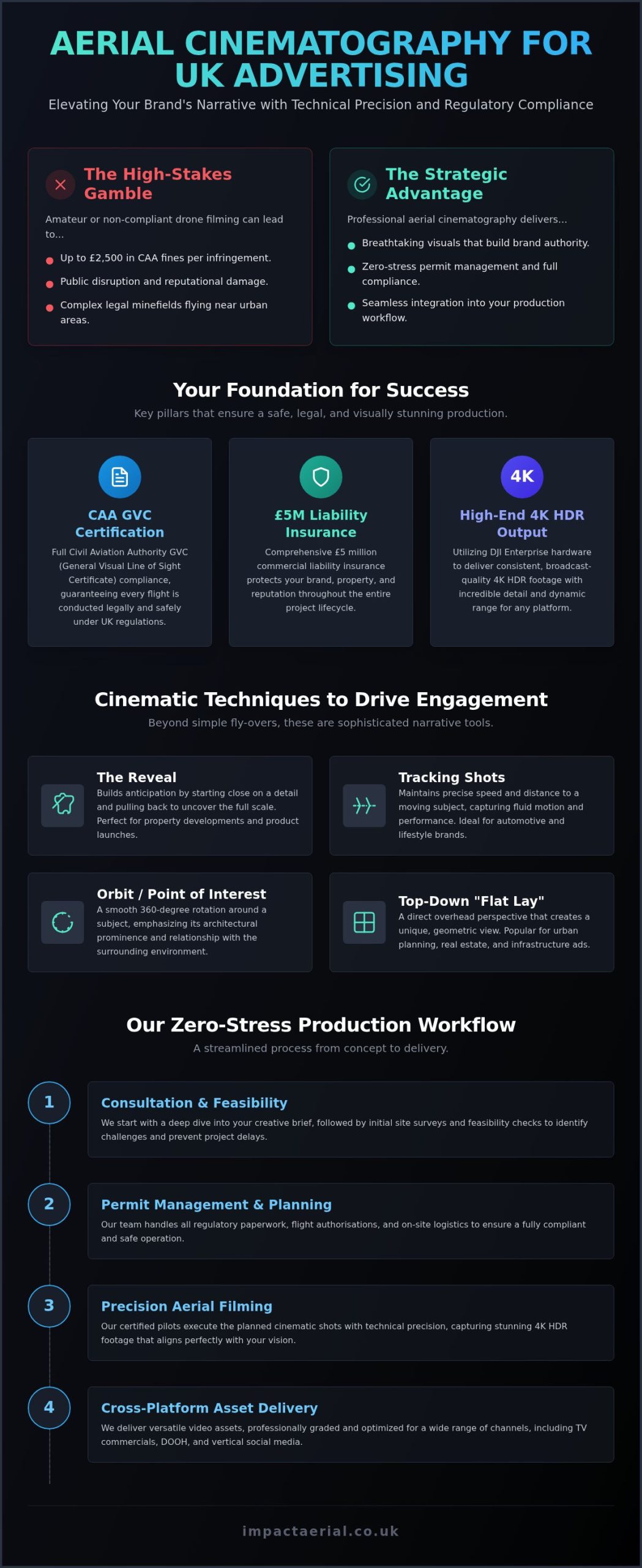
Why Partner with Impact Aerial for Your UK Drone Requirements

Impact Aerial stands at the intersection of creative excellence and technical precision. We provide a comprehensive suite of professional services that bridge the gap between high-end cinematography and industrial data collection. As a technical consultant, we don’t just fly; we manage the entire lifecycle of your project. This includes everything from the initial brief to the final delivery of broadcast-quality media or actionable technical reports. Our commitment to the highest safety standards is evidenced by our CAA GVC certification and £5m commercial liability insurance, providing the reassurance you need when operating near high-value assets.

West Midlands Roots, Nationwide Reach

Based in Birmingham, we leverage our regional knowledge of the West Midlands while maintaining the logistical capability for nationwide deployment. Providing consistent drone services across the UK requires a meticulous approach to travel planning, local airspace permissions, and risk management. We’ve successfully delivered projects for the property, construction, and advertising sectors nationwide. This reach ensures that multi-site organizations receive a uniform standard of data and media quality across their entire portfolio, regardless of the specific location.

Our Technology and Post-Production Edge

We utilize the latest DJI Enterprise hardware to ensure superior flight stability and image resolution. This equipment is specifically designed for the rigors of industrial work, making it the ideal platform for PV solar farm thermal surveys UK. However, the Impact Aerial difference lies in our post-production capabilities. While many operators simply hand over raw files, we provide full post-production editing as part of our service. This turns raw 4K HDR footage into compelling brand stories and transforms complex radiometric data into clear, prioritized maintenance schedules.

Our client-centric approach focuses on reliability and precision. When conducting PV solar farm thermal surveys UK, we understand that your ROI depends on the accuracy of our findings. By combining high-end sensors with expert data analysis, we identify defects that others might miss. This meticulous attention to detail ensures your project is completed on time and to the highest professional standards. We act as your trusted specialist, allowing you to focus on your core business while we handle the complexities of the aerial environment.

Securing Your Competitive Edge with Professional Aerial Solutions

Choosing a drone partner in 2026 is a strategic decision that impacts both operational safety and the quality of your business data. We’ve explored how the transition to professional standards requires more than just high-end hardware; it demands a meticulous approach to CAA GVC certification and comprehensive risk management. Whether you’re looking to enhance your marketing with 4K HDR media or require technical PV solar farm thermal surveys UK to protect your infrastructure, the focus must always remain on precision and legal compliance.

Impact Aerial provides the reassurance of CAA GVC Certified Pilots and £5m commercial liability insurance, ensuring your project is handled by technical consultants rather than just operators. Our expert post-production services turn raw data into actionable insights and cinematic stories that drive results. You can Request a Professional Drone Service Quote from Impact Aerial today to discuss your specific site requirements. We look forward to helping you leverage the full potential of professional drone technology for your next project.
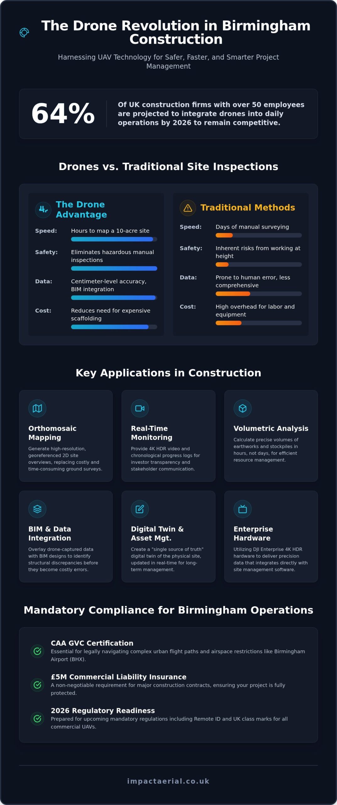
Frequently Asked Questions

Do I need a special license to hire a drone service in the UK?

You don’t need a personal license to hire a service, but the operator you contract must hold a valid UK Civil Aviation Authority (CAA) commercial authorization. For most professional work in 2026, this means hiring a pilot with a General Visual Line of Sight Certificate (GVC). This certification ensures the pilot is trained in complex risk assessments and maintains a formal Operations Manual, protecting your business from legal liability during aerial projects.

What is the difference between a professional drone pilot and a hobbyist?

The primary differences lie in regulatory compliance, insurance, and technical hardware. Professional pilots hold GVC certification and carry commercial-grade liability insurance, whereas hobbyists typically lack these legal protections. Professionals use DJI Enterprise drones capable of capturing specialized data, such as PV solar farm thermal surveys UK. They act as technical consultants who understand airspace management and post-production, rather than individuals simply capturing casual imagery without a structured safety framework.

How much does it cost to hire professional drone services?

Costs for professional drone services vary based on the project’s complexity, location, and the specific hardware required. Factors such as the need for specialized thermal sensors or extensive post-production editing will influence the final quote. While we don’t provide fixed price lists, a professional service includes the cost of CAA compliance, £5m liability insurance, and expert data analysis. It’s best to request a tailored consultation to define your specific deliverables and site constraints.

Can drones fly in rain or high winds?

Most professional drones shouldn’t fly in heavy rain or winds exceeding 20 to 25mph, though some Enterprise models have higher weather resistance ratings. Safety is the priority; high winds can destabilize the gimbal, affecting the quality of 4K HDR visuals or technical data. We monitor weather patterns closely in the days leading up to a shoot. If conditions are unsafe, we reschedule the flight to ensure the integrity of your data and the safety of the aircraft.

Are there restrictions on where drones can fly in UK cities?

Yes, there are significant restrictions on flying drones in UK cities, particularly within Flight Restriction Zones (FRZs) near airports. Professional operators must secure specific permissions from Air Traffic Control and the CAA when flying in congested areas. We handle all airspace authorizations and local council notifications as part of our project management. This meticulous planning ensures that your urban construction monitoring or property filming stays fully compliant with the latest 2026 aviation laws.

How long does a typical drone survey or filming session take?

A typical session ranges from a few hours for a property survey to several days for large-scale industrial sites. The duration depends on the total area and the density of data required. Conducting PV solar farm thermal surveys UK involves methodical flight paths to capture every panel with radiometric precision. We provide a detailed timeline during the initial consultation so you know exactly how long the on-site execution and subsequent data processing will take.

What insurance coverage should a professional drone company have?

A professional drone company must have specialist commercial liability insurance that complies with EC 785/2004 regulations. Standard hobbyist or public liability policies often exclude aviation risks, leaving you vulnerable. We carry £5m in commercial liability insurance as an industry standard for high-value sectors like construction and energy. This coverage protects your business against third-party injury or property damage, providing essential reassurance and financial security throughout the duration of the flight operation.

What deliverables will I receive after a drone survey?

Deliverables are tailored to your project goals and can include raw 4K HDR footage, edited cinematic videos, or high-resolution orthomosaic maps. For technical inspections like PV solar farm thermal surveys UK, you’ll receive detailed reports and annotated imagery highlighting specific anomalies. We also provide full post-production services, ensuring your marketing content is polished and your technical data is actionable. All files are typically delivered via a secure digital link within 24 to 72 hours after the flight.

Drone Filming for UK Advertising: Aerial Marketing Guide

A breathtaking aerial shot can be the difference between a campaign that fades into the digital background and one that captures the national imagination; however, in the UK, cinematic ambition must always be anchored by strict aviation discipline. You likely recognize that high-quality 4K HDR footage is now the gold standard for standout social media and television content. Despite this, the logistical hurdles of drone filming for advertising UK often feel like a significant barrier. It’s natural to worry about the complexities of CAA compliance, the unpredictability of British weather, or whether the final output justifies the investment. You need certainty.

This guide demonstrates how to leverage professional drone filming to create high-impact, fully compliant advertising content that elevates your brand in the UK market. We’ll show you how to navigate technical requirements while ensuring your project is protected by robust insurance and expert risk mitigation. You will learn how a meticulous approach to aerial cinematography, from our Birmingham base to the furthest reaches of the UK, transforms raw 4K data into a polished narrative. We cover everything from GVC certification and £5m liability coverage to the post-production techniques that make your brand’s story resonate with your target audience.

Key Takeaways

  • Understand why CAA GVC certification and £5m commercial liability insurance are the essential benchmarks for legal and safe brand protection in the UK.
  • Discover how 4K HDR capabilities and commercial-grade DJI Enterprise drones provide the high-tier visual precision required for modern TV and social media campaigns.
  • Learn how to integrate drone filming for advertising UK into your marketing strategy to achieve unconstrained camera movement and deeper emotional resonance.
  • Identify the critical steps in the production process, from the initial technical consultation to managing unpredictable UK weather with flexible scheduling.
  • See how a centralized Birmingham hub facilitates rapid, expert deployment for high-impact aerial projects across the entire country.

The Evolution of Drone Filming for Advertising in the UK

Aerial advertising serves as a powerful medium for scale and perspective. It isn’t just about high angles; it’s about the emotional resonance that comes from seeing a brand’s environment in its entirety. While traditional ground-based filming relies on fixed tracks or handheld stabilization, modern UAVs provide unconstrained movement across three axes. This technical freedom allows for cinematic sweeps that were previously impossible without massive production budgets. Modern drone filming for advertising UK has evolved from a niche specialty into a primary tool for establishing brand authority.

To better understand the creative possibilities of this technology, watch this demonstration of aerial advertising in action:

By 2026, 4K HDR has moved from a luxury feature to the absolute minimum standard for UK broadcast and digital advertising. This level of chromatic accuracy ensures that footage remains vibrant and sharp across all platforms, from mobile social feeds to large-scale TV displays. In sectors like property and tourism, this “Big Picture” approach triggers a psychological response of awe and trust. It provides the viewer with a comprehensive understanding of a location that ground-level shots simply cannot replicate. Professional drone filming for advertising UK now sets the benchmark for visual storytelling by combining technical precision with creative vision.

Why Ground-Level Content is No Longer Enough

Social media platforms are saturated with traditional video content. To cut through the noise, brands must offer something distinct. Aerial perspectives provide an instant premium feel, signaling high production value to the consumer. For industrial or hospitality clients, drones are essential for showing context. Whether it’s the sprawling footprint of a manufacturing facility or the secluded luxury of a coastal resort, a drone captures the entire value proposition in a single frame. This perspective validates the size and scope of a business more effectively than any ground-level montage.

The Shift from Novelty to Essential Marketing Tool

The transition is clear: drones have replaced expensive helicopter shoots for approximately 90% of UK commercial work. This shift has democratized high-end cinematography, allowing for seamless integration into multi-channel campaigns across TV, web, and social media. Utilizing DJI Enterprise commercial-grade drones, we capture data with a level of stability and detail that was once the preserve of major film studios. High-quality aerial visuals in high-value property marketing provide the comprehensive spatial context buyers require to justify a premium investment. This strategic use of technology ensures that the marketing budget is spent on high-impact visuals rather than logistical overheads.

Cinematic Perspectives: From 4K HDR to High-Speed FPV

The “cinematic look” in modern marketing isn’t an accident. It’s the result of precise technical choices involving frame rates, lighting, and HDR colour grading. To achieve the high-tier quality required for 2026 broadcast standards, we utilize a fleet of DJI Enterprise commercial-grade drones. These systems are designed to capture 4K HDR data, which is essential for maintaining detail in the highlights and shadows of the often unpredictable UK light. By shooting at 24 frames per second for traditional narrative flow or higher rates for crisp slow-motion, drone filming for advertising UK provides a versatile toolkit for any creative brief.

The choice of hardware determines the emotional impact of the footage. While one project might require the steady, authoritative sweep of a stabilized gimbal, another might demand the high-octane energy of a First Person View (FPV) system. Professional pilots prioritize the right tool for the specific creative problem, ensuring the visual narrative aligns with the brand’s identity.

Standard Professional Drones for Smooth, Grand Vistas

For projects requiring stability and grandeur, standard professional drones are the industry workhorse. These platforms use three-axis stabilized gimbals to eliminate micro-vibrations, producing rock-steady 4K footage even in moderate winds. They’re the optimal choice for capturing construction milestones, sprawling real estate developments, and the scenic expanses of the hospitality sector. In the UK, where the light can shift from bright sun to heavy cloud in minutes, the high dynamic range (HDR) capabilities of these drones ensure that the final edit remains vibrant and professional without losing detail in the grey “flat” light often found in the West Midlands or northern regions.

FPV Drones: The New Frontier of Dynamic Storytelling

FPV (First Person View) drones represent a significant shift in aerial cinematography. Unlike standard drones, FPV units are controlled via goggles that provide the pilot with a truly immersive view. This allows for “fly-through” shots that can transition from an outdoor landscape, through a narrow office window, and into a warehouse or event space in one continuous, adrenaline-fueled motion. This level of immersion is perfect for high-speed advertising and brand launches that want to convey energy and technical edge.

Operational safety for these high-speed maneuvers is governed by the Civil Aviation Authority Drone Guidance, ensuring that even the most aggressive shots remain within legal and safety bounds. Because FPV requires exceptional manual dexterity and split-second decision-making, it’s a specialized skill set that separates technical consultants from hobbyists. Our team combines technical mastery with high-end aerial filming and photography to deliver results that meet these rigorous standards while pushing creative boundaries.

Drone Filming for UK Advertising: Aerial Marketing Guide

Vetting Your Partner: Safety, Insurance, and CAA Compliance

Hiring an unlicensed pilot for drone filming for advertising UK represents a critical liability that can jeopardize your brand’s reputation and legal standing. Beyond the immediate threat of Civil Aviation Authority (CAA) enforcement, using an unvetted operator often voids corporate insurance policies and exposes your business to severe repercussions if an incident occurs. A professional drone license isn’t just a piece of paper; it’s the primary indicator of an operator’s commitment to rigorous safety standards and national aviation law.

While many entry-level pilots hold an A2 Certificate of Competency (A2 CofC), the General Visual Line of Sight Certificate (GVC) is the professional gold standard for commercial advertising work. This certification requires a deeper level of pilot training, including a formal practical flight assessment and a comprehensive understanding of complex UK airspace. Choosing a GVC-certified partner ensures that your production team possesses the technical proficiency to manage high-stakes filming environments safely and effectively.

Understanding CAA Regulations for Commercial Work

The distinction between hobbyist flight and commercial work is defined by the concept of “valuable consideration.” If any form of payment, benefit, or commercial gain is exchanged for the footage, the flight is classified as commercial. Professional pilots must manage permissions in restricted or urban UK airspace through a methodical planning process. At Impact Aerial, we handle the administrative burden of flight permissions, which includes:

  • Developing site-specific risk assessments for every location.
  • Maintaining an approved Operational Manual that dictates safety protocols.
  • Securing necessary clearances from Air Traffic Control (ATC) when operating in controlled zones near airports or city centres.

This meticulous preparation allows us to operate legally in areas where hobbyists cannot, protecting your production from mid-shoot shutdowns by authorities.

Protecting Your Brand Reputation with Professional Insurance

Standard public liability insurance rarely covers the specific risks associated with aerial operations. We carry £5m commercial liability insurance specifically tailored for drone filming. This level of coverage is essential for advertising shoots, as it protects against property damage, public injury, and potential data privacy claims. Our approach to risk mitigation involves a technical consultation phase to identify hazards before the drone ever leaves the ground. This provides you with the reassurance that your project is handled by specialists who prioritize operational security as much as the final cinematic output. By integrating these safety protocols into the creative process, we ensure a smooth production that respects both the law and your brand’s integrity.

Planning a Successful Aerial Advertising Shoot in the UK

Successful drone filming for advertising UK requires more than just launching a UAV; it demands a methodical approach to pre-production and stakeholder management. Our Birmingham-based team coordinates UK-wide shoots by first aligning your creative vision with technical flight feasibility. This initial consultation is critical for identifying potential logistical constraints before they impact your budget. Managing the UK’s variable weather is a core part of our operational reliability. We utilize advanced meteorological monitoring and build flexible “Plan B” dates into the production schedule to ensure your campaign stays on track regardless of the forecast.

Pre-Production: From Brief to Flight Plan

This phase focuses on defining the “hero shots” that will define the campaign’s success. We conduct comprehensive site surveys to identify local hazards such as power lines, tall buildings, or sensitive infrastructure. If your creative brief requires filming in congested urban areas, we handle the necessary Civil Aviation Authority notifications and local stakeholder communications. Informing neighbours and local authorities is a standard part of our risk mitigation strategy, ensuring that the shoot proceeds without interruption or public concern. This meticulous preparation provides the psychological comfort that your brand’s production is being handled by meticulous specialists.

The Shoot Day and Post-Production Workflow

On the day of the shoot, we provide safety briefings for all on-site personnel and offer live monitor viewing so you can review the 4K HDR footage in real-time. This collaborative approach allows for immediate adjustments to framing or flight paths. The transition from raw data collection to a professional aerial filming drone cinematic output occurs in our dedicated post-production suite. Here, our editors apply precise colour grading and music synchronization to elevate the raw visuals. We also ensure the final formats are optimized for your specific distribution channels, whether that involves 9:16 vertical crops for social media or full 16:9 ratios for television advertising.

To begin your pre-production roadmap and secure your shoot dates, you can consult with our technical production team for a detailed feasibility assessment and project quote.

Impact Aerial: Your Professional Drone Partner in the UK

Impact Aerial represents a unique fusion of technical certification and creative expertise within the British market. We provide a streamlined transition from the initial technical consultation to the final cinematic edit, ensuring every frame meets the highest standards of 4K HDR quality. Our comprehensive drone services span multiple sectors, ranging from high-tier advertising to detailed construction site monitoring and commercial property surveys. By maintaining a meticulous focus on CAA GVC certification and operational compliance, we protect both the visual shot and your brand’s legal integrity. Choosing a specialist for drone filming for advertising UK involves more than just selecting a camera; it requires a partner who understands the rigorous demands of commercial aviation and high-end production.

Nationwide Coverage with a Local Professionalism

Our Birmingham headquarters serves as a strategic hub for rapid UK-wide deployment. This central location allows us to mobilize quickly for projects in London, Manchester, and beyond, providing a level of responsiveness that regional operators often struggle to match. We possess a deep understanding of UK-specific urban filming challenges, including the complex permissions required for congested city centres and sensitive industrial zones. This local knowledge, combined with our national reach, ensures your production remains on schedule and fully compliant with all aviation protocols. We invite you to consult with our technical team regarding your specific 2026 marketing goals to see how our expertise can support your brand’s vision.

A Full-Service Approach to Visual Content

Our capabilities extend well beyond standard cinematography. We offer a full-service approach that includes high-resolution drone photography and the creation of immersive virtual tours for the property and hospitality sectors. Utilizing a fleet of DJI Enterprise commercial-grade drones, we ensure hardware reliability and high-end data security for every client. This technological edge is balanced with a commitment to human expertise; our pilots are trained to handle the most demanding creative briefs with precision and safety. Every project is backed by £5m commercial liability insurance, providing the final layer of reassurance for your business. We don’t just capture raw footage; we deliver a secure, high-impact production environment that allows your creative output to stand out without technical or legal compromise.

Elevating Your Brand Perspective in 2026

Integrating aerial visuals into your marketing strategy is no longer a luxury; it’s a requirement for brands that want to command attention. You’ve seen how the right technical approach, from smooth 4K HDR vistas to high-speed FPV fly-throughs, creates a premium feel that ground-level shots cannot match. Choosing a specialist for drone filming for advertising UK ensures that your creative ambition is supported by rigorous safety protocols and national aviation compliance.

Professional production requires more than just high-end hardware. It demands the reassurance provided by CAA GVC certified pilots and the security of £5m commercial liability insurance. At Impact Aerial, we combine these technical credentials with expert 4K HDR post-production to deliver content that stands out on any platform. Our Birmingham-based team is ready to mobilize nationwide to bring your vision to life.

Request a Professional Drone Filming Quote from Impact Aerial Today. We look forward to helping you capture the big picture and elevate your brand’s narrative.

Frequently Asked Questions

Do I need a special permit for drone filming for advertising in the UK?

Commercial drone filming for advertising UK requires specific certification from the Civil Aviation Authority (CAA). For most professional advertising projects, a General Visual Line of Sight Certificate (GVC) is the required standard. This isn’t a “permit” in the casual sense but a legal requirement for any “valuable consideration” work. We manage all additional flight permissions required for restricted zones or urban environments to ensure your production remains fully compliant with national aviation laws.

How much does professional drone filming for an ad campaign cost?

Project costs are determined by the specific requirements of your creative brief rather than a flat fee. Factors influencing the investment include the location’s complexity, the type of hardware required, and the extent of post-production services needed. We provide bespoke quotes after an initial technical consultation. This ensures the budget aligns with the high-tier 4K HDR output and safety standards your brand requires for a professional campaign without inventing arbitrary pricing.

Can you fly drones in central London or other UK city centres for advertising?

Flying in central London or other major UK city centres is possible but requires meticulous planning and specific clearances. These operations often involve coordinating with Air Traffic Control and securing permissions from the CAA for flight in congested areas. Our team handles the administrative burden of these notifications and risk assessments. This proactive approach allows us to capture stunning urban perspectives while maintaining the highest levels of operational security and public safety.

What happens if the weather is bad on the scheduled day of the drone shoot?

We prioritize flight safety and will reschedule if weather conditions, such as high winds or heavy rain, exceed operational limits. Our team utilizes advanced meteorological monitoring to provide early warnings; we typically build “Plan B” dates into the production schedule. This flexible approach ensures that we capture your 4K HDR footage in the best possible light without compromising the safety of the crew, the public, or the equipment during the shoot.

Is drone filming for advertising covered by standard business insurance?

Standard business insurance policies almost always exclude aviation activities, making specialized commercial drone insurance a necessity. Professional operators must carry insurance that specifically covers third-party liability and data privacy for aerial work. We maintain £5m in commercial liability insurance, which provides the necessary protection for your brand during a shoot. This coverage is a critical component of our risk mitigation strategy and offers the reassurance that your project is fully protected.

How long does it take to get the final edited drone video back?

The timeline for delivering final edited content typically ranges from a few days to two weeks, depending on the project’s complexity. This duration allows for a comprehensive post-production workflow, including 4K HDR colour grading, music synchronization, and format optimization for various social media platforms. We discuss specific deadlines during the pre-production phase to ensure your content is ready for your campaign launch, maintaining a steady rhythm from the shoot to the final edit.

What is the difference between a standard drone and an FPV drone for ads?

Standard drones use stabilized gimbals to produce smooth, grand vistas and are ideal for property or landscape marketing. In contrast, FPV (First Person View) drones offer an immersive, high-speed perspective that can fly through tight spaces like warehouses or offices. While standard drones provide an authoritative “big picture” view, FPV units deliver a dynamic, adrenaline-fueled experience. Both tools solve different creative problems and are often used together in a comprehensive drone filming for advertising UK campaign.

Do I need to notify the police before a drone advertising shoot?

You don’t usually need to notify the police for a standard drone shoot, provided you are operating legally within CAA regulations. However, we consider informing local authorities and neighbours a best practice for risk mitigation and stakeholder management. This proactive communication prevents unnecessary interruptions and ensures that the local community is aware of the professional nature of the operation. We handle these notifications as part of our comprehensive pre-flight planning process to ensure a stress-free production.

Drone Data Collection Services: A Professional Guide to Aerial Intelligence in 2026

What if the most hazardous and expensive stages of your project’s data gathering could be completed without a single person leaving the ground? For many UK industries, traditional reliance on scaffolding and manual inspections isn’t just slow; it’s a significant liability that drains budgets and increases site risk. Professional drone data collection services are no longer a futuristic concept; they’re a standard requirement for meticulous project management in 2026. By integrating high-resolution aerial intelligence, businesses can replace weeks of manual labour with hours of precise, digital data capture.

You likely understand the frustration of waiting for site surveys while costs mount and safety protocols grow more complex. We’ll show you how professional aerial intelligence transforms these bottlenecks into competitive advantages. This guide explores how to leverage advanced sensor integration and AI-powered analytics to achieve faster project turnarounds and superior accuracy. We also examine the critical 2026 UK drone regulations, including Remote ID requirements and CAA GVC certification, to ensure your operations remain fully compliant while delivering actionable insights that drive efficiency.

Key Takeaways

  • Understand how professional drone data collection services move beyond simple imagery to provide quantitative, actionable aerial intelligence for commercial decision-making.
  • Explore the technical capabilities of RGB, Thermal, and LiDAR sensors and how photogrammetry converts 2D captures into high-precision 3D models and orthomosaics.
  • Evaluate the “speed to insight” advantages and significant safety improvements gained by replacing manual high-access inspections with rapid aerial deployments.
  • Learn how to apply aerial data to specific workflows, from construction site monitoring and progress tracking to detailed commercial property condition reports.
  • Identify the essential criteria for selecting a compliant UK partner by verifying CAA GVC pilot credentials and enterprise-grade hardware standards.

What are Professional Drone Data Collection Services?

Professional drone data collection services involve the systematic gathering of aerial imagery and sensor-based information for rigorous commercial analysis. This process goes beyond simple observation; it turns an Unmanned Aerial Vehicle (UAV) into a sophisticated data acquisition tool. By using professional-grade hardware, such as DJI Enterprise platforms, we capture high-resolution perspectives that ground-based methods simply cannot reach. This systematic approach ensures that every flight mission produces a reliable, repeatable digital record of a physical asset.

The Shift from Visual Imagery to Actionable Data

There’s a fundamental difference between aerial photography and technical data collection. While photography focuses on aesthetics, professional data collection prioritises quantitative accuracy. Our DJI Enterprise 4K HDR sensors capture minute details that are often invisible to the naked eye from the ground. This level of precision is essential for identifying structural micro-fissures or thermal anomalies. Every image we capture is embedded with precise metadata and geotagging. This allows us to stitch thousands of individual captures into a single, cohesive map or 3D model where every point is geographically referenced. We call this “Actionable Aerial Intelligence” because it provides the specific facts needed to make informed business decisions.

UK Regulatory Compliance: The Foundation of Reliable Data

Operating in the UK requires a meticulous approach to legality and safety. For commercial drone data collection services, CAA GVC certification is a non-negotiable standard. This qualification ensures that the pilot is fully trained in the latest aviation regulations and risk assessment procedures. Our commitment to these protocols means the data we deliver is legally robust and suitable for professional surveying reports or insurance assessments. Safety isn’t just about flying; it’s about comprehensive risk mitigation. We back every project with £5m commercial liability insurance. This level of coverage protects our clients’ interests and ensures that high-stakes environments, such as construction sites or industrial facilities, remain secure throughout the data capture process. Our pilots are not just operators; they are technical consultants dedicated to maintaining the highest industry standards.

Key Technologies Powering Modern Aerial Surveys

The accuracy of modern drone data collection services depends entirely on the precision of the sensors deployed. We typically utilise a triad of core technologies: RGB (Visual), Thermal, and LiDAR. While standard RGB cameras provide the high-resolution visual context needed for 4K HDR assessments, thermal and LiDAR sensors provide depth and heat-based data that visual inspections simply can’t match. This multi-sensor approach allows us to deliver a comprehensive digital twin of any site or asset. High-contrast 4K HDR cameras are particularly vital for property inspections, as they reveal subtle colour variations that might indicate damp or material degradation on a commercial roof.

Photogrammetry and 3D Modelling

Photogrammetry is the science of making reliable measurements through photographs. By capturing a series of overlapping images from various angles, we can generate dense “point clouds” that represent the physical world in a digital space. These models allow for precise volume and distance measurements, which are invaluable for construction teams managing aggregate stockpiles or tracking earthwork progress. It’s a method that turns hundreds of individual 2D images into a single, high-fidelity 3D asset that project managers can interact with from their desks. This transition from raw imagery to quantitative data ensures that every measurement is repeatable and verifiable.

Thermal Imaging for Industrial Inspections

Thermal technology has revolutionised how we approach preventative maintenance and industrial health. By detecting minute heat anomalies, we can identify failing components in electrical infrastructure or significant heat loss in building envelopes. This is particularly effective for PV solar farm thermal surveys, where identifying a single malfunctioning cell can significantly improve overall energy yield. These specialized sensors allow us to spot structural weaknesses or insulation gaps before they escalate into costly failures. Our thermal data provides a non-destructive way to assess the health of complex assets without interrupting daily operations.

Integrating this thermal data into broader commercial drone surveys provides a layer of intelligence that traditional ground-based inspections miss. While we gather this technical data, our pilots strictly adhere to UK drone privacy rules to ensure all captured information is handled with total professionalism and legal compliance. This adherence to official standards ensures the data remains admissible for official reporting. If you’re looking to enhance your site’s safety and efficiency, our team can help you select the right sensor package for your specific project requirements.
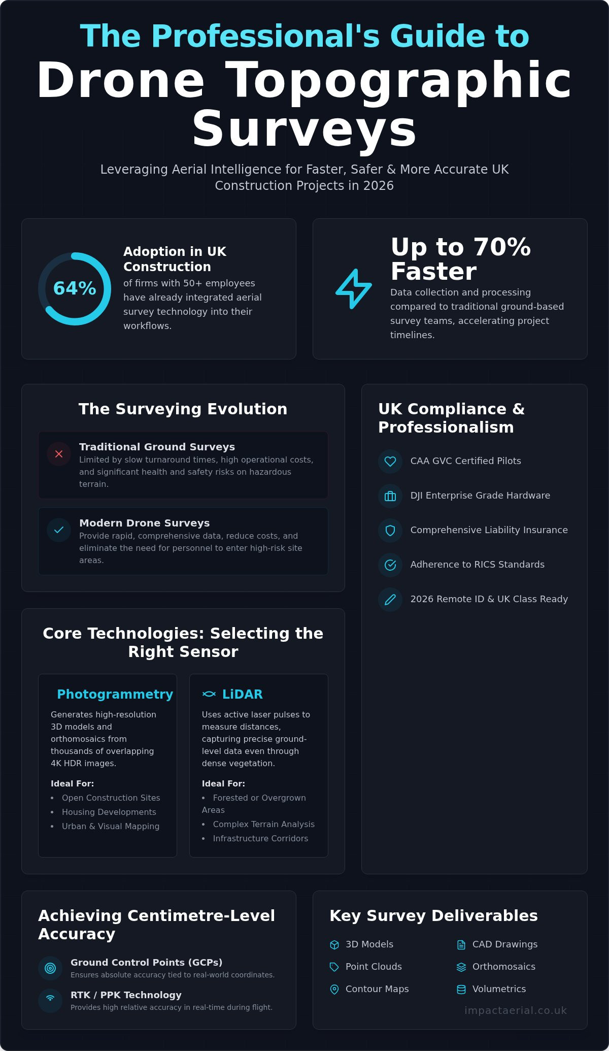
Drone Data Collection Services: A Professional Guide to Aerial Intelligence in 2026

Drone Data vs. Traditional Surveying: A Comparison

Traditional surveying methods often involve extensive lead times and significant logistical hurdles. In contrast, drone data collection services offer a rapid “speed to insight” that manual ground surveys cannot replicate. While a traditional team might spend days setting up equipment and navigating site obstacles, a professional drone deployment can be airborne in minutes. This agility doesn’t just save time; it provides a level of repeatability that is essential for longitudinal site monitoring. Because our drones follow precise, GPS-guided flight paths, we can capture the exact same data points week after week, providing a clear, chronological record of project progress.

Enhanced Site Safety and Risk Mitigation

Removing the need for human personnel to work at height is perhaps the most significant advantage of aerial intelligence. Roof inspections and structural surveys traditionally require scaffolding or high-access equipment, both of which introduce substantial “Work at Height” risks. By using drones, we eliminate these hazards entirely. Our pilots can access confined or unstable areas that would be too dangerous for staff to enter, capturing high-resolution data from a safe distance. This safety-first culture provides immense psychological comfort for project managers. They can rest assured that their site is being meticulously monitored by experts without the administrative and safety burdens associated with manual high-access work.

Efficiency and Cost-Benefit Analysis

The financial argument for aerial data is compelling. By reducing the reliance on expensive plant hire, such as cherry pickers or complex scaffolding systems, we significantly lower the overheads of any survey. On large-scale construction sites, it’s common to see survey timelines compressed from several days to just a few hours. This efficiency also extends to environmental impact. Replacing heavy, diesel-powered machinery with agile, electric UAVs helps firms lower their carbon footprint while maintaining high data standards. The true return on investment, however, is found in preventative maintenance. Early detection of a minor defect via drone data can prevent it from becoming a catastrophic failure, saving thousands of pounds in remedial costs and avoiding project delays.

Industry Applications: Turning Data into Decisions

Professional drone data collection services provide specific value across diverse UK sectors by converting raw aerial captures into structured intelligence. While previous sections detailed the technology and its safety advantages, the true impact is felt in the operational decisions these insights empower. From the initial site survey to the final marketing phase, aerial data acts as a single source of truth for all stakeholders involved in high-stakes projects. This systematic approach ensures that every project phase is backed by verifiable, high-resolution evidence.

In the building sector, construction site monitoring allows project managers to track progress with centimetre-level accuracy. This visibility is essential for managing subcontractors and ensuring that project timelines remain on schedule. Similarly, for property managers, drone property surveys provide a non-destructive way to assess roof conditions and dilapidations. This data-centric approach is also vital for infrastructure maintenance, where inspecting bridges or telecommunications towers manually would be prohibitively expensive and risky.

BIM and CAD Integration for Construction

A significant advantage of modern aerial surveys is the seamless compatibility with existing professional workflows. We export captured data into industry-standard formats, such as LAS point clouds or DXF files, which integrate directly into Building Information Modelling (BIM) and CAD software. This addresses a common industry gap by ensuring that aerial data isn’t just a standalone visual, but a functional part of the design process. Digital twins enable architects and engineers to overlay as-built drone data with original design models to identify discrepancies early. In large-scale UK infrastructure projects, these models allow remote teams to collaborate on a single, high-fidelity digital representation of the site.

Property and Asset Management

For commercial real estate, aerial intelligence serves both maintenance and investment purposes. High-resolution virtual tours and 3D data allow remote investors to explore properties in detail without the need for site visits. This is particularly effective for Grade I and II listed buildings, where meticulous documentation is required for heritage preservation. Routine aerial inspections of gutters and roof structures also prevent water ingress, protecting the long-term structural integrity of the asset. When high-end visuals are required for advertising, our aerial filming and photography services combine technical precision with cinematic quality to showcase assets at their best.

If you’re ready to integrate these insights into your next project, book a consultation with our technical team to discuss a tailored data collection strategy.

Choosing the Right Drone Data Partner in the UK

Selecting a provider for drone data collection services requires more than just looking at a portfolio of impressive images. It’s about vetting the operational standards that underpin the data’s reliability. A professional partner should act as a technical consultant, ensuring that every flight mission is compliant, insured, and tailored to your specific project goals. Without this level of scrutiny, you risk receiving data that’s either legally inadmissible or technically flawed.

  • Verify pilot credentials: Commercial operations in the UK require CAA GVC certified pilots who understand the nuances of 2026 aviation regulations.
  • Assess the hardware: Enterprise-grade equipment ensures data integrity through high-resolution sensors and stable flight performance in varied conditions.
  • Confirm insurance: A minimum of £5m commercial liability coverage is essential for risk mitigation on industrial and construction sites.
  • Review post-production: Determine if the provider delivers raw files or offers comprehensive data analysis and professional editing to make the data actionable.

The Impact Aerial Professional Standard

Our Birmingham-based team provides expert, “human-in-the-loop” consultation for projects across the UK. We don’t just fly; we meticulously plan every mission to meet the highest safety standards and regulatory requirements. We provide an end-to-end service, managing everything from the initial technical consultation to the final post-production editing of your data sets. This meticulous approach ensures that the aerial intelligence you receive is ready for immediate integration into your professional workflows, providing the reassurance that your project is in expert hands.
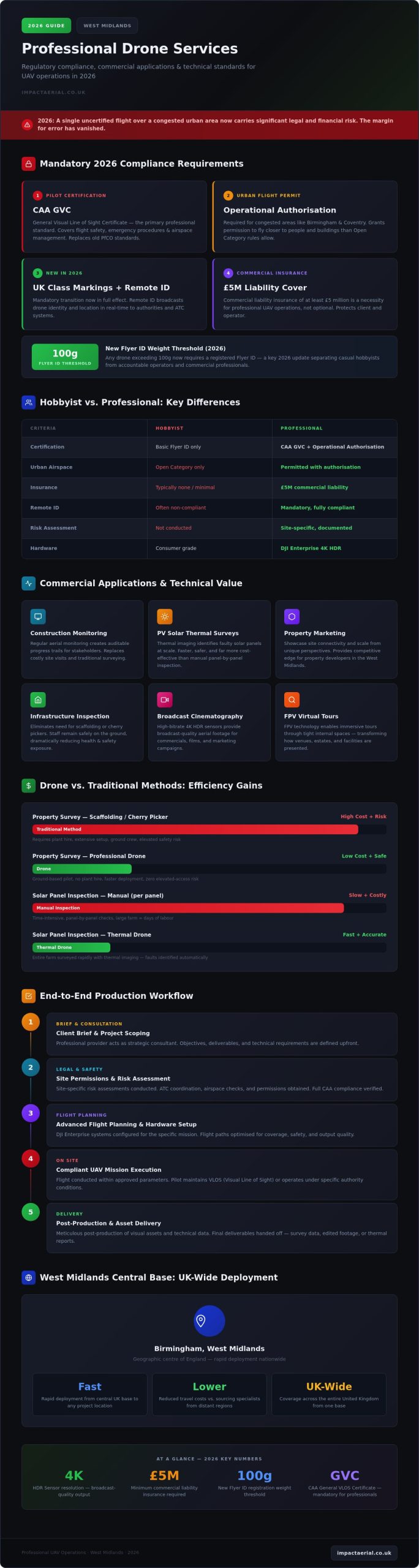
Requesting a Quote and Project Planning

To provide an accurate quote for drone data collection services, we need specific details about your site location, the required deliverables, and any known access constraints. Project timelines are often influenced by weather conditions and airspace restrictions, such as Temporary Restricted Areas (TRAs) or NOTAMs. We handle these administrative burdens by conducting thorough pre-flight site assessments and monitoring meteorological data in real-time. Getting started is straightforward. A brief consultation allows us to align our technical capabilities with your project’s unique requirements, ensuring a structured and methodical path toward capturing the data you need.

Future-Proofing Your Operations with Aerial Intelligence

The transition to sophisticated drone data collection services has redefined how UK industries manage risk and capture site information. By moving beyond simple imagery toward quantitative data, you gain a repeatable, high-precision record that integrates directly into your professional workflows. This shift doesn’t just save time. It fundamentally improves site safety by removing personnel from hazardous environments.

Success in 2026 requires a partner who understands the intersection of advanced technology and strict regulatory compliance. Our team provides the reliability of CAA GVC certified pilots and £5m commercial liability insurance, ensuring your data is captured safely and legally. We provide an end-to-end solution that includes expert post-production editing, turning raw captures into clear, actionable business intelligence.

Ready to enhance your project’s accuracy and efficiency? Request a Professional Drone Data Quote from Impact Aerial today. Let’s elevate your site intelligence together.

Frequently Asked Questions

What is the difference between a drone survey and drone data collection?

Professional drone data collection services involve the systematic gathering of raw aerial information, such as high-resolution imagery or LiDAR points, using specialized sensors. A drone survey is the application of that captured data to a specific professional standard or report. Collection is the technical acquisition phase. The survey represents the final interpreted intelligence used by architects or engineers to make informed site decisions based on that raw data.

How accurate is drone data for construction measurements?

Aerial data is highly precise, often achieving a sub-centimetre Ground Sample Distance (GSD). When we use DJI Enterprise hardware combined with precise Ground Control Points (GCPs), the resulting 3D models provide the centimetre-level accuracy required for volumetric calculations. This level of detail allows project managers to track earthwork progress or material stockpiles with a degree of precision that matches or exceeds traditional manual ground-based surveying methods.

Do I need to notify the CAA before hiring a drone data collection service?

You don’t need to notify the Civil Aviation Authority (CAA) yourself when hiring a professional operator. As a CAA GVC certified service, Impact Aerial handles all necessary flight planning, risk assessments, and airspace notifications. We ensure every mission complies with the latest UK drone regulations. Our team manages the administrative burden, including checking for restricted zones or temporary flight restrictions, so your project remains fully compliant without additional effort.

What file formats can drone data be exported in for BIM or CAD?

We export aerial intelligence into several industry-standard formats to ensure seamless integration with professional workflows. Common exports include .LAS or .LAZ for dense point clouds, .DXF or .DWG for CAD drawings, and .OBJ for 3D textured models. We also provide high-resolution GeoTIFFs for orthomosaic maps. These formats allow architects and engineers to overlay “as-built” aerial data directly onto their design models for precise discrepancy analysis and project tracking.

Can drones collect data in built-up urban areas like London or Birmingham?

Drones can operate in built-up urban environments like Birmingham and London, provided the pilot holds the correct CAA certifications. Our GVC certified pilots are trained to operate safely in congested areas by conducting meticulous site-specific risk assessments. We coordinate with local authorities and air traffic control when necessary to secure flight permissions. Operating in urban centres requires a safety-first culture and high-end hardware to mitigate risks associated with signal interference.

How much does professional drone data collection cost in the UK?

The cost of professional drone data collection services varies depending on several factors, including the site’s scale, the complexity of the airspace, and the specific sensors required. A simple visual inspection of a commercial roof differs in scope from a multi-day LiDAR survey for a large infrastructure project. We provide tailored quotes based on a thorough consultation to ensure the pricing reflects your project’s specific data requirements and safety protocols.

What happens if the weather is bad on the day of the drone survey?

Safety is our primary concern, so we don’t fly in conditions that exceed the operational limits of our DJI Enterprise hardware. If high winds or heavy rain are forecast for your survey, we’ll coordinate with you to reschedule the flight for the next available safe weather window. Our pilots monitor real-time meteorological data to make informed “go or no-go” decisions. This ensures that data integrity is never compromised by adverse environmental factors.

Why is £5m liability insurance necessary for drone services?

Carrying £5m commercial liability insurance is a standard requirement for operating on professional construction and industrial sites in the UK. This level of coverage provides essential reassurance and risk mitigation for our clients. It ensures that in the unlikely event of an incident, all parties are protected against third-party property damage or injury. High-value insurance is a hallmark of a professional operator who takes the operational and legal side of their business seriously.