
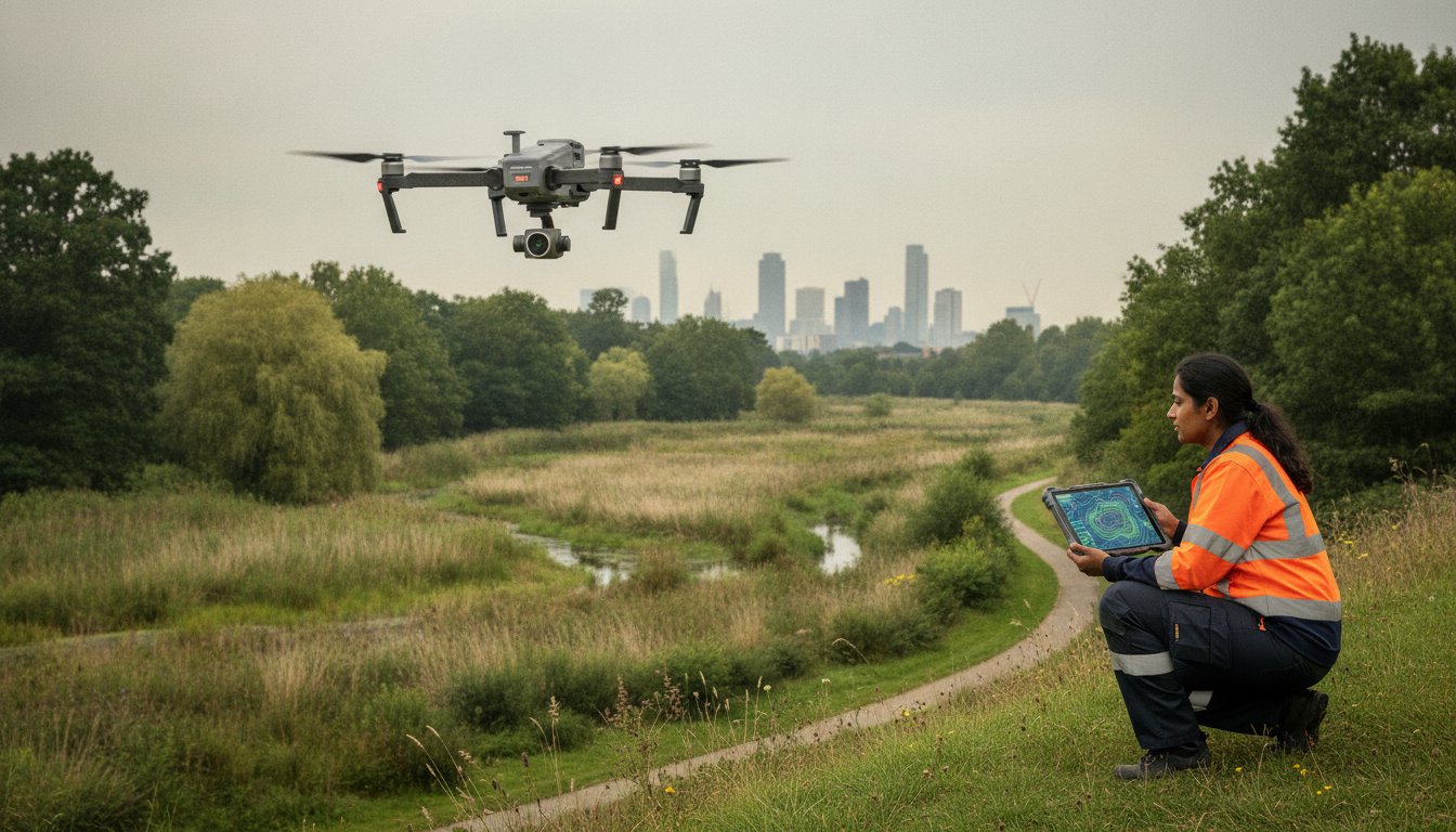
For years, aerial imagery was viewed as a luxury visual extra for final reports, but in the current UK planning landscape, it has become a non-negotiable data layer for defensible environmental consultancy. Relying on manual habitat mapping often leads to inaccuracies, while traditional ground surveying in hazardous or inaccessible terrain presents significant safety risks and high operational costs. You likely find that these traditional methods struggle to keep pace with the rigorous demands of modern project timelines and the precision required for high-stakes reporting.
This guide demonstrates how professional aerial photography for environmental consultants transforms these challenges into streamlined, high-resolution workflows. By integrating advanced drone data, you can achieve the accuracy required for mandatory 10% Biodiversity Net Gain (BNG) assessments while significantly reducing site time. We will explore the shift toward centimetre-accurate orthomosaic maps for GIS, faster Environmental Impact Assessment (EIA) delivery, and the necessity of using CAA GVC certified pilots. You’ll learn how to secure legally compliant data that strengthens planning applications and ensures your projects remain on schedule and within budget.
Key Takeaways
- Learn how high-resolution data ensures compliance with the mandatory 10% Biodiversity Net Gain (BNG) requirement for UK planning applications.
- Discover how professional aerial photography for environmental consultants produces centimetre-accurate orthomosaics for precise habitat and hydrology mapping.
- Understand why advanced enterprise-grade drone hardware is essential for maintaining data integrity and meeting rigorous technical reporting standards.
- Master the workflow of converting raw 2D aerial imagery into actionable 3D models compatible with ArcGIS, QGIS, and AutoCAD.
- Identify the critical safety credentials, including CAA GVC certification and £5m liability insurance, required for surveying complex or hazardous rural environments.
The Strategic Value of Aerial Photography for Environmental Consultants
High-resolution data serves as more than just a visual aid; it’s the technical foundation for a robust Environmental Impact Assessment (EIA). While traditional ground-based surveys have their place, they’re increasingly insufficient for the scale and complexity of modern UK developments. The industry is seeing a decisive shift from qualitative visual checks toward quantitative remote sensing data. By integrating professional aerial photography for environmental consultants, teams gain access to precise, measurable insights that ground teams simply can’t match within the same timeframe. This transition to a data-first approach reduces site time and drastically improves consultant safety by removing the need to physically traverse hazardous or unstable terrain. Clear, high-definition imagery also enhances stakeholder communication, making complex environmental constraints easy to understand for non-technical planning committees.
Overcoming Traditional Survey Limitations
Professional drone hardware allows environmental teams to visualise inaccessible areas like deep wetlands, dense ancient woodland, or steep railway embankments without risking personnel. It also mitigates the “observer effect” on local wildlife. Ground-based teams often inadvertently disturb the very species they’re trying to monitor. In contrast, high-altitude capture using aerial photography allows for ecological monitoring that’s far less intrusive. This technology creates a repeatable, timestamped visual record. You can return to the exact same coordinates month after month to provide a verifiable audit trail for long-term monitoring projects. Having this consistent data set is vital for identifying subtle changes in vegetation health or habitat encroachment over several seasons. Precision matters.
Meeting Modern Compliance Standards
The introduction of mandatory 10% Biodiversity Net Gain (BNG) in England has raised the bar for data accuracy. Professional aerial photography for environmental consultants provides the high-resolution baseline needed to calculate these gains with confidence. This data serves as defensible evidence during planning committees and regulatory reviews, where vague descriptions aren’t enough. For projects targeting BREEAM certification, comprehensive site documentation from the air offers a clear record of ecological protection and enhancement measures throughout the construction lifecycle. Relying on CAA GVC certified pilots ensures that all data is captured within the strict legal frameworks required for formal planning submissions. This level of compliance is essential for mitigating risk and ensuring that project data stands up to legal scrutiny.
Core Applications: From Habitat Mapping to Hydrology
The application of aerial photography for environmental consultants extends far beyond simple site overviews. High-resolution orthomosaics allow for meticulous habitat classification that manual walkovers often miss due to scale or perspective. By using 4K HDR sensors, consultants can identify subtle changes in vegetation health or track the encroachment of invasive species across large UK estates with precision. This data provides a technical baseline for topographic changes and coastal erosion monitoring throughout a project’s lifecycle, ensuring that environmental shifts are documented with scientific rigor. Digital surveys capture every detail of the terrain, enabling a level of analysis that traditional methods simply can’t replicate within the same budget.
Biodiversity Net Gain (BNG) Monitoring
Establishing an accurate baseline is the most critical step in meeting the mandatory 10% Biodiversity Net Gain (BNG) requirement for UK developments. Aerial data allows you to calculate area-based metrics with centimetre-level precision, providing a defensible starting point for planning applications. Because BNG requires ongoing monitoring for at least 30 years, having a repeatable, digital visual record is invaluable. It’s a tool that allows for consistent comparison over decades, proving that the promised ecological enhancements are actually being delivered on the ground. This long-term data integrity is vital for maintaining project compliance and stakeholder trust.
Hydrology and Catchment Management
Managing watercourses and floodplains requires a comprehensive understanding of catchment dynamics. Aerial surveys identify drainage patterns and potential runoff risks that are invisible from ground level. You can map sensitive riparian zones and assess watercourse health without disturbing fragile banks or local ecosystems. This non-invasive approach is particularly useful for visualising floodplain dynamics during the early stages of environmental planning. When you need to present complex hydrological data to regulatory bodies, professional aerial photography for environmental consultants offers the clarity required for successful planning approvals. Utilising professional aerial data collection ensures your GIS outputs are built on a foundation of accuracy and regulatory compliance.
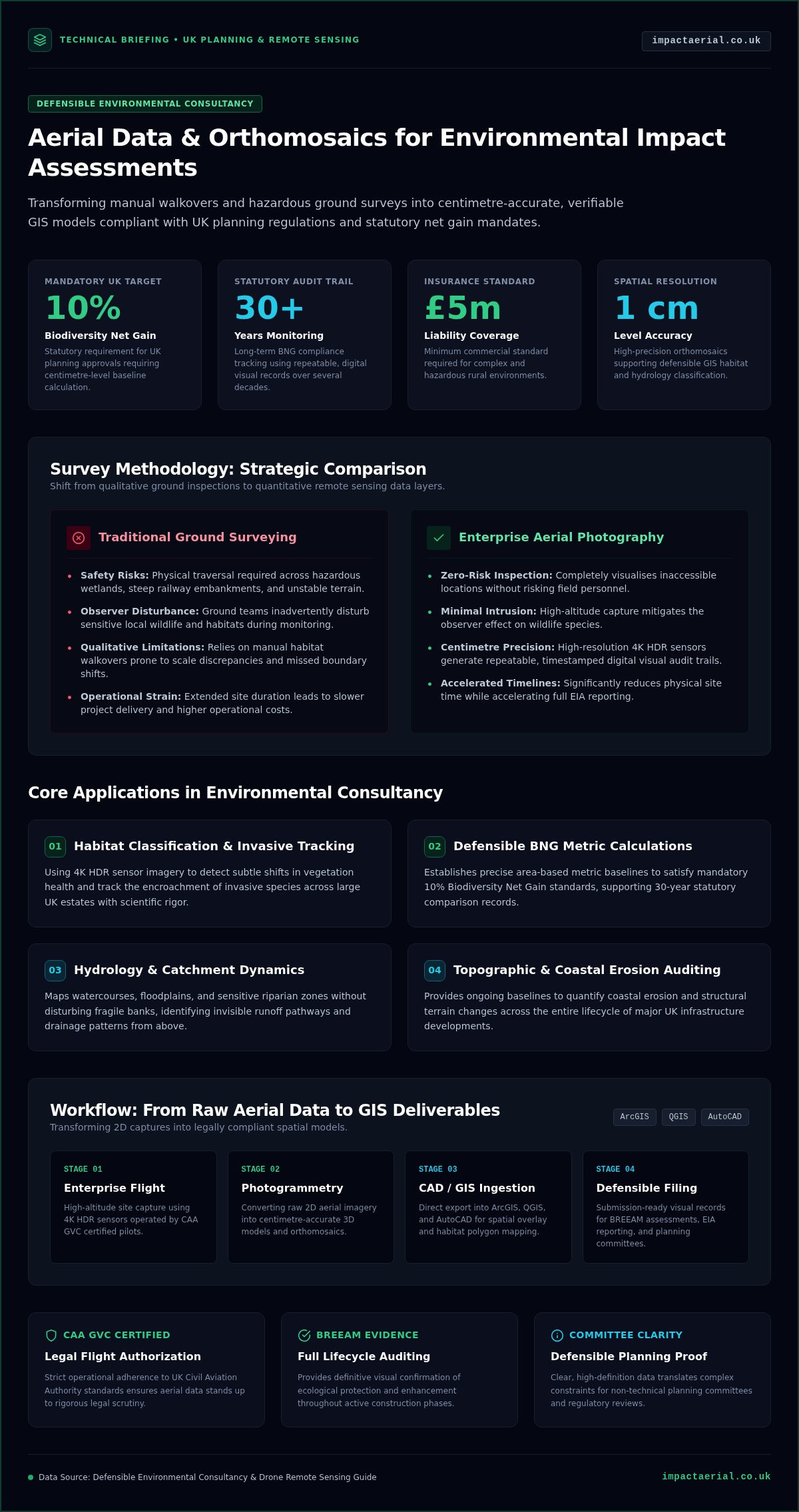
Technical Standards: Hardware, Sensors, and UK Compliance
Precision in environmental reporting starts with the hardware. While hobbyist drones produce visually pleasing images, professional data collection requires industrial-grade equipment designed for repeatability and accuracy. High-resolution 4K HDR sensors are non-negotiable in this field. These sensors provide the dynamic range necessary to distinguish between subtle vegetation shades or identify small invasive species in varying light conditions. Relying on DJI Enterprise hardware ensures flight stability and data integrity, offering integrated GPS accuracy that consumer models simply cannot match. This technical distinction is vital when your findings must stand up to scrutiny during a public inquiry or a formal planning committee meeting.
Risk mitigation is equally important. Professional operators carry £5m commercial liability insurance as an industry standard. This coverage provides the necessary reassurance for consultants working on large-scale infrastructure projects or sensitive habitats. It ensures that every aspect of the operation, from take-off to data delivery, is backed by a framework of professional accountability. When you commission aerial photography for environmental consultants, you aren’t just buying images; you’re investing in a compliant, technical service that prioritises site safety and data precision.
The Necessity of CAA GVC Certification
The UK drone regulatory framework has undergone significant changes, transitioning from the old PfCO (Permission for Commercial Operations) to the current GVC (General Visual Line of Sight Certificate) and A2 CofC standards. For environmental consultants, hiring a pilot with the correct GVC certification is a legal requirement for many complex operations. This is particularly true when flying near congested areas, public infrastructure, or construction sites. A GVC-certified pilot has demonstrated the advanced flight skills and safety knowledge required to operate within these strict legal boundaries. This certification is your guarantee that the data collection process is fully compliant with Civil Aviation Authority (CAA) regulations, protecting your project from legal delays or liabilities.
Sensor Selection for Environmental Data
Different environmental assessments demand specific sensor capabilities. Standard RGB sensors are the primary tool for high-resolution habitat mapping and general site monitoring. However, complex projects often require more specialised data. Thermal imaging is essential for monitoring nocturnal species or identifying heat signatures in PV solar farm surveys. Multispectral sensors take this further by capturing data across different light wavelengths to assess plant health through NDVI (Normalised Difference Vegetation Index). This level of technical detail allows aerial photography for environmental consultants to provide deep analytical insights into ecosystem vitality and moisture levels that are impossible to capture through traditional photography alone.
Workflow Integration: From Raw Data to GIS Insights
Raw imagery is only the starting point. The true value of aerial photography for environmental consultants lies in the post-production phase, where technical expertise converts thousands of 2D images into centimetre-accurate 3D models and georeferenced maps. This process, known as photogrammetry, uses advanced algorithms to triangulate points across overlapping photos. The result is a high-density point cloud that provides a foundation for detailed environmental analysis. These data sets are designed for immediate use, exporting seamlessly into industry-standard software such as ArcGIS, QGIS, and AutoCAD. This ensures that your environmental findings are integrated into the existing project ecosystem without manual digitisation errors.
Beyond technical mapping, virtual tours provide stakeholders with immersive site walkthroughs that static photos can’t match. These tours allow planning committees and clients to visit the site remotely, viewing environmental constraints from any angle. For long-term projects, archiving this data creates a robust audit trail for environmental compliance. It provides an indisputable record of site conditions at specific intervals, which is essential for defending against potential regulatory challenges or verifying mitigation measures years after project completion.
Creating Accurate Orthomosaics
Developing a reliable orthomosaic requires a methodical three-step technical workflow. First, we plan autonomous flight paths to ensure consistent overlap, typically 75% to 80%, which is critical for stitching accuracy. Second, the imagery is processed through photogrammetry software to create a single, georeferenced map that accounts for lens distortion and terrain relief. Finally, this aerial data is overlaid with existing topographical surveys to provide a comprehensive view of the site. This layered approach ensures that your GIS insights are both visually clear and spatially accurate.
Interactive Data and Reporting
Modern environmental reporting demands more than just text and tables. High-impact aerial videography and 3D terrain models bring client reports to life, making them more persuasive during stakeholder engagement and public consultations. These interactive assets help non-experts visualise complex environmental data, such as flood risk zones or habitat corridors. By integrating high-resolution data into your existing drone survey workflows, you ensure that every project phase is backed by defensible, technical evidence. If you’re ready to enhance your reporting precision, you can book a consultation for our technical data collection services today.
Choosing an Aerial Partner for Environmental Projects
Selecting a provider for aerial photography for environmental consultants requires a shift in perspective. You aren’t simply hiring a photographer; you’re engaging a technical partner who understands the rigours of Environmental Impact Assessments (EIAs) and the legal weight of planning data. The UK’s rural environments present unique challenges, from unpredictable weather patterns to complex airspace near infrastructure. A partner must demonstrate more than just flight skill. They need a deep understanding of how to capture data that is spatially accurate and legally defensible. This expertise ensures that the data collected serves as a reliable foundation for your professional reporting.
What to Look for in a Drone Service Provider
The first step in your evaluation is verifying regulatory compliance. You must check for CAA GVC certified status and ensure the provider carries at least £5m in commercial liability insurance. Beyond paperwork, scrutinise their portfolio for technical environmental data collection rather than just cinematic marketing shots. High-resolution habitat mapping requires different flight parameters than creative filming, such as specific overlap percentages and consistent altitudes. Finally, ensure they utilise commercial-grade DJI Enterprise hardware. These platforms are built for the stability and sensor precision required to produce centimetre-accurate orthomosaics. Using consumer drones for professional environmental reporting risks data degradation and project delays.
Partnering with Impact Aerial
Impact Aerial operates as a technical consultant to your environmental team. We don’t just provide raw files; we deliver actionable insights through meticulous post-production and data processing. Our pilots are experts in navigating hazardous or inaccessible terrain, ensuring that your ground teams remain safe while we capture the necessary site data. With our national UK coverage and local expertise from our West Midlands base, we provide a responsive service that aligns with your project timelines. This local grounding allows us to understand regional planning nuances while maintaining a national standard of excellence.
We integrate seamlessly with your existing workflows, providing data that slots directly into your GIS or CAD software. Our commitment to safety and precision means you can trust the integrity of every map, model, and report we generate. This professional approach provides the psychological comfort and tangible business benefits needed to secure planning approvals and meet BNG targets. If you’re ready to elevate your project data, Contact Impact Aerial for a professional drone survey quote to discuss your specific requirements.
Elevating Environmental Data with Precision Aerial Insights
The shift toward data-driven environmental reporting is no longer optional for UK consultants. High-resolution orthomosaics and 3D terrain models provide the defensible evidence required for mandatory 10% Biodiversity Net Gain (BNG) targets and complex planning applications. By moving beyond traditional ground surveys, you eliminate safety risks in hazardous terrain while gaining centimetre-accurate insights that integrate directly into your GIS workflows. These technical assets ensure your findings stand up to the most rigorous regulatory scrutiny.
Implementing aerial photography for environmental consultants requires a partner who prioritises technical compliance and data integrity. Working with CAA GVC certified pilots ensures your project adheres to strict UK aviation regulations, while £5m public liability insurance provides the necessary operational reassurance. Our use of DJI Enterprise 4K HDR drones guarantees that every pixel contributes to a robust, professional report. This meticulous approach to data collection allows your team to focus on analysis rather than manual mapping.
Precision data is the foundation of successful environmental stewardship and project approval. We are ready to help you transform your site surveys into powerful analytical assets. Request a Technical Consultation for Your Environmental Project today and secure the high-tier data your consultancy deserves. We look forward to supporting your next project with expert aerial insights.
Frequently Asked Questions
Is a specific drone license required for environmental surveys in the UK?
Yes, a specific qualification is necessary for professional environmental surveys in the UK. Commercial operators must hold a General Visual Line of Sight Certificate (GVC) or an A2 Certificate of Competence (A2 CofC) issued by the Civil Aviation Authority. These certifications ensure the pilot understands the legal framework and safety protocols required for complex site work. Hiring a GVC certified pilot provides the legal assurance that your data collection is compliant with current national aviation standards.
How accurate is drone data for land-use mapping compared to traditional methods?
Drone data offers significantly higher precision than traditional manual walkovers, especially across large or complex terrains. When using professional hardware, we achieve centimetre-level accuracy in our orthomosaic maps. This level of detail is essential for aerial photography for environmental consultants who need to calculate precise habitat areas for Biodiversity Net Gain (BNG) assessments. It replaces the estimations of ground surveys with georeferenced, technical data that integrates directly into GIS software for exact land-use classification.
Can drones be used for nocturnal wildlife monitoring?
Yes, drones equipped with advanced thermal sensors are highly effective for monitoring nocturnal species without causing significant disturbance. These sensors detect heat signatures against the cooler ground, allowing consultants to track wildlife movement or identify roosting sites in total darkness. This non-invasive method provides a safer and more efficient alternative to traditional night-time ground surveys. It’s particularly useful for protected species surveys where maintaining a distance is critical for ethical and legal compliance.
What insurance coverage should an aerial photographer have for commercial sites?
A professional aerial service provider should carry a minimum of £5m in commercial liability insurance for work on environmental or commercial sites. This level of coverage is considered the industry standard for commercial operations in the UK. It protects both the consultant and the client against unforeseen incidents during data collection. We maintain this high level of indemnity to provide psychological comfort and ensure our operations meet the strict risk assessment requirements of large-scale infrastructure projects.
How does weather affect aerial photography for environmental projects?
Weather conditions play a critical role in flight safety and data quality. High winds, heavy rain, or thick fog generally prevent drone operations to protect the hardware and ensure data integrity. However, overcast conditions are often ideal for aerial photography for environmental consultants because they provide soft, consistent lighting without harsh shadows. This uniformity makes it easier to stitch images together and accurately identify vegetation types across a site. We monitor local forecasts meticulously to schedule flights during optimal windows.
What file formats are typically provided for GIS integration?
We provide data in various industry-standard formats to ensure seamless integration with your existing software. For 2D mapping and orthomosaics, GeoTIFF files are the standard for ArcGIS and QGIS. If you require 3D terrain models or topographic data, we can deliver files in .obj, .dxf, or .las formats for use in AutoCAD. These technical outputs allow environmental consultants to overlay aerial data with historical site maps and topographical surveys without any loss of spatial accuracy.
Are drones allowed to fly over protected SSSI sites?
Drones can operate over Sites of Special Scientific Interest (SSSI), but the process requires careful planning and specific permissions. You often need to secure consent from Natural England or the relevant local authority before take-off. Professional operators conduct thorough risk assessments to ensure the flight doesn’t disturb sensitive habitats or nesting birds. Using a certified pilot ensures that these legal requirements are managed correctly, providing a non-invasive way to monitor these protected areas without physical site entry.
How much does a professional aerial survey cost for a consultant?
Professional survey costs vary based on the site’s geographic size, the complexity of the terrain, and the specific data outputs required. A simple habitat map for a small planning application involves different resources than a multi-day survey of a large industrial estate. We provide bespoke quotes tailored to your project’s technical needs. Factors like sensor selection and post-production processing time also influence the total investment. Requesting a specific project estimate ensures your budget aligns with the data quality needed.
 2 Norton Drive, Wythall, Birmingham, B47 6HH Company registration number: 11138586. VAT Number: 366 9068 55


