
Could a roof, façade or site issue change your view of a commercial property before exchange, even if it’s hard to see from the ground? A pre-acquisition aerial survey for commercial property adds a broader visual perspective, helping buyers identify visible areas that may need closer investigation. It can document exterior conditions and show how the building sits within its surroundings, but it can’t establish hidden defects or replace a building survey or structural assessment.
That distinction matters when due diligence is moving quickly. Aerial imagery is most useful as additional evidence considered alongside building surveys, legal enquiries and other relevant assessments. Knowing what it can and can’t show helps you interpret the findings appropriately and identify where follow-up may be needed.
This guide explains what aerial evidence can reveal, how it complements other pre-purchase checks and how to define a practical survey scope. It also covers the information to prepare and the value of a managed, safety-conscious process. Impact Aerial’s commercial property surveys use CAA GVC-certified pilots and high-specification commercial drones, with project support from initial consultation through to post-production.
Key Takeaways
- A pre-acquisition aerial survey for commercial property can help you identify visible areas that deserve closer attention during due diligence.
- Set the survey’s purpose, site areas of interest and intended use before capture to keep the scope aligned with your purchase decision.
- Use aerial imagery alongside physical building inspection and legal due diligence, with each source addressing different questions.
- Prepare a clear brief with the property address, decision deadline, priorities and intended audience to support effective planning.
- Consider site scale and specific areas of interest when agreeing the capture plan and imagery review.
What a pre-acquisition aerial survey can reveal about commercial property
A pre-acquisition aerial survey for commercial property is drone imagery planned around a buyer’s review of a site. Compared with ground-level viewpoints alone, it can provide a broader record of visible roof areas, external elevations and the relationship between buildings, boundaries and access. The agreed brief defines what is captured and which questions the imagery is intended to support.
This perspective is particularly useful when a site is extensive, a roof is difficult to view from the ground, or access routes and boundary features need to be understood in context. The imagery can help you identify visible areas to discuss during further due diligence. It can’t show what lies beneath a surface or behind a structure. For background on the broader methods and uses of aerial surveys, see What is an Aerial Survey?
The video below shows an example of a drone flyover documenting existing commercial property conditions:
Which commercial property questions can aerial imagery support?
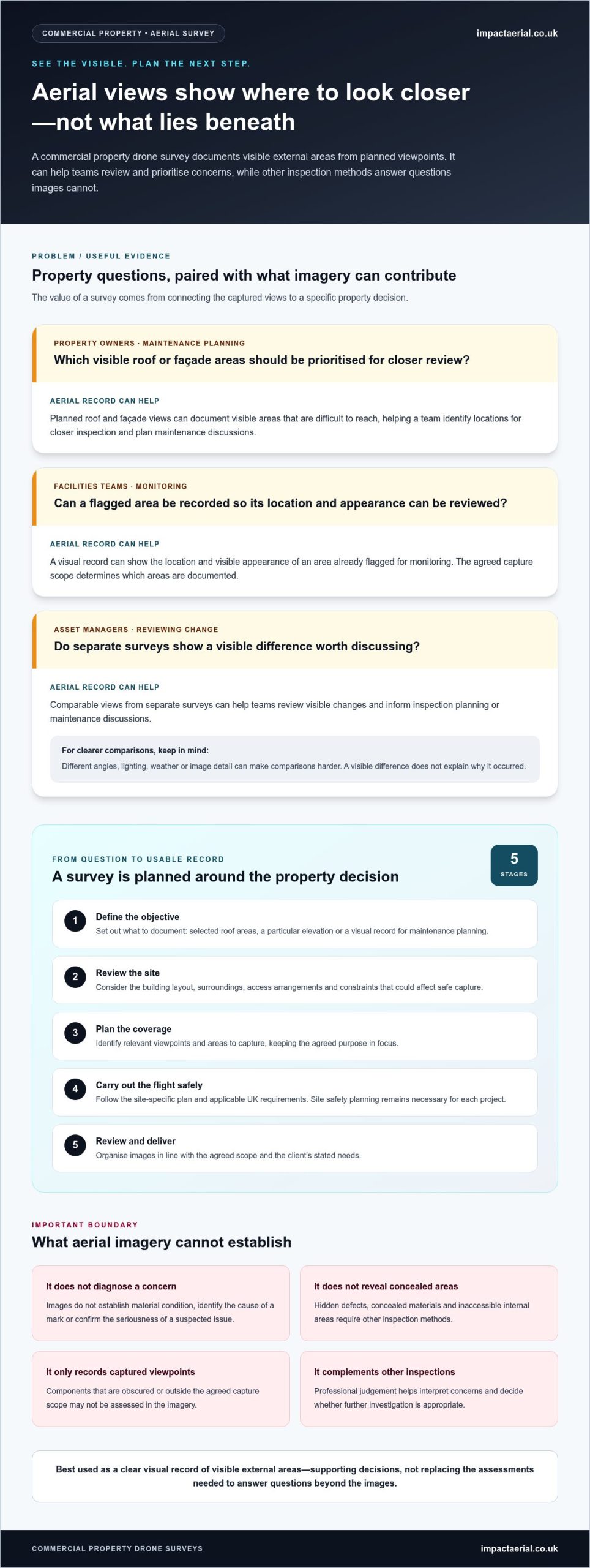
An elevated view can document visible roof sections and external features, and show how buildings relate to yards, parking areas, boundaries and access points. This context can help you prepare specific follow-up questions. For instance, you might flag a roof area that is difficult to view from the ground or a site feature that needs further review.
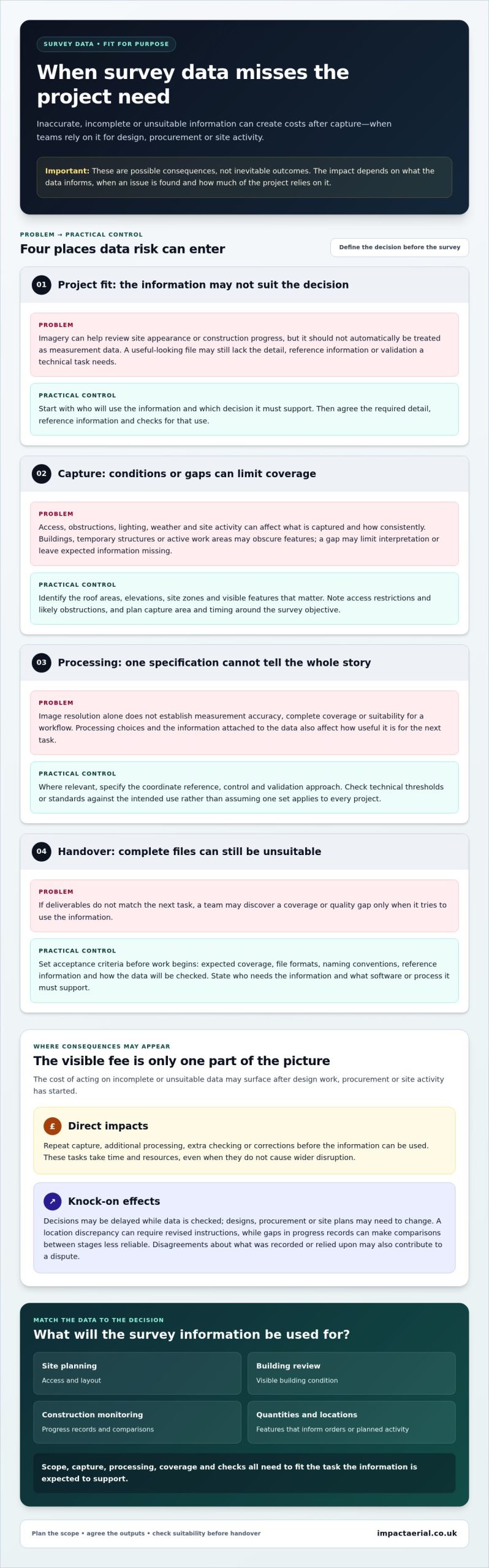
Aerial evidence documents visible conditions; it is not a building condition assessment. An image may show a mark, a change in appearance or an area of concern, but it can’t diagnose the cause or confirm the condition of unseen materials.
Where an aerial survey’s limits matter
Drone imagery can’t reveal concealed defects, assess a building’s internal condition or replace close physical inspection. It also doesn’t provide structural, legal, valuation or environmental advice. Those questions require the relevant due diligence and professional assessment. Aerial imagery is a separate visual input, not a substitute for them.
What can be captured depends on practical conditions and the agreed scope. Access restrictions, visibility, weather and the position of buildings or other features can affect the available views. A clear brief focuses the capture on priority areas. Reviewing the resulting imagery against that brief can help identify observations for you to raise through the appropriate due diligence process. Visible evidence can guide questions, but it shouldn’t be treated as proof that a defect is present or absent.
How a commercial property drone survey is planned and delivered
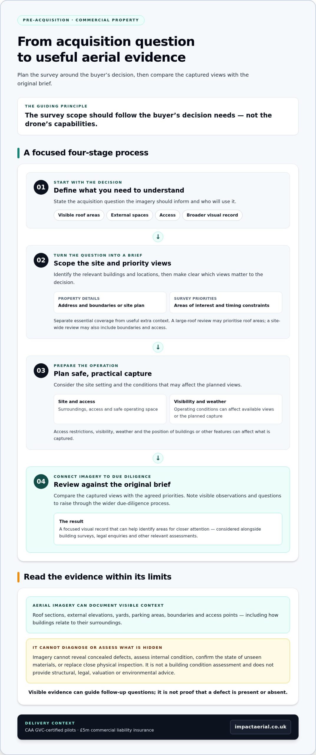
A useful survey starts with the acquisition decision, not the flight plan. First, the buyer and survey team identify what the imagery needs to help assess. They then agree which areas to capture, plan a safe operation and review the resulting images against the original brief. This keeps the work focused on due diligence rather than producing broad coverage without a clear purpose.
The survey scope should follow the buyer’s decision needs, not the drone’s capabilities. For a pre-acquisition aerial survey for commercial property, you might prioritise roof views, access routes, site layout or a general visual record. Each priority can shape the capture plan and the way the imagery is reviewed.
Set the acquisition question before planning the flight
Start by stating what you need to understand and who will use the imagery. Is the priority to view visible roof areas, understand how buildings relate to external spaces, document access or create a broader visual record? Share the property address, boundaries or site plan, areas of interest and any relevant timing constraints. Impact Aerial supports projects from initial consultation through to post-production, keeping the brief, capture and review connected.
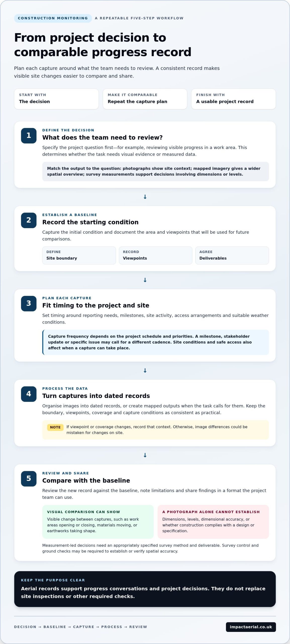
A practical sequence is:
- Define the decision. Describe the acquisition question the imagery should inform.
- Scope the site. Mark the relevant buildings and locations, then identify the views that matter to the decision.
- Plan safe capture. Consider the site setting, access and operating conditions when preparing the approach.
- Review the imagery. Compare the captured views with the brief and note observations or questions for the wider due diligence process.
A clear brief separates essential coverage from useful extra context. For example, a buyer focused on a large roof can identify the roof areas of interest. A site-wide review may also need to cover boundaries and access. Make these priorities explicit in the agreed scope, without expecting imagery to answer questions that need physical inspection.
Plan safe, useful aerial capture in the UK
Capture planning considers the property’s surroundings and conditions on site, including safe operating space, access and visibility. Weather and other operating conditions can affect whether a planned capture can be carried out as intended. Impact Aerial uses CAA GVC-certified pilots and holds £5m commercial liability insurance, supporting a safety-conscious approach to commercial property survey work.
UK drone operations are subject to Civil Aviation Authority requirements, and the applicable guidance depends on the planned operation. The UK Drone Regulations for Commercial Surveys can help buyers understand the regulatory context. Planning should follow current official guidance rather than assume every site or flight has the same requirements.
During review, the imagery is considered against the agreed priorities. Use visible details to frame follow-up questions for the relevant due diligence work, without treating photographs as measurements or a condition verdict. If you’re preparing a property brief, discussing your commercial property survey requirements can help shape a focused capture plan.
Aerial survey versus building survey: how the evidence works together
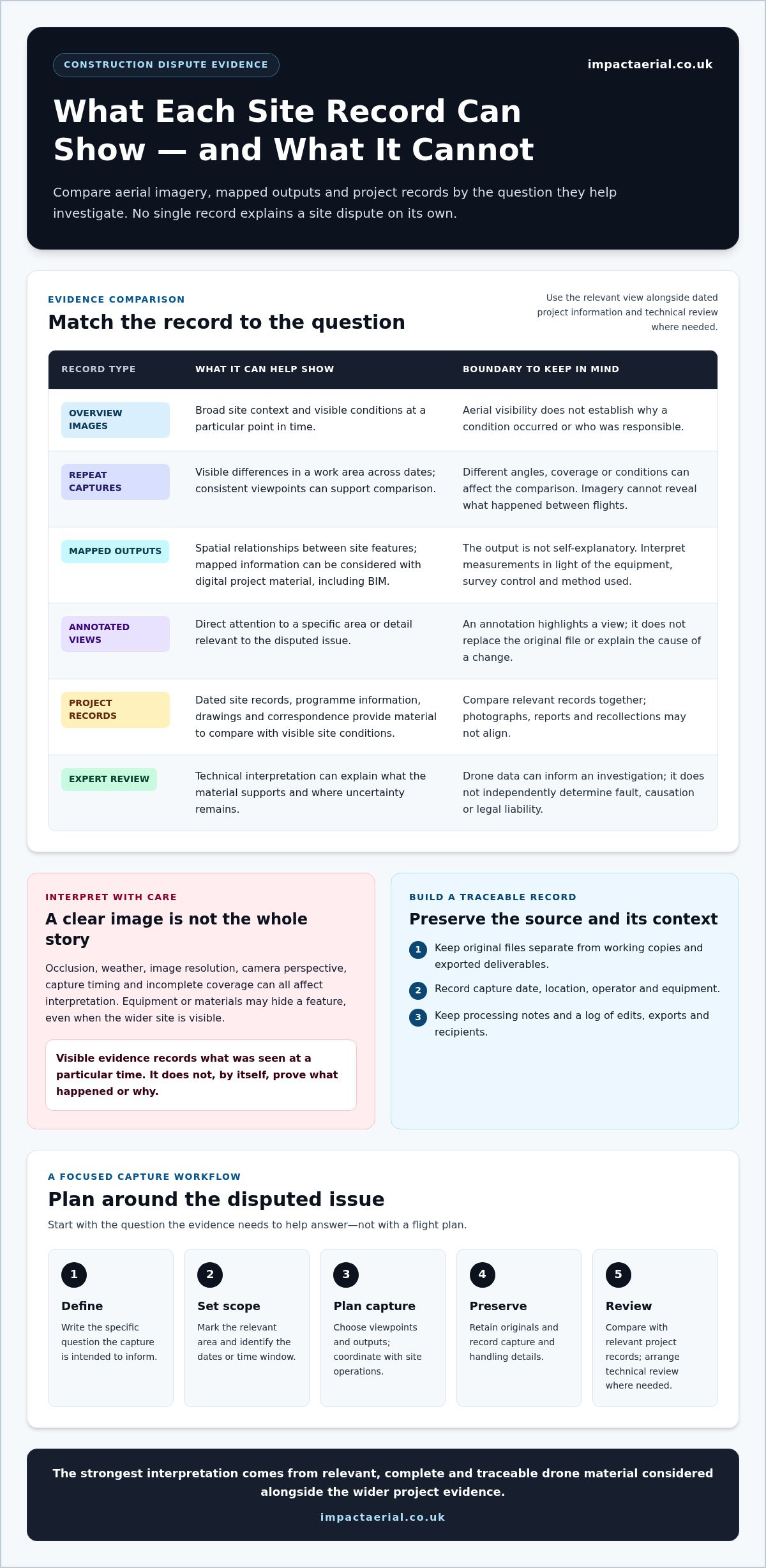
Commercial property due diligence draws on evidence that answers different questions. Aerial imagery gives buyers a wider view of visible areas and site context. A building survey involves physical inspection, while legal due diligence addresses matters such as title and planning. These approaches complement one another. A pre-acquisition aerial survey for commercial property can help focus attention, but it doesn’t replace professional inspection or determine the conclusions of other assessments.
| Evidence source | Purpose and typical evidence | Key limitations | Buyer decision it can inform |
|---|---|---|---|
| Aerial imagery | Documents visible roof areas, elevations and wider site context from elevated viewpoints. | Shows only what is visible in the captured views. It can’t establish concealed condition or diagnose the cause of a visible feature. | Which visible areas or site features may warrant follow-up? |
| Physical building inspection | Assesses the building through closer inspection, with findings shaped by the survey’s agreed scope. | Access, inspection scope and the nature of the investigation affect what can be assessed. | What does the inspection indicate about the building’s condition and need for further investigation? |
| Legal due diligence | Reviews legal matters such as title and relevant planning information. | Doesn’t assess physical building condition or establish what aerial imagery shows. | What legal issues or obligations may affect the transaction? |
What aerial imagery adds to conventional property due diligence
Elevated views can provide context that is difficult to gain from one ground-level position, particularly across larger sites or where the relationship between roof areas and external spaces matters. If imagery is annotated, your team can refer to the same visible location when discussing a question or deciding whether to investigate further. An annotation helps locate an observation; it doesn’t confirm what caused it.
This makes aerial evidence a useful visual reference alongside conventional reports, not a verdict on structural integrity, regulatory compliance or market value. For context on professional surveying standards and the wider built environment, buyers can consult RICS Standards for Property Surveys.
When a building survey or specialist assessment remains essential
Questions about concealed condition, structural performance or the cause and severity of a defect need the appropriate building assessment. For example, a photograph of a roof feature may help identify where closer inspection could be useful, but it can’t determine whether the roof is structurally sound. Specialist investigations may also be needed for issues outside the scope of a general inspection.
Keep each decision with the relevant discipline: physical condition with building assessment, title and planning with legal due diligence, valuation with valuation advice, and environmental matters with relevant environmental review. Aerial findings can help frame questions for those processes, but they don’t settle them. Aerial imagery supports professional inspection by adding visual context; it does not replace the inspection itself.
How to scope a pre-purchase aerial survey for your property
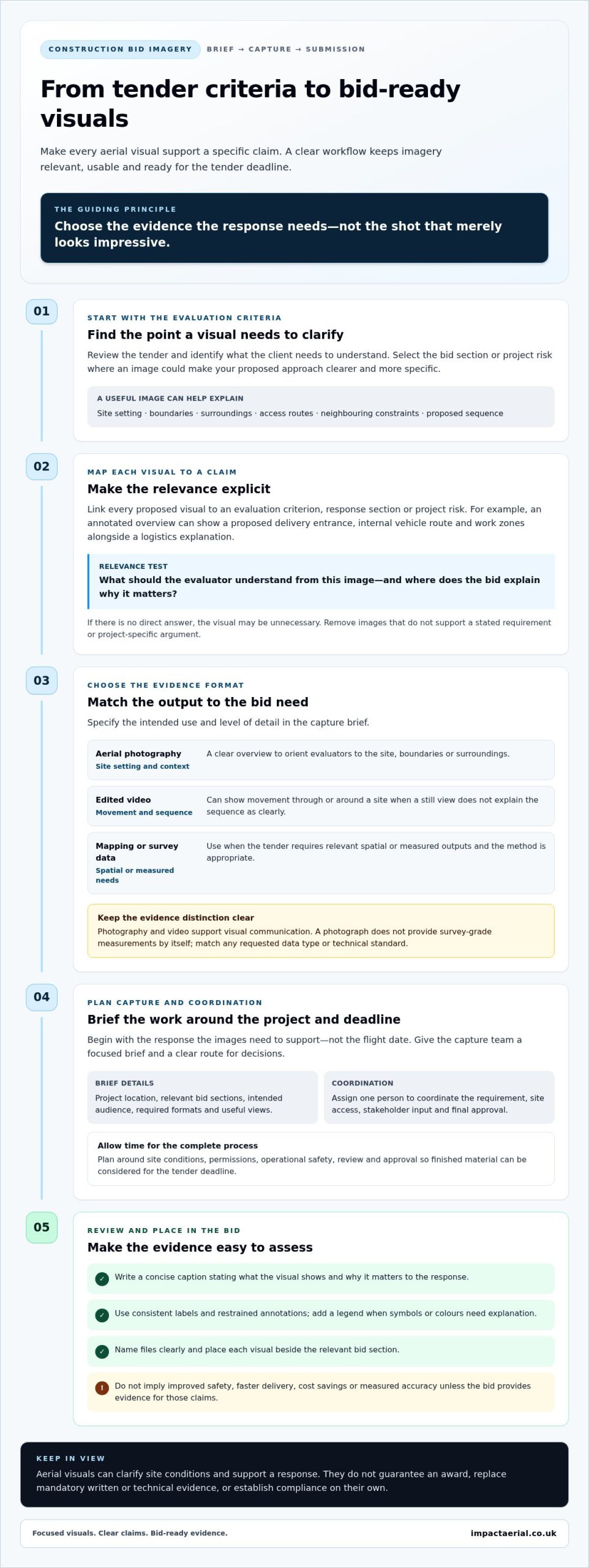
A focused brief makes aerial capture more relevant to the acquisition decision. Give the survey team enough context to understand which parts of the property matter, who will review the imagery and when it needs to inform the transaction. A useful scope sets out clear priorities, while leaving flight planning and practical feasibility to project planning.
Build a focused survey brief for the asset
Start with the questions that remain unanswered. For each one, identify a visible area or viewpoint that may provide useful context. For example, a question about the layout of a large site might involve several buildings, external areas and access routes. A roof-focused brief should identify the relevant building or roof sections.
Use this template to organise the information:
- Property address: Include the full address and, where useful, a site plan or boundary information.
- Decision deadline: State when the imagery needs to inform the acquisition process, so timing can be considered during planning.
- Priorities: List the unanswered questions and the buildings, boundaries, access routes or external areas relevant to them.
- Intended audience: Note who will review the imagery, such as your internal team or advisers, and how it will support their work.
- Site scale and context: Describe the extent of the property and any areas requiring particular attention.
Site scale affects how much ground and how many separate features are relevant to the agreed scope. A single building may need a different set of views from a multi-building site with extensive external areas. A clear priority list keeps the capture proportionate to your questions, rather than treating every part of the property as equally important.
For broader background on aerial data collection and survey approaches, the commercial drone survey guide provides useful context for shaping your brief.
Prepare for the review and follow-up
Before capture, the project team considers access, flight feasibility and image visibility. Site surroundings and operating conditions can affect which viewpoints are practical. The agreed scope should reflect what can be captured safely and clearly, rather than assume every requested view will be available.
Plan how the imagery will be reviewed, too. Identify the stakeholders who need to see it and agree how observations will be organised for discussion. Keep a separate list of questions that need a building inspection, legal review or other technical assessment. This distinction helps your team use visual evidence appropriately without treating it as a conclusion on matters outside its purpose.
For regulatory context, consult the UK drone licensing and CAA rules guide. As requirements can depend on the operation, current CAA guidance should inform flight planning.
A well-prepared brief gives a pre-acquisition aerial survey for commercial property a clear role in due diligence: visual evidence tied to the buyer’s priorities. To shape a project around your asset and review needs, discuss a commercial property aerial survey with Impact Aerial.
Commission your commercial property aerial survey with Impact Aerial
Commissioning a commercial property aerial survey starts with the asset and the decision you need to make. Share the property brief, identify priority buildings or external areas, and explain who will use the imagery and when it needs to inform the transaction. Impact Aerial works with you to shape a project scope around those requirements, plan the capture and review the imagery in context. The result is an additional source of visual evidence for acquisition due diligence, not a replacement for building inspection or other professional advice.
What working with Impact Aerial looks like
Impact Aerial manages projects from initial consultation through to post-production. Your property brief informs project planning, including the areas of interest and practical considerations for capture. Once the scope is agreed, aerial imagery is gathered and reviewed against the project priorities. The material produced is tied to that scope, so make clear which views and areas matter to your decision.
Impact Aerial’s commercial property surveys are carried out by CAA GVC-certified pilots using commercial-grade drones with 4K HDR cameras. The company also holds £5m commercial liability insurance. These credentials support a professional, safety-conscious approach to planning and capture. Based in Birmingham and the West Midlands, Impact Aerial provides UK-wide service coverage.
Keeping the brief, planning and review connected helps stakeholders understand what the imagery is intended to show. It also makes it easier to distinguish visible observations from questions that need a separate building, structural or legal assessment. Aerial evidence can inform wider due diligence, while conclusions about condition and other specialist matters remain with the appropriate assessment.
Take the next step with a clear project brief
To start scoping the work, bring together a few practical details. A concise brief can include:
- Asset type and location: Describe the property and provide its address.
- Priority areas: Identify the buildings, roofs, boundaries or external spaces relevant to your review.
- Transaction timing: Share the decision deadline or key dates the imagery needs to support.
- Intended use: Explain who will review the imagery and which acquisition questions it should help inform.
This information helps tailor the aerial survey scope to the property, your priorities and the intended review. It also gives project planning a clear starting point, so capture focuses on relevant visual evidence rather than being expected to answer every due diligence question.
If you’re considering a pre-acquisition aerial survey for commercial property, discuss a commercial property survey with Impact Aerial. Share the asset type, location, priorities and transaction timing to begin shaping a survey around your acquisition requirements.
Turn outstanding questions into a clear next step
Before your acquisition timetable advances, decide which unanswered questions would benefit from clearer visual context. Rank them by relevance to the purchase decision, then identify who needs to review the evidence and how it will feed into wider due diligence. This makes the next step practical and gives aerial imagery a defined role instead of leaving it as another disconnected file in the transaction.
A pre-acquisition aerial survey for commercial property is most useful when its purpose is agreed in advance and its findings are considered alongside the right professional assessments. The aim isn’t to make a purchase decision from imagery alone. It’s to give your team another relevant perspective as you evaluate the asset and decide where further investigation may be appropriate.
To define the visual evidence your transaction needs, plan your commercial property aerial survey with Impact Aerial. Share your priorities and property details to start shaping a focused project brief.
Frequently Asked Questions
Is a pre-acquisition aerial survey a replacement for a building survey?
No. Aerial imagery can help buyers understand visible features and site context, but it can’t inspect concealed areas or provide the findings of a physical building survey. Treat it as one input in due diligence. An image may help your team identify a roof area to discuss, while the building assessment addresses condition. Legal title, valuation and environmental questions also need their relevant professional review.
Can a drone survey identify roof defects before buying a commercial property?
It can document visible roof areas and draw attention to features that merit closer review, but it can’t guarantee that every defect will appear in the imagery or diagnose what caused a visible mark. Results depend on visibility, operating conditions and the agreed capture scope. If an image raises a concern, record its location and include that observation in the appropriate follow-up inspection rather than treating it as a definitive finding.
Does a commercial property drone survey include a structural assessment?
No. A drone survey captures aerial imagery and visual information within its agreed scope; structural conclusions require appropriate inspection and professional expertise. If imagery shows an area you want investigated, use it to identify the location and frame a question for the relevant assessment. Keep the distinction clear in acquisition discussions: an image can document what is visible, but it can’t establish structural performance.
Do UK drone surveys need CAA permission?
Requirements depend on the planned operation and location, so there isn’t one permission that automatically applies to every commercial property survey. The flight circumstances need to be considered against current Civil Aviation Authority guidance. Impact Aerial uses CAA GVC-certified pilots, but a pilot qualification alone doesn’t mean every operation follows the same requirements. Project planning should establish the applicable operational conditions for the specific site and capture.
Can an aerial survey be carried out while a commercial property is occupied?
Yes, an occupied property can be considered as part of the project plan, alongside people on site, access and operating conditions. Share details such as busy loading areas, restricted parts of the site or times when external areas are in use. This helps inform a safe capture plan and the imagery priorities. Aerial capture doesn’t remove the need to arrange any separate access or physical inspection required for due diligence.
What should I include when requesting a pre-acquisition aerial survey?
For a pre-acquisition aerial survey for commercial property, provide the asset type and address, the areas you want documented, the questions the imagery should inform and your transaction timeline. Name the intended reviewers, such as your internal acquisition team or relevant advisers. If you have a site plan or can identify priority locations, include that context. A focused brief helps Impact Aerial shape the scope around the property and intended use.

 2 Norton Drive, Wythall, Birmingham, B47 6HH Company registration number: 11138586. VAT Number: 366 9068 55


