
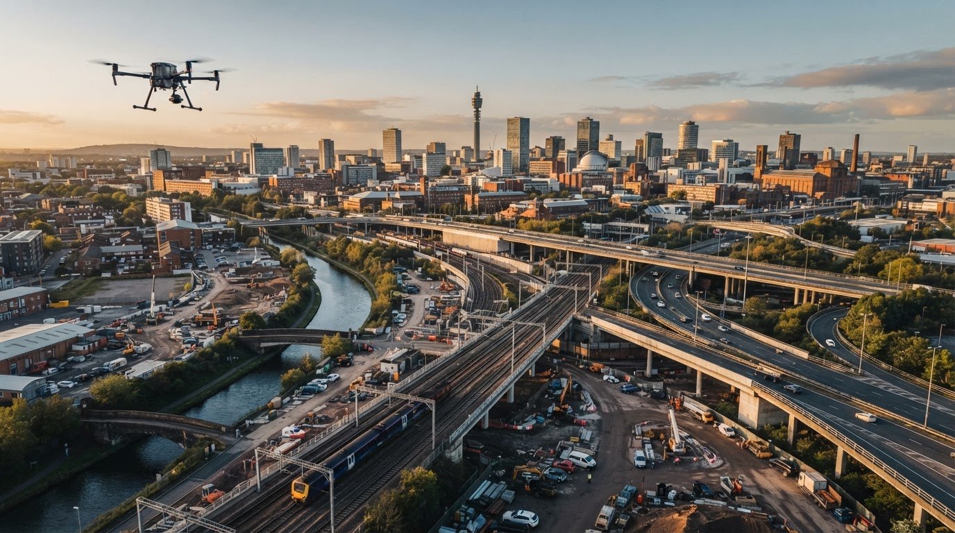
What if the right aerial view for a transport project isn’t a drone photograph? Aerial photography for transport infrastructure can document routes, structures and construction progress, but it won’t automatically provide the measured outputs needed for mapping, inspection or surveying. Choose the capture method according to the decision the imagery needs to support.
Before commissioning work near roads, railways or other operational assets, consider the asset, site access, permissions, safety controls and intended use. These details affect which capture method is appropriate and how the project should be planned. This guide compares aerial imagery options, explains what to include in a brief and outlines what to check when choosing a professional provider.
You’ll find practical considerations for distinguishing photography from mapping, inspection and survey outputs, planning access and minimising disruption. You’ll also learn how to assess a provider’s credentials, insurance and post-production capability. Impact Aerial’s CAA GVC-certified pilots, £5m commercial liability insurance and post-production services offer useful points of comparison when assessing providers.
Key Takeaways
- Choose aerial photography for transport infrastructure according to the decisions the images need to support, not simply the aircraft used.
- Compare drone, ground and satellite imagery by viewpoint, resolution, timing and access. Establish whether photographs alone will meet your needs.
- Assess live traffic, rail operations, public access, nearby structures and airspace restrictions before planning capture.
- Prepare a concise brief covering asset locations, dates, intended audience, image formats, usage and post-production requirements.
- When comparing providers, check relevant credentials, insurance, operational planning and their ability to deliver clear, usable images.
How aerial photography helps document transport infrastructure
Aerial photography records a place or asset in still images or video from an elevated viewpoint. It can show layout, relationships and visible activity, but a photograph is not automatically a map, measured survey or engineering assessment. Those outputs require appropriate capture methods, processing and, where needed, specialist interpretation. A high-level overview of aerial photography explains its wider uses, but project imagery should be planned around the particular asset and purpose.
For transport infrastructure, aerial photography can give project teams a clear view of roads, rail corridors, bridges, stations, ports and construction activity. A well-chosen overview may show how an asset sits within its surroundings, where approaches and access routes meet, and how works relate to nearby land use. These images support documentation and communication. They don’t, by themselves, establish structural integrity or engineering condition.
The video below shows aerial work related to transport infrastructure. It offers context for considering elevated viewpoints, but the right approach for a specific project depends on its intended use and site arrangements.
Which transport assets can benefit from aerial imagery?
Corridor-wide views may help document sections of road or railway, subject to access and operational planning. Elevated perspectives can show approaches to a bridge, a station’s relationship to surrounding streets, port-side activity or construction works alongside an existing route. These are potential applications, not guaranteed coverage or proof of asset condition. Viewpoint, weather, access and operational constraints all affect what can be captured usefully.
What decisions can project photography support?
Before choosing a viewpoint, ask who will use the images and what they need to understand. Progress updates may call for repeatable views from agreed positions. Stakeholder presentations may need wider context, while project records may require clearly labelled images. Communications materials may benefit from a concise visual story. Match the audience and decision to the image formats and post-production needs in the brief. For broader principles, see this drone photography guide.
In practice, aerial photography for transport infrastructure is most useful when it answers a defined visual question. If the decision depends on measurements or condition assessment, specify that need separately rather than assuming photographs will provide survey or engineering evidence.
What aerial photography can capture and where survey data is needed
The right capture method depends on what the project needs to show. Drone photography offers flexible, site-specific viewpoints. Ground photography can record details from accessible locations, while satellite imagery can provide a broader view, depending on resolution and availability. Survey-led capture is intended to produce defined spatial data or measurements. These approaches can complement one another, but they aren’t interchangeable.
When is drone photography preferable to other capture methods?
For a bridge approach, construction area or section of transport corridor, a drone may capture viewpoints that are difficult to achieve from the ground. Aerial photography for transport infrastructure can help create a current visual record, but suitability depends on permissions, weather, safe operating conditions and site access. Compare the practical trade-offs before choosing:
- Drone photography: Flexible elevated views of a specific site. Depends on safe operating conditions, permissions and access arrangements.
- Ground photography: Close views from accessible positions. May offer less context across a large site or corridor.
- Satellite imagery: Broad-area context. Available detail and suitability for a particular site or date can vary.
- Survey-led capture: Planned around defined spatial or measurement outputs. Requires agreement on technical specifications and deliverables.
Drones are used in transport settings to support work to monitor and fix critical infrastructure, as described by Iowa State University’s Institute for Transportation. The project purpose still determines whether visual documentation is enough or technical data is required.
When should a transport project specify a survey instead?
Specify a survey when decisions depend on measured dimensions, spatial relationships or mapped outputs, rather than visual context alone. Before commissioning technical data collection, define the required measurements, coordinate system, accuracy expectations and deliverable formats. Confirm these with the provider so you can assess the proposed method and processing against the project’s requirements.
Photographs alone don’t establish dimensions, structural integrity or compliance. An image may help identify a visible feature for discussion, but it isn’t a substitute for a specified condition assessment or engineering conclusion. If those decisions are in scope, state them clearly and confirm who is responsible for the relevant technical assessment.
For further guidance on scope and data considerations, read the drone survey guide. If you’re planning a photography project, you can also discuss aerial photography requirements with Impact Aerial and clarify the intended deliverables before capture.

How to assess safety, access, and operational constraints
Before commissioning aerial photography for transport infrastructure, establish whether the proposed capture can be planned safely around the asset’s operations. A live road, railway, bridge or station brings site-specific hazards, access controls and stakeholder requirements that need consideration before a flight is scheduled. Permissions and applicable CAA requirements depend on the location and operation, so verify current rules and any site-specific permissions with the relevant parties.
What should a project risk assessment consider?
The operator needs to assess the actual site and proposed activity, not rely on a generic checklist. Key factors may include:
- People and traffic: Vehicle movements, public access, workers and any arrangements needed to keep people clear of the operating area.
- Transport operations: The effect of capture planning on live road or rail activity, site procedures and communication with operational teams.
- Structures and surroundings: Bridges, overhead infrastructure, buildings and other obstacles that may affect safe access or flight planning.
- Conditions and contingencies: Weather, emergency arrangements, communication methods and what happens if conditions change or the planned activity can’t proceed.
Agree access points, timing, safeguarding measures and named contacts with the relevant site stakeholders. Clear coordination helps the operator plan around site activity and can reduce avoidable disruption to teams and the public. The precise controls should follow an assessment of the location and proposed work.
How can buyers verify a drone provider’s readiness?
Ask the provider how they’ll plan the specific project, including who is responsible for permissions, what information they need from the site, and how changes or cancellation will be handled. Check relevant pilot qualifications, experience with comparable environments, insurance, operating procedures and the project-specific risk assessment. Credentials matter, but they don’t replace a clear plan for the actual location.
Impact Aerial has CAA GVC-certified pilots and £5m commercial liability insurance. Confirm current credentials and insurance details as part of procurement, along with the proposed aircraft and camera configuration for your project. Review the UK drone licence guide for regulatory background, and verify current CAA requirements for the specific operation rather than relying on general guidance alone.
How to brief and compare aerial photography providers
A clear brief helps providers propose suitable capture, plan around site constraints and quote against the same scope. For aerial photography for transport infrastructure, work through five steps: define the purpose, identify the assets, set out access constraints, specify the required outputs, then compare providers against those needs. If you also need measurements or technical survey outputs, state that separately so photography isn’t scoped as a substitute.
What information belongs in an infrastructure photography brief?
Give providers the locations and assets to capture, relevant site contacts, access arrangements and any operational windows or constraints. Explain who’ll use the images and what they need to communicate. Then specify preferred viewpoints, image formats, editing expectations, usage rights and delivery deadlines. Flag any requirement for measurements or other technical outputs at the outset.
If dates are flexible, say so and explain any project milestones the imagery needs to support. A concise, complete brief gives providers a consistent basis for planning and proposals.
Which questions help compare provider proposals?
Ask who will plan the operation, manage permissions, coordinate site access and communicate schedule changes. Request examples of relevant work, confirmation of qualifications and insurance, and details of the proposed equipment. Compare how clearly each proposal describes capture, post-production and final deliverables, not just the time on site.
For broader provider-evaluation guidance, read the professional drone services guide.
- Scope: Are all locations, assets and requested viewpoints included?
- Planning: Does the proposal explain how access and operational constraints will be coordinated?
- Outputs: Are formats, editing, usage and delivery expectations clear?
- Assurance: Are relevant experience, qualifications and insurance confirmed?
- Costing: Is the quotation specific to the agreed scope and site conditions, with any assumptions made clear?
Before appointing a provider, resolve gaps in responsibilities and deliverables in writing. If your brief is ready, discuss your infrastructure photography project with Impact Aerial.
Plan transport infrastructure photography with Impact Aerial
Impact Aerial is a professional drone services company based in Birmingham and the West Midlands, providing aerial filming, photography and surveying services across the UK. For aerial photography for transport infrastructure, start by defining the intended use: perhaps images for a progress update, project record, stakeholder presentation or communications material. That purpose helps shape the capture plan and final deliverables.
What can clients expect from the project process?
Use the initial consultation to discuss the asset, location, site conditions and access arrangements. The scope, permissions, scheduling, capture requirements and expected outputs can then be considered together, with site-specific planning informing whether and how the work proceeds. Impact Aerial provides aerial photography and post-production, using commercial-grade professional drones with 4K HDR cameras. Confirm the proposed aircraft and camera configuration for each project.
After capture, post-production can prepare images for their agreed purpose. Document the required formats, editing and delivery expectations in the scope rather than assuming them. If the project also needs specialist survey measurements or other technical outputs, raise these separately and confirm whether they’re included before proceeding. Photography alone shouldn’t be treated as a substitute for a defined survey deliverable.
What should you send when requesting a discussion?
A useful first enquiry can be concise. Include the information you already have, and flag what still needs to be confirmed:
- Site and asset: Location, asset type and the areas or viewpoints of interest.
- Purpose and audience: Why the images are needed and who will use them.
- Timing: Relevant dates, project milestones or preferred capture window.
- Access and operations: Known safety requirements, access arrangements and constraints involving live activity, stakeholders or the public.
- Deliverables: Preferred image formats, intended usage, editing needs and any separate survey requirements.
Impact Aerial’s pilots hold CAA GVC certification, and the company has £5m commercial liability insurance. Confirm these details alongside project-specific planning and the proposed deliverables. Sharing your asset, intended use, access constraints and preferred timing gives the team a practical starting point for discussing the scope.
Discuss your transport infrastructure photography project.
Make your next infrastructure imagery project count
Effective aerial photography for transport infrastructure starts with the decision the images need to support. Match the capture method to the intended use, distinguish visual records from survey or engineering outputs, and define the deliverables before commissioning work.
Site-specific planning matters as much as the brief. Clear information about access, operational constraints, timing and stakeholders helps providers assess the project and plan responsibly. When comparing proposals, look beyond the images themselves: check relevant qualifications, insurance, communication and post-production capability.
Impact Aerial serves clients across the UK with CAA GVC-certified pilots, commercial-grade DJI Enterprise drones with 4K HDR cameras, and £5m commercial liability insurance. Share your asset, intended use and known site requirements to begin a project discussion.
Discuss your transport infrastructure photography project and take the next step towards a clear, well-planned brief.
Frequently Asked Questions
What is aerial photography for transport infrastructure?
Aerial photography for transport infrastructure is still imagery or video captured from an elevated viewpoint to document an asset, site or project. It can provide visual context for roads, railways, bridges, stations, ports and construction activity. The result is imagery for communication or records, not automatically a map, measured survey or engineering assessment. The project brief should define the intended audience, viewpoints, image formats and any separate technical data requirements.
Can drones photograph live roads and railway infrastructure?
Potentially, but each operation needs to be assessed for its location, permissions, site access and safety arrangements. Live traffic, rail activity, public access, nearby structures and applicable CAA requirements can affect whether and how capture is planned. Coordinate with the relevant site stakeholders before scheduling work, and confirm responsibilities, safeguarding, timing and contingency arrangements with the operator. A provider shouldn’t assume a proposed flight is suitable simply because the asset is accessible.
How is aerial photography different from a drone survey?
Aerial photography produces images or video intended to show an asset or project visually. A drone survey is scoped around collecting and processing data for defined technical outputs, which may include measurements or mapped products. The equipment and capture approach depend on the required deliverable. If decisions rely on dimensions, positional accuracy or other specified data, agree the technical requirements and outputs before commissioning. Photographs alone shouldn’t be treated as survey evidence.
What can aerial photographs show on a transport infrastructure project?
Depending on access, viewpoint and conditions, photographs may show the layout of a site, approaches to a structure, nearby land use, visible construction activity or how works relate to surrounding assets. A planned sequence of images may also help communicate progress or create a project record. However, photographs show visible details from particular viewpoints and times. They don’t automatically reveal hidden defects, establish structural integrity or confirm engineering compliance.
Is a drone operator’s insurance and certification important for infrastructure work?
Yes. Check relevant pilot qualifications, insurance cover, experience and the operator’s project-specific planning. Credentials support procurement checks, but they don’t replace current permissions, applicable CAA requirements or a site risk assessment. Impact Aerial’s pilots hold CAA GVC certification, and the company has £5m commercial liability insurance. Confirm current details, the proposed equipment and how the provider will coordinate with the site before agreeing the work.
What should I include in a brief for transport infrastructure photography?
Include the site location, asset type, purpose, intended audience and relevant dates or project milestones. Note access arrangements, site contacts, operational activity, known safety constraints and stakeholder requirements. Describe the viewpoints, image formats, usage rights, editing expectations and delivery deadlines you need. If measurements or technical survey outputs are also required, state them separately so providers can confirm whether they’re within scope and propose an appropriate approach.
Can aerial photography replace a transport infrastructure survey?
Not if the project needs measured or technical survey outputs. Photographs can support visual documentation, but they don’t by themselves establish dimensions, positional accuracy, structural condition or compliance. Define what the decision requires, then specify the measurements, coordinate system, accuracy expectations and deliverables with a suitable provider. Photography and survey data may serve different purposes in the same project, but their scope and responsibilities should be agreed clearly before work begins.
 2 Norton Drive, Wythall, Birmingham, B47 6HH Company registration number: 11138586. VAT Number: 366 9068 55


