
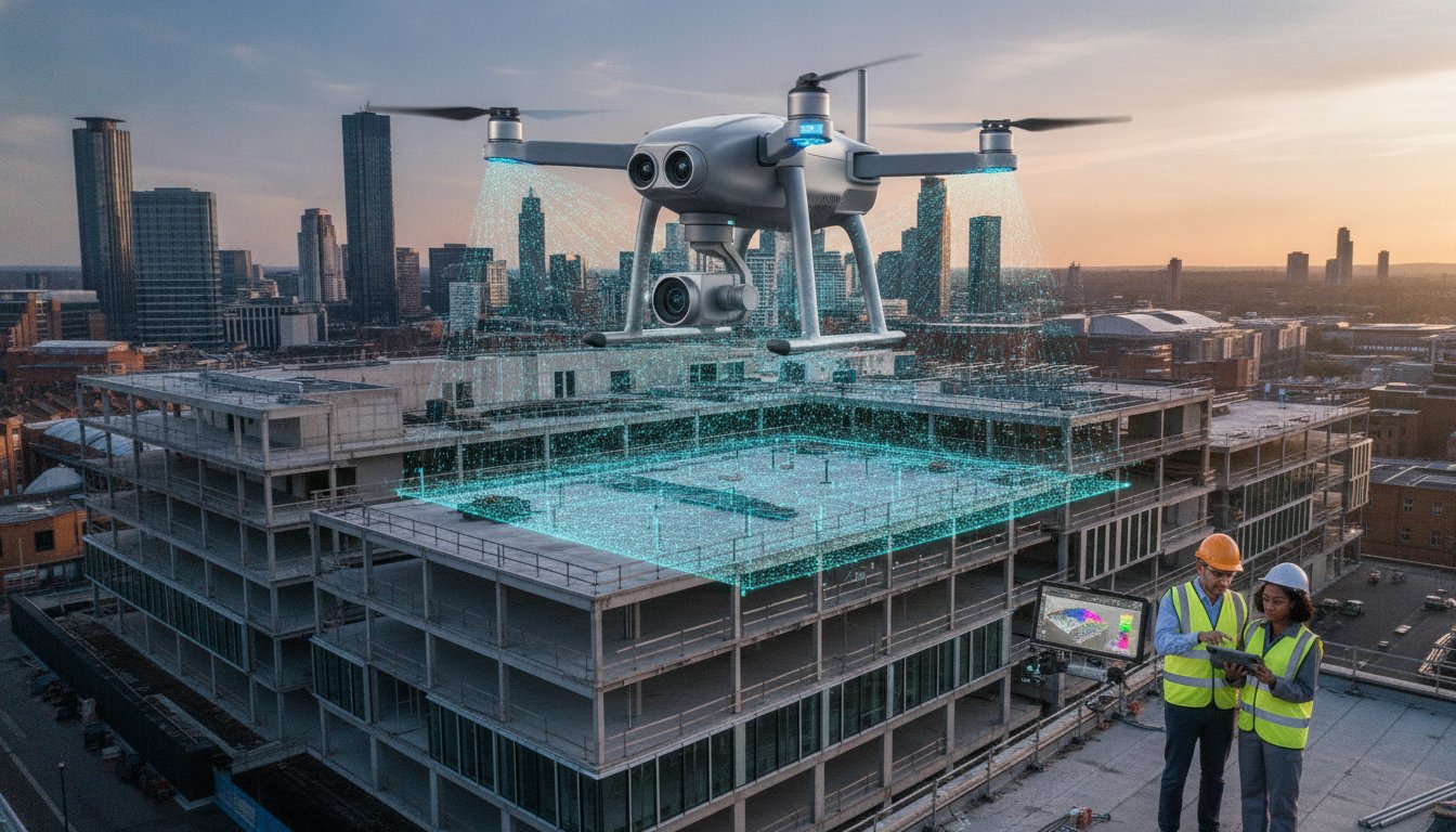
What if the most hazardous and expensive stages of your project’s data gathering could be completed without a single person leaving the ground? For many UK industries, traditional reliance on scaffolding and manual inspections isn’t just slow; it’s a significant liability that drains budgets and increases site risk. Professional drone data collection services are no longer a futuristic concept; they’re a standard requirement for meticulous project management in 2026. By integrating high-resolution aerial intelligence, businesses can replace weeks of manual labour with hours of precise, digital data capture.
You likely understand the frustration of waiting for site surveys while costs mount and safety protocols grow more complex. We’ll show you how professional aerial intelligence transforms these bottlenecks into competitive advantages. This guide explores how to leverage advanced sensor integration and AI-powered analytics to achieve faster project turnarounds and superior accuracy. We also examine the critical 2026 UK drone regulations, including Remote ID requirements and CAA GVC certification, to ensure your operations remain fully compliant while delivering actionable insights that drive efficiency.
Key Takeaways
- Understand how professional drone data collection services move beyond simple imagery to provide quantitative, actionable aerial intelligence for commercial decision-making.
- Explore the technical capabilities of RGB, Thermal, and LiDAR sensors and how photogrammetry converts 2D captures into high-precision 3D models and orthomosaics.
- Evaluate the “speed to insight” advantages and significant safety improvements gained by replacing manual high-access inspections with rapid aerial deployments.
- Learn how to apply aerial data to specific workflows, from construction site monitoring and progress tracking to detailed commercial property condition reports.
- Identify the essential criteria for selecting a compliant UK partner by verifying CAA GVC pilot credentials and enterprise-grade hardware standards.
What are Professional Drone Data Collection Services?
Professional drone data collection services involve the systematic gathering of aerial imagery and sensor-based information for rigorous commercial analysis. This process goes beyond simple observation; it turns an Unmanned Aerial Vehicle (UAV) into a sophisticated data acquisition tool. By using professional-grade hardware, such as DJI Enterprise platforms, we capture high-resolution perspectives that ground-based methods simply cannot reach. This systematic approach ensures that every flight mission produces a reliable, repeatable digital record of a physical asset.
The Shift from Visual Imagery to Actionable Data
There’s a fundamental difference between aerial photography and technical data collection. While photography focuses on aesthetics, professional data collection prioritises quantitative accuracy. Our DJI Enterprise 4K HDR sensors capture minute details that are often invisible to the naked eye from the ground. This level of precision is essential for identifying structural micro-fissures or thermal anomalies. Every image we capture is embedded with precise metadata and geotagging. This allows us to stitch thousands of individual captures into a single, cohesive map or 3D model where every point is geographically referenced. We call this “Actionable Aerial Intelligence” because it provides the specific facts needed to make informed business decisions.
UK Regulatory Compliance: The Foundation of Reliable Data
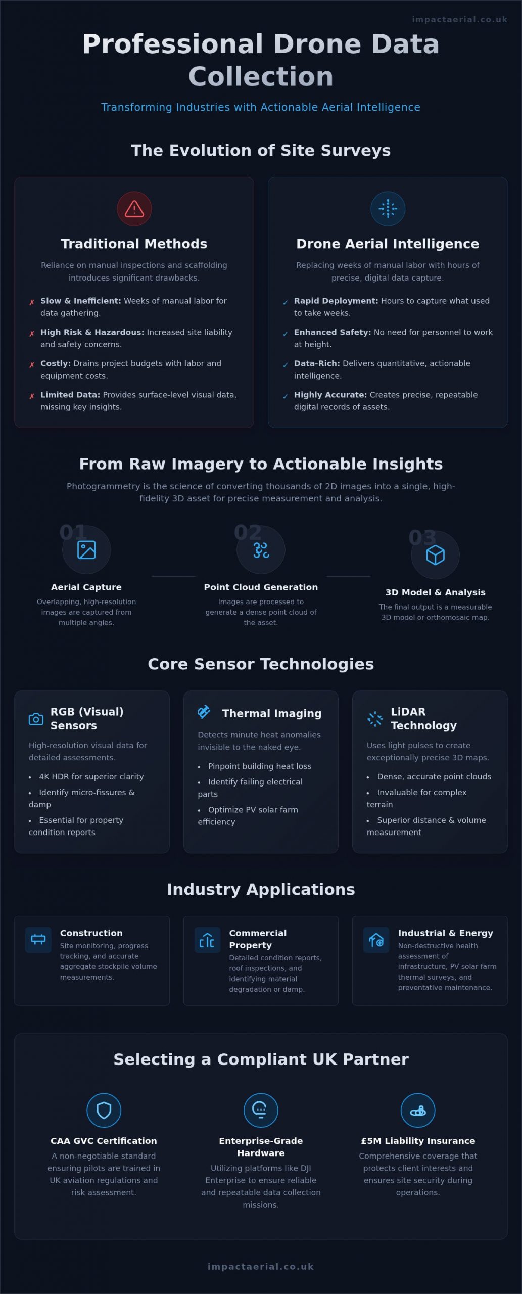
Operating in the UK requires a meticulous approach to legality and safety. For commercial drone data collection services, CAA GVC certification is a non-negotiable standard. This qualification ensures that the pilot is fully trained in the latest aviation regulations and risk assessment procedures. Our commitment to these protocols means the data we deliver is legally robust and suitable for professional surveying reports or insurance assessments. Safety isn’t just about flying; it’s about comprehensive risk mitigation. We back every project with £5m commercial liability insurance. This level of coverage protects our clients’ interests and ensures that high-stakes environments, such as construction sites or industrial facilities, remain secure throughout the data capture process. Our pilots are not just operators; they are technical consultants dedicated to maintaining the highest industry standards.
Key Technologies Powering Modern Aerial Surveys
The accuracy of modern drone data collection services depends entirely on the precision of the sensors deployed. We typically utilise a triad of core technologies: RGB (Visual), Thermal, and LiDAR. While standard RGB cameras provide the high-resolution visual context needed for 4K HDR assessments, thermal and LiDAR sensors provide depth and heat-based data that visual inspections simply can’t match. This multi-sensor approach allows us to deliver a comprehensive digital twin of any site or asset. High-contrast 4K HDR cameras are particularly vital for property inspections, as they reveal subtle colour variations that might indicate damp or material degradation on a commercial roof.
Photogrammetry and 3D Modelling
Photogrammetry is the science of making reliable measurements through photographs. By capturing a series of overlapping images from various angles, we can generate dense “point clouds” that represent the physical world in a digital space. These models allow for precise volume and distance measurements, which are invaluable for construction teams managing aggregate stockpiles or tracking earthwork progress. It’s a method that turns hundreds of individual 2D images into a single, high-fidelity 3D asset that project managers can interact with from their desks. This transition from raw imagery to quantitative data ensures that every measurement is repeatable and verifiable.
Thermal Imaging for Industrial Inspections
Thermal technology has revolutionised how we approach preventative maintenance and industrial health. By detecting minute heat anomalies, we can identify failing components in electrical infrastructure or significant heat loss in building envelopes. This is particularly effective for PV solar farm thermal surveys, where identifying a single malfunctioning cell can significantly improve overall energy yield. These specialized sensors allow us to spot structural weaknesses or insulation gaps before they escalate into costly failures. Our thermal data provides a non-destructive way to assess the health of complex assets without interrupting daily operations.
Integrating this thermal data into broader commercial drone surveys provides a layer of intelligence that traditional ground-based inspections miss. While we gather this technical data, our pilots strictly adhere to UK drone privacy rules to ensure all captured information is handled with total professionalism and legal compliance. This adherence to official standards ensures the data remains admissible for official reporting. If you’re looking to enhance your site’s safety and efficiency, our team can help you select the right sensor package for your specific project requirements.
Drone Data vs. Traditional Surveying: A Comparison
Traditional surveying methods often involve extensive lead times and significant logistical hurdles. In contrast, drone data collection services offer a rapid “speed to insight” that manual ground surveys cannot replicate. While a traditional team might spend days setting up equipment and navigating site obstacles, a professional drone deployment can be airborne in minutes. This agility doesn’t just save time; it provides a level of repeatability that is essential for longitudinal site monitoring. Because our drones follow precise, GPS-guided flight paths, we can capture the exact same data points week after week, providing a clear, chronological record of project progress.
Enhanced Site Safety and Risk Mitigation
Removing the need for human personnel to work at height is perhaps the most significant advantage of aerial intelligence. Roof inspections and structural surveys traditionally require scaffolding or high-access equipment, both of which introduce substantial “Work at Height” risks. By using drones, we eliminate these hazards entirely. Our pilots can access confined or unstable areas that would be too dangerous for staff to enter, capturing high-resolution data from a safe distance. This safety-first culture provides immense psychological comfort for project managers. They can rest assured that their site is being meticulously monitored by experts without the administrative and safety burdens associated with manual high-access work.
Efficiency and Cost-Benefit Analysis
The financial argument for aerial data is compelling. By reducing the reliance on expensive plant hire, such as cherry pickers or complex scaffolding systems, we significantly lower the overheads of any survey. On large-scale construction sites, it’s common to see survey timelines compressed from several days to just a few hours. This efficiency also extends to environmental impact. Replacing heavy, diesel-powered machinery with agile, electric UAVs helps firms lower their carbon footprint while maintaining high data standards. The true return on investment, however, is found in preventative maintenance. Early detection of a minor defect via drone data can prevent it from becoming a catastrophic failure, saving thousands of pounds in remedial costs and avoiding project delays.
Industry Applications: Turning Data into Decisions
Professional drone data collection services provide specific value across diverse UK sectors by converting raw aerial captures into structured intelligence. While previous sections detailed the technology and its safety advantages, the true impact is felt in the operational decisions these insights empower. From the initial site survey to the final marketing phase, aerial data acts as a single source of truth for all stakeholders involved in high-stakes projects. This systematic approach ensures that every project phase is backed by verifiable, high-resolution evidence.
In the building sector, construction site monitoring allows project managers to track progress with centimetre-level accuracy. This visibility is essential for managing subcontractors and ensuring that project timelines remain on schedule. Similarly, for property managers, drone property surveys provide a non-destructive way to assess roof conditions and dilapidations. This data-centric approach is also vital for infrastructure maintenance, where inspecting bridges or telecommunications towers manually would be prohibitively expensive and risky.
BIM and CAD Integration for Construction
A significant advantage of modern aerial surveys is the seamless compatibility with existing professional workflows. We export captured data into industry-standard formats, such as LAS point clouds or DXF files, which integrate directly into Building Information Modelling (BIM) and CAD software. This addresses a common industry gap by ensuring that aerial data isn’t just a standalone visual, but a functional part of the design process. Digital twins enable architects and engineers to overlay as-built drone data with original design models to identify discrepancies early. In large-scale UK infrastructure projects, these models allow remote teams to collaborate on a single, high-fidelity digital representation of the site.
Property and Asset Management
For commercial real estate, aerial intelligence serves both maintenance and investment purposes. High-resolution virtual tours and 3D data allow remote investors to explore properties in detail without the need for site visits. This is particularly effective for Grade I and II listed buildings, where meticulous documentation is required for heritage preservation. Routine aerial inspections of gutters and roof structures also prevent water ingress, protecting the long-term structural integrity of the asset. When high-end visuals are required for advertising, our aerial filming and photography services combine technical precision with cinematic quality to showcase assets at their best.
If you’re ready to integrate these insights into your next project, book a consultation with our technical team to discuss a tailored data collection strategy.
Choosing the Right Drone Data Partner in the UK
Selecting a provider for drone data collection services requires more than just looking at a portfolio of impressive images. It’s about vetting the operational standards that underpin the data’s reliability. A professional partner should act as a technical consultant, ensuring that every flight mission is compliant, insured, and tailored to your specific project goals. Without this level of scrutiny, you risk receiving data that’s either legally inadmissible or technically flawed.
- Verify pilot credentials: Commercial operations in the UK require CAA GVC certified pilots who understand the nuances of 2026 aviation regulations.
- Assess the hardware: Enterprise-grade equipment ensures data integrity through high-resolution sensors and stable flight performance in varied conditions.
- Confirm insurance: A minimum of £5m commercial liability coverage is essential for risk mitigation on industrial and construction sites.
- Review post-production: Determine if the provider delivers raw files or offers comprehensive data analysis and professional editing to make the data actionable.
The Impact Aerial Professional Standard
Our Birmingham-based team provides expert, “human-in-the-loop” consultation for projects across the UK. We don’t just fly; we meticulously plan every mission to meet the highest safety standards and regulatory requirements. We provide an end-to-end service, managing everything from the initial technical consultation to the final post-production editing of your data sets. This meticulous approach ensures that the aerial intelligence you receive is ready for immediate integration into your professional workflows, providing the reassurance that your project is in expert hands.
Requesting a Quote and Project Planning
To provide an accurate quote for drone data collection services, we need specific details about your site location, the required deliverables, and any known access constraints. Project timelines are often influenced by weather conditions and airspace restrictions, such as Temporary Restricted Areas (TRAs) or NOTAMs. We handle these administrative burdens by conducting thorough pre-flight site assessments and monitoring meteorological data in real-time. Getting started is straightforward. A brief consultation allows us to align our technical capabilities with your project’s unique requirements, ensuring a structured and methodical path toward capturing the data you need.
Future-Proofing Your Operations with Aerial Intelligence
The transition to sophisticated drone data collection services has redefined how UK industries manage risk and capture site information. By moving beyond simple imagery toward quantitative data, you gain a repeatable, high-precision record that integrates directly into your professional workflows. This shift doesn’t just save time. It fundamentally improves site safety by removing personnel from hazardous environments.
Success in 2026 requires a partner who understands the intersection of advanced technology and strict regulatory compliance. Our team provides the reliability of CAA GVC certified pilots and £5m commercial liability insurance, ensuring your data is captured safely and legally. We provide an end-to-end solution that includes expert post-production editing, turning raw captures into clear, actionable business intelligence.
Ready to enhance your project’s accuracy and efficiency? Request a Professional Drone Data Quote from Impact Aerial today. Let’s elevate your site intelligence together.
Frequently Asked Questions
What is the difference between a drone survey and drone data collection?
Professional drone data collection services involve the systematic gathering of raw aerial information, such as high-resolution imagery or LiDAR points, using specialized sensors. A drone survey is the application of that captured data to a specific professional standard or report. Collection is the technical acquisition phase. The survey represents the final interpreted intelligence used by architects or engineers to make informed site decisions based on that raw data.
How accurate is drone data for construction measurements?
Aerial data is highly precise, often achieving a sub-centimetre Ground Sample Distance (GSD). When we use DJI Enterprise hardware combined with precise Ground Control Points (GCPs), the resulting 3D models provide the centimetre-level accuracy required for volumetric calculations. This level of detail allows project managers to track earthwork progress or material stockpiles with a degree of precision that matches or exceeds traditional manual ground-based surveying methods.
Do I need to notify the CAA before hiring a drone data collection service?
You don’t need to notify the Civil Aviation Authority (CAA) yourself when hiring a professional operator. As a CAA GVC certified service, Impact Aerial handles all necessary flight planning, risk assessments, and airspace notifications. We ensure every mission complies with the latest UK drone regulations. Our team manages the administrative burden, including checking for restricted zones or temporary flight restrictions, so your project remains fully compliant without additional effort.
What file formats can drone data be exported in for BIM or CAD?
We export aerial intelligence into several industry-standard formats to ensure seamless integration with professional workflows. Common exports include .LAS or .LAZ for dense point clouds, .DXF or .DWG for CAD drawings, and .OBJ for 3D textured models. We also provide high-resolution GeoTIFFs for orthomosaic maps. These formats allow architects and engineers to overlay “as-built” aerial data directly onto their design models for precise discrepancy analysis and project tracking.
Can drones collect data in built-up urban areas like London or Birmingham?
Drones can operate in built-up urban environments like Birmingham and London, provided the pilot holds the correct CAA certifications. Our GVC certified pilots are trained to operate safely in congested areas by conducting meticulous site-specific risk assessments. We coordinate with local authorities and air traffic control when necessary to secure flight permissions. Operating in urban centres requires a safety-first culture and high-end hardware to mitigate risks associated with signal interference.
How much does professional drone data collection cost in the UK?
The cost of professional drone data collection services varies depending on several factors, including the site’s scale, the complexity of the airspace, and the specific sensors required. A simple visual inspection of a commercial roof differs in scope from a multi-day LiDAR survey for a large infrastructure project. We provide tailored quotes based on a thorough consultation to ensure the pricing reflects your project’s specific data requirements and safety protocols.
What happens if the weather is bad on the day of the drone survey?
Safety is our primary concern, so we don’t fly in conditions that exceed the operational limits of our DJI Enterprise hardware. If high winds or heavy rain are forecast for your survey, we’ll coordinate with you to reschedule the flight for the next available safe weather window. Our pilots monitor real-time meteorological data to make informed “go or no-go” decisions. This ensures that data integrity is never compromised by adverse environmental factors.
Why is £5m liability insurance necessary for drone services?
Carrying £5m commercial liability insurance is a standard requirement for operating on professional construction and industrial sites in the UK. This level of coverage provides essential reassurance and risk mitigation for our clients. It ensures that in the unlikely event of an incident, all parties are protected against third-party property damage or injury. High-value insurance is a hallmark of a professional operator who takes the operational and legal side of their business seriously.
 2 Norton Drive, Wythall, Birmingham, B47 6HH Company registration number: 11138586. VAT Number: 366 9068 55


