
Table of Contents
- What Do Drone Surveys Involve?
- Why Use Drone Surveys for Inspections and Mapping?
- Types of Drone Survey for Construction and Property
- Using Aerial Thermal Imaging Surveys for Building Diagnostics
- Understanding CAA Drone Regulations UK Commercial Operators Must Follow
- Drone Roof Inspection Cost: What Determines the Price?
- How to Choose a Drone Survey Provider
- Frequently Asked Questions
Last Updated: September 6, 2026
Drone surveys have transformed how construction firms, property developers, and facility managers capture site data, moving beyond ground-level photography to deliver precise measurements and high-resolution imagery from above. A drone survey is the use of an unmanned aerial vehicle equipped with cameras or sensors to collect spatial data, visual records, or thermal information for analysis and decision-making. In this guide from Impact Aerial, a CAA-certified operator with over 20 years in aerial media, we break down what these surveys involve, how to navigate CAA drone regulations UK operators must follow, and what drives drone roof inspection cost. Below, we show you exactly how to evaluate providers and understand the value of professional aerial data collection.
The appeal is obvious when you consider the alternative: traditional methods often require scaffolding, cherry pickers, or manned aircraft, which are slow and expensive. Drone surveys deliver the same data in a fraction of the time, often within a single site visit. But the technology only performs when the pilot understands both the equipment and the legal framework around it. We will cover the main survey types, the regulatory basics, and the practical questions to ask before commissioning any aerial work.
What Do Drone Surveys Involve?
A drone survey involves planning a flight path, deploying a drone with the appropriate sensor, and processing the captured data into a usable deliverable such as an orthomosaic map, a 3D model, or a thermal report. The process begins with a site assessment to identify hazards, confirm airspace restrictions, and determine the ground sampling distance required for your accuracy goals. Pilots then fly a systematic grid pattern to ensure overlapping images or scans cover the entire area of interest.
Most commercial drone surveys rely on photogrammetry or LiDAR. Photogrammetry stitches hundreds of overlapping photographs into a georeferenced 2D map or 3D model, while LiDAR uses laser pulses to measure distances and penetrate vegetation. The choice depends on your terrain and the level of detail required. Ground control points are often placed before the flight to improve positional accuracy, and the entire operation is logged for compliance with the Civil Aviation Authority.
Skipping the pre-flight airspace check is a common mistake. Operating without the correct permissions can lead to fines, grounded projects, and safety incidents on site. Always confirm your provider holds a valid CAA permission before work begins.
Why Use Drone Surveys for Inspections and Mapping?
The core benefit of drone surveys is the combination of speed, safety, and accuracy that traditional methods cannot match. Inspecting a roof, a facade, or a solar farm by foot or scaffold puts workers at height and disrupts operations; a drone completes the same inspection from the ground in under an hour. For mapping, drones capture data across large sites in a single flight, producing outputs that ground teams would take days to measure manually.
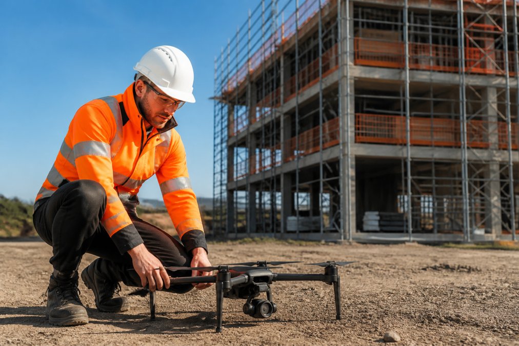
The data quality is another deciding factor. High-resolution orthomosaics give project managers an accurate record of progress, while thermal cameras detect defects invisible to the naked eye. This approach also improves safety records by removing the need for personnel to work at height, a key concern under UK health and safety law. For facilities managers, regular aerial inspections create a time-stamped history of asset condition, supporting maintenance planning.
Types of Drone Survey for Construction and Property
Photogrammetry and Orthomosaic Mapping
Photogrammetry is the most widely used drone survey method for construction and property because it produces visually clear, measurable outputs at a reasonable cost. The drone captures hundreds of overlapping images, which software processes into an orthomosaic, a geometrically corrected map accurate to centimetres. Project managers use these maps to monitor earthworks, calculate stockpile volumes, and track site progress against programme.
For property developers, orthomosaic mapping supports marketing and planning applications by providing a complete, current view of the land. The output is easy to share with stakeholders who lack technical GIS skills. The main limitation is that photogrammetry relies on visible light, so it struggles in dense vegetation or low-light conditions. For those cases, LiDAR is the better tool.
LiDAR Scanning for Detailed Terrain Data
LiDAR scanning uses laser pulses to measure the distance between the sensor and the ground, generating millions of precise points that form a 3D point cloud. Unlike photogrammetry, LiDAR can penetrate tree cover to reveal the underlying terrain, making it essential for surveying heavily vegetated sites or conducting corridor mapping for infrastructure. The data produces accurate digital terrain models regardless of lighting conditions.
The trade-off is cost and processing complexity. LiDAR sensors are expensive, and the point cloud data requires specialist software and skills to interpret. For most construction projects, photogrammetry offers sufficient accuracy at a fraction of the price. LiDAR becomes the right choice when vegetation removal is not possible or when the project demands sub-centimetre vertical accuracy across challenging terrain.
Using Aerial Thermal Imaging Surveys for Building Diagnostics
Aerial thermal imaging surveys detect temperature differences across a building envelope, revealing issues such as moisture ingress, missing insulation, and failing electrical connections. A thermal camera mounted on a drone captures infrared radiation, which software converts into a temperature map of the surveyed surface (energy.gov). This non-destructive method identifies defects early, preventing costly repairs and reducing energy waste.
For commercial facility managers, thermal surveys are particularly valuable for flat roof inspections, where water trapped beneath the membrane shows up as a distinct temperature anomaly. Solar farm operators also rely on thermal imaging to locate faulty photovoltaic cells that underperform or overheat. The key to accurate results is flying at the correct time of day, as solar loading and ambient temperature affect the readings. Early morning or evening flights generally produce the clearest thermal contrast.
For the most accurate thermal results, schedule surveys for early morning after a cool night. The temperature difference between wet insulation and dry areas is at its maximum, making defects far easier to identify.
Understanding CAA Drone Regulations UK Commercial Operators Must Follow
Commercial drone operations in the UK are governed by the Civil Aviation Authority, and all operators must hold the appropriate permissions before flying. The core requirement is an operational authorisation, which requires passing a theory exam and demonstrating a clear understanding of airspace, safety, and privacy rules (caa.co.uk). Pilots must also hold a valid GVC (General Visual Line of Sight Certificate) qualification to prove their competence.
Beyond the operator permission, every flight must comply with the CAA drone regulations UK covering maximum altitude, visual line of sight, and proximity to people and property. Flights near airports, prisons, or other restricted areas require additional permissions, and operators must maintain a safety case documenting their procedures. Insurance is also a practical requirement; most clients expect proof of at least £5 million in public liability cover before allowing work on site. The CAA publishes detailed guidance on operational requirements that all commercial operators should follow.
Drone Roof Inspection Cost: What Determines the Price?
Drone roof inspection cost varies significantly based on the size and complexity of the roof, the type of survey required, and the accessibility of the site. A straightforward visual inspection of a small commercial roof may take under an hour, while a full thermal survey of a large industrial complex requires more flight time, data processing, and specialist equipment. The accuracy you need also drives the price, as higher-resolution sensors and additional ground control points add to the cost.
The condition of the roof matters more than many clients expect. A roof with multiple levels, parapets, or obstructions requires more careful flight planning and additional passes to capture every angle. The location of the site also affects the price, as travel time and any airspace restrictions near the property are factored into the quote. Rather than comparing headline prices, ask providers what the survey includes: the number of flights, the type of sensor, the deliverables, and the turnaround time. All of these elements influence the final figure.
How to Choose a Drone Survey Provider
Choosing a drone survey provider comes down to verifying three things: certification, insurance, and relevant experience. Confirm that the operator holds a valid CAA permission and that their pilots are GVC qualified, then ask for proof of public liability insurance. The right paperwork protects you from liability if something goes wrong on site, and it demonstrates that the provider takes compliance seriously.
Experience in your specific sector matters just as much as the technical credentials. A provider who has surveyed solar farms understands the flight patterns needed to capture every panel, while one focused on construction knows how to schedule flights around site activity. Ask for examples of previous work and check whether the provider offers post-production and data processing in-house. A common mistake is hiring a pilot who can fly but cannot deliver the processed maps or reports you need. The full package from Impact Aerial’s commercial survey services includes CAA-licensed pilots, a £5m insurance policy, and professional post-production to turn raw data into usable insights.
| Survey Type | Best For | Key Output | Typical Use Case |
|---|---|---|---|
| Photogrammetry | Site mapping, volume calculations | Orthomosaic, 3D model | Construction progress tracking |
| LiDAR | Vegetated terrain, corridor mapping | 3D point cloud | Infrastructure planning |
| Thermal Imaging | Building diagnostics, solar farm checks | Temperature map | Roof defect identification |
The best drone survey provider combines technical skill with regulatory compliance. Verify CAA certification, insurance cover, and sector experience before reviewing their portfolio. A provider with all three will deliver accurate, actionable data.
Commissioning a drone survey is a decision about data quality, safety, and regulatory compliance, not just about getting a camera in the air. The right provider turns aerial capture into measurable value, whether that means spotting a roof defect before it becomes a leak or tracking site progress against a construction schedule. Impact Aerial combines CAA GVC Certified operators, a modern fleet of latest 4K, High Dynamic Range (HDR) DJI Enterprise commercial drones, and over 20 years of experience in aerial photography, videography, media production, and marketing to deliver surveys you can act on. Contact Impact Aerial to discuss your project and get a tailored quote.
Frequently Asked Questions
What are the main benefits of using drone surveys for building inspections?
Drone surveys deliver accurate, high-resolution data quickly, often in a fraction of the time ground teams need. They improve safety by removing the need for personnel to work at height or enter hazardous areas. The data captured, including 4K imagery and precise measurements, supports better decision-making for maintenance and progress monitoring. This leads to fewer site disruptions and a safer working environment.
Do I need a CAA licence to operate a drone for commercial surveys?
Yes. Any commercial drone operation must follow CAA drone regulations UK operators are bound by. This requires you to hold a valid GVC (General Visual Line of Sight Certificate). You also need to register as an operator with the CAA and have appropriate insurance. This legal framework ensures all commercial flights are conducted safely and responsibly.
How accurate are drone surveys compared to traditional methods?
Modern drone surveys, using techniques like photogrammetry and LiDAR, deliver centimetre-level accuracy. This makes them highly effective for detailed topographic mapping, volume calculations, and structural inspections. Accuracy depends on factors such as flight planning, ground control points, and the quality of the sensors used. A professional provider will follow strict methodologies to ensure the data meets your project’s specific tolerances.
What data outputs can I expect from a professional drone survey?
You typically receive more than just video footage. Outputs can include high-resolution orthomosaic maps, 3D models, thermal images from aerial thermal imaging surveys, and detailed point clouds from LiDAR. Reports are usually delivered with annotations and measurements relevant to your goals, such as defect location or stockpile volume. The provider should confirm the exact deliverables, formats, and software compatibility before the flight.
 2 Norton Drive, Wythall, Birmingham, B47 6HH Company registration number: 11138586. VAT Number: 366 9068 55


