
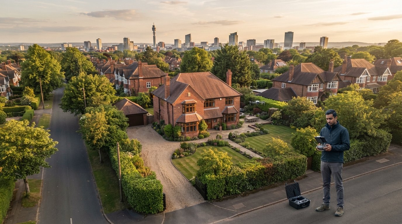
Did you know that 83% of property sellers now explicitly seek out estate agents who utilize drone photography in their marketing strategies? In a competitive 2026 market, standard ground-level shots often fail to capture the true scale of a listing, leaving properties stagnant on portals. You’ve likely felt the frustration of losing a high-value instruction to a competitor with a more sophisticated visual portfolio. It’s a common challenge, but the solution requires more than just a camera. Professional aerial photography for estate agents has become a strategic asset that balances high-end visual impact with rigorous regulatory adherence.
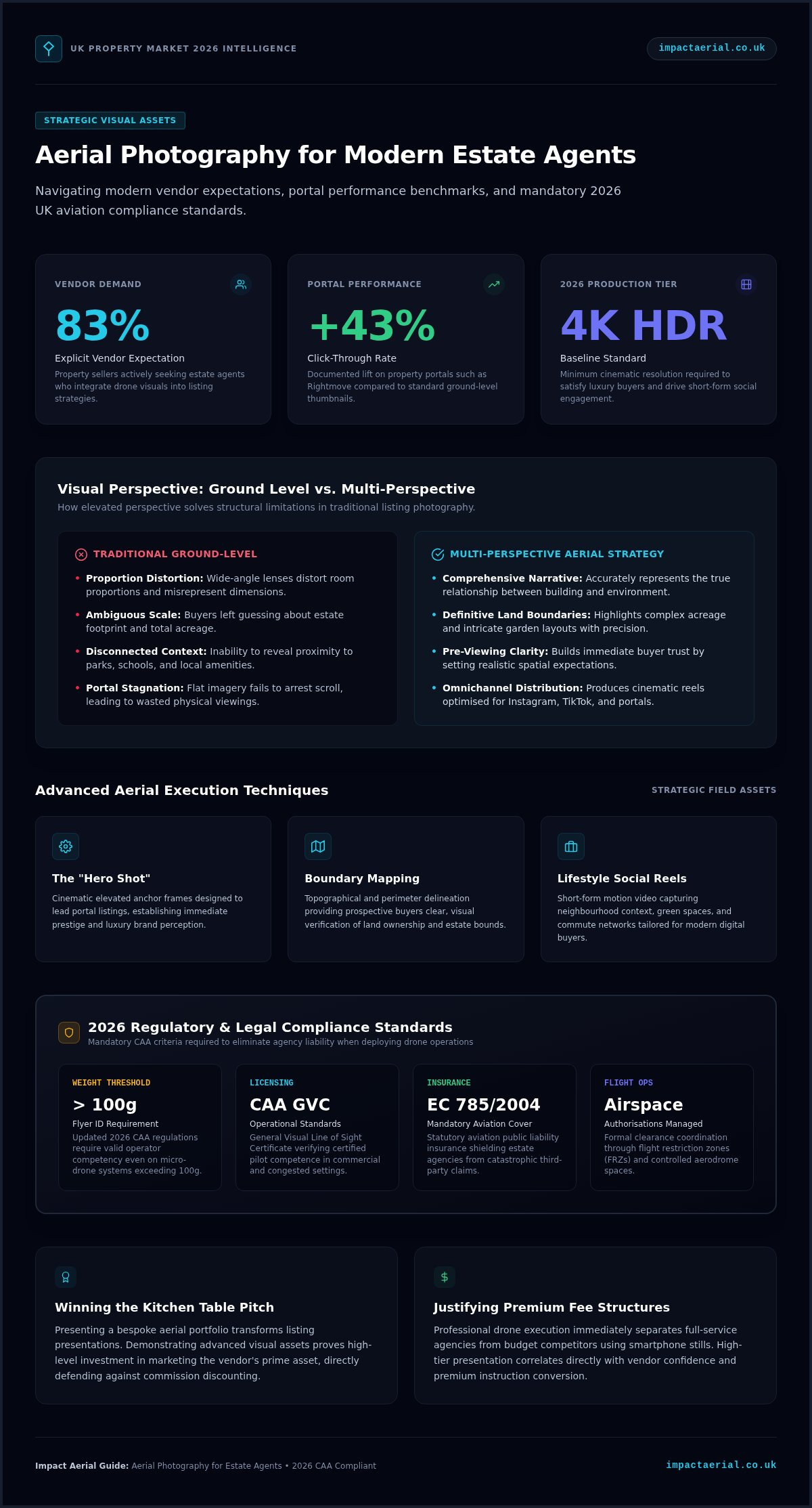
You understand that premium marketing is the lifeblood of your agency, yet the fear of legal liability from unlicensed drone operators is a valid concern. This guide promises to demonstrate how professional drone services mitigate these risks while delivering a 43% higher click-through rate on platforms like Rightmove. We’ll preview the essential 2026 CAA compliance standards, including the latest Flyer ID requirements for drones over 100g and mandatory insurance mandates. By the end of this article, you’ll have complete peace of mind and a clear roadmap to securing faster sales and higher-quality instructions through expert aerial filming and photography.
Key Takeaways
- Discover how multi-perspective aerial imagery overcomes the limitations of traditional ground-level photography to accurately represent the scale and context of premium listings.
- Learn how a sophisticated aerial portfolio serves as a powerful differentiator during listing presentations, helping you secure high-value instructions and justify premium commissions.
- Identify the legal and insurance requirements for 2026, ensuring your use of aerial photography for estate agents remains fully compliant with CAA GVC standards and EC 785/2004 regulations.
- Explore advanced techniques such as ‘Hero Shots’ and boundary mapping to provide prospective buyers with a comprehensive understanding of land ownership and property potential.
- Gain insights into the operational advantages of partnering with certified specialists who manage complex airspace permissions and deliver high-tier 4K HDR outputs.
The Strategic Value of Aerial Photography for Modern Estate Agents
The 2026 UK property market has moved past the era where ground-level stills were sufficient for high-end listings. Today, aerial photography for estate agents is a fundamental requirement for any agency aiming to dominate the premium instruction space. While traditional wide-angle lenses provide a glimpse of interior rooms, they often distort proportions and fail to convey the true relationship between a building and its environment. By applying established aerial photography principles, agents can now present a comprehensive visual narrative that ground-based equipment simply cannot replicate. This high-tier perspective provides a level of clarity that builds immediate trust with serious buyers.
This shift represents a move toward multi-perspective marketing. High-value buyers aren’t just looking at the bricks and mortar; they’re evaluating the estate’s footprint and its place within the wider landscape. Standard photography often leaves these buyers guessing about the property’s scale, which can lead to wasted viewings or, worse, a lack of interest from serious prospects. Aerial imagery removes this ambiguity by offering a definitive look at the property in its entirety, setting realistic expectations before a physical viewing is even booked.
To better understand how high-quality visuals can transform your property listings, watch this helpful video:
Beyond the Front Door: Capturing the Full Property Story
Aerial views provide clarity that a floorplan alone cannot achieve. They allow agents to highlight precise land boundaries and intricate garden layouts with absolute precision. This is particularly vital for complex estates where acreage or unique topographical features are the primary selling points. By showing proximity to local amenities, schools, and green spaces from an elevated vantage point, you provide buyers with the context they need to make informed decisions. It’s about telling a story of the lifestyle the property offers, rather than just documenting its physical dimensions. Using professional aerial photography for estate agents ensures this story is told with technical excellence and visual flair.
Meeting the Demands of 2026 Property Buyers
Modern buyer behaviour has evolved, with a significant rise in lifestyle searches. Prospective owners want to see cinematic content that evokes a sense of place, and they don’t settle for mediocre visuals anymore. This is why many top-tier agents incorporate high-end visual media from HMBD Real Estate Marketing to ensure their property listings make a lasting impression. In 2026, 4K HDR video has become the baseline expectation for luxury listings, as it offers the clarity and dynamic range required to stand out on high-resolution screens. Beyond portal listings, these aerial visuals drive substantial social media engagement. Short-form drone reels on platforms like Instagram and TikTok help agencies build anticipation and reach a wider demographic of potential buyers. This approach positions your agency as a technologically adept market leader, capable of meeting the sophisticated visual expectations of today’s digital-first buyers.
Winning More Instructions: How Drone Imagery Differentiates Your Agency
Winning a new instruction often happens at the kitchen table, where the vendor evaluates your agency’s ability to market their most valuable asset. When you present a portfolio featuring high-tier aerial photography for estate agents, you aren’t just showing photos; you’re demonstrating a commitment to premium marketing standards. This professional approach helps justify higher commission rates by proving you invest in the best tools to secure a sale. Vendors see that you go beyond the standard smartphone snaps, positioning your agency as a tech-forward leader in the 2026 property market.
Data from May 2026 indicates that listings featuring drone photography on portals like Rightmove achieve a 43% higher click-through rate compared to static ground-only listings. This visibility is crucial. If a buyer doesn’t click on your listing, they won’t see the interior shots you’ve worked hard to curate. By leading with a cinematic aerial perspective, you ensure your listings capture attention in a crowded digital marketplace.
Differentiating Your Agency in a Crowded Market
In a saturated market, your digital “shop window” needs a hero shot that stops the scroll. High-resolution aerial perspectives create an immediate wow factor that leads to more vendor referrals. It’s not just about the imagery itself, but the professional authority it conveys. By ensuring all operations adhere to the UK Civil Aviation Authority Drone Code, you signal to vendors that your agency values safety and legal compliance. This meticulousness builds trust, showing that you protect the vendor’s property and reputation as much as your own. This level of care is a powerful differentiator that “cowboy” operators simply cannot match.
The ROI of Professional Aerial Content
The return on investment for professional aerial content is quantifiable and immediate. Properties marketed with professional aerial imagery sell up to 68% faster than those using only traditional methods. This efficiency is vital for high-value properties that might otherwise stagnate on the market. Comprehensive views also attract international and out-of-area buyers who need to understand the property’s context before committing to a long-distance viewing. Leveraging this content for professional drone filming across your agency’s social media channels further solidifies your brand identity. It transforms a single listing into a promotional asset that showcases your agency’s modern, high-end capabilities to future vendors.
Compliance, Safety, and Insurance: Protecting Your Agency’s Reputation
Estate agents often overlook the legal complexities inherent in commercial drone operations. If your agency commissions a drone shoot, you’re legally responsible for ensuring the pilot is properly certified and insured. Hiring a “hobbyist” friend or allowing a staff member to use a personal drone for marketing purposes is a direct violation of UK law. Under the Air Navigation Order 2016, any flight conducted for “valuable consideration” is classified as a commercial operation. This status requires specific insurance and pilot competency. Failing to verify these credentials exposes your agency to severe corporate liability and potential prosecution.
Professional aerial photography for estate agents in 2026 requires meticulous technical oversight. For missions in residential or congested urban areas, pilots must hold a CAA Operational Authorisation, which is supported by a General Visual Line of Sight Certificate (GVC). This certification proves the pilot has met national standards for safety and operational competence. While legal minimums for insurance exist, they’re often insufficient for high-value property environments. Impact Aerial carries £5m in commercial liability insurance, ensuring that both the agency and the vendor are protected against third-party claims.
The Risks of Using Unlicensed ‘Hobbyist’ Pilots
The National Association of REALTORS® drone guidance highlights that while aerial imagery is a powerful marketing tool, it must be balanced with strict legal compliance. Financial penalties for hiring non-commercial operators are substantial, but the cost to your reputation is often higher. A drone accident in a suburban neighbourhood creates a public relations crisis that traditional marketing never risks. Holding a valid A2 CofC or GVC is a non-negotiable requirement for any commercial operator. It’s the only way to ensure your agency isn’t complicit in illegal aviation activity.
Impact Aerial’s Safety-First Approach
We prioritize risk mitigation through exhaustive pre-flight planning. Every property shoot begins with a detailed risk assessment using tools like Altitude Angel to identify Flight Restriction Zones or temporary NOTAMs. We exclusively use DJI Enterprise hardware, which offers superior signal stability and obstacle avoidance compared to consumer models. This technical advantage is critical when flying in urban areas with high radio interference. We also maintain transparent communication with neighbours and local authorities. This professional conduct ensures that every mission is executed safely, protecting the integrity of your agency’s brand while delivering high-tier visual results.
Maximising Property Value with Advanced Aerial Perspectives
Capturing the perfect ‘Hero Shot’ is the cornerstone of effective aerial photography for estate agents. This primary image isn’t just an overhead view; it’s a meticulously composed shot that highlights the property’s architectural strengths while showcasing its relationship to the surrounding landscape. In the 2026 market, buyers expect to see more than just a facade. They want to understand the property’s flow and layout before they arrive. Cinematic drone movements, such as the ‘Reveal’ shot, create a sense of discovery that static images can’t match, building an emotional connection that often translates into higher offers.
For complex estates, boundary mapping provides essential clarity that traditional ground photography misses. By providing a clear, top-down view of land ownership, you eliminate buyer uncertainty regarding fence lines and garden extensions. We also integrate virtual tours with high-resolution aerial 360-degree panoramas. This allows prospective buyers to spin the view 360 degrees from an elevated position, seeing exactly how the property sits within the cul-de-sac or the wider countryside. It’s a level of transparency that high-value buyers find incredibly reassuring.
Technical Excellence: 4K HDR and Post-Production
Outdoor property shoots often face high-contrast lighting challenges, where bright skies can wash out the detail of the building. This is why 4K HDR is essential. It captures a wider dynamic range, ensuring both the shadow detail in the garden and the highlights on the roof are perfectly exposed. Our post-production services go beyond simple colour grading. We use advanced editing techniques to remove unsightly temporary objects like wheelie bins, estate agent boards, or parked cars that detract from the property’s curb appeal. This meticulous attention to detail ensures your marketing portfolio looks polished and professional.
Specialised Property Surveys
Modern aerial photography for estate agents is increasingly serving a dual purpose: marketing and due diligence. Using drones for roof and chimney inspections during the listing phase provides buyers with immediate confidence in the building’s structural integrity. This proactive approach can prevent sales from falling through at the survey stage, as it addresses potential issues before they become deal-breakers. For eco-home listings, we can even capture thermal data to demonstrate energy efficiency to environmentally conscious buyers. If you want to elevate your listings with this level of technical precision, you can book a professional drone consultation today.
Partnering with Impact Aerial: Professional Drone Services for the UK
Impact Aerial provides a comprehensive suite of professional drone services tailored to the specific needs of the UK property market. Centrally based in the West Midlands, we offer Birmingham-based expertise with a national reach, ensuring that whether you’re marketing a suburban semi-detached or a vast rural estate, our team can be on-site quickly. We don’t just provide raw footage; we offer full project management from the initial consultation through to final delivery. This approach allows estate agents to focus on their core business while we handle the technical and regulatory complexities of aerial photography for estate agents. Our goal is to act as a technical consultant, providing the high-end output your brand demands.
Our Process: Seamless Integration with Your Marketing Workflow
We’ve designed our workflow to be as non-intrusive as possible. Scheduling is handled with meticulous care, accounting for weather windows and vendor availability to ensure the property is captured in its best light. On-site, our pilots act as a professional extension of your agency. They maintain a high level of professionalism, reassuring the vendor that their home is being marketed by experts who value safety and privacy. It’s about providing psychological comfort to the homeowner while we secure the data you need.
Once the flight is complete, our post-production team works rapidly. We understand the pace of the 2026 property market, which is why we prioritize a fast turnaround. We guarantee the delivery of edited, high-tier content within 24 to 48 hours. This ensures your listings go live without delay, equipped with the 4K HDR visuals required to capture buyer attention immediately.
The Impact Aerial Difference
Our commitment to quality is underpinned by our use of DJI Enterprise hardware. These aren’t consumer-grade drones; they’re commercial platforms chosen for their superior reliability, signal stability, and advanced safety features. This hardware allows us to operate effectively in challenging urban environments where signal interference is a common risk for lesser equipment. Beyond residential property, our expertise spans the construction and commercial sectors, giving us a unique perspective on technical data collection and structural surveys. You’ll have direct access to our CAA GVC certified pilots for technical advice, ensuring every project is grounded in expert knowledge.
Bespoke packages are available for both independent boutique agents and large national chains, allowing you to scale your aerial marketing as needed. Getting started with your first shoot is straightforward. We’ll discuss your specific requirements, assess the airspace, and provide a clear timeline for delivery. By choosing a partner that prioritizes compliance and quality, you’re investing in a long-term strategic asset that protects your agency’s reputation while helping you win more instructions.
Elevating Your Agency’s Market Position in 2026
The 2026 property market requires more than just standard ground-level shots. It demands a sophisticated visual strategy that captures scale, context, and quality. By integrating professional aerial photography for estate agents, you don’t just improve your listings; you protect your agency’s reputation through strict CAA compliance. We’ve explored how high-tier perspectives win instructions at the kitchen table and how advanced techniques like boundary mapping provide buyers with the clarity they need to commit.
Impact Aerial ensures your agency remains at the forefront of this technological shift. Our CAA GVC Certified Pilots use DJI Enterprise Grade Equipment to deliver 4K HDR content that truly differentiates your brand. With £5m Commercial Liability Insurance, you can operate in residential areas with complete peace of mind, knowing every flight is legally sound and professionally managed. Ready to transform your property marketing? Request a Professional Aerial Photography Quote for Your Next Listing and start securing higher-value instructions today. Your next landmark sale is just one flight away.
Frequently Asked Questions
Do I need special permission to fly a drone over a residential property?
Commercial operators don’t need specific permission from neighbours to fly over their land, but they must adhere to the CAA Drone Code regarding distances from uninvolved people and privacy. Impact Aerial handles all pre-flight planning and necessary airspace permissions, such as notifying local authorities or Air Traffic Control if required. We ensure every mission remains fully compliant with 2026 aviation regulations and GDPR privacy standards to protect your agency’s reputation.
Is aerial photography for estate agents worth the investment for smaller houses?
Yes, aerial photography for estate agents provides significant value for smaller suburban properties by showcasing garden size, cul-de-sac positioning, and proximity to local green spaces. It helps a listing stand out in a crowded digital marketplace where buyers increasingly expect contextual data. For smaller homes, drone imagery provides a unique “lifestyle” perspective that traditional ground shots cannot capture, helping to qualify buyers and increase physical viewing appointments.
What happens if the weather is poor on the day of the shoot?
Safety is our primary concern, and we don’t operate in high winds or heavy rain that could compromise the mission or equipment. If the forecast is unsuitable, we monitor conditions closely and coordinate with your agency to reschedule the shoot at the earliest possible window. We handle all logistics and vendor communication regarding weather delays, ensuring a seamless experience for both the estate agent and the homeowner.
Can drones be used in restricted airspace like central Birmingham or London?
Yes, but these operations require specific authorizations and advanced planning. As a CAA GVC certified operator, Impact Aerial has the expertise to secure permissions for flights within Flight Restriction Zones and congested urban environments. We manage the entire application process with Air Traffic Control and relevant national authorities. This ensures that your high-end property marketing in city centres is conducted legally, safely, and without operational risk.
How much does professional drone photography cost for a single property?
Pricing varies based on the property’s location, the complexity of the airspace, and the specific deliverables required, such as 4K video or virtual tours. We offer bespoke packages tailored to both independent boutique agents and national chains. Instead of a one-size-fits-all fee, we provide transparent quotes that reflect the professional expertise, £5m insurance coverage, and high-tier DJI Enterprise equipment used for every mission to ensure premium results.
Do you provide video editing as part of your estate agent packages?
Professional post-production services are a core part of our offering. We don’t just deliver raw files; our team provides full colour grading, object removal, and cinematic editing to create a polished final product. This ensures your aerial footage is ready for immediate use on portals like Rightmove or social media platforms. We maintain high-tier visual standards to ensure the final output matches your agency’s professional brand identity.
Are your pilots fully insured and CAA certified?
Every Impact Aerial pilot is fully CAA GVC certified and operates under a valid Operational Authorisation. We carry £5m in commercial liability insurance, which is specifically designed for professional drone operations and complies with EC 785/2004 regulations. This level of certification and coverage provides your agency with complete peace of mind, mitigating the severe legal and financial risks associated with hiring unlicensed or under-insured “hobbyist” operators.
What is the difference between an A2 CofC and a GVC pilot?
An A2 Certificate of Competency allows for lower-risk operations with smaller drones, while the General Visual Line of Sight Certificate is the professional standard for commercial operations in congested areas. Impact Aerial pilots hold the GVC, which is a more comprehensive qualification required for an Operational Authorisation. This allows us to fly commercial-grade DJI Enterprise aircraft closer to buildings and people in residential settings while remaining fully compliant with safety protocols.
 2 Norton Drive, Wythall, Birmingham, B47 6HH Company registration number: 11138586. VAT Number: 366 9068 55


