Drone Photography for Planning Disputes: Using Aerial Evidence to Win Appeals

How much can a subjective opinion about a property’s scale cost you when a local planning authority rejects a project based on a perceived overlooking issue? You likely know the frustration of he-said-she-said arguments where the lack of clear evidence stalls a vital development for months. Traditional land surveys are often prohibitively expensive. Relying on standard Land Registry maps is also a gamble, as they frequently lack the granular detail needed for modern boundary conflicts.

Using professional drone photography for planning disputes changes the narrative by providing precise, high-resolution aerial data that subjective assessments can’t ignore. As CAA GVC Certified operators, we provide the technical accuracy and commercial liability insurance necessary to ensure your evidence stands up in a formal appeal. You’ll discover how our 4K DJI Enterprise fleet and advanced photogrammetry techniques deliver the peace of mind required to resolve complex disputes. This guide details how to leverage aerial surveys to overturn rejections and secure the planning permissions your project deserves.

Key Takeaways

  • Learn why professional drone photography for planning disputes provides superior, measurable aerial data that surpasses the limitations of traditional ground-level photography.
  • Discover how technical photogrammetry transforms high-resolution 4K HDR imagery into accurate 2D and 3D maps to pinpoint critical boundary markers.
  • Understand the significant cost and speed advantages of deploying drones compared to traditional land surveying methods or erecting expensive scaffolding.
  • Find out how to ensure your evidence is legally admissible in a UK planning appeal by hiring CAA-certified pilots with GVC credentials.
  • Gain insights into working with planning professionals to identify the specific “angles of proof” required to build a compelling, data-driven case.

The Role of Drone Photography in UK Planning and Boundary Disputes

In the UK legal system, drone photography for planning disputes has evolved from a luxury to a technical necessity. It isn’t just a simple snapshot. It’s a precise data-gathering tool that provides a definitive record of land use and site conditions. To understand how these tools have developed, it’s helpful to look at the history of aerial photography, which shows the transition from basic observation to the centimetre-accurate photogrammetry used by professional operators today.

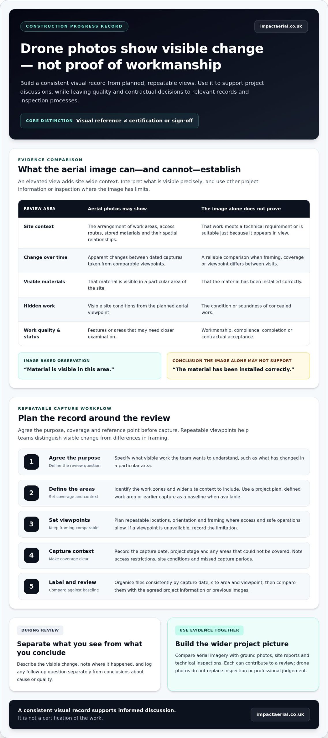
Traditional ground-level photography often fails because it’s limited by physical obstructions like hedges, walls, or steep topography. These perspectives are inherently subjective and can be easily contested in court. By contrast, aerial imagery offers an objective view that captures the entire site context in a single frame. This shift from anecdotal claims to objective data is vital for property law. As a CAA GVC Certified operator, Impact Aerial ensures that all data is captured following strict safety and regulatory standards, providing a level of professional credibility that ground-based snapshots cannot match.

To better understand the technical power of these visuals, watch this helpful video:

Common Types of Disputes Solved by Aerial Imagery

Boundary line disagreements involving fences, walls, and encroaching structures are the most frequent applications for our professional services. We use high-resolution sensors to overlay current site conditions onto Land Registry title plans. In Right of Way and Access cases, drones are used to identify historical usage patterns or physical obstructions that aren’t visible from the road. For planning application appeals, aerial views demonstrate the site context and the exact distances between neighbouring properties, often proving that a proposed development won’t be as intrusive as objectors claim.

Why Visual Evidence is Essential for the Planning Inspectorate

The Planning Inspectorate relies on clarity to make informed decisions. Aerial views simplify complex site layouts for planning officers, allowing them to see the relationship between buildings and the wider landscape. Our use of 4K HDR imagery is particularly effective for “overlooking” and “overshadowing” claims; the high dynamic range ensures details in shadows are visible, providing a fair assessment of light impact. Additionally, we use drones to document the “commencement of works.” This provides a timestamped, visual record that protects planning permissions from expiring, offering our clients added peace of mind during long-term projects.

Using drone photography for planning disputes ensures that your evidence is rooted in technical fact rather than personal opinion. This methodical approach to data-gathering is what separates a professional survey from a casual photograph.

While the technical requirements of drone surveys are specific to planning, the value of hiring a professional photographer translates to all fields, including personal milestones. For readers who may also be looking for high-end family portraiture in the Sydney area, you can visit Moments In Bloom Photography to explore their newborn and maternity sessions.

Technical Precision: Moving from Photos to Measurable Aerial Data

Planning inspectors and local authorities require more than just a visual overview. They need evidence that is quantifiable. Professional drone photography for planning disputes bridges the gap between anecdotal claims and hard data. By utilizing 4K HDR sensors, we capture imagery with enough clarity to identify minute details like historic boundary markers, survey pegs, or specific vegetation types from a height of 30 metres. Every pixel in these files contains embedded metadata, including the exact GPS coordinates and the precise altitude of the drone at the moment of capture.

This metadata creates a verifiable ‘point in time’ record that is difficult to challenge in a legal setting. To ensure these operations remain compliant and the data remains admissible in an appeal, all flights must strictly follow UK drone regulations as defined by the Civil Aviation Authority. Adhering to these standards ensures that the evidence is gathered safely and legally, providing necessary peace of mind for developers and legal counsel during a high-stakes dispute.

Photogrammetry and 3D Site Modelling

Photogrammetry is the technical process of making measurements from photographs. By capturing hundreds of overlapping images from various angles, we create digital twins of a site. These 3D models allow developers to simulate proposed structures within a real-world context, proving exactly how a new build affects the light or scale of neighbouring properties. High-density point clouds are a core component of professional drone surveying, offering a level of spatial accuracy that traditional ground-based photography simply cannot replicate.

Orthomosaic Mapping for Boundary Accuracy

Standard aerial shots often suffer from perspective distortion where objects further from the centre appear tilted. Orthomosaic mapping solves this by stitching hundreds of images into a single, top-down (nadir) view that is geometrically corrected. The result is a map where the scale is uniform across the entire image, allowing for centimetre-accurate measurements. We can overlay these maps directly onto HM Land Registry titles to identify discrepancies in boundary lines. If a dispute involves a claim of adverse possession or a change in land use over a 10-year period, comparing current orthomosaics with archival data provides a clear, chronological narrative for the inspector. If you need to establish a definitive record of your site, you can book a technical consultation with our specialist team to discuss your requirements.

Drones vs. Traditional Methods: Why Aerial Evidence Wins

Traditional evidence collection often relies on ground-level photography or expensive physical infrastructure. In complex planning appeals, these methods frequently fail to provide the clarity required by the Planning Inspectorate. Utilizing drone photography for planning disputes offers a more rigorous, data-driven alternative that addresses the limitations of human-scale observation. It’s a shift from subjective snapshots to objective, technical data-gathering.

  • Cost-efficiency: Traditional scaffolding for a standard two-storey commercial property can exceed £900 just for the initial setup and hire. A professional drone deployment provides superior visual data for a fraction of that investment, with no fixed infrastructure required.
  • Rapid Deployment: We can often mobilise and capture site conditions within a 24-hour window. This speed is vital when capturing evidence before site conditions change or before a local authority conducts a site visit.
  • Safety and Access: Our CAA GVC Certified pilots safely access hazardous rooflines, fragile structures, or boggy terrain that would be inaccessible to land surveyors. We don’t need to put personnel at risk to get the perfect shot.
  • Contextual Clarity: A single flight captures the entire site boundary, its topography, and its relationship to neighbouring infrastructure in one cohesive dataset.

Ground-Level vs. Aerial Perspectives

Ground-level photos often suffer from perspective distortion. They make distances look shorter or longer depending on the lens focal length. This is a common point of contention in disputes regarding “overlooking” or “loss of light.” A bird’s-eye view eliminates these ambiguities. It provides a geometrically accurate representation of the relationship between multiple properties. We capture angles that are physically impossible to reach from the ground, ensuring no “blind spots” exist in your appeal documentation. This perspective allows planners to see exactly how a proposed development sits within the wider landscape.

Historical Archives vs. Real-Time Data

Planning enforcement cases often hinge on proving how land was used over a specific period, such as the 4-year or 10-year rules. Combining historical satellite imagery with modern, high-resolution drone photography creates a powerful, chronological timeline of evidence. Our 4K HDR sensors provide real-time verification of current site status, which is essential for active enforcement cases. This meticulous approach gives our clients the technical data needed to challenge inaccurate assertions from local authorities. For added peace of mind, all our professional services are backed by specialist commercial liability insurance, ensuring every flight is compliant and protected.

How to Prepare Drone Evidence for a Planning Appeal

High-quality evidence for a planning appeal isn’t a result of luck. It requires a methodical approach that starts long before the drone leaves the ground. You must first consult with a qualified planning professional to identify the specific angles of proof required for your case. This strategic alignment ensures that the drone photography for planning disputes targets the exact points of contention, such as precise ridge heights, sightlines, or the perceived massing of a proposed structure. By developing a flight plan that addresses these technical requirements, you create a visual narrative that is difficult for opposing parties to refute.

Ensuring Legal Admissibility

Hobbyist footage is frequently dismissed in formal planning hearings or court proceedings because it lacks the necessary technical rigour. To ensure your data is accepted, you must hire a CAA-certified pilot who can provide verifiable metadata and GPS coordinates for every frame captured. This technical data forms a clear chain of custody, proving the authenticity of the digital evidence. The Planning Inspectorate requires assurance that images haven’t been manipulated or misrepresented. Professional operators use high-resolution sensors and precision flight logs to provide this peace of mind, ensuring the evidence stands up to intense scrutiny.

Addressing Privacy and Data Protection

Privacy is a critical hurdle in any aerial survey. You must navigate the complexities of GDPR and Article 8 of the Human Rights Act, which protects an individual’s right to respect for their private and family life. Professional pilots manage these concerns by conducting thorough pre-flight risk assessments and implementing neighbour notification protocols where necessary. Holding a valid drone license and GVC certification is a legal requirement for this type of commercial work. It demonstrates that the operator is trained to handle sensitive data and understands the legalities of overflight rules in congested areas.

Once the footage is captured, the post-production phase must be handled with extreme care. Any annotations, such as height markers or boundary lines, should be applied as overlays. You must never alter the original pixel data of the raw files, as this can lead to claims of evidence tampering. The final evidence package should be submitted to the local authority or the Planning Inspectorate as a structured, professional report. This package usually includes high-resolution stills, 4K video clips, and a signed statement of truth from the certified pilot. This level of professionalism transforms a simple photo into a powerful legal instrument.

To secure the professional aerial evidence you need for your next appeal, contact the experts at Impact Aerial today.

Why Impact Aerial is the Trusted Choice for Planning Evidence

Impact Aerial provides the technical precision required for high-stakes legal appeals. We utilise commercial-grade DJI Enterprise hardware to capture data with sub-centimetre accuracy. This level of detail is vital when drone photography for planning disputes must stand up to scrutiny in a public inquiry or court setting. Our pilots hold the CAA GVC (General Visual Line of Sight Certificate) qualification, ensuring every flight adheres to the latest UK Specific Category regulations. This certification demonstrates our commitment to staying current with Civil Aviation Authority standards and safety protocols.

For added peace of mind, we maintain £5m commercial liability insurance as standard. This level of coverage is essential for sites involving complex commercial infrastructure or high-density residential developments. We don’t just provide raw footage; we deliver a comprehensive service. This includes initial feasibility consultations and the production of expert witness reports that translate aerial data into persuasive evidence. Our meticulous approach ensures that every pixel of data gathered serves a specific purpose in your planning strategy.

  • High-resolution 4K and HDR imaging for maximum clarity.
  • CAA GVC Certified pilots with extensive operational experience.
  • Full compliance with UK drone laws and privacy regulations.
  • Expert witness reporting tailored for legal professionals.

Our Birmingham and UK-Wide Reach

Based in Birmingham, we provide rapid deployment across the West Midlands and the wider UK. Our team regularly collaborates with architects, solicitors, and developers to resolve boundary disagreements or height restriction challenges. In a 2024 case involving a commercial property dispute, our high-resolution orthomosaic maps provided the definitive proof needed to settle a long-standing access rights issue. We understand the local planning nuances within the West Midlands, making us a strategic partner for regional projects. Our ability to mobilise quickly means we can capture site conditions before they change, preserving vital evidence for your case.

Get a Professional Consultation Today

Every planning appeal is unique. We tailor our flight paths and data-gathering techniques to your specific legal requirements. Our post-production team provides detailed annotation services, highlighting key site features or proposed changes with absolute clarity. This professional approach ensures your evidence is presented in a format that planning inspectors can easily interpret. You can rely on our drone services to deliver the quality your case demands. Precision is not optional in legal disputes; it’s the foundation of a successful appeal. Contact Impact Aerial to secure your drone evidence and strengthen your position with authoritative aerial data.

Leverage Precision Data to Strengthen Your Planning Appeal

Winning a planning appeal requires more than subjective claims; it demands indisputable, measurable evidence. By transitioning from traditional ground-level photography to advanced aerial data, you provide the Planning Inspectorate with a clear, birds-eye perspective that ground-based methods simply can’t replicate. Professional drone photography for planning disputes transforms complex boundary or impact arguments into high-resolution visual facts that are difficult to contest.

Technical accuracy and legal compliance are critical when your project’s future is at stake. Impact Aerial utilizes a 4K HDR DJI Enterprise fleet to capture every site detail with meticulous precision. For added peace of mind, all operations are conducted by CAA GVC Certified Pilots and are fully protected by £5m commercial liability insurance. This professional rigor ensures that every piece of evidence we provide is credible, compliant, and ready for use in formal UK legal proceedings. Don’t leave your appeal to chance when you can present the most authoritative view of your site.

Secure Professional Aerial Evidence for Your Dispute – Contact Impact Aerial

We’re ready to help you build a stronger, data-driven case today.

Frequently Asked Questions

Is drone photography legally admissible in UK courts for boundary disputes?

Yes, drone photography is legally admissible in UK courts and tribunals provided the data meets Civil Procedure Rules Part 35 requirements for expert evidence. High-quality aerial imagery provides an objective, bird’s-eye view that clarifies property lines more effectively than ground-level photos. To ensure the evidence holds up in a planning appeal, it’s essential that the data-gathering process is documented by a professional who can verify the time, date, and GPS coordinates of every shot.

How much does drone photography for a planning dispute cost?

Professional drone photography for planning disputes typically ranges from £300 to £1,500 depending on the project’s complexity and the required deliverables. A basic site survey might sit at the lower end, while detailed photogrammetry or orthomosaic mapping for large developments requires more flight time and data processing. For added peace of mind, these costs often include pre-flight risk assessments and the provision of a full safety report alongside the high-resolution imagery.

Do I need my neighbor’s permission to fly a drone for evidence?

You don’t generally need a neighbor’s permission to fly a drone for evidence as long as the pilot complies with CAA GVC or A2 CofC regulations and UK privacy laws. Under the Data Protection Act 2018, we focus on capturing the disputed land while minimizing the collection of private data from surrounding properties. Our pilots use professional-grade equipment to zoom into specific boundary details from a legal distance, ensuring the survey remains compliant and respectful of privacy rights.

What is the difference between a standard photo and an orthomosaic map?

A standard photo captures a single perspective with inherent lens distortion, whereas an orthomosaic map is a top-down, geometrically corrected image created from hundreds of overlapping photos. We use advanced photogrammetry software to stitch these images together, resulting in a map that’s accurate to within 3 centimeters. This provides a measurable, high-quality record of the site that planners can use to verify distances and land use with absolute precision.

Can drones prove a ‘Right of Way’ has been used for 20 years?

While a drone flight today only captures current conditions, the high-resolution imagery can reveal physical evidence of long-term use, such as established track marks or worn paths. By comparing our modern drone photography for planning disputes with historical satellite data or older aerial surveys, legal teams can build a chronological case for a 20-year Right of Way claim. This visual evidence often proves more compelling to a Planning Inspector than verbal testimony alone.

What happens if the weather is bad on the day of the survey?

If weather conditions like high winds over 20mph or heavy rain make flying unsafe, we’ll reschedule the survey for the next available clear day. Safety is our primary concern, and our CAA-certified pilots constantly monitor meteorological data to ensure we don’t risk the equipment or the quality of your evidence. We don’t charge extra for weather-related delays, ensuring you receive the high-quality, clear imagery required for your planning appeal without additional financial risk.

How quickly can I receive the aerial evidence after the flight?

You’ll typically receive raw high-resolution images within 24 hours of the flight completion. More complex data sets, such as 3D models or orthomosaic maps, usually require 3 to 5 working days for processing and quality checks. This rapid turnaround ensures that your legal team has the necessary evidence to meet strict planning appeal deadlines, providing a significant advantage in time-sensitive disputes.

Why should I hire a CAA-certified pilot instead of using my own drone?

Hiring a CAA-certified pilot is essential because evidence gathered by an unlicensed operator may be dismissed in court and likely lacks valid commercial liability insurance. Our pilots hold the GVC (General Visual Line of Sight Certificate), which allows us to operate professionally in more complex environments. For added peace of mind, we provide a full audit trail of the flight, ensuring the data is gathered safely, legally, and to a standard that planning authorities trust.

Professional Drone Inspection Services in Liverpool: Expert Aerial Surveys

Why are you still committing thousands of pounds to scaffolding and risking personnel at height when a 20-minute flight can capture superior data with zero physical risk? You likely recognise that traditional surveying in a dense urban environment like Liverpool is a logistical nightmare. Between the strict Flight Restriction Zones (FRZ) surrounding Liverpool John Lennon Airport and the meticulous requirements for local council permissions, the barriers to entry often feel insurmountable. It’s a common frustration for site managers who need fast results without the red tape.

Our professional drone inspection services liverpool are designed to eliminate these hurdles. We provide the technical precision of 4K and thermal data while ensuring absolute regulatory compliance for your peace of mind. As CAA GVC Certified operators, we handle the complex paperwork and safety protocols required for Liverpool’s unique maritime and urban airspace. This article outlines how our expert aerial surveys reduce typical survey times by 60% and provides a clear roadmap for obtaining high-resolution data in even the most restricted zones.

Key Takeaways

  • Discover how 4K HDR and thermal sensor technology provide precision data for structural integrity checks across Liverpool’s unique maritime and urban landscape.
  • Learn why professional drone inspection services liverpool offer a safer, more efficient alternative to traditional access, potentially reducing survey costs by up to 70%.
  • Understand the critical regulatory requirements for city centre operations, including navigating the Liverpool John Lennon Airport Flight Restriction Zone (FRZ).
  • Explore how CAA GVC certification and £5m commercial liability insurance provide essential peace of mind for complex construction and property projects.
  • Identify the strategic advantages of using non-intrusive UAV surveys for meticulous asset management, from historic docks to modern high-rise developments.

What are Drone Inspection Services in Liverpool and Why are They Essential?

Professional drone inspections represent a non-intrusive, highly efficient method for modern asset management. In a city like Liverpool, where the architectural landscape is a complex mix of 18th-century maritime history and 21st-century urban regeneration, traditional maintenance checks often prove difficult. An Unmanned Aerial Vehicle (UAV) allows for rapid data collection at heights that would otherwise require weeks of planning. By utilising professional drone inspection services liverpool property managers can secure high-resolution visual data without the logistical burden of street closures or heavy machinery.

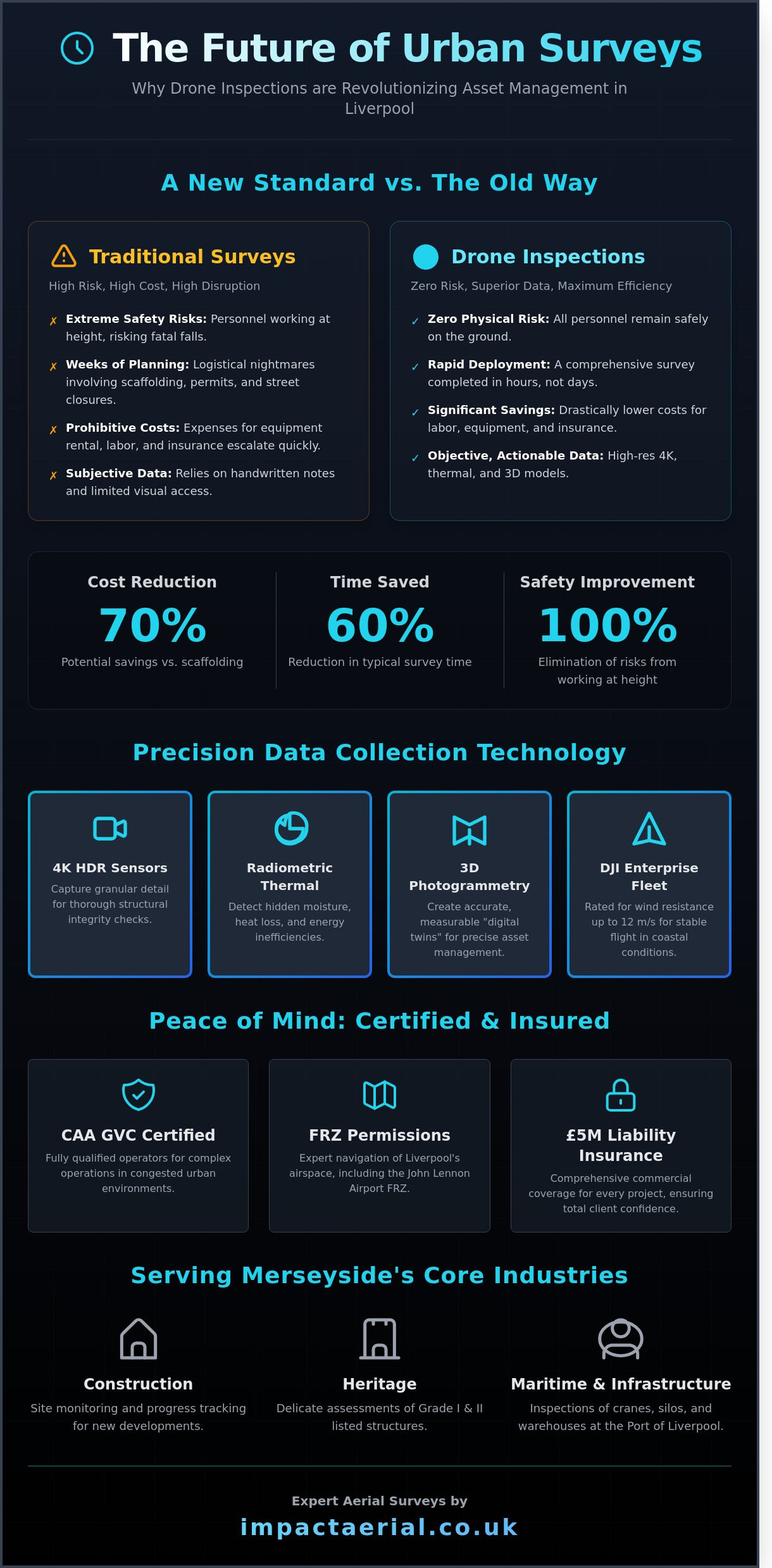
Impact Aerial adopts a meticulous, safety-first approach to every project. Our fleet includes DJI Enterprise commercial drones equipped with 4K High Dynamic Range (HDR) sensors, ensuring that every drone survey captures the granular detail required for technical reports. For Merseyside surveyors, these aerial methods have become the primary choice over scaffolding, which is often slow and restrictive. A drone can typically complete a comprehensive roof survey in under 3 hours; a task that usually takes days to coordinate manually.

To better understand how these aerial surveys work in practice, watch this detailed demonstration of a professional roof inspection:

The Shift from Manual to Digital Inspections

The transition to digital inspections has replaced subjective hand-written notes with objective 4K HDR imagery and precise digital twins. This technology creates a repeatable record of an asset’s condition over time. Safety remains the most significant benefit. According to the Health and Safety Executive (HSE) 2023 summary, falls from height remain the leading cause of workplace fatalities in the UK. Drone inspection services liverpool businesses employ eliminate this risk profile by keeping personnel safely on the ground while the UAV handles the dangerous work at elevation.

Core Industries Served in Merseyside

Our aerial services are tailored to the specific demands of the Liverpool economy. We provide essential support for several key sectors:

  • Construction: We offer site monitoring and progress tracking for new developments in the Baltic Triangle and the city centre.
  • Heritage: We conduct delicate assessments on Liverpool’s Grade I and II listed structures, where preserving the building’s fabric is a priority.
  • Maritime and Infrastructure: Our teams perform detailed inspections along the Port of Liverpool, focusing on cranes, silos, and large-scale warehouse roofing.

Every operation we conduct is backed by our CAA GVC certification and comprehensive commercial liability insurance. This provides our clients with the peace of mind that their inspections are being handled by qualified experts who understand the unique regulatory requirements of flying in a busy metropolitan environment.

Precision Data Collection: The Technology Behind the Survey

To deliver the highest standard of drone inspection services liverpool, we utilise a fleet of DJI Enterprise commercial drones. These aircraft are specifically engineered for stability and performance in challenging coastal environments. The Mersey’s waterfront presents unique wind conditions that often ground consumer-grade equipment. Our DJI M300 RTK systems are rated for wind resistance up to 12 metres per second, ensuring we deliver reliable data regardless of the local microclimate. Our fleet carries 4K High Dynamic Range (HDR) cameras for visual clarity and radiometric thermal sensors for deep structural analysis.

We use photogrammetry to process hundreds of high-resolution aerial images into accurate, measurable 3D models. This technology allows site managers to take precise measurements and conduct volumetric analysis from their desks. For added peace of mind, all data is handled through secure protocols. Professional post-production ensures that final survey reports meet the rigorous standards expected by industry stakeholders and adhere to the latest UK drone regulations. We provide a meticulous audit trail for every flight, ensuring technical compliance and data integrity.

Thermal Surveys for Energy Efficiency

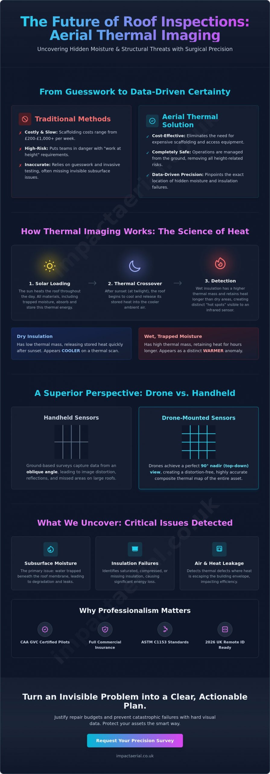
Our radiometric thermal sensors identify heat loss in commercial properties, providing a clear map of insulation failures or water ingress. In the renewable sector, we conduct PV Solar Farm inspections to detect cell defects that are invisible to the naked eye. These sensors capture temperature data for every pixel, allowing us to pinpoint anomalies with a precision of plus or minus 2 degrees Celsius. Thermal photogrammetry serves as a vital tool for preventative maintenance by identifying potential failures before they result in system downtime.

Structural and Asset Inspections

Drones provide safe access to high-risk areas like industrial chimneys, church steeples, and 5G cell towers without the need for expensive scaffolding or cherry pickers. We capture never-before-seen angles that reveal snagging issues in new builds or hidden wear in heritage structures. High-resolution video and 45-megapixel stills provide the empirical evidence required for insurance and dilapidation claims. These detailed visual records often reduce inspection costs by 60% compared to traditional manual methods. If you require a detailed look at your assets, you can book a professional survey to secure high-quality data for your next project.

Comparing Drone Surveys vs. Traditional Access Methods

Traditional access methods like scaffolding often create more logistical problems than they solve for Liverpool property managers. When you opt for drone inspection services liverpool, the financial shift is immediate. Industry data suggests that UAV-based surveys typically offer a 60% to 70% cost saving compared to erecting scaffolding or using mobile elevating work platforms (MEWPs). This saving stems from the removal of heavy plant hire and the massive reduction in onsite labour hours. While a scaffolding crew might spend two days setting up for a roof inspection, a CAA GVC certified pilot can complete the same task in under three hours.

Safety remains the most compelling reason for the transition. By keeping boots on the ground, companies eliminate the risks associated with the Work at Height Regulations 2005. There are numerous industries benefiting from drone inspections because they remove personnel from hazardous zones, such as fragile roofs or high-rise facades. Beyond safety, the data depth is incomparable. Instead of a few handheld photos from a ladder, a professional drone survey provides:

  • High-resolution 4K imagery of every structural element.
  • Thermal data to identify hidden heat loss or moisture ingress.
  • Thousands of geo-tagged data points for millimetre-accurate defect tracking.

Scaffolding and Cradles: The Hidden Costs

Erecting scaffolding in Liverpool city centre requires expensive pavement licences and permits from the local authority, which can cost hundreds of pounds before work even starts. Beyond the rental fees, fixed structures present significant security risks; they essentially provide a staircase for unauthorised access to upper floors. Drones offer a stealthier, non-invasive alternative. They don’t block shop fronts or obstruct pedestrian traffic on busy streets like Bold Street, ensuring business continuity remains uninterrupted during the process.

Environmental and Speed Advantages

Using electric UAVs significantly lowers the carbon footprint of a structural survey. There’s no need for heavy diesel lorries to transport tonnes of metal tubing to the site. Speed is another critical factor, especially after the heavy storms that frequently batter the Merseyside coastline. A survey drone can be deployed within minutes of arriving on-site, providing rapid situational awareness that traditional methods cannot match. For large-scale Merseyside industrial sites, this efficiency is often the difference between a proactive repair and a catastrophic failure. Our drone inspection services liverpool ensure that even the most complex structures are assessed with total precision and zero downtime.

Operating drone inspection services liverpool involves navigating one of the most regulated airspaces in the North West. Success depends on more than just high-quality hardware; it requires a disciplined approach to legal compliance. Liverpool’s geography, featuring a major international airport and a dense urban centre, means that professional operators must manage multiple layers of permission before a drone even leaves the ground. For added peace of mind, we handle every aspect of this bureaucratic process to ensure your project remains on the right side of the law.

Restricted Zones and Local Coordination

The Liverpool John Lennon Airport Flight Restriction Zone (FRZ) is a primary consideration for any survey in the south of the city. This zone typically extends in a 2-2.5 nautical mile radius from the airfield, and we coordinate directly with Air Traffic Control (ATC) to secure flight windows that don’t disrupt commercial aviation. When projects move into the city centre, our team liaises with the Liverpool Film Office to manage operations near iconic landmarks like the Royal Liver Building or the Pier Head.

Certain sites require even higher levels of scrutiny. Flying near HMP Liverpool or critical infrastructure at the Port of Liverpool necessitates a “Non-Standard Flight” (NSF) authorisation. We handle this technical application through NATS, usually requiring a minimum of 21 days’ notice for approval. If a survey requires drones to hover over public highways, we work with Merseyside Police and local authorities to coordinate necessary road closures. This ensures the safety of the public while we capture the high-resolution data your project requires.

The Importance of Certified Pilots

It’s a common misconception that any drone owner can provide commercial data. Hobbyists lack the legal authority and the specialist insurance required for professional drone inspection services liverpool. Our pilots hold the CAA GVC (General Visual Line of Sight Certificate), which is the industry standard for complex urban operations. We’ve proactively managed the transition from the PfCO to ensure our clients remain compliant with all current UK regulations.

Staying ahead of the curve is essential, especially with the upcoming changes to the UK drone license framework in 2026. These regulations focus heavily on “privacy by design,” a principle we already integrate into our workflow. We use advanced post-processing to redact sensitive information, ensuring that while we gather high-quality structural data, we don’t infringe on the privacy of Liverpool residents. This meticulous attention to detail, backed by our £10 million commercial liability insurance, provides the reliability that only a certified, professional operator can offer.

Consult with our CAA-certified specialists to ensure your next Liverpool survey is fully compliant and safe.

The Impact Aerial Advantage for Your Liverpool Project

Impact Aerial delivers a streamlined, end-to-end management process for every asset survey we undertake. Our approach to drone inspection services liverpool starts with a detailed consultation to identify the specific data points required by your stakeholders. We manage the entire project lifecycle, including airspace permissions, local authority notifications, and the final delivery of high-resolution datasets. Our team possesses deep local expertise regarding the unique environmental and architectural challenges of the North West. We understand the complexities of operating near the Mersey and within the high-density urban corridors of the city centre.

For added peace of mind, Impact Aerial maintains £5m in commercial liability insurance. This level of cover is a cornerstone of our professional identity and ensures that our clients, from private developers to municipal bodies, are fully protected during every flight. We provide customised reporting that bridges the gap between raw aerial imagery and actionable engineering data. Whether you require thermal mapping, 3D point clouds, or high-definition orthomosaics, we deliver files in formats that integrate directly into the workflows of surveyors and architects.

Safety-First Operational Culture

Safety is the foundation of our reputation in this niche but increasingly diverse market. Every flight in Liverpool is preceded by a rigorous, site-specific risk assessment that accounts for local obstacles, weather patterns, and pedestrian traffic. We utilise the latest DJI Enterprise fleet, which offers redundant systems and superior stability in the challenging wind conditions often found across Merseyside. Our operational protocols are designed to be exhaustive; we implement safety cordons and real-time telemetry monitoring that exceed standard CAA requirements to ensure the highest levels of site security.

Start Your Aerial Inspection Today

Securing a bespoke quote for your Merseyside asset is a straightforward process. During our initial consultation, we match the specific capabilities of our drone fleet to your data requirements, ensuring you don’t pay for unnecessary sensors while getting exactly the detail you need. We provide clear timelines and transparent pricing for projects of all scales, from single-building roof checks to large-scale infrastructure surveys. Contact Impact Aerial to learn how we provide professional drone services for clients across the UK who demand precision, safety, and technical excellence.

  • Initial Consultation: Defining your specific data and resolution needs.
  • Pre-Flight Planning: Handling all CAA compliance and local risk assessments.
  • Data Delivery: Providing high-quality, survey-grade results in your preferred format.

Elevate Your Liverpool Asset Management Strategy

Choosing professional drone inspection services liverpool ensures your project benefits from meticulous data gathering without the safety risks or high costs of traditional access methods. Our team uses the latest DJI Enterprise fleet to capture 4K HDR imagery. This technology provides a level of detail that manual inspections simply can’t achieve. We handle the technical complexities of Liverpool’s urban flight restriction zones, ensuring every survey is fully compliant with current UK regulations. For added peace of mind, our operations are led by CAA GVC Certified pilots and backed by £5m commercial liability insurance. This professional framework guarantees that your site remains safe while you receive leading-quality photogrammetry and structural reports. It’s time to replace expensive scaffolding with efficient, tech-driven aerial surveys that deliver results in a fraction of the time. We look forward to providing the precision your site requires.

Request a Professional Drone Inspection Quote for Your Liverpool Site

Frequently Asked Questions

Do I need a permit for a drone inspection in Liverpool city centre?

Yes, operating in Liverpool city centre requires specific permissions from the Civil Aviation Authority (CAA) and often coordination with Liverpool City Council for land access. As CAA GVC certified pilots, we manage the necessary risk assessments and flight notifications on your behalf. For added peace of mind, we handle all applications to ensure compliance with CAP 722 safety guidelines for congested urban environments.

How much does a drone roof survey cost in Liverpool?

The cost of a drone roof survey depends on the scale of the building and the complexity of the local airspace, so we provide bespoke quotes after a site assessment. While we don’t offer a flat rate, industry data from the Drone Safe Register indicates that drone inspections can reduce traditional scaffolding costs by up to 70%. We provide transparent pricing based on the specific data-gathering requirements of your property.

Can drones fly near Liverpool John Lennon Airport?

It’s possible to fly near Liverpool John Lennon Airport, provided we obtain a Flight Restriction Zone (FRZ) waiver from the airport’s Air Traffic Control. Our team coordinates directly with technical staff at the airport to secure the necessary clearance for your project. This process ensures our drone inspection services liverpool remain fully compliant with aviation law while operating within the airport’s 5-kilometre protected radius.

What resolution are the images provided in a drone inspection?

We provide ultra-high-definition imagery using 4K High Dynamic Range (HDR) sensors and 20-megapixel or 45-megapixel cameras. These professional systems capture granular detail, allowing you to zoom in on specific defects like hairline cracks or loose masonry. The resulting data-gathering provides a level of precision that far exceeds what’s possible with traditional ground-based photography or handheld binoculars.

How long does a typical drone survey take to complete?

A typical on-site drone survey takes between 1 and 4 hours to complete, depending on the size and complexity of the structure. A standard commercial unit usually requires about 45 minutes of actual flight time to capture all necessary angles. This efficiency is a core benefit of our drone inspection services liverpool, as it allows for rapid data collection without the lengthy setup times associated with scaffolding.

What happens if the weather is bad on the day of the survey?

If weather conditions like high winds exceeding 20mph or heavy rain occur, we’ll reschedule the survey to the next available clear day at no extra cost. Safety is our primary concern, and our DJI Enterprise drones require stable conditions to capture the highest quality data. We monitor Met Office forecasts 48 hours in advance to keep you informed of any potential changes to the flight schedule.

Is drone surveying legal for RICS-accredited reports?

Yes, drone surveys are fully legal and widely accepted as a primary data source for RICS-accredited reports and professional building surveys. The high-resolution imagery we provide allows Chartered Surveyors to make informed assessments without physically accessing a dangerous roof. Using professional aerial data ensures your reports are backed by objective, verifiable evidence that meets the rigorous standards of the Royal Institution of Chartered Surveyors.

Does a drone inspection require me to close my business?

No, you don’t need to close your business or halt operations while we conduct an aerial inspection. Unlike traditional methods that might block entrances with heavy machinery, our drones operate from a small, designated take-off zone that stays clear of your customers. For added peace of mind, we work around your schedule to ensure minimal disruption, often completing the work during quiet periods or before your peak trading times.