
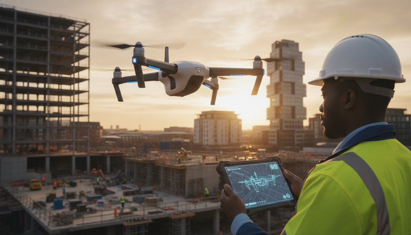
In 2026, relying on traditional scaffolding for a routine visual check isn’t just an operational delay; it’s a financial liability that modern project managers can no longer justify. Professional aerial site inspections have evolved into a critical digital foundation for UK construction compliance, replacing manual errors with high-fidelity data. You’ve likely felt the frustration of mounting health and safety ‘red tape’ just to give stakeholders a glimpse of progress, or the sting of inconsistent monitoring that leads to costly rework.
We understand that maintaining total transparency while managing on-site risk is a delicate balance. This guide will show you how to enhance safety and reduce costs by integrating drone technology into your workflow. We’ll preview the latest 2026 regulatory requirements, from mandatory UK class markings to Remote ID compliance, ensuring your projects remain both efficient and fully insured. By the end, you’ll know how to turn raw aerial footage into a remote management tool that provides psychological comfort and tangible business results.
Key Takeaways
- Professional aerial site inspections provide a cost-effective alternative to traditional scaffolding, offering high-fidelity data while significantly reducing on-site safety risks.
- Understand the technical transition from simple photography to advanced photogrammetry, enabling the creation of measurable 3D digital twins for remote project management.
- Navigate the 2026 UK regulatory landscape, including mandatory UK class markings, Remote ID requirements, and the necessity of CAA GVC certification for commercial operations.
- Learn how to achieve total transparency for stakeholders through consistent, error-free site monitoring that eliminates manual data collection inaccuracies.
- Discover how specialist drone solutions can decrease onboarding incidents by up to 80% through meticulous site documentation and a safety-conscious approach to data.
Understanding Aerial Site Inspections: The Modern Standard for Site Intelligence
Aerial site inspections represent the systematic collection of visual and geospatial data using Unmanned Aerial Vehicles (UAVs). This process has transitioned from a niche service to a fundamental requirement for UK construction and property management. Unlike traditional methods that rely on manual observation, an Aerial survey provides a high-fidelity record that serves as the primary intelligence source for a project’s lifecycle. It’s no longer just about taking photos; it’s about capturing a comprehensive dataset that informs every stage of development.
Core stakeholders now view these inspections as indispensable. Project Managers use the data to verify progress against schedules, while HSE Officers rely on the footage to conduct risk assessments without exposing staff to height-related hazards. Investors and remote stakeholders gain total transparency, allowing them to monitor their assets from any location without the costs associated with frequent site travel.
To see the level of detail and efficiency achievable with modern drone hardware, watch this demonstration of a professional roof inspection:
The Core Components of an Industrial-Grade Inspection
An industrial-grade inspection isn’t just about resolution; it’s about the synthesis of different data types. 4K HDR visual data provides the meticulous structural detail required for identifying wear or defects in high-value assets. Geospatial accuracy adds another layer, providing the topographical context necessary for site planning and earthworks calculations. For more specialized needs, such as PV solar farm surveys, thermal sensors identify electrical faults or heat loss that the naked eye simply cannot detect. This multi-layered approach ensures that aerial site inspections deliver more than just a view; they deliver actionable intelligence.
Why Remote Site Management is Essential in 2026
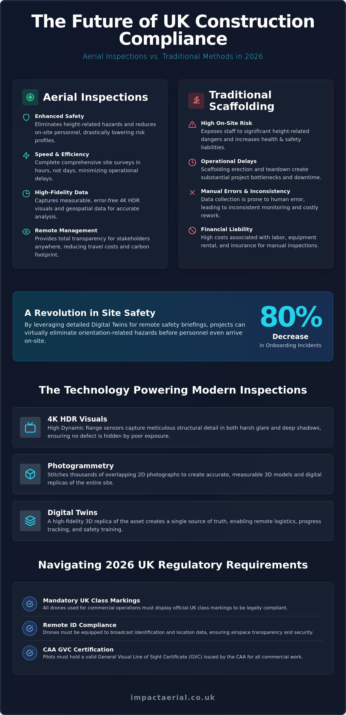
Remote site management has moved from a luxury to a necessity. It overcomes the logistical hurdles of site access and reduces the carbon footprint of project oversight. The rise of the ‘Digital Twin’ has created a single source of truth for all parties involved. By providing a high-fidelity 3D replica of the site, teams can manage everything from logistics to safety training remotely. Impact Aerial’s internal data indicates that this approach can lead to an 80% decrease in onboarding incidents, as personnel can be fully briefed on site hazards before they ever step foot on the ground. This reduction in on-site presence directly lowers the overall project risk profile.
The Technical Ecosystem: 4K HDR, Photogrammetry, and Digital Twins
Professional aerial site inspections rely on industrial-grade hardware that maintains stability in unpredictable UK environments. We utilize DJI Enterprise drones because they provide the mechanical reliability and precision optics necessary for high-stakes surveys. A critical component of this setup is 4K HDR capability. High Dynamic Range (HDR) allows the sensor to capture structural detail in both the harsh glare of a metal roof and the deep shadows of a facade, ensuring that no defect is hidden by poor exposure. This technical precision is what separates a professional survey from a standard photography flight.
The transformation of these images into actionable data occurs through photogrammetry. This process involves stitching thousands of overlapping 2D photographs to create accurate, measurable 3D models. To ensure total site intelligence, we often integrate this aerial data with ground-based 360 photography. This creates a seamless transition from the exterior envelope to the interior spaces, providing a level of continuity that traditional photography can’t match. It’s a comprehensive approach that ensures stakeholders have a complete view of their assets without blind spots.
From Raw Data to Actionable Insights
The workflow is divided into three meticulous phases. First, the Capture phase uses pre-planned, automated flight paths to guarantee 100% site coverage without gaps. Second, the Processing phase utilizes photogrammetry software to generate high-density 3D point clouds and orthomosaic maps. Finally, the Interpretation phase allows your technical team to analyze the site for structural anomalies or schedule deviations from the safety of the office. If you’re looking to combine technical precision with high-end output, our aerial filming drone services deliver the visual fidelity required for both engineering analysis and stakeholder updates.
Building the Digital Twin
Digital twin technology transforms aerial site inspections from a one-off event into a persistent digital asset. This virtual replica acts as a single source of truth throughout a project’s lifecycle. Beyond simple monitoring, digital twins are increasingly used for immersive HSE inductions, where site workers can familiarize themselves with hazards in a safe, virtual environment before arriving on-site. These outputs are designed for direct integration with industry-standard BIM and CAD software, allowing architects and site managers to overlay current conditions against original design models to detect clashes early and prevent costly rework.
Aerial vs. Manual Inspections: A Comparison of Safety, Speed, and Data Accuracy
Traditional methods of site review often involve significant logistical hurdles and inherent risks. When comparing manual processes to aerial site inspections, the primary differentiator is the immediate removal of personnel from high-risk environments. Instead of sending engineers onto fragile roofs or up telecommunication towers, a UAV captures the necessary data from a safe distance. This shift doesn’t just protect staff; it simplifies the entire health and safety planning process, reducing the volume of risk assessments and method statements required for basic site access.
The speed advantage is equally compelling. A manual team might take several days to survey a multi-hectare site on foot, navigating obstacles and recording measurements by hand. In contrast, a professional drone can cover the same area in a matter of hours. This efficiency ensures minimal disruption to active construction sites. There’s no need to pause heavy machinery or clear specific zones for personnel access, allowing the project to maintain its momentum while data is collected in the background.
The ROI of Drone-Led Data Collection
The financial benefits extend beyond the initial cost of equipment or service fees. By identifying structural discrepancies or site errors early in a 3D model, project managers can avoid the rework that often plagues large-scale developments. Improved risk mitigation also has the potential to lower insurance premiums, as underwriters increasingly recognize the safety benefits of drone technology. The return on investment for a professional drone survey is primarily realized through the massive reduction in man-hours required for site mapping, often condensing a week-long manual survey into a single afternoon of flight.
Addressing Common Misconceptions
A frequent question regarding aerial site inspections is whether the data matches the accuracy of a physical tape measure. With modern RTK (Real-Time Kinematic) positioning, drones achieve sub-centimetre precision, providing a level of geospatial accuracy that manual methods struggle to replicate consistently. Another common myth is that drones are only viable for massive infrastructure projects. In reality, the cost-efficiency of a drone survey makes it highly effective for smaller commercial roof inspections where the alternative is expensive scaffolding or cherry pickers.
While weather limitations like high winds or heavy rain can impact flight schedules, professional pilots use advanced meteorological monitoring to manage these environmental risks. They don’t just fly; they strategically plan operations around weather windows to ensure data quality and operational safety. This meticulous planning ensures that even in the unpredictable UK climate, drone-led inspections remain a reliable and consistent tool for modern site management.
Navigating UK Compliance: Safety Standards and Regulatory Requirements
Operating professional aerial site inspections in the UK requires more than just a capable drone; it demands a robust framework of legal compliance and meticulous risk management. As of January 2026, the regulatory environment has become more stringent to ensure public safety and airspace integrity. Every commercial operation must be led by a pilot holding a CAA General Visual Line of Sight Certificate (GVC). This qualification is the industry standard for complex site work, ensuring the operator understands the technicalities of the specific UK class markings (UK0 to UK6) and the mandatory Remote ID broadcasts now required for most enterprise-grade aircraft. For organisations seeking to validate these compliance frameworks, International Associates Limited provides the independent assessment and assurance services necessary to maintain high operational standards.
Safety-conscious project managers must also verify that their service provider carries EC 785/2004 compliant insurance. While this is the legal baseline, high-value construction sites and infrastructure projects often necessitate significantly higher coverage to mitigate potential financial exposure. We maintain £5m commercial liability insurance to provide stakeholders with absolute reassurance when operating near expensive assets or in congested urban environments. Every project begins with a comprehensive pre-flight risk assessment, a mandatory step for professional drone services to identify potential hazards such as overhead power lines, restricted airspace, or nearby public gatherings.
Why Certification is Non-Negotiable
Hiring a ‘hobbyist’ pilot for commercial site inspections is a significant legal liability for any business. Certification through the CAA ensures that a pilot is professionally trained in emergency procedures, airspace management, and meteorological analysis. Without a valid drone license and the appropriate Operational Authorisation, any data collected might be inadmissible for official insurance or planning reports. This professional vetting is what guarantees the reliability of the high-fidelity data and the physical safety of everyone on site.
Site Preparation and Red Tape Management
Managing the administrative side of an inspection involves careful planning around GDPR and privacy concerns. Professional operators use specific protocols to ensure that any peripheral data, such as images of the public or neighbouring properties, is handled according to UK data protection laws. Before the drone team arrives, site managers should ensure that all relevant stakeholders are informed and that any necessary permissions for restricted or urban areas have been secured. A standard checklist includes verifying that take-off and landing zones are clear and ensuring the flight path doesn’t interfere with other active site operations. For a compliant and expertly managed survey, book a consultation with our specialist drone team.
Optimising Your Project with Impact Aerial’s Specialist Drone Solutions
Impact Aerial operates as a technical consultant rather than a standard service provider, delivering a structured “Consultation to Post-Production” model. Centrally based in Birmingham and serving the entire UK, we provide the meticulous data collection required for high-stakes aerial site inspections. Our approach ensures that every flight is underpinned by CAA GVC certified pilots and DJI Enterprise hardware, providing the precision necessary for modern construction and property management. We don’t just capture footage; we provide a comprehensive digital foundation that empowers your team to make informed, data-driven decisions.
A key differentiator in our service is the implementation of digital twin technology. Internal data shows that our clients experience an 80% decrease in onboarding incidents when using these high-fidelity virtual replicas for site inductions. By allowing personnel to familiarise themselves with site hazards in a controlled, digital environment, we significantly lower the risk profile of active projects. Whether you require an aerial filming drone for stakeholder presentations or complex geospatial data for engineering, our full-service model covers every stage of the process.
Specialised Inspections: From Roofs to Solar Farms
Our expertise spans multiple sectors, with tailored solutions for specific industrial challenges. For PV Solar Farms, we conduct thermal surveys to identify defective cells and maximize return on investment. In the construction sector, our site monitoring services provide real-time progress tracking and volume calculations that keep projects on schedule. For commercial property managers, we deliver comprehensive structural assessments that identify defects in hard-to-reach areas, eliminating the need for costly and disruptive scaffolding. These specialised aerial site inspections are designed to provide total transparency and psychological comfort to investors and HSE officers alike.
Getting Started with Your Aerial Inspection
The process begins with a tailored consultation to understand the unique complexity of your site. We evaluate airspace restrictions, structural challenges, and data requirements to provide a precise quote. During the initial project brief, we define the specific outputs you need, whether that involves raw 4K footage, 3D point clouds, or orthomosaic maps. Once the data is captured and processed, we deliver it in formats ready for immediate use. You can access your site data through cloud-based platforms for remote management or integrate it directly into existing BIM and CAD software workflows. This methodical delivery ensures that the insights we provide are immediately actionable for your technical team.
Future-Proofing Your Site Intelligence for 2026 and Beyond
In 2026, the transition from manual data collection to automated, high-fidelity site documentation is no longer optional for competitive construction and property projects. By integrating aerial site inspections into your workflow, you replace high-risk manual processes with sub-centimetre precision and persistent digital twins. This approach doesn’t just satisfy the latest CAA GVC certification standards; it provides a comprehensive source of truth for every stakeholder involved, from project managers to investors.
Impact Aerial is centrally based in Birmingham, providing UK-wide coverage with a safety-first culture. Our pilots are fully CAA GVC certified, and our operations are backed by £5m commercial liability insurance, ensuring your project remains compliant and protected. Whether you’re managing a complex construction build or a large-scale PV solar farm, we provide the technical expertise to turn raw aerial data into actionable business intelligence that reduces rework and enhances site safety.
Request a Professional Site Inspection Quote from Impact Aerial today and take the first step toward a safer, more transparent site management strategy. We look forward to helping you optimize your next project with precision and reliability.
Frequently Asked Questions
Are aerial site inspections legal for commercial projects in the UK?
Yes, aerial site inspections are fully legal for commercial use provided the operator holds a valid General Visual Line of Sight Certificate (GVC) from the Civil Aviation Authority (CAA). In 2026, compliance also requires adherence to specific UK class markings and Remote ID broadcast regulations. Hiring a certified specialist ensures that your project data is legally admissible for insurance and planning purposes while meeting all national safety standards.
How much does a professional drone site inspection cost?
The cost of a professional inspection varies based on the site’s scale, its location, and the specific data outputs you require. Factors such as the need for thermal sensors, high-density 3D mapping, or multi-day monitoring for construction progress will influence the final investment. Because every project has unique technical challenges, it’s best to request a tailored quote to ensure your structural or geospatial requirements are accurately priced.
What level of accuracy can I expect from a drone survey?
You can expect sub-centimetre precision when using enterprise-grade drones equipped with Real-Time Kinematic (RTK) positioning technology. This high level of accuracy is consistent across the entire site, making the data ideal for earthworks calculations and structural facade measurements. Such precision allows your technical team to overlay current site conditions against original CAD or BIM design models to identify discrepancies early in the build process.
How long does it take to complete an aerial inspection of a standard construction site?
A standard construction site survey typically takes between two and four hours of flight time to complete. This is a massive reduction in time compared to manual methods, which often require several days of on-site work. Larger infrastructure projects or multi-hectare sites might require a full day of operations, but the speed of data acquisition remains one of the primary advantages of using drone technology for site intelligence.
Do I need to clear the site or stop work during the drone flight?
No, you don’t need to stop work or clear the site in most cases. Professional pilots plan automated flight paths that minimize disruption to active machinery and personnel. Because the drone operates from a safe altitude, construction activities can continue as normal. This allows for consistent progress monitoring without the logistical downtime or “red tape” associated with traditional manual inspections or scaffolding installations.
What happens if the weather is poor on the day of the inspection?
If weather conditions such as high winds or heavy rain exceed safe operational limits, the inspection will be rescheduled for the next available window. Professional pilots use advanced meteorological tools to monitor local conditions in real-time before and during the flight. We prioritize the safety of your assets and our equipment, ensuring that data is only captured when environmental conditions allow for high-fidelity visual and thermal output.
What kind of files and data will I receive after the inspection is complete?
You’ll receive a comprehensive suite of digital assets tailored to your project’s specific needs. Common deliverables include high-resolution 4K HDR video, orthomosaic maps, and 3D point clouds. These files are typically provided in industry-standard formats compatible with BIM, CAD, and GIS software. This ensures that your technical team can integrate the aerial data directly into existing management workflows for immediate analysis and reporting.
Can drone inspections help with my HSE and safety compliance?
Yes, aerial site inspections are a powerful tool for enhancing HSE and safety compliance on any project. By removing personnel from high-risk environments like fragile rooftops or tall structures, you directly reduce the likelihood of on-site accidents. Additionally, using digital twins for site inductions has been shown to decrease onboarding incidents by 80%, providing a safer and more transparent environment for all workers and subcontractors.
 2 Norton Drive, Wythall, Birmingham, B47 6HH Company registration number: 11138586. VAT Number: 366 9068 55


