
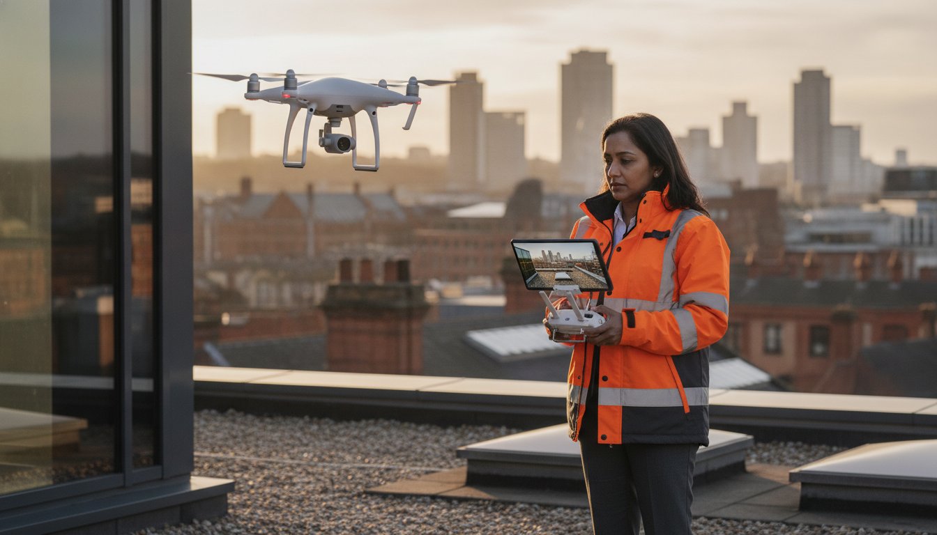
Traditional scaffolding and manual roof inspections aren’t just expensive; they’re often an unnecessary safety liability for your Manchester project. You’re likely familiar with the frustration of long lead times and the mounting costs of manual access, all while worrying about the inherent risks of sending personnel into high-risk areas. Choosing a professional drone survey manchester allows you to bypass these logistical hurdles entirely. By utilizing enterprise-grade technology, we provide a faster, safer, and more cost-effective alternative to traditional inspection methods.
This article explains how our CAA GVC certified pilots deliver high-precision 4K HDR data while maintaining strict adherence to the latest 2026 aviation standards. You’ll learn how we manage the technicalities of Manchester’s airspace, including the new 100g Flyer ID requirements and specific Flight Restriction Zones like the one surrounding HMP Manchester. We’ll preview the tangible benefits of enterprise-grade hardware, showing you how to achieve superior inspection results and significant cost savings without the risks of traditional manual methods.
Key Takeaways
- Discover how a professional drone survey manchester eliminates the high costs and long lead times associated with traditional scaffolding and manual roof inspections.
- Understand the technical difference between standard aerial photos and high-precision 4K HDR data captured using DJI Enterprise hardware for commercial-grade results.
- Learn about the specialized applications for aerial data, ranging from detailed chimney inspections on heritage buildings to construction site progress monitoring.
- Gain insight into navigating Manchester’s complex airspace, including mandatory compliance with Flight Restriction Zones around Manchester Airport and HMP Manchester.
- See why working with CAA GVC certified pilots and maintaining £5m commercial liability insurance is essential for mitigating risk in dense urban environments.
The Growing Demand for Drone Surveys in Manchester
Drone surveying is a high-precision data collection method that utilizes an Unmanned Aerial Vehicle (UAV) to capture structural information from perspectives that were previously inaccessible. In a city like Manchester, where urban regeneration is transforming the skyline with complex high-rise developments, the need for rapid and accurate property assessments has never been higher. A professional drone survey manchester provides a technical solution that bypasses the logistical bottlenecks of traditional surveying, offering a digital-first approach to property management across the North West.
Commercial landlords and developers are increasingly moving away from manual inspections. The density of Manchester’s city center means that deploying heavy machinery or extensive scaffolding often requires complex permits and road closures. By contrast, a drone can be deployed in a fraction of the time, capturing granular detail without disrupting the surrounding environment. This shift toward technological integration ensures that property maintenance keeps pace with the city’s rapid growth.
To better understand this concept, watch this helpful video:
Why Manchester Businesses are Switching to UAV Inspections
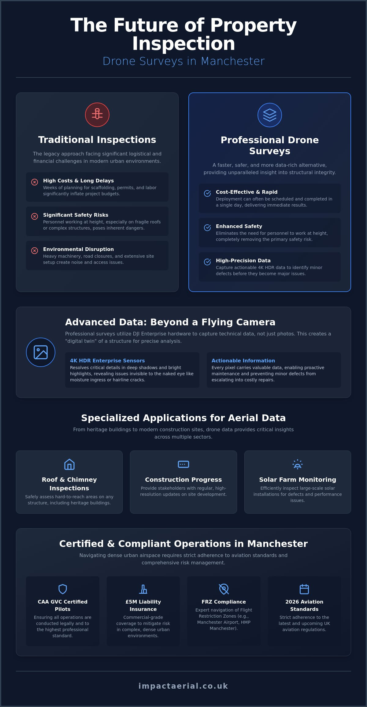
The primary driver for this shift is the speed of deployment. Traditional surveyor access often involves weeks of planning and lead times for equipment hire. A drone survey manchester can often be scheduled and completed in a single day, providing immediate results. This efficiency doesn’t come at the cost of quality. Our use of DJI Enterprise hardware ensures that clients receive high-resolution 4K HDR data, allowing for a level of structural analysis that manual eyes simply can’t match from the ground. It’s a method that significantly reduces health and safety risks, as it eliminates the need for personnel to work at height on fragile roofs or chimneys.
Traditional vs. Drone Surveying: A Cost Comparison
When evaluating the financial impact, the comparison between traditional methods and UAV inspections is stark. Traditional scaffolding can take days to erect and dismantle, involving significant labor costs and insurance premiums. Drones remove these variables from the equation. By utilizing DJI Enterprise sensors, we capture survey-grade data with extreme precision. For commercial landlords, the ROI of drone surveys is found in the ability to identify minor structural defects before they escalate into expensive, long-term repairs. This proactive maintenance strategy ensures that assets remain compliant and structurally sound without the exorbitant overheads of legacy inspection techniques.
Advanced Data Collection: Beyond Standard Aerial Photography
Drones are often misunderstood as mere flying cameras. For a professional drone survey, the focus shifts from aesthetic shots to technical data acquisition. We utilize DJI Enterprise hardware specifically designed for commercial-grade output, ensuring every pixel carries actionable information for stakeholders. This data-centric approach is vital for Manchester’s construction sector, where precision isn’t optional. It’s about capturing a digital twin of a structure that architects and engineers can use for reliable analysis.
When conducting a drone survey manchester, the quality of the raw data determines the utility of the final report. Unlike consumer drones, enterprise-grade sensors provide the dynamic range and resolution required to identify hairline cracks or moisture ingress that would be invisible to the naked eye. This level of detail is a prerequisite for professional property management and long-term asset protection.
The Role of 4K HDR and Enterprise Sensors
High Dynamic Range (HDR) technology is essential when inspecting Manchester’s dense urban architecture. It allows our sensors to resolve details in deep shadows, such as under eaves or within complex roof structures, which standard cameras would lose to black-crushing. Alongside this, our hardware features advanced optical zoom. This allows pilots to maintain a safe stand-off distance while capturing granular detail of masonry or joints. Operating within UK drone flight restrictions requires this technical balance of safety and sensor power. Architects and building engineers rely on this clarity to make informed structural decisions without the need for physical samples.
From Raw Data to Post-Production Excellence
Raw footage is only the beginning of our methodical workflow. Our technical consultants process this data into various formats, ensuring it integrates seamlessly into client reports or Building Information Modelling (BIM) software. For developers looking to showcase progress or engage investors, we offer professional virtual tour creation. These immersive experiences allow remote stakeholders to walk through a site as if they were there in person. Whether you need a drone survey manchester for technical analysis or marketing-grade visuals, the quality of the post-production determines the final value. We ensure the transition from flight to data delivery is structured and efficient. If you’re planning a complex project, you can view our full range of commercial services to see how we handle technical data delivery.
Key Applications: From Roof Inspections to Solar Farm Monitoring
The versatility of aerial technology allows us to address diverse structural challenges across the Greater Manchester region. While many providers offer basic photography, a professional drone survey manchester involves specialized flight paths and sensor configurations tailored to specific assets. This includes everything from the intricate masonry of Victorian heritage sites to the sprawling infrastructure of modern industrial estates. By deploying UAVs, we capture data that would otherwise require weeks of manual labor and high-risk access equipment.
Infrastructure management also benefits from these technical advancements. Assessing the integrity of bridges, communication towers, and industrial chimneys requires a level of precision that traditional methods often lack. Recent developments in Advanced data collection for inspections have highlighted how drone-captured data can be analyzed to detect subtle structural shifts, ensuring public safety and extending the lifespan of critical Manchester assets.
Commercial Property and Roof Inspections
One of the most critical applications in the current market is the identification of structural defects in commercial roofing. We help landlords and facility managers identify issues such as RAAC (Reinforced Autoclaved Aerated Concrete) panels, which require meticulous monitoring to prevent failure. A drone roof survey provides a non-invasive way to inspect these materials alongside more common problems like moisture ingress and gutter blockages. This is particularly valuable for Manchester’s historic and listed buildings, where traditional access methods could potentially damage fragile facades or decorative stonework.
Specialized PV Solar Farm Thermal Surveys
As the North West transitions toward renewable energy, the maintenance of large-scale solar installations has become a priority. Our PV solar farm thermal surveys utilize high-resolution radiometric sensors to identify cell defects, bypass diode failures, and string issues that are invisible to the naked eye. These hotspots don’t just reduce efficiency; they can lead to fire risks if left unaddressed. By automating data collection over several acres, we provide developers with a comprehensive health map of their assets. This proactive approach ensures that drone survey manchester services directly contribute to maximizing the ROI of renewable energy investments through precise, actionable maintenance reports.
Navigating Manchester’s Complex Airspace and Flight Restrictions
Operating a drone in a major metropolitan area requires an advanced understanding of aviation law. Manchester’s airspace is a patchwork of controlled zones and restricted areas that demand constant monitoring. While much of the city center is technically outside the primary Manchester Airport Flight Restriction Zone (FRZ), the environment remains highly sensitive. Proximity to HMP Manchester (Strangeways) and the active corridors for Barton Aerodrome means that any professional drone survey manchester must be preceded by rigorous airspace checking and notification.
Meticulous Planning for Urban Drone Flights
City center projects involve more than just launching a UAV. Tall buildings like the Deansgate Square towers create complex signal interference and localized turbulence that can catch inexperienced pilots off guard. Our pre-flight workflow includes detailed risk assessments and site surveys to identify these physical and electronic hazards. We also maintain open lines of communication with Greater Manchester Police and Manchester City Council. This coordination ensures that all stakeholders are aware of our operations, preventing unnecessary interruptions and maintaining the highest standards of urban flight safety.
Legal Requirements for Commercial Drone Operators
The regulatory framework for drones has evolved significantly, moving from the old PfCO system to the current CAA GVC standards. This transition ensures that pilots operating in congested areas possess the technical knowledge required for complex maneuvers. It’s now a legal necessity for operators to hold a valid Operator ID, and as of January 1, 2026, a Flyer ID is mandatory for any drone weighing 100 grams or more. These regulations are in place to ensure accountability across the industry.
Hiring a pilot who is CAA GVC certified is the only way to guarantee that your survey is conducted legally within the “Specific Category.” This certification allows us to operate at the reduced separation distances often required in dense Manchester streets. To ensure your project remains fully compliant with the latest aviation laws, you should consult with our certified aerial specialists before commencing any site work.
Why Impact Aerial is Manchester’s Trusted Drone Partner
Selecting a provider for a professional drone survey manchester requires more than just technical skill; it requires a partner that understands the high-stakes nature of commercial operations. We operate as technical consultants, managing every phase of the project from the initial airspace feasibility study through to the final post-production delivery. While our operations have a national reach, our specific expertise in the North West allows us to navigate local planning nuances and urban environmental challenges with surgical precision. This end-to-end project management ensures that complex data collection remains seamless for our clients.
Our reputation is built on a foundation of reliability and authoritative knowledge. We don’t just capture imagery; we provide a comprehensive data service that supports informed decision-making for developers, architects, and facility managers. By choosing a specialist with a proven track record in Manchester’s rapidly evolving skyline, you ensure your project is handled by professionals who prioritize technical accuracy and regulatory adherence above all else.
Safety, Compliance, and Risk Mitigation
Our operations are built on a foundation of meticulous risk management. For every Manchester flight, we implement strict safety protocols that exceed standard regulatory requirements. This commitment to security is backed by our commercial drone insurance, which provides £5m in liability coverage. This level of protection is essential for commercial clients who need absolute peace of mind when working in dense urban corridors or near high-value assets. We provide transparent reporting and maintain rigorous data security standards, ensuring that your structural information is handled with the highest level of professional discretion.
Expert Consultation for Your Manchester Project
We provide tailored solutions for property management, construction site monitoring, and the renewable energy sector. Whether you need a detailed structural analysis of a city-centre heritage building or a comprehensive thermal map of a PV solar farm, our team delivers data that’s ready for immediate integration into your workflow. If you’re planning an upcoming project and need to understand the specific logistics and aerial filming prices uk, our consultants can provide a detailed breakdown of costs and operational requirements. Impact Aerial remains Manchester’s premier choice for those who value technical excellence, regulatory compliance, and a safety-first approach to aerial data collection.
Elevate Your Structural Inspections with Precision Data
Digital-first property management is no longer a luxury for Manchester’s developers and landlords; it’s a technical necessity. By replacing slow, hazardous manual access with a professional drone survey manchester, you gain immediate access to survey-grade 4K HDR data that traditional methods simply can’t provide. Navigating complex Flight Restriction Zones and adhering to current CAA regulations requires a specialist approach to ensure both legal compliance and operational safety across the city’s evolving skyline.
Our team brings the reassurance of CAA GVC Certified Pilots and £5m Commercial Liability Insurance to every project. Utilizing industry-leading DJI Enterprise 4K HDR equipment, we deliver granular structural insights while mitigating the risks inherent in dense urban environments. This combination of high-end hardware and meticulous planning ensures your data is accurate, actionable, and fully compliant with the latest aviation standards.
Book your Manchester drone survey with Impact Aerial today to streamline your next inspection and reduce your operational overheads. We look forward to providing the expert aerial perspective your project requires.
Frequently Asked Questions
Do I need special permission for a drone survey in Manchester city centre?
Yes, conducting a drone survey manchester city centre requires meticulous planning and coordination with local authorities. While the city centre is largely outside airport Flight Restriction Zones, its density and proximity to sensitive sites like HMP Manchester demand formal notification. We manage all necessary communications with Manchester City Council and Greater Manchester Police to ensure every flight is fully authorised and safe for the public.
How much does a professional drone survey cost in Manchester?
The cost of a professional drone survey is determined by the specific requirements of your project, including site size and the complexity of the data needed. Factors such as the duration of flight operations, the use of specialised thermal sensors, and the depth of post-production reporting all influence the final quote. We provide tailored estimates after a technical consultation to ensure the service meets your exact structural or monitoring needs.
What is the difference between a standard drone photo and a drone survey?
A standard drone photo is a simple visual record, whereas a drone survey is a methodical data collection process designed for structural analysis. Surveys utilise enterprise-grade sensors to capture high-precision, actionable information that architects and engineers can rely on. This technical approach often involves 4K HDR videography and radiometric data, providing a much higher level of granular detail than a basic aerial photograph.
Can drones fly near Manchester Airport for inspections?
Drones can operate within the Manchester Airport Flight Restriction Zone (FRZ), but only with explicit permission from National Air Traffic Services (NATS) and Air Traffic Control. Our GVC certified pilots are experienced in securing these legal clearances. The process involves a formal application and strict adherence to specific flight windows, ensuring that our technical inspections never interfere with manned aviation or airport safety protocols.
What data formats will I receive after a drone survey?
Clients receive their data in industry-standard formats that are ready for immediate integration into professional workflows. This typically includes high-resolution JPEGs and 4K HDR MP4 files for visual property inspections. For more technical applications, we provide data compatible with Building Information Modelling (BIM) software, including 3D mesh models and radiometric thermal files specifically processed for PV solar farm analysis and structural reports.
How long does it take to complete an aerial roof inspection?
A typical drone survey manchester for a commercial roof is often completed within one to four hours on-site. This speed is a significant advantage over traditional scaffolding, which can take days to install. The UAV can quickly navigate hard-to-reach areas such as high-level gutters and internal valleys, capturing a comprehensive data set in a single visit without disrupting the building’s daily operations.
What happens if the weather is bad on the day of the flight?
Safety is our absolute priority, so we don’t operate in high winds or heavy precipitation that exceeds our hardware’s technical limits. If the meteorological conditions are unsuitable, we simply reschedule the flight for the next available safe window. Our pilots monitor local weather data in real-time and maintain constant communication with clients to ensure that all data is captured under optimal conditions for clarity.
Is Impact Aerial insured for flights over public areas in Manchester?
Yes, we maintain £5m in commercial liability insurance specifically tailored for professional drone operations in congested urban environments. This high level of coverage is a prerequisite for working over public areas and near high-value commercial assets in Manchester. It provides our clients with essential peace of mind and ensures our operations meet the rigorous procurement standards required by corporate and local government stakeholders.
 2 Norton Drive, Wythall, Birmingham, B47 6HH Company registration number: 11138586. VAT Number: 366 9068 55


