
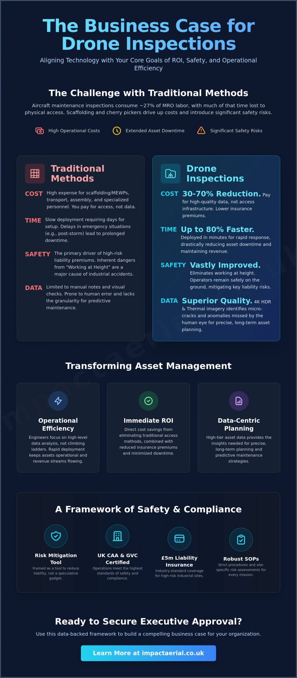
Did you know that aircraft maintenance inspections account for approximately 27% of total MRO labor hours, with a significant portion of that time spent simply on physical access? When you’re tasked with getting buy-in for a drone inspection program, the challenge isn’t proving the technology works; it’s proving that it makes business sense. You already know the high costs of scaffolding and cherry pickers are eating into your margins. You’re also well aware of the liability and safety risks that come with every manual survey conducted at height.
This article provides a comprehensive framework for securing executive approval by aligning drone technology with your organization’s core goals of ROI, safety, and operational efficiency. We’ll guide you through building a professional business case that prioritizes regulatory compliance and risk mitigation while highlighting the potential for a 30% to 70% reduction in inspection costs. We will examine how transitioning to a data-centric approach can reduce downtime and provide the high-tier asset data required for precise long-term planning.
Key Takeaways
- Quantify the financial advantages of aerial surveys over traditional scaffolding and cherry pickers to build a data-backed case for immediate ROI.
- Master the strategic process of getting buy-in for a drone inspection program by tailoring your business case to the specific priorities of Finance and Health & Safety stakeholders.
- Navigate the complex landscape of UK CAA regulations and GVC certifications to ensure your proposed operations meet the highest standards of safety and compliance.
- Evaluate the long-term benefits of managed services versus in-house programs to determine the most cost-effective way to scale your aerial data capabilities.
- Develop a robust Proof of Concept strategy that uses high-impact, low-risk projects to demonstrate measurable improvements in safety and operational efficiency.
Quantifying ROI: Drone Inspections vs. Traditional Methods
The transition from traditional access methods to aerial solutions is primarily a financial decision. For many facility managers, the process of getting buy-in for a drone inspection program begins with a clear-eyed look at the ledger. Traditional methods like scaffolding or cherry pickers aren’t just expensive; they’re logistically heavy. They require transport, assembly, and specialized personnel before a single bolt is even inspected. By contrast, an unmanned aerial vehicle (UAV) can be deployed in minutes, capturing comprehensive data without the need for extensive site preparation.
To better understand this concept, watch this helpful video:
The Cost of Access vs. The Cost of Data
In the UK, the daily hire rates for mobile elevating work platforms (MEWPs) and the logistical overhead of erecting scaffolding often dwarf the actual cost of the survey itself. When you use drones, you’re paying for high-quality data rather than the infrastructure required to reach it. Industry data suggests that drone-based inspections can reduce overall costs by 30% to 70% compared to these legacy methods. A single flight can replace several days of manual labor, significantly lowering the man-hours required on-site. This shift also impacts your insurance profile. By reducing the frequency of personnel working at height, you mitigate the primary driver of high-risk liability premiums.
Intangible Benefits: Speed and Safety
Speed is a critical factor in asset management. After a severe storm, waiting days for a scaffolding crew to arrive isn’t an option. Drones provide a rapid response capability that keeps assets operational. For example, in the aviation sector, drone-based inspections have been shown to reduce inspection time by 80%. This isn’t just about saving time; it’s about reducing downtime and maintaining revenue streams. It’s a faster, more reliable way to handle emergency surveys.
The quality of the output provides long-term planning value that manual notes cannot match. 4K HDR imagery and thermal data allow engineers to identify structural micro-cracks or thermal anomalies that the human eye might miss. Instead of skilled engineers spending their day climbing ladders, they can focus on high-level data analysis from the safety of the ground. In this framework, we define ROI as the sum of direct cost savings and significant risk reduction. This dual benefit makes getting buy-in for a drone inspection program a straightforward case of operational common sense.
Overcoming the Safety and Compliance Hurdle
For many executive boards, the primary hesitation surrounding aerial technology isn’t the cost, but the perceived liability. To succeed in getting buy-in for a drone inspection program, you must frame the technology as a sophisticated risk-mitigation tool rather than a speculative gadget. Professional drone operations are built on a foundation of strict Standard Operating Procedures (SOPs) that often exceed the safety requirements of traditional manual inspections. This begins with robust insurance; carrying £5m in commercial liability coverage is the industry standard for high-risk industrial sites, providing the financial reassurance that legal and finance departments require.
Safety managers are frequently the strongest allies in this transition. By moving personnel away from hazardous environments, you directly address the “Working at Height” risks that lead to a significant portion of industrial accidents. A meticulous approach to safety, supported by comprehensive site-specific risk assessments and flight planning, ensures that every mission is conducted with precision. This level of professional oversight is a critical component of building a business case for drone technology that satisfies both internal safety audits and external regulatory bodies.
Understanding UK Drone Regulations
The UK regulatory landscape for drones has undergone significant changes, moving away from the old PfCO towards more specific certifications. Working with CAA GVC certified pilots is now essential for any commercial program. The General Visual Line of Sight Certificate (GVC) demonstrates a pilot’s competence in handling complex missions in industrial environments. These certifications, alongside the A2 Certificate of Competency (A2 CofC), ensure that the operator understands the legal framework and airspace restrictions necessary to maintain a compliant operation. Without these credentials, getting buy-in for a drone inspection program becomes nearly impossible, as the legal risks would outweigh the operational benefits.
The Safety Business Case
Drones are an essential asset for companies pursuing “Zero Harm” corporate initiatives. While manual surveys require personnel to navigate fragile roofs or rely on complex scaffolding, drone surveys allow for high-resolution data capture from a safe distance. This eliminates the need for dangerous manual roof inspections and significantly reduces the potential for workplace injuries. Beyond immediate safety, these digital surveys create a permanent, timestamped audit trail. This historical record is invaluable for health and safety managers during compliance audits or insurance reviews. If your organization is ready to enhance its safety protocols, exploring our professional drone survey capabilities can provide the technical foundation you need for a successful transition.
Mapping Your Stakeholders: Who Needs to Say ‘Yes’?
Securing the necessary approval for a new technology initiative is rarely a solo endeavor. When getting buy-in for a drone inspection program, you must recognize that different departments view value through very different lenses. A successful business case addresses the specific anxieties and KPIs of each internal stakeholder group. By aligning the technical capabilities of aerial surveys with the strategic objectives of finance, safety, and operations, you transform a technical proposal into an essential corporate strategy.
Success depends on building a coalition of support across these four key pillars:
- The Finance Director: They look for long-term cost-avoidance and a clear path to ROI.
- The Health & Safety Manager: Their priority is the measurable reduction of Working at Height risks and the creation of robust audit trails.
- The Operations Manager: They value asset uptime and the ability to conduct surveys without halting production.
- The IT/Data Manager: They require assurance regarding data security, cybersecurity protocols, and how drone-collected data integrates with existing Building Information Modeling (BIM) systems.
Addressing the CFO’s Financial Concerns
Your Chief Financial Officer is primarily concerned with the bottom line. To win them over, present the program as a cost-avoidance strategy rather than a new expense. Highlight how shifting from a CAPEX-heavy in-house program to an OPEX-based managed service reduces initial investment and maintenance costs. Using current aerial filming prices UK as a benchmark allows for accurate budgeting and demonstrates that the service is a scalable, professional solution. Emphasize that the 30% to 70% cost reduction mentioned earlier isn’t just a projection; it’s a direct result of eliminating the logistical heavy-lifting associated with traditional access equipment.
Winning Over the H&S Department
The Health and Safety department needs to know that this technology won’t introduce new liabilities. You should demonstrate how aerial operations fit seamlessly into existing Method Statements and Risk Assessments. Drones provide repeatable, objective data that is invaluable for safety audits, as it removes the subjective nature of manual inspections. Address potential privacy concerns early by outlining your GDPR-compliant data handling processes. When safety managers see that drone surveys support Zero Harm initiatives by keeping boots on the ground, they often become the strongest advocates for getting buy-in for a drone inspection program.
Operations and IT teams also play a vital role. Operations managers are often swayed by the fact that aircraft maintenance inspections, which typically account for 27% of MRO labor hours, can see an 80% reduction in time when using drones. For IT managers, the focus should be on how high-resolution data is stored and integrated. Providing a clear roadmap for data flow ensures that the high-end output doesn’t become a digital silo, but instead enriches the entire asset management ecosystem.
Building a Proof of Concept (PoC) Strategy
The most effective way of getting buy-in for a drone inspection program is through a structured Proof of Concept (PoC). While the theoretical benefits of aerial data are clear, senior leadership often requires tangible evidence from their own assets before committing to a full-scale rollout. A PoC bridges the gap between technical potential and operational reality. It allows you to test the technology in a controlled environment, identify potential friction points, and gather the data necessary to validate your business case. By starting small, you reduce initial risk while creating a repeatable model for success.
Selecting Your First Inspection Site
Choosing the right location for your pilot is a strategic decision. You should identify a high-impact, low-risk project where the advantages are immediately obvious. A drone roof survey is frequently the best starting point for industrial facilities. Roofs are inherently difficult and dangerous to access, making the safety and speed improvements of a drone mission undeniable. This “low hanging fruit” approach ensures that the contrast between old and new methods is as sharp as possible.
The criteria for a successful PoC site should include easy ground access for the pilot, clear objectives, and a known historical baseline for comparison. If you choose a site with recurring maintenance issues, the drone’s ability to provide high-resolution imagery will be even more striking. Setting clear expectations for the initial data output ensures that stakeholders aren’t just looking at aerial photographs, but are instead reviewing actionable engineering data that supports long-term planning.
Measuring Success and ROI
To turn a pilot project into a permanent program, you must define clear KPIs. Track the specific man-hours saved during the setup and execution phases compared to previous manual surveys. Use 4K HDR imagery to highlight defects that manual inspections might have missed, such as hairline cracks in masonry or blocked drainage systems that aren’t visible from a ladder. This empirical evidence provides the reassurance that finance and operations departments require to move forward.
Documenting the entire process is vital for creating a compelling visual report for the board. A successful PoC acts as the ultimate internal sales tool, providing a concrete demonstration of how the technology solves specific departmental pain points. When the board sees side-by-side comparisons of traditional manual notes versus a comprehensive digital survey, the decision to scale becomes a matter of logic. If you’re ready to launch your pilot project, our team can help you design a professional drone inspection strategy that delivers measurable results from day one.
Partnering for Success: Managed Services vs. In-House
Deciding between an in-house team and a managed service provider is the final strategic hurdle in getting buy-in for a drone inspection program. While the idea of total internal control is often appealing to stakeholders, the hidden costs of a self-managed fleet can quickly undermine the projected ROI. Beyond the initial purchase of hardware, an in-house program requires continuous investment in pilot training, CAA licensing renewals, and specialized insurance. Hardware in this sector depreciates rapidly; a significant CAPEX investment today could be technologically obsolete within 24 to 36 months.
Partnering with professional drone services transforms these unpredictable costs into a fixed, scalable OPEX model. This approach grants your organization immediate access to high-end technology, such as DJI Enterprise drones equipped with thermal and RTK sensors, without the burden of ownership. As your program grows, managed services allow you to scale operations across multiple UK sites without the need to hire and train additional internal staff or manage complex equipment maintenance schedules.
The Case for Professional Managed Services
Professional providers bring more than just equipment; they provide a layer of regulatory security and technical precision. Expert pilots manage all CAA flight permissions and site-specific risk assessments, ensuring every mission is fully compliant with current aviation standards. This meticulousness extends to post-production and data analysis. Instead of receiving raw footage, your stakeholders receive structured, high-tier data that integrates directly into your existing asset management systems. This consistency is vital for maintaining professional quality standards across a national portfolio of industrial assets.
Making the Final Recommendation
When presenting your final business case to the executive board, focus on the transition from high-risk manual labor to a risk-mitigated, data-centric strategy. Summarize the key drivers: a 30% to 70% reduction in inspection costs, an 80% improvement in turnaround times, and the elimination of primary “Working at Height” hazards. By proposing a managed service model, you simplify the process of getting buy-in for a drone inspection program by demonstrating a commitment to fiscal responsibility and operational excellence.
The evidence is clear; drone technology is no longer a future prospect but a current necessity for competitive asset management. If you’re ready to secure approval and begin your transition to aerial data, Contact Impact Aerial to discuss your drone inspection program today. Our team will provide the technical expertise and regulatory reassurance needed to ensure your program’s success from the very first flight.
Securing the Future of Asset Management
Shifting your organization toward aerial data is a fundamental move toward safer, more efficient operations. You’ve seen how quantifying ROI and mapping departmental needs can dismantle internal resistance. By starting with a focused Proof of Concept, you provide the board with the empirical evidence they need to approve a wider rollout. This strategic approach ensures that every stakeholder, from Finance to Health and Safety, understands the tangible benefits of digital transformation.
The process of getting buy-in for a drone inspection program is simplified when you prioritize professional standards and risk mitigation. Partnering with experts allows you to skip the logistical hurdles of in-house fleet management while maintaining strict compliance with UK aviation laws. It’s about moving from reactive maintenance to a proactive, data-driven culture that protects both your budget and your personnel.
We are ready to help you build a compelling business case for your executive team. Our operations are supported by CAA GVC Certified Pilots, £5m Commercial Liability Insurance, and a commercial-grade DJI Enterprise Fleet. You can Request a Consultation for Your Drone Inspection Program today to begin your digital transformation. We look forward to helping your business reach new heights of operational efficiency.
Frequently Asked Questions
How much does it cost to start a drone inspection program in the UK?
Starting a program involves hardware procurement, pilot training, and regulatory compliance costs. If you’re getting buy-in for a drone inspection program, explain that initial costs vary based on fleet complexity and software requirements. While in-house programs require a significant upfront investment, managed services allow you to avoid these capital expenditures. You should also account for ongoing maintenance and the rapid depreciation of specialized aerial hardware.
Do I need a special license for commercial drone inspections?
Yes, all commercial drone operations in the UK must comply with Civil Aviation Authority (CAA) regulations. Pilots typically require a General Visual Line of Sight Certificate (GVC) or an A2 Certificate of Competency (A2 CofC) depending on the drone’s weight and the flight environment. These certifications ensure that operators understand the legal and safety frameworks necessary for professional surveys and industrial data collection.
What are the main safety benefits of using drones for inspections?
The primary safety benefit is the total elimination of “Working at Height” risks for personnel. Drones allow for high-resolution data capture from the ground, removing the need for scaffolding or fragile roof access. This supports corporate “Zero Harm” initiatives and significantly reduces the potential for workplace accidents. Additionally, aerial surveys minimize the time spent in hazardous industrial environments, improving the overall risk profile of the site.
How do drones perform in typical UK weather conditions?
Professional enterprise drones are engineered to operate in challenging environments, often carrying IP55 or higher weather-resistance ratings. They can maintain stability in moderate winds and continue capturing data during light rain. However, pilots must ground the aircraft during high gusts or severe downpours to maintain safety and data quality. Professional operators always conduct site-specific weather assessments before every flight to ensure reliable results.
Can drone data be integrated into my existing asset management software?
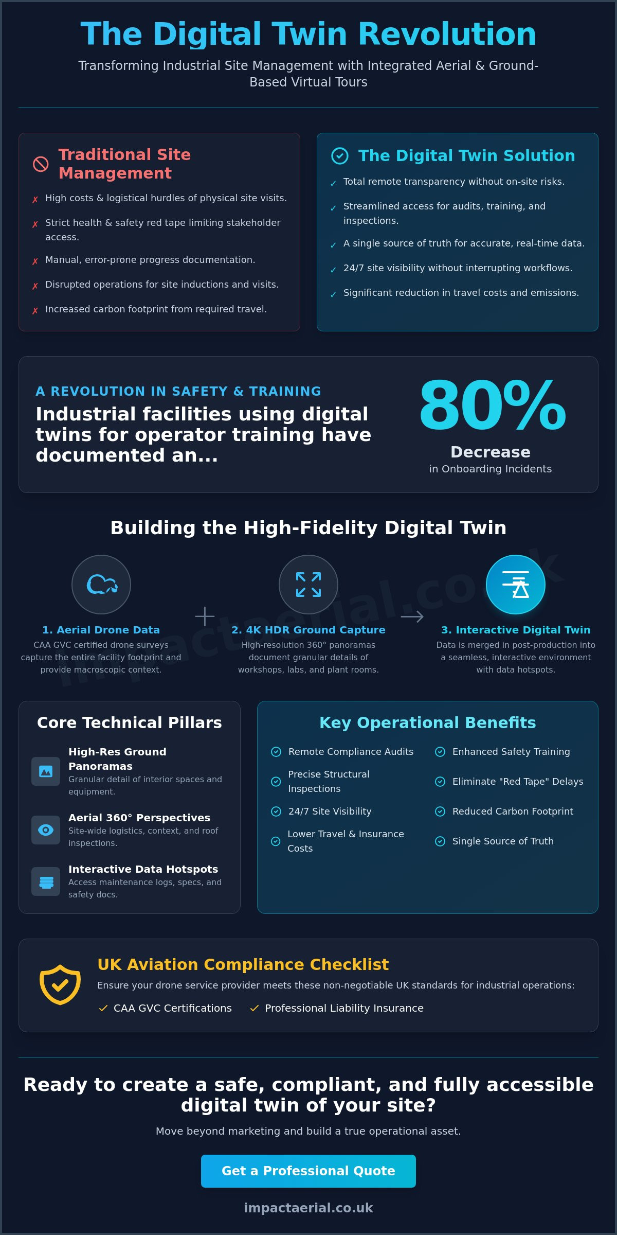
Modern aerial data is highly versatile and can be exported into formats compatible with most BIM, CAD, and GIS systems. This allows you to integrate high-resolution imagery and 3D models directly into your existing asset management workflows. By feeding this data into your Digital Twin or ERP software, you ensure that stakeholders have access to accurate, timestamped information for long-term maintenance planning and structural analysis.
What insurance coverage is required for a commercial drone program?
Commercial drone operations require specialized aviation liability insurance that meets EC 785/2004 standards. While the legal minimum is lower, the industrial standard for high-risk sites is typically £5 million in public liability coverage. This protection is vital when getting buy-in for a drone inspection program, as it provides the financial reassurance required by legal and finance departments during the risk assessment process.
Is it better to hire a drone service provider or buy my own equipment?
Managed services are generally more efficient for organizations looking to scale quickly without significant upfront capital investment. Outsourcing to a professional provider removes the burden of pilot training, equipment maintenance, and regulatory upkeep. It also ensures you have access to the latest DJI Enterprise technology without the risk of hardware obsolescence. This model allows your internal team to focus on data analysis rather than flight logistics.
How long does a typical drone inspection take compared to traditional methods?
Drone inspections are significantly faster than traditional methods, often completing in hours what would take days with scaffolding. For example, a comprehensive roof survey can be finished in a single morning without disrupting site operations. This rapid turnaround reduces asset downtime and allows for immediate response after storm damage. The speed of deployment is a major factor in improving overall operational efficiency and reducing logistical overhead.
 2 Norton Drive, Wythall, Birmingham, B47 6HH Company registration number: 11138586. VAT Number: 366 9068 55


