
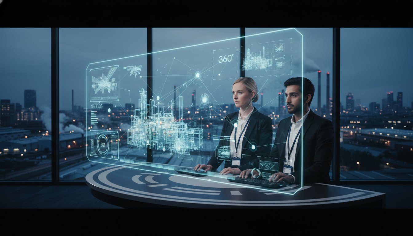
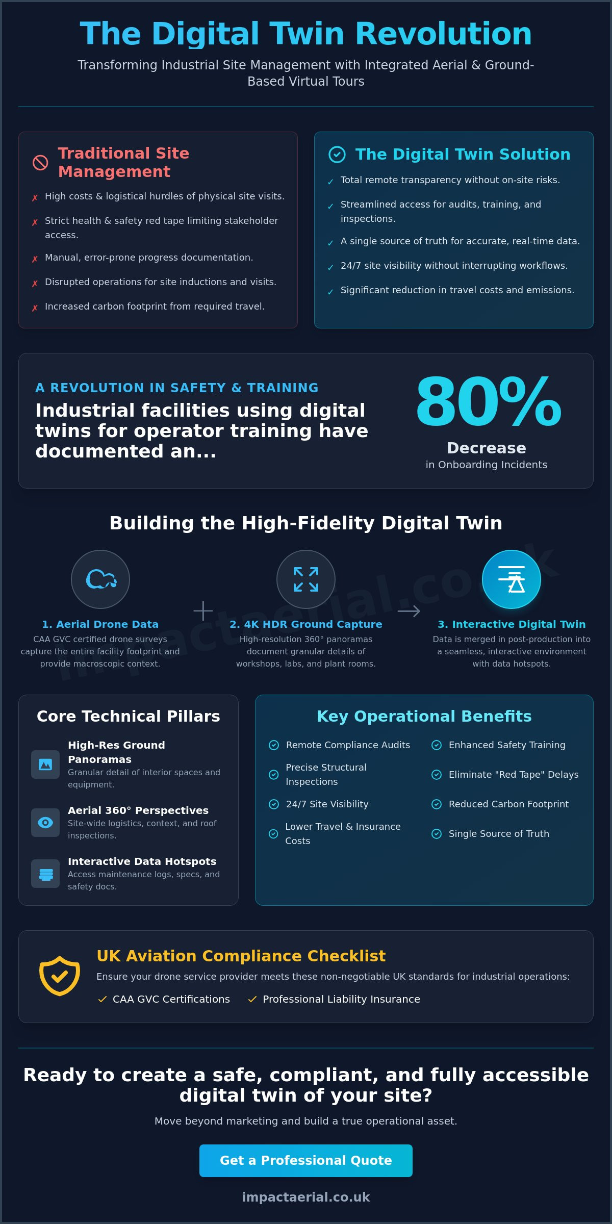
Did you know that industrial facilities utilizing digital twins for operator training have documented an 80% decrease in onboarding incidents? Managing a complex facility in 2026 often feels like a constant struggle against logistical hurdles and the high costs of physical site visits. You likely find that strict health and safety red tape makes stakeholder access difficult, while documenting progress across a massive footprint remains a manual, error-prone task.
This guide demonstrates how a professional virtual tour for industrial sites transforms these operational pains into a streamlined digital asset. By integrating 4K HDR drone data with immersive 360° environments, you can provide stakeholders with total transparency without the risks of on-site presence. We’ll explore how these tools create a high-fidelity digital twin for remote management, enhance safety training compliance, and utilize aerial-to-interior continuity to document your facility with meticulous precision. From CAA GVC certified drone surveys to post-production, you’ll learn how to maintain a safe, compliant, and fully accessible site from any location.
Key Takeaways
- Move beyond simple marketing by adopting digital twin technology that provides a single source of truth for remote site management and operational transparency.
- Discover how a virtual tour for industrial sites integrates 4K HDR ground photography with aerial drone data to create a comprehensive, granular record of your facility.
- Reduce on-site risk and logistical friction by utilizing immersive visuals for remote compliance audits, safety training, and structural inspections.
- Learn the essential technical checklist for site preparation, ensuring your facility meets the safety and operational standards required for professional drone flight and 360 capture.
- Ensure your project remains compliant with UK aviation regulations by verifying CAA GVC certifications and professional liability insurance before starting any industrial site monitoring.
What is an Industrial Virtual Tour and Why is it Essential in 2026?
A virtual tour for industrial sites is no longer just a visual walk-through; it’s a high-resolution, interactive 360° environment that bridges the gap between physical assets and digital management. By combining ground-based 4K HDR photography with aerial drone data, these tours provide a comprehensive “digital twin” that reflects the actual state of a facility. To understand What is an Industrial Virtual Tour in a modern context, you must view it as a data-rich portal that supports safety, compliance, and operational decision-making.
The shift from marketing-focused imagery to functional digital twin technology has been rapid. In 2026, the global digital twin market is projected to reach $39.75 billion, reflecting how critical these models have become for industries like manufacturing, logistics, and energy. For UK site managers, remote accessibility has become the standard. It allows for precise oversight of large-scale construction and power generation sites without the need for constant physical presence.
The following video provides an excellent example of how large-scale infrastructure projects utilize these immersive environments for stakeholder communication:
The Core Components of an Industrial-Grade Tour
A professional-grade tour relies on three technical pillars. First, high-resolution 360° ground panoramas capture granular detail in workshops, labs, and plant rooms. Second, aerial 360° perspectives provide the necessary context for roof inspections and site-wide logistics. Finally, interactive “hotspots” allow users to click on specific equipment to view technical data, maintenance logs, or safety documentation. This layered approach ensures that every stakeholder, from engineers to HSE officers, has access to the specific information they need without stepping foot on the floor.
Solving the ‘Red Tape’ Challenge
Industrial sites are often restricted by strict health and safety protocols that make hosting non-essential staff a significant liability. A virtual tour for industrial sites bypasses this “red tape” by allowing stakeholders to conduct site visits from any location. This significantly reduces the carbon footprint and travel costs associated with international investor visits. It also ensures 24/7 site visibility. Managers can inspect progress or review layout changes without disrupting active production lines or requiring expensive site inductions for every visitor. This level of transparency builds trust while maintaining the highest safety standards.
Building the Digital Twin: Merging Aerial and Ground-Based Technology
Constructing a functional digital twin requires more than just a camera on a tripod. It demands a sophisticated merger of data layers that provide both scale and detail. Commercial-grade DJI Enterprise drones provide the macroscopic view, capturing the entire footprint of a facility from the air. This aerial data is then integrated with 4K HDR ground photography to document the granular details of workshops and labs. This dual-layered approach is the foundation of professional drone services, ensuring that the final output is technically accurate rather than just visually appealing.
The transition between these perspectives must be seamless. Expert post-production services are essential to stitch these environments together, allowing a user to navigate from a roof-level inspection down to a specific piece of machinery on the factory floor. Without this meticulous editing, the user experience becomes disjointed, losing the “single source of truth” that a virtual tour for industrial sites is supposed to provide. Precision in the capture phase ensures that every measurement and visual reference holds up under technical scrutiny.
Aerial Perspectives for Industrial Context
Logistics hubs and large-scale infrastructure, such as the scale seen at the London Gateway, require an aerial perspective to grasp their operational flow. By utilizing advanced aerial filming drone techniques, we capture cinematic yet data-driven overviews that provide essential context. These 360° aerial captures are linked directly to ground-level views. This allows a remote manager to survey a site-wide logistics bottleneck from 400 feet and then instantly “drop in” to the specific loading bay to investigate the cause. It’s an intuitive way to manage vast industrial environments without leaving the office.
Ground-Level Precision for Technical Areas
Inside technical areas like high-risk additive workshops or specialized research laboratories, precision is the priority. We use high-resolution sensors to ensure that every safety sign, machine serial number, and warning label is perfectly legible. Navigating these restricted internal spaces requires a cautious and meticulous approach to avoid disrupting active production lines or sensitive equipment. High-end sensors allow for clear visuals even in low-light plant rooms, ensuring that a virtual tour for industrial sites serves as a reliable tool for remote structural inspections. If you need to document a complex facility with this level of authority, consider how professional construction site monitoring can secure your operational transparency.
Beyond Marketing: Virtual Tours for Safety, Training, and Compliance
The true value of a virtual tour for industrial sites lies in its transition from a visual asset to a functional safety tool. While high-resolution imagery is impressive, its real-world application in 2026 focuses on risk mitigation and regulatory compliance. By creating a high-fidelity digital environment, site managers provide a safe space for staff to familiarize themselves with hazardous zones without physical exposure. This approach is highly effective; research into industrial digital twins has shown that immersive training can lead to a 50% reduction in training time and an 80% decrease in onboarding incidents.
A professional tour acts as a permanent record for any drone survey or documentation project. It provides an “as-built” snapshot that is invaluable for future maintenance and facilities management. This data-centric approach ensures that every structural element is logged and accessible, creating a single source of truth that survives project handovers and staff turnover. It’s a meticulous way to maintain continuity across the entire lifecycle of an asset.
Immersive HSE and Safety Inductions
Traditional safety inductions often rely on static presentations that fail to capture the complexity of an active site. A virtual tour transforms this process by allowing trainees to identify specific hazards in a risk-free virtual environment before they ever arrive on the floor. You can embed safety videos, PDF equipment manuals, and interactive warning signs directly into the 360° view. This standardization is particularly beneficial for companies managing multiple global sites. It ensures every employee receives the exact same high-tier safety training regardless of their physical location.
Remote Auditing and Project Monitoring
Compliance audits often involve significant logistical friction, requiring experts to travel to remote or restricted areas. Integrating a virtual tour with survey drone data allows for precise structural assessments and remote inspections. Contractors use these tours to explain complex project progress to clients, providing visual evidence that matches technical reports. This level of transparency satisfies regulatory requirements and builds psychological comfort for stakeholders who cannot visit the site in person. It turns a visual walk-through into a rigorous tool for operational oversight and long-term asset management.
Planning Your Industrial Virtual Tour: A Technical Checklist
Executing a successful virtual tour for industrial sites requires a methodical planning phase that aligns with your facility’s operational objectives. You must first define the scope of the project: is the primary goal external marketing or internal technical documentation? While marketing tours focus on brand narrative and visual flow, technical tours prioritize asset tagging, survey accuracy, and safety compliance. Site preparation involves more than simple tidiness. It requires a coordinated effort between your security teams and HSE officers to ensure every capture point is accessible and compliant with active site regulations.
Managing access is often the most complex part of the process. You must coordinate with site security to ensure that drone operations do not interfere with sensitive communication equipment or trigger automated security alarms. It is also standard practice to verify that your service provider maintains £5 million in commercial liability insurance, which provides the necessary reassurance when operating around high-value industrial assets. This meticulous approach to planning ensures that the data collection phase is efficient and does not disrupt active production lines.
Pre-Shoot Preparation and Safety
Safety remains the non-negotiable foundation of any industrial shoot. Before the first 360° capture or drone take-off, you must review site-specific risk assessments and method statements (RAMS). This includes clearing non-essential personnel from designated flight paths to maintain strict exclusion zones during drone operations. It is also vital to verify that the pilot holds the correct drone license and permissions for your specific UK airspace. Ensuring all permits are in place well before the shoot date prevents costly delays and maintains full regulatory compliance throughout the project.
Selecting Hotspots and Interactive Elements
The utility of your digital twin depends on the specific technical data you choose to embed. Identify key machinery, high-risk safety zones, or structural transition points that require detailed 360° close-ups. By defining a clear user journey, you can tailor the experience for different stakeholders. For instance, an engineer might need direct links to BIM data or technical manuals, whereas a visitor might only require a high-level site overview. Preparing these technical documents in advance ensures a seamless post-production phase where data is mapped accurately to the physical asset. If you are ready to document your facility with this level of technical rigor, contact us to discuss our professional Virtual Tour Creation services.
Why Impact Aerial is the Standard for Industrial Drone and 360 Services
Impact Aerial positions itself as a technical consultancy rather than a typical creative agency. We specialize in delivering high-resolution virtual tour for industrial sites across the West Midlands and the wider UK. Our approach is grounded in the reality of complex industrial operations, where safety and data accuracy are the primary drivers of every project. By combining advanced drone photography with specialized post-production services, we create digital twins that serve as reliable, long-term assets for site management and stakeholder engagement.
Choosing a partner for industrial data collection requires a focus on risk mitigation. We maintain £5 million in commercial liability insurance, providing essential reassurance for projects involving high-value assets and sensitive infrastructure. This level of coverage is a baseline requirement for the tier-one contractors and energy providers we support. It reflects our commitment to professional service standards and our understanding of the financial stakes involved in large-scale industrial site monitoring.
Meticulous Compliance and Safety Standards
Adherence to the latest CAA regulations is the cornerstone of our operations. In 2026, navigating the evolving UK drone laws requires constant vigilance and updated certifications. Our pilots are CAA GVC certified, ensuring that every flight is conducted within a strict legal framework. Our GVC certification ensures that all operations are conducted within the legal requirements of the Civil Aviation Authority, protecting site managers from the significant legal and financial liabilities associated with non-compliant drone use.
Industrial zones often present unique technical challenges, such as electromagnetic interference from power lines or heavy machinery. Our DJI Enterprise fleet is specifically designed to handle these environments, utilizing redundant systems and shielded components to maintain stable flight and data integrity. This technical adeptness allows us to capture a virtual tour for industrial sites in locations where consumer-grade equipment would fail, ensuring a comprehensive record of even the most challenging plant rooms and workshops.
From Consultation to Post-Production
Our collaborative project management approach ensures that the final digital asset aligns with your corporate identity and operational needs. We don’t just deliver raw imagery; our post-production services include the creation of custom-branded interfaces that reflect your brand’s professional standing. This includes the integration of interactive hotspots, technical overlays, and BIM data as discussed in previous sections.
We provide ongoing support and hosting for your industrial digital twin, ensuring it remains a functional tool for your team. Whether you are managing a PV solar farm thermal survey or a large-scale manufacturing plant, our methodical workflow guides you from the initial safety assessment to the final delivery. This end-to-end service model provides the psychological comfort and tangible business benefits that modern industrial leaders demand.
Securing the Future of Industrial Site Management
Adopting a virtual tour for industrial sites is a strategic shift toward operational transparency and enhanced safety. These digital twins provide a permanent, data-rich record that reduces the need for high-risk physical visits and streamlines complex stakeholder communication. By merging meticulous aerial data with granular ground-level photography, you create a functional asset that supports everything from remote compliance audits to standardized HSE inductions.
The success of your digital transformation depends on technical accuracy and regulatory adherence. Impact Aerial provides the expertise required for high-value facilities, utilizing CAA GVC Certified Pilots and maintaining £5m Commercial Liability Insurance to ensure your project remains compliant and secure. As specialists in industrial and construction data, we provide the precision needed to turn visual walk-throughs into powerful management tools. If you are ready to enhance your site’s documentation and safety protocols, you can Request a Professional Virtual Tour Quote from Impact Aerial today. We look forward to helping you bridge the gap between your physical assets and digital oversight.
Frequently Asked Questions
Are virtual tours for industrial sites safe to produce during active operations?
Yes, producing a virtual tour for industrial sites is safe during active operations provided that a rigorous Risk Assessment and Method Statement (RAMS) is followed. Our pilots coordinate with site managers to establish exclusion zones for drone flight and schedule ground-level captures during low-activity windows. This ensures that the data collection process doesn’t disrupt production lines or compromise the safety of your personnel.
Can drone virtual tours be integrated with existing BIM or CAD models?
Integration with BIM or CAD models is a standard feature of a technical digital twin. You can embed links to specific architectural drawings or Building Information Modeling data directly into interactive hotspots within the 360° environment. This allows engineers to compare the as-built visual state with the original design specifications, facilitating more accurate maintenance and remote structural inspections.
How long does it take to capture a virtual tour for a large factory?
The time required for capture varies based on the facility’s scale, but a typical large factory usually takes between one and three days on-site. This timeframe allows for the meticulous capture of both aerial perspectives and granular ground-level technical areas. Following the site visit, the post-production phase involves stitching the imagery and integrating technical data, which is completed in a separate, structured workflow.
What are the specific CAA requirements for flying drones on industrial sites in the UK?
Commercial drone operations on UK industrial sites require pilots to hold a CAA GVC (General Visual Line of Sight Certificate). This certification is the standard for operating in the Specific Category under current 2026 regulations. Additionally, pilots must have valid commercial insurance and, in many cases, specific permissions for operating in congested areas or restricted airspace near industrial infrastructure.
Can virtual tours be used for official HSE safety inductions?
Virtual tours are highly effective for supplementing official HSE safety inductions. While they don’t replace hands-on demonstrations required by specific regulations, they provide a risk-free environment for trainees to identify hazards and learn site layouts. Embedding instructional videos and PDF manuals within the tour ensures that safety training is standardized across your entire workforce regardless of their location.
Is it possible to update a virtual tour as construction or site layout changes?
Updating your virtual tour for industrial sites is an efficient process because the digital environment is modular. If a factory layout changes or a construction project reaches a new milestone, we can rescan specific areas or reshoot aerial 360s without redoing the entire project. This ensures your digital twin remains an accurate reflection of the physical site throughout its operational lifecycle.
What level of detail can I expect from ground-based 360° photography?
You can expect a high level of technical detail that ensures safety signs, machine labels, and serial numbers are perfectly legible. We utilize high-resolution sensors and HDR processing to capture clear visuals even in the challenging lighting conditions often found in plant rooms or specialized labs. This precision is essential for remote auditing and providing a single source of truth for stakeholders.
How much does a professional industrial virtual tour cost in the UK?
The cost of a professional industrial tour is determined by the size of the facility and the complexity of the technical data integration required. Factors such as the number of capture points, the inclusion of aerial drone data, and the depth of interactive hotspots all influence the final investment. We recommend a technical consultation to define the specific scope and documentation needs of your site.
 2 Norton Drive, Wythall, Birmingham, B47 6HH Company registration number: 11138586. VAT Number: 366 9068 55


