
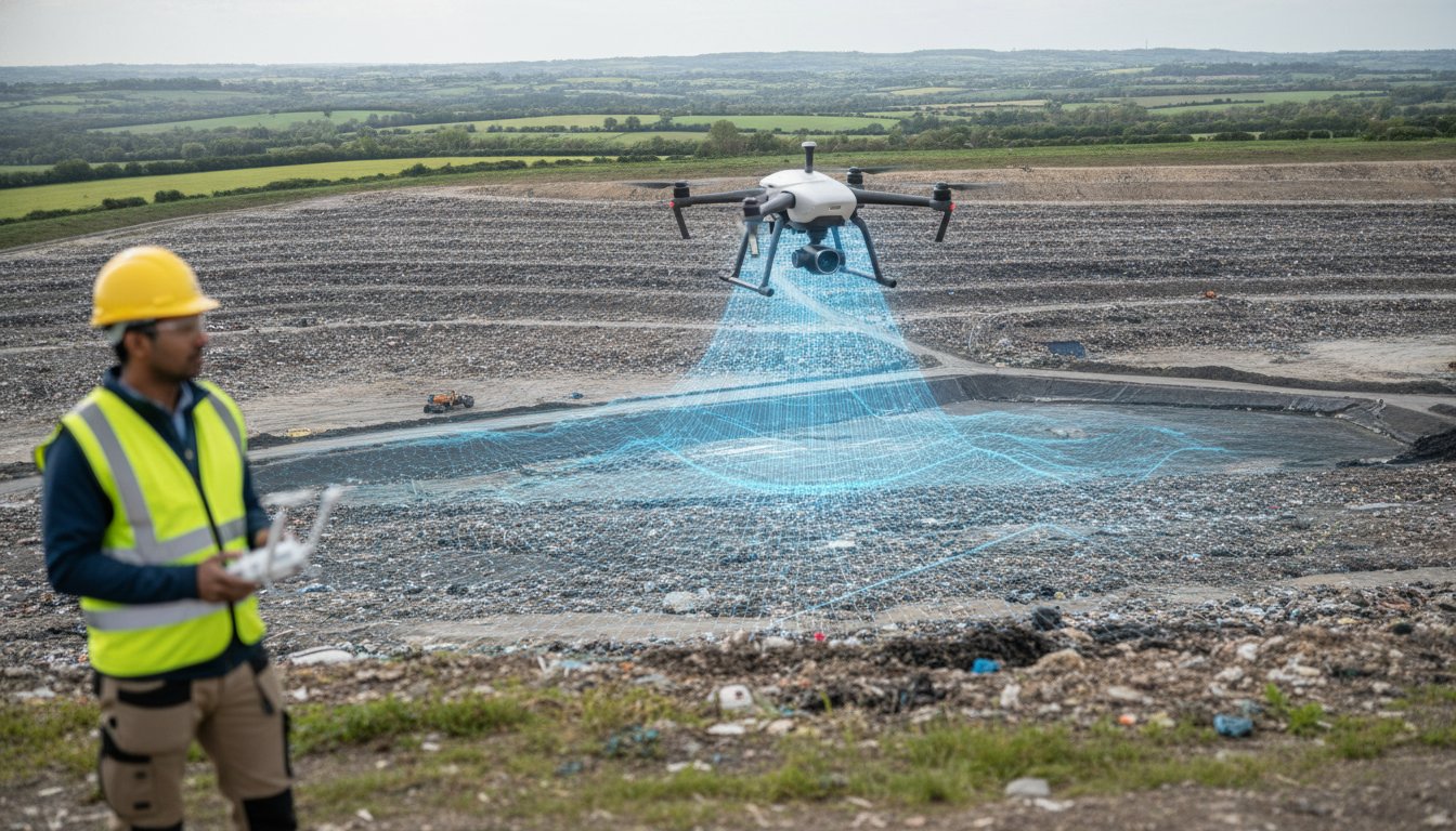
How much is a single centimetre of error worth when the Environment Agency is auditing your remaining airspace? For many UK landfill operators, traditional ground surveying isn’t just a slow process. It’s a significant safety liability that frequently results in “best guess” volumetric estimations. Walking on unstable waste piles to gather data puts staff at risk and often leads to the inaccurate reporting that triggers heavy EA fines. Integrating a professional drone survey for landfill sites changes this dynamic by shifting from interpolated estimation to absolute data certainty.
You’ll discover how millimetre-accurate volumetric data and high-resolution 3D site models provide a legally robust audit trail for your operations. We’ll outline how professional aerial surveys ensure compliance with the October 2026 mandatory Digital Waste Tracking Service while maintaining a zero-harm safety profile. From precise airspace calculations to reduced surveying costs, this guide explains how meticulous aerial data helps you navigate the increasingly strict regulatory environment with confidence and technical precision.
Key Takeaways
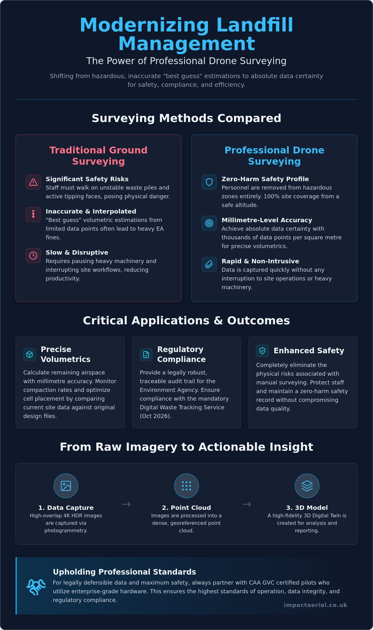
- Eliminate the significant safety risks of manual ground surveying by transitioning to high-altitude aerial data capture for 100% site coverage.
- Achieve millimetre-accurate volumetric reports that allow for precise remaining airspace calculations and compaction monitoring against original design files.
- Ensure full regulatory compliance by utilizing a professional drone survey for landfill sites to provide the traceable topographical evidence required by the Environment Agency.
- Gain superior data density with thousands of points per square metre, enabling the creation of high-resolution 3D models that far exceed traditional GPS capabilities.
- Understand the operational necessity of hiring CAA GVC certified pilots who utilize enterprise-grade hardware to maintain the highest safety and data standards.
Why Drone Surveys are Essential for Modern Landfill Management
Modern landfill management requires a level of precision that manual methods simply cannot provide. UAV landfill surveying involves high-altitude data capture using specialized aircraft to perform topographical mapping and volumetric analysis. This shift from “walking the lines” with handheld GPS units to 100% aerial coverage allows for millimetre-level precision across the entire subject site. Beyond simple mapping, these surveys support critical environmental licensing requirements and are vital for the eventual surrender of licenses for closed sites. Precise data ensures that landfill gas monitoring and leachate management systems are accurately positioned and monitored according to strict environmental standards. The result is a zero-harm safety profile and a rapid data turnaround that provides site managers with actionable insights in a fraction of the time required by traditional methods. Operators no longer need to rely on “interpolated estimations” that can lead to regulatory friction; instead, they gain absolute data certainty.
To better understand how this technology is applied in real-world scenarios, watch this helpful video:
The Safety Advantage: Eliminating On-Site Hazards
Safety is the cornerstone of any industrial operation. Traditional surveying requires staff to traverse active tipping faces and unstable terrain, exposing them to significant physical risks. By using a drone survey for landfill sites, you remove personnel from these hazardous zones entirely. This transition eliminates the risk of vehicle-pedestrian interfaces during peak operational hours. Data is captured from a safe altitude, allowing site work to continue without the need to pause heavy machinery or interrupt complex workflows. This non-intrusive approach ensures that your site remains productive while maintaining the highest possible safety standards for all on-site personnel. It provides psychological comfort to management, knowing that accurate data doesn’t come at the cost of staff welfare.
From Raw Imagery to Actionable 3D Models
The technical process begins with photogrammetry. Here, 4K HDR images are captured with high overlap and processed into georeferenced point clouds. These point clouds form the basis of a Digital Elevation Model (DEM), which provides a clear visualization of the site’s topography. This technical output allows operators to see every contour and slope with absolute clarity, identifying potential drainage issues or slope instabilities before they become critical. In this context, a Digital Twin is a high-fidelity, georeferenced 3D digital replica of the landfill site that allows for real-time analysis and historical comparison of waste levels and site evolution. By comparing these models over time, you create a meticulous record of site changes that is invaluable for long-term planning and compliance auditing.
Critical Applications: Volumetrics, Airspace, and Compaction
Calculating remaining airspace is no longer a matter of interpolation or guesswork. A professional drone survey for landfill sites provides absolute data certainty by generating high-resolution 3D overlays that compare current site conditions against the original Top of Waste (TOW) design files. This process allows operators to identify overfill hotspots long before they lead to regulatory friction or the need for expensive remediation. By capturing millions of data points across the entire site surface, aerial surveys ensure that every cubic metre of licensed void space is accounted for with millimetre-level precision.
Maximizing Airspace Efficiency
Efficiency in waste management depends on knowing exactly how materials are settling. By using advanced cross-section analysis, site managers can track how waste compresses under the final cap. This Z-axis data is critical for refining cell placement strategies and optimizing the use of available space. As highlighted in the technical review on Applying Drone Technology to Landfills, integrating CAD design files with drone-captured 3D meshes allows for a level of precision planning that traditional ground surveys cannot match. You can visualize the current state of a cell versus its final design profile in a digital environment, allowing for proactive adjustments to daily tipping operations.
Compaction and Settlement Monitoring
Monitoring compaction rates is essential for ensuring the maximum utilization of your licensed void space. By comparing sequential surveys over time, drones generate detailed heat maps that visualize elevation changes across the site. These maps are invaluable for identifying “soft spots” or uneven settlement in closed cells that might otherwise go unnoticed. Unlike standard software-only solutions, a meticulous approach to data collection enables “Z-axis” cross-section analysis. This provides a clear view of how materials are compressing over weeks or months, ensuring the density of the waste meets engineering requirements. Identifying these trends early helps maintain site integrity and prevents the structural issues often associated with uneven settlement.
Effective management also extends to the logistics of cover soil and daily cell materials. Drones provide accurate volumes for these stockpiles in minutes, ensuring that you never run short of essential materials for site maintenance. This technical approach to aerial data collection ensures that every operational decision is backed by a precise, georeferenced audit trail. It’s a methodical process that turns raw imagery into a powerful management tool for modern waste facilities.
Environmental Monitoring and UK Regulatory Compliance
Meeting Environment Agency (EA) requirements for topographical evidence is a fundamental part of modern waste management. The EA demands precise, verifiable data to monitor site status and ensure that operations remain within their permitted boundaries. A professional drone survey for landfill sites provides this evidence with a level of detail that ground-based teams cannot match. It creates a definitive georeferenced record that satisfies regulatory audits and provides a transparent history of site activity. For local authorities managing un-licensed closed landfill sites, aerial surveys are invaluable for delineating waste boundaries where historical records may be incomplete or inaccurate.
When commissioning a drone survey for landfill sites, the technical credentials of the flight team are paramount. It is essential to hire CAA GVC certified pilots who understand the complexities of industrial airspace. This certification isn’t just a badge; it’s a legal requirement for complex commercial operations that ensures the pilot has the competency to manage risks on high-hazard sites. Operating without these credentials or the appropriate insurance can lead to significant legal liabilities for the site operator.
Advanced sensor technology has expanded the scope of environmental monitoring beyond simple photography. Thermal and multispectral sensors can now detect early signs of leachate leaks or sub-surface gas migration by identifying thermal anomalies or vegetation stress. This proactive approach is backed by global standards, such as the guidance from the EPA on detecting landfill emissions with drones, which highlights how aerial platforms provide a safer and more comprehensive view of methane plumes than traditional ground-level “sniffing” methods.
LiDAR vs. Photogrammetry for Closed Sites
Choosing the right sensor depends on the lifecycle stage of the landfill cell. While photogrammetry is excellent for active tipping faces, LiDAR (Light Detection and Ranging) is essential for older, closed sites. LiDAR pulses can penetrate heavy vegetation and scrub, allowing us to create accurate terrain models of the ground surface beneath the canopy. This is critical for monitoring settlement or identifying drainage issues on sites that have been reclaimed by nature and are no longer easily accessible on foot.
Audit-Ready Data for License Surrender
Surrendering an environmental license is a meticulous process that requires proof of site stability. We provide 100% coverage surveys that serve as definitive topographical evidence for the EA during the surrender application. Maintaining a digital archive of these surveys offers long-term liability protection, proving the state of the site at the point of handover. To ensure total client security, professional operators maintain £5m commercial liability insurance, providing the necessary reassurance when working in high-risk waste environments.
Comparing Drone Surveys to Traditional Ground-Based Methods
The technical superiority of aerial data collection becomes most apparent when comparing data density. Traditional ground surveys rely on a surveyor manually capturing a few hundred GPS points across a site. This method results in an “interpolated” model, where software must estimate the terrain between those sparse data points. In contrast, a professional drone survey for landfill sites captures thousands of points per square metre. This creates an “absolute” model that reflects the true topography of the waste mass without the guesswork associated with manual sampling. This level of detail is essential for high-stakes decisions regarding remaining capacity and regulatory reporting.
Operational speed is another critical differentiator. Surveying a 50-acre landfill site on foot can take between two and three days of intensive field work. A specialized UAV can capture the same area in approximately 30 minutes. This massive reduction in man-hours doesn’t just lower costs; it makes frequent monitoring financially viable. Instead of annual or quarterly snapshots, operators can perform monthly or even weekly capacity checks to maintain a tighter grip on their compaction rates and tipping schedules. This efficiency allows for a more responsive management style that adapts to the daily realities of waste intake.
Accuracy and Precision Standards
Achieving survey-grade accuracy requires more than just a high-resolution camera. We utilize RTK (Real-Time Kinematic) drones and strategically placed Ground Control Points (GCPs) to ensure that every pixel is georeferenced with absolute precision. While ground teams struggle with the “interpolated” gaps in their data, our aerial approach provides a continuous 3D mesh. A continuous data blanket ensures that 100% coverage eliminates the risk of missing topographic anomalies that often fall between the gaps of sparse manual survey points. This precision is vital when calculating the financial value of remaining void space or preparing for an Environment Agency audit.
Operational Continuity
One of the most significant advantages of aerial surveying is the lack of site downtime. Ground teams often require heavy machinery to stop or move to different cells to ensure their safety, which disrupts the tipping workflow. Drones operate in the airspace above the site, allowing for zero-harm data collection while your plant remains fully operational. Furthermore, the ability to utilize thermal or LiDAR sensors means surveys can often proceed in varied weather conditions or lighting that would hinder traditional optical methods. This reliability ensures that your data collection schedule remains on track, regardless of the operational challenges on the ground.
If you’re ready to transition from manual estimations to absolute data certainty, our team provides comprehensive drone commercial property surveys and industrial mapping across the UK. We handle the technical complexity so you can focus on efficient site management. For operators who also need to manage transport compliance, you can explore Remote Tachograph Download with Fleetalyse to streamline your fleet’s data collection.
Partnering with Impact Aerial for Professional Landfill Surveys
Partnering with Impact Aerial provides a methodical transition from raw data to actionable site intelligence. We specialize in commercial drone surveys tailored specifically for the rigours of industrial waste environments. Our approach centers on utilizing high-specification DJI Enterprise hardware, which ensures the highest possible data integrity for your volumetric and compliance reporting. Beyond the flight itself, our comprehensive post-production services transform millions of georeferenced points into usable CAD and BIM formats. This allows your engineering teams to integrate aerial models directly into existing site management workflows without technical friction.
Safety is our primary operational pillar. Every mission begins with exhaustive risk assessments and CAA-approved flight planning to ensure total compliance with national aviation standards. We understand that landfill sites are high-risk environments with complex machinery and shifting terrains. Our protocols are designed to maintain a zero-harm safety profile while delivering the technical precision required by modern environmental regulations. It’s about providing the reassurance that your surveying needs are met by a compliant, professional operator.
Our Technical Capabilities
We deploy specialized 4K HDR and thermal-equipped enterprise drones to capture multi-layered data sets in a single flight. While we have deep experience working within the West Midlands, our team operates nationwide to support major waste operators across the UK. This geographical reach is balanced with a meticulous focus on data compatibility; we ensure our outputs integrate seamlessly with your site management software and long-term design platforms. Whether you’re monitoring an active cell or managing a closed site, our multi-sensor payloads provide the clarity needed for effective oversight.
Get a Professional Landfill Assessment
Starting a drone survey for landfill sites begins with a structured consultation to scope your specific data requirements. We perform a site feasibility study to identify the optimal flight paths and sensor choices for your terrain. Our pricing remains transparent, and we prioritize rapid report delivery to help you meet time-sensitive compliance deadlines or EA audit windows. This structured approach provides the psychological comfort of knowing your data is handled by vetted specialists who value industry standards as much as you do. We don’t just deliver images; we deliver the technical certainty required to manage your site’s future.
Contact Impact Aerial today for a bespoke drone survey quote.
Future-Proofing Your Waste Management Strategy
Transitioning to aerial data collection is no longer a luxury for UK landfill operators; it’s a regulatory and operational necessity. By replacing manual surveys with a professional drone survey for landfill sites, you eliminate the safety risks associated with unstable terrain while gaining millimetre-accurate volumetric data. This precision ensures that your remaining airspace calculations and compaction monitoring are based on absolute data certainty rather than interpolated guesswork. As the Environment Agency increases its focus on digital waste tracking, having a georeferenced audit trail becomes your strongest asset for long-term compliance and successful license surrender.
We provide the technical expertise and regulatory reassurance your facility requires. Our team of CAA GVC Certified Pilots operates with £5m Commercial Liability Insurance and utilizes expert DJI Enterprise Hardware to deliver high-tier results. Request a Professional Landfill Survey Quote today to secure a bespoke assessment for your site. Take control of your site’s data and safety profile with a solution built for the demands of modern waste management.
Frequently Asked Questions
How accurate are drone surveys for calculating landfill volume?
Drone surveys achieve millimetre-level precision, typically within 2-5cm vertical accuracy when using RTK or PPK-corrected datasets. This level of detail is essential for calculating remaining void space and monitoring compaction rates against original TOW design files. By capturing thousands of points per square metre, drones provide a far more reliable volumetric report than traditional ground-based sampling.
Does the drone interfere with active landfill machinery or GPS systems?
Drones don’t interfere with active landfill machinery or on-site GPS systems because they operate on distinct, regulated frequency bands. Modern enterprise drones use encrypted transmission protocols to ensure signal integrity in industrial environments. Since the survey takes place in the airspace above the site, operations can continue without interruption, maintaining total operational continuity and safety for ground personnel.
What UK regulations apply to flying drones on a landfill site?
Commercial drone operations on landfill sites must comply with CAA regulations, specifically requiring pilots to hold a General Visual Line of Sight Certificate (GVC). Operators must also adhere to Remote ID mandates starting January 1, 2026, for class-marked drones. These strict standards ensure that every flight is conducted within a legal framework that prioritizes site safety and data accountability.
Can drones detect landfill gas or leachate leaks?
Drones equipped with specialized thermal and multispectral sensors can identify the thermal signatures of leachate leaks and gas migration. While standard RGB cameras capture topographical data, these advanced sensors detect vegetation stress or temperature anomalies that indicate sub-surface issues. This proactive monitoring allows site managers to address environmental risks before they escalate into regulatory breaches or Environment Agency fines.
How often should a landfill site be surveyed by a drone?
The ideal frequency for a drone survey for landfill sites depends on waste intake volumes, but many operators opt for monthly or quarterly assessments. Frequent surveys allow for tighter control over compaction rates and more accurate monthly reporting to the Environment Agency. Regular data capture ensures that any overfill hotspots are identified early, preventing expensive remediation work at the end of the cell’s life.
What file formats are provided after a drone landfill survey?
Data’s typically delivered in industry-standard formats including .DXF and .DWG for CAD integration, and .OBJ or .PLY for 3D meshes. We also provide GeoTIFFs for orthomosaic mapping and .LAS or .LAZ files for detailed point clouds. These formats ensure that the aerial data integrates seamlessly with your existing Building Information Modelling (BIM) and site management software.
How long does it take to get the volumetric report after the flight?
Most volumetric reports are processed and delivered within 48 to 72 hours following the flight mission. While the data capture itself takes less than an hour for a typical 50-acre site, the post-production phase involves rigorous photogrammetric processing to ensure survey-grade accuracy. This rapid turnaround allows site managers to make data-driven decisions while the site conditions are still current and relevant to operations.
Is a drone survey cheaper than a traditional land survey?
Drone surveys are significantly more cost-effective than traditional land surveys due to the drastic reduction in field hours and personnel risk. A 50-acre site that would take days to survey on foot is completed in minutes from the air. This efficiency reduces the total man-hours required for data collection and processing, making high-frequency monitoring a financially viable option for modern waste facilities.
 2 Norton Drive, Wythall, Birmingham, B47 6HH Company registration number: 11138586. VAT Number: 366 9068 55


