
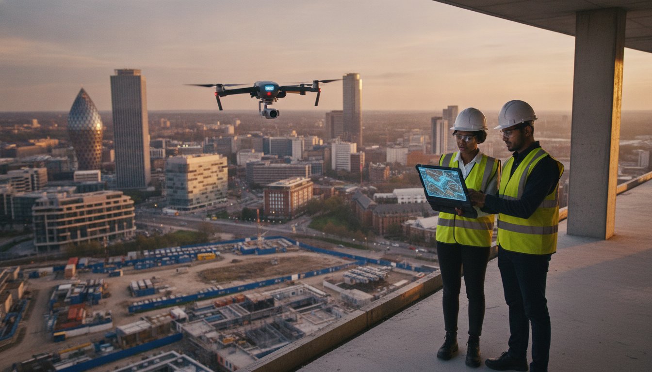
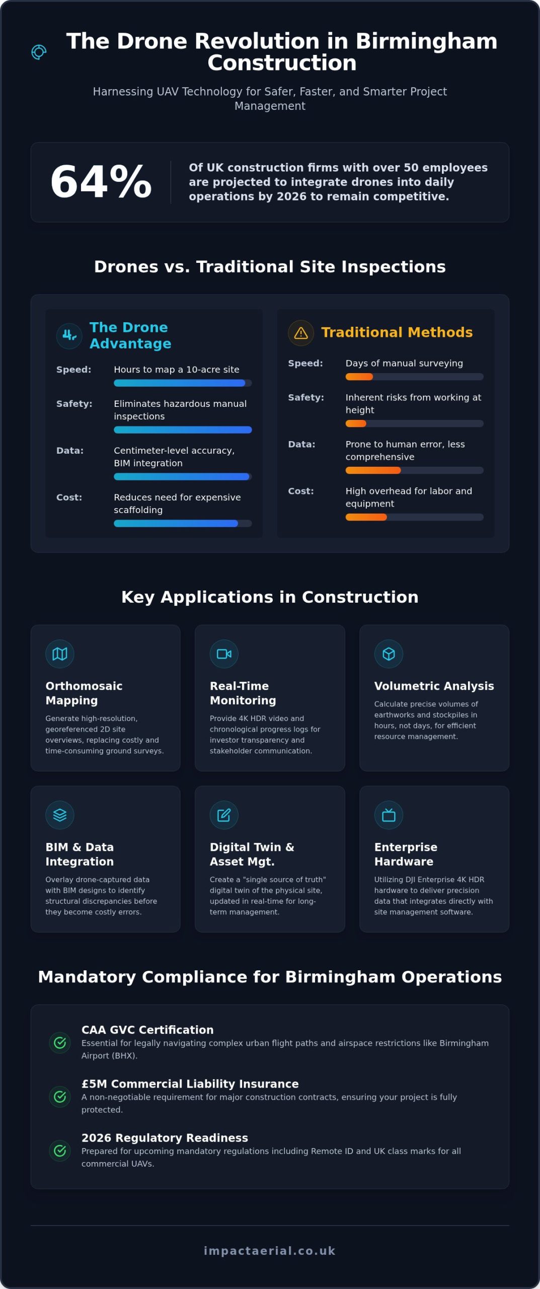
By 2026, approximately 64% of UK construction firms with over 50 employees have integrated drones into their daily operations to stay competitive. If you’re managing a major project in the West Midlands, you already know that the traditional costs of scaffolding for simple inspections and the inherent safety risks of manual site surveys are becoming unsustainable. Utilizing professional construction drone services Birmingham is no longer a luxury; it’s a critical safety and compliance infrastructure for the city’s current development surge.
We understand that your primary focus is keeping projects on track while meeting rigorous safety standards. This guide will show you how to leverage drone technology to secure high-resolution progress reports and accurate volumetric data for earthworks without the overhead of manual methods. We’ll preview the essential 2026 regulatory landscape, including mandatory Remote ID and UK class marks, while explaining how CAA GVC certified pilots with £5m commercial liability insurance ensure your site remains fully compliant in complex urban environments.
Key Takeaways
- Understand how professional construction drone services Birmingham provide high-resolution orthomosaic mapping and real-time monitoring to replace expensive scaffolding and manual inspections.
- Learn why CAA GVC certification and £5m commercial liability insurance are mandatory for navigating complex urban flight paths and Birmingham Airport (BHX) airspace restrictions.
- Discover the efficiency gains of UAV technology, which can map a 10-acre site in hours rather than days, providing precise volumetric data for earthworks.
- Explore the role of DJI Enterprise 4K HDR hardware in delivering precision data that integrates directly with project timelines and site management software.
- Gain insights into the 2026 Birmingham skyline transformation and how local specialists tailor flight plans to meet specific regional infrastructure requirements.
The Evolution of Construction Drone Services in Birmingham
Construction drone services Birmingham have transitioned from simple aerial photography to a sophisticated data ecosystem. In 2026, the city’s skyline is undergoing a massive transformation. Major infrastructure projects like the Big City Plan and the continued evolution of Curzon Street require a level of oversight that ground-based teams can’t provide alone. Site managers no longer view Unmanned Aerial Vehicles (UAVs) as optional gadgets. They’re essential instruments for precision surveying, reporting, and long-term asset management.
Traditional site monitoring is becoming obsolete in dense urban environments. Manual surveys often involve high costs and safety risks, especially when inspecting vertical structures or sprawling earthworks. By integrating drone applications in construction, project leads capture high-resolution data that traditional scaffolding simply can’t reach. This shift ensures every inch of a Birmingham development is documented with mathematical accuracy, providing a digital twin of the physical site that updates in real-time.
To see how these aerial perspectives are currently supporting major local infrastructure, watch this continuous overflight of the HS2 Birmingham route:
The Role of Drones in Modern Site Management
Drones provide a “single source of truth” for site conditions, which is vital for managing complex relationships with stakeholders and investors. Real-time tracking allows managers to document project timelines with visual evidence that isn’t up for debate. This data-centric approach offers several advantages:
- Investor Transparency: Share 4K HDR progress videos that prove milestones are met on schedule.
- Risk Mitigation: Reduce hazardous manual inspections at height, protecting your workforce from unnecessary danger.
- Data Integration: Overlay drone maps with BIM designs to spot structural discrepancies before they become expensive errors.
Why Local Expertise Matters in the West Midlands
Operating in the West Midlands requires a deep understanding of its specific development zones. From the historic Jewellery Quarter to the industrial sprawl of Digbeth, every site has unique flight constraints and safety protocols. Having a pilot based in the West Midlands allows for rapid deployment of construction drone services Birmingham when weather windows open. Impact Aerial brings this local expertise to every project, combining DJI Enterprise hardware with a meticulous approach to CAA GVC compliance. Our team carries £5m commercial liability insurance as standard, which is a non-negotiable requirement for major construction contracts in central Birmingham. We don’t just fly; we provide a technical consultancy that understands the regional property sector’s demands.
Key Applications: From Site Monitoring to Technical Surveys
Professional construction drone services Birmingham provide a dual benefit by delivering both high-precision engineering data and high-impact marketing assets. In 2026, site managers use these tools to replace fragmented reporting with a unified digital record. Weekly or monthly site monitoring sessions create a chronological visual log, which is essential for settling contractor disputes or documenting progress for insurance purposes. This methodical approach ensures that every phase of the build, from initial groundworks to the final “topping out,” is recorded with consistent accuracy.
Technical surveys have evolved significantly through the use of high-resolution orthomosaic mapping. By capturing hundreds of overlapping images, we create 2D site overviews where every pixel is georeferenced. This allows for precise volumetric analysis of earthworks and stockpile management. Instead of waiting days for manual calculations, managers receive volume data in hours. This efficiency is supported by academic research on construction drones, which highlights how photogrammetry and 3D modeling reduce errors in large-scale infrastructure projects. We also deploy thermal sensors to conduct building fabric inspections and PV solar farm surveys, identifying heat leaks or faulty cells that are invisible to the naked eye. To complement these aerial insights, many projects also require detailed subterranean data; for example, Drainamic Ltd provides professional CCTV drain surveys and MSCC5-coded reporting to ensure that below-ground infrastructure is as well-documented as the skyline.
Capturing survey-grade data requires specialized hardware and a meticulous flight plan. We utilize DJI Enterprise drones to ensure high-precision data capture that integrates seamlessly into existing BIM and CAD workflows. This compatibility allows site engineers to overlay current aerial data onto original designs to detect structural deviations early. By providing a “digital twin” of the West Midlands site, we help teams maintain the rigorous standards required for modern urban development. If you need to verify site conditions against your project timeline, our construction site monitoring services offer a reliable, data-centric solution.
Marketing and Stakeholder Visuals
While the technical data drives the build, 4K HDR cinematic filming drives the business. High-end visuals are vital for investor relations and public consultations. We produce immersive virtual tours that allow potential buyers to explore off-plan properties before the first brick is laid. This level of detail builds confidence and accelerates sales cycles. Many firms now view professional drone photography as a primary tool for stakeholder engagement, turning a complex construction site into a compelling narrative for future residents and commercial tenants.
Safety, Compliance, and Birmingham Airspace Regulations
Operating a drone in an urban environment requires more than technical skill; it demands a deep understanding of the Civil Aviation Authority (CAA) framework. Birmingham’s airspace is particularly complex due to the Flight Restriction Zone (FRZ) surrounding Birmingham Airport (BHX). Any construction drone services Birmingham operating in Sheldon, Solihull, or central development zones must secure specific permissions from Air Traffic Control. Impact Aerial manages these logistics through established protocols, ensuring every flight is authorized and logged before the rotors even spin, often utilizing flight tracking tools like AeroDataBox to monitor real-time airport data.
Tier 1 contractors and large-scale developers require a level of professional indemnity and public liability that hobbyists cannot provide. Impact Aerial carries £5m commercial liability insurance as a standard, meeting the rigorous procurement requirements of major West Midlands projects. This insurance, combined with our GVC certification, provides the reassurance that all liabilities are managed. We conduct exhaustive site-specific risk assessments (RAMS) for every deployment, covering everything from local bird populations to nearby power lines and high-rise structures.
Understanding UK Drone Laws in 2026
The regulatory environment has matured significantly. By 2026, the transition from the A2 CofC to the GVC (General Visual Line of Sight Certificate) has become the standard for commercial pilots working on major infrastructure. New hardware now carries mandatory UK class marks, and Remote ID is a legal requirement for almost all commercial flights. Operating in “Congested Areas” like the Birmingham city centre involves strict legal mandates regarding distances from uninvolved people. You can find more detail on these specific requirements in our drone license guide.
Risk Mitigation on Active Construction Sites
Managing an active site involves constant movement, making coordination between the pilot and the site manager essential. We establish clear take-off and landing zones that remain isolated from plant machinery and heavy traffic. Urban environments present unique technical challenges, such as electromagnetic interference from steel-framed buildings. We mitigate this by using enterprise-grade hardware with redundant signal systems. Our flight operations are also dictated by strict weather criteria. We don’t fly if wind gusts exceed 22mph or if precipitation threatens the integrity of the data. This safety-first culture ensures that our presence on your site never adds to your risk register.
Comparing Drone Surveys to Traditional Site Inspections
For decades, site managers across the West Midlands relied on physical access for inspections. Scaffolding, cherry pickers, and rope access teams were the standard. These methods are notoriously slow and carry high operational costs. Utilizing professional construction drone services Birmingham provides a leaner, more agile alternative. A drone can inspect a facade or a high-reach structural element in minutes; scaffolding can take days to erect and dismantle. This transition isn’t just about speed. It’s about the safety ROI. By drastically reducing “Man-at-Risk” hours, projects lower their overall risk profile and insurance liabilities.
The ROI of Aerial Site Monitoring
The financial return on drone technology extends well beyond the initial survey day. High-resolution aerial evidence is a definitive tool for dispute resolution. If a subcontractor claims work is complete or a milestone is met, you have dated visual proof to verify the claim immediately. Identifying construction defects early is another significant cost-saver. Spotting a building fabric leak or a structural alignment issue during the early phases prevents expensive rework during the final stages. You can explore more about the drone survey benefits for long-term asset management to see how this data persists throughout the building’s lifecycle.
Integration with Modern Construction Tech
In 2026, drone data is no longer a standalone asset. It integrates directly into your existing digital ecosystem. Scan-to-BIM workflows utilize aerial photogrammetry to create high-fidelity Digital Twins of the site. These models allow remote stakeholders to conduct virtual walkthroughs from any location, reducing the need for frequent site visits. Health and safety audits also gain an objective layer of oversight. Aerial imagery provides a clear record of site cleanliness, material storage, and PPE compliance. It’s an essential component of a transparent, data-driven site management strategy. To see how these surveys can be tailored to your specific project goals, consult with the specialists at Impact Aerial.
Partnering with Impact Aerial for Your Birmingham Project
Choosing the right provider for construction drone services Birmingham involves more than just selecting a pilot. It requires a partner who understands the high-stakes nature of West Midlands development. Our approach is strictly consultation-led. We start by identifying your specific site goals, whether that’s verifying earthworks volumes or creating high-end marketing films for stakeholders. This ensures every flight plan is tailored to deliver maximum value without redundant data capture. We don’t just fly; we act as technical consultants to ensure the data you receive is fit for purpose.
We rely on DJI Enterprise hardware for all our construction deployments. These systems are designed for reliability in demanding urban environments, offering 4K HDR visual clarity and the signal redundancy needed for precise mapping. The work doesn’t end when the drone lands. Our post-production team processes the raw data into actionable reports, georeferenced maps, or professionally edited films ready for investor presentations. This end-to-end service ensures you receive high-tier quality from the initial briefing to the final delivery, backed by the reassurance of our £5m commercial liability insurance.
Our End-to-End Project Management
We manage every aspect of the aerial operation so your site team can stay focused on the build. Our meticulous management process includes:
- Initial Assessment: We handle all necessary airspace clearances, including formal coordination with Birmingham Airport (BHX) for sites within the Flight Restriction Zone.
- On-Site Execution: Our pilots are CAA GVC certified and operate with minimal disruption to your ground crews, adhering to strict site-specific RAMS.
- Secure Delivery: Data is delivered via secure portals in your required formats, ensuring seamless integration with your existing BIM or CAD workflows.
Get a Quote for Your West Midlands Site
Pricing for our services is transparent and project-specific. Several factors influence the final cost, including the total acreage of the site, the frequency of monitoring visits, and the complexity of the local airspace. We offer flexible options, ranging from one-off structural inspections to long-term monitoring contracts that cover the entire project lifecycle. This flexibility allows us to support both niche developments and major infrastructure projects across the region.
If you’re looking for more details on industry standards and what to expect from a specialist operator, read our professional drone services guide. To initiate a survey on your Birmingham site, contact our team to discuss your requirements and receive a tailored quote. We’re ready to provide the precision data and visual oversight your project demands.
Securing Your Project’s Future with Precision Data
The 2026 development landscape in the West Midlands demands a level of data precision and operational safety that traditional methods can’t provide. By integrating construction drone services Birmingham into your project workflow, you replace expensive scaffolding and manual spot checks with high-resolution mapping and real-time monitoring. This transition doesn’t just save time; it provides a definitive digital record that protects your business from disputes and identifies defects before they become costly liabilities.
Partnering with a specialist ensures that your site remains fully compliant with evolving CAA regulations and complex airspace restrictions around Birmingham Airport. Our team brings expert West Midlands knowledge, CAA GVC certified pilots, and £5m public liability insurance to every contract, offering the reliability Tier 1 contractors expect. Whether you need a one-off inspection or a long-term monitoring partner, we provide the technical expertise to keep your project moving forward safely and efficiently.
Ready to transform your site oversight with industry-leading aerial technology? Request a Professional Drone Service Quote for Your Birmingham Project and let’s discuss your specific site goals. We look forward to supporting your next build with the precision it deserves.
Frequently Asked Questions
Do I need special permission to use a drone on my Birmingham construction site?
Yes, you must grant permission as the landowner or site manager, while the pilot manages all regulatory authorizations. For construction drone services Birmingham, this involves checking the CAA’s interactive maps and coordinating with local authorities if the site is in a restricted zone. Professional operators handle the risk assessments and flight notifications, ensuring your project remains compliant with the latest 2026 drone safety standards.
How much do construction drone services cost in Birmingham?
The cost of drone services varies based on the complexity of the site and the specific data outputs required. Factors such as the frequency of site monitoring visits, the need for technical mapping, and the post-production requirements for stakeholder videos all influence the final quote. We provide tailored pricing for both one-off structural inspections and long-term asset management contracts to ensure you only pay for the data you need.
Can drones fly in central Birmingham near the airport?
Drones can operate in central Birmingham and areas near the airport, provided the pilot secures permission from Air Traffic Control (ATC). Sites within the Flight Restriction Zone (FRZ) require formal coordination and a specific flight window. Our GVC certified pilots are experienced in managing these complex logistics, ensuring that your project’s aerial surveys are conducted legally and safely within the busy West Midlands airspace.
What data formats do you provide for construction surveys?
We provide data in various industry-standard formats to ensure seamless integration with your existing workflows. For mapping and surveying, this typically includes:
- GeoTIFF and orthomosaic maps for 2D overviews
- OBJ or LAS files for 3D modeling and point clouds
- High-resolution JPEG images and 4K HDR MP4 video files
These formats are compatible with most major BIM and CAD software platforms used in modern construction.
How quickly can you deploy a drone pilot to a West Midlands site?
Our base in the West Midlands allows for rapid deployment to sites across Birmingham. We can often be on-site within 24 to 48 hours, depending on the complexity of the required airspace clearances. Early consultation is always recommended for sites near the airport or in restricted urban zones; these require additional time for formal authorizations from the Civil Aviation Authority or local ATC.
What happens if the weather is bad on the day of the flight?
Safety is our primary concern, so we don’t operate if the weather conditions exceed our strict safety thresholds. We typically don’t fly in heavy rain or if wind gusts exceed 22mph; this can compromise both safety and data accuracy. If a flight is postponed due to weather, we work closely with your site manager to reschedule the operation for the earliest possible safe window.
Is £5m insurance enough for a major UK construction project?
Yes, £5m commercial liability insurance is the standard requirement for most Tier 1 contractors and major UK construction projects. This level of coverage provides the necessary reassurance for operating in high-density urban environments. It protects all stakeholders against unforeseen incidents and is a non-negotiable proof point for any professional drone operator working on significant regional infrastructure or commercial property developments.
Can drones assist with BREEAM or environmental assessments?
Drones are increasingly used to support environmental assessments and BREEAM certifications. Our thermal surveys identify heat loss through the building fabric, while high-resolution mapping helps document land use and biodiversity metrics. These data-driven insights allow site managers to prove compliance with environmental standards and optimize the energy efficiency of new builds, providing clear evidence for sustainability audits and long-term project reporting.
 2 Norton Drive, Wythall, Birmingham, B47 6HH Company registration number: 11138586. VAT Number: 366 9068 55


