
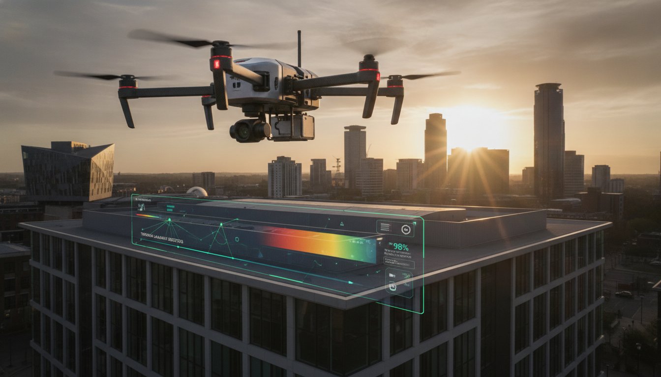
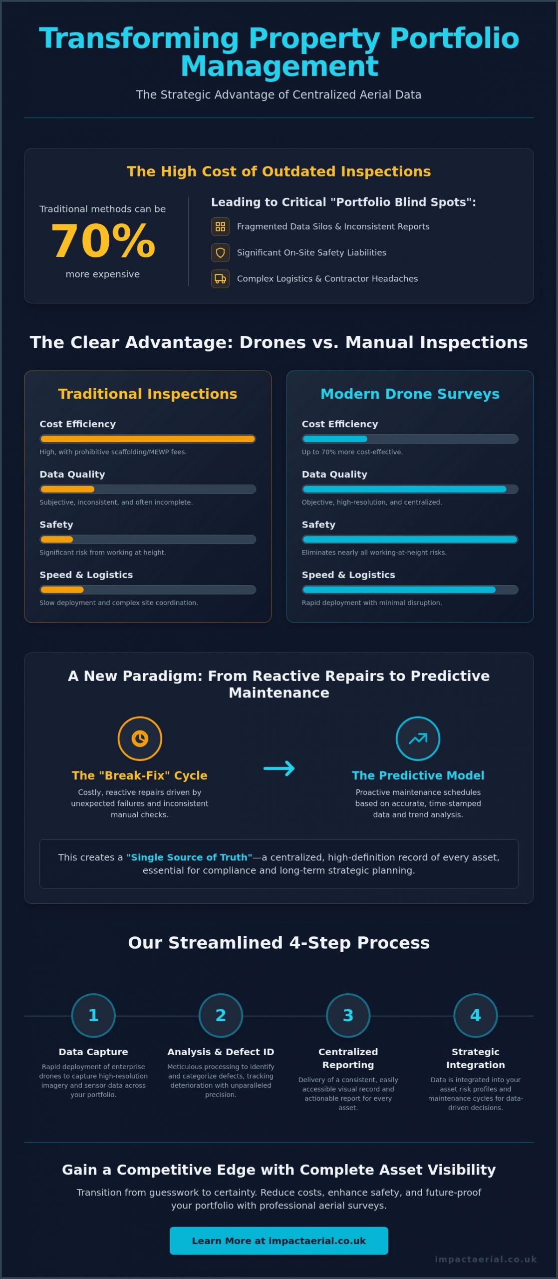
Did you know that traditional survey methods requiring scaffolding or mobile elevating work platforms can be up to 70% more expensive than modern aerial alternatives? For UK asset managers overseeing dozens of diverse sites, these manual inefficiencies don’t just drain maintenance budgets; they create fragmented data silos and significant safety liabilities. You’ve likely experienced the logistical headache of coordinating regional contractors and the frustration of receiving inconsistent reports that make long-term planning nearly impossible. Managing a complex estate requires a level of precision and oversight that manual inspections simply cannot deliver at scale.
Implementing a professional drone survey for property portfolio management allows you to transition from expensive reactive repairs to a streamlined, predictive maintenance model. You’ll discover how to transform multi-site oversight with data-driven surveys that reduce operational risk and provide a centralised, high-definition record of every asset. This guide explores the strategic integration of aerial data into your workflow, ensuring your portfolio remains compliant with evolving CAA regulations while significantly lowering your survey-related health and safety risks. We’ll examine how meticulous data capture and technical expertise provide the psychological comfort and tangible financial benefits your business requires.
Key Takeaways
- Learn why traditional regional inspections create data silos and how a centralised aerial approach provides a consistent visual record across your entire estate.
- Understand how enterprise-grade hardware and specialised sensors enable high-precision defect detection that manual site visits often miss.
- Compare the significant time and cost advantages of rapid drone deployment versus the logistical complexity of scaffolding for multi-site inspections.
- Discover a step-by-step framework for integrating a drone survey for property portfolio management into your existing asset risk profiles and lease cycles.
- Explore how professional certification and centralised UK operations ensure consistent, compliant reporting that meets the highest safety and regulatory standards.
The Evolution of Property Portfolio Management: Why Drones are Essential
Property management has moved beyond simple facility maintenance into a complex era of asset lifecycle optimisation. A drone survey for property portfolio management represents a fundamental shift in how UK asset managers oversee large-scale estates, moving away from subjective manual checks toward objective, high-resolution digital data. By utilising advanced aerial survey technologies, managers can now obtain a comprehensive view of every asset, regardless of its location or height. This approach ensures that decision-making is rooted in technical precision rather than anecdotal evidence.
Many organisations suffer from what we call the “Portfolio Blind Spot.” This occurs when high-level financial data is disconnected from the actual physical condition of the buildings. Without a centralised visual record, asset managers often rely on disparate reports from various regional contractors, leading to inconsistent data and reactive, costly “break-fix” cycles. This lack of visibility often results in minor defects escalating into major capital expenditures because they weren’t identified during the early stages of deterioration.
To better understand how this technology is applied on-site, watch this helpful video demonstrating aerial data capture:
Modern compliance requirements, such as the Building Safety Act 2022, demand a “golden thread” of information that is transparent and easily accessible. Drones facilitate this by providing repeatable, time-stamped evidence of building integrity, which is essential for both ESG reporting and long-term safety audits. This transition to proactive maintenance helps preserve capital and ensures that high-value assets remain compliant with national standards. It’s about building a reliable database that supports both daily operations and long-term strategic goals.
The Limitations of Traditional Multi-Site Inspections
Traditional inspections often fail at scale due to the prohibitive costs of hiring scaffolding or mobile elevating work platforms for every site visit. When managing multiple properties across the UK, the logistical headache of coordinating these inspections is immense. Manual surveys are also inherently subjective; different surveyors may interpret the same defect in varied ways, creating a fragmented picture of the portfolio’s health. Working at height remains one of the primary safety liabilities for property owners, making traditional roof and facade inspections a significant risk factor that requires rigorous mitigation.
The Data-Centric Approach to Asset Oversight
Transitioning to a digital model allows stakeholders to access a “single source of truth” across the entire estate. High-resolution aerial data provides a meticulous visual history of every asset, allowing for side-by-side comparisons over several years to track deterioration rates accurately. This level of detail enables predictive maintenance schedules based on real-world evidence rather than guesswork or generic timelines. Drone surveys provide a non-intrusive method for gathering building data without tenant disruption, ensuring that business operations continue smoothly while critical inspections take place.
Key Drone Survey Technologies for Diverse Property Portfolios
Professional asset management requires more than just a standard camera in the sky. The effectiveness of a drone survey for property portfolio management depends heavily on the deployment of enterprise-grade hardware, such as the DJI Matrice or Mavic 3 Enterprise series. These platforms are designed for the rigours of commercial environments, offering the stability and flight endurance necessary to cover multi-acre industrial sites or complex retail parks in a single mobilisation. High-resolution 4K HDR imagery is the baseline requirement for dilapidation reports; it provides the clarity needed to identify hairline fractures in masonry or failing gutter seals that lower-tier equipment would simply overlook.
Precision is maintained through the use of RTK (Real-Time Kinematic) positioning and GPS-tagged data. This technology ensures that every captured image is georeferenced with centimetre-level accuracy, allowing managers to overlay aerial data onto existing site plans or GIS systems. All flight operations must be conducted by pilots who strictly follow UK drone safety regulations to ensure the legality and insurance validity of the data collected. Integrating these advanced sensors into your annual maintenance plan ensures a high-tier level of quality, which is why many asset managers opt for specialised drone commercial property surveys to secure their long-term data strategy.
Thermal Imaging for Energy Efficiency and Leak Detection
Radiometric thermal sensors are essential for identifying energy loss and sub-surface moisture across a portfolio. These cameras detect minute temperature variances, making them highly effective at spotting insulation gaps or water ingress on flat industrial roofs before leaks penetrate the building envelope. For portfolios with extensive solar PV arrays, thermal drones can rapidly identify malfunctioning cells that reduce energy yield. This data is invaluable for asset managers aiming to improve BREEAM ratings or EPC scores, as it provides documented evidence of thermal performance and targeted areas for remediation.
3D Modelling and Digital Twins for Asset Lifecycle Planning
Photogrammetry allows for the creation of high-fidelity 3D models and digital twins of every asset in a portfolio. By processing hundreds of overlapping aerial images, we generate accurate digital replicas that allow stakeholders to take precise measurements of facade areas or roof pitches from their desks. These models are particularly useful during tender processes for maintenance contracts; providing contractors with an accurate 3D model reduces the need for multiple site visits and ensures more competitive, accurate quotes. This digital record serves as a foundation for long-term lifecycle planning, ensuring that every repair is based on verified spatial data.
ROI Analysis: Drone Surveys vs. Traditional Portfolio Inspections
The financial case for integrating a drone survey for property portfolio management becomes clear when you examine the logistical mobilisation required for traditional inspections. Compare the timeline for ten regional sites. Conventional methods often require multiple weeks of coordination, scaffolding permits, and physical site access that disrupts tenants. In contrast, a professional drone team can mobilise and complete the same ten surveys in a fraction of the time, often within a single week of favourable weather. Industry data suggests that drone mapping can be up to 400 times faster than traditional ground surveys, allowing asset managers to move from data collection to decision-making at an accelerated pace.
Cost savings are equally compelling. Professional drone surveys are typically 30% to 70% cheaper than traditional methods that require scaffolding or mobile elevating work platforms. These savings aren’t just limited to equipment hire. By identifying minor defects early, such as a slipped tile or a blocked parapet gutter, you prevent the type of large-scale water ingress that results in expensive capital expenditure and tenant compensation claims. A documented history of proactive maintenance can also lead to “hidden” savings, such as more favourable insurance premiums, as underwriters recognise the reduced risk profile of a well-monitored estate.
Manual surveying hours are often inflated by the sheer difficulty of accessing high-value commercial assets. Drones reduce these professional fees by providing surveyors with all the necessary visual data upfront. Instead of spending hours on a roof, a surveyor can review high-definition imagery from their office, focusing their expertise on analysis rather than the logistics of access. This efficiency ensures that your professional budget is spent on expert insight rather than site mobilisation.
Standardising Data Across a National Portfolio
Consistency is often the greatest challenge for managers overseeing assets from London to Birmingham. Using a single, specialised drone service provider ensures that every report follows the exact same technical standard and visual format. This comprehensive drone survey methodology serves as the baseline for all data collection across your estate. All reports are hosted in a centralised digital portal, providing stakeholders with instant access to the physical condition of any building in the portfolio without searching through disparate regional files.
Risk Mitigation and Health & Safety Compliance
The “Work at Height” regulations remain a primary concern for any property professional. Traditional manual surveys carry inherent safety liabilities that drones almost entirely eliminate. By keeping personnel on the ground, you remove the logistical and safety headaches associated with roof access. Drones eliminate the need for physical roof access, thereby removing the #1 cause of major workplace injuries in the sector. To ensure total portfolio-wide protection, we operate with £5m commercial liability insurance, providing you with the psychological comfort that all operations are fully covered and strictly compliant with national safety standards.
Implementing Drones into Your Property Management Strategy
Successful implementation of a drone survey for property portfolio management requires a shift in perspective. You shouldn’t view aerial inspections as isolated, one-off events. Instead, they must be integrated as a recurring data stream within your broader asset management framework. This starts with a clear operational plan that addresses scheduling, tenant liaison, and data integration. By establishing a standardised workflow, you ensure that the high-resolution data captured on-site translates directly into actionable maintenance tasks within your existing CAFM (Computer-Aided Facility Management) systems.
Scheduling should be driven by asset risk profiles rather than arbitrary dates. A warehouse roof in a coastal environment, for instance, may require a more frequent inspection cadence than a modern retail unit in a sheltered urban area. You should also align these surveys with lease cycles. Conducting an aerial audit six months before a lease expiry provides the documented evidence needed for accurate dilapidation claims. Privacy is paramount in urban environments. Asset managers must develop a clear communication plan for tenants, ensuring they are notified of flight times and the strict privacy protocols followed by the flight crew. Modern software allows for the automatic blurring of faces and sensitive information, maintaining compliance with UK data protection standards.
Step 1: Portfolio Audit and Priority Mapping
The first phase involves categorising your estate to identify high-priority assets. Focus on buildings with aging facades, complex roof structures, or known historical issues. By mapping these risks, you can set a logical inspection cadence, such as annual surveys for high-value industrial units and bi-annual checks for newer office blocks. This proactive mapping ensures that your budget is allocated where the risk of failure is highest. Aligning these surveys with your planned maintenance cycles allows you to verify that previous repairs were completed to the required standard, creating a continuous loop of quality control across the portfolio.
Step 2: Choosing a Qualified UK Drone Partner
Selecting the right operator is a matter of regulatory compliance and operational reliability. A valid General Visual Line of Sight Certificate (GVC) from the Civil Aviation Authority is non-negotiable for commercial work. Beyond licensing, you must evaluate a provider’s capacity for national multi-site mobilisations. A partner with a centralised base can offer consistent reporting standards across the UK, ensuring that a survey in Manchester is identical in quality to one in Southampton. It’s often beneficial to partner with drone services that provide end-to-end project management, from initial risk assessments to final data delivery. This meticulous approach provides the psychological comfort that your assets are being monitored by experts who value safety as much as you do.
To begin standardising your asset oversight with a data-driven approach, contact the specialists at Impact Aerial to discuss your portfolio requirements.
Impact Aerial: The Professional Standard for UK Portfolio Surveys
Impact Aerial provides a sophisticated solution for asset managers seeking a reliable drone survey for property portfolio management. From our central hub in Birmingham, we offer nationwide coverage, ensuring a rapid response to multi-site requirements across the UK. Our operations are built on a foundation of technical excellence and regulatory strictness. We don’t just capture images; we provide a high-tier visual record that serves as a strategic asset for your business. This centralised approach eliminates the inconsistency of regional contractors, providing you with a uniform data standard from one site to the next.
Our hardware fleet is equipped for the most demanding commercial environments. We deliver qualitative outputs including 4K HDR video for detailed dilapidation assessments, radiometric thermal reports for energy efficiency audits, and high-fidelity 3D digital twins for precise spatial planning. Every mission is preceded by a meticulous risk assessment and executed by CAA GVC certified pilots who understand the operational complexities of live commercial sites. This technical expertise ensures that the data we provide is not only visually impressive but also legally and technically robust for your long-term records.
Expertise in Commercial and Industrial Sectors
Our team possesses deep experience in high-stakes environments, ranging from expansive PV solar farms to active construction sites. We serve the West Midlands and the wider UK with professional drone photography that captures the necessary detail for complex insurance and maintenance reports. We recognise that asset managers require more than just raw data. We provide custom reporting formats designed specifically for your stakeholders, ensuring the information is actionable and integrates seamlessly into your existing management systems. This focus on the industrial sector allows us to provide insights that generalist operators often overlook.
Compliance, Insurance, and Peace of Mind
In a market that is rapidly evolving, our commitment to officialdom and safety remains constant. We strictly adhere to the latest drone license regulations, including the 2026 Remote ID mandates and updated night flying protocols. This meticulousness extends to our financial protections; we maintain £5m commercial liability insurance. This coverage provides you with the psychological comfort that every flight is fully insured and conducted under the highest professional standards. Our focus on risk mitigation ensures that your drone survey for property portfolio management is not only effective but also fully compliant with national aviation authority standards.
Contact Impact Aerial to discuss your property portfolio survey requirements and discover how our data-centric approach can optimise your maintenance budget and reduce your operational risk.
Future-Proofing Your Estate with Precision Aerial Data
Adopting a digital, aerial-first strategy is a fundamental requirement for maintaining a competitive and compliant estate. By integrating a drone survey for property portfolio management into your recurring maintenance schedule, you replace fragmented regional reports with a high-definition, centralised visual record. This data-centric approach doesn’t just reduce immediate survey costs compared to traditional scaffolding; it provides the predictive insights needed to extend the lifecycle of every asset in your care.
Impact Aerial is ready to support your national mobilisation with technical precision and meticulous safety standards. Our Birmingham-based team provides UK-wide coverage, operating with CAA GVC Certified Pilots and £5m Commercial Liability Insurance to ensure total reliability. Whether you oversee industrial parks or complex retail portfolios, our 4K HDR and thermal reporting will help you eliminate data silos and secure your maintenance budgets for the long term.
Request a tailored drone survey quote for your property portfolio today and take the first step toward proactive asset optimisation. We look forward to helping you transform your property oversight with industry-leading aerial intelligence.
Frequently Asked Questions
How much does a drone survey for a property portfolio cost?
Costs for aerial inspections are bespoke and depend on the portfolio size, location complexity, and the specific sensors required for the mission. Factors such as the number of assets and the need for specialised thermal data or 3D modelling will influence the final investment. While commercial pricing is tailored to each project, asset managers often find that mobilisation efficiencies across multiple sites provide a significant cost advantage over traditional access methods.
Are drone surveys legal in congested UK urban areas?
Drone surveys are entirely legal in congested urban areas when conducted by a professional operator holding the necessary Civil Aviation Authority (CAA) certifications. Our pilots are GVC certified, which allows for commercial flight in complex environments following a rigorous pre-flight risk assessment. We manage all necessary airspace notifications and ensure that operations strictly adhere to national safety standards to protect the public and your assets.
How long does it take to survey a typical commercial property?
A standard commercial property survey is typically completed within two to four hours on-site. This timeline can vary based on the building’s total footprint and the complexity of the architectural features being inspected. Larger industrial estates or retail parks may require a full day of flight operations, but this remains significantly faster than the days or weeks needed to deploy traditional scaffolding or high-access platforms.
What kind of reports will I receive for my portfolio management software?
You’ll receive a suite of high-resolution deliverables including 4K HDR imagery, orthomosaic maps, and comprehensive thermal reports. These data sets are provided in industry-standard formats that integrate seamlessly with CAFM and other property management software. For advanced planning, we also provide 3D digital twins that allow stakeholders to take precise measurements of facades and roof areas from any digital device.
Do I need to notify tenants before a drone survey takes place?
It’s standard practice to notify tenants at least 48 to 72 hours before any flight operations begin on-site. Clear communication ensures that tenants are aware of the non-intrusive nature of the survey and understand the strict privacy protocols we follow, such as blurring sensitive information. Providing a scheduled window for the survey helps maintain positive tenant relations while ensuring our flight crew has unrestricted access to the site.
Can drones identify specific roof defects like solar panel micro-cracks or water ingress?
Specialised radiometric sensors can accurately identify sub-surface water ingress and malfunctioning solar cells that are invisible to the naked eye. By detecting minute temperature variances, a drone survey for property portfolio management can pinpoint insulation failures and moisture traps before they cause structural damage. This technical precision allows for targeted repairs, ensuring that your maintenance budget is spent where it’s most effective.
What insurance coverage should a professional drone operator have for portfolio work?
A professional operator must carry a minimum of £5 million in commercial liability insurance that is fully compliant with EC 785/2004 regulations. This level of coverage is essential for protecting asset managers and property owners against potential third-party risks during multi-site mobilisations. Always verify that your provider’s insurance specifically covers commercial UAV operations to ensure your portfolio remains protected under all circumstances.
How do drone surveys help with dilapidation claims and lease negotiations?
Aerial surveys provide an objective, high-definition visual record of an asset’s condition at a specific point in time. This time-stamped evidence is invaluable during lease negotiations and dilapidation claims, as it removes the subjectivity often found in manual surveyor reports. Using a drone survey for property portfolio management ensures that all parties have access to a “single source of truth,” which can significantly accelerate the settlement process and reduce legal disputes.
 2 Norton Drive, Wythall, Birmingham, B47 6HH Company registration number: 11138586. VAT Number: 366 9068 55


