
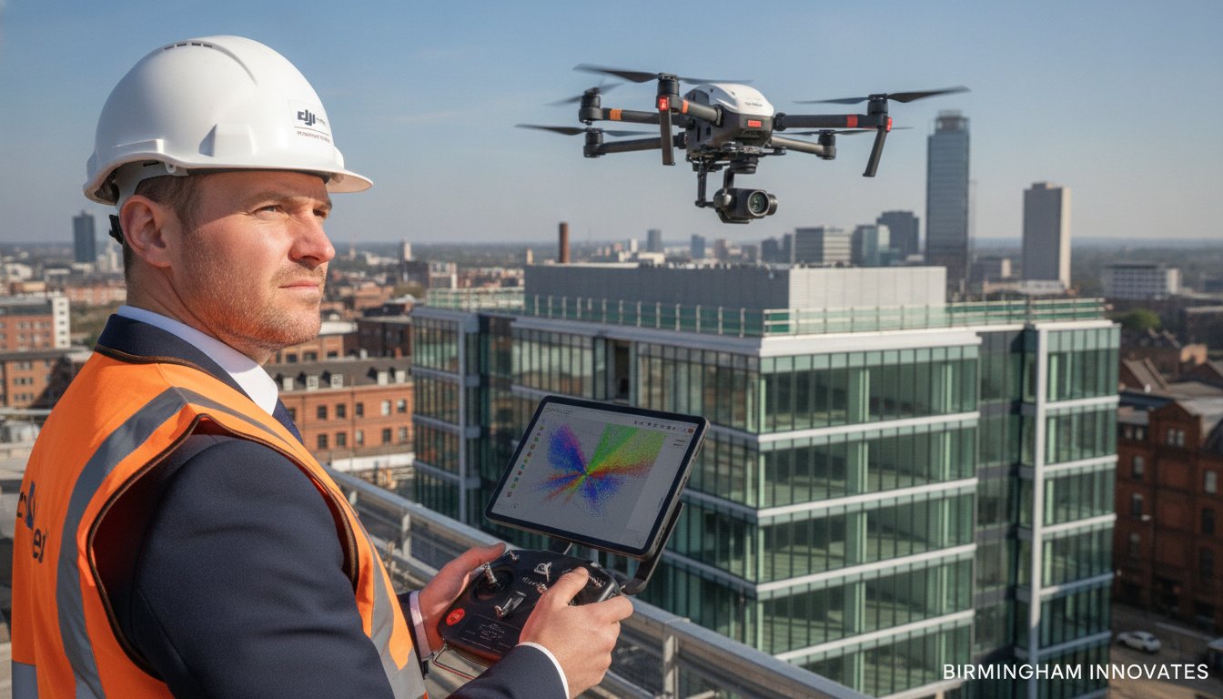
What if you could eliminate the six-figure liability of scaffolding and the weeks-long wait for site data with a single afternoon of flight? For years, the UK construction and property sectors have accepted high costs and safety risks as the unavoidable price of doing business. You’re likely all too familiar with the slow turnaround of traditional land surveys and the psychological weight of putting staff at height just to inspect a roof or a bridge. It’s a bottleneck that doesn’t just eat your budget; it stalls your entire project timeline.
This definitive guide for 2026 reveals how professional commercial drone surveys UK are transforming these outdated workflows into high-speed data engines. We’ll show you how to leverage CAA GVC certified expertise and DJI Enterprise hardware to achieve centimeter-level accuracy while virtually eliminating the need for cherry pickers. You’ll learn how technical consultancy and precision thermal imaging bridge the gap between site reality and digital planning. We’re moving beyond simple aerial photography to explore the regulatory standards, hardware capabilities, and ROI-driven processes that define current industry leadership. From PV solar farm thermal surveys to complex construction monitoring, discover the roadmap to safer, smarter, and more profitable site management.
Key Takeaways
- Learn why modern commercial drone surveys UK have evolved from simple aerial photography into high-precision geospatial data instruments essential for precision site planning.
- Understand the critical role of DJI Enterprise hardware and 4K HDR sensors in providing the granular detail required for accurate roof inspections and construction monitoring.
- Identify why CAA GVC certification and comprehensive liability insurance are the industry standards for ensuring safe, legal, and compliant aerial operations.
- Discover how drone technology reduces project overheads and safety risks by replacing traditional access methods like scaffolding and cherry pickers.
- Explore the professional end-to-end workflow that ensures data accuracy, from initial site permissions through to final post-production delivery.
What is a Commercial Drone Survey and Why is it Essential?
A commercial drone survey is a systematic process of capturing high-precision geospatial data using Unmanned Aerial Vehicles (UAVs). Unlike standard aerial photography, which captures a moment in time, a professional survey focuses on measurable, actionable intelligence. In the context of commercial drone surveys UK, this transition from “pretty pictures” to “data-centric outputs” allows project managers to integrate aerial findings directly into CAD and BIM workflows. This methodology, often referred to as an Unmanned Aerial Photogrammetric Survey, provides a digital twin of a site that is accurate to within millimeters.
To better understand the technical depth and practical realities of this industry, watch this helpful video:
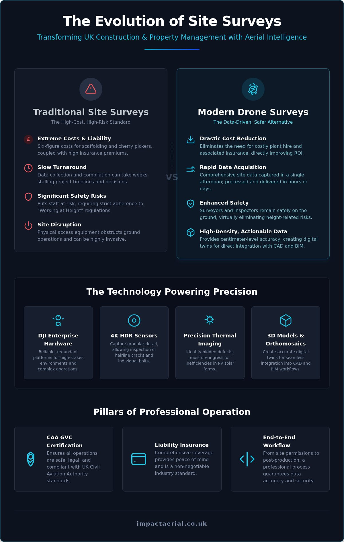
In 2026, the reliance on heavy access equipment is fading. Scaffolding and cherry pickers are no longer the default choice for initial site assessments. These traditional methods are slow to erect and carry high insurance premiums. By contrast, commercial drone surveys UK offer a non-invasive alternative that captures comprehensive site data without disrupting ongoing ground operations. This rapid deployment capability ensures that project timelines remain intact while stakeholders receive higher-density data than a manual inspection could ever provide.
The Evolution of Aerial Data Collection
The leap from hobbyist RC aircraft to DJI Enterprise intelligence has redefined professional standards. We’ve moved beyond simple visuals into the realm of multi-spectral analysis. High-resolution 4K HDR sensors capture granular detail, while thermal imaging identifies hidden defects in PV solar farms or commercial roofing. This technological maturity supports Digital Value Engineering, allowing firms to identify potential issues before they become costly structural failures. It’s a proactive approach that replaces guesswork with empirical evidence.
Key Industry Drivers for Drone Adoption
Stricter adherence to “Working at Height” regulations remains a massive driver for UK businesses. The legal and financial consequences of site accidents mean that any technology reducing human exposure to height is a priority. Drones provide this safety buffer, keeping surveyors firmly on the ground. Financial pressures also play a significant role. Property managers and construction firms are under constant demand to reduce overheads.
- Rapid Turnaround: Data that once took weeks to compile is now available in days or even hours.
- Site Monitoring: Real-time updates allow for better coordination and stockpile volumetrics.
- Cost Efficiency: Eliminating plant hire for cherry pickers directly improves project ROI.
The Technology Behind High-Precision UAV Surveying
Professional-grade results in commercial drone surveys UK depend entirely on the distinction between consumer-grade equipment and enterprise-grade hardware. While hobbyist drones are capable of capturing decent imagery, they lack the sensor stability, redundancy, and data-precision required for technical consultancy. We utilize DJI Enterprise platforms because they provide the reliability needed for high-stakes environments, such as active construction sites or offshore assets. These systems are designed to operate within the strict safety parameters defined by the UK Civil Aviation Authority (CAA) Drone Guidance, ensuring every flight is both legal and insured.
The core of our capability lies in the 4K HDR sensors. These cameras capture granular detail that allows surveyors to zoom into a single bolt on a telecommunications mast or a hairline crack in a chimney stack without losing clarity. This level of resolution is a prerequisite for generating high-fidelity 2D orthomosaics and 3D point clouds. When you need to bridge the gap between raw telemetry and architectural planning, these precision instruments provide the definitive data set your project team requires.
Visual vs. Thermal Sensors
RGB sensors are the standard choice for property marketing, roof inspections, and schedule of condition reports. They provide a clear, natural-light perspective that stakeholders can easily interpret. However, visual light only tells half the story. Thermal sensors are essential for identifying heat loss in building envelopes and diagnosing defects in renewable energy infrastructure. Thermal surveys identify “hot spots” in solar arrays by detecting localized heat anomalies that indicate cell failure or electrical resistance. This allows for targeted maintenance that preserves the efficiency of the entire site.
Data Processing and Post-Production
Capturing raw aerial data is only the first stage of the workflow. The true value of commercial drone surveys UK emerges during post-production. We transform thousands of individual images into actionable reports through photogrammetry. This process creates high-density point clouds and 3D models that integrate seamlessly with existing CAD and BIM software. For property developers, this means the aerial data can be used directly for site volumetrics or virtual tour creation.
Our meticulous approach to data handling ensures that the final output is a precision instrument. If you require a technical assessment for a complex asset, exploring professional drone commercial property surveys is a logical next step. By providing high-end output and specialized thermal analysis, we ensure your data is accurate, compliant, and ready for immediate use in your digital planning environment.
Compliance and Safety: The UK Regulatory Landscape
Operating within the UK’s airspace requires more than just technical skill; it demands a deep commitment to the legal frameworks established by the Civil Aviation Authority (CAA). For any business commissioning commercial drone surveys UK, understanding these regulations isn’t just about ticking boxes. It’s about ensuring the safety of personnel and the legality of the data collected. The CAA framework is designed to manage risk, particularly when operating near people or in built-up areas. Professional operators don’t just “fly”; they navigate a complex set of operational authorizations that grant them the legal right to conduct work where others cannot.
The General Visual Line of Sight Certificate (GVC) is the gold standard for pilots in this sector. It demonstrates a level of competency and theoretical knowledge far beyond the basic tests required for recreational use. When you hire an operator with GVC certification, you’re hiring a professional who understands the nuances of The Drone and Model Aircraft Code and can apply it to complex site conditions. This meticulous adherence to national standards is what separates a technical consultant from a casual operator.
The Legal Requirement for Commercial Work
Hiring a hobbyist or an uncertified pilot for a commercial site survey is a significant legal risk. In the UK, any “valuable consideration” exchanged for drone work classifies it as commercial operation. Hobbyists lack the specific operational authorizations needed to fly in congested areas or close to buildings, which are common requirements for property and construction projects. If an incident occurs, an uncertified pilot will likely have no valid insurance, leaving your business exposed to massive liability. We maintain strict compliance to provide total psychological comfort to our clients. You can read more about the specific requirements in our guide to the UK Drone License: A Simple Guide to CAA Rules in 2026.
Insurance and Liability Reassurance
Risk mitigation is at the heart of our operational planning. While we use DJI Enterprise hardware with built-in redundancies, we also carry £5m commercial liability insurance as a standard safeguard. This coverage protects your business from third-party risks and operational accidents that standard public liability policies often exclude. Our safety protocols involve a layered approach to protection:
- Site-Specific Risk Assessments: Detailed RAMS (Risk Assessment Method Statements) are produced for every project before we arrive on-site.
- Pre-flight Planning: We check NOTAMs (Notices to Airmen) and local flight restrictions to ensure the airspace is clear.
- On-site Safety Checks: Establishing clear take-off and landing zones to keep the public and site staff safe during the flight.
This disciplined approach ensures that every one of our commercial drone surveys UK is conducted with the highest tier of professional safety. We don’t just meet the minimum legal requirements; we set a benchmark for operational excellence in the aerial surveying industry.
Primary Applications of Drone Surveys Across Sectors
The utility of commercial drone surveys UK has expanded rapidly, moving from specialized niche applications to becoming a fundamental requirement for large-scale project management. Across the construction, property, and energy sectors, the ability to capture high-density data from a safe, ground-based position has redefined operational standards. By integrating aerial intelligence into daily workflows, businesses can move beyond reactive maintenance toward a model of proactive asset management and precision planning.
Construction and Infrastructure Monitoring
Modern construction sites rely on constant data flow to remain on schedule and within budget. Drones have replaced traditional, labor-intensive land surveys by providing high-accuracy site topography and stockpile volumetrics in a fraction of the time. This rapid data acquisition allows for real-time progress monitoring, ensuring that the digital twin of the site matches the physical reality. Safety is also significantly improved; by using UAVs, you remove personnel from hazardous zones, unstable terrains, and heights. For a deeper look at these methodologies, see our Drone Survey: The Complete Guide to Aerial Data Collection.
Commercial Property and Asset Management
In the property sector, the primary pain point has always been the cost and logistical complexity of access. Commercial drone surveys UK eliminate the need for expensive scaffolding or cherry pickers for routine roof inspections and schedule of condition reports. We capture 4K HDR imagery that provides granular detail of building envelopes, identifying structural issues that manual inspections might miss. These assets also serve a dual purpose for property advertising, providing high-end aerial filming and immersive 3D virtual tours that help secure tenancies or sales for commercial real estate.
Specialised Thermal Surveys for Solar Farms
The renewable energy sector benefits immensely from the integration of thermal sensors. Large-scale PV solar farms require regular monitoring to maintain peak efficiency, yet manual ground inspections are often impractical. Our specialized thermal surveys identify defective cells and string failures by detecting heat anomalies that indicate electrical resistance or cell damage. This precision data allows for targeted maintenance, maximizing the energy output and overall ROI of the solar asset. Regular aerial inspections ensure that minor defects don’t escalate into site-wide performance drops.
Whether you are managing a national infrastructure project or a localized property portfolio, our technical consultancy ensures you receive the highest tier of data accuracy and safety. If you are ready to modernize your site data, contact us today to discuss our professional drone surveying services and how we can support your specific project requirements.
The Impact Aerial Workflow: From Consultation to Delivery
The effectiveness of commercial drone surveys UK is rooted in a structured, methodical workflow that prioritizes data integrity and operational safety. We don’t just deploy pilots; we act as technical consultants to ensure the raw telemetry captured on-site translates into high-value business intelligence. This end-to-end process is designed to provide psychological comfort to project stakeholders while delivering the granular detail required for complex architectural and engineering decisions.
Step 1: Consultation and Planning
The initial phase centers on defining your specific data requirements. We assess site constraints, such as proximity to congested areas or restricted airspace, and determine the optimal resolution needed for your deliverables. Whether you require centimeter-level accuracy for land topography or high-resolution visual data for a schedule of condition report, we provide a transparent, professional quote based on the project’s technical scope. Securing necessary airspace clearances and conducting preliminary site research ensures that when we arrive, the operation proceeds without legal or logistical delays.
Step 2: On-Site Data Collection
Execution begins with meticulous pre-flight safety checks and the establishment of dedicated take-off and landing zones. Our pilots deploy DJI Enterprise drones, capturing 4K HDR and thermal imagery according to the pre-defined flight plan. We understand that your site is an active working environment. Our workflow is designed to minimize disruption to your daily operations, allowing work to continue while we gather data from a safe, non-invasive distance. This ground-based safety approach is a core benefit of modern commercial drone surveys UK, removing the need for heavy machinery and personnel at height.
Step 3: Post-Production and Reporting
The final stage is where raw data is transformed into precision models. Our post-production team uses specialized software to stitch thousands of individual images into 2D orthomosaics, 3D point clouds, or virtual tours. We deliver final reports in your preferred format, whether that’s a PDF summary or files ready for immediate CAD and BIM integration. For a broader look at how these technical workflows integrate with business needs, explore A Complete Guide to Professional Drone Services in the UK. This disciplined approach ensures that the data you receive is not just a visual record, but a precision instrument for your project’s success.
Future-Proofing Your Site Data with Precision Aerial Surveys
Adopting commercial drone surveys UK is no longer just a technological upgrade; it’s a strategic move towards total site safety and data-centric project management. We’ve explored how transitioning from traditional access methods to DJI Enterprise aerial platforms eliminates the risks of working at height while delivering millimeter-accurate geospatial data. By integrating these high-resolution outputs directly into your CAD and BIM workflows, you’re ensuring every decision is backed by empirical, real-time evidence. Whether you’re managing a solar farm, a construction site, or a commercial property portfolio, the goal remains the same: maximizing ROI through meticulous technical consultancy.
Impact Aerial provides the professional infrastructure your projects deserve. Our team of CAA GVC certified pilots operates with £5m commercial liability insurance, providing total psychological comfort and operational security across our UK-wide coverage. Don’t let outdated survey methods bottleneck your progress or compromise your safety standards. It’s time to leverage high-end output that bridges the gap between site reality and digital planning. You can Request a Professional Drone Survey Quote from Impact Aerial today to see how our expertise transforms your operational efficiency. We look forward to helping you elevate your next project.
Frequently Asked Questions
How much does a commercial drone survey cost in the UK?
Costs for a drone survey vary based on site size, complexity, and the specific data deliverables you require. A large construction site needing 3D point clouds requires a different investment than a small residential roof inspection. We provide transparent, project-specific quotes following an initial consultation. This ensures you only pay for the precision and sensor technology your specific asset management needs without any hidden fees.
Do I need a special license to hire a drone surveyor?
You don’t need a license to hire a professional, but the operator must hold valid CAA authorizations. Specifically, for commercial drone surveys UK, you should verify the pilot has a General Visual Line of Sight Certificate (GVC). This ensures they’re legally compliant and have passed rigorous safety assessments. Hiring uncertified hobbyists can void your insurance and lead to significant legal liabilities for your business.
How accurate are drone land surveys compared to traditional methods?
Drone surveys offer centimeter-level accuracy that rivals traditional ground-based methods while capturing significantly higher data density. By using RTK (Real-Time Kinematic) technology and DJI Enterprise hardware, we can produce digital twins that are precise enough for CAD and BIM integration. While traditional land surveys are still valuable for specific subsurface work, aerial photogrammetry provides a much faster and more comprehensive overview of surface topography and site structures.
Can drones fly in rain or high winds during a survey?
Professional drones have specific weather limitations, though enterprise models offer improved ingress protection ratings. We typically don’t fly in heavy rain or winds exceeding 20mph to ensure data quality and operational safety. High winds can cause sensor vibration, which degrades the granular detail of 4K HDR imagery. If weather conditions aren’t optimal, we’ll reschedule the flight to maintain our commitment to high-end output and precision.
How long does a typical commercial drone survey take to complete?
On-site data collection is remarkably efficient, often taking between one hour and a full day depending on the site’s scale. A standard roof inspection might be completed in under 60 minutes, while a large PV solar farm thermal survey could take several hours of flight time. The majority of the project timeline is spent in post-production, where raw telemetry is stitched into precision models and final reports for delivery.
Is my site suitable for a drone survey if it is in a restricted area?
Most restricted areas are accessible if the operator follows the correct CAA procedures for flight permissions. We handle the logistical heavy lifting, including coordinating with local Air Traffic Control or securing specific authorizations for congested UK areas. Our GVC certified pilots are trained to navigate complex airspace safely. Even if your site is near an airport or sensitive infrastructure, we can usually secure the necessary legal clearances to proceed.
What insurance should a professional drone company have?
A reputable operator must carry specialized commercial drone insurance that is compliant with EC Regulation 785/2004. For high-stakes commercial drone surveys UK, we recommend hiring companies with at least £5m in commercial liability insurance. This level of coverage provides reassurance against third-party risks and operational accidents. Always ask to see a valid insurance certificate before work begins to ensure your business is fully protected during the flight.
What kind of data files will I receive after the survey?
You’ll receive data in formats that integrate seamlessly with your existing professional software. Common deliverables include high-resolution 4K HDR images, 2D orthomosaic maps, and 3D models such as point clouds or textured meshes. For thermal surveys, we provide specialized reports identifying heat anomalies. We deliver these files via secure digital transfer, ensuring your technical team can begin analysis or CAD integration immediately after the post-production phase.
 2 Norton Drive, Wythall, Birmingham, B47 6HH Company registration number: 11138586. VAT Number: 366 9068 55


