
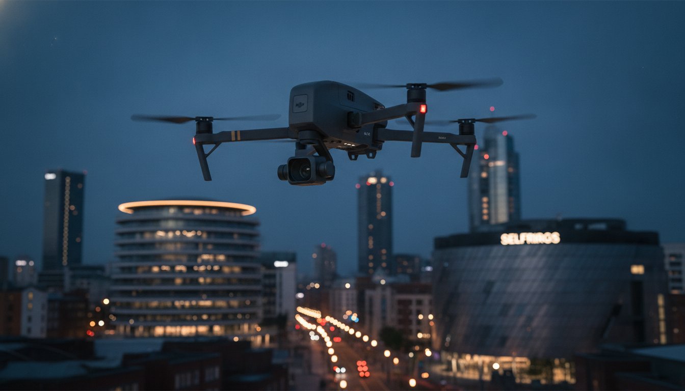
Capturing the perfect angle of the Birmingham skyline is no longer just about artistic vision; it’s a high-stakes technical operation governed by strict aviation laws. You likely understand that while a drone can reach heights a tripod never could, the density of the city centre makes traditional flights both dangerous and illegal if handled by uncertified operators. Professional aerial photography Birmingham requires more than just a camera in the sky. It demands a meticulous approach to risk mitigation and precise urban navigation.
This 2026 guide explores how professional drone services transform property, construction, and marketing projects with high-resolution imagery that meets the most demanding technical standards. You’ll learn how to secure stunning visuals while ensuring full legal compliance and psychological peace of mind. We’ll cover the essential role of CAA GVC-certified pilots, the necessity of £5m commercial liability insurance, and how DJI Enterprise hardware delivers the precise data required for construction monitoring and thermal surveys. From navigating strict urban flight restrictions to delivering post-production excellence, we provide the authoritative roadmap for your next Birmingham project.
Key Takeaways
- Understand how Birmingham’s rapid urban transformation and the “Big City Plan” are driving the demand for precise, high-resolution aerial perspectives.
- Learn how to navigate strict urban flight regulations by ensuring your provider holds CAA GVC certification and appropriate commercial liability insurance for aerial photography Birmingham.
- Discover the cost and technical advantages of using DJI Enterprise drone technology over traditional helicopter platforms for agile, high-end visual data collection.
- Identify high-value commercial applications for drone technology, including accurate construction site monitoring and technical PV solar farm thermal surveys.
- Explore the professional workflow required for successful urban operations, covering everything from complex flight permissions to expert post-production services.
The Evolution of Aerial Photography in Birmingham’s Urban Landscape
Birmingham’s skyline is currently undergoing its most significant transformation since the post-war era. As the city executes its ambitious “Big City Plan”, developers and stakeholders require more than simple ground-level documentation. While the history of aerial photography began with balloons and fixed-wing aircraft, the modern West Midlands landscape demands the agility of drone technology. Traditional ground photography often fails to capture the sheer scale of 20-year masterplans or the complex interactions between new structures and existing infrastructure. It simply cannot offer the comprehensive spatial context needed to manage a site of this magnitude.
Modern aerial photography Birmingham has transitioned from occasional historical snapshots to a vital tool for real-time progress monitoring. Developers don’t just wait for monthly site visits; they use high-resolution aerial data to track daily milestones across sprawling construction zones. This shift ensures that project timelines remain transparent and data-driven, providing a level of oversight that was previously impossible for large-scale West Midlands developments. By moving away from static archives toward live data streams, project managers can identify potential bottlenecks before they escalate.
To better understand the scale of these urban changes, watch this helpful video showing the city from above:
Capturing the West Midlands Regeneration
Major hubs like Paradise Circus and Snowhill represent the pinnacle of Birmingham’s commercial growth. By 2031, the city’s focus on green, innovative urban design will be fully realized, and documenting this shift requires precise aerial perspectives. Aerial imagery is now a staple for Birmingham City Council planning submissions. It allows officials to visualize how a proposed development integrates with the surrounding urban fabric. These perspectives provide clarity on height, shadow impact, and aesthetic harmony within the West Midlands skyline, which is essential for obtaining regulatory approval in a congested city centre.
The Impact of Professional Imagery on Property Marketing
For commercial listings, 4K HDR drone shots are no longer a luxury. High-resolution imagery creates a powerful psychological effect on potential investors, offering a “bird’s eye” view that conveys authority and scale. These visuals do more than just show a building. They provide essential context. By highlighting a property’s proximity to New Street Station or major arterial roads, aerial photography Birmingham helps investors understand the logistical value of a site instantly. This spatial awareness is a critical driver for engagement in competitive commercial markets, where the relationship between a building and its transport links can determine its ultimate market value.
Compliance and Safety: The Legal Reality of Birmingham Drone Flights
Operating a drone in a densely populated metropolitan area like Birmingham requires far more than just a Flyer ID. It’s a complex legal landscape where safety and compliance are paramount. While a hobbyist might capture a casual sunset over the canals, professional aerial photography Birmingham involves navigating strict Civil Aviation Authority (CAA) regulations that govern every second of flight time. Failure to adhere to these rules doesn’t just result in poor data; it exposes businesses to significant legal liability and hefty fines.
Safety isn’t optional. For commercial projects, the distinction between a certified professional and a hobbyist is found in their operational authorizations. Professional pilots must mitigate risks that uncertified operators often ignore, such as signal interference from urban infrastructure or the presence of uninvolved persons in public spaces. Hiring an uninsured or uncertified pilot can lead to your business being held responsible for any accidents or privacy breaches that occur during the mission.
Understanding CAA GVC Certification
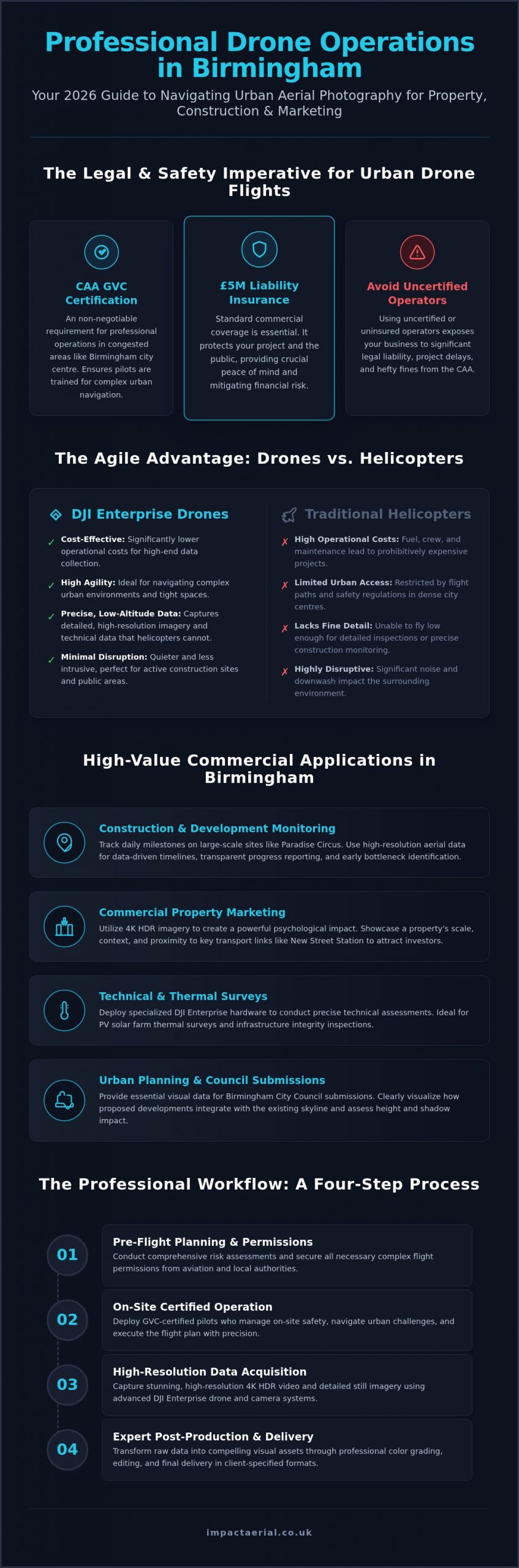
GVC certification represents the gold standard for commercial drone operation, providing the necessary legal framework for pilots to operate safely within congested city limits. This qualification allows for closer proximity flights in urban centres like the Jewellery Quarter, where buildings and people are in constant proximity. Standard ‘Open Category’ rules, specifically Category A3, often require drones to stay at least 150 metres away from residential, commercial, or industrial areas. This restriction makes capturing detailed imagery of city-centre developments virtually impossible without the specific authorizations granted to GVC-certified pilots. Maintaining this professional status requires rigorous theoretical training and practical flight tests, ensuring the pilot can handle emergency procedures in high-pressure urban environments.
Risk Mitigation and Commercial Insurance
In the corporate world, £5m public liability insurance is the industry standard for high-value sites. This level of coverage provides psychological comfort and financial security for developers and stakeholders. Aerial data has long been a cornerstone of urban planning with aerial photography, but modern digital captures require strict adherence to CAA protocols to remain valid for official use. Every professional Birmingham shoot begins with a detailed risk assessment that identifies potential hazards like power lines, tall structures, and restricted airspace. Professional services also manage the complex process of obtaining flight permissions from local authorities and air traffic control. For projects requiring high-tier compliance, exploring professional drone surveying services ensures your data is captured within the full scope of the law.
Drones vs. Helicopters: Choosing the Right Platform for Your Project
While traditional fixed-wing or rotary aircraft once dominated the skies, modern aerial photography Birmingham has been revolutionized by the emergence of enterprise-grade drone technology. The decision between a helicopter and a drone often hinges on the specific technical requirements of your West Midlands project. For broad, high-altitude landscape shots, helicopters remain a viable tool. However, for the intricate urban environment of Birmingham, the agility and precision of DJI Enterprise drones are almost always superior. Helicopters are physically limited by their size and the massive downwash created by their rotors, which prevents them from getting close to buildings without causing damage or safety hazards.
Cost-efficiency is another primary driver in the shift toward drone platforms. Traditional aerial filming in the UK used to require thousands of pounds in aviation fuel, pilot fees, and airfield logistics. Drone technology has effectively democratized these services, allowing for high-tier visual data collection at a fraction of the historical cost. Beyond the financial benefits, the environmental impact is a significant consideration for modern corporate social responsibility. Electric drones operate with a negligible carbon footprint compared to the heavy fuel consumption of traditional aircraft. This makes them the preferred choice for developers focused on sustainable urban regeneration.
Precision and Detail: The 4K HDR Advantage
DJI Enterprise sensors provide a level of technical detail that traditional platforms struggle to match at lower altitudes. The ability of a drone to hover with centimetre-level precision allows for perfectly framed “hero” shots that capture every architectural nuance. Drones can capture angles that are physically impossible for fixed-wing or rotary aircraft, such as looking directly down a narrow street or flying level with a third-story window for a structural inspection. These close-proximity capabilities are essential for property surveys where high-resolution data is needed to identify minor defects in masonry or roofing that a helicopter would simply miss from a safe distance.
Operational Flexibility in the City Centre
Urban logistics heavily favour the drone over the helicopter. Launching a drone requires a very small physical footprint, often just a few square metres of secure ground space. This rapid deployment allows pilots to capitalize on narrow “golden hour” lighting windows or brief gaps in the West Midlands weather. Additionally, noise pollution is a major factor in residential areas. Drones operate quietly, ensuring minimal disruption to the local community. Unlike helicopters, which require extensive flight planning and airfield coordination, a drone team can be on-site and airborne quickly, providing a level of responsiveness that traditional aviation cannot match in a busy city centre environment.
Commercial Applications: From Construction to Thermal Surveys
Modern aerial photography Birmingham has evolved into a multi-disciplinary tool for data acquisition. While the visual appeal of a city-centre skyline is undeniable, the commercial value lies in the precision of the data captured. From large-scale infrastructure projects to individual commercial assets, drones provide a perspective that ground-based teams cannot achieve safely or cost-effectively. This technical utility is now a standard requirement for developers who prioritize data-driven decision-making over traditional, manual inspection methods.
Construction and Development Monitoring
Regular drone flights have become essential for managing complex construction timescales. For West Midlands contractors, weekly progress reports provide a transparent audit trail for stakeholders and investors. These reports ensure that project milestones are documented with high-resolution visual evidence, which helps manage expectations and resolve potential disputes. Beyond simple documentation, creating time-lapse content allows developers to showcase the entire lifecycle of a Birmingham build, providing powerful collateral for future tenders. Learn more about our construction site monitoring services to see how we support site managers with accurate visual data.
Commercial property surveys also benefit from this high-resolution output. Inspecting a roof or a tall structural element traditionally required expensive scaffolding or risky rope access. Drones equipped with 4K HDR sensors can identify cracks, water ingress, or masonry issues in a fraction of the time. This non-invasive approach minimizes site downtime and significantly reduces the health and safety risks associated with working at height in busy urban environments.
Technical Data and Thermal Imaging
The adoption of thermal camera drones is rising rapidly for energy audits in Birmingham warehouses and industrial parks. These specialized sensors can detect heat loss and structural flaws that are invisible to the naked eye. By identifying compromised insulation or moisture trapped within roofing systems, businesses can implement targeted repairs rather than costly full-scale replacements. Read our guide on PV Solar Farm thermal surveys to understand how specialized imaging maximizes return on investment for renewable energy assets.
For marketing and engagement, virtual tour creation offers an immersive experience by combining aerial and ground-level views. This provides prospective tenants or buyers with a comprehensive understanding of a property’s layout and its position within the wider urban context. If you are ready to integrate these technical capabilities into your next project, you can request a professional drone survey to ensure full compliance and high-tier results.
Partnering with Impact Aerial: Professional Birmingham Specialists
Choosing a partner for aerial photography Birmingham requires a specialist who understands both the creative and regulatory demands of the West Midlands. Impact Aerial provides an end-to-end service that prioritizes technical precision and legal compliance. We guide our clients through a structured process, starting with an initial consultation to define project objectives, followed by rigorous pre-flight planning and expert data acquisition. Our methodology is built on a foundation of reliability and safety, ensuring that every mission delivers high-tier results that meet professional standards.
Every project begins with a comprehensive consultation where we align our technical capabilities with your commercial goals. We don’t just fly; we solve specific business challenges through high-resolution data and cinematic visual storytelling. This commitment to excellence has established us as a trusted technical consultant for corporate clients across the West Midlands. Whether you are managing a large-scale construction site or marketing a premium commercial asset, our team provides the expertise needed to navigate the complexities of urban drone operations.
Local Knowledge, National Standards
Navigating Birmingham-specific airspace restrictions requires more than just technical skill; it requires deep local insight. We manage complex permissions involving local council by-laws and specific urban flight zones, ensuring every mission is fully authorized and safe. Our track record includes successful collaborations with property developers, construction firms, and advertising agencies throughout the region. Being based in the West Midlands allows our team to offer short-notice flexibility, capitalising on optimal weather windows to deliver high-tier results without unnecessary delay.
Our pilots hold the latest CAA GVC certifications, and our operations are backed by £5m commercial liability insurance. This isn’t just a formality; it’s our promise of psychological comfort for every stakeholder involved. By partnering with a local specialist, you ensure that your project benefits from a team that knows the streets, the skyline, and the legal requirements of Birmingham inside out. We customize our service packages to meet the specific needs of Birmingham businesses, ensuring a bespoke approach for every client.
Beyond the Shoot: Post-Production Excellence
The value of our service extends far beyond the flight itself. Our in-house editing team transforms raw 4K HDR footage into cinematic marketing assets that drive engagement and showcase your project’s best features. For technical clients, we provide geo-referenced data that facilitates precise site assessments and structural monitoring. This meticulous approach ensures that the output is not just visually stunning but also technically actionable for engineers and project managers. Ready to elevate your next project? Request a bespoke aerial photography quote for your Birmingham project.
Elevating Your Birmingham Project with Precision Data
Professional aerial photography Birmingham has evolved into a critical asset for the city’s ongoing urban regeneration. By integrating CAA-compliant drone operations into your workflow, you ensure that every visual asset is captured safely and legally within the congested city centre. The transition from traditional helicopter platforms to DJI Enterprise technology allows for a level of architectural detail and technical accuracy that was previously unattainable. Whether you require precise construction monitoring or high-tier marketing visuals, the right aerial partner provides the data-centric insights necessary for success in 2026.
Impact Aerial stands as a trusted technical consultant for the West Midlands. Our team of CAA GVC certified pilots operates with £5m commercial liability insurance, providing the psychological comfort and professional reliability required for corporate projects. We handle everything from complex flight permissions to cinematic post-production. Don’t settle for uncertified hobbyists when your project’s reputation and safety are on the line.
Request a Professional Aerial Photography Quote for Birmingham to secure the high-resolution imagery your development deserves. We look forward to helping you visualize the future of the West Midlands.
Frequently Asked Questions
Do I need a permit for aerial photography in Birmingham city centre?
Most Birmingham city centre operations require specific flight permissions and coordination with local authorities or private land owners. While the Civil Aviation Authority governs the airspace, take-off and landing often require landowner permission. Professional operators manage this process by conducting site-specific risk assessments and liaising with Birmingham City Council or relevant stakeholders to ensure every flight remains within the full scope of the law.
How much does professional aerial photography cost in the UK?
Pricing for professional services is typically project-specific, reflecting the complexity of the urban environment and the technical requirements of the data. Factors such as the need for specialized sensors, the duration of the shoot, and the post-production workload all influence the final quote. For commercial projects in the West Midlands, we provide bespoke estimates after an initial consultation to ensure the service aligns with your budget.
Can drones fly in bad weather over the West Midlands?
Safety is our primary concern, and drones generally cannot operate in heavy rain or high winds that exceed the manufacturer’s safe operating limits. Enterprise-grade drones have better wind resistance than consumer models, but West Midlands weather can be unpredictable. We monitor meteorological data closely and maintain flexibility to reschedule flights during optimal weather windows, ensuring the highest quality results without compromising the safety of property.
What is the difference between a drone survey and drone photography?
The primary difference lies in the intended output and technical rigour. Drone photography focuses on aesthetic composition and high-resolution visuals for marketing or documentation. In contrast, a drone survey involves capturing geo-referenced data used for technical analysis, such as 3D mapping or structural inspections. While both use similar hardware, surveys require specialized software and meticulous flight paths to produce accurate, measurable results for engineers.
How high can a commercial drone fly for photography purposes?
Under standard UK Civil Aviation Authority regulations, the maximum legal altitude for drone flight is 120 metres, which is approximately 400 feet, above ground level. This height is sufficient to capture comprehensive views of the Birmingham skyline while maintaining safe separation from manned aircraft. If a project requires higher altitudes, specific authorizations from the CAA are necessary, which professional operators can facilitate through a detailed safety case.
What insurance should a professional drone photographer have?
A professional operator must have specialist public liability insurance that complies with EC 785/2004 regulations. For high-value commercial sites in the West Midlands, £5m in coverage is the industry standard. This insurance protects the client and the pilot against potential accidents or damage. It’s a critical requirement that distinguishes a legitimate commercial service from an uninsured hobbyist, providing essential financial security and peace of mind during urban shoots.
How long does a typical drone shoot in Birmingham take?
The duration of a shoot depends on the project’s scope, but most standard assignments for aerial photography Birmingham are completed within a half-day or full-day session. This timeframe includes on-site risk assessments, equipment setup, and multiple flights to capture various angles and lighting conditions. More complex tasks, such as construction monitoring or detailed structural surveys, may require recurring visits over several weeks to document progress accurately.
Do you provide edited videos as well as still photos?
Yes, we provide a complete end-to-end service that includes both high-resolution still imagery and professionally edited 4K HDR video. Our post-production team specializes in creating cinematic marketing assets, incorporating colour grading, sound design, and motion graphics where required. This comprehensive approach ensures that your Birmingham project is showcased through a diverse range of visual media, suitable for everything from investor presentations to large-scale digital advertising campaigns.
 2 Norton Drive, Wythall, Birmingham, B47 6HH Company registration number: 11138586. VAT Number: 366 9068 55


