
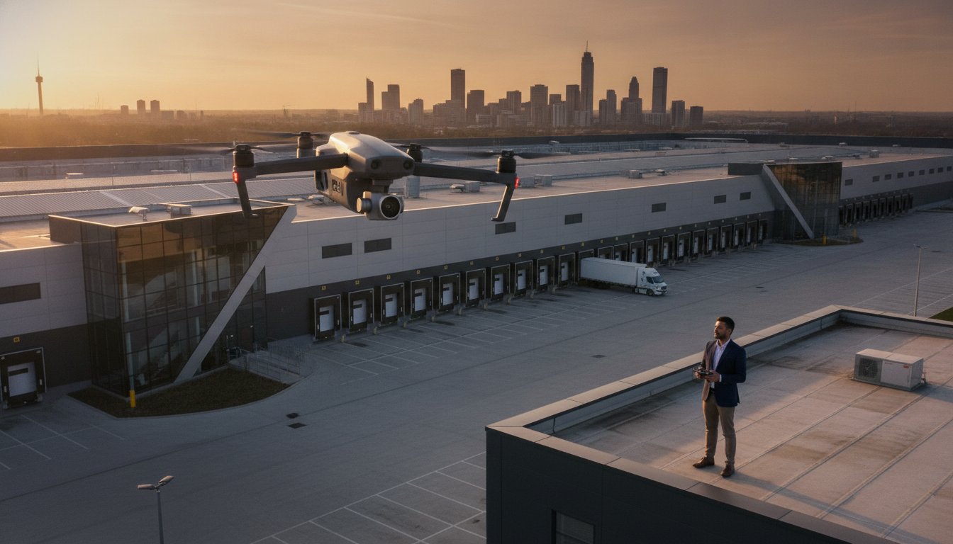
In 2026, a high-resolution aerial view of a Birmingham logistics hub or a London office development isn’t just a marketing luxury; it’s a strategic data asset that must balance cinematic appeal with strict UK regulatory compliance. You’ve likely seen how poor quality imagery fails to do justice to high-value portfolios, or perhaps you’ve felt the headache of managing multiple contractors for different visual needs. It’s a common frustration for asset managers who need to attract premium tenants while mitigating the corporate risk of hiring uninsured or non-compliant operators.
This professional guide explores how to leverage drone commercial property photography to document and manage real estate assets with precision. You’ll learn how to integrate cinematic 4K HDR drone footage with brochure-ready architectural shots to create a compelling narrative for your property. We’ll also cover the essential safety standards, including the necessity of CAA GVC certified pilots and DJI Enterprise hardware, ensuring your visual marketing is as legally robust as it is visually stunning. By the end of this guide, you’ll understand how to coordinate high-tier visual assets that satisfy both marketing departments and compliance officers.
Key Takeaways
- Learn how to integrate drone commercial property photography with ground-based architectural shots to create a comprehensive digital twin for high-value UK assets.
- Understand the critical legal requirements for 2026, including the necessity of CAA GVC certified pilots and £5m commercial liability insurance to mitigate corporate risk.
- Discover why DJI Enterprise hardware and 4K HDR post-production are essential for producing brochure-ready visuals that attract premium tenants.
- Gain insights into the tactical selection between drone, mast, and ground-level photography based on specific site restrictions and marketing objectives.
- Master the briefing process to ensure your site surveys identify hazards and optimal lighting windows before the first flight begins.
What is Commercial Property Photography in 2026?
In 2026, commercial property photography has evolved into a high-precision discipline that integrates aerial and ground-based data. It’s no longer just about aesthetic marketing; it’s a specialist service designed to document, manage, and inspect high-value real estate assets. While the history of aerial photography began with balloons and fixed-wing aircraft, modern drone commercial property photography uses DJI Enterprise UAVs to create seamless digital twins of complex UK structures. All operations must be conducted by CAA GVC certified pilots to ensure safety and legality on site.
Today’s industry standard demands 4K HDR imagery and high-resolution rectified shots that eliminate lens distortion. These assets serve a dual purpose. They provide cinematic marketing material for high-end brochures while offering technical data for ESG (Environmental, Social, and Governance) reporting. For example, high-resolution imagery helps asset managers document solar panel health or green roof biodiversity, providing tangible evidence for sustainability audits. In many cases, these photos are captured during a wider drone survey to ensure no part of the building envelope is overlooked.
Commercial vs. Residential Photography Workflows
The logistics required for a 1.2 million sq. ft distribution centre in the Midlands are vastly different from a residential shoot. Professional workflows must account for institutional stakeholders, such as pension funds and global asset managers, who require technical accuracy over lifestyle filters. This necessitates maintaining geometrically correct lines in every architectural shot. If a building’s vertical lines aren’t perfectly straight, the asset looks unstable and unprofessional to potential investors. We use tilt-shift techniques and post-production software to ensure every structure appears exactly as the architect intended.
Key Sectors Served in the UK Market
The UK market has distinct requirements across different asset classes, each demanding a specific technical approach:
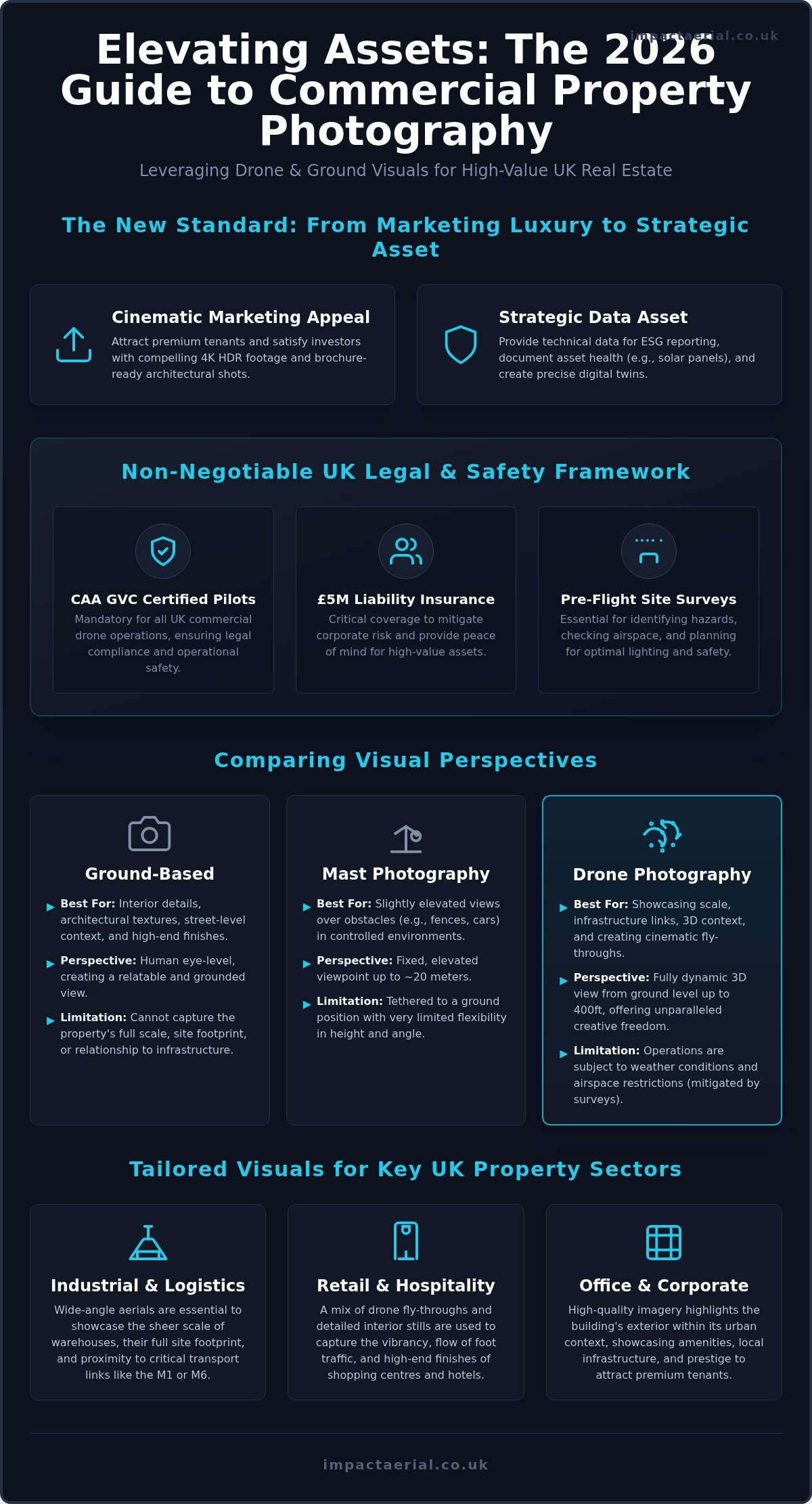
- Industrial and Logistics: We use wide-angle aerials to showcase the sheer scale of warehouses and their proximity to critical transport links like the M1 or M6. Drone commercial property photography is essential here to capture the entire site footprint in a single frame.
- Retail and Hospitality: The focus shifts to the vibrancy of shopping centres and hotel foyers. This often requires a mix of drone fly-throughs and detailed interior stills to show the flow of foot traffic and high-end finishes.
- Office and Corporate: We highlight amenities, breakout spaces, and local infrastructure. High-quality imagery captures the building’s exterior within its urban context, helping to attract premium corporate tenants who value location and prestige.
The Impact of Aerial Drone Technology on Property Marketing
Aerial technology has fundamentally changed how institutional investors perceive a site’s potential. Unlike traditional mast photography, which is tethered to a ground position and limited in height, drone commercial property photography provides a three-dimensional understanding of a development. This dynamic perspective is essential for elevating your listing with drone video, showcasing not just the building, but its relationship to critical infrastructure. For commercial valuation, demonstrating immediate proximity to arterial road networks and rail terminals is often as vital as the architectural design itself. Institutional investors don’t just want to see a building; they want to see an asset in motion. Using a specialised aerial filming drone allows us to create immersive marketing reels that guide a viewer through the site as if they were arriving in person. These cinematic fly-throughs trigger a sense of scale and prestige that static images cannot replicate.
Cinematic Video vs. High-Resolution Stills
Selecting the right medium depends on the intended platform. We deploy 4K video for website hero sections and social media reels to capture attention within seconds. Cinematic sequences create a narrative flow that ground-based shots lack, providing a “big picture” view of the property. Conversely, high-resolution stills remain the gold standard for large-format site hoardings and printed marketing brochures where every pixel is scrutinised. Combining both into a unified drone photography strategy ensures your property is represented across all digital and physical touchpoints. This integrated approach allows asset managers to maintain a consistent brand identity across their entire portfolio while providing the technical detail required by surveyors and architects.
Hardware Standards: DJI Enterprise and 4K HDR
Prosumer drones often fall short in professional commercial environments due to limited sensor sizes and poor signal stability. We utilise DJI Enterprise hardware because it delivers the precision and reliability required for complex UK sites. A critical feature is High Dynamic Range (HDR) capability, which allows us to capture intricate detail in deep shadows without blowing out bright skies. This technical edge is especially important in the unpredictable weather of the West Midlands, where lighting can change rapidly. By using DJI Enterprise hardware for drone commercial property photography, we ensure that every shot meets the technical specifications required for high-end architectural rendering. Our equipment ensures crisp, stable imagery even in challenging conditions, providing the reliability you need for high-stakes property launches. You can explore our full range of professional aerial services to see how we maintain these rigorous standards.
Comparing Ground-Based, Mast, and Drone Photography
Professional property marketing requires a multi-layered approach. While drone commercial property photography offers unmatched site-wide perspectives, it’s most effective when integrated with ground-based and mast-mounted imagery. Each platform serves a specific technical purpose. Ground-level shots provide the tactile detail of interiors, while elevated masts offer a tactical solution for extremely restricted UK city centres where flight might be prohibited under The Drone and Model Aircraft Code. Drones remain the gold standard for cinematic marketing content and comprehensive site overviews, but a hybrid strategy ensures every angle of the asset is documented with precision.
When to Prioritise Ground-Based Interiors
Capturing the internal “feel” of a corporate space requires the nuance of ground-based architectural photography. Drones are exceptional for exteriors, but they cannot replicate the subtle interplay of natural light and texture found in modern foyers or breakout areas. We use wide-angle, non-distorted lenses to document amenities like gyms and cafes, ensuring the vertical lines remain perfectly straight. This human-eye perspective is vital for attracting premium tenants who need to visualise their daily workflow within the building. It’s about documenting the flow of the space, from the reception desk to the high-end finishes of a boardroom, providing a sense of scale that aerial shots might miss.
The Drone Advantage for Site Planning
For large-scale developments, drones provide a perspective that masts and ground crews simply cannot match. They allow us to capture the full facade of tall structures without the perspective distortion common in ground-up shots. This is particularly useful for site planning and construction monitoring. By adopting a survey drone perspective, asset managers can view a 10-acre site footprint in minutes rather than hours. This speed of deployment doesn’t just save time; it provides a geometrically accurate overview that is essential for development planning and site-wide marketing. It’s a technical consultant’s approach to visual data, ensuring that drone commercial property photography contributes to both the marketing brochure and the project management file.
Compliance, Safety, and the 2026 UK Legal Landscape
Executing drone commercial property photography missions in 2026 requires more than just technical skill; it demands a deep understanding of UK aviation law. As assets become more complex and urban environments more crowded, the margin for error disappears. You must ensure your provider holds a CAA GVC certified status, which is the gold standard for pilots operating in the “Specific Category.” This certification isn’t just a badge; it’s a legal requirement for most commercial operations involving heavier enterprise hardware near buildings and people.
Professional pilots mitigate corporate risk by producing comprehensive Risk Assessment and Method Statements (RAMS) for every flight. These documents identify site-specific hazards, from overhead power lines to public footpaths, ensuring the operation remains within the law. Privacy and GDPR also play a significant role in 2026. Capturing imagery in busy urban environments requires a meticulous approach to data management, ensuring that bystanders and neighbouring properties aren’t unlawfully identified in your marketing materials. Our team handles these complexities as part of our standard drone services, providing you with peace of mind and legally compliant assets.
Understanding the UK Drone Licence in 2026
The distinction between an A2 CofC and a GVC (General Visual Line of Sight Certificate) is critical for property managers to understand. While the A2 CofC is suitable for lighter drones in less restricted areas, the GVC is essential for “Congested Areas” found in UK city centres. This qualification allows for more flexible operating distances from uninvolved persons, which is often the only way to legally capture a high-rise office block or a central retail development. The Civil Aviation Authority (CAA) strictly regulates these permissions, and operating without the correct qualification can lead to heavy fines and the invalidation of insurance policies.
Corporate Responsibility and Insurance
Hiring an uncertified hobbyist for drone commercial property photography isn’t just a safety risk; it’s a significant financial liability. Most standard public liability policies won’t cover commercial drone activity unless the pilot is specifically qualified and insured for it. We maintain £5m commercial liability insurance as a minimum standard for all corporate property sites. This level of cover protects the property owner and the asset manager against third-party damage or injury during the shoot. When vetting your supplier, use this checklist for your procurement team:
- Verify the pilot’s CAA Flyer ID and Operator ID.
- Request a copy of the current GVC or OA (Operational Authorisation) document.
- Confirm the insurance policy specifically mentions EC 785/2004 compliance.
- Review past RAMS for similar urban property environments.
If you need to ensure your next project is fully compliant and professionally executed, you can book a consultation with our CAA-certified team today.
Hiring and Briefing Your Commercial Property Photographer
Securing high-quality visual assets for a multi-million pound development starts with a clear objective. When hiring a specialist for drone commercial property photography, you must first define the primary goal of the project. Are these images intended for a high-end marketing brochure, an institutional annual report, or a technical drone survey? Each requirement demands a different flight plan and sensor configuration. A technical survey focuses on data density and overlap, whereas marketing photography prioritises “golden hour” lighting and cinematic composition to evoke an emotional response from potential tenants.
A professional team doesn’t just show up and fly. We conduct a meticulous pre-shoot site survey to identify physical hazards like telecommunication masts or overhead lines. This phase also includes solar path analysis to determine the optimal lighting windows for each building elevation. When requesting a quote, provide the exact site location, access requirements, and the specific list of deliverables you need. This allows us to prepare the necessary RAMS and ensure the operation is both safe and efficient from the moment we arrive on site.
Creating a Comprehensive Creative Brief
A detailed creative brief is the foundation of a successful shoot. You should specify a comprehensive shot list that includes hero aerials, wide context shots showing transport links, and ground-based detailed architectural features. Technical requirements are equally important. Institutional investors often require high-resolution RAW files for maximum flexibility, while marketing teams might prefer 4K ProRes video for website hero sections. We manage the entire timeline, from the initial site risk assessment to the final delivery of edited, brochure-ready assets, typically within an agreed post-production window. This phase is where RAW data is transformed through colour grading and geometric correction to ensure every vertical line is perfectly straight.
Why a Local Specialist with National Reach Matters
Choosing a Birmingham-based team provides a significant tactical advantage for rapid deployment across the West Midlands and the wider UK. We understand the local geography and the specific lighting conditions of the region’s major industrial hubs. However, consistency is the primary reason why asset managers trust us to travel nationwide. Using a single professional partner ensures that your entire property portfolio maintains a uniform visual standard, regardless of location. We don’t just provide photos; we deliver strategic assets that support your commercial objectives. To discuss your next project and ensure your marketing is as legally robust as it is visually stunning, you can request a professional commercial property photography quote from Impact Aerial today.
Securing Your Property Assets with Technical Precision
In 2026, the standard for marketing and managing high-value UK real estate has shifted toward integrated, data-rich visual assets. Professional drone commercial property photography now serves as a critical bridge between cinematic marketing and technical site documentation. By combining CAA GVC certified pilots with DJI Enterprise 4K HDR hardware, asset managers can ensure their portfolios are represented with absolute precision while maintaining full legal compliance.
The key to success lies in vetting your partners as thoroughly as your investments. Relying on experts who provide £5m public liability insurance and meticulous risk assessments isn’t just a safety precaution; it’s a commitment to corporate responsibility. Whether you’re documenting a national logistics hub or a central London office development, the right imagery attracts premium tenants and provides a clear record for ESG reporting.
Ready to transform your property’s visual narrative? Elevate your property marketing with Impact Aerial; Book your professional shoot today. We’re here to provide the technical expertise and creative vision your assets deserve.
Frequently Asked Questions
Do I need permission from the CAA for a drone shoot at my commercial property?
Commercial drone operations in the UK require an Operational Authorisation from the Civil Aviation Authority (CAA). While you, as the property owner, provide land access permission, the pilot is responsible for ensuring the flight complies with aviation law. Professional operators hold a GVC (General Visual Line of Sight Certificate) to fly enterprise-grade equipment in urban areas. This ensures the drone commercial property photography mission is conducted safely and remains legally compliant with current standards.
How much does commercial property photography cost in the UK?
Pricing for commercial property photography in the UK depends on several technical factors, including the scale of the asset, its geographical location, and the specific deliverables required. A large industrial distribution centre requires more flight time and post-production than a single retail unit. You should request a bespoke quote that accounts for pre-flight site surveys, the complexity of the airspace, and whether you require 4K HDR video alongside high-resolution stills.
Can drones fly in central Birmingham or London for property photos?
Drones can operate in major city centres like Birmingham and London, provided the pilot has the correct CAA certifications and local airspace clearances. These environments are often classified as congested areas or Flight Restriction Zones (FRZs) near airports. Professional pilots conduct thorough risk assessments and coordinate with National Air Traffic Services (NATS) where necessary. Using DJI Enterprise hardware with stable signal technology is essential for maintaining safety in these high-interference urban settings.
What is the difference between architectural photography and commercial property photography?
Architectural photography focuses on the artistic design and aesthetic intent of a building, often for portfolio use by designers. Commercial property photography is a broader, asset-focused discipline designed to market, document, and manage real estate. It prioritises the property’s relationship to its environment, transport links, and technical state. This discipline often involves integrating drone commercial property photography with ground-based shots to provide a comprehensive overview for institutional investors and asset managers.
How long does a typical commercial drone shoot take?
A typical drone shoot for a commercial asset usually takes between half a day and a full day on site. The duration depends on the complexity of the shot list and the size of the property. For example, a 10-acre industrial site requires more time for comprehensive coverage than a standalone office block. This timeframe includes the initial safety setup, multiple flight rotations to capture different lighting angles, and the necessary ground-based photography.
What insurance should a professional commercial drone photographer have?
Professional operators must carry specialist commercial drone insurance that complies with EC 785/2004 regulations. We recommend a minimum of £5 million in public liability insurance for all corporate property sites. This level of cover is a standard requirement for procurement teams and asset managers to mitigate corporate risk. It protects against third-party damage or injury, ensuring that the property owner isn’t held liable for incidents occurring during the aerial operation.
Can you provide 360-degree virtual tours for large commercial spaces?
We provide comprehensive virtual tour creation for large-scale commercial spaces, including warehouses, office floors, and retail developments. These tours allow potential tenants or investors to navigate the property remotely, providing a detailed sense of scale and layout. By integrating high-resolution 360-degree panoramas with aerial site overviews, we create an immersive digital twin of the asset. It’s a highly effective tool for international stakeholders who can’t visit the UK site in person.
What happens if the weather is bad on the scheduled day of the shoot?
Safety is our primary concern, so we don’t fly in heavy rain or high winds that exceed the technical limits of our DJI Enterprise drones. If the forecast indicates poor weather, we monitor the conditions closely in the 48 hours leading up to the shoot. In the event of a weather-related cancellation, we reschedule the session for the next available window with optimal lighting. This ensures your property is captured in the best possible conditions.
 2 Norton Drive, Wythall, Birmingham, B47 6HH Company registration number: 11138586. VAT Number: 366 9068 55


