
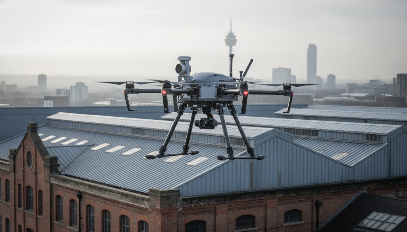
The traditional roof survey is rapidly becoming an expensive relic for Birmingham’s commercial property sector. You’ve likely felt the frustration of paying for weeks of scaffolding or hiring MEWPs just to identify a minor leak, all while worrying about the safety risks of manual inspections. Partnering with a professional drone surveyor birmingham allows you to bypass these high-cost, high-disruption methods that often feel outdated in a modern, data-driven world.
Professional aerial inspections solve these logistical bottlenecks by delivering precision data without the site downtime. We agree that your priority is maintaining site safety while securing accurate, actionable building reports. This guide demonstrates how drone technology provides 4K HDR visual clarity and thermal insights with zero disruption to your daily operations. You’ll learn about the technical requirements, from CAA GVC certifications to £5m liability insurance, ensuring your project remains fully compliant, meticulously documented, and safer for everyone involved.
Key Takeaways
- Discover how aerial inspections significantly reduce project lead times and overheads by removing the need for costly scaffolding and heavy machinery.
- Understand the technical advantages of using DJI Enterprise hardware with 4K HDR sensors to identify minute structural defects that are often missed by ground-based surveys.
- Identify the essential regulatory requirements for hiring a professional drone surveyor birmingham, including the necessity of CAA GVC certification and £5m commercial liability insurance.
- Explore how professional drone surveying ensures zero-disruption to site operations, allowing your business to continue as normal during complex structural assessments.
- Learn how high-resolution survey data is processed through professional post-production to create detailed, authoritative, and actionable building reports.
Why Drone Surveying is Essential for Birmingham Property & Construction
Birmingham’s skyline is a complex mosaic of Victorian heritage, brutalist landmarks, and glass-fronted skyscrapers. Traditional surveying methods often struggle with these tight urban spaces, where erecting scaffolding is both logistically difficult and prohibitively expensive. A professional drone surveyor birmingham provides the agility required to capture data from perspectives that are physically impossible for ground-based teams to reach safely. This technology has transitioned from a niche alternative to a core industry standard across the West Midlands, offering a fusion of technical precision and operational efficiency.
The primary advantage of aerial data collection lies in its non-invasive nature and the unprecedented depth of information it provides. By utilizing high-resolution UAVs, surveyors can identify hairline fractures, displaced tiles, or blocked guttering in a fraction of the time it takes to mobilize a manual inspection team. This speed does not come at the cost of quality; instead, it delivers a level of visual clarity that allows for more informed decision-making and long-term asset management.
To better understand how this technology is applied in professional surveying projects, watch this helpful video:
The Shift in West Midlands Site Management
A drone survey is a non-invasive aerial inspection method that uses unmanned aerial vehicles to capture high-resolution imagery and structural data. In Birmingham, construction leads are increasingly adopting this method for progress monitoring, allowing stakeholders to oversee multi-million pound developments through weekly visual updates. This data is vital for urban planning and large-scale regeneration projects, as it provides a comprehensive overview of how new structures interact with the city’s existing infrastructure and transport links.
Key Applications for Local Commercial Property
The application of drone technology is particularly effective for historic city-centre structures where traditional access might damage fragile masonry. By using photogrammetry, surveyors can create accurate 3D models of listed buildings to plan restoration works with surgical precision. Industrial zones around the city also utilize these surveys for thermal imaging to conduct energy efficiency audits. Meanwhile, in rapidly developing areas like Digbeth, drone data is essential for initial site investigations, providing developers with clear topographical insights before the first shovel hits the ground.
The Technology Behind High-Precision Aerial Data Collection
Precision in aerial surveying isn’t just about the pilot’s skill; it’s about the technical capabilities of the hardware. For a drone surveyor birmingham, the choice of equipment determines whether a structural defect is identified or overlooked. DJI Enterprise drones represent the industry gold standard because they combine airframe stability with sophisticated sensor payloads. These systems are designed to operate within strict Civil Aviation Authority (CAA) regulations, ensuring that every flight is both legal and safe while capturing high-fidelity data.
Hardware Spotlight: DJI Enterprise Capabilities
The ability to maintain flight stability is critical when navigating Birmingham’s narrow urban corridors and high-rise wind tunnels. DJI Enterprise hardware excels here, providing a steady platform for high-zoom lenses that allow for detailed asset inspection from a safe standoff distance. This means surveyors don’t need to fly dangerously close to structures to capture minute details. If you’re interested in the specific technical specs of these aircraft, you can read our guide on survey drones to see how they differ from consumer models.
While some competitors focus solely on laser scanning, the value of 4K HDR visual data shouldn’t be underestimated. High dynamic range sensors capture details in both deep shadows and bright highlights, which is essential for spotting hairline fractures in masonry or corrosion on metal roofing. This visual clarity is complemented by thermal imaging sensors, which are indispensable for PV solar farm surveys. These sensors detect “hot spots” in solar panels or identify significant heat loss in industrial units, providing a layer of data that the human eye simply cannot see.
From Raw Data to Post-Production Excellence
Every professional drone surveyor birmingham knows that raw footage is rarely enough for a commercial stakeholder to make a critical decision. The transition from raw data to an actionable report happens in post-production. Professional editing clarifies findings, highlights areas of concern, and organizes hours of flight time into concise, high-impact video summaries. This process makes the data easier for stakeholders to digest and act upon quickly.
This technical workflow often includes creating immersive virtual tours, which allow property managers to remotely inspect a site from any location. This level of documentation provides a permanent, high-resolution record of a building’s condition that traditional methods cannot match. If you need this level of detail for your next project, our team provides comprehensive drone commercial property surveys tailored to the specific needs of the West Midlands market.
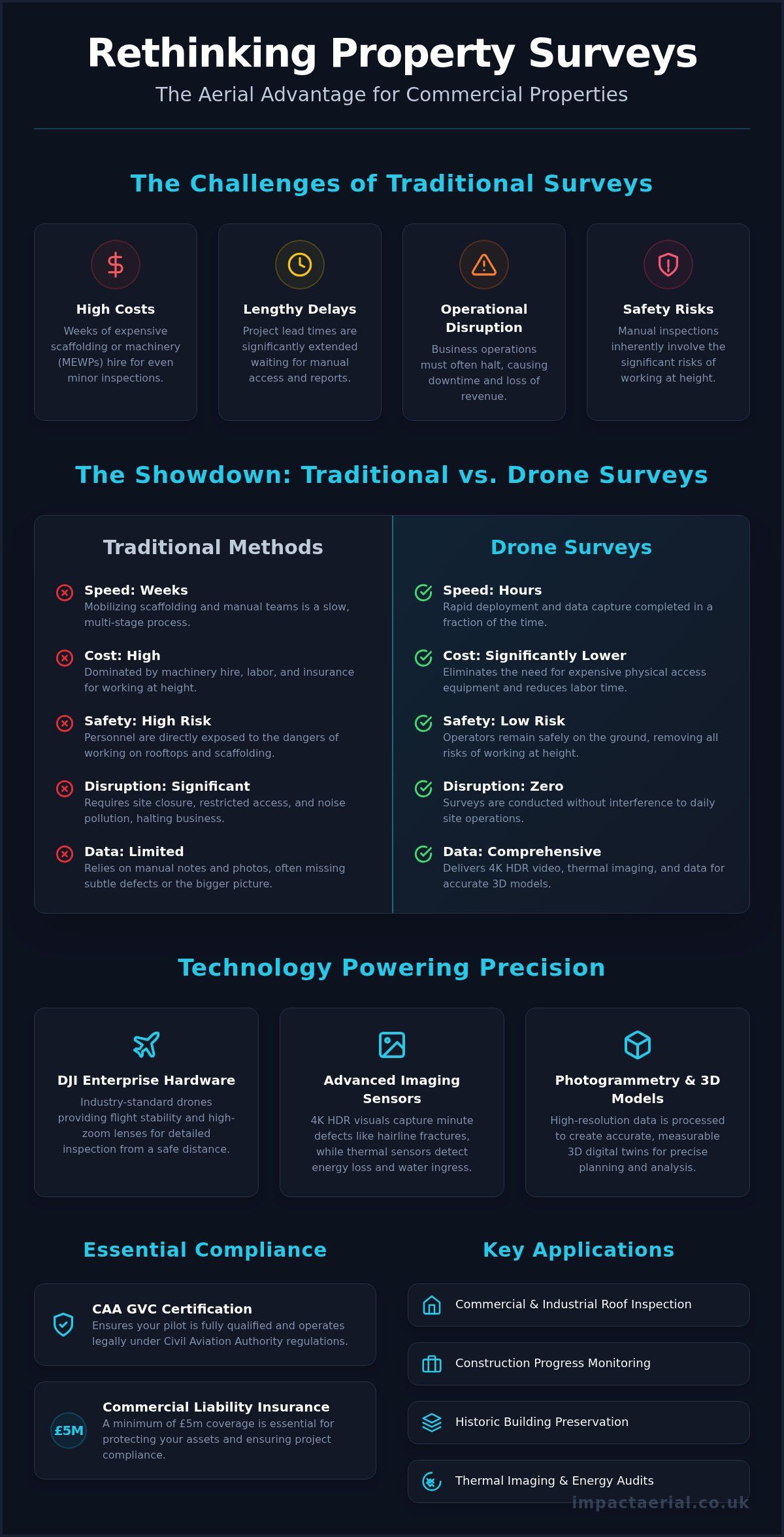
Drone Surveys vs. Traditional Access: Cost, Safety, and Speed
Choosing a drone surveyor birmingham transforms how structural health is assessed by removing the single greatest liability in the construction industry: working at height. Traditional inspections often require personnel to navigate precarious rooflines or balance on ladders to get a clear view of defects. By keeping boots on the ground, property managers significantly reduce their risk profile while obtaining superior data from angles that were previously inaccessible.
Speed is another critical differentiator that makes aerial methods the modern standard. While a manual inspection of a large Birmingham warehouse might take days of preparation and execution, an aerial survey is often completed in just a few hours. This rapid turnaround allows for faster reporting and quicker remedial action, which is vital when dealing with active leaks or structural instability that could worsen during the time it takes to organize traditional access.
Financial efficiency is perhaps the most tangible benefit for commercial clients. Some industry professionals report that drone surveys typically cost between 60% and 70% less than traditional scaffolding or MEWP (Mobile Elevated Work Platform) hire. This financial saving is coupled with the benefit of zero disruption; your business remains fully operational without the sight of steel poles or the obstruction of essential parking spaces and site access routes.
The Safety Advantage
Safety isn’t just about avoiding falls; it’s about data integrity and liability management. Using professional drone services ensures that even the most unreachable areas, such as church spires or high-rise facades, are inspected without physical contact that could damage fragile historic masonry. All operations are conducted under strict Civil Aviation Authority regulations, providing an additional layer of professional reassurance and legal compliance for corporate clients and insurers.
Economic Impact for Property Managers
For property managers, the return on investment for aerial monitoring is found in early defect detection. Identifying a loose tile or a blocked valley gutter through regular surveys prevents the catastrophic costs of internal water damage and business interruption. Often, these maintenance tasks require the expertise of tradespeople who have qualified through an intensive plumbing course UK to ensure long-term property maintenance. Additionally, drones eliminate the logistical nightmare and high fees associated with city-centre road closures often required for large cherry pickers. A drone can be deployed and complete a full roof survey in the time it takes a scaffolding team to merely unload their equipment and begin assembly.
Operating a drone in a densely populated urban centre like Birmingham requires more than just technical skill; it demands a deep understanding of the legal framework established by the Civil Aviation Authority (CAA). For a drone surveyor birmingham, compliance isn’t a checkbox but a prerequisite for every flight. Urban environments present unique challenges, such as proximity to pedestrians and the complexities of Birmingham City Council’s specific land-use policies. A professional operator must conduct rigorous risk assessments to mitigate these factors before the aircraft even leaves the ground.
The city’s geography adds layers of complexity that hobbyists simply aren’t equipped to handle. From the high-rise corridors of the city centre to the sensitive airspace surrounding Birmingham Airport, every flight path must be meticulously planned. Professional surveyors use specialized software to identify “No Fly Zones” and temporary flight restrictions, ensuring that your project doesn’t inadvertently breach national aviation laws. This level of preparation provides the psychological comfort that your business is protected from both legal repercussions and safety incidents.
The Importance of CAA Certification
The General Visual Line of Sight Certificate (GVC) is the non-negotiable standard for commercial drone operations in the UK. Unlike hobbyist flyers, GVC-certified pilots have undergone rigorous theoretical and practical examinations to prove their competence in complex environments. This certification is particularly vital when managing flights within controlled airspace or near congested areas. For a detailed breakdown of these requirements, you can consult our UK drone license guide, which explains the current 2026 standards and what they mean for commercial clients.
Commercial liability insurance is the bedrock of professional reassurance. While basic cover might suffice for rural flights, the industry minimum for urban surveying is £5m. This level of protection ensures that property owners and site managers are fully shielded against unforeseen incidents. It’s essential to verify that your chosen surveyor holds specific commercial drone insurance rather than a generic public liability policy, as the latter often excludes aviation-related risks.
A Checklist for Hiring Your Drone Surveyor
To ensure your project is handled with the necessary technical and legal precision, follow this vetting process:
- Verify CAA credentials: Ask for the operator’s Flyer ID and Operator ID, and confirm their GVC status is current.
- Review Birmingham-based projects: Experience in the local West Midlands landscape ensures they understand specific city-centre flight corridors and local restrictions.
- Confirm sensor capabilities: Ensure their hardware, such as DJI Enterprise models, matches the specific data depth you require for structural or thermal analysis.
- Evaluate the data delivery plan: Confirm how the raw footage will be processed into an actionable survey report that your stakeholders can easily interpret.
If you require a fully compliant aerial inspection for your site, our team provides drone commercial property surveys that adhere to the highest safety and regulatory standards in the West Midlands.
Impact Aerial: Your Leading Drone Survey Partner in the West Midlands
Impact Aerial operates as a specialized drone surveyor birmingham, providing a seamless bridge between raw technical data and high-end visual reporting. Being based directly in the West Midlands gives us an intimate understanding of the local architectural landscape and the specific regulatory requirements of the region. We don’t just capture imagery; we provide a comprehensive end-to-end service that manages every aspect of your project, from the initial airspace risk assessment to the final post-production edit.
Our methodology focuses on delivering psychological comfort through meticulous compliance. We understand that commercial clients require more than just a drone in the air; they need the assurance that comes with CAA GVC certified pilots and £5m commercial liability insurance. This professional foundation allows us to operate in complex Birmingham city-centre environments while maintaining the “zero disruption” standard that modern site management demands.
Our Local Expertise
Our track record in Birmingham includes a wide range of commercial property surveys and large-scale construction site monitoring projects. We utilize DJI Enterprise 4K HDR hardware to ensure that every pixel of data is sharp, clear, and actionable for your engineering teams. Beyond technical surveys, our expertise in drone photography for construction allows us to provide stakeholders with visually stunning progress reports that are as cinematic as they are accurate. This combination of technical precision and visual excellence ensures that findings are easily understood by all project stakeholders.
We offer specialized solutions tailored to the needs of the West Midlands industrial and energy sectors. This includes PV solar farm thermal surveys to identify underperforming cells and detailed property condition reports for historic city-centre assets. By combining technical precision with professional post-production, we turn complex aerial data into immersive virtual tours and structured reports that simplify your decision-making process.
Ready to Start Your Project?
Every site in Birmingham has its own set of challenges, from urban congestion to sensitive airspace near the airport. We begin every project with a thorough consultation to define your specific data and visual requirements. This ensures that the flight plan we develop is optimized for both safety and data depth, providing you with the most relevant information for your asset management needs. If you’re ready to secure faster, safer, and more accurate building data, you can Contact Impact Aerial for a Professional Drone Survey today to request a tailored quote for your site.
Future-Proofing Your Property Strategy with Aerial Intelligence
The transition to drone-led inspections represents a significant advancement for the West Midlands’ property and construction sectors. By replacing slow, hazardous manual methods with high-resolution 4K data, you gain a level of structural insight that was previously unattainable. Choosing a qualified drone surveyor birmingham ensures that your site remains fully operational while you benefit from technical precision that reduces overheads significantly. It’s no longer just an alternative; it’s the professional standard for modern asset management.
We combine deep local knowledge with the highest safety standards to deliver actionable reports. Our team of CAA GVC Certified Pilots operates with £5m Public Liability Insurance, providing the professional reassurance your business requires in complex city-centre environments. You don’t have to compromise on safety or data depth to achieve speed. Book Your Professional Birmingham Drone Survey Today and take the first step toward a safer, more efficient site monitoring process. We look forward to helping you elevate your next project.
Frequently Asked Questions
Do I need a permit for a drone survey in Birmingham city centre?
Professional drone operations in Birmingham city centre require strict adherence to CAA regulations and often specific permissions from the local authority if taking off from public land. A qualified drone surveyor birmingham will conduct a comprehensive risk assessment and handle all necessary notifications before the flight. This meticulous planning ensures your project remains fully compliant with national aviation laws while avoiding potential fines or legal complications associated with unauthorized urban flights.
How much does a professional drone survey cost in the UK?
Professional survey costs are determined by the specific requirements of your site, including the total acreage and the technical depth of the data required. Factors such as the proximity to sensitive airspace and the need for specialized thermal sensors will influence the final investment. We focus on providing a cost-effective alternative to heavy machinery, ensuring the price reflects the high-tier hardware used and the expert post-production necessary to create actionable building reports.
Can drones perform roof surveys in bad weather?
Flight safety and data quality are our primary concerns, so we don’t operate in heavy rain or high winds. Most enterprise-grade drones have specific wind resistance limits, typically around 22mph. If the weather conditions are unsuitable, we reschedule the survey to ensure the 4K HDR imagery is clear and the aircraft remains stable. This commitment to quality ensures the structural defects we identify are captured with absolute precision.
What is the difference between a drone survey and drone photography?
The primary difference lies in the technical intent and the equipment used. Drone photography focuses on aesthetic visuals for marketing or promotional use. In contrast, a survey conducted by a professional drone surveyor birmingham utilizes technical sensors to identify structural defects, thermal leaks, or maintenance requirements. The output is a data-centric report designed for engineers and property managers rather than a creative agency, emphasizing accuracy and structural integrity over visual flair.
How accurate is drone data for topographical land surveys?
When integrated with Ground Control Points (GCPs) and RTK technology, drone data is exceptionally accurate for topographical mapping. It can achieve sub-centimetre horizontal and vertical precision, providing developers with detailed terrain models. This level of accuracy is essential for initial site investigations and construction monitoring, allowing for precise volume calculations and structural alignment checks that match or exceed the results of traditional ground-based surveying methods.
Is drone surveying safer than traditional methods?
Drone surveying is inherently safer because it removes the requirement for staff to work at height. By keeping surveyors on the ground, you eliminate the risks associated with ladders, fragile roof surfaces, and scaffolding. This proactive approach to safety reduces your corporate liability and insurance burden while ensuring that even unreachable structural elements are inspected thoroughly without putting human life at risk during the data collection process.
How long does a typical drone inspection take to complete?
Efficiency is a hallmark of aerial inspections. A typical survey for a commercial warehouse or office block in Birmingham is often completed in two to four hours. This speed allows for minimal site disruption, as there is no need for lengthy equipment setup or road closures. Once the flight is finished, the data is moved into post-production, significantly reducing the total project lead time compared to traditional manual inspection methods.
What deliverables will I receive after a drone survey?
You will receive a comprehensive suite of digital assets tailored to your project goals. This typically includes:
- High-resolution 4K HDR imagery of structural defects
- Edited video summaries highlighting areas of concern
- Thermal maps for energy efficiency audits
- 3D models or orthomosaic maps for construction sites
All data is processed through professional post-production to ensure the final report is organized, authoritative, and ready for immediate review by your technical stakeholders.
 2 Norton Drive, Wythall, Birmingham, B47 6HH Company registration number: 11138586. VAT Number: 366 9068 55


