
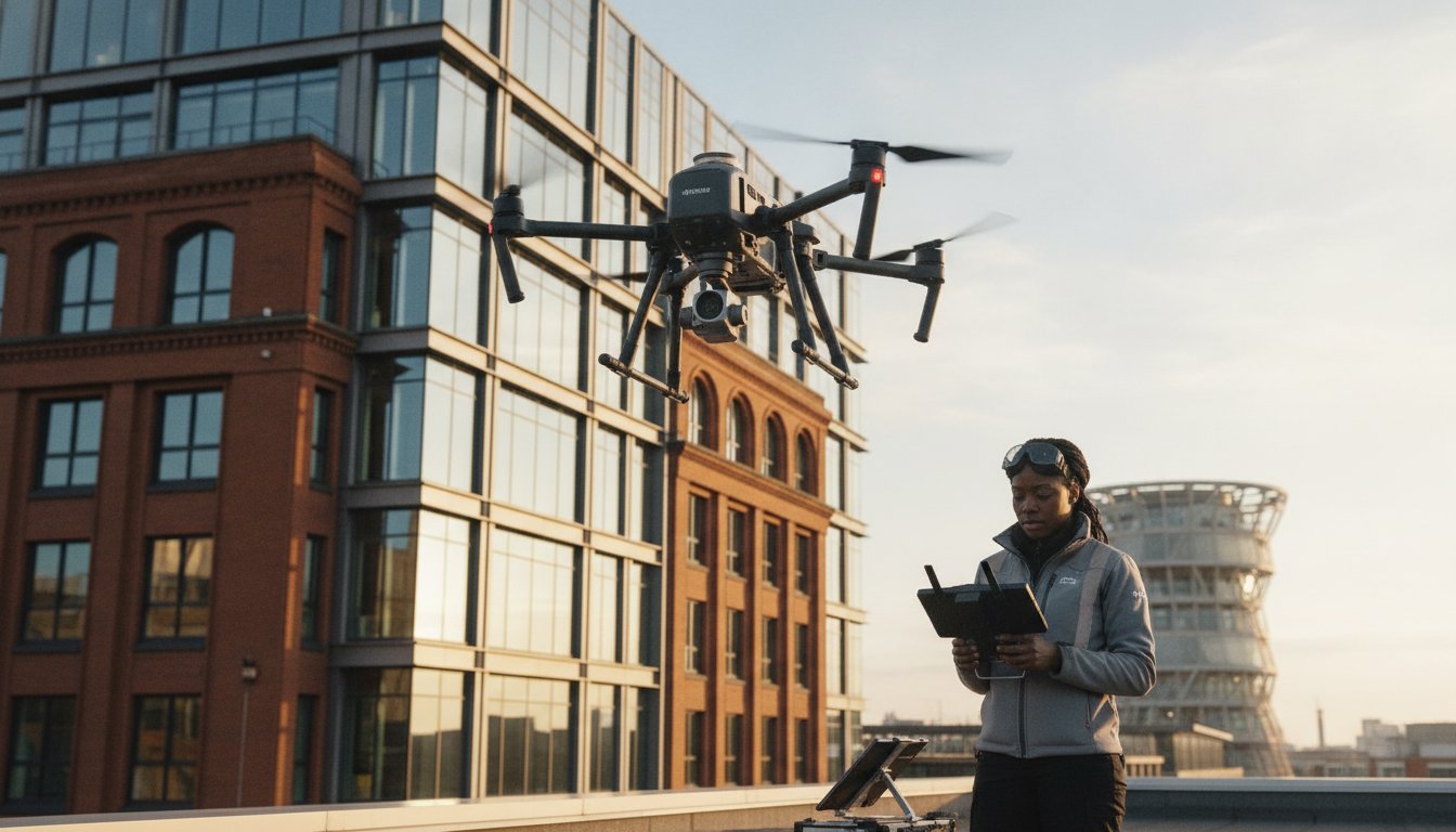
Why are you still budgeting thousands of pounds for scaffolding and plant hire just to identify a few slipped tiles or a blocked gutter? In Birmingham’s complex urban landscape, traditional access methods often create more logistical headaches than they solve, leaving property managers facing high costs and significant health and safety liabilities. You likely already know that working at height remains a primary safety concern, yet the necessity of maintaining structural integrity makes these risks feel unavoidable.
This expert guide demonstrates how a professional drone building survey in Birmingham transforms these high-risk inspections into streamlined, data-driven missions. By utilizing commercial-grade DJI Enterprise hardware and 4K HDR imaging, we provide a safer and significantly faster alternative to manual surveys. You’ll discover how to achieve full compliance with the latest CAA regulations while securing the detailed structural data required for long-term maintenance planning. We will examine the specific advantages of aerial data collection across the West Midlands, from mitigating site disruption to the precision of post-production reporting that informs your critical asset management decisions.
Key Takeaways
- Learn how DJI Enterprise sensors capture high-resolution 4K HDR data; this identifies micro-cracks and structural fatigue that manual inspections often miss.
- Understand why CAA GVC certification and £5m liability insurance are essential benchmarks for ensuring safety and regulatory compliance in the West Midlands.
- Discover how a professional drone building survey birmingham delivers significant ROI by eliminating the logistical costs and safety risks of traditional scaffolding.
- Explore how aerial data collection supports Birmingham’s commercial sectors by providing precise defect identification for retail hubs and industrial sites.
- Gain a clear framework for commissioning your next survey, including the essential details your brief must contain for accurate maintenance planning.
Drone Building Surveys: Why Essential in Birmingham?
A professional drone building survey in Birmingham is far more than a simple aerial photograph. It is a high-precision data-collection mission that utilizes Unmanned Aerial Vehicles (UAVs) equipped with 4K HDR sensors to capture granular structural details. This methodology has transformed how asset managers in the West Midlands approach maintenance, shifting the focus from basic visual inspections to comprehensive, data-driven structural analysis.
Birmingham’s unique architectural tapestry demands this level of technical sophistication. Whether you are managing sprawling industrial sites in Digbeth or sensitive heritage assets in the Jewellery Quarter, specialized aerial approaches are required to identify defects without physical contact. This non-invasive technique ensures 100% safety by removing the need for personnel to work at height while maintaining zero disruption to daily business operations.
To better understand how this technology integrates with construction and site monitoring workflows, watch this helpful video:
The Evolution of Aerial Inspections in the West Midlands
Over the last decade, drones have effectively replaced the traditional ‘man-on-a-roof’ method across the region. This transition is particularly evident in Birmingham’s 2026 urban regeneration projects, where speed and precision are paramount. Moving beyond simple photography, modern commercial drone surveys provide a digital twin of the asset, allowing for repeated, accurate measurements over time. This evolution enables property owners to track structural fatigue and water ingress with a level of detail that was previously impossible without significant manual labour.
Key Advantages Over Traditional Scaffolding
The primary driver for adopting drone technology is the total elimination of the ‘Working at Height’ risk profile. By keeping surveyors on the ground, businesses significantly reduce their liability and safety insurance concerns. The efficiency gains are equally compelling. A drone building survey in Birmingham can often complete the inspection of a complex city centre office block in just a few hours, a task that would take days to rig with scaffolding. From a financial perspective, removing the five-figure price tag associated with scaffolding hire for a simple inspection ensures that maintenance budgets are spent on actual repairs rather than access equipment.
Advanced Technical Capabilities: DJI Enterprise and 4K HDR Data
A professional drone building survey in Birmingham requires hardware that far exceeds consumer-grade capabilities. We utilize specialized professional drone systems that are recognized as the industry standard for high-stakes urban data collection. These aircraft aren’t just flying cameras; they’re sophisticated aerial platforms designed to carry advanced sensors that capture granular structural data with absolute precision.
The use of 4K HDR (High Dynamic Range) sensors is critical when inspecting Birmingham’s diverse property portfolio. HDR technology allows us to capture detail in both the brightest highlights of a glass facade and the deepest shadows of a brickwork cavity in a single frame. This clarity is essential for identifying micro-cracks, early-stage water ingress, and structural fatigue that lower-resolution equipment simply cannot detect. Beyond visual imagery, these platforms allow us to capture precise measurements and thermal data, providing a multi-layered view of a building’s performance.
Hardware Focus: Why Professional-Grade Drones Matter
Operating in the West Midlands requires equipment that can handle unpredictable weather and complex signal environments. Our professional drone systems provide the flight stability necessary to operate safely near high-rise structures, even in gusty conditions. Their advanced zoom capabilities are a significant safety feature; they allow our pilots to capture high-resolution detail from a safe stand-off distance, eliminating the risk of close-proximity flight. Furthermore, these systems feature multi-directional obstacle sensing and redundancy in their propulsion and battery systems, ensuring total reliability when flying over busy city centre streets.
From Raw Imagery to Professional Survey Reports
The value of a drone building survey in Birmingham is truly realized during the post-production phase. Raw footage is meticulously edited to enhance clarity, making it easier for structural engineers to sign off on maintenance plans. We don’t just provide a folder of images; we deliver actionable data that integrates directly into your existing property management software. This creates a permanent digital record of your building’s condition, which is invaluable for insurance renewals and long-term compliance auditing. By leveraging these advanced systems, you can secure a comprehensive drone building survey in Birmingham that provides a definitive record of your asset’s health.

Safety and Compliance: CAA GVC Certification in Birmingham
Executing a drone building survey in Birmingham requires more than technical skill; it demands a rigorous adherence to UK aviation law. The Civil Aviation Authority (CAA) mandates that commercial operators hold a General Visual Line of Sight (GVC) certification. This qualification ensures that pilots possess the theoretical knowledge and practical flight competence to operate safely in complex environments. At Impact Aerial, our commitment to this standard provides the foundational reassurance that every mission is conducted within the strictest legal frameworks.
Operating within a dense city centre involves unique liabilities that hobbyist-grade insurance cannot cover. We maintain £5m in commercial liability insurance as a baseline standard for all Birmingham projects. This level of coverage is essential for protecting your business interests when surveying high-value assets near public highways or adjacent properties. Our safety methodology begins long before the drone leaves the ground, involving a meticulous pre-flight planning process that accounts for local obstacles, weather patterns, and specific urban risks.
Navigating UK Drone Laws in 2026
The regulatory landscape for UAVs continues to evolve, making it vital to partner with an operator who understands the current UK drone license requirements. We maintain comprehensive flight logs and maintenance records for every aircraft in our fleet, providing a transparent audit trail for our clients. This documentation is particularly crucial when managing flights within restricted zones, such as the airspace surrounding Birmingham Airport (BHX). We handle all necessary coordination with Air Traffic Control and local authorities to ensure your survey proceeds without legal interruption.
Urban Risk Management and Public Safety
Conducting a drone building survey in Birmingham often means operating in high-footfall areas like the Bullring or Grand Central. Managing ‘uninvolved persons’ is a critical component of our safety protocol. We often deploy a dedicated observer to support the pilot, providing an extra pair of eyes to monitor the surrounding environment and ensure public safety is never compromised.
Privacy compliance is another pillar of our professional service. When capturing data in mixed-use zones where residential and commercial properties sit side-by-side, we apply strict data protection measures. Our sensors are focused exclusively on the target asset, and any incidental data is managed in accordance with UK GDPR. This meticulous approach to both physical safety and digital privacy ensures that your building survey is a low-risk, high-reward investment for your property management strategy.
Specific Applications for Birmingham’s Commercial Sectors
Birmingham’s property market requires a multifaceted approach to inspection. Whether you’re managing a high-rise office in the city centre or a sprawling warehouse in the Black Country, a professional drone building survey in Birmingham provides the specific data points needed for effective asset management. In the retail sector, we identify roofing defects and drainage issues across large-scale hubs, ensuring that structural maintenance doesn’t interfere with the customer experience. This sector-specific data allows for targeted repairs rather than costly, blanket maintenance programs.
For those looking to expand their footprint in the UK market, you can learn more about identifying and securing high-yield property deals through professional sourcing.
The Jewellery Quarter’s heritage assets present unique challenges for property owners. For these listed buildings, non-contact surveys are essential to preserve delicate masonry and intricate facades. Drones allow us to document every architectural detail without the vibration or physical risk associated with traditional access equipment. Similarly, for businesses investing in sustainable energy, our PV solar farm surveys use thermal imaging to identify cell failures and underperforming panels. This data-centric approach directly impacts ROI by ensuring maximum energy output for Birmingham’s commercial solar installations.
Construction Site Monitoring and Progress Reporting
Progress monitoring on West Midlands construction projects has moved beyond simple snapshots. We provide weekly site updates and stakeholder reports that offer a comprehensive view of development milestones. Our UAVs perform volumetric analysis for earthworks and material stockpiles, providing accurate data for site managers to track logistics. This improves on-site safety by reducing the need for manual inspections in hazardous zones or areas with active plant machinery. These digital updates ensure all stakeholders remain informed without needing to be physically present on-site.
Specialist Surveys: Thermal and 3D Virtual Tours
Our technical capabilities extend to detecting heat loss and insulation failures through specialized thermal sensors. This is a vital tool for Birmingham businesses looking to reduce energy costs and carbon footprints by identifying specific points of thermal bridging. We also combine high-resolution drone photography with interior data to create immersive 3D virtual tours. These tours are essential for property marketing and providing a complete building overview for remote stakeholders. By integrating aerial and ground-level data, we deliver a holistic view of the asset’s condition. If you need precise data for your commercial assets, you can book a drone building survey in Birmingham to secure a comprehensive structural report.
ROI and Next Steps: How to Commission a Drone Survey
Calculating the return on investment (ROI) for a drone building survey in Birmingham requires looking beyond the initial quote. Traditional access methods, such as scaffolding or cherry pickers, often incur five-figure costs before an inspection even begins. By contrast, aerial data collection eliminates these massive mobilization fees and the associated logistical delays. When you factor in the speed of delivery and the reduction in health and safety liability, the financial case for drone-based inspections becomes definitive. You aren’t just paying for a flight; you’re investing in a high-resolution data set that informs years of maintenance budgeting.
To secure an accurate proposal, your brief should be as detailed as possible. We require the specific location, building height, and the type of data output you need, such as thermal analysis or 3D modeling. Local Birmingham expertise is a significant logistical advantage here. Our deep understanding of the West Midlands airspace and local council policies allows us to reduce lead times and travel costs, ensuring your mission is executed with maximum efficiency and minimum site disruption.
Evaluating Your Drone Service Provider
Not all operators provide the same level of professional rigor. When vetting a provider for a drone building survey in Birmingham, you should use a strict checklist to ensure compliance and quality. Verify that they hold current CAA GVC certification and maintain at least £5m in commercial liability insurance. It’s also vital to ask for case studies that demonstrate their ability to operate in complex urban environments. A key differentiator is the quality of the final output. While many hobbyists offer ‘raw footage’, a professional specialist utilizes platforms like PHOTO iD to provide a structured survey report that highlights specific defects and structural concerns in a format ready for your engineering team.
Getting Started with Impact Aerial
Our process is designed to provide complete psychological comfort and technical precision. It begins with a detailed initial consultation to understand your specific data requirements. This is followed by a comprehensive site assessment where we evaluate local risks and airspace restrictions. Once the mission is complete, our post-production team meticulously reviews the 4K HDR imagery to ensure every micro-crack or insulation failure is documented. If you are ready to modernize your property management strategy, you can Request a professional drone survey quote today to receive a bespoke proposal for your Birmingham project.
Securing the Future of Your Birmingham Property Assets
Transitioning your maintenance strategy from reactive to data-driven is no longer a luxury; it’s a commercial necessity. By leveraging 4K HDR imagery and DJI Enterprise hardware, you gain a level of structural insight that traditional methods simply can’t match. We have explored how a professional drone building survey birmingham eliminates the logistical burden of scaffolding while providing the precise data required for long-term asset management.
Safety remains the foundation of every mission. With our CAA GVC certified pilots and £5m commercial liability insurance, you can be confident that your property inspections are handled with meticulous care. Our deep expertise in Birmingham urban airspace ensures that even the most complex city centre projects are executed without legal or operational friction. It’s time to replace high-risk manual inspections with a faster, safer, and more cost-effective digital solution.
Book Your Birmingham Drone Building Survey with Impact Aerial and take the first step towards smarter property maintenance. We look forward to helping you protect your structural investments with precision and reliability.
Frequently Asked Questions
Is a drone building survey legal in Birmingham city centre?
Yes, conducting a drone building survey in Birmingham city centre is entirely legal when performed by a CAA GVC certified operator. We coordinate with local authorities and Birmingham City Council to ensure every flight adheres to specific urban airspace regulations. Our pilots manage all necessary permissions, including coordination with Air Traffic Control if the site falls within restricted zones like the Birmingham Airport (BHX) catchment area.
How much does a drone building survey cost compared to scaffolding?
A drone survey typically costs a fraction of traditional scaffolding because it eliminates the high expense of plant hire and manual labor. While we don’t quote fixed industry rates, businesses save significantly by removing the need for 5-figure scaffolding setups. You pay for a specialized data-collection mission rather than weeks of site disruption and heavy equipment rental, making it a far more efficient allocation of your maintenance budget.
What happens if the weather is bad on the day of the survey?
If weather conditions exceed safe operating limits, we simply reschedule the mission to the next available window at no additional cost. High winds or heavy rain can compromise the stability of the DJI Enterprise hardware and the quality of the 4K HDR data. We monitor localized West Midlands weather patterns meticulously in the 48 hours leading up to a flight to ensure the safest and most accurate results possible.
Do I need to notify my neighbours or Birmingham City Council before a flight?
Professional operators handle most notifications as part of their pre-flight planning process. While you don’t usually need formal permission from neighbours, we recommend informing adjacent occupants as a matter of courtesy. Regarding the local council, we manage any specific requirements for flying over public highways or council-owned land. Our privacy protocols ensure that data collection remains strictly focused on your specific commercial asset.
How long does it take to receive the final survey report and images?
You will typically receive your processed imagery and detailed report within three to five working days. This timeframe allows our post-production team to meticulously review the raw footage and enhance the clarity of structural data for your engineers. This is significantly faster than traditional manual surveys, which often require weeks to compile comprehensive reports and coordinate site access for multiple personnel.
Can drones detect internal building issues like leaks or heat loss?
Drones detect external indicators of internal structural problems, such as thermal bridging, heat loss, or moisture ingress. By using advanced thermal sensors, we can pinpoint exactly where insulation has failed or where water is trapped behind a facade. This non-invasive method identifies the source of internal leaks and energy inefficiencies without needing to perform destructive testing on the building’s interior.
What insurance coverage should a professional drone pilot have?
A professional pilot must hold specialist commercial UAV insurance, with £5m liability coverage being the industry standard for urban projects. This specific coverage protects your business against unforeseen incidents in high-density environments like Birmingham city centre. It’s essential to verify that your provider’s insurance is current and explicitly covers commercial operations rather than simple hobbyist flight, providing you with total psychological comfort during the survey.
Is the drone survey data accurate enough for a structural engineer’s report?
The data captured during a drone building survey in Birmingham is highly accurate and specifically tailored for structural engineering requirements. Our 4K HDR cameras identify micro-cracks and material fatigue with a level of detail that often surpasses what a surveyor can see from a ladder. This high-resolution digital record provides a definitive baseline for engineers to sign off on maintenance plans and structural safety certificates.
 2 Norton Drive, Wythall, Birmingham, B47 6HH Company registration number: 11138586. VAT Number: 366 9068 55


