
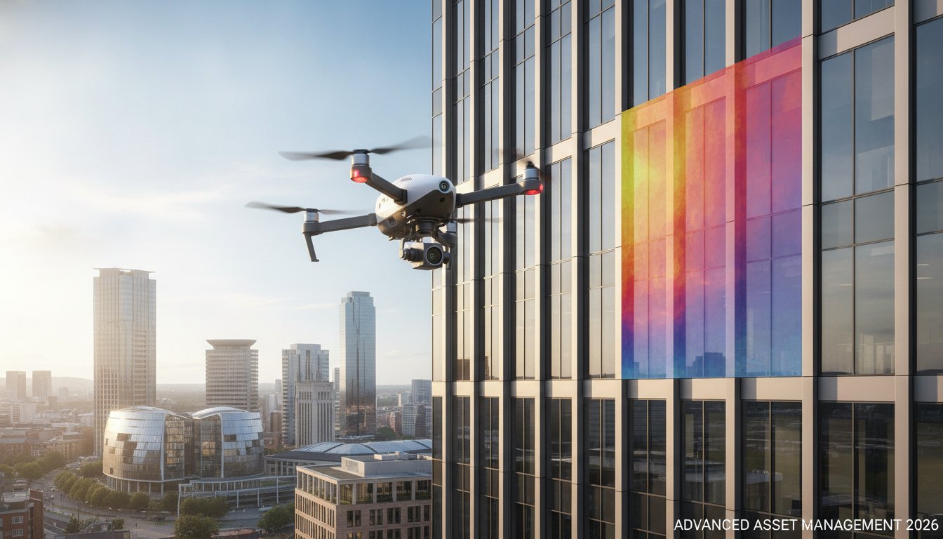
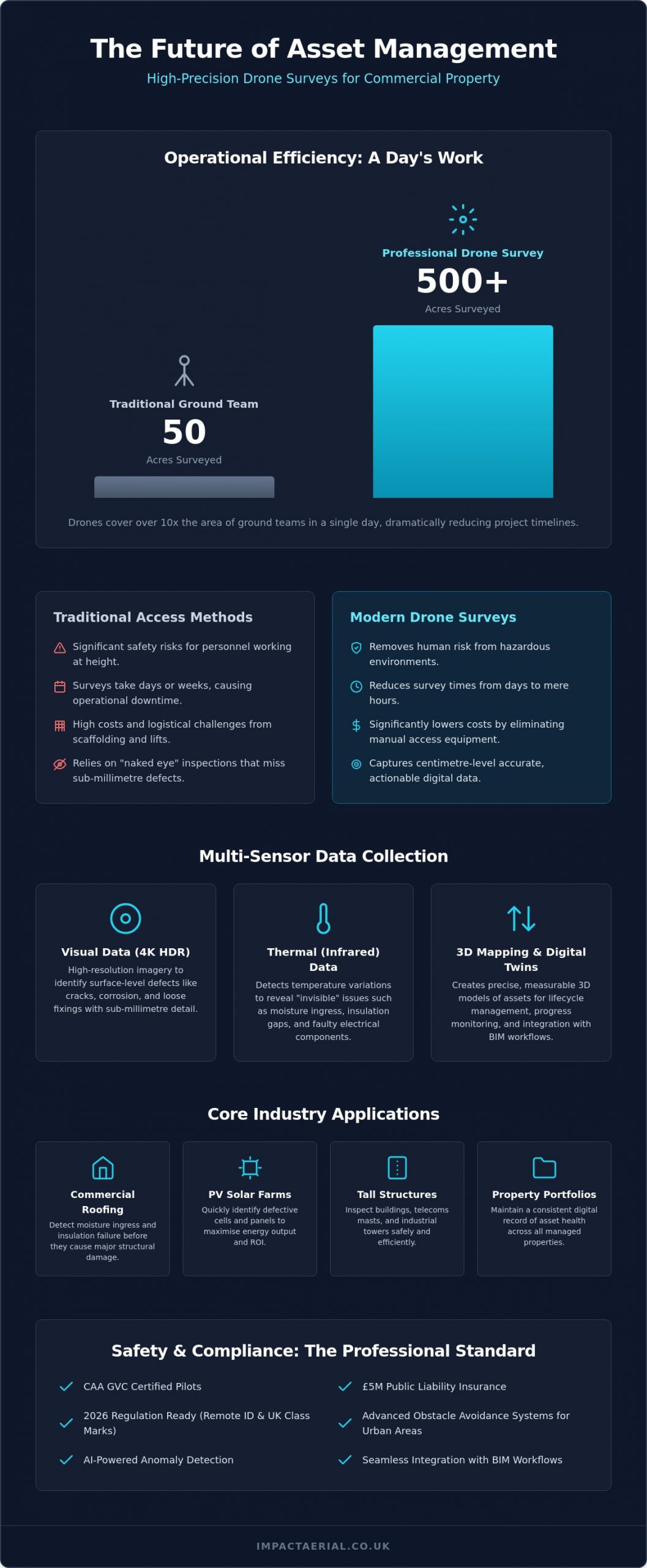
Did you know that a professional drone survey can cover up to 500 acres in a single day, while traditional ground teams often struggle to reach 50? In a dense urban environment, the logistical nightmare of erecting scaffolding often feels like an unavoidable tax on property maintenance. If you’re managing commercial assets, a drone survey birmingham offers a way to bypass these escalating costs and the inherent safety risks of manual inspections at height.
We understand that reliability and meticulous compliance are your top priorities when commissioning aerial work. This guide explains how to secure high-resolution 4K and thermal data for your decision-making while significantly reducing operational downtime. We’ll also break down the critical 2026 CAA regulatory updates, from Remote ID mandates to the new UK class marks, and explain how our advanced drone technology delivers the centimetre-level accuracy your Birmingham project demands.
Key Takeaways
- Learn how high-precision UAV sensors transform asset management by providing actionable digital data for structural integrity and external cladding inspections.
- Compare the operational efficiency of drones versus traditional access methods, focusing on how to remove human risk while reducing survey times from days to hours.
- Explore the specific benefits of thermal and 3D mapping for detecting moisture ingress in commercial roofing and maximising ROI on PV solar farm arrays.
- Understand the 2026 regulatory landscape to ensure your drone survey birmingham is conducted by CAA GVC certified pilots with professional £5m liability insurance.
What is a Drone Survey and How is it Transforming Birmingham’s Asset Management?
A professional drone survey birmingham represents a significant technical evolution in how we monitor the built environment. Rather than relying on static images, modern Unmanned Aerial Vehicles (UAVs) act as airborne data collection platforms. They use 4K HDR sensors and thermal imaging to capture high-precision datasets that were previously inaccessible. This shift from simple visual observation to actionable digital data is critical in 2026. For property managers in the West Midlands, this means moving away from traditional “naked eye” inspections that often miss sub-millimetre defects or hidden thermal leaks.
To understand the broader context, it’s helpful to look at What is an Aerial Survey and how it has historically served as a foundation for mapping and structural analysis. Today, this technology facilitates proactive asset lifecycle management. By identifying issues before they require emergency repairs, Birmingham’s commercial property owners can maintain structural integrity while controlling long-term costs. It’s no longer just about taking a photo; it’s about creating a digital record of an asset’s health.
To better understand the practical application of this technology in the local area, watch this video regarding professional drone services:
The Core Technology: More Than Just a Flying Camera
Precision is the hallmark of professional operations. We utilize DJI Enterprise hardware because it offers the stability and signal reliability required for complex urban environments like Birmingham city centre. These platforms carry 4K HDR cameras capable of capturing sub-millimetre detail on structural defects, from hairline cracks in masonry to loose cladding fixings. The process doesn’t end when the drone lands. Raw data is meticulously processed into a comprehensive survey drone inspection report. These reports provide stakeholders with a clear, data-backed roadmap for maintenance, prioritising urgent repairs to prevent further degradation.
Why 2026 is the Year of the Autonomous Inspection
The landscape of aerial data collection has changed rapidly. In 2026, advanced obstacle avoidance systems allow for safe flight in congested city centres where traditional methods would be too risky or disruptive. AI now plays a vital role, automatically scanning thousands of images to identify rust, cracks, and thermal anomalies with a level of consistency humans can’t match. This data isn’t just for standalone reports; it integrates directly into Building Information Modelling (BIM) workflows. This allows architects and engineers to overlay current aerial data onto digital twins of Birmingham’s most iconic commercial assets. As the demand for a drone survey birmingham grows, the focus remains on delivering high-fidelity data that supports smarter, faster business decisions.
Types of Aerial Data: Visual, Thermal, and 3D Mapping Explained
Selecting the correct data capture method is the most critical decision in any drone survey birmingham. A standard visual inspection is excellent for identifying surface cracks, but it won’t reveal the hidden moisture trapped beneath a warehouse roof. To provide a truly comprehensive asset report, we deploy a range of specialised sensors tailored to the specific structural or environmental challenge. This technical approach ensures that the data we provide is not just a collection of images, but a functional tool for asset management.
High-resolution visual data remains the primary tool for structural integrity assessments on tall buildings and telecommunications masts. Using 4K HDR cameras, we identify corrosion, loose fixings, or masonry decay that ground-based teams simply cannot see. When we need to understand the “invisible” health of a building, we switch to thermal (infrared) sensors. These detect minute temperature variances, highlighting moisture ingress or insulation gaps in commercial roofing systems before they become costly structural failures. Adhering to UK drone safety and compliance laws ensures these complex data sets are collected legally and safely in urban environments.
For construction and land development, photogrammetry and 3D mapping allow us to create accurate digital twins of Birmingham’s evolving skyline. While photogrammetry is perfect for visual site monitoring, LiDAR (Light Detection and Ranging) is the superior choice for topographic surveys on complex terrain. LiDAR uses laser pulses to penetrate vegetation and provide centimetre-level accuracy, even on overgrown sites. This distinction is vital for developers who need precise ground-level data without the time-consuming process of manual clearing.
Thermal Imaging for Energy Efficiency
Thermal drones are essential for maintaining PV solar farms. By identifying “hot spots” in real-time, we help operators prevent cell failure and maximise energy output. This technology is equally valuable for industrial warehouses across the West Midlands, where detecting insulation gaps is a key step in meeting UK Net Zero building standards. If you need to evaluate your property’s thermal performance, you can book a professional property survey to get started.
Visual Surveys for Preventative Maintenance
Preventative maintenance is about catching small issues before they escalate. We conduct close-quarter inspections of chimney stacks, bridges, and listed Birmingham heritage sites without the need for expensive scaffolding or cherry pickers. A drone survey birmingham provides the high-detail imagery required for insurance claims and long-term structural preservation. To ensure your assets are protected by the most suitable policy, you can check out Compare Property Insurance to find the best rates for your portfolio. This approach allows for continuous construction site monitoring without interrupting ground operations, keeping your project on schedule and within budget.
Drones vs. Traditional Access: A Commercial Comparison for 2026
For decades, commercial property managers in the West Midlands accepted the logistical burden of scaffolding as a necessary evil. In 2026, a drone survey birmingham has replaced these cumbersome methods by offering a faster, safer, and more data-rich alternative. Traditional access methods, such as rope access or cherry pickers, require extensive setup times and introduce significant health and safety liabilities. By removing the human element from high-risk environments, we eliminate the primary cause of workplace accidents at height while providing a more detailed perspective of the asset.
The difference in speed is stark. A manual inspection of a complex multi-storey structure that typically requires three days of scaffolding erection and surveying can now be completed in a four-hour drone flight. This efficiency doesn’t come at the cost of precision. We use pre-programmed, repeatable flight paths to ensure that asset comparisons are consistent year-on-year. This creates a reliable audit trail for structural health, allowing you to track the degradation of specific components with centimetre-level accuracy over several years.
Reducing Operational Downtime in Birmingham
Conducting a drone survey birmingham allows your commercial assets to remain fully operational throughout the inspection. In busy commercial hubs like Brindleyplace, traditional scaffolding causes significant disruption to tenants and pedestrians, often requiring pavement closures and complex permits. Drone operations minimise this footprint entirely. We also provide rapid deployment services, responding to emergency structural concerns or storm damage within hours. This agility ensures that critical safety decisions are made based on real-time data rather than waiting for a manual team to arrive on-site.
The ROI of Aerial Data Collection
The return on investment is clear when evaluating the commercial benefits of modern technology. By choosing a professional drone survey over traditional scaffolding hire, businesses avoid the high costs of equipment rental and the labour-intensive assembly process. Early detection of rust, loose cladding, or minor leaks prevents these issues from developing into catastrophic failures that require six-figure repair budgets. Most property managers achieve a 70% reduction in total inspection costs by replacing traditional access methods with high-precision aerial data collection. This financial saving, combined with superior data, makes the transition to drone-led inspections a strategic business decision for any asset owner.
Core Industry Applications: From Solar Farms to Property Portfolios
A drone survey birmingham provides the high-precision data necessary for diverse commercial sectors, ranging from heritage preservation to heavy industrial site management. While visual inspections are now a baseline requirement, the true value lies in the sector-specific application of sensor technology across the West Midlands. For Birmingham landlords, rapid external cladding and roof surveys are vital for maintaining compliance with fire safety and building regulations. These surveys provide a meticulous record of an asset’s condition without the logistical delays or high costs associated with traditional access methods.
In the infrastructure sector, high-zoom enterprise drones allow for the safe inspection of rail networks and bridges. Engineers can identify fatigue, corrosion, or structural decay from a distance, completely removing personnel from track-side hazards. This methodology is becoming the standard for asset managers who prioritise safety and data accuracy. For the West Midlands’ extensive bridge networks, this approach avoids the need for complex road closures, significantly reducing the cost of routine maintenance while ensuring every bolt and weld is documented for historical comparison.
Specialised PV Solar Farm Thermal Surveys
PV solar farm thermal surveys are essential for maintaining peak efficiency on large-scale arrays. Using radiometric thermal sensors, we detect faulty bypass diodes and string failures that are invisible to the naked eye. This georeferenced data allows maintenance teams to navigate directly to the affected panel, reducing labour time and ensuring the site meets 2026 UK renewable energy performance standards. By identifying cell degradation early, operators can maximise their return on investment and prevent small faults from escalating into significant power losses. Our approach provides a level of technical detail that ground-based teams simply cannot match within the same timeframe.
Drones in the Construction Lifecycle
The construction sector relies on drones for more than just progress photos. During the earthworks phase, drones equipped with RTK technology generate centimetre-accurate point clouds. This allows for precise volume calculations of stockpiles and excavations, ensuring that contractors are billed accurately for material moved. Weekly progress captures provide stakeholders with a clear, visual record of development, which is essential for transparent reporting and project management. Read our guide to professional drone services to see how drones improve site safety throughout the build.
If your business requires high-precision data for asset management or site monitoring, you can book a professional drone survey to secure an accurate, compliant assessment of your commercial property.
Safety, Compliance, and Hiring: Choosing a Professional UK Drone Service
Commissioning a drone survey birmingham requires more than just finding a skilled pilot; it demands a partner who operates within the strict legal framework established for 2026. As the technology has matured, so have the regulations. Modern aerial inspections are no longer viewed as experimental but as a regulated professional service. Hiring an uncertified operator doesn’t just risk poor data quality; it exposes your business to significant legal and financial liabilities. We prioritize meticulous compliance to ensure every flight is conducted safely and according to the latest national standards.
Risk mitigation is the cornerstone of urban operations. Before any drone takes flight in a congested area like Birmingham city centre, a comprehensive pre-flight site assessment is mandatory. This includes identifying local hazards, establishing emergency procedure protocols, and ensuring Remote ID is active as per 2026 mandates. Data privacy is equally critical. Professional operators must adhere to strict GDPR protocols when handling aerial imagery that may capture public spaces or private property, ensuring that your data collection remains compliant with UK privacy laws.
Insurance is another non-negotiable factor. While some hobbyist-level operators may offer basic cover, £5m commercial liability insurance is the industry standard for enterprise work. This level of protection provides the reassurance that all stakeholders are covered in the unlikely event of an incident. It reflects a commitment to professional standards that matches the high-precision data we deliver for your commercial assets.
Understanding CAA Regulations in 2026
The distinction between hobbyist flying and commercial ‘Specific Category’ operations is sharper than ever. The CAA GVC (General Visual Line of Sight Certificate) is the legal necessity for pilots conducting complex commercial work in 2026. This certification proves the pilot has the technical knowledge and flight competence to operate in challenging environments. If you hire an uncertified or uninsured operator, your business could be held liable for any regulatory breaches. Consult our UK drone license guide for full compliance details and to understand the current requirements for Flyer and Operator IDs.
What to Look for in a Birmingham Drone Partner
When selecting a partner for a drone survey birmingham, look for proven experience in your specific industry. A team that understands thermal solar arrays or construction monitoring will provide far more value than a generalist. The quality of deliverables is the ultimate metric of success. You should receive actionable, data-rich reports and 3D models, not just raw footage that requires further processing. Local expertise is also a significant advantage. A Birmingham-based team understands the local airspace constraints and can offer rapid West Midlands deployment for emergency inspections. Contact Impact Aerial for a professional consultation on your next Birmingham survey project to ensure your data is captured with precision and total compliance.
Future-Proofing Your Assets with Precision Aerial Data
Adopting a drone survey birmingham is no longer just a trend for forward-thinking property managers; it’s a fundamental risk mitigation strategy for 2026. By transitioning from manual, high-risk inspections to data-driven aerial surveys, you secure a more accurate record of structural health while significantly reducing operational costs. Whether you’re managing a vast PV solar farm or a heritage property in the city centre, the ability to detect defects early prevents minor maintenance issues from escalating into expensive structural failures.
Choosing a partner who prioritises meticulous compliance is essential for protecting your commercial interests. As a local specialist, we provide the technical expertise required to navigate the 2026 regulatory landscape safely and legally. Our team utilizes a Birmingham-based specialist fleet operated by CAA GVC certified pilots, backed by £5m commercial liability insurance for your total peace of mind. High-precision data is the key to smarter, more efficient asset lifecycle management.
Request a Professional Drone Survey Quote from Impact Aerial today and discover how we can streamline your next inspection project. We’re ready to help you elevate your asset management standards with industry-leading aerial intelligence.
Frequently Asked Questions
Are drone inspections as accurate as manual inspections?
Drone inspections frequently exceed the accuracy of traditional manual methods. By using DJI Enterprise hardware equipped with 4K HDR sensors, we capture sub-millimetre detail on structural defects that might be missed by the naked eye. When combined with RTK technology, these systems provide centimetre-level positioning data, which is essential for high-precision 3D mapping and repeatable year-on-year asset comparisons.
What are the legal requirements for drone inspections in the UK for 2026?
In 2026, the Civil Aviation Authority (CAA) requires all commercial pilots to hold a GVC (General Visual Line of Sight Certificate) for complex operations. All drones must have Remote ID enabled to broadcast their identity and location during flight. Additionally, operators must display a valid Operator ID, and drones placed on the market must carry a specific UK class mark, ranging from UK0 to UK6.
How much does a drone roof survey cost in Birmingham compared to scaffolding?
While we don’t provide fixed costs without a site assessment, industry data indicates that drone surveys are significantly more cost-effective than traditional access. You eliminate the high daily hire rates and the labour costs associated with scaffolding assembly and strike. For large-scale commercial assets, a drone survey birmingham can reduce total inspection expenditure by 50% to 75% compared to manual methods.
Can drones perform inspections in confined spaces or indoors?
Specialised UAVs are designed specifically for internal and confined space inspections. These units feature protective cages and sophisticated collision-avoidance sensors, allowing them to navigate industrial tanks or large Birmingham warehouses safely. This capability removes the requirement for personnel to enter hazardous, high-risk, or oxygen-depleted environments, significantly improving site safety protocols.
What happens if the weather is bad on the day of the drone survey?
High winds and heavy rain are the primary reasons for rescheduling a flight. While our enterprise hardware can handle moderate conditions, safety and data clarity remain our priorities. We monitor local weather forecasts meticulously in the days leading up to a project and coordinate with clients to find the next available window with optimal flying conditions.
Do I need to notify my neighbours or Birmingham City Council before a drone flight?
Professional operators handle all necessary pre-flight planning and risk assessments. For most private commercial sites, you don’t require formal council permission, though we check for local airspace restrictions near airports or sensitive sites. We always recommend informing immediate neighbours as a matter of professional courtesy to maintain transparency and address any privacy concerns early.
How long does it take to receive the inspection report after the flight?
Most comprehensive inspection reports are delivered within 48 to 72 hours of the flight completion. This timeframe allows our technical team to process raw 4K imagery or thermal data into actionable, professional reports. This rapid turnaround is a major advantage for a drone survey birmingham, as it enables property managers to make faster, data-backed decisions on urgent structural repairs.
Can drones detect thermal leaks or moisture in a building’s structure?
Radiometric thermal sensors are highly effective at detecting moisture ingress and heat loss that is invisible to the naked eye. By identifying minute temperature variances on a building’s surface, drones highlight exactly where insulation has failed or where water is trapped beneath a roof membrane. This data is vital for Birmingham businesses aiming to meet UK Net Zero building standards and reduce energy costs.
 2 Norton Drive, Wythall, Birmingham, B47 6HH Company registration number: 11138586. VAT Number: 366 9068 55


