
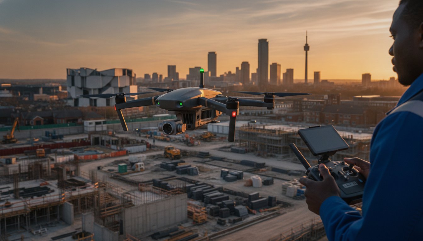
With the UK drone market now valued at over $1.1 billion, it’s clear that unmanned aircraft have moved far beyond the realm of hobbyist gadgets. You likely recognize that capturing the true scale of a West Midlands construction site or a city-centre development requires the unique perspective of professional aerial photography in Birmingham. Yet, operating in a dense urban environment brings valid concerns regarding the latest 2026 CAA regulations, from Remote ID mandates to the strict requirements for green flashing lights during night operations.
We understand that you need more than just a striking visual; you require actionable 4K HDR data and the peace of mind that comes with £5m commercial liability insurance. This guide will show you how expert drone filming can transform your project’s marketing and technical oversight while maintaining a safety-first approach. We’ll break down the critical differences between GVC-certified commercial pilots and casual flyers, explain the impact of the 2026 UK class marks, and demonstrate how high-resolution surveys provide the precision your stakeholders demand.
Key Takeaways
- Understand why CAA GVC certification is now the industry standard for ensuring legal compliance and safety in Birmingham’s complex urban airspace.
- Discover why professional aerial photography birmingham has become the preferred choice over helicopters for capturing high-resolution architectural details and reducing project costs.
- Learn how construction and property sectors utilize DJI Enterprise hardware to generate actionable data for site monitoring and premium marketing.
- Explore the technical benefits of an end-to-end service that includes regulatory feasibility checks and expert post-production editing.
- Identify the critical insurance and safety benchmarks, including £5m liability coverage, required to mitigate operational risks during commercial drone missions.
What is Professional Aerial Photography in Birmingham?
Professional aerial photography in Birmingham represents the intersection of advanced aviation technology and high-end imaging. While the historical definition of What is Aerial Photography? encompasses any image taken from an airborne platform, modern commercial standards rely almost exclusively on Unmanned Aerial Vehicles (UAVs). These systems have replaced traditional helicopter shoots because they offer superior agility and precision at a fraction of the operational footprint. For Birmingham’s rapidly changing skyline, this technology provides the only viable way to document vertical growth without the logistical complexity of manned aircraft.
To better understand how these perspectives translate to real-world visuals of the city’s skyline, watch this helpful video:
The city is currently undergoing a massive transformation under the ‘Big City Plan’, which aims to create over 1.5 million square metres of new floorspace. Capturing these developments requires more than just a camera in the sky; it demands a technical understanding of urban flight paths and high-dynamic-range (HDR) imaging. Professional aerial photography birmingham services ensure that every detail of a new development, from the Bullring to the Jewellery Quarter, is documented with clarity that serves both promotional and engineering purposes. It’s about providing a meticulous record of change that ground-based photography simply cannot match.
The Core Benefits for West Midlands Businesses
Local firms benefit from the rapid deployment of DJI Enterprise hardware, which can be airborne within minutes of site arrival. This efficiency is critical for time-sensitive construction milestones where project managers need immediate visual confirmation of progress. Unlike traditional scaffolding or fixed-wing aircraft, drones navigate tight urban corridors with ease, providing perspectives that were previously impossible to achieve. This capability offers a cost-effective alternative for routine inspections and marketing campaigns, allowing businesses to allocate resources more effectively while maintaining high standards of visual output and operational safety.
Marketing vs. Technical Aerial Data
There is a distinct difference between cinematic storytelling and technical data collection. In the property and tourism sectors, the focus is on visual impact, using 4K HDR cameras to capture vibrant, high-contrast scenes that drive engagement. Conversely, a technical drone survey prioritizes “hair-splitting” detail and measurable data. These surveys use high-resolution imagery to identify structural anomalies or track site topography with centimetre-level accuracy. Whether you’re producing a promotional film for a new commercial listing or conducting a complex roof inspection, the choice of sensor and flight profile is tailored to the specific technical requirement of the mission.
Navigating UK Drone Laws and Safety in Birmingham
Birmingham’s airspace is among the most strictly monitored in the UK. Because of the proximity to Birmingham International Airport and the density of the city centre, flying a drone for commercial purposes requires meticulous planning. It’s not just about getting the shot. It’s about adhering to the latest UK drone laws and safety protocols. Every mission involves a comprehensive pre-flight survey to identify Flight Restriction Zones (FRZs) and potential hazards like high-rise buildings or public gatherings. Failure to account for these variables can lead to significant legal penalties and operational shutdowns.
You must ensure you hire a drone license holder for any commercial project. As of 2026, the Civil Aviation Authority (CAA) has tightened enforcement on unauthorized commercial flights. Working with a registered operator isn’t just a legal requirement. It’s a risk management strategy. Professional aerial photography birmingham providers conduct site-specific risk assessments to ensure that every flight is conducted within the legal framework of the Specific category. This involves checking for temporary flight restrictions, which are common during events like Birmingham Pride or major construction milestones.
Why CAA GVC Certification is Non-Negotiable
The General Visual Line of Sight Certificate (GVC) is the industry standard for commercial drone operations in urban environments. It proves a pilot’s competency in handling complex maneuvers and understanding aviation law. In the West Midlands, where multi-million pound developments are the norm, the GVC allows pilots to operate closer to buildings and people than a standard hobbyist could ever legally manage. This certification is essential for remaining compliant with the 2026 standards. These rules now include mandatory Remote ID broadcasting for enterprise-grade hardware and green flashing lights for any night-time operations.
The Role of £5m Commercial Liability Insurance
Standard insurance policies are rarely sufficient for the complexities of city-centre flight. We maintain £5m in commercial liability insurance to provide absolute reassurance for project managers and stakeholders. This level of coverage is a hallmark of a professional service. It protects against the unforeseen operational risks inherent in high-value sectors like construction and infrastructure. It ensures that if an incident occurs, the financial and legal interests of the client remain fully protected. Risk mitigation starts long before the drone leaves the ground. If you’re planning a project and need to verify flight feasibility, you can consult with our technical team to review the specific airspace requirements for your site.
Drones vs. Helicopters: The Best Choice for Birmingham Projects
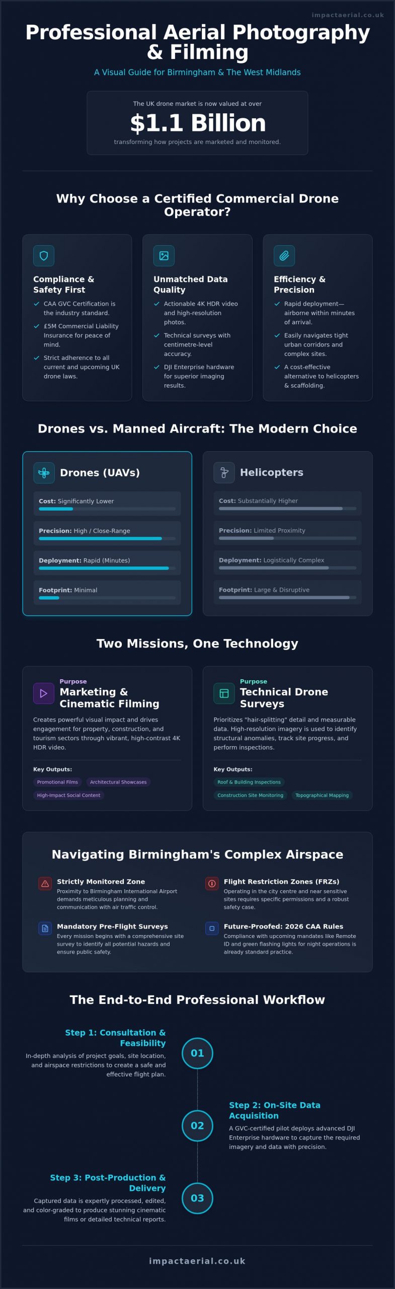
For decades, the only way to achieve a bird’s-eye view of the city was via manned aircraft. Today, the choice between drones and helicopters for aerial photography birmingham projects is largely determined by precision and budget. While helicopters offer speed across vast distances, they lack the surgical accuracy required for modern urban development. Manned aircraft must maintain a minimum altitude of 1,000 feet over congested areas like Birmingham city centre. This restriction prevents them from capturing the close-quarter architectural details that define a building’s character. Drones operate in the space between ground level and 400 feet, providing a perspective that is both intimate and expansive.
Operational costs represent another significant divide. A helicopter mission involves substantial fuel expenses, pilot fees, and airport landing charges. In contrast, electric UAVs are highly efficient and have a negligible carbon footprint. This makes them the preferred choice for firms committed to ESG (Environmental, Social, and Governance) targets. By removing the need for aviation fuel and large flight crews, drone technology allows for more frequent site visits and data capture sessions without inflating the project budget. This level of detail is vital for Sector-Specific Applications such as heritage management and land surveys, where every centimetre of a structure must be documented. For more information on how local heritage and community initiatives benefit from these detailed visual records, click here.
Operational Flexibility and Urban Access
Drones provide a level of agility that manned aircraft cannot match. We can launch a mission from a small car park or a construction compound, avoiding the need for heliports. This small operational footprint is essential in residential areas of Birmingham where noise pollution and disruption must be kept to a minimum. Because drones can fly at low altitudes, they capture angles that were previously only accessible via expensive scaffolding or cranes. They navigate tight urban corridors with ease, ensuring that even the most tucked-away architectural features are visible in high resolution.
Post-Production and Deliverable Quality
The workflow for an aerial filming drone mission is significantly more streamlined than helicopter-based shoots. Digital stabilization systems on modern drones ensure that 4K HDR footage remains perfectly still, even in the gusty conditions often found around the West Midlands. On-site, we can review data immediately on high-brightness monitors, allowing for instant feedback and adjustments. This real-time review ensures that every technical requirement is met before the team leaves the site. Once the flight is complete, the digital files integrate seamlessly into post-production suites for 3D virtual tour creation or cinematic editing, providing a faster turnaround for time-sensitive marketing campaigns.
Sector-Specific Applications in the West Midlands
Professional aerial photography birmingham is no longer restricted to simple marketing shots. It has become a vital component of industrial and commercial operations across the West Midlands. By utilizing DJI Enterprise grade hardware, we provide specialized data that supports complex decision-making processes in several key sectors. This technical approach ensures that every flight delivers maximum value, whether it’s for an energy firm or a property developer. The precision offered by modern UAVs allows us to capture data that was previously too expensive or dangerous to obtain.
Construction and Building Site Progress
Construction projects in Birmingham require constant oversight to remain on schedule and within budget. We provide regular site monitoring that offers stakeholders a clear bird’s eye view of development milestones. This data is essential for progress tracking and accurate reporting to investors. Beyond simple visuals, aerial data supports precision site planning and mapping. It allows teams to overlay architectural plans with real-world progress to ensure every phase of the build aligns with the original design specs.
Safety is another primary driver for adoption. Drones allow for the inspection of hard-to-reach areas, such as high-level roofing or structural joints, without the need for expensive scaffolding or risky manual climbs. This proactive approach to safety audits helps identify potential issues before they become costly delays. It provides a meticulous record of site conditions that can be used for insurance purposes or health and safety compliance reviews.
Commercial Real Estate and Advertising
We produce cinematic video content that captures the architectural elegance of a property while demonstrating its functional advantages. Utilizing professional drone photography has been shown to significantly increase enquiry rates by providing potential tenants with a comprehensive understanding of the site. It’s about creating an emotional connection through visual storytelling while providing the technical detail that commercial buyers demand.
Our expertise also extends to specialized technical fields. We offer PV solar farm thermal surveys that identify defective cells and energy inefficiencies invisible to the naked eye. For large-scale Birmingham venues, we create immersive virtual tours that allow event planners to explore spaces remotely with 360-degree clarity. If you’re ready to integrate these specialized services into your next project, you can book a consultation with our Birmingham team today to discuss your technical requirements.
The Impact Aerial Approach: From Consultation to Post-Production
Our operational framework is designed to provide a seamless transition from initial concept to the delivery of high-resolution technical data. Every project for aerial photography birmingham begins with a rigorous consultation phase. We don’t just launch a drone; we conduct a comprehensive feasibility study that accounts for Birmingham’s specific urban density and the latest 2026 CAA regulations. This ensures that your project is legally compliant and operationally sound from day one. By integrating project management with technical execution, we remove the uncertainty that often accompanies complex aerial missions.
Hardware choice is a critical pillar of our reliability. We utilize DJI Enterprise grade drones, which are engineered for the demanding environments of the West Midlands. These systems offer redundant flight controllers and advanced obstacle avoidance, ensuring that we can capture 4K HDR imagery with absolute precision. This level of technology is vital for maintaining the safety standards our commercial clients expect, particularly when operating near sensitive infrastructure or high-value assets. It’s this commitment to using industry-leading tools that allows us to deliver the “hair-splitting” detail required for technical surveys and high-end marketing alike.
Project Management and Post-Flight Editing
The value of our service extends well beyond the flight itself. Once the raw data is captured, our post-production team begins the meticulous process of transforming it into marketing-ready assets. This includes professional colour grading to ensure visual consistency and the integration of graphics or music for cinematic video projects. We fill the “post-production gap” by providing a complete workflow that handles everything from the initial risk assessment to the final edit. We deliver these high-resolution files via secure cloud platforms, providing you with immediate access to actionable data for construction monitoring or property advertising.
Why Choose a Local Birmingham Expert?
Choosing a local specialist means working with a team that has deep knowledge of West Midlands flight paths and restricted zones. We understand the nuances of local airspace, from the flight restriction zones near the airport to the specific requirements for city centre developments. This local expertise translates to quicker response times and a more efficient regulatory approval process. We’re committed to providing professional, authoritative drone services that prioritize the safety and success of your Birmingham-based projects. Our meticulous approach ensures that every mission is conducted with the highest level of compliance and precision.
Booking your aerial photography birmingham project is a straightforward process. It starts with a technical review of your site and a discussion regarding your specific deliverables. Whether you need a one-off survey or recurring site monitoring, our team is ready to provide the expert insight your project deserves. You can contact us today to begin your project feasibility check and secure a professional perspective for your West Midlands development.
Elevating Your Birmingham Project with Professional Precision
The landscape of the West Midlands is evolving rapidly. Adopting professional aerial photography birmingham is no longer a luxury; it’s a strategic necessity for construction monitoring and commercial marketing. You’ve seen how the 2026 CAA regulations and Remote ID mandates have redefined safety in the city centre. By choosing a partner that prioritizes technical data over basic imagery, you ensure your project stakeholders receive the high-resolution 4K HDR insights they require.
Our team utilizes DJI Enterprise Grade Hardware to deliver unparalleled reliability and visual quality. We operate as CAA GVC Certified Pilots, providing the legal framework needed for complex urban missions. With £5m Commercial Liability Insurance, we offer the psychological comfort and risk mitigation essential for high-value developments.
Ready to transform your site oversight? Request a professional aerial photography quote from Impact Aerial today. We look forward to documenting your vision with technical excellence and local expertise.
Frequently Asked Questions
Do I need a permit for aerial photography in Birmingham city centre?
Yes, specific permissions are required for most flights within the city centre due to its dense urban environment and proximity to Birmingham International Airport. Professional operators manage the necessary coordination with Air Traffic Control and the West Midlands Police to secure flight authorization. This process ensures all operations remain compliant with local bylaws and temporary flight restrictions that frequently affect the city’s central business district.
What is the difference between a hobbyist and a professional drone pilot?
The distinction lies in legal certification, the level of insurance, and the technical capability of the hardware used. Professional pilots hold a CAA GVC (General Visual Line of Sight Certificate), allowing them to operate in congested areas where hobbyists are legally restricted. Professionals also carry specialist commercial liability insurance and utilize enterprise-grade equipment designed for high-resolution data capture and superior reliability in complex environments.
How much does professional aerial photography in Birmingham cost?
Project costs are determined by the specific technical requirements, the duration of the flight, and the complexity of the post-production workflow. Factors such as the need for specialized thermal sensors or coordination within restricted airspace will influence the final investment. Because every mission is unique, we provide bespoke quotes that reflect the precise deliverables and regulatory checks required for your specific West Midlands site.
Can drones fly in bad weather or high winds in the West Midlands?
Enterprise drones are engineered to withstand moderate winds and light precipitation, but safety and image quality are the deciding factors for any flight. Most professional systems have a maximum wind resistance rating of approximately 12 to 15 metres per second. If conditions exceed these safety limits or visibility is significantly reduced, we reschedule the mission to protect the equipment and ensure the data meets our high-quality standards.
What insurance coverage does a professional drone service need?
Commercial drone operators must have specialist public liability insurance that complies with EC Regulation 785/2004. Standard business or hobbyist insurance is insufficient for commercial missions. We maintain £5 million in commercial liability coverage to protect our clients and the public during operations on high-value sites. This level of protection is a standard requirement for most construction, infrastructure, and industrial projects in the UK.
How long does it take to receive the final edited aerial photos?
The turnaround time for aerial photography birmingham typically ranges from 24 hours for raw data to five working days for fully edited assets. While initial imagery can often be reviewed on-site, professional post-production requires time for meticulous colour grading and technical verification. For complex cinematic videos or detailed structural surveys, we ensure every deliverable undergoes a rigorous quality check before being shared via our secure cloud platform.
Are there weight limits for drones flying over people in the UK?
Yes, UK aviation law dictates strict weight categories and proximity rules based on the drone’s class mark and the pilot’s certification. Under the 2026 regulations, drones are classified from C0 to C4, each with specific limitations regarding flight over uninvolved persons. GVC certified pilots operating in the Specific category can fly heavier aircraft with a detailed risk management plan, whereas lighter drones in the Open category follow different distance requirements.
Can you provide thermal imaging for industrial roof surveys?
We provide specialized thermal imaging using DJI Enterprise sensors to identify structural anomalies and heat loss. This technology is essential for detecting water ingress in industrial roofing or identifying defective cells in solar farm installations. The thermal data is processed alongside high-resolution visual imagery to create a comprehensive report that highlights technical issues invisible to the naked eye, supporting proactive maintenance and energy efficiency audits.
 2 Norton Drive, Wythall, Birmingham, B47 6HH Company registration number: 11138586. VAT Number: 366 9068 55


