
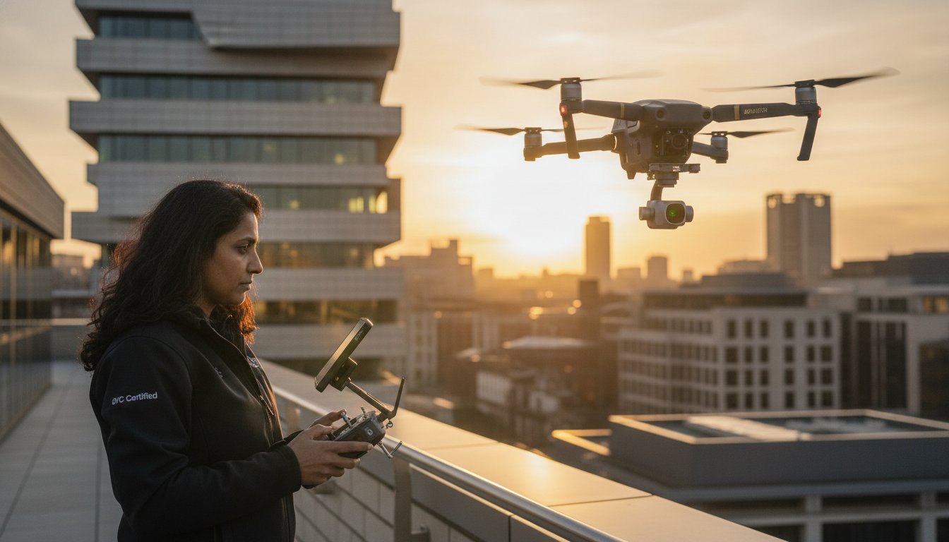
In 2026, the distinction between a hobbyist and a legal commercial operator is no longer just a matter of creative skill; it’s defined by a strict new 100g weight threshold and mandatory Remote ID broadcasting. You likely recognize that high-end commercial drone photography can transform your project’s visual impact and ROI. However, the mounting complexity of CAA compliance and the fear of receiving low-quality, shaky results can make the investment feel like a significant risk. It’s understandable to feel overwhelmed by the transition to UK class markings and the requirement for green flashing lights during night operations.
This guide will clarify the path to professional-grade aerial imagery while ensuring your operations remain fully legal under the latest UK aviation standards. You’ll gain a technical understanding of what constitutes a “pro” shot and how to navigate the 2026 regulatory landscape with confidence. We’ll also provide a structured framework to help you choose between the costs of a DIY setup and the security of hiring a GVC-certified expert with the necessary £5m commercial liability insurance. By the end of this article, you’ll have a clear roadmap for capturing precision data and stunning visuals without the legal or technical headaches.
Key Takeaways
- Learn why professional sensor specifications and 4K HDR capabilities are now the minimum technical standards for high-end industrial and property imagery.
- Understand the 2026 UK drone regulations, including the necessity of CAA GVC certification and new Remote ID requirements for full legal compliance.
- Evaluate the true ROI of commercial drone photography by comparing the hidden costs of DIY equipment and licensing against hiring a vetted specialist.
- Discover how to mitigate operational risk through detailed Risk Assessments (RAMS) and the reassurance of £5m commercial liability insurance.
- Identify the importance of professional post-production in transforming raw aerial data into high-value, polished commercial assets for your business.
What is Professional Commercial Drone Photography in 2026?
Professional commercial drone photography is the strategic use of Unmanned Aerial Vehicles (UAVs) to acquire high-resolution visual data for industrial, commercial, and marketing purposes. While early adoption often focused on the novelty of the “flying camera,” the industry has matured into a sophisticated technical discipline. In 2026, aerial imagery is a functional necessity across the UK’s built environment. High-tier output now requires 4K HDR (High Dynamic Range) as a baseline. This technology ensures that details in both deep shadows and bright highlights are preserved, which is essential for technical inspections and high-end marketing. Without this dynamic range, images often lose critical data in high-contrast environments, such as construction sites or glass-fronted commercial properties.
The role of the professional pilot has also evolved beyond simple flight control. It’s no longer sufficient to simply maintain a stable hover. Modern commercial drone photography requires an operator who functions as both a technical flight technician and a creative director. They must understand light, composition, and the specific data requirements of the client while maintaining strict adherence to CAA safety protocols. This dual expertise allows the pilot to capture imagery that isn’t just visually striking but also serves a specific business objective, whether that’s a marketing hero shot or a technical survey.
The Evolution of Aerial Perspectives
The history of aerial photography reveals a transition from expensive, logistically heavy helicopter charters to the agile, battery-powered systems we use today. Drones provide a unique spatial context that ground-based cameras cannot replicate. Bird’s-eye views are perfect for mapping large-scale infrastructure, yet the real value often lies in low-altitude aerials. These shots provide an intimate, human-scale perspective that is particularly effective for commercial property marketing, where showing the relationship between a building and its immediate surroundings is vital.
Key Industries Benefiting from Drone Imagery
Several sectors have integrated UAV technology into their standard operating procedures to improve efficiency and visual impact.
- Commercial Real Estate: Aerial views are essential for showcasing the scale of logistics hubs and their proximity to transport infrastructure. They provide potential investors with a comprehensive view of the asset.
- Construction: Site managers use imagery for progress reporting and precision monitoring through a drone survey, which provides a verifiable audit trail of works and helps identify potential issues before they become costly.
- Advertising: Brands rely on cinematic hero shots to create compelling narratives. The ability to move a camera through three-dimensional space allows for storytelling that was previously cost-prohibitive for most UK businesses.
The Technical Blueprint: Professional Hardware vs. Consumer Gadgets
Achieving high-end results in commercial drone photography depends heavily on the physical capabilities of the hardware. While consumer-grade drones often boast high megapixel counts, they typically lack the sensor size necessary for professional-tier output. Professional systems utilize 1-inch sensors or larger, which provide superior light-gathering capabilities and a higher signal-to-noise ratio. This hardware advantage is essential for print-ready imagery and detailed web assets. In 2026, 4K HDR is the technical baseline for the industry. It allows for the preservation of intricate details in deep shadows and bright highlights, ensuring that no data is lost during high-contrast shoots, such as those involving reflective glass facades or industrial steel structures.
Precision is another area where professional systems diverge from consumer gadgets. In regions like the West Midlands, where wind conditions can be unpredictable, advanced gimbal stabilization is mandatory. These mechanical systems ensure tack-sharp images by counteracting micro-vibrations and gusts, maintaining a perfectly level horizon. Our commitment to utilizing top-tier professional hardware ensures that every flight delivers consistent and repeatable results. If you require high-resolution data for your next project, our team provides professional aerial filming and photography tailored to your specific technical requirements.
Camera Sensors and Optics
Professional optics offer a level of clarity that digital zoom simply cannot replicate. To manage light effectively, professional pilots use Neutral Density (ND) filters. These act as “sunglasses” for the sensor, allowing us to maintain specific shutter speeds and apertures for optimal exposure. Every shot is captured in RAW format, providing the maximum amount of data for the post-production stage. This flexibility is vital for color grading and detail recovery, ensuring the final asset aligns with your brand’s visual standards. All operations are conducted while strictly adhering to the legal guidelines for Navigating UK Drone Laws and Safety.
Flight Technology and Reliability
Safety is integrated into the core of professional flight technology. Omnidirectional obstacle avoidance systems provide a critical layer of protection for both the site infrastructure and the UAV itself. For long-term projects like construction monitoring, GPS positioning allows for precise, repeatable survey shots. This ensures that a photo taken in January can be perfectly overlaid with one taken in June, providing an accurate visual audit. Managing the logistics of a full-day commercial drone photography shoot also requires robust battery management systems and rapid-charging stations to ensure continuous operation without site delays.
Professional Services vs. DIY: A Commercial Comparison
While consumer drone manufacturers often market their products as “beginner-friendly,” the reality of executing high-stakes commercial drone photography is far more complex. The initial purchase price of a drone is merely the first of many hidden costs. To operate legally and safely in a commercial capacity, you must account for specialized insurance, CAA GVC certification fees, and the significant time investment required to master flight maneuvers. DIY attempts often result in a steep learning curve that risks both the equipment and the site’s safety. Without a professional background, it’s difficult to manage the technical variables that ensure a successful shoot on the first attempt.
Professional drone services provide essential risk mitigation through comprehensive £5m commercial liability insurance and strict adherence to safety protocols. This level of coverage is rarely available to hobbyists or uncertified operators, leaving businesses vulnerable to significant financial and legal liability. Expert pilots deliver consistency, capturing the exact data or imagery required even when facing challenging environmental factors like high winds or complex urban environments. They possess the experience to adapt to changing site conditions without compromising the final output.
The Value of Post-Production
The difference between raw footage and a finished asset is significant. In the UK, weather conditions are rarely perfect, often resulting in flat, grey skies that can dull a marketing campaign. Professional colour grading transforms these shots into vibrant, high-impact visuals that grab attention. Beyond colour, digital clean-up and object removal allow for the deletion of temporary site clutter or unsightly vehicles from property shots. Integrating these stills with an aerial filming drone video ensures a cohesive visual identity across your entire digital presence.
Efficiency and Project Management
Hiring a specialist streamlines the entire project lifecycle. Professional pilots manage all pre-flight planning, including site permissions and airspace notifications, which can be a bureaucratic hurdle for the uninitiated. On a busy construction or industrial site, an expert pilot identifies the “money shot” quickly, minimizing disruption to your operations. While a DIY editor might spend days struggling with software, a professional team provides rapid turnaround times. We deliver polished, ready-to-use assets that meet your immediate commercial deadlines, allowing you to focus on your core business objectives.
Navigating UK Drone Laws and Safety in 2026
Operating a UAV for business purposes in the UK requires more than just technical skill; it demands total regulatory compliance. As of January 1, 2026, the legal landscape has become significantly more stringent. A Flyer ID is now mandatory for anyone operating a drone weighing 100g or more, a sharp decrease from the previous 250g limit. Additionally, all new hardware must carry a UK class mark (UK0 to UK6), and most commercial drones are now legally required to broadcast a Remote ID. These changes ensure that commercial drone photography remains a safe and accountable industry, but they also place a higher burden of proof on the operator. To protect your business from liability, you must follow a strict verification process before any rotors spin on your site.
Your first priority is to verify that the pilot holds a valid UK drone license and current CAA GVC certification. Once credentials are confirmed, you should request a project-specific Risk Assessment and Method Statement (RAMS). This document outlines how the pilot will manage site-specific hazards. You must also confirm the operator carries at least £5m in commercial drone liability insurance, as standard business policies typically exclude aviation risks. Finally, ensure the pilot has a clear protocol for GDPR compliance, particularly regarding the accidental capture of bystanders or private property. If you require a fully compliant partner for your next project, contact us to discuss our CAA GVC certified drone services.
Why CAA GVC Certification is Non-Negotiable
The General Visual Line of Sight Certificate (GVC) is the gold standard for professional operators. It allows pilots to fly in the “Specific” category, which is essential for complex commercial drone photography in congested urban environments like Birmingham or London. While hobbyists in the “Open” category face severe distance restrictions from people and buildings, a GVC-certified pilot can operate much closer to structures with the correct authorizations. This certification provides the peace of mind that your operator has undergone rigorous theoretical and practical testing by a CAA-approved entity.
Safety Protocols on Site
Professional safety begins long before the drone leaves the ground. A meticulous operator performs a pre-flight site survey and monitors weather data from sources like the Met Office to ensure wind speeds and precipitation levels are within safe operating limits. If the site is near an airfield, the pilot must coordinate with local Air Traffic Control (ATC) to secure the necessary flight windows. During the shoot, maintaining a sterile area and a safe distance from uninvolved persons is paramount. In 2026, any drone flown at night must also be equipped with a green flashing light to ensure high visibility for other aircraft and ground personnel.
Elevating Your Vision with Impact Aerial’s Expert Solutions
Choosing a partner for commercial drone photography requires a balance of creative vision and technical rigour. Impact Aerial provides a bespoke project management service that bridges this gap, moving beyond the simple delivery of raw files to provide a comprehensive visual solution. Based in Birmingham, we provide national coverage across the UK, ensuring that high-tier aerial imagery is accessible regardless of your project’s location. Our operations are built on a foundation of meticulous compliance, supported by CAA GVC certified pilots and £5m commercial liability insurance. This level of professional indemnity provides the psychological comfort and financial security necessary for large-scale industrial and commercial contracts.
We utilize a sophisticated fleet of DJI Enterprise drones, which are specifically selected for their reliability and sensor capabilities. These systems allow us to meet the diverse requirements of our clients, from high-resolution marketing stills to precision data collection for construction monitoring. By integrating the technical specifications discussed in earlier sections with a client-focused approach, we ensure that every flight delivers tangible business benefits. Our team doesn’t just capture images; we provide a structured, professional service that mitigates risk while maximizing the aesthetic and functional value of your aerial assets.
Our Creative and Technical Process
Our workflow is designed to be methodical and transparent, ensuring consistency from the initial contact to the final asset delivery. It begins with a detailed consultation to understand your specific industry requirements and project goals. We don’t believe in a one-size-fits-all approach. Instead, we tailor our flight plans and equipment selection to the unique challenges of your site.
- Consultation: We define the technical parameters, such as required resolution, specific angles, and data formats.
- Execution: Our pilots execute the mission using 4K HDR technology, adhering to the strict safety protocols and RAMS outlined during the planning phase.
- Delivery: The process concludes with high-end post-production. We transform raw data into polished assets, providing secure digital delivery that fits your internal timelines.
Why Choose a West Midlands Specialist?
Operating from the West Midlands provides significant logistical advantages for our clients. Our local knowledge of Birmingham and the surrounding regions allows for faster deployment and more efficient site surveys. We’ve established strong relationships with local authorities, which is essential for managing the permissions required for complex urban shoots. While we operate nationwide, our roots in this industrial hub have shaped our meticulous, data-centric approach to commercial drone photography. If you’re ready to secure professional-grade imagery that meets the highest regulatory standards, request a professional drone photography quote from Impact Aerial today.
Secure Your Aerial Competitive Advantage in 2026
Professional commercial drone photography has moved beyond simple novelty to become a core requirement for UK property, construction, and marketing sectors. Success in this field now depends on navigating the 2026 CAA GVC requirements while maintaining the highest technical standards. By prioritizing 4K HDR Enterprise grade equipment and expert post-production, you ensure your visual assets provide the clarity and detail necessary for high-stakes decision-making. The technical blueprint we’ve discussed highlights that while hardware is the foundation, the pilot’s expertise is what ultimately secures the “money shot” safely and legally.
The risks of uncertified DIY operations are simply too high for modern businesses to ignore. Choosing a partner with £5m commercial liability insurance and a proven track record of safety provides the reassurance you need to focus on your primary goals. It’s about more than just a camera in the sky; it’s about reliable data, legal compliance, and cinematic quality that sets your brand apart. We’re committed to helping you navigate these complexities with precision and professional rigour.
Ready to transform your project’s visual impact? Book Your Professional Drone Photography Consultation with our expert team today. We look forward to helping you reach new heights with confidence and technical excellence.
Frequently Asked Questions
Do I need a license to use drone photography for my business in the UK?
Yes, any individual or business using a drone for commercial purposes must comply with strict CAA regulations. As of 2026, you must hold a valid Flyer ID and Operator ID for any camera-equipped drone weighing 100g or more. For professional commercial drone photography in urban or congested areas, a GVC (General Visual Line of Sight Certificate) is essential to operate legally within the Specific category.
How much does professional drone photography cost in 2026?
Professional rates vary based on the project’s complexity and the specialized hardware required for the mission. Industry data for 2026 indicates that basic property packages typically range from £200 to £400; while half-day or full-day rates for complex industrial sites can range from £450 to over £1,200. These figures usually encompass pre-flight planning, site-specific risk assessments, and professional post-production services.
Can drones fly and take photos in the rain or high winds?
Professional DJI Enterprise drones can operate in moderate winds, but rain remains a significant operational restriction. While some industrial UAVs possess high IP ratings for moisture resistance, we prioritize image clarity and flight safety. High winds can compromise stability or reduce battery efficiency, so we monitor Met Office data to ensure conditions allow for tack-sharp 4K HDR results.
What is the difference between a roof survey and drone photography?
A roof survey is a technical data collection exercise focused on identifying structural defects, while drone photography is a creative service intended for marketing or progress reporting. Surveys often utilize high-overlap mapping and thermal sensors to detect moisture or heat loss. Photography focuses on composition, lighting, and cinematic appeal to showcase a property’s scale and aesthetic value.
How long does a typical drone photography session take?
A typical on-site session usually lasts between one and four hours. This duration allows for essential safety briefings, equipment calibration, and capturing a comprehensive range of angles. Large-scale construction projects or complex industrial sites may require a full day to ensure all technical requirements are met while maintaining strict adherence to on-site safety protocols.
Is £5m insurance enough for a commercial drone shoot?
£5m commercial liability insurance is the standard requirement for the vast majority of UK commercial projects. This level of coverage provides the necessary reassurance for operating near high-value infrastructure or in public environments. Certain high-risk sites, such as major transport hubs or power stations, may occasionally require higher limits, which we can arrange on a project-specific basis.
What file formats do you provide for the final aerial images?
We deliver final assets in multiple formats tailored to your specific end-use. Creative marketing imagery is typically provided as high-resolution JPEGs or TIFFs, while technical data can be delivered in RAW format for maximum editing flexibility. All video content is supplied in 4K HDR to ensure the highest possible quality for professional presentations and digital marketing platforms.
Can you fly drones in restricted areas like central London or near airports?
Flying in restricted zones like central London or Flight Restriction Zones (FRZ) near airports is possible with the correct authorizations. We manage the complex process of obtaining Non-Standard Flight (NSF) permissions and coordinating directly with local Air Traffic Control. These operations require the advanced safety systems of Enterprise-grade hardware and the proven expertise of GVC-certified pilots.
 2 Norton Drive, Wythall, Birmingham, B47 6HH Company registration number: 11138586. VAT Number: 366 9068 55


