
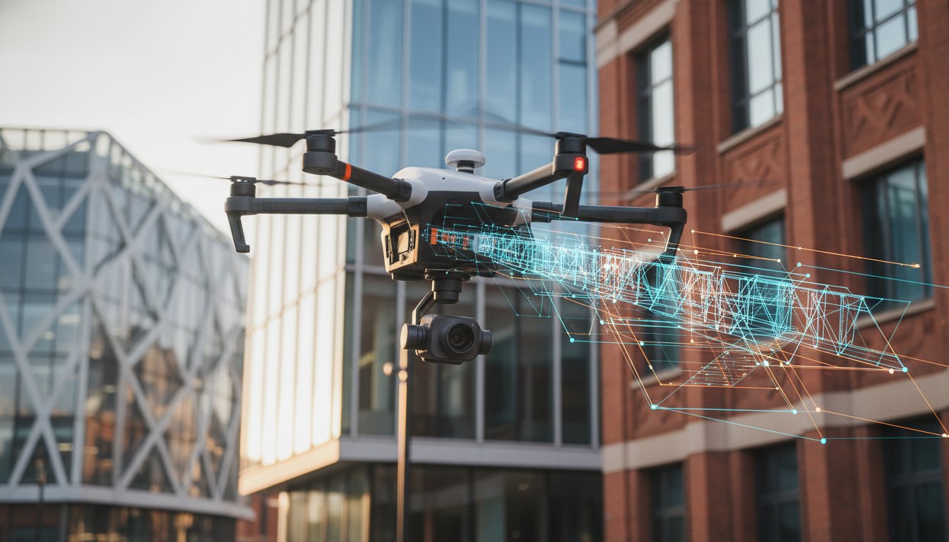
Why are you still budgeting for weeks of expensive scaffolding and high-risk manual labor when a single flight can capture superior data in an afternoon? Most property managers recognize that traditional access methods are becoming an unsustainable drain on both time and safety budgets. Integrating a commercial building survey drone into your maintenance strategy isn’t just a tech upgrade; it’s a critical shift toward data-centric precision. It’s the most effective way to eliminate the inherent risks of working at height while securing a comprehensive view of your asset’s condition.
You’re likely looking for a solution that provides high-resolution roof and facade data without the disruption of heavy machinery or closed-off walkways. This professional guide for 2026 outlines how to achieve those results through fully insured, CAA-compliant operations. We’ll cover the essential regulatory landscape, including the latest UK class marks and Remote ID requirements, to ensure your next inspection is as legally robust as it is technically detailed. From identifying early-stage defects to creating digital twins, you’ll discover how to transform your property management from reactive repairs to predictive, cost-effective maintenance.
Key Takeaways
- Understand how a modern commercial building survey drone acts as a precision data-acquisition tool, replacing high-risk manual inspections with digital accuracy.
- Learn how 4K HDR imagery and thermal building analysis identify critical structural defects, such as hairline cracks and thermal bridges, with surgical precision.
- Compare the logistical and financial advantages of aerial surveys against traditional scaffolding to significantly reduce your operational overheads.
- Navigate the 2026 UK regulatory landscape, ensuring your projects remain compliant with the latest CAA certifications and Remote ID requirements.
- Discover a methodical approach to site feasibility and flight planning that guarantees high-tier data quality while maintaining site safety.
The Evolution of Commercial Building Surveys: Why Drones are Essential in 2026
The modern commercial building survey drone isn’t just a flying camera. It’s a sophisticated data-acquisition engine that has redefined how we assess large-scale assets in 2026. While traditional “eyes-on” inspections once sufficed, the complexity of modern architecture and the rising costs of manual access have made them obsolete for comprehensive reporting. We’ve moved into an era where precision and safety are non-negotiable, and digital data capture is the only way to meet those standards.
This shift represents a fundamental change from reactive maintenance to proactive asset management. Instead of waiting for a visible leak to appear, property managers now use aerial data to identify hairline cracks or blocked drainage systems before they escalate into structural failures. Drones easily overcome the physical limitations of high-rise structures and complex roof geometries that would otherwise require weeks of preparation and significant financial investment to inspect manually.
To see how these tools are applied in real-world scenarios, watch this demonstration of rapid aerial measurement:
The Limitations of Traditional Building Inspections
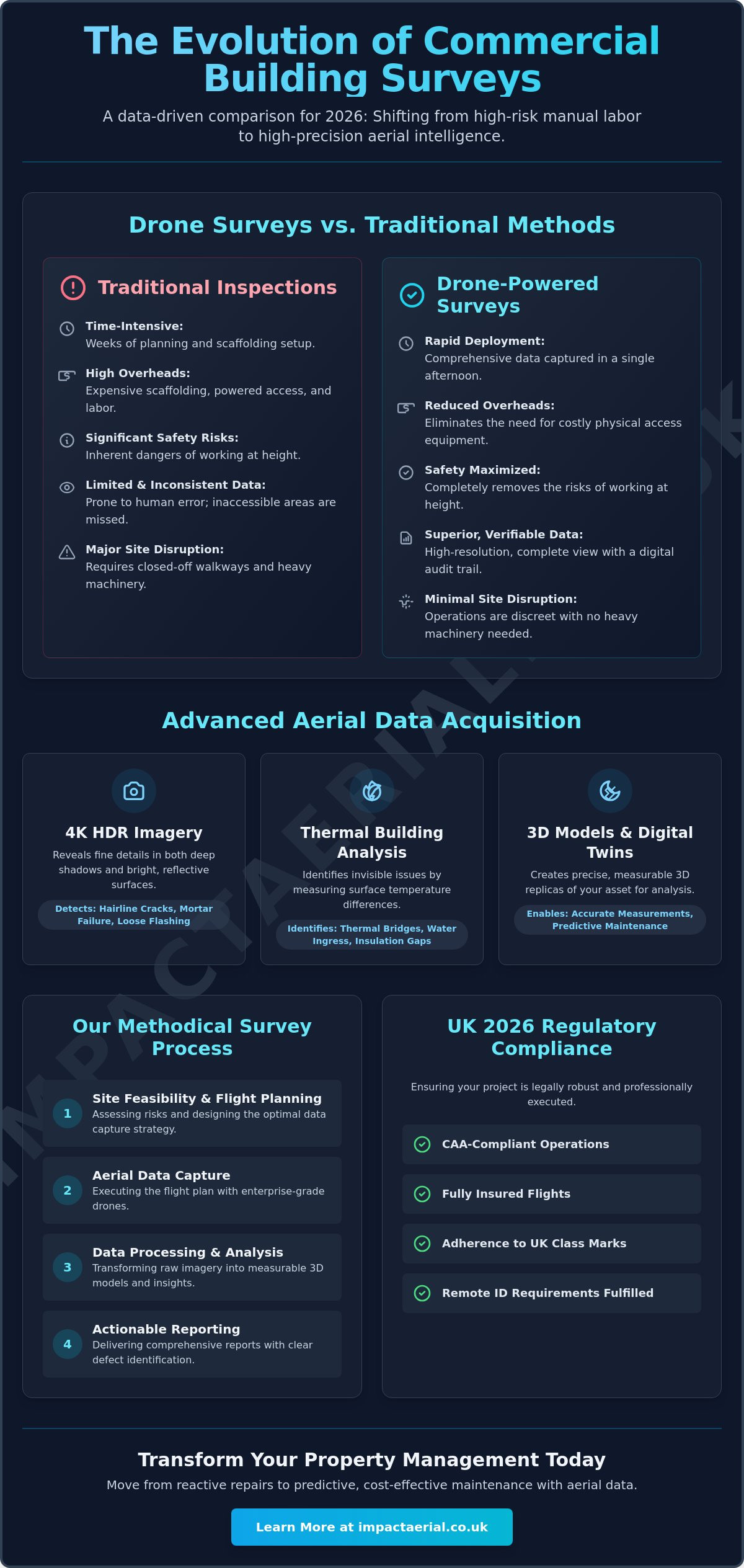
Physical access remains the biggest hurdle for manual inspections. Reaching gutters, chimneys, and parapets on high-rise structures requires significant investment in scaffolding or powered access. These methods are slow and introduce substantial safety risks to personnel. There’s also the issue of human error. A surveyor on a ladder might miss a subtle defect that a high-resolution sensor captures with ease. Manual recording is often inconsistent, whereas a digital capture provides a verifiable audit trail that’s essential for insurance and compliance purposes.
Bridging the Gap with Aerial Data
Aerial technology provides a 360-degree perspective of the building envelope, capturing data in confined spaces where heavy machinery cannot operate. By utilizing an Unmanned aerial photogrammetric survey, professionals can generate precise 3D models and orthomosaic maps. This scientific approach to data collection is a cornerstone of modern building consultancy. It allows for a more comprehensive drone survey that informs long-term maintenance budgets. You get a complete visual and thermal overview of the asset, ensuring no section of the roof or facade remains uninspected, regardless of how inaccessible it might seem from the ground.
Technical Capabilities: From 4K Imagery to Thermal Building Analysis
Deploying a commercial building survey drone requires more than just basic flight skills; it demands high-tier hardware capable of operating in demanding environments. We utilize DJI Enterprise platforms specifically for their stability and high-wind performance. These systems remain steady at altitudes where gusty conditions would compromise the data quality of consumer-grade equipment. This stability is the foundation for capturing the sharp, measurable data sets required for professional structural assessments.
The integration of 4K HDR cameras has fundamentally changed how we identify building fatigue. These sensors provide the dynamic range necessary to see into the deep shadows of parapets while maintaining detail on highly reflective metal roofing. This level of clarity allows surveyors to spot hairline cracks, mortar failure, and loose flashing that are often invisible from the ground. When combined with photogrammetry software, these images revolutionize building inspections by creating immersive 3D digital twins. Stakeholders can virtually “walk” the roof, taking precise measurements and inspecting defects without ever leaving their desks.
High-Resolution Visual Inspections
Modern aerial sensors feature powerful zoom capabilities that allow for extreme close-up detail without the drone needing to fly in close proximity to the structure. This significantly reduces operational risk near sensitive equipment like HVAC units or telecommunications masts. We employ systematic grid mapping to ensure 100% coverage of large commercial roofs. By standardizing this data capture, property managers can perform year-on-year condition monitoring to track the rate of decay in specific building elements.
Thermal Imaging and Energy Efficiency
The most significant technical advancement in 2026 is the widespread use of thermal sensors for building fabric analysis. These sensors detect “cold spots” in insulation that signal energy waste, providing essential data for ESG reporting and carbon reduction targets. Thermal imaging is also the most effective way to detect hidden water leaks in flat roof systems. By identifying moisture ingress before it penetrates the internal ceiling, owners can avoid the massive costs associated with full roof replacements. Understanding the specific role of a survey drone in these high-stakes environments is key to making informed maintenance decisions.
For those overseeing complex portfolios, commissioning professional drone commercial property surveys ensures that every thermal anomaly and structural defect is documented with absolute precision.
Cost-Benefit Analysis: Drone Surveys vs. Traditional Access Methods
Choosing a commercial building survey drone over traditional access methods isn’t just a technological preference; it’s a strategic financial decision. While the visual data is superior, the true value lies in the elimination of logistical bloat. Traditional surveying often involves significant “mobilisation debt,” where a large portion of the budget is spent before a single photo is even taken. By switching to aerial data capture, property managers can reallocate these funds toward actual repairs rather than the equipment needed to find them.
The “single-visit” advantage is a key driver of this efficiency. A drone captures high-density data across the entire building envelope in a fraction of the time it takes a surveyor to move a cherry picker or climb a scaffold. This speed doesn’t just save time; it accelerates the entire maintenance cycle. Faster data acquisition leads to quicker insurance claims and more accurate repair tenders, ensuring that structural issues are addressed before they become catastrophic. Some industry professionals report that adopting a drone-first approach can reduce overall survey costs by up to 60% compared to traditional manual access methods.
Scaffolding and Cherry Pickers: The Hidden Costs
Traditional access methods carry substantial hidden costs that are often overlooked during the planning phase. These include:
- Permit Fees: Local authorities often require expensive permits for blocking public highways, pavements, or loading bays.
- Labour Intensity: You’re paying for the hours spent on assembly and disassembly, not just the inspection time.
- Security Vulnerabilities: Left-standing scaffolding is a security risk, often requiring additional temporary alarms or 24/7 monitoring to prevent unauthorized site access.
- Site Downtime: Heavy machinery often requires cordoning off large areas, which can halt business operations or restrict tenant access.
The ROI of Drone-First Surveying
The return on investment for a commercial building survey drone is tied directly to risk mitigation. By keeping personnel on the ground, you significantly reduce the liability associated with working at height. This safety-first approach is a core component of UK Civil Aviation Authority (CAA) commercial drone regulations, which prioritize public and operator safety. When you remove the need for physical access, you also remove the disruption that kills business flow. There are no blocked car parks, no noisy machinery outside windows, and no restricted walkways. For many commercial landlords, the ability to conduct a comprehensive drone commercial property survey without inconveniencing tenants is the most valuable benefit of all.
Navigating UK Regulations: CAA Compliance, Insurance, and Privacy
Operating a commercial building survey drone in 2026 requires strict adherence to the Civil Aviation Authority (CAA) framework. It’s no longer enough to simply hire a pilot; you need a vetted professional who understands the specific legalities of urban flight. This includes ensuring all equipment carries the mandatory UK class marks (UK1 through UK6) and complies with the Remote ID requirements that became mandatory for most commercial-spec aircraft on January 1, 2026. These regulations aren’t just red tape; they’re the foundation of a safe, professional industry that protects both the operator and the property owner.
For any commercial building site, £5 million in public liability insurance is the non-negotiable industry standard. This coverage provides the necessary financial security and psychological comfort for stakeholders, protecting against the rare but possible instances of equipment failure or third-party damage in congested areas. We don’t treat insurance as a box-ticking exercise but as a core component of our risk mitigation strategy.
Understanding Pilot Qualifications
The distinction between a hobbyist and a professional is defined by the specific drone license and certifications held. For complex building surveys, a General Visual Line of Sight Certificate (GVC) is essential. This qualification, which typically requires a formal course and practical assessment, allows pilots to apply for an Operational Authorisation from the CAA. This authorization is what legalizes flight in “congested” commercial zones where structures and people are in close proximity. Always verify a pilot’s current Operational Authorisation and their specific Flyer ID status before commissioning any high-level work.
Safety is built into our process through meticulous pre-flight assessments and the establishment of on-site safety cordons. We analyze local airspace, identify ground hazards, and ensure a clear take-off and landing zone is secured before the aircraft ever leaves the ground. This methodical approach is what separates a professional commercial building survey drone operation from an amateur flight.
Privacy and Public Relations
Operating in urban environments means managing GDPR and privacy concerns with absolute care. Best practices involve notifying tenants and neighboring property owners well in advance of the flight to maintain transparency. Captured imagery undergoes strict data security protocols, including the redaction of faces or vehicle registration plates that aren’t relevant to the structural survey. The Impact Aerial commitment to meticulous safety and compliance ensures that your data collection is legally robust and socially responsible.
If you require a compliant and fully insured aerial inspection for your portfolio, explore our professional drone commercial property surveys to ensure your project meets every regulatory standard.
Choosing a Professional Partner: The Impact Aerial Survey Process
Selecting the right partner for a commercial building survey drone operation is a decision that impacts your long-term asset strategy. At Impact Aerial, we don’t just “fly drones”; we execute a meticulous technical process designed to deliver high-tier data while maintaining absolute site safety. Our workflow is structured to provide clarity from the initial enquiry through to the final data integration into your management systems.
- Step 1: Consultation and Site Feasibility: We begin by understanding your specific objectives, whether you’re tracking construction progress or identifying roof defects. We conduct a thorough feasibility check to ensure the site is suitable for UAV operations under current CAA guidelines.
- Step 2: Flight Planning and Notifications: Our team handles all regulatory requirements. This includes filing flight plans, notifying relevant authorities, and coordinating with neighboring properties to ensure a transparent and compliant operation.
- Step 3: On-Site Data Capture: We deploy enterprise-grade hardware to capture high-resolution visual and thermal data. Our pilots maintain strict safety cordons throughout the mission, ensuring zero disruption to your business flow.
- Step 4: Post-Production and Reporting: Raw data is processed by specialists who highlight critical building defects. We transform thousands of images into a cohesive technical report that provides a clear audit trail for your stakeholders.
- Step 5: Delivery and Support: We provide the final deliverables in formats that work for you. Whether you need a simple PDF report or a complex 3D model, we support the integration of this data into your existing asset management software.
Professional Drone Services Tailored for Property
Our reporting is bespoke. We offer everything from raw 4K video and high-resolution orthomosaics to detailed point clouds for architectural planning. Our expert post-production team specializes in identifying building fatigue, mortar failure, and thermal anomalies that might otherwise go unnoticed. While we provide national coverage across the UK, our focused West Midlands base allows us to offer specialized support to regional commercial hubs with rapid mobilization times. This local expertise ensures we understand the specific environmental and regulatory challenges of the area.
Next Steps for Your Building Inspection
Integrating aerial data into your maintenance workflow is the most effective way to protect your property’s value in 2026. If you’re ready to move away from the high costs and risks of traditional access, requesting a technical quote is the first step. We’ll help you determine the best sensor configuration for your specific structure, ensuring you get the exact data you need for your repair tenders or insurance reviews. Don’t leave your asset’s condition to chance. Book your commercial building survey with Impact Aerial today to experience the precision of professional drone technology.
Future-Proofing Your Asset Maintenance Strategy
The transition toward digital asset management is no longer a luxury for commercial property owners; it’s a necessity for operational efficiency. By replacing hazardous manual inspections with a high-precision commercial building survey drone, you secure a level of detail that traditional scaffolding simply cannot match. You’ve seen how thermal sensors and 4K imagery identify structural risks before they become financial liabilities, allowing for predictive maintenance that protects your long-term capital.
Professionalism in this field is defined by strict adherence to safety and regulation. Our operations are led by CAA GVC Certified Pilots using DJI Enterprise Technology, backed by £5m Commercial Liability Insurance for your total reassurance. This combination of high-tier hardware and meticulous compliance ensures your survey is delivered with surgical precision and zero site disruption. It’s the most reliable way to maintain your building’s envelope while keeping personnel safely on the ground.
Get a Professional Quote for Your Commercial Drone Survey
Taking the first step toward a smarter, safer inspection process is a clear investment in your building’s future. We look forward to helping you transform your property data into actionable results that drive your business forward.
Frequently Asked Questions
Is a drone survey legal for a commercial building in a busy city centre?
Yes, aerial inspections in urban environments are entirely legal provided the operator holds the correct CAA Operational Authorisation. Pilots must be GVC certified to operate in “congested areas” where people and structures are in close proximity. As of 2026, the aircraft must also comply with Remote ID and UK class mark regulations. We conduct rigorous risk assessments and establish safety cordons to ensure every flight meets national aviation standards.
How much does a commercial building survey drone cost compared to scaffolding?
Drone surveys are significantly more cost-effective because they eliminate the expensive mobilisation debt associated with scaffolding and heavy machinery. You save on labour hours for assembly, permit fees for blocking public highways, and the costs of site downtime. While pricing varies based on project scale, the primary financial advantage is the reduction in personnel risk and the speed of data acquisition compared to manual access.
Can a drone detect roof leaks and insulation issues?
A commercial building survey drone equipped with thermal sensors is highly effective at identifying moisture ingress and insulation failures. Thermal imaging detects temperature differentials across the building envelope; “cold spots” often signal water-saturated insulation or significant heat loss. This allows property managers to identify hidden defects before they penetrate the internal ceiling, facilitating predictive maintenance that prevents costly full-scale roof replacements.
What qualifications should I look for when hiring a drone survey company?
You should prioritise companies that employ CAA GVC certified pilots and hold a valid Operational Authorisation for specific category flights. It’s essential to verify they carry at least £5 million in commercial liability insurance and use 2026-compliant hardware with UK class marks. Professional firms should also demonstrate a clear understanding of GDPR and privacy protocols when capturing data in sensitive urban or commercial locations.
How long does a typical commercial drone building inspection take?
Most aerial inspections are completed within a few hours, whereas traditional manual methods often take days or weeks. The total time depends on the structure’s complexity and whether you require visual 4K HDR imagery, thermal mapping, or 3D modelling. Because there’s no need for time-consuming equipment assembly or scaffolding erection, we can arrive, capture the necessary data, and depart with virtually zero disruption to your business operations.
What happens to the data and imagery after the survey is complete?
Captured imagery undergoes professional post-production to generate high-resolution technical reports and immersive 3D digital twins. Specialists review the data to highlight structural fatigue or mortar failure, providing a clear audit trail for stakeholders. The final deliverables are provided in formats compatible with standard asset management software. We ensure all personal data is redacted in compliance with GDPR before the final report is issued.
Do I need to notify my tenants or neighbours before a drone flight?
Yes, notifying tenants and neighbouring properties is a professional requirement for managing privacy and transparency. While a commercial building survey drone focuses strictly on structural elements, proactive communication helps address potential concerns before the flight begins. Providing a clear schedule and explaining the safety protocols ensures that the operation remains socially responsible and avoids any friction with local residents or business occupants.
Can a drone survey be used for insurance claims and building valuations?
High-density aerial data provides a verifiable and objective audit trail that’s essential for insurance claims and valuations. Detailed imagery and thermal reports offer the concrete evidence required by loss adjusters to process claims for storm damage or structural failure. For valuations, this data ensures that the asset’s condition is assessed with total accuracy, providing a more reliable foundation for financial reporting than ground-level inspections alone.
 2 Norton Drive, Wythall, Birmingham, B47 6HH Company registration number: 11138586. VAT Number: 366 9068 55


