
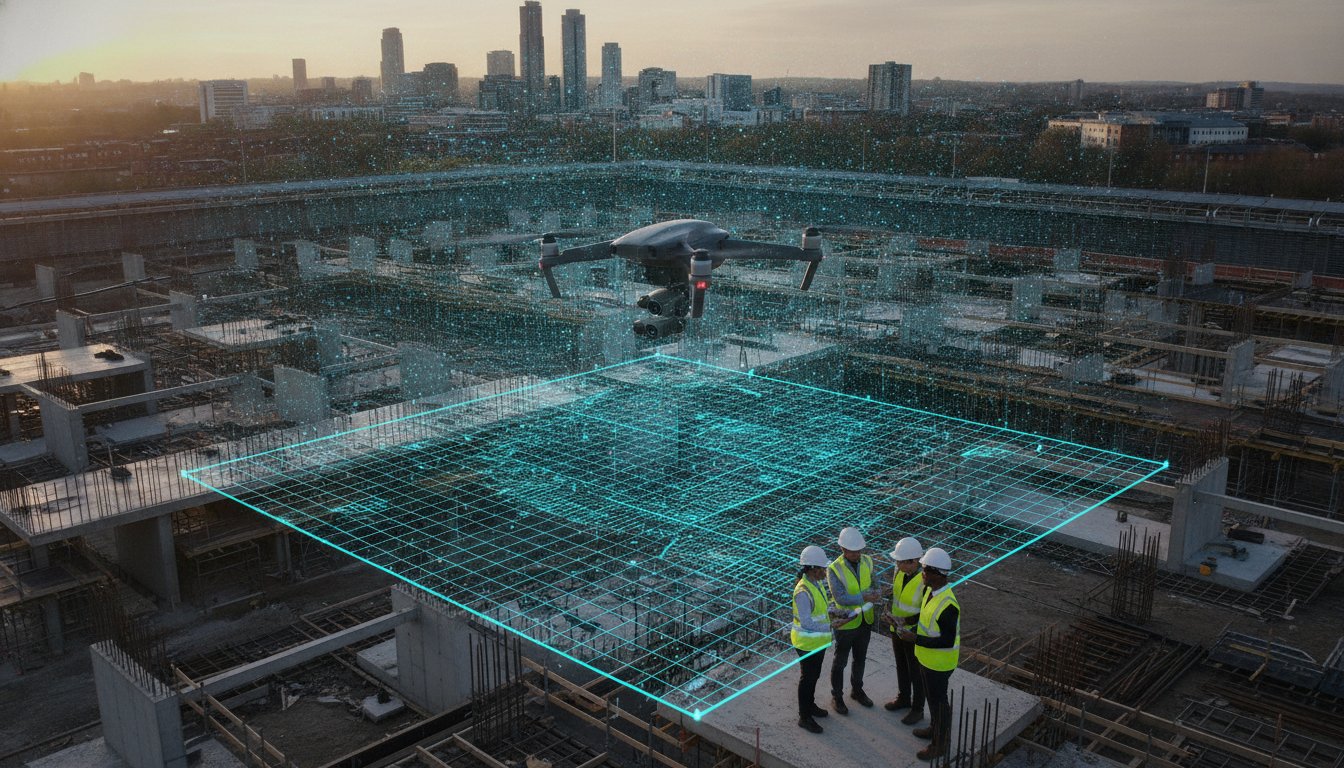
What if you could eliminate the highest safety risks on your site while simultaneously capturing data with centimetre-level precision? For project managers, the traditional methods of manual inspection and ground-based surveying often feel like a choice between high costs and safety compromises. You already know that keeping a complex site on schedule requires constant, accurate visibility, yet the complexity of 2026 UK drone regulations can be a significant barrier to entry. Integrating professional aerial photography for civil engineering projects is no longer just a trend; it’s a critical safety and data layer that transforms how you monitor progress.
This guide explores how high-resolution drone imagery and DJI Enterprise hardware deliver the precision data needed for modern infrastructure. We’ll show you how to maintain full CAA compliance under the latest UK class marking standards while reducing site risk through remote inspections. You’ll see how £5m commercial liability insurance and GVC-certified pilots provide the operational security your project requires. We’re going to preview the tools and processes that streamline stakeholder communication and protect your site’s bottom line.
Key Takeaways
- Understand how modern drone technology provides high-precision data that goes beyond basic imagery to support technical engineering requirements.
- Learn how aerial photography for civil engineering projects improves stakeholder communication through high-resolution progress documentation and professional post-production.
- Identify the essential hardware and sensor specifications, such as DJI Enterprise systems, required for reliable data collection in challenging site conditions.
- Navigate the latest 2026 UK drone regulations to ensure your site remains compliant with CAA GVC standards and adequate liability coverage.
- Discover how professional aerial surveys reduce onsite risks by replacing high-risk manual inspections with safe, remote monitoring solutions.
The Role of Aerial Photography in Modern Civil Engineering
In the context of 2026 infrastructure development, aerial photography for civil engineering projects has evolved from a marketing luxury into a fundamental technical requirement. It involves the systematic capture of high-resolution imagery to support site analysis, progress tracking, and risk management. While basic photography focuses on aesthetics, the engineering application prioritises data-driven visual assets that provide a measurable record of site conditions. Understanding what is an aerial survey helps clarify how these methods differ from standard photography, specifically through the integration of geospatial data and high-precision sensors. This technology effectively bridges the gap between ground-level detail and the broad, often outdated perspective of satellite imagery, offering a real-time, high-fidelity view of the worksite.
Visualising Scale and Complexity
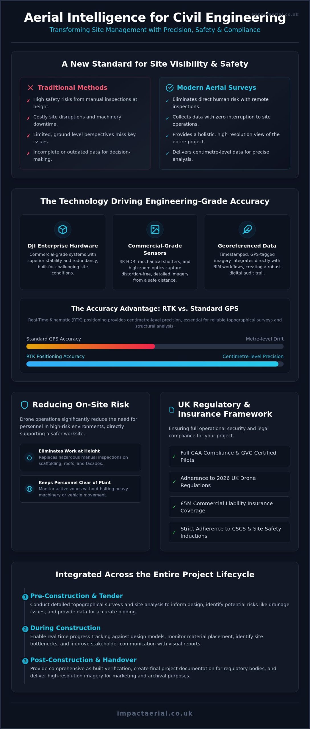
Modern civil engineering sites are often too expansive to monitor effectively from the ground. Aerial photography allows project managers to capture the entire project footprint within a single high-resolution frame, providing a holistic view of logistics and material placement. This perspective is vital for identifying site bottlenecks, such as plant congestion or drainage issues, which are frequently invisible from a pedestrian viewpoint. By utilising 4K HDR sensors, we document intricate structural details with enough clarity to support remote inspections of bridge piers, roof structures, or high-rise facades. This level of visual documentation ensures that every phase of the project is recorded with technical precision, facilitating better communication with stakeholders and regulatory bodies.
Reducing Human Risk and Site Disruption
Safety remains the primary concern on any UK construction site. Professional drone operations significantly enhance safety protocols by eliminating the need for personnel to work at height for routine visual inspections. Instead of deploying scaffolding or mobile elevating work platforms (MEWPs) for a simple roof check, a drone can complete the task in minutes without any physical risk to staff. We can monitor active zones without halting heavy machinery or plant movement, ensuring that progress continues uninterrupted while data is collected. Using drones for site inspections directly supports a safer working environment by keeping personnel out of high-risk areas while maintaining strict adherence to CSCS standards and site-specific safety inductions.
Technical Precision: Hardware and Data Accuracy
Achieving professional-grade results in aerial photography for civil engineering projects requires more than off-the-shelf consumer equipment. We utilise DJI Enterprise hardware because these systems are designed for the rigours of commercial environments, offering superior stability and redundancy. A critical component for engineering accuracy is RTK (Real-Time Kinematic) positioning. Unlike standard GPS which can drift by several metres, RTK provides centimetre-level precision. This ensures that every image is precisely located in 3D space, making the data viable for topographical surveys and structural analysis. Adhering to the latest UK drone regulations ensures these advanced systems are deployed legally and safely, providing the technical reliability that large-scale infrastructure projects demand.
Commercial-Grade Sensors and Optics
Commercial-grade sensors differ significantly from consumer models. We prioritise drones equipped with mechanical shutters. These are vital for civil works because they eliminate the “rolling shutter” distortion that occurs when capturing moving site elements or flying at speed. Combined with 4K HDR sensors, we capture a high dynamic range that preserves detail in both deep shadows and bright highlights. This clarity is essential when inspecting dark structural voids or bright concrete surfaces in midday sun. High-zoom optics also play a key role, allowing us to document intricate details like weld joints or bolt integrity from a safe distance, maintaining site safety without sacrificing visual quality.
Data Reliability and Georeferencing
Data reliability is the foundation of any successful aerial survey. Every image we capture is automatically timestamped and GPS-tagged, creating a robust digital audit trail for project records. This georeferenced data integrates directly with Building Information Modelling (BIM) workflows, allowing engineers to overlay real-world progress against original design models. To ensure week-on-week accuracy, we use automated flight paths. By flying the exact same coordinates and camera angles at regular intervals, we provide stakeholders with consistent, comparable data for precise timeline monitoring. For projects requiring this level of technical rigour, partnering with a specialist in aerial filming and photography ensures your data meets strict engineering standards.
Mapping the Project Lifecycle: From Tender to Completion
Professional aerial photography for civil engineering projects provides a continuous thread of visual evidence from the initial bid to the final handover. It isn’t just about capturing progress; it’s about creating a verifiable record that supports decision-making at every milestone. This phased approach aligns with Purdue University research on aerial photography in engineering, which highlights how aerial assets are essential for planning and site characterisation. By integrating these visuals early, firms move from reactive site management to a proactive, data-led strategy that ensures transparency for all parties involved.
Pre-Construction and Tender Support
Winning a major civil contract requires a compelling narrative of site understanding. Capturing baseline conditions before any ground is broken allows teams to provide clear context for environmental impact assessments (EIA). These high-resolution visuals create high-impact bid documents and support public consultations by showing exactly how the proposed works fit into the existing landscape. It demonstrates a level of meticulousness that builds trust with clients before the first plant arrives on site. This early-stage documentation also serves as a legal baseline, protecting contractors against future claims regarding pre-existing site damage.
Active Construction Monitoring
Once the project is live, the focus shifts to verifying programme milestones. Weekly or monthly flights allow project managers to track earthworks, foundation progress, and structural assembly with total clarity. Using a combination of time-lapse sequences and high-resolution stills, you can provide internal and external stakeholders with undeniable proof of progress. For projects requiring more technical mapping or volumetric calculations, a comprehensive drone survey can be integrated into these regular flights to provide deeper topographical insights alongside the visual documentation. This consistent monitoring keeps projects on schedule and provides an early warning system for potential delays.
Handover and Legacy Documentation
The final phase of any project is as critical as the first. Final site inspections from above help identify snagging issues that might be missed at ground level, such as drainage pooling on roofs or alignment errors in large-scale paving. Documenting “as-built” conditions provides a permanent visual record for future maintenance and repairs, which is invaluable for the asset owner. Beyond the technical requirements, the post-production of professional videography allows your firm to create corporate case studies that showcase the completed infrastructure in its best possible light. We ensure all final assets are delivered to a professional standard, providing a lasting legacy of your project’s success.
Safety, Compliance, and UK Drone Regulations
Operating aerial photography for civil engineering projects requires a rigorous approach to legal compliance and risk management. As of January 2026, UK drone regulations have evolved, making it mandatory for commercial drones to broadcast Remote ID and adhere to specific UK class markings. For project managers, the primary concern is often liability. This is why a minimum of £5m commercial liability insurance, compliant with EC Regulation 785/2004, is the standard for any professional operation on a civil site. Hiring an uncertified or under-insured operator doesn’t just risk the flight; it creates a shared liability for the client in the event of an incident.
The Importance of CAA Certification
Professional pilots must hold the General Visual Line of Sight Certificate (GVC) to operate in the “Specific Category,” which covers most commercial work on complex sites. While the A2 Certificate of Competence (A2 CofC) allows for lower-risk operations, the GVC is the gold standard for infrastructure projects. It demonstrates that the pilot has undergone formal training and maintains an Operations Manual approved by the CAA. You should always verify your pilot’s credentials on the official CAA register to ensure they’re authorised for the current year. For a full breakdown of these legal requirements, consult our UK drone license guide.
Risk Mitigation and Flight Planning
Safety on an active site is managed through a comprehensive Risk Assessment and Method Statement (RAMS). This document isn’t a formality; it’s a technical blueprint for the flight that identifies hazards like tower cranes, overhead power lines, and personnel movement. Every flight we conduct is preceded by a desktop survey to check for temporary airspace restrictions or NOTAMs (Notices to Airmen) that might affect the site. We provide the reassurance that every operational risk has been calculated and mitigated before the hardware leaves the ground.
Impact Aerial follows a meticulous four-step preparation process for high-risk civil sites:
- Desktop Airspace Analysis: We check aeronautical charts and the latest 2026 Remote ID requirements to ensure the site is clear for flight.
- Site-Specific RAMS: We develop a custom risk assessment that defines exclusion zones and emergency landing procedures tailored to your site’s layout.
- Physical Site Survey: Our pilots conduct a ground-level inspection to identify dynamic hazards like moving plant machinery or changing weather conditions.
- Stakeholder Safety Briefing: We coordinate directly with your site safety officer to ensure our flight times don’t conflict with critical site operations.
If you require a compliant and safety-focused partner for your next project, contact us to discuss our construction site monitoring services.
The Impact Aerial Advantage for Civil Engineering
Impact Aerial provides a specialised partnership that combines local West Midlands expertise with the logistical capacity for nationwide UK coverage. We understand that civil engineering projects are complex, high-stakes environments where operational reliability isn’t optional. Based in Birmingham, we’re ideally positioned to serve the central infrastructure hub while maintaining the mobility to support large-scale works across the country. Our operations are built on a foundation of CAA GVC certification and £5m commercial liability insurance, providing the reassurance that every flight meets the highest professional standards. By choosing a dedicated specialist, you gain an end-to-end service that manages everything from initial airspace consultations to the final delivery of high-precision aerial photography for civil engineering projects.
Professional Post-Production and Reporting
Raw footage is rarely sufficient for a technical boardroom presentation or a formal stakeholder report. Our post-production team transforms high-resolution 4K imagery and stills into actionable assets that deliver genuine value to your engineering team. We provide bespoke reporting that includes precise annotations, site boundary overlays, and milestone markers to provide clear context for every frame. These assets are delivered via secure, cloud-based platforms, ensuring that your remote project teams and off-site consultants can access the latest site data almost immediately. This streamlined delivery ensures that decision-makers always have the most current visual evidence at their fingertips, regardless of their physical location.
Your Trusted UK Drone Partner
Civil engineering firms across the UK choose Impact Aerial for long-term contracts because we offer more than just a camera in the sky. We provide a safety-first culture that is meticulously ingrained in every operation, integrating seamlessly with your existing site safety protocols and CSCS requirements. Our commitment to the latest DJI Enterprise technology ensures we remain at the forefront of data accuracy and operational reliability. Whether you’re monitoring a single bridge construction or a multi-year road infrastructure project, our team provides the consistent, high-tier results required for professional documentation. We don’t just capture images; we provide a reliable data layer that protects your project’s timeline and reputation.
For a broader look at how our technology supports various commercial sectors, you can view our professional drone services overview. If you’re ready to enhance your site monitoring with high-precision data and authoritative reporting, Contact Impact Aerial for a civil engineering project quote to discuss your specific requirements.
Elevating Site Intelligence Through Precision Data
The adoption of professional drone technology has fundamentally shifted how infrastructure is managed in 2026. By moving beyond simple visual records to data-centric outputs, firms now ensure centimetre-level accuracy and full regulatory compliance. Integrating professional aerial photography for civil engineering projects provides a definitive audit trail from the initial tender through to the final handover. This approach doesn’t just streamline project management; it actively reduces site risk by replacing hazardous manual inspections with safe, remote monitoring.
Success on complex sites relies on the combination of expert operators and commercial-grade hardware. Impact Aerial delivers this through our CAA GVC Certified Pilots and Expert DJI Enterprise Operators, backed by £5m Commercial Liability Insurance. We provide the technical rigour and operational security required to protect your project’s reputation and timeline. Whether you’re based in the West Midlands or managing a nationwide infrastructure scheme, our team is ready to deliver high-precision results.
Request a Consultation for Your Engineering Project
We look forward to helping you reach new heights in project efficiency and site safety.
Frequently Asked Questions
Do drone pilots need special permits to fly over civil engineering sites?
Yes, commercial pilots must hold a General Visual Line of Sight Certificate (GVC) to operate on complex civil sites. This certification allows flights in the Specific Category, which is necessary for most engineering environments. Pilots must also have a valid CAA Operator ID and conduct a full risk assessment before taking off. Adhering to these legal requirements ensures that the operation remains compliant with current UK aviation laws and site safety standards.
What is the difference between a drone survey and aerial photography?
While they’re related, the primary difference lies in the output. Aerial photography for civil engineering projects produces high-resolution visual assets for progress monitoring and stakeholder reporting. In contrast, a drone survey captures technical data for creating measurable 3D models or topographical maps. Photography provides the visual context, showing site status, while a survey provides the geospatial data that integrates directly with Building Information Modelling (BIM) workflows.
Can drones fly in high winds or rain on a construction site?
Commercial-grade hardware, such as DJI Enterprise drones, can operate in moderate winds and light moisture due to their high IP ratings. However, we typically ground flights if wind speeds exceed 15 metres per second or during heavy downpours. Safety is our absolute priority on any active site. If conditions are unsafe for flight, we reschedule to ensure we don’t risk personnel, plant machinery, or the precision of the data being collected.
How much does aerial photography for civil engineering cost in the UK?
Costs for professional aerial services in the UK are determined by several project-specific variables. These include the site’s location, the frequency of visits required for progress monitoring, and the complexity of the post-production editing. Because every civil project has unique technical requirements, we provide bespoke quotes rather than fixed rates. This ensures you receive a service tailored to your engineering goals without paying for unnecessary extras or compromising on data quality.
Why is £5m drone insurance necessary for engineering projects?
A minimum of £5m commercial liability insurance is required to meet the risk management standards of the UK construction and civil engineering industries. This level of coverage protects both the operator and the client against significant financial claims resulting from accidental damage or injury. Most Tier 1 contractors and infrastructure owners mandate this specific insurance level as a prerequisite for site access, ensuring that all operational risks are professionally mitigated.
How long does it take to receive the aerial footage after a shoot?
We typically deliver raw high-resolution imagery and 4K footage within 24 hours of the site visit. For more complex outputs, such as annotated progress reports or edited corporate videography, the turnaround is usually between 48 and 72 hours. We use secure cloud-based platforms for delivery, allowing your project teams to access and share the data immediately. This rapid turnaround ensures that your stakeholder meetings always feature the most current site information.
What drone hardware is best for inspecting structural civil engineering?
DJI Enterprise drones are the industry standard for structural inspections due to their stability and advanced sensor options. Systems equipped with high-zoom optics allow our pilots to inspect bolt integrity or weld joints from a safe distance, maintaining site safety. Additionally, 4K HDR sensors ensure that structural details remain visible even in challenging lighting conditions. These tools provide the technical precision required for bridge inspections, roof surveys, and high-rise structural assessments.
 2 Norton Drive, Wythall, Birmingham, B47 6HH Company registration number: 11138586. VAT Number: 366 9068 55


