
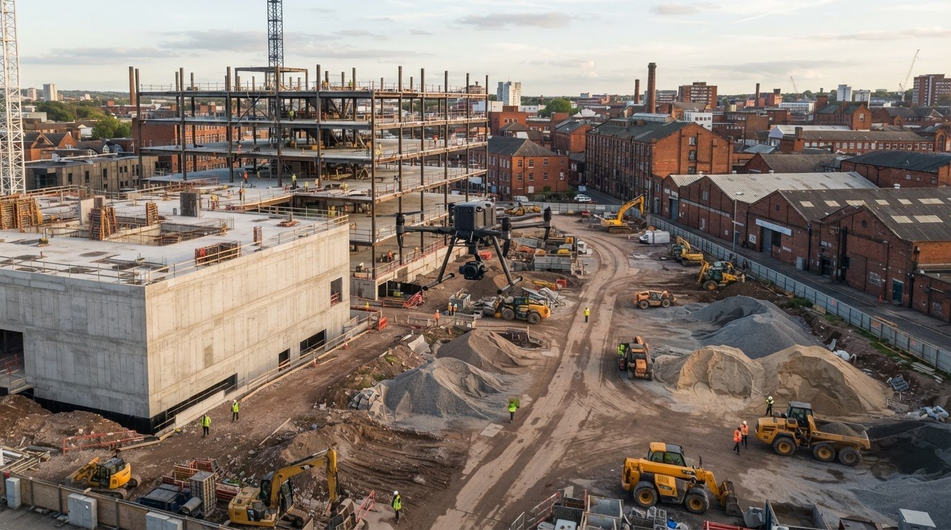
A drone survey is most useful when it gives a construction team a clear, repeatable view of site conditions. The business case for drone surveys in construction depends on using aerial records to compare progress over time, assess stockpiles and inform site planning. Drone imagery and models can help teams review completed work against milestones and discuss changes to materials, access and on-site activity.
That does not make every traditional survey redundant. The value depends on what needs measuring, how often information is needed and whether aerial data provides enough detail for the decision.
This article explains how drones can support construction progress monitoring, stockpile assessment and site analysis, and how coordinated survey outputs can give teams a shared view of a project. It also outlines where drone surveys fit, how they can inform project decisions and when another survey method may be more appropriate.
Key Takeaways
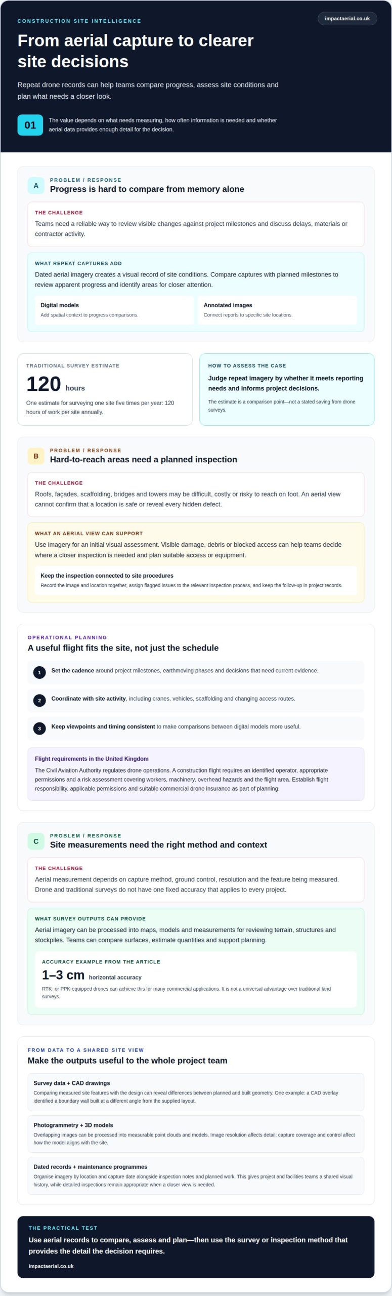
- Use repeat aerial records to compare site progress with project milestones and give teams a clearer basis for discussing changes.
- Understand how aerial views can support initial assessments of hard-to-reach areas while informing safe access planning.
- See how site imagery and models can help assess stockpiles, terrain and logistics before decisions are made.
- Learn why planning the capture and coordinating survey outputs matters when teams need a shared, useful view of the site.
Construction progress monitoring
Repeated drone flights create a dated visual record, so teams can compare site conditions as work progresses.
Progress Tracking and Schedule Comparison
Progress tracking compares dated aerial imagery with planned milestones to show visible changes between captures. Project managers can use these comparisons to review apparent progress and identify areas for closer attention. Digital models add spatial context, while annotated images connect reports to specific locations. Together, these records give teams a shared visual reference for schedule discussions.
Progress Reporting and Demonstrated Business Cases
Progress reporting turns repeat captures into dated evidence for milestone reviews and discussions about delays, materials and contractor activity. One estimate puts traditional surveying of one site five times per year at 120 hours of work per site annually. The business case for drone surveys in construction depends on whether repeat imagery can meet reporting needs and inform project decisions.
Survey Programme Planning and Flight Cadence
For active earthworks, recurring drone surveys let teams compare quantities and visible progress over time. Set the capture schedule around project milestones, earthmoving phases and decisions that need current evidence. Coordinate flights with site activity, including cranes, vehicles, scaffolding and changing access routes. Consistent viewpoints and capture timing make comparisons between digital models more useful.
Integration with Existing Maintenance Programmes
Connect dated drone records with existing maintenance programmes to give project and facilities teams a shared visual history. Organise imagery by location and capture date, then keep it with inspection notes and planned work records. This helps distinguish construction progress from condition issues that need maintenance attention. Aerial records can inform priorities, while detailed inspections remain appropriate when a closer view is needed.
How are Drones Used in Construction?
A drone can capture a visual view of areas that are difficult, costly or risky to reach on foot. On a construction site, this can inform inspection planning without replacing detailed ground-level checks.
Site Safety and Hard-to-Reach Areas
Drone surveys provide an initial visual assessment of roofs, façades, scaffolding, bridges and towers. Teams can review visible conditions and plan suitable access before a closer inspection. For example, imagery may show apparent damage or an obstruction on a roof, helping determine whether a worker needs to reach that location. The value is better-informed planning, not treating an aerial view as proof that an area is safe.
Hazard Identification and High-Risk Inspections
Aerial imagery can flag visible concerns for review, such as debris, damaged surfaces or blocked access routes. A drone can capture views of a difficult location before workers are sent to inspect it, helping teams plan suitable equipment and access. Software can organise the resulting imagery, but it cannot reveal every hidden defect or replace a properly planned physical inspection.
In the United Kingdom, the Civil Aviation Authority regulates drone operations. A construction flight requires an identified operator, appropriate permissions and a risk assessment covering workers, machinery, overhead hazards and the flight area. Site activity can change quickly: cranes, vehicles, power lines and scaffolding may affect where and when a drone can fly.
Insurance is part of operational planning. The construction business and flight operator should establish who is responsible for the flight, which permissions apply and whether commercial drone insurance suits the work. These points matter particularly near occupied buildings, public spaces or neighbouring properties, where flight activity and imagery require careful management.
Use the aerial view to support a safety review, then assign any flagged issue to the relevant inspection process. Keep the location and image together in project records so ground teams can find the item, assess it and report what action followed. This keeps drone monitoring connected to site procedures rather than treating footage as a standalone safety decision. Planned drone monitoring can contribute visual records for construction teams assessing site conditions.
Construction site analysis and stockpile measurement
Drone surveys turn aerial imagery into maps, models and measurements for site decisions. Accuracy depends on capture method, ground control, resolution and the feature measured. RTK- or PPK-equipped drones can achieve horizontal accuracy within 1-3 cm for many commercial applications. That isn’t a universal advantage over traditional land surveys; each method suits different measurement needs.
Measured Survey Data and CAD Drawings
Measured survey data records site features and dimensions, while CAD drawings show them in a design or construction plan. Comparing the two can reveal differences between planned and built geometry. For example, a CAD overlay identified a section of boundary wall built at a different angle from the supplied layout. This revealed a change to the intended plot geometry and helped the team assess the discrepancy.
Photogrammetry and Three-Dimensional Measurement
Photogrammetry processes overlapping images to reconstruct an area or object as measurable data. The resulting point clouds and 3D models can represent terrain, structures and stockpiles for review. Image resolution affects the detail available, while capture coverage and control affect how the model aligns with the site. Teams can use the output to compare surfaces, estimate quantities and support planning.
Accuracy Compared with Traditional Land Surveys
Drone and traditional surveys don’t have one fixed accuracy that applies to every project. The required detail, ground control, capture method and feature type determine whether aerial measurement is suitable. Ground sample distance is one factor to consider when assessing survey accuracy. Photogrammetry can also be less suitable than terrestrial laser scanning for checking thin structural steel.
For terrain analysis, mapped surfaces help teams assess levels and gradients. A drone survey provided measurable evidence of the end-to-end gradient across a newly constructed football pitch on a residential development. Models can also represent surface shape and volume to support stockpile measurement. These outputs help project teams assess earthworks and compare site conditions with design information.
Construction site capture and coordinated survey outputs
Drone capture produces aerial imagery and mapping that teams can coordinate with other project records. It can cover broad areas efficiently, while terrestrial laser scanning and conventional surveying may suit details that aerial imagery cannot resolve.
Data Collection and Resource Use
Drone data collection captures broad site areas without requiring surveyors to walk every section. One estimate compares conventional coverage of approximately five acres per hour with drone surveying at 120 acres per hour. That difference can change how teams allocate survey time, especially across large or changing construction sites. The value depends on whether the resulting data answers the project’s measurement needs.
Survey Turnaround and Site Disruption
Survey turnaround includes both on-site flight capture and the processing needed to deliver usable outputs. Commercial construction flights typically take 30 minutes to a few hours, while processing can extend delivery beyond the flight itself. A highway project using volumetric analytics reduced survey turnaround to 48-72 hours. Planning capture around site operations helps limit disruption from vehicles, cranes and active work areas.
Quality Control and Surveying Methods
Quality control checks whether captured data is complete, aligned and suitable for its intended use. Aerial photogrammetry can support mapping and broad surface comparisons; terrestrial laser scanning can capture detailed geometry, and conventional surveying can measure points. The appropriate method depends on the feature, required detail and site conditions. Combining methods can cover areas where one capture approach leaves gaps.
Flight planning must account for changing site conditions, including people, power lines, dust and scaffolding. In the United Kingdom, the Civil Aviation Authority regulates drone operations. Before capture, the operator plans the flight, considers permissions and completes a site risk assessment. Post-capture quality checks can identify missing coverage before teams rely on mapped outputs.
Coordinate survey outputs with project drawings, site records and the teams using them, so measurements support practical decisions. Arrange construction drone capture to create coordinated aerial records for site planning and review.
Impact Aerial: Drone Commercial Property Surveys
Impact Aerial provides Drone Commercial Property Surveys and Construction Site Monitoring for teams that need aerial records to assess buildings or track site activity. These services are useful when rooflines, façades or changing site conditions need a clear visual review from beyond ground-level viewpoints.
For construction teams, captured imagery can support progress reviews and provide a consistent record for project discussions. The capture plan depends on the site, the areas to be viewed and how the imagery will inform decisions.
For related requirements, Impact Aerial also provides Aerial Filming and Photography and PV Solar Farm Thermal Surveys. Contact Impact Aerial to discuss your project’s survey requirements.
Make Your Next Survey Decision Count
Define the project requirement before planning a survey. Identify the decision the information must support, the site areas involved and how project teams will use the resulting data. A clear purpose helps align capture, reporting and review with construction priorities.
The business case for drone surveys in construction is strongest when the data serves a defined task. Aerial views can inform project decisions, while other methods may be more suitable when close detail or a specific measurement is required. Consider how survey information will fit existing records and who needs to act on it.
Impact Aerial also provides Aerial Filming and Photography, PV Solar Farm Thermal Surveys and Drone Commercial Property Surveys. Discuss your project with Impact Aerial to explore the right aerial survey approach for your requirements. A well-defined brief is a sound place to start.
Frequently Asked Questions
What do you need to implement a drone surveying programme?
Start with a defined project decision, such as checking a boundary, reviewing earthworks or documenting a roof. Establish who plans and operates each flight, which permissions and risk controls apply, and how imagery will be stored and shared. In the UK, the Civil Aviation Authority regulates drone operations. Agree the required outputs and format in advance so the data fits the project’s records.
Ready to experience the future of building surveys?
Yes. Drone surveys can capture building information from elevated viewpoints, making them useful when project teams need visual records of roofs, façades or site conditions for planning and review. A clear brief identifies the area of interest, the decision the imagery should support and how the finished information will be used. Impact Aerial provides drone surveying for construction and commercial property projects.
What are the main benefits of drone surveys on UK construction sites?
Drone surveys give project teams an aerial perspective for reviewing site conditions, hard-to-access structures and changing work areas. This can help teams plan inspections, document progress and discuss a shared visual record. For example, a site manager can review current imagery for visible obstructions on access routes before coordinating deliveries. The benefit is clearer context for decisions, not a substitute for every ground inspection.
How much time and money can construction drone surveys save?
Savings vary by project, depending on site size, capture frequency, required outputs and the conventional survey work replaced. A sound comparison accounts for flight planning, capture, processing and review, then weighs those inputs against avoided site visits, access arrangements and delays to decisions. The business case is strongest when recurring survey information supports a specific operational or reporting need.
What construction survey data and deliverables can drones provide?
Depending on the brief, drone surveys can produce aerial imagery, mapped views, point clouds and three-dimensional models. These outputs can help teams review terrain, structures, stockpile shape and site layout. For example, a model can provide a visual record for discussing how earthworks relate to the wider site. The right deliverable answers the project question and can be interpreted by the people making decisions.
What are the risks and limitations of using drones for construction surveys?
Flights can be affected by weather, people, vehicles, cranes, power lines, scaffolding, dust and debris. Imagery may also include workers, neighbouring properties, public spaces or commercially sensitive information, so data handling needs to be planned. Photogrammetry may not provide enough detail for every feature, including thin structural steel. Match aerial data to the measurement task and use another survey method where finer detail is essential.
 2 Norton Drive, Wythall, Birmingham, B47 6HH Company registration number: 11138586. VAT Number: 366 9068 55


