
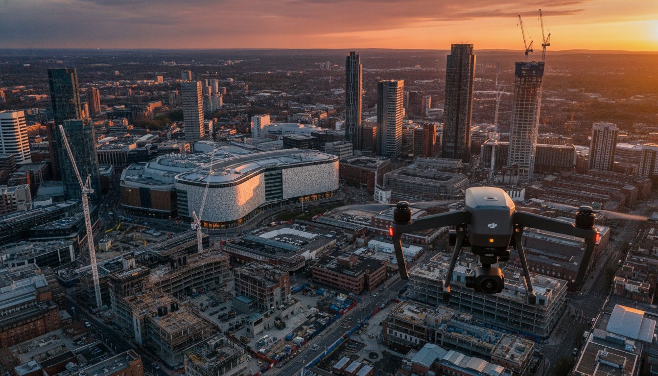
What if the biggest risk to your Birmingham construction project isn’t the budget, but the legal fallout of an unauthorized drone flight? Capturing the scale of the city’s 2026 skyline requires more than just a camera in the air; it demands a meticulous approach to urban compliance. You likely recognize that high-quality aerial footage is now essential for both site monitoring and high-end marketing. However, the logistical challenge of filming in congested areas like the Bullring, or navigating the specific restrictions of West Midlands airspace, often creates a barrier of uncertainty for project managers and creative directors alike.
Our professional drone videography Birmingham services bridge the gap between technical precision and cinematic storytelling. We understand the pressure to deliver stunning 4K HDR visuals while maintaining absolute safety standards. In this article, you will discover how GVC-certified pilots use enterprise-grade hardware to manage complex flight paths and how expert post-production transforms raw data into a powerful business asset. We will also break down the importance of £5m liability insurance and strict CAA adherence to ensure your project remains entirely stress-free from takeoff to delivery.
Key Takeaways
- Understand why CAA GVC certification and £5m commercial liability insurance are mandatory for legal, safe drone operations within Birmingham’s congested city centre.
- Discover how professional drone videography birmingham captures high-end 4K HDR cinematic footage to showcase developments aligned with the Big City Plan.
- Learn the logistical requirements for navigating restricted Birmingham airspace, including securing permissions for sites near BHX and New Street Station.
- Explore how drone technology provides accurate construction site monitoring by documenting every project phase from initial groundworks to final completion.
- Identify how the combination of technical surveying expertise and professional post-production transforms raw aerial data into compelling marketing assets.
The Rise of Aerial Videography in Birmingham’s 2026 Skyline
Birmingham’s skyline is undergoing its most significant transformation in decades. Driven by the ambitious Big City Plan, the city is evolving into a global hub, creating a massive demand for precise visual records. Professional drone videography birmingham services have moved from being a luxury to a critical requirement for developers, architects, and city planners. While national franchise portals offer a generic approach, they often lack the granular knowledge of Birmingham’s unique geography and the specific flight constraints of the West Midlands. Expert drone videography birmingham providers bridge the gap between technical surveying and high-end cinematic production.
Local expertise is vital. Navigating the wind tunnels created by new high-rises or managing the complex logistics of filming near the city’s transport hubs requires a pilot who understands the terrain. This isn’t just about getting a high shot; it’s about delivering 4K HDR footage that serves as a legal and historical record of the city’s growth. For stakeholders, these aerial perspectives provide strategic value that ground-based teams simply can’t replicate:
- Real-time progress tracking for remote investors and international partners.
- High-fidelity visual assets for public planning consultations and community engagement.
- Risk-managed documentation for insurance, safety compliance, and site handovers.
Supporting Urban Regeneration with Drone Data
The regeneration of Digbeth and the Jewellery Quarter represents a major shift in Birmingham’s industrial identity. We use drones to document these infrastructure milestones in real-time, capturing the transition from derelict sites to modern residential and commercial hubs. High-resolution video acts as a transparent tool for investor relations. It allows project teams to inspect progress on major developments without the logistical overhead of frequent site visits, providing a data-rich perspective that supports faster decision-making and clearer communication.
Cinematic Storytelling for Birmingham Businesses
Many businesses are evolving their visual strategy, moving beyond static drone photography to embrace dynamic video narratives. While a single image captures a moment, cinematic video captures the energy of the city. We’re seeing a sharp rise in the use of FPV (First Person View) drones for corporate video within the city centre. These agile aircraft can fly through internal spaces or navigate tight urban corridors, providing a visceral sense of scale. Integrating these aerial perspectives into existing brand marketing strategies ensures that Birmingham-based companies stand out in a crowded digital marketplace.
Safety, Compliance, and the CAA: Choosing a Professional Pilot
Operating a drone in a major metropolitan area like Birmingham isn’t just about technical skill; it’s about strict legal adherence. For commercial projects, hiring an uncertified operator is a significant liability that can result in heavy fines or halted projects. Professional drone videography birmingham requires a pilot who holds a General Visual Line of Sight Certificate (GVC) from the Civil Aviation Authority (CAA). This certification ensures the operator has undergone rigorous training in air law, meteorology, and flight safety protocols, which are essential for navigating the complex urban canyons of the city centre.
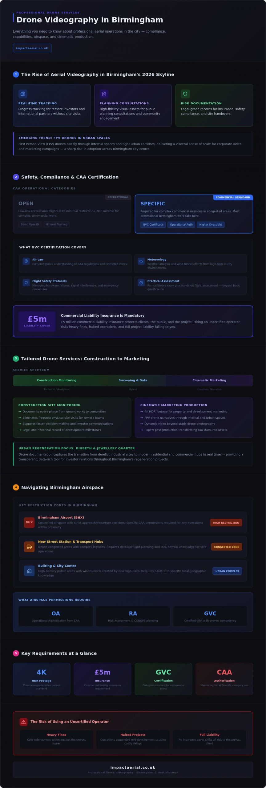
Under current drone license regulations, the ‘Open’ category covers low-risk recreational flights with minimal restrictions, while the ‘Specific’ category requires operational authorization for complex commercial missions in congested areas. Most professional work in Birmingham falls under the ‘Specific’ category, necessitating a higher level of oversight and planning.
Why GVC Certification is the Gold Standard
The GVC represents a higher tier of professional competency than a basic Flyer ID. It requires a formal theory exam and a practical flight assessment, proving the pilot can manage an aircraft safely even during hardware failures or signal interference. In high-density areas, certified pilots use these skills to maintain safe distances from uninvolved persons and property. To verify a pilot’s credentials, you should always ask to see their CAA Operator ID and their GVC certificate before any work begins. This transparency is a hallmark of a professional service provider.
Mitigating Risk in Public Spaces
Filming in iconic locations like the Bullring or around New Street Station presents unique challenges. Professional operators use a detailed Risk Assessment and Method Statement (RAMS) to identify hazards, from pedestrian footfall to electromagnetic interference from railway infrastructure. A critical component of this risk management is £5m commercial liability insurance. While standard hobbyist policies might cover rural flights, urban drone videography birmingham demands high-limit coverage to protect against property damage or injury in populated environments. This insurance provides psychological comfort and tangible security for corporate and construction clients.
Pre-flight planning often takes longer than the flight itself, involving site surveys and local authority notifications. If you’re planning a complex shoot, consulting with a compliant specialist ensures your project meets every legal requirement without compromising on visual quality.
From Construction Monitoring to Marketing: Tailored Drone Services
While the visual impact of a drone videography birmingham project is immediate, its true value lies in the specialized application of the data captured. We provide a range of services that cater to the distinct needs of the West Midlands business community, from high-stakes construction monitoring to polished marketing campaigns. For construction firms, drones offer a consistent, high-resolution record of progress. Documenting a site from initial groundworks through to final completion provides a transparent audit trail for stakeholders and project managers without the need for intrusive ground-level inspections.
In the competitive world of property development, an aerial filming drone creates cinematic content that static imagery can’t match. These dynamic sequences are essential for marketing and advertising, offering prospective buyers or tenants a comprehensive view of a property’s context within the Birmingham urban environment. Beyond traditional video, we integrate virtual tours that combine 360-degree aerial perspectives with internal walk-throughs, creating a seamless experience for the viewer that builds confidence in the development.
The Post-Production Workflow
The transition from raw data to a finished asset is where professional expertise becomes most evident. Our post-production suite focuses on colour grading 4K HDR footage to achieve a consistent, cinematic look that aligns with your brand identity. For construction clients, we add motion graphics and site boundary annotations to highlight specific milestones or infrastructure points. Sound design and licensed music are also integrated to elevate corporate video productions, ensuring the final output is ready for high-level presentations or social media distribution.
Drone Surveys for Property Professionals
For property managers and RICS-qualified surveyors, drones significantly reduce both the cost and safety risks associated with traditional scaffolding or cherry pickers. Using high-resolution sensors, we identify roof defects, structural issues, or thermal leaks that are invisible from the ground. In the West Midlands, this technology is increasingly applied to PV solar farm assessments. Thermal imaging identifies failing cells or hotspots across vast arrays in a fraction of the time required for manual inspections. This data-centric approach ensures that drone videography birmingham serves as a functional tool for maintenance and asset management.
Navigating Birmingham Airspace: Logistics and Permissions
Birmingham’s airspace is among the most regulated in the UK. Successful drone videography birmingham relies on a deep understanding of these invisible boundaries. A primary consideration is the Flight Restriction Zone (FRZ) around Birmingham Airport (BHX), which extends several kilometres and covers major development sites. Operating within this zone requires specific coordination with Air Traffic Control (ATC) and often involves strict time windows to avoid interfering with commercial aviation. We manage these technical dialogues as part of our pre-flight process, ensuring your project remains legal and safe.
Sensitive urban sites like New Street Station or the BT Tower present additional layers of complexity. These locations are subject to heightened security protocols, often requiring direct liaison with the West Midlands Police and local council authorities. Weather also plays a decisive role. High winds or heavy rain in the West Midlands can compromise both safety and image stability. Due to the unpredictable nature of British weather and sudden changes in local airspace security, short-notice rescheduling is a standard precautionary measure to ensure flight safety and data quality.
City Centre Flight Challenges
High-rise environments like the city centre introduce technical hurdles such as electromagnetic interference and signal multipathing. These phenomena can disrupt the connection between the controller and the drone, requiring advanced pilot skills and enterprise-grade hardware to mitigate. We strategically select launch points, such as secure rooftops or private land near the Library of Birmingham, to maintain a clear line of sight. Coordinating with the West Midlands Police is a non-negotiable step for urban missions. It prevents unnecessary security alerts and ensures that the public remains safe and informed during the operation.
Planning for Success
Securing the necessary permissions for complex urban flights typically requires a lead time of 7 to 14 days. This window allows for a structured approach to safety:
- Thorough site surveys and technical risk assessments (RAMS).
- Processing of applications through the CAA or local Air Traffic Control.
- Coordination with private landowners for secure launch and recovery sites.
We use DJI Enterprise software to plan precise flight paths, which allows us to simulate the mission before the drone leaves the ground. This technology ensures we capture the exact angles required while maintaining safe distances from buildings and people. Our goal is always to deliver high-end results with minimal disruption to your business or the public. If you have a project within a restricted zone, you can contact our team to discuss the specific permissions required for your location.
Why Impact Aerial is Birmingham’s Leading Drone Partner
Choosing a partner for drone videography birmingham projects requires a balance of local knowledge and technical sophistication. We operate as a specialized consultancy based in the West Midlands. This means our team understands the logistical nuances of the region better than a nationwide agency. We don’t just provide height; we deliver a hybrid service that blends the precision of technical surveying with the narrative power of creative videography. This dual expertise ensures that whether you need to identify a structural fault or produce a high-end marketing film, the output meets the highest professional standards.
Our commitment to safety is foundational. As we move through 2026, we continue to lead the market by adhering to evolving CAA regulations and maintaining £5m in commercial liability insurance. We also prioritize environmental responsibility by using electric-powered UAVs that minimize noise pollution and carbon footprints on-site. Every project we undertake is managed with meticulous attention to detail. This provides the psychological comfort that your brand and site are in expert hands. We live and work here. That local presence allows us to respond quickly to changing weather windows or urgent project requirements.
Our Hardware: DJI Enterprise Technology
We invest heavily in DJI Enterprise technology to ensure reliability and superior image quality. These aircraft are equipped with 4K HDR cameras that provide exceptional dynamic range, capturing detail in both high-contrast shadows and bright highlights. For urban Birmingham environments, safety is enhanced by triple-redundancy systems, including multiple IMUs and compasses, which prevent flight failures in complex signal areas. This high-tier hardware allows us to operate with a level of precision that consumer-grade drones cannot achieve. It’s about reliability in high-stakes environments.
Start Your Project Today
Our consultation process is structured and methodical. It begins with a detailed project brief where we establish your specific goals, followed by a thorough site assessment and permission phase. We offer flexible booking options, particularly for construction progress monitoring, allowing you to schedule flights around key project milestones. Once the data is captured, our post-production team delivers edited assets tailored to your requirements. We guide you from the initial brief to the final delivery with absolute transparency.
Ready to elevate your visual data? Request a professional drone videography quote for your Birmingham project today.
Elevate Your Birmingham Project with Precision Aerial Data
The transformation of the West Midlands skyline requires a sophisticated approach to visual documentation. Successful drone videography birmingham relies on more than just high-end hardware; it demands a meticulous understanding of CAA GVC compliance and the logistical complexities of restricted airspace. By integrating technical surveying with cinematic post-production, you turn raw aerial data into a strategic business asset that supports both site management and high-impact marketing.
Ensuring your project remains safe and legal is our priority. We provide the security of £5m commercial liability insurance and the expertise of pilots who are deeply familiar with the unique geography of the city. Whether you’re monitoring a major construction milestone or launching a new corporate campaign, our expert post-production suite is included to ensure every frame meets your professional standards. This comprehensive approach mitigates risk while delivering the visual clarity needed for 2026’s competitive landscape.
Book your Birmingham drone videography consultation with Impact Aerial to secure your flight window. We look forward to helping you capture the energy and scale of your next development.
Frequently Asked Questions
Do you need permission to fly a drone in Birmingham city centre?
Yes, you require specific permissions to fly a drone in Birmingham city centre for commercial purposes. Pilots must hold CAA operational authorization and often need to coordinate with the West Midlands Police or Birmingham City Council. This ensures that flights over congested areas like the Bullring remain compliant with safety regulations. We manage these permissions as part of our standard pre-flight planning process.
How much does professional drone videography cost in the UK?
Professional drone videography costs in the UK vary significantly based on the project’s complexity, location, and the level of post-production required. Factors such as the need for specific airspace permissions or the use of enterprise-grade hardware also influence the final quote. We provide bespoke pricing for each Birmingham project to ensure you only pay for the specific technical and creative resources your mission demands.
Can drones fly in Birmingham Airport’s restricted airspace?
Drones can fly within the Birmingham Airport (BHX) Flight Restriction Zone, but only with prior permission from Air Traffic Control. This process involves submitting a flight plan and obtaining a non-standard flight clearance. Our pilots are experienced in managing these technical dialogues, ensuring that your drone videography birmingham project proceeds legally without disrupting commercial aviation schedules.
What is the difference between 4K and HDR drone video?
4K refers to the resolution of the video, providing a high level of detail with roughly 8 million pixels per frame. HDR, or High Dynamic Range, relates to the camera’s ability to capture detail in both the brightest highlights and the darkest shadows. Combining 4K with HDR results in cinematic footage that looks lifelike and professional, which is essential for high-end property marketing and corporate films.
Are your Birmingham drone pilots CAA GVC certified?
Yes, all our Birmingham drone pilots are fully CAA GVC certified. This General Visual Line of Sight Certificate is the professional standard for operating in complex urban environments. It proves that the pilot has passed rigorous theory and practical assessments. This certification is mandatory for the ‘Specific’ category operations we typically conduct within the city centre to ensure absolute safety and compliance.
What happens if the weather is bad on the day of the shoot?
If the weather is unsuitable for flight, we typically reschedule the shoot to the next available clear window. Safety is our primary concern; high winds, rain, or low visibility can compromise the aircraft and the quality of the footage. We monitor specialized aviation forecasts 48 hours before takeoff. This proactive approach ensures we only fly when conditions allow for the high-quality 4K HDR results our clients expect.
Do you provide edited videos or just raw drone footage?
We provide both raw footage and fully edited cinematic videos depending on your project requirements. Our in-house post-production suite allows us to offer colour grading, motion graphics, and sound design. This service transforms raw aerial data into a polished marketing asset or a detailed construction progress report. We’ll discuss your preferred delivery format during the initial consultation to match your specific brand guidelines.
How much public liability insurance does a drone pilot need?
For commercial drone videography birmingham, a pilot should carry at least £5m in public liability insurance. While the legal minimum for some flights is lower, most corporate and construction clients require £5m to cover the risks associated with urban environments. We maintain this level of coverage as standard. It provides essential protection for people, property, and your business reputation during every mission we undertake.
 2 Norton Drive, Wythall, Birmingham, B47 6HH Company registration number: 11138586. VAT Number: 366 9068 55


