
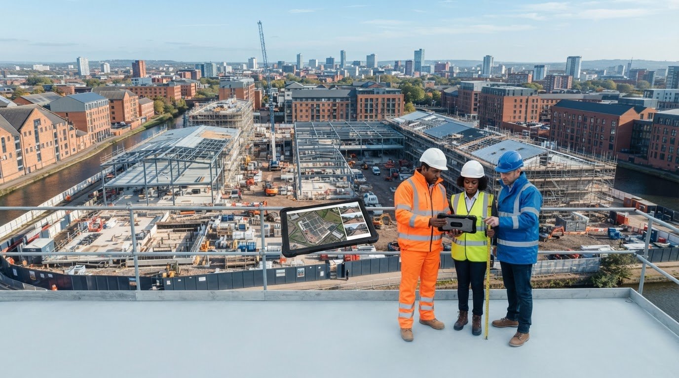
Aerial photos can make contractor progress easier to compare, but they can’t prove that hidden work is sound or replace a technical inspection. If you’re validating contractor work with drone photos, the value lies in building a consistent visual record, not treating images as certification. Ground-level updates can miss the wider site picture, while a single aerial visit may be difficult to compare with the next.
That’s why a useful record starts with a clear plan. Agree what areas and visible stages need documenting, then compare repeat captures against project information and previous images. You’ll learn how to plan and use drone photos in this way, understand what they can and can’t show, and create records that support informed project discussions without overstating what the evidence proves.
This guide covers practical capture planning, consistent image comparisons and the limits of aerial views when assessing detailed workmanship. It also explains how professional construction monitoring can provide the visual record without requiring the client to manage drone operations, from initial consultation through capture and relevant post-production.
Key Takeaways
- Build a useful visual record by agreeing the project baseline, areas of interest and review questions before capture.
- Use repeatable viewpoints and clear image labels to make visible progress easier to compare across site visits.
- When validating contractor work with drone photos, distinguish what an image directly shows from assumptions about workmanship, quality or contractual status.
- Compare aerial imagery with ground photos, site reports and technical inspections to understand what each can contribute to a review.
- Turn visible changes into clear, logged questions for the project team, rather than treating drone images as certification or sign-off.
Why Validate Contractor Work with Drone Photos?
Progress updates are harder to assess when each visit produces a different collection of ground-level images. One photograph may show a work area in detail but leave its position on the site unclear; another may capture a broad view without making a particular change easy to spot. A dated, repeatable aerial record adds wider context, helping project teams compare visible site conditions over time.
Here, validation means documenting visible work against an agreed baseline, such as a project plan, defined work area or earlier capture. It doesn’t mean independently certifying workmanship, compliance, completion or contractual acceptance. The images can support a review, but decisions about quality or contractual status must be informed by the relevant project records and inspection processes.
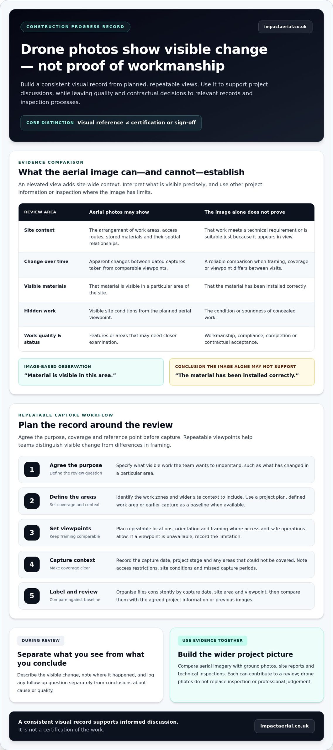
Drone-based progress documentation records visible site conditions from planned viewpoints over time; it can show change, but it cannot certify the quality or completion of work.
That distinction makes the record more useful. Rather than treating a striking aerial image as a verdict, teams can use it to understand what appears to have changed, where it happened and what may need closer examination. This is the practical value of validating contractor work with drone photos: a consistent visual reference for discussion, not a substitute for professional judgement.
What drone photos can show on a construction site
Depending on the viewpoint and visible conditions, aerial photos may show the arrangement of work areas, access routes, stored materials and apparent changes between capture dates. An elevated view can make spatial relationships clearer, for example, how a work zone sits beside a site entrance or how activity is distributed across a larger footprint.
Keep observations precise. “Material is visible in this area” describes the image; “the material has been installed correctly” makes a claim the image alone may not support. Photos may help identify an area for follow-up, but they can’t reveal concealed work or establish workmanship from appearance alone.
When aerial documentation is useful to project teams
Recurring captures can support progress reviews, client updates and project records by giving participants a shared view of visible site conditions. When images are dated and taken from comparable viewpoints, the team can distinguish apparent change from differences caused by framing or coverage.
Use the images to formulate follow-up questions: has a work area changed, is access still clear, or does a visible feature need closer inspection? Log the observation and the question separately from any conclusion about cause or quality. For broader context on aerial work across the sector, the site’s Drones in Construction: A Complete Guide article covers related applications.
Impact Aerial provides construction site monitoring across the UK, with project management from initial consultation through capture and, where relevant, post-production. A professionally planned visual record can help teams review visible progress while keeping the limits of aerial evidence clear.
How to Build a Repeatable Drone Photo Record of Contractor Progress
A useful photo record is designed around the project review, not simply the flight. Before capture, agree what the images should help the team understand, which areas matter and what information they’ll be compared against. A programme item, drawing or earlier site record can provide a baseline when supplied by the project team. This preparation keeps the capture relevant and gives reviewers a clear frame of reference.
Use a simple workflow:
- Agree the purpose. Define the review questions, such as what visible work has changed in a specific area.
- Define the areas. Identify the work zones and site context the record needs to cover.
- Set viewpoints. Plan repeatable locations, orientation and framing where site access and safe operations allow.
- Capture and record context. Note the date, project stage and any areas that couldn’t be covered.
- Label and review. Organise the files consistently, then compare them with the agreed baseline.
Matching viewpoints across dates makes visible changes easier to distinguish from differences in framing.
Set the baseline, capture areas and review cadence
Before the first visit, record the stage of the project, the date and the site areas the image record is intended to cover. Agree a practical capture schedule with the project team that reflects work phases and review needs, rather than assuming every area needs the same frequency. Note access restrictions, changing site conditions and missed capture periods so gaps in the record are clear.
Review the plan when the project or site conditions change. If a planned viewpoint is unavailable, record that limitation rather than presenting a different angle as directly comparable. Safe operations take priority, and flight planning should reflect the conditions on the day. For current UK drone information, consult the Civil Aviation Authority (CAA) guidelines.
Label images so teams can compare them later
Choose a consistent file-naming or folder system that identifies the capture date, site area and viewpoint. For example, a team might group images by project date, then area, with a viewpoint label that remains stable between visits. Keep original captures separate from edited, annotated or presentation versions, so reviewers can tell the source image from material prepared for discussion.
Where the project team supplies relevant programme items or drawings, link image references to them using the agreed project terminology. Don’t add unsupported interpretations to filenames; labels should help people locate and compare images, not imply that the image proves quality or completion.
For teams that need a managed, repeatable capture process, Impact Aerial’s construction site monitoring supports visual project records from initial consultation through capture and, where relevant, post-production.
Drone Photos vs Site Reports: What the Evidence Can Establish
Different records answer different questions. Aerial imagery can provide a broad view of visible site conditions, while ground photos may show a feature at closer range. Reports record written observations, and technical inspections assess matters that images alone can’t establish. Used together, these sources give a project team a more balanced basis for review.
Visual progress evidence complements, rather than replaces, technical inspection.
| Method | Visible coverage | Detail and context | Questions it can help answer |
|---|---|---|---|
| Aerial photos | Broad view of site areas and layout | Strong spatial context; small features may be hard to see | What visible areas or site conditions appear to have changed? |
| Ground photos | Usually a more local view | Can show closer detail, with less site-wide context | What does a particular accessible feature look like? |
| Site reports | Coverage depends on what the report records | Written project context and observations | What was recorded about progress, activity or issues? |
| Technical inspections | Defined by the inspection scope | Assessment by the appropriate project professional | Does the work meet the relevant technical criteria? |
These methods aren’t interchangeable. A photo alone doesn’t establish hidden quality, specification compliance or acceptance. For example, an image may show that a roof area appears covered, but it can’t confirm concealed layers or whether the work meets a specification. Keep the evidence type matched to the question being asked.
What aerial photos can and cannot verify
An aerial image may show visible materials in a work zone, a changed site layout or apparent progress between capture dates. What it shows depends on viewpoint, timing, image quality and project context. If a feature raises concern, record what is visible and refer the question to the appropriate project professional or inspection record. Don’t turn appearance into a conclusion about workmanship.
Combining images with reports and project information
Dated images can sit alongside site diaries, programme updates and drawings supplied by the project team. Use them as separate, traceable records: note the image reference and the visible observation, then keep decisions, approvals and contractual conclusions in their relevant project documents. The article Drone Survey: The Complete Guide to Aerial Data Collection offers broader context on how aerial data is gathered and used.
For example, an image might show that a work area looks different from the previous capture. A programme update may provide context about planned activity, while a technical inspection record addresses whether particular work meets its requirements. This separation helps readers understand what each source contributes without overstating what the image proves. In validating contractor work with drone photos, the strongest approach is to use the image to identify and locate visible changes, then rely on the relevant project records and professional assessment for conclusions.
Construction sites also require careful operational planning. For background on site-specific considerations, see Drone safety in construction.
How to Review Drone Photos Consistently and Act on Findings
A consistent review turns a set of images into a structured record of observations and follow-up questions. Start by checking whether the images can be compared fairly, then describe only what is visible. A photo may show a change in a work area; it doesn’t necessarily explain why the change occurred or establish whether the work meets project requirements.
Use this checklist for each review:
- Confirm the reference details. Check that the capture date, site area and viewpoint are identifiable. If any are missing, record that limitation before drawing comparisons.
- Compare like with like. Match images from similar viewpoints and note changes in framing, weather, access or site layout that could affect what is visible.
- Describe the observation. State what can be seen, such as a changed arrangement of materials or a newly visible work area. Avoid assigning a cause or judging quality from appearance alone.
- Log the follow-up. Add the image references, relevant project context and a named follow-up owner to the appropriate review record.
Separate observations from conclusions
Use neutral wording that another reviewer can trace back to the image. For example, “the marked area appears clear in this view” is an observation; “the contractor has completed the work” is a conclusion that may need other project information. Keep decisions about quality, cause or contractual status within the project’s established decision-making and reporting process.
If a visible difference is material, log the question and refer it through that process to the appropriate project professional. Link the observation to relevant programme information or inspection records where available. This gives the team a clear route for follow-up without presenting an image as approval or sign-off.
Handle gaps and uncertain views carefully
Mark an obscured, inaccessible or poorly framed area as inconclusive, not as evidence that work is absent. Note when a capture was missed or conditions made comparison unsuitable. Avoid unnecessary capture of neighbouring property or identifiable people, and handle images in line with applicable UK privacy guidance and the project’s agreed retention arrangements.
For validating contractor work with drone photos, a transparent record of uncertainty matters as much as a clear view. It shows reviewers where the imagery can support comparison and where another source or closer inspection is needed.
Impact Aerial’s construction site monitoring can support a managed visual record, with capture planned around project requirements. Arrange construction site monitoring to discuss a consistent approach to documenting visible progress.
How Impact Aerial Supports Construction Site Monitoring
A managed capture process can help project teams create a consistent visual record without taking on drone operations themselves. Impact Aerial provides construction site monitoring across the UK, combining project planning, aerial capture and, where relevant, post-production. The aim is to document visible site conditions in a useful, organised way, giving teams imagery to support progress reviews and project records.
Professional capture is supported by CAA GVC certified pilots using commercial-grade drones equipped with 4K HDR cameras. Impact Aerial also holds £5m commercial liability insurance. These credentials support a professional approach to aerial work, while the purpose of the imagery remains clear: it records what is visible from the chosen viewpoints. It doesn’t certify contractor workmanship, compliance, completion or contractual acceptance, and it doesn’t replace technical inspection.
What a professionally managed capture process involves
The service journey runs from initial consultation through capture and, where relevant, post-production. Planning can take account of the site areas the project team wants recorded, the intended comparisons and conditions that may affect a view. This helps align the capture with the project’s documentation needs. Schedules, formats and outputs should reflect the individual project rather than assumptions about a standard package.
Before capture, teams can outline the questions they need imagery to support, such as documenting visible changes across defined work areas. The capture plan can then reflect the site context and safe operational conditions. If access or conditions limit a view, the record should make that limitation clear rather than imply that an area was covered. The result is documentation support, not an independent assessment of the contractor’s work.
Plan the next step for your construction project
A useful starting point is to set out the site context, monitoring goals and progress questions the team wants documented. Identify relevant work areas and explain how the resulting images will fit into existing project reviews. This gives the capture process a clear purpose and helps keep the visual record aligned with the information the team needs.
For teams validating contractor work with drone photos, professional monitoring can provide a consistent aerial perspective while leaving technical judgements to the appropriate inspection and project processes. Impact Aerial’s UK-wide construction monitoring is a practical option for building that visual record. Discuss construction site monitoring with Impact Aerial.
Make Your Next Progress Review More Useful
The next step is to decide what your team needs to see, and how those observations will inform its existing review process. Choose the project areas where a visual record could add context, identify who will review the images, and agree how questions will be recorded and followed up. A clear purpose helps keep the imagery relevant without treating it as a substitute for technical judgement.
Used this way, validating contractor work with drone photos becomes part of a disciplined project record: a way to make visible progress easier to discuss while keeping evidence, interpretation and decisions distinct. The approach can be shaped around your site context and monitoring goals, with capture planned to support the questions that matter to your team.
Impact Aerial provides construction site monitoring across the UK, supported by CAA GVC certified pilots, commercial-grade drones equipped with 4K HDR cameras and £5m commercial liability insurance. To discuss a practical visual record for your project, discuss construction site monitoring with Impact Aerial. A considered capture plan is a confident place to start.
Frequently Asked Questions
Can drone photos prove that a contractor has completed work?
No. Drone photos may show visible features associated with a work stage, but they can’t establish that every required task is complete or accepted. For example, an aerial view might show a section of roof with a new surface, but not confirm concealed layers or compliance with the specification. Use images as supporting records, and refer completion decisions to the project’s agreed inspection and sign-off process.
How often should a construction site be photographed by drone?
There’s no single frequency that suits every project. Set the capture cadence around the purpose of the record, the pace of visible change and the team’s review cycle. A phase with substantial external progress may warrant more frequent comparison than a period where little visible change is expected. Agree the plan with the project team, then adjust it as work stages or site priorities shift.
Are drone photos useful when weather or site conditions change?
Yes, but changing conditions can affect what an image shows and how fairly it compares with earlier captures. Rain, temporary coverings, new storage areas or altered access routes may change the appearance of a location without indicating a change in the contractor’s work. Record relevant conditions with the capture, and treat a comparison as inconclusive if they obscure the feature being reviewed.
Can drone photos be used in a construction progress report?
Yes. A progress report can include selected drone images as visual references, with captions that identify the capture date, location and observation. For instance, a caption could direct readers to a visible change in a defined work area. Keep the caption factual and distinguish the image observation from reported progress, approvals or decisions. Follow the project’s own requirements for report preparation and record handling.
Do drone photos show defects that ground-level photos might miss?
They can reveal patterns or visible concerns across a broad area that may be difficult to appreciate from ground level, such as an apparent difference between roof sections. But an aerial image may not show fine detail, and appearance alone doesn’t confirm a defect or its cause. Use a photograph to flag a location for closer review, then rely on the appropriate inspection to assess the issue.
How should a project team organise drone photos for later review?
Use a shared structure that makes each image easy to retrieve, such as folders by project, capture date and site area, with viewpoint labels where useful. Keep source files separate from annotated copies, and avoid replacing originals with edited versions. Agree who can access the archive and how it should be retained under the project’s record-management arrangements, so reviewers can locate relevant images without relying on personal inboxes.
Do drone photos capture work inside buildings?
Not through a roof or closed walls. Exterior aerial photography can document visible external conditions, but it won’t show enclosed rooms or concealed construction. Interior imagery would require a separately planned capture inside the building, subject to suitable access and safe operating conditions. For internal workmanship, use appropriate site photography, project records or inspection methods that can directly show the area being assessed.
 2 Norton Drive, Wythall, Birmingham, B47 6HH Company registration number: 11138586. VAT Number: 366 9068 55


