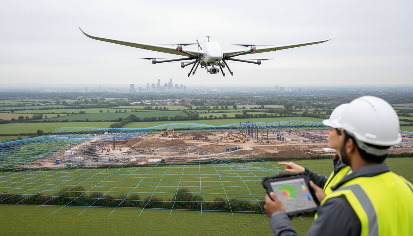
Trying to establish a clear budget for your next project but finding transparent pricing a challenge? For many developers, project managers, and landowners, determining the true drone land survey cost per hectare UK providers will charge can be a frustrating exercise filled with vague estimates and potential hidden fees. The final price is influenced by a host of technical factors, from the required Ground Sample Distance (GSD) and data processing complexity to site accessibility and the specific outputs you need, such as orthomosaic maps or 3D point clouds.
This comprehensive 2026 pricing guide is designed to provide the clarity you need. We will break down the key variables that shape the cost of professional aerial surveys, explain the difference between various survey types, and provide realistic price brackets you can expect to see in the market. Our goal is to empower you with the knowledge to confidently assess quotes, understand fair market value, and partner with Impact Aerial, a fully insured, CAA GVC Certified operator who can deliver the precise, high-quality data your project demands, offering you complete peace of mind.
Key Takeaways
- Understand the typical price range for a drone survey, which can vary from as little as £100 to over £400 per hectare based on project requirements.
- Discover the seven critical factors, from site accessibility to data complexity, that influence your final survey cost beyond the baseline per-hectare rate.
- Learn why the initial drone land survey cost per hectare uk is a strategic investment that delivers significant ROI through faster data collection and enhanced safety.
- Find out what a comprehensive quote from a CAA GVC Certified operator should include, ensuring you receive accurate, actionable data with no hidden fees.
UK Drone Land Survey Costs: A Per-Hectare Price Breakdown
Understanding the investment required for a drone survey is the first step in planning your project. While every site has unique complexities, we can provide a clear, data-driven overview of typical costs. The most significant factor influencing the final price is the technology required to achieve your desired accuracy and deliverables.
Here is a summary of the guide prices you can expect for professional drone survey services in the UK for 2026:
| Survey Type | Typical Cost Per Hectare | Best For |
|---|---|---|
| Standard Photogrammetry (RTK/PPK) | £150 – £250 | Topographic maps, volume calculations, site monitoring |
| High-Precision LiDAR | £300 – £500+ | Dense vegetation, complex terrain, infrastructure surveys |
These figures, ranging from as little as £100 to over £400 per hectare, serve as a reliable starting point. However, the true drone land survey cost per hectare UK providers quote will depend on factors we will explore later in this guide, such as site accessibility, risk assessments, and the level of data processing required. The two primary methodologies driving these costs are Photogrammetry and LiDAR.
To better understand how professionals approach pricing these complex jobs, this video from a fellow surveyor offers valuable insight:
Standard Photogrammetry (RTK/PPK) Survey Costs
Typical Cost: £150 – £250 per hectare.
This is the most common and cost-effective method for acquiring high-quality survey data. It involves capturing hundreds or thousands of overlapping high-resolution images, which are then processed to create detailed 3D models and maps. The technique, known as an Unmanned Aerial Photogrammetric Survey, is ideal for most construction, agricultural, and land development projects. The inclusion of RTK (Real-Time Kinematic) or PPK (Post-Processed Kinematic) technology ensures centimetre-level accuracy without extensive ground control points.
- Common Deliverables: High-resolution Orthomosaic maps, Digital Surface Models (DSM), 3D point clouds, and contour lines.
High-Precision LiDAR Survey Costs
Typical Cost: £300 – £500+ per hectare.
LiDAR (Light Detection and Ranging) is a more specialised and therefore more expensive technology. A LiDAR sensor emits laser pulses to measure distances to the Earth’s surface with extreme precision. Its key advantage is the ability to penetrate vegetation canopies, allowing it to map the true ground level beneath trees and dense brush. This makes it indispensable for forestry management, flood risk analysis, and surveys of complex terrain or infrastructure like power lines.
- Common Deliverables: Highly accurate Digital Terrain Models (DTM), classified point clouds (distinguishing ground from vegetation/buildings), and detailed 3D models.
7 Key Factors That Influence Your Per-Hectare Cost
While a ‘per hectare’ figure provides a useful baseline, the final quote for a professional drone survey is influenced by several critical project-specific variables. Understanding these factors not only clarifies pricing but also helps you provide the necessary details for an accurate quotation. This detailed approach ensures every operation is planned meticulously for safety, compliance, and the delivery of high-quality, actionable data. The overall drone land survey cost per hectare uk is a reflection of the expertise, technology, and risk management involved.
1. Project Size & Economies of Scale
The total area of the site is a primary cost driver. For larger projects, typically over 50 hectares, significant economies of scale apply. This reduces the per-hectare rate as fixed costs like mobilisation, risk assessment, and operational planning are spread over a larger area. Conversely, very small sites (under 2 hectares) are often subject to a minimum project fee or a half-day rate to cover these essential, non-negotiable overheads.
2. Site Complexity & Terrain
A flat, open field with clear lines of sight is the most straightforward and cost-effective scenario. The cost increases with complexity, as more intensive flight planning and on-site time are required. Key factors include:
- Obstructions: Buildings, dense woodland, and power lines necessitate complex, often multi-level, flight paths.
- Terrain: Steep gradients or quarries can impact the pilot’s ability to maintain a visual line of sight (VLOS) and require specialised flight programming.
- Accessibility: Poor site access for the survey team and their equipment can increase setup time and logistical costs.
3. Required Accuracy & Deliverables
The level of detail you require directly impacts flight time and data processing. Higher accuracy is defined by a lower Ground Sample Distance (GSD), which requires the drone to fly lower and slower. Furthermore, achieving absolute accuracy (tying the survey to Ordnance Survey coordinates) necessitates the use of Ground Control Points (GCPs), adding significant fieldwork. The final deliverables-whether a simple orthomosaic map, a 3D point cloud, or CAD-ready topographical plans-will also determine the extent of post-processing work required by our specialists.
4. Airspace Classification & Location
Where your site is located is a crucial safety and cost consideration. Operating in controlled or restricted airspace, such as near airports or sensitive facilities, requires detailed risk assessments and often non-standard permissions from the Civil Aviation Authority (CAA). All professional operations must strictly adhere to the UK’s Drone and Model Aircraft Code to ensure public safety and full legal compliance. Additionally, remote locations may incur travel and accommodation costs, which will be factored into the final project fee.

What’s Included in a Professional Drone Survey Quote?
When evaluating the drone land survey cost per hectare UK providers quote, it’s crucial to understand what you are paying for. A professional quote extends far beyond the pilot’s time on-site. It represents a comprehensive, end-to-end data-gathering service designed for accuracy, safety, and compliance. This detailed approach is the key difference between a certified commercial operator and a less experienced ‘man with a drone’, ensuring you receive actionable, reliable data for your project.
Core Inclusions: The Standard Service
Every professional survey begins long before the drone takes flight. A standard quote from a reputable provider like Impact Aerial will always include these fundamental components, ensuring a safe and effective operation from start to finish.
- Pre-flight Survey Planning: Detailed desktop surveys of the site, airspace analysis, and the creation of comprehensive Risk Assessments and Method Statements (RAMS).
- Certified Pilot & Professional Equipment: The services of a CAA GVC Certified pilot operating professional-grade, survey-specific drones and sensors.
- On-site Data Acquisition: The flight operation itself, including the establishment of Ground Control Points (GCPs) where required to achieve centimetre-level accuracy.
- Comprehensive Insurance: For added peace of mind, we hold £5 million in public liability insurance, covering all our commercial operations.
Data Processing and Standard Deliverables
The work is only half-complete once the drone has landed. The captured raw data is unusable without expert processing. A professional quote includes the necessary photogrammetry software expertise to transform thousands of images into precise, measurable outputs.
- Initial Data Processing: Converting raw aerial images into a high-resolution orthomosaic map and a 3D point cloud.
- Quality Assurance: Rigorous internal checks to ensure data integrity, accuracy, and completeness before delivery.
- Secure Digital Delivery: Provision of industry-standard file formats such as GeoTIFF (for GIS/CAD), LAS/LAZ (point cloud), and OBJ (3D model).
Potential Additional Costs to Consider
While a standard quote covers most requirements, certain project-specific needs may incur additional fees. Transparency is key, and a professional operator will always discuss these with you upfront.
- Advanced Data Analysis: Services like volumetric calculations for stockpiles, cut-and-fill analysis, or the generation of detailed topographic reports.
- Travel & Accommodation: For projects located significantly outside our standard West Midlands service area.
- Urgent Turnaround or Out-of-Hours Work: Expedited data processing or flights required on weekends or bank holidays.
- Specialist Permissions: Complex operations requiring an Operational Authorisation from the CAA, such as flights in restricted airspace near airports or sensitive sites.
Cost vs. Value: The ROI of a Drone Land Survey
When evaluating the drone land survey cost per hectare uk, it is crucial to view the figure not as an expense, but as a strategic investment in project efficiency, safety, and data integrity. While traditional terrestrial surveying methods have their place, they often involve higher long-term costs due to extended timelines and larger ground crews. A professional drone survey delivers a powerful return on investment by fundamentally improving how projects are planned and executed.
The value becomes clear when you analyse the core benefits that directly impact your bottom line and project outcomes.
Faster Turnaround, Faster Decisions
A single drone can accurately survey many hectares in a single day, a task that could take a ground crew days or even weeks. This rapid data acquisition means critical information-from topographic maps to 3D models-is delivered to your team faster. For time-sensitive construction and development projects, this acceleration minimises costly delays, streamlines planning phases, and enables key decisions to be made with up-to-the-minute site intelligence.
Unmatched Safety on Difficult Sites
Safety is a non-negotiable priority on any site. Drone surveys mitigate significant risks by eliminating the need for surveyors to work at height, on unstable ground, or within hazardous zones like quarries or live industrial sites. Our CAA GVC certified pilots operate from a safe location, capturing comprehensive data without physical entry. This drastically reduces on-site risk, lowers liability, and can lead to more favourable insurance premiums, all while ensuring complete data capture.
Richer Data for Better Project Outcomes
The data captured by a drone survey is vastly superior in detail and scope to most ground-based methods. By capturing millions of data points, we create a high-resolution digital twin of your site. This allows for meticulous analysis, from precise volumetric calculations for stockpiles to identifying subtle drainage issues missed by the human eye. This provides a verifiable, time-stamped record of site conditions that empowers superior design and management. See how our survey data transforms projects.
Ultimately, the gains in project speed, the comprehensive risk reduction, and the superior quality of the data create a compelling ROI. When you partner with a professional service like Impact Aerial, you are investing in a safer, smarter, and more profitable project from the outset.
How to Get an Accurate Drone Survey Quote
Navigating the various quotes for a drone survey can be complex. To ensure you receive a proposal that is both accurate and reflects true value, it is crucial to provide detailed project information and understand what separates a professional operator from a low-cost alternative. This guide will empower you to secure a quote that aligns with your project’s technical and commercial needs.
Information to Prepare for Your Quote
To provide you with a precise and comprehensive quote, we require specific details about your project. Preparing this information beforehand will streamline the process and ensure the final figure accurately reflects the scope of work. Please have the following details ready:
- Site Location: A full UK postcode, What3Words address, or OS grid reference.
- Total Area: The size of the survey area, preferably in hectares (ha).
- Required Accuracy: The desired Ground Sample Distance (GSD) and any specific tolerances required for your project.
- Desired Deliverables: Let us know what final outputs you need, such as a Topographic Survey, 3D Point Cloud, Orthomosaic Map, or Digital Terrain Model (DTM).
- Site Conditions: Any known hazards (e.g., overhead power lines, public rights of way) or access restrictions that may impact flight planning.
Why the Cheapest Quote Can Be the Most Expensive
While a low initial price can seem attractive, it often signals a lack of professionalism that can lead to significant costs down the line. Unqualified operators may lack the correct CAA GVC certification or, critically, adequate commercial liability insurance. This puts your project and business at serious risk.
Furthermore, using non-survey-grade equipment results in poor quality data. Inaccurate measurements and low-resolution imagery can lead to flawed designs, costly rework, and project delays. Investing in a professional service ensures the data you receive is reliable, actionable, and fit for purpose, preventing expensive errors.
Request Your No-Obligation Quote from Impact Aerial
At Impact Aerial, we provide a professional, data-driven service built on a foundation of safety and precision. We are fully CAA GVC Certified and hold comprehensive commercial liability insurance for your complete peace of mind. Our detailed quotes are transparent, with no hidden fees, providing a clear breakdown of the drone land survey cost per hectare uk for your specific project.
Ready to move forward with confidence? Contact our team of experts today to discuss your requirements and receive a detailed, no-obligation proposal for your land survey.
Get Your Professional Survey Quote
From Cost Per Hectare to Project Value: Your Next Steps
As we’ve explored, the drone land survey cost per hectare uk is influenced by far more than just area. Factors like terrain complexity, data resolution, and site accessibility all play a crucial role in determining the final price. However, the most important takeaway is the significant return on investment; a professional drone survey delivers superior data accuracy, enhanced site safety, and accelerated project timelines that far outweigh the initial outlay.
To move from an estimate to a precise figure, partnering with a certified and experienced provider is essential. At Impact Aerial, we provide professional, data-driven survey services backed by decades of combined surveying and aviation experience. Our operations utilise professional, survey-grade drone systems and are fully compliant, giving you complete peace of mind that your project is in expert hands.
Ready to unlock the efficiency and precision of aerial data for your project? Request a detailed, no-obligation quote for your survey project. Let our CAA GVC Certified and fully insured team provide the clarity you need to move forward with confidence.
Frequently Asked Questions
How much does a drone survey for a small plot (under 1 hectare) cost?
For small plots, a fixed project fee is more common than a per-hectare rate. You can typically expect costs to range from £450 to £850. This pricing reflects the minimum half-day rate required for a professional operator to cover pre-flight planning, risk assessments, on-site data capture, and initial data processing. While the drone land survey cost per hectare uk is a useful metric for larger sites, smaller projects have foundational costs that must be covered regardless of size.
Is photogrammetry accurate enough or do I need a LiDAR survey?
For the vast majority of topographic surveys, volume calculations, and construction site monitoring, photogrammetry provides exceptional accuracy, typically within 20-50mm. It is a highly effective and cost-efficient method for data-gathering. However, if your project involves surveying through dense vegetation or requires the absolute highest precision for hard surfaces like new road layouts, a LiDAR survey may be the more appropriate professional service. We can advise on the best technology for your specific project requirements.
How quickly can I get the final data after the drone flight?
Our standard turnaround for delivering processed, high-quality data is typically between 3 to 5 business days following the on-site survey. Initial draft data or orthomosaic imagery can often be made available within 48 hours for preliminary review. The final delivery timeline depends on the complexity of the project and the specific outputs required, such as detailed 3D models, point clouds, or integration into CAD software. We always provide a clear delivery schedule in our formal quotation.
What qualifications should a commercial drone surveyor have in the UK?
A professional drone surveyor must hold a valid General Visual Line of Sight Certificate (GVC) issued by the Civil Aviation Authority (CAA), which permits commercial operations. For added peace of mind, they must also hold comprehensive commercial liability insurance. Beyond these legal requirements, a reputable surveyor will have specific training in survey-grade data capture techniques, extensive flight experience, and a portfolio demonstrating their expertise in producing accurate and reliable survey outputs.
Can drones survey land with dense tree cover?
Standard photogrammetry struggles with dense tree cover as the sensors map the top of the canopy, not the ground beneath. For accurately mapping terrain under heavy foliage, a drone equipped with a LiDAR (Light Detection and Ranging) sensor is required. LiDAR’s laser pulses can penetrate gaps in the leaves to capture the true ground level, making it the essential technology for surveying woodlands or densely vegetated areas where a “bare earth” model is needed.
Do you charge for travel to sites across the UK?
As a Birmingham-based operator, our quotations for projects within the West Midlands typically include all travel costs. For sites located further afield across the UK, a travel and accommodation charge may be applied to cover the additional time and expense. This is always calculated transparently and will be clearly itemised within your formal, no-obligation quotation, ensuring there are no hidden fees. We are committed to providing top-quality services nationwide.
