
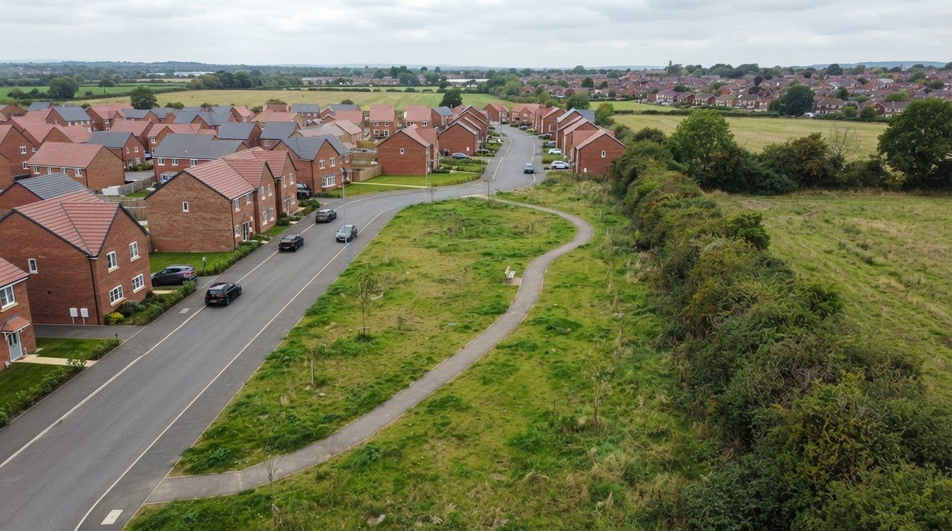
A mapped boundary is only useful when its real-world context is clear. In England, a Section 106 agreement is a legal obligation attached to land under section 106 of the Town and Country Planning Act 1990. Aerial photography for Section 106 agreements can show the site and its surroundings to help inform how an agreement area is represented as a polygon, but it doesn’t define the legal boundary or replace the agreement itself.
It’s understandable to want a clear record of which land an obligation covers, particularly when preparing a proposal or discussing it before an application. This article explains how aerial imagery can support polygon mapping, what it can show during pre-application discussions, and where its limits lie. You’ll also learn how to distinguish useful visual context from the legal description that determines the land covered by an agreement.
Key Takeaways
- Understand what a Section 106 agreement attaches to, and why accurately identifying the affected land matters.
- See how dated aerial images can help document visible site conditions and changes relevant to monitoring.
- Learn why photographs can support a planning or legal case without automatically deciding it.
- Explore how monitoring imagery can be planned around the obligation, site activity and the changes that need recording.
What is a Section 106 agreement in UK planning?
In England, a Section 106 agreement is a legal obligation attached to land under section 106 of the Town and Country Planning Act 1990. It can secure measures or restrictions connected with a development. Once signed, the obligation remains attached to the land it covers, rather than applying only to the original developer. A future buyer therefore takes on obligations attached to the site.
The Community Infrastructure Levy Regulations 2010 set legal tests in regulation 122 for planning obligations considered when granting permission. An obligation must be necessary to make the development acceptable in planning terms, directly related to it, and fairly and reasonably related in scale and kind. The National Planning Policy Framework paragraph 203 also says obligations should be used only where unacceptable impacts cannot be addressed through a planning condition. These tests help distinguish development-related requirements from unrelated requests.
A local planning authority and people with interests in the land may be involved, including the landowner, mortgagees and long-term leaseholders. The terms depend on the proposal. For example, an agreement may secure affordable housing on a major development or restrict a house to occupation by someone with a local connection. A significant on-site habitat enhancement may also be secured through a planning condition, a Section 106 agreement or a conservation covenant.
The written agreement identifies the obligation and the land it affects. A map or polygon can help show the relevant area, but the agreement’s wording and land description remain important to understanding its scope. Barrow Borough Council’s Section 106 Agreements dataset, for example, represents the area affected by each agreement as a polygon. That kind of spatial record can help readers distinguish the agreement area from neighbouring land.
Section 106A of the Town and Country Planning Act 1990 provides for applications to modify or discharge an obligation. If an appeal follows refusal or non-determination of a section 106A application, it is made under section 106B, according to The National Archives (legislation.gov.uk). This route concerns the legal obligation; aerial imagery can add visual context, but does not itself change the agreement.
What evidence can aerial photographs provide for Section 106 compliance monitoring?
For monitoring, aerial photography for section 106 agreements can provide a dated visual record of visible site conditions. Images may show building progress, altered access routes, completed landscaping or changes to open areas. A sequence from similar viewpoints helps reviewers identify visible changes more clearly than isolated photographs. The images record what was visible at capture, rather than proving every aspect of compliance.
Images are most useful when tied to a specific obligation. If an agreement covers habitat enhancement, photographs may show the location and visible condition of planted areas or habitat works. Appearance alone cannot establish ecological quality or maintenance history. Images of housing may show buildings on site, but cannot establish who occupies them or whether occupancy conditions are being followed.
A useful record can include:
- A wide view showing the site and its surroundings.
- Closer images of the relevant works or features.
- Capture dates and location notes for future comparison.
- Consistent viewpoints that make visible changes easier to assess.
For example, successive views of an agreed landscaped area may help document its development and visible condition. A planning officer, landowner or project team can use this context when reviewing progress. Consider photographs alongside the agreement, plans and other relevant records. Imagery cannot explain the legal wording or establish whether every requirement has been met.
Aerial photography for section 106 agreements is most useful when each image has a clear purpose and relates to a defined site feature. A capture plan can identify relevant viewpoints, the areas to document and changes worth recording. This keeps the imagery focused on compliance discussions and provides a more organised visual record for later review.
Are drone photographs admissible as evidence in UK planning enforcement or Section 106 disputes?
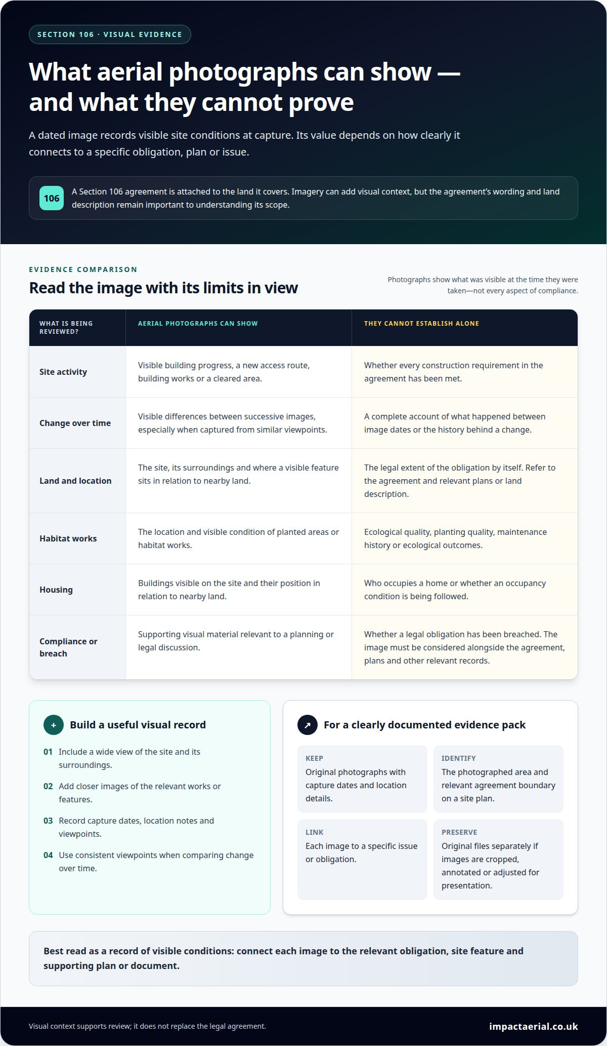
Drone photographs can provide supporting visual material in a planning enforcement or Section 106 dispute. They show visible site conditions at the time of capture, such as a new access road, building works or a cleared area. A photograph does not, by itself, establish that a legal obligation has been breached. Its relevance depends on what it depicts and how that connects to the agreement, approved plans and issue under discussion.
Admissibility and evidential weight depend on the process and the material presented. A clear, well-documented image gives reviewers more context than an unexplained picture. Keep the original image files and record the capture date, location, viewpoint and purpose. If images are cropped, annotated or adjusted for presentation, retain the originals separately so those changes are transparent.
A useful evidence pack can include:
- Original photographs with capture dates and location details.
- A site plan identifying the photographed area and relevant agreement boundary.
- Images from consistent viewpoints, where comparison over time matters.
- A short note linking each image to a specific issue or obligation.
For example, a photograph of landscaping may document its visible condition, but cannot establish planting quality, maintenance history or ecological outcomes. A view of a building may show its position in relation to nearby land, but the agreement and relevant plans provide the planning context. Similarly, a photograph of an access route cannot establish on its own whether construction meets every agreed requirement.
Present images in sequence when change over time matters, and label each view clearly. Avoid captions that claim more than the photograph shows. Aerial imagery is most useful alongside dated site records, agreement documents and other relevant evidence. This keeps the material factual: the image records visible details, while the accompanying documents explain their relevance to the dispute.
How often should aerial photographs be taken to monitor Section 106 obligations
Set the capture interval around the Section 106 obligation, site activity and changes that need recording. A single annual view may miss the sequence of work on a construction site. For example, imagery before groundworks and after access works are completed can show visible change more clearly than an isolated photograph. The agreement’s monitoring requirements should guide the schedule.
For construction-related obligations, plan captures around meaningful project stages, such as site clearance, building progress, access installation or landscaping. Capturing images after relevant stages can create a useful record without treating every site visit as equally informative. If work pauses or the site changes substantially, an additional capture can document that point in the project timeline.
Habitat or landscaping obligations need a schedule suited to the visible features being monitored. Vegetation changes with the seasons, so a view during active growth may show different details from one taken in winter. Keep viewpoints consistent where possible, and note the capture date and feature being recorded. This helps distinguish genuine change from differences caused by the season or camera position.
A practical monitoring plan can identify:
- The obligation or site feature each capture relates to.
- Project milestones that make a new image useful.
- Seasonal conditions affecting visibility, such as leaf cover.
- Any change that should prompt an extra capture, such as new works.
For a Section 106 agreement covering several features, schedule imagery around each feature’s progress rather than relying on one broad overview. Compare later photographs with earlier views from similar positions, and retain dates and location notes. This creates a clearer visual timeline for planning discussions and compliance records. Plan aerial monitoring imagery around the site changes your agreement needs to document.
Impact Aerial: Aerial Filming and Photography
Impact Aerial provides Aerial Filming and Photography to capture clear views of land, site boundaries and visible works relevant to Section 106 discussions. If you need a visual record to support pre-application conversations or monitor changes during construction, aerial imagery can help show how the site relates to its surroundings.
Shape the capture approach around the features to document, such as access routes, landscaping or visible work in progress. For projects that need ongoing site records, Construction Site Monitoring can track development activity through aerial views. Photographs provide visual context, while the agreement and its plans define the obligations and affected land.
Contact Impact Aerial to discuss aerial photography for your Section 106 project.
Make your next planning discussion more informed
Before commissioning imagery, identify the decision it needs to support. A clear brief can connect the land to be shown with the features or changes that matter, helping keep the resulting record focused and useful. Aerial photography for Section 106 agreements works best as part of a considered evidence approach, not as a substitute for the agreement, its plans or professional judgement.
Consider how the images will be used: for an early discussion, a progress record or a later review. The intended purpose can guide the viewpoints, capture timing and context needed. Establishing this from the outset helps ensure the imagery serves the project rather than simply documenting it.
If you’re planning a project and want to discuss suitable aerial imagery, contact Impact Aerial about your site. A well-framed conversation can help you define a practical next step with confidence.
Frequently Asked Questions
What do I need to know?
Use aerial images as visual context, not as a replacement for the Section 106 agreement or its mapped legal description. Before planning a capture, identify the land and specific planning issue under discussion. For example, a pre-application meeting may benefit from an annotated overview showing the proposed work area alongside nearby access routes. Keep annotations distinct from the source image so readers can tell recorded details from interpretation.
How can aerial photography support Section 106 planning obligations?
Aerial photography can help explain how an obligation relates to the wider site. For a proposed habitat area, an overview can show its position beside buildings, paths or adjoining land. A clear annotation can identify the relevant polygon and direct reviewers to the feature under discussion. Use the image to orient the conversation, then refer to the agreement and its plans to establish the obligation’s actual scope.
What UK rules apply to drone aerial photography for planning sites?
Drone operations in the UK must be planned in line with applicable Civil Aviation Authority requirements. The required operational authorisation and pilot competency depend on the flight. Commercial status alone does not describe every operational requirement. Site access, nearby people and structures, and the intended flight area also affect planning. A compliant operator considers these factors before capturing images rather than treating every site as a routine flight.
What permissions and privacy requirements apply to aerial photography in the UK?
Plan site access and take-off arrangements with the people responsible for the land, and agree how the capture will fit site safety procedures. Frame images around the planning area, avoiding unnecessary views of neighbouring homes or identifiable people. If people or private spaces appear, consider whether the material is needed for its stated purpose, restrict access to the files and avoid wider sharing without a clear reason.
What are the limitations and risks of using aerial imagery for Section 106 evidence?
Overhead views can hide details beneath trees, roofs or temporary coverings, while perspective can make distances and boundaries difficult to judge. An image records a moment, not what happened before or after it was captured. Do not draw legal boundary conclusions from pixels alone. Preserve original files and capture details, and label any edited copy. Use plans or other records to establish details the photograph cannot show.
 2 Norton Drive, Wythall, Birmingham, B47 6HH Company registration number: 11138586. VAT Number: 366 9068 55


