
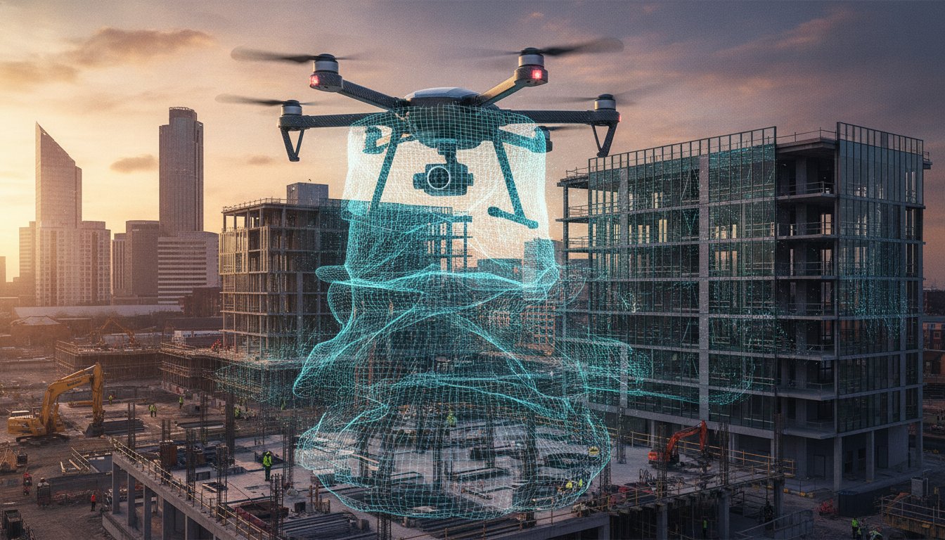
If your property marketing relies on static ground-level shots, you aren’t just missing the view; you’re losing the true scale of the entire investment. It’s frustrating when standard photography fails to capture the full footprint of a large-scale development or complex industrial site, leaving potential stakeholders guessing about the layout. You need a way to provide context and depth that traditional lenses simply cannot reach.
We understand that while the visual potential of aerial data is exciting, the logistics of drone virtual tour services can feel daunting. You might worry about the complexities of 2026 UK CAA regulations or wonder how to safely integrate high-resolution 360° panoramas into your website without compromising performance. This guide is designed to provide professional clarity and reassurance. You’ll discover how high-precision aerial data transforms site inspections and marketing into immersive, interactive experiences.
We’ll walk you through the essential technical requirements, from using commercial-grade DJI Enterprise hardware to ensuring your project is backed by CAA GVC certified pilots and £5m commercial liability insurance. By the end of this article, you’ll know exactly how to leverage these digital twins to mitigate business risk, increase engagement, and maintain full regulatory compliance across the UK.
Key Takeaways
- Discover how interactive, 360-degree aerial environments provide a comprehensive sense of scale that standard ground-level photography simply cannot match.
- Learn why professional-grade hardware, including 4K HDR sensors and GPS-locked stability, is critical for creating high-precision digital twins of your assets.
- Evaluate the specific use cases for aerial perspectives versus ground-based tours to ensure you’re using the most effective visual tool for your property.
- See how industries like construction and commercial real estate use these assets to reduce unnecessary site visits and accelerate stakeholder reporting cycles.
- Understand the business value of hiring professional drone virtual tour services that prioritize safety through CAA GVC certification and £5m public liability insurance.
The Evolution of Property Perspectives: What Are Drone Virtual Tour Services?
Professional drone virtual tour services have redefined how stakeholders interact with physical assets. Unlike a standard aerial photograph that provides a single fixed perspective, a virtual tour is a dynamic, interactive 360-degree environment. Users can rotate their view, zoom in on specific details, and navigate between multiple vantage points across a site. In 2026, these assets have shifted from being high-end marketing novelties to essential digital infrastructure for property developers, surveyors, and site managers.
The realism of these tours depends heavily on the use of high-resolution 4K HDR imagery. This technology ensures that lighting remains consistent across the entire spherical capture, preventing the “blown-out” skies or dark shadows often seen in amateur attempts. By providing a seamless, high-fidelity experience, businesses can offer a level of transparency that builds immediate trust with remote investors and project partners. It’s about delivering a digital twin that feels as tangible as a physical site visit.
How 360° Aerial Imaging Differs from Ground Tours
Ground-based tours are excellent for internal room layouts, but they lack the ability to show a property in its wider geographic context. Aerial imaging provides unrestricted vantage points that ground cameras simply cannot reach. This perspective is vital for showing the scale of industrial complexes or the proximity of a development to critical transport links. It’s a balance between the “wow factor” of a sweeping view and the practical data required for site analysis. You aren’t just looking at a building; you’re understanding its relationship with the surrounding environment.
Key advantages of the aerial perspective include:
- Unrestricted Vantage Points: Capturing views from heights and angles impossible for tripod-mounted cameras.
- Contextual Awareness: Showing the surrounding infrastructure, access roads, and neighbouring sites in a single view.
- Scale Perception: Providing a true sense of the footprint for large land parcels or multi-building estates.
The Technology Behind the Immersion
Capturing these environments requires meticulous flight planning and commercial-grade hardware. The use of DJI Enterprise drones ensures maximum stability during the 360-degree rotation. This stability is crucial for the post-production stage, where individual images are stitched together to create a fluid, navigable interface. Many advanced tours now incorporate photogrammetry techniques to add depth and measurable data to the visual experience. These tours can be integrated into existing platforms like Matterport or delivered via custom-coded web overlays, ensuring they fit perfectly into your current digital workflow.
Technical Requirements for Professional Aerial Virtual Tours
High-quality drone virtual tour services rely on a sophisticated stack of hardware and software to deliver usable, high-fidelity data. It isn’t just about capturing a series of images; it’s about maintaining absolute visual consistency across a 360-degree panorama. To achieve this, we utilize 4K HDR sensors that manage the extreme dynamic range found in aerial environments. These sensors prevent the “blown-out” highlights in the sky and the loss of detail in shadowed areas on the ground. Precision is further maintained through GPS-locked hovering. This ensures the aircraft remains at an exact coordinate while rotating, allowing for perfect image alignment during the stitching process.
Compatibility is another critical technical hurdle. In 2026, a professional tour must be fully responsive. It should perform seamlessly whether a stakeholder is viewing it on a mobile device in the field, a desktop in the office, or through a VR headset for a fully immersive experience. Delivering this level of performance requires optimized hosting solutions that prioritize speed without sacrificing the resolution of the 360-degree environment.
Hardware Matters: Why Consumer Drones Aren’t Enough
Consumer-grade aircraft often lack the flight stability required for commercial projects, especially on UK coastal or hilltop sites where wind speeds are unpredictable. Professional DJI Enterprise drones provide the motor power and advanced flight controllers necessary to hold a steady position in challenging conditions. This stability is essential for preventing motion blur and ensuring that every frame of the 360-degree capture is sharp. Furthermore, the increased sensor size on enterprise models provides the dynamic range needed to produce professional results in varied lighting conditions. Larger battery capacities also ensure we can cover massive commercial footprints in a single session, reducing the need for frequent landings and battery swaps.
Post-Production and Hosting
The raw data captured in the field undergoes a rigorous post-production process to create a cinematic and professional finish. This involves “zenith patching” to digitally reconstruct the sky where the drone’s own hardware would be visible, as well as the careful removal of the drone’s shadow from the ground. These meticulous edits maintain the professional illusion of a floating, detached perspective. For projects requiring more than just a visual overview, we can add interactive hotspots. These links can connect the viewer to detailed drone survey data, site maps, or floor plans.
Safety remains the foundation of our technical workflow. Every flight is conducted in strict accordance with UK drone safety and compliance regulations. Our pilots are CAA GVC certified and we carry £5m in public liability insurance to mitigate risk on every project. If you need a technical partner for your next development, you can view our full range of aerial services to see how we deliver precision data across the UK.
Aerial vs. Ground-Based Tours: A Comparison Framework
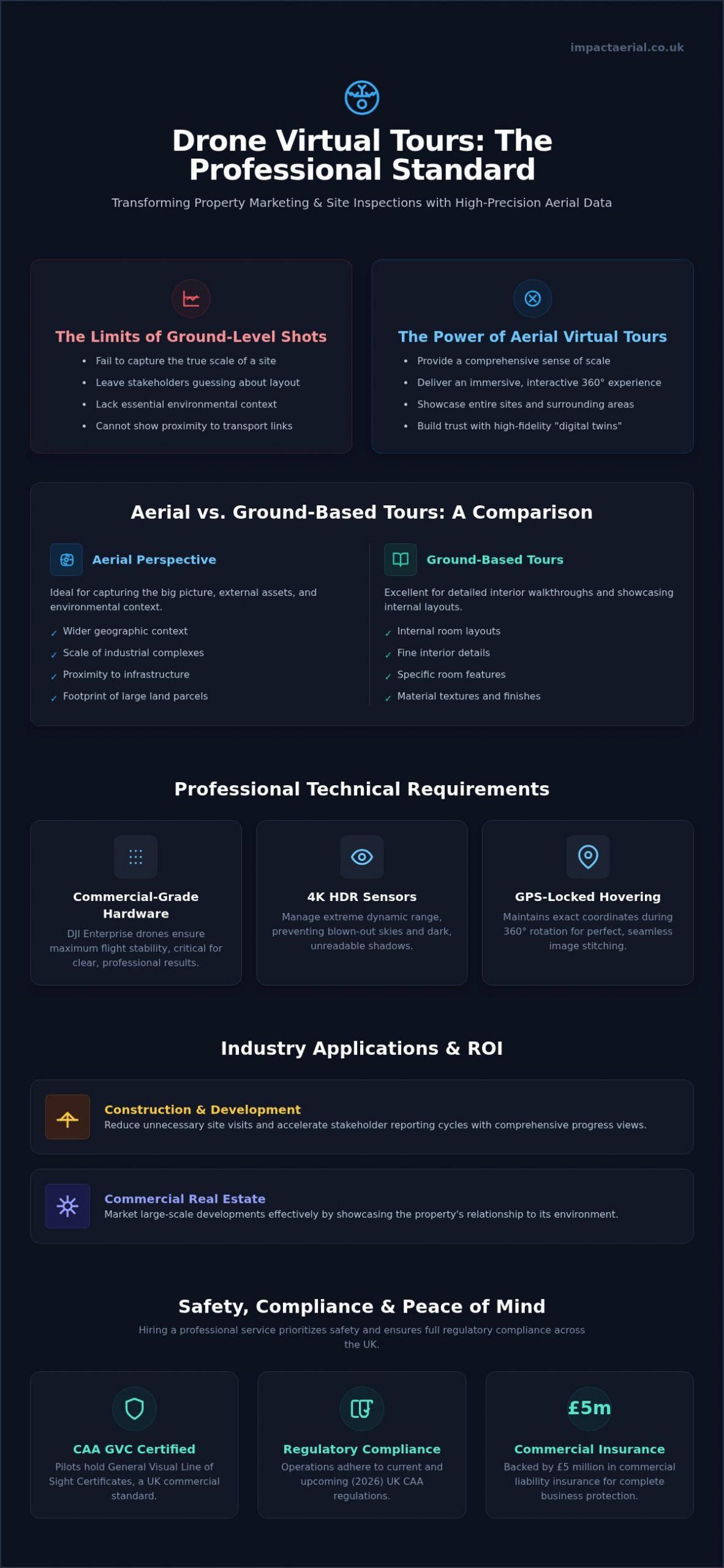
Choosing between aerial and ground-based perspectives depends on the specific data requirements of your project. Ground-based solutions, such as Matterport, remain the industry standard for internal room layouts and high-detail floor plans. They allow a user to walk through a building at eye level, providing an intimate sense of space. However, these systems can’t capture the broader environment or the structural integrity of a roof. When you invest in drone virtual tour services, you’re securing a high-precision asset that bridges the gap between ground-level detail and bird’s-eye context.
The deployment process also varies significantly. Ground tours require physical access to every room, which is often time-consuming for expansive industrial complexes. In contrast, aerial tours require meticulous pre-flight planning and strict adherence to 2026 CAA regulations. Our CAA GVC certified pilots manage these legal complexities. They ensure that the data collection process is both compliant and safe. This technical expertise allows us to capture data that ground-based tripods simply can’t reach, especially in complex or hazardous environments.
When to Choose Aerial Virtual Tours
Aerial perspectives are the superior choice for roof inspections, land development, and large commercial assets. For high-end real estate, showing the neighbourhood context is often more valuable than seeing the interior alone. Stakeholders need to see the proximity to transport links, green spaces, and neighbouring infrastructure. Additionally, these services are vital for monitoring construction progress. By capturing the same coordinates over several months, we create time-lapse virtual tours that provide an undeniable record of site development. This level of remote monitoring reduces the need for frequent site visits, saving time and operational costs.
The Hybrid Approach: The Best of Both Worlds
For many 2026 projects, the most effective solution is a hybrid model. This involves transitioning seamlessly from an aerial fly-in to a ground-based 3D walkthrough. We often integrate high-fidelity aerial videography within these interactive tours to provide a cinematic introduction before the user begins their self-guided exploration. Based in Birmingham, we provide these hybrid solutions across the West Midlands and the wider UK. This unified approach ensures a professional user experience. It provides consistent branding across all marketing and survey assets. By combining these technologies, you provide a comprehensive digital twin that serves both marketing and technical reporting needs.
Maximising ROI: Industry-Specific Applications in 2026
Measuring the return on investment for aerial data requires looking beyond the initial visual impact. In 2026, drone virtual tour services have become high-precision instruments for risk mitigation and operational efficiency across several UK sectors. By providing a navigable, 360-degree environment, these assets allow stakeholders to conduct detailed site inspections from any location, significantly reducing the costs associated with travel and physical site access. Whether you’re managing a massive industrial footprint or a sensitive heritage site, the ability to remotely monitor conditions with 4K clarity provides a tangible competitive advantage.
In addition to commercial projects, tourism and heritage organisations use these digital twins to preserve and promote UK landmarks. These interactive environments allow the public to explore restricted or fragile areas without causing physical wear, supporting both conservation and educational outreach. For insurance and surveying purposes, this level of documentation is invaluable. It provides a meticulous record of site conditions that can be used for accurate risk assessment and the resolution of claims with objective, high-fidelity evidence.
Drone Virtual Tours for Construction Site Monitoring
The construction and AEC sectors benefit most from the transition toward “Digital Twins.” By capturing regular 360-degree aerial panoramas, project managers can track on-site progress against Building Information Modelling (BIM) data with high accuracy. This process isn’t just about documentation; it’s a critical safety tool. Using drones to inspect high-elevation structures reduces the requirement for personnel to work at height, directly lowering the risk profile of the project. Drone virtual tours act as a visual ‘time capsule’ for site audits, providing a permanent, verifiable record of every project phase.
High-End Property and Marketing
In the competitive commercial and residential markets, cinematic aerial perspectives create an emotional connection that ground-level shots cannot replicate. Integrating these tours with professional real estate photography allows developers to differentiate their listings on crowded property portals. We’ve seen that immersive content significantly increases time-on-site for prospective buyers, as they can explore the neighbourhood context and site boundaries at their own pace. This transparency speeds up the sales cycle by filtering out less-interested parties before a physical viewing is even scheduled.
From our base in Birmingham, we help businesses across the West Midlands and the wider UK turn aerial data into actionable business assets. If you’re ready to enhance your project reporting or property marketing, you can book our professional drone services to start building your digital twin today.
Safety, Compliance, and Choosing a Professional UK Provider
Operating a drone commercially in the UK is a highly regulated activity. In 2026, the Civil Aviation Authority (CAA) maintains strict standards to ensure public safety and airspace security. For any business commissioning drone virtual tour services, checking for a General Visual Line of Sight Certificate (GVC) is the first step in due diligence. This certification isn’t just a badge; it’s proof that the pilot has undergone rigorous theoretical and practical assessments to operate safely in complex environments. Without this, your project is legally non-compliant from the moment the rotors spin.
Risk mitigation is another cornerstone of professional operations. While a hobbyist might offer lower rates, they often lack the necessary £5m commercial public liability insurance required for industrial or commercial sites. This insurance protects your business from the financial consequences of accidental damage or injury. Beyond insurance, a professional provider conducts comprehensive pre-flight planning and site-specific risk assessments. This meticulous preparation identifies potential hazards like overhead power lines, restricted flight zones, or high-density pedestrian areas before the aircraft even leaves the ground.
Privacy and data protection are equally critical. Aerial photography naturally captures the surrounding area, which may include private residences or individuals. A compliant provider adheres to strict GDPR protocols, ensuring that any identifiable data is handled legally or redacted during the post-production phase. This commitment to privacy protects your brand from potential legal challenges and ensures your digital assets remain a benefit rather than a liability for your organisation.
The Impact Aerial Standard
Based in Birmingham, we provide specialized expertise across the West Midlands while maintaining a robust UK-wide reach. Our approach to drone services is defined by a commitment to safety and technical precision. We manage every aspect of the project, from the initial airspace consultation to the final 360-degree edit. This end-to-end management ensures that your virtual tour is not only visually stunning but also fully compliant with the latest 2026 aviation standards.
Vetting Your Drone Service Provider
Hiring an uncertified pilot is a significant liability that can result in heavy fines or voided insurance policies. A “hobbyist” pilot simply cannot provide the level of operational security required for a commercial contract. Use this checklist to ensure your provider meets professional standards:
- CAA GVC Certification: Verify the pilot’s current credentials and Operator ID.
- Commercial Insurance: Confirm a minimum of £5m public liability coverage.
- Specialized Hardware: Ensure they use commercial-grade DJI Enterprise drones for stability.
- Data Portfolio: Review previous 360-degree projects for quality and consistency.
If you’re ready to elevate your property marketing or site monitoring with a trusted partner, contact Impact Aerial for a consultation today. We provide the technical expertise and regulatory reassurance you need for a successful aerial project.
Securing Your Competitive Advantage through Aerial Data
The transition from static aerial photography to interactive digital twins represents a fundamental shift in how UK businesses monitor assets and market high-value properties. By integrating high-precision 360° data with professional post-production, you provide stakeholders with a transparent, immersive experience that builds immediate trust. Technical success depends on high-fidelity sensors and strict adherence to the 2026 CAA regulatory framework.
Choosing professional drone virtual tour services ensures your project is handled with the meticulous care it deserves. Impact Aerial provides a specialized, safety-first approach to every flight. We are Birmingham based but offer UK-wide coverage, supported by CAA GVC certified pilots and £5m commercial liability insurance. This combination of local expertise and national reach allows us to deliver high-end results that mitigate business risk while maximizing engagement.
If you’re ready to transform your property perspectives and streamline your site reporting, our team is prepared to assist. Take the first step toward creating a high-precision digital asset for your business today. Request a Professional Drone Virtual Tour Quote
Frequently Asked Questions
Are drone virtual tours legal in urban areas like Birmingham?
Yes, provided the operator holds the correct CAA certifications. We operate regularly in Birmingham and across the UK using CAA GVC certified pilots. Legal urban flight requires meticulous planning, risk assessments, and adherence to specific distance requirements from people and property. By following the 2026 UK drone regulations, we manage all necessary permissions and airspace notifications to ensure your drone virtual tour services remain fully compliant and safe in built-up environments.
How much do drone virtual tour services cost in the UK?
Pricing for professional drone virtual tour services depends on several project-specific factors. These include the total number of 360-degree capture points required, the complexity of the airspace, and any post-production requirements like interactive hotspots or custom branding. While basic packages exist for smaller properties, large-scale commercial sites require bespoke quotes. We recommend discussing your specific deliverables with a certified provider to receive an accurate estimate tailored to your site’s unique operational needs and data requirements.
What is the difference between a 360 drone photo and a virtual tour?
A 360 drone photo is a single spherical image that allows a user to look in every direction from one fixed point. In contrast, a virtual tour is an interactive environment composed of multiple 360-degree images linked together. This allows users to move through the site by clicking on navigation points. A tour provides a navigable, comprehensive digital twin of the entire property rather than just a single panoramic view captured from the air.
Can I view drone virtual tours on my mobile phone?
Yes, all professional tours are designed to be fully responsive across mobile devices, tablets, and desktops. We use optimized hosting solutions that ensure the 4K HDR imagery loads quickly without compromising resolution on smaller screens. Many tours also support gyro-navigation; this means the view moves as you rotate your phone, providing a more intuitive experience. This cross-platform compatibility is essential for stakeholders who need to access immersive site data while working in the field.
How long does it take to capture a drone virtual tour for a commercial site?
The time required for on-site data capture varies based on the size and complexity of the property. For a standard commercial site, the flight operations typically take between two and four hours. This includes the time needed for pre-flight safety checks and capturing multiple 360-degree panoramas at various heights. Larger industrial complexes or multi-building construction sites may require a full day of operation to ensure every critical vantage point is documented with technical precision.
Do I need special software to host a drone virtual tour on my website?
You don’t need any specialized software on your own server to host a tour. We typically provide a simple embed code or a direct URL that works just like a YouTube video or an interactive map. The tour is hosted on a high-performance, dedicated server that handles all the data-heavy processing. This approach ensures that your website remains fast and responsive while providing users with a seamless, high-resolution immersive experience without technical overhead.
What happens if the weather is bad on the day of the shoot?
Safety is our primary concern, so we monitor weather forecasts meticulously leading up to the project date. If high winds or heavy rain make flight operations unsafe or compromise image quality, we’ll reschedule the shoot for the next available clear day. Our commercial DJI Enterprise drones can handle moderate conditions, but we prioritize optimal lighting and stability to ensure your virtual tour meets our high-fidelity quality standards without putting people or property at risk.
Is a drone virtual tour better than standard aerial photography?
It isn’t necessarily better, but it serves a different purpose. Standard aerial photography is excellent for high-impact marketing images and fixed technical reports. However, a virtual tour provides an interactive, navigable perspective that allows stakeholders to explore the site at their own pace. For complex site monitoring or remote inspections, the ability to zoom in and rotate the view provides significantly more context and data than a series of static images alone.
 2 Norton Drive, Wythall, Birmingham, B47 6HH Company registration number: 11138586. VAT Number: 366 9068 55


