
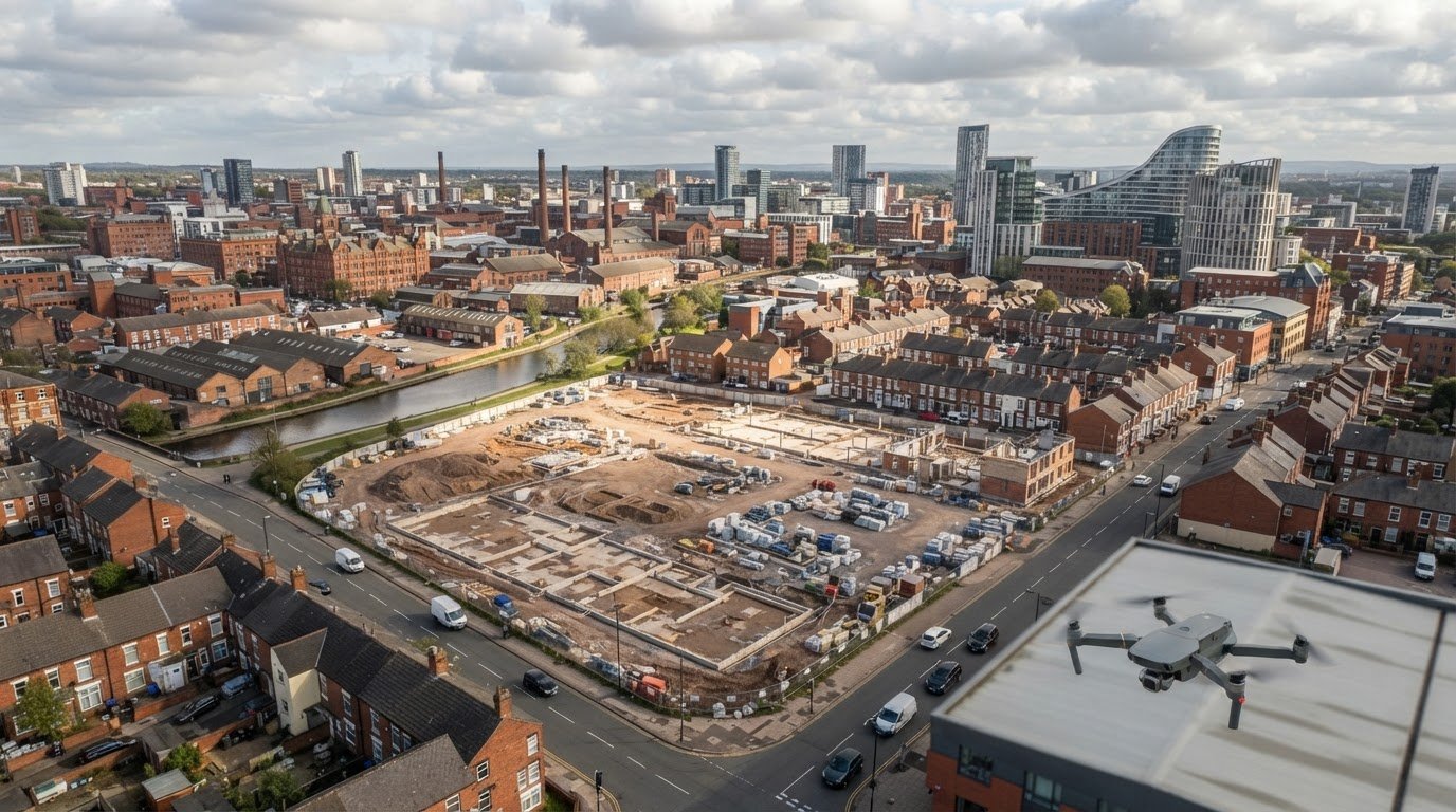
Weather can determine whether an aerial shoot can go ahead and how clearly images show the site. For aerial photography for public inquiry work, cloud, rain, wind and changing light all matter, but poor conditions do not automatically make useful evidence impossible.
It is understandable to focus on the weather: a clear view helps, but the right image also depends on its angle, framing and the detail needed to explain the issue. This article explores how conditions affect aerial photography, and how bird’s-eye, elevated and high-resolution views can each support public inquiry evidence.
You will learn what different view styles reveal, when image resolution matters and how weather can affect the final result. Together, these factors help make aerial imagery relevant, legible and informative for the question being examined.
Key Takeaways
- Weather affects visibility, light and whether conditions are suitable for aerial photography, so image planning needs to account for the day’s conditions.
- Choose a bird’s-eye or elevated angle according to what the evidence needs to show, including context around the subject.
- Oblique, panoramic and plan-style views each communicate a site differently; the most useful choice depends on the inquiry’s focus.
- Higher resolution can reveal finer detail, while the image format and capture method affect how clearly that detail can be examined.
Is aerial photography dependent on the weather?
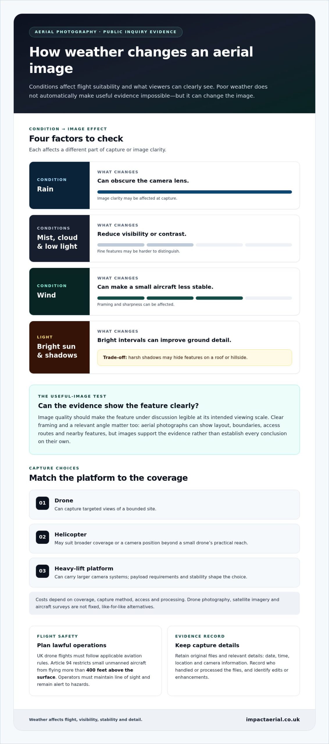
Yes. Weather affects whether a drone or radio-controlled aircraft can fly safely and whether its images show useful detail. Rain can obscure a lens, while mist, cloud and low light reduce visibility or contrast. Wind can make a small aircraft less stable, affecting framing and sharpness. A clear, bright interval can improve ground detail, but harsh shadows may hide features on a roof or hillside.
For a bounded site, a drone can capture targeted views; a helicopter may suit broader coverage or a camera position beyond a small drone’s practical reach. Heavy-lift platforms can carry larger camera systems, with payload requirements and stability shaping the choice. Costs depend on coverage, capture method, access and processing, so drone photography, satellite imagery and aircraft surveys are not fixed, like-for-like alternatives.
UK drone photography must follow applicable aviation rules. According to The National Archives (legislation.gov.uk), Article 94 restricts small unmanned aircraft from flying more than 400 feet above the surface. Article 95 was omitted (31.12.2020) by virtue of The Air Navigation (Amendment) Order 2020 (S.I. 2020/1555), arts. 1(2), 8 (with art. 13); it sets no current threshold for persons. Operators must maintain line of sight and remain alert to hazards. Arrange lawful flight operations and secure access to launch and landing locations; photographing land from the air is distinct from accessing it.
For inquiry evidence, retain original image files and relevant capture details, such as the date, time, location and camera information. Record who handled or processed the files, and identify any edits or enhancements. Image quality should make the feature under discussion legible at the intended viewing scale.
Aerial photographs can show site layout, boundaries, access routes or the relationship between a proposed change and nearby features. Their value depends on clear framing and an explained connection to the inquiry issue. Images support the evidence; they do not establish every conclusion on their own.
To commission aerial photography for a public inquiry, define the site, issue, required views and intended use. Privacy risks arise if images capture identifiable people or private activities, so frame the relevant land and avoid unnecessary details. Composition techniques such as the rule of thirds or golden ratio can direct attention to a feature without losing its surroundings.
Bird’s-eye and elevated aerial views
Two viewpoints can answer different questions about the same site. A bird’s-eye image looks vertically down, making boundaries, paths and relationships between features easier to compare. For example, a view of a proposed access road can show its route beside existing buildings. This plan-like perspective prioritises layout over the height or appearance of structures. Use it when the inquiry concerns land use, site extent or the arrangement of features.
An elevated view looks across the subject rather than straight down. It can include background behind the main feature, explaining its setting better than a bird’s-eye image. A photograph of a building, for instance, might show its roof and façade alongside nearby roads or development. This context can help viewers understand what lies beyond a boundary. Choose an elevated angle when the surroundings or visible height are central to the issue.
Choose a viewpoint to answer the evidence question, not simply by preference. For a site-layout question, a vertical image can make the overall arrangement clearer. For a question about visual impact, an elevated image may show how a structure appears against its surroundings. Pairing both angles can make the contrast easier to interpret, provided each image has a clear purpose. Keep framing consistent when comparing locations or stages, and identify the viewpoint so readers understand what they are seeing.
Before capture, define the feature under review and the context needed to interpret it. Then choose a position that keeps relevant boundaries and landmarks visible, without letting unrelated foreground dominate. A single frame may not show both fine detail and the full setting; separate views can communicate those needs more clearly. For a site-specific discussion of suitable perspectives, explore aerial viewpoints for your site.
When a subject depends on its surroundings for context, an oblique line of sight can show its relationship with what lies behind it. In these cases, the background may carry more interpretive value than a direct overhead view. This approach is useful when what appears beyond the subject matters to interpreting the image. An elevated view that includes the background can be more effective than a bird’s-eye view.
Oblique, panoramic and plan-style views
An oblique photograph captures the subject from an angle, showing both its surface and visible sides. For a proposed building, it can include the roofline, façade, nearby homes and street frontage in one frame. This helps explain relationships that a straight-down image may conceal. The trade-off is perspective: features nearer the camera can appear larger, while distant features seem smaller. Use recognisable landmarks, such as a junction or boundary wall, to orient viewers.
A panoramic view covers a wider field, making it useful for showing a site within its surrounding landscape. For example, a panorama across a development area might include an access road, adjoining fields and nearby buildings. It can be captured as a wide frame or assembled from overlapping images. When images are joined, alignment or exposure differences may create visible seams or distortions. Keep key evidence away from joins, and retain the individual source images alongside the finished panorama.
A plan-style view looks vertically down and presents the site in a map-like layout. It can make boundaries, routes and spacing between features easier to compare. For an access question, a plan view may show a track crossing the site, while an oblique frame adds context about nearby structures. The formats serve different purposes: a plan view prioritises layout, while an angled view gives a stronger sense of height and setting.
Choose the format according to the point the inquiry needs to assess. First, identify the feature, such as a proposed entrance or a line of trees. Then decide whether the evidence needs surrounding context, broad coverage or a clear layout. Finally, keep the viewpoint and framing consistent across comparison images. Views captured before and after a site change, for example, are easier to interpret when they show the same boundary and approach. Label each image with its viewpoint and subject so readers can distinguish an overview from a closer contextual view.
High-resolution aerial photography
Resolution affects how clearly an image records ground features, such as roof edges, paths or field boundaries. The useful level of detail depends on the inquiry question: a broad site overview may need less detail than an image intended to show a small feature. Enlarging a low-resolution image will not recover information the camera did not capture, so decide on the required viewing scale before planning the imagery.
The Environment Agency’s vertical aerial photography uses a high-resolution camera mounted vertically beneath an aircraft. Its images have resolutions between 10cm and 50cm, and the agency has captured this data regularly since 2006. These figures describe ground detail represented in the imagery, not a guarantee that every feature will be visible. Contrast, shadows, vegetation and image sharpness also affect interpretation.
Coverage and file format influence how the material can be examined. Environment Agency vertical aerial photography is available in 5km download zip files for each survey year. Some datasets include near-infrared imagery, while some are four-band RGBN rasters. These additional bands can support analysis beyond ordinary visible colour, but the appropriate dataset depends on the feature being assessed. For a public inquiry, record the survey year and image source alongside the relevant view.
Where three-dimensional form matters, stereo photography uses several photographs of the same area taken from different positions to create 3D images. Drone-captured data can also be processed into 3D models for detailed analysis. A model may help examine roof geometry or site levels, while a conventional photograph can make a specific feature easier to recognise. Keep the original photographs available so the processed output can be understood in context.
Before commissioning capture, identify the smallest feature the evidence must show, the area requiring coverage and whether a flat image or 3D model is more useful. Then match resolution and output to that purpose. Arrange high-resolution aerial photography to capture imagery suited to detailed site evidence.
Derby Homes assessed more than 8,000 roof coverings to identify sites suitable for solar photovoltaic systems. Certain datasets use near-infrared imagery; others are four-band RGBN rasters.
Impact Aerial: Aerial Filming and Photography
Impact Aerial provides aerial filming and photography for projects that need clear, purposeful views of a site.
For public inquiry evidence, aerial photography can capture site context, access routes or specific features from selected perspectives. Share the issue being examined, the locations of interest and the views needed, such as a broad overview or closer images. Impact Aerial also provides PV Solar Farm Thermal Surveys, Drone Commercial Property Surveys and Construction Site Monitoring for relevant project needs.
Contact Impact Aerial to discuss aerial filming and photography for your inquiry.
Plan the next step for your inquiry
Before commissioning images, turn the inquiry’s central issue into a clear evidence brief. Identify the decision the photographs should help inform, who will review them and how the material will be presented. This gives the capture plan a defined purpose and helps keep the resulting evidence relevant, rather than simply collecting attractive views.
For aerial photography for a public inquiry, Impact Aerial provides Aerial Filming and Photography. Related services include PV Solar Farm Thermal Surveys and Drone Commercial Property Surveys, which address different site-assessment needs. The right starting point depends on the evidence required and the subject under consideration.
Share the inquiry context, the area of interest and the intended use of the imagery to begin a focused discussion. Contact Impact Aerial to discuss aerial photography for your project. A clear brief helps turn a complex site into evidence that readers can understand and assess.
Frequently Asked Questions
What is aerial photography used for in a UK public inquiry?
Aerial photography can help inquiry participants understand a site’s layout and relationship to surrounding land. For example, images may show how a proposed access point connects with an existing road, or where buildings sit relative to a site boundary. In aerial photography for a public inquiry, dated views can also help compare visible site conditions over time and support a clearer examination of the evidence.
What privacy and data protection risks arise from aerial photography in the UK?
Images may capture identifiable people or private activities. Frame the relevant land, avoid unnecessary details, and retain original files with relevant capture and handling records.
 2 Norton Drive, Wythall, Birmingham, B47 6HH Company registration number: 11138586. VAT Number: 366 9068 55


