
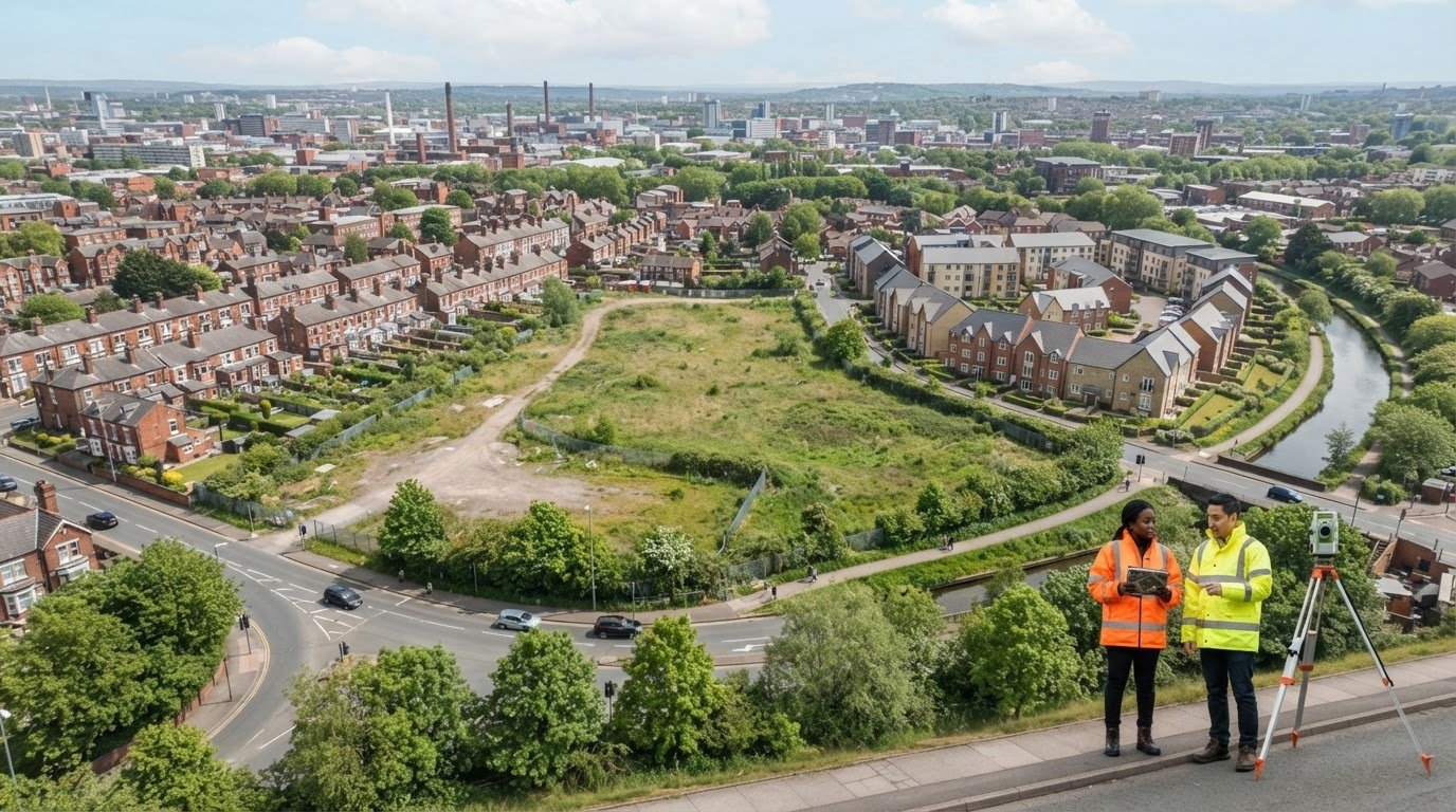
Could one carefully chosen aerial view make the relationship between an appeal site and its neighbours easier to understand? Ground-level photographs can leave important context out of frame. That is why aerial photography for planning appeal evidence can be useful when each image answers a clear question about the site.
If you’re unsure which views relate to your appeal grounds, or whether aerial images can stand in for plans and reports, start with a clear brief. Aerial photographs can illustrate site layout, surrounding land uses and neighbouring relationships, but they don’t replace required planning documents or prove every technical point.
This guide explains how to identify relevant views, brief a site-specific capture and present the images with useful context. It also covers what aerial photography can and cannot demonstrate, so you can commission visual material that supports your case without overstating its role. A considered approach keeps the evidence focused on the issues your appeal needs to address.
Key Takeaways
- Use aerial photography for planning appeal evidence to clarify relevant site features and relationships, with each view answering a defined question.
- Choose a focused set of views and use informative captions to help an unfamiliar reader understand the site.
- Match each planning question to the right material: aerial photographs, location plans, measured surveys and written evidence have different purposes.
- Build the photography brief around the appeal issue, relevant documents and the specific questions the images should address.
- Impact Aerial’s process follows Consultation → Site Survey → Safety Assessment → Flight → Post-Production → Presentation → Handover & Sign-Off.
Aerial photography for planning appeal: what it can, and cannot, show
Aerial photography captures a site from above, providing a perspective that ground-level photographs may not. For an appeal, aerial photography for planning appeal evidence is most useful when a particular view helps explain a defined issue, such as how a proposed development sits within its surroundings or how an access route relates to the site. The wider practice of Aerial photography covers different platforms and uses. For planning, the important consideration is whether the chosen viewpoint makes the relevant context easier to interpret.
In brief: “Aerial imagery is illustrative visual material showing a site and its surroundings from above; it is not a formal planning plan, measured survey, written statement or specialist report.” It can help a reader orient themselves, but it doesn’t automatically replace anything required for the particular appeal.
Which appeal questions could an aerial view help explain?
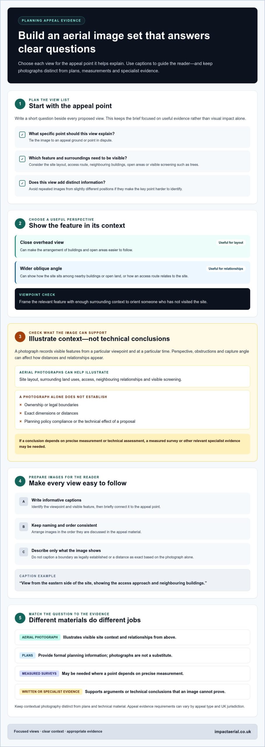
Start with the appeal ground or point in dispute, then ask what a photograph could make clearer. A view may show the broad layout of buildings and open areas, the position of an access route, or the relationship between the appeal site and neighbouring buildings. Where visible, it may also illustrate screening, such as existing trees or other features between the site and nearby properties.
Keep the purpose specific. If the issue concerns the apparent proximity of a structure to a neighbouring building, a carefully chosen angle might make that relationship easier to see. It still shows a visual perspective, not a definitive boundary or measured distance. Use the caption to identify the view and connect it to the point being addressed, without presenting the image as proof of a conclusion it cannot establish.
What aerial photographs cannot establish on their own
A photograph records visible features from a particular viewpoint and at a particular time. On its own, it does not establish ownership, legal boundaries, exact dimensions, compliance with planning policy or the technical effect of a proposal. Perspective, obstructions and the angle of capture can affect how distances and relationships appear. A measured survey or other relevant specialist evidence may be needed for conclusions that depend on precise measurements or technical assessment.
Images can make site context clearer, but they can’t guarantee that an appeal will succeed or that a submission will meet the applicable evidence requirements. Requirements can vary by appeal type and UK jurisdiction. Before relying on photographs as part of an appeal package, distinguish their illustrative role from the formal plans, statements and reports required for the case, and consult current guidance from the relevant appeal body and planning authority.
How to make aerial photographs clear, relevant and useful in an appeal
A useful set of appeal photographs is selected for what it explains, not simply for visual impact. Begin with the issue the Inspector needs to understand, then plan views that show the relevant part of the site with enough surrounding context to orient someone who hasn’t visited. Keep the framing and captions consistent so readers can compare views and follow the accompanying explanation.
An aerial image is relevant to an appeal point when it clearly shows a feature or relationship that helps the reader understand that point, without being presented as a substitute for measured or specialist evidence.
Build a view list around the appeal grounds
Write a short question beside each proposed view. This keeps the brief focused and avoids collecting attractive images that add little to the case. For example, a view might explain how an access route meets the site, where neighbouring buildings sit in relation to the proposal, or whether visible screening separates the site from its surroundings.
Choose viewpoints that show both the feature in question and its context. A close overhead view may make the layout easier to follow, while a wider oblique angle may show how the site sits among nearby buildings or open land. Include views that add distinct information; repeated images from slightly different positions can make the key point harder to identify.
- Question: What specific appeal point should this view help explain?
- View: Which angle shows the relevant feature and its surroundings clearly?
- Limit: Is the point visual, or does it require a measured drawing or specialist assessment?
Don’t imply that a photograph supplies exact measurements, georeferencing or a map output unless those are separately specified. Keep contextual photography distinct from plans and technical material.
Present images with useful context
Use plain-language captions to orient the reader. Identify the viewpoint and visible feature, then briefly explain its relevance to the appeal point. For example: “View from the eastern side of the site, showing the access approach and neighbouring buildings.” The supporting text can connect the view to the argument while making clear that the photograph illustrates context rather than proving a legal or technical conclusion.
Use a consistent naming system and arrange images in the order they’re discussed in the appeal material. Avoid captions that assert more than the image shows, such as claiming that a boundary is legally established or a distance is exact. For broader guidance on image capture and aerial perspectives, see this drone photography guide.
A site-specific aerial photography brief helps align the proposed views with the appeal questions before capture begins.
Aerial photographs, maps and surveys: choosing the right supporting material
Choose appeal evidence according to the question in dispute. A photograph can make the site’s visible setting easier to understand, while a plan, survey or written statement serves a different purpose. Treat aerial photography for planning appeal material as one part of an evidence package, not a catch-all document. Broader drone survey guidance can explain the range of aerial data applications, but the appeal issue should determine what material you need.
| Material | Question it can help answer | Role and limits |
|---|---|---|
| Aerial photograph | What visible features and relationships shape the site’s setting? | Illustrates context from above; doesn’t itself establish exact measurements or a legal boundary. |
| Location plan | Where is the site in relation to its wider area? | Provides a formal plan where required; a photograph isn’t a substitute for it. |
| Measured survey | What are the relevant dimensions or positions? | Provides measured information within the survey’s scope, rather than general visual context. |
| Written evidence | How does the appellant explain the relevant facts and planning arguments? | Sets out the case and can refer to other evidence; it doesn’t replace visual or measured material where those are needed. |
When photographs add context, and when a plan is needed
Aerial photographs can show visible setting and spatial relationships, such as how a building sits among neighbouring structures or how an access route meets the site. They help readers interpret the surroundings, but don’t necessarily identify the site in the formal way a location plan does. If the appeal requirements specify a location plan, provide it as a separate document. Consult current official guidance for the relevant appeal and authority before preparing the submission.
When a survey or specialist assessment may be relevant
Where the disputed point depends on dimensions, technical performance or another specialist conclusion, illustrative photography may not answer it. A survey or assessment is distinct evidence, with its own scope and purpose. For example, a photograph may show a feature’s apparent relationship to nearby buildings, while a measured survey may be needed to address a question that depends on precise dimensions. Let the appeal issue guide whether additional evidence is useful rather than assuming every case needs the same material.
Use the comparison as a starting point, not a substitute for checking requirements. Formal submission rules depend on the appeal type and relevant authority, and procedures can differ across the UK. Confirm which documents are required and how they must be presented using current official guidance. Give each item a clear role: plans identify, photographs illustrate, surveys measure within their scope, and written evidence explains the case.
How to brief aerial photography for a planning appeal
A focused brief turns an appeal issue into a practical capture plan. For aerial photography for planning appeal purposes, provide the site location, relevant appeal documents and a clear explanation of the questions the images should help address. Include the proposal and appeal grounds, along with any existing plans that can help identify the site or indicate suggested viewpoints.
Prepare a concise site and image brief
Summarise the points at issue and identify the features that need visual context. If an existing plan is available, mark possible viewpoints or areas of interest, making clear that these are suggestions for planning the capture, not measured outputs. State preferred image formats or presentation needs, and distinguish those preferences from formal submission requirements, which depend on the appeal.
A practical briefing process follows the stages below, from understanding the project to reviewing the delivered material:
- Consultation: Share the site location, proposal, appeal grounds and relevant documents so the imagery brief can be shaped around the questions at issue.
- Site Survey: Identify site features and potential viewpoints relevant to the brief.
- Safety Assessment: Consider access, privacy and applicable flight requirements as part of planning the operation.
- Flight: Capture the agreed views, with each intended to provide relevant visual context.
- Post-Production: Prepare the selected imagery for clear review and presentation.
- Presentation: Organise the images with captions that identify each viewpoint and explain its relevance without overstating what it shows.
- Handover & Sign-Off: Review the material and complete the handover.
Review the images before submission
Check each image against the question it was intended to address. Is the relevant feature visible? Does the view include enough context to orient someone unfamiliar with the site? Does the caption state the viewpoint and explain its connection to the appeal issue? Remove redundant images and revise any annotation that suggests a photograph establishes a legal boundary, exact measurement or technical conclusion.
Flight planning should account for site access, privacy and applicable requirements, rather than treating capture as a purely photographic task. For general compliance context, consult this UK drone rules guide. Requirements can vary with the operation, so use current official guidance when planning a flight and preparing appeal documents.
Impact Aerial plans site-specific aerial photography through consultation and its defined workflow. Discuss your appeal photography brief to plan views around the questions your evidence needs to clarify.
How Impact Aerial supports appeal-related aerial photography
Appeal-related aerial photography works best when the capture is planned around the site and the issues the images need to clarify. Impact Aerial’s consultation covers the appeal context, relevant documents and proposed viewpoints before capture. This shapes a project-specific brief, keeping the imagery focused on useful site context rather than simply collecting attractive angles.
Each project follows a defined sequence: Consultation → Site Survey → Safety Assessment → Flight → Post-Production → Presentation → Handover & Sign-Off. The process runs from initial discussion through to delivery. The imagery can provide visual context for an appeal, but it doesn’t guarantee admissibility, permission or a successful decision, and it doesn’t replace required plans or specialist evidence.
Operational standards are central to the service. All Impact Aerial pilots are CAA-GVC Certified (as of early 2026), the company holds full UK CAA Operational Authorisation and carries £5 million commercial liability insurance. Impact Aerial provides aerial photography in Birmingham and the West Midlands.
Capture and prepare project-specific imagery
Impact Aerial uses the DJI Matrice 210 Enterprise platform, with 4K HDR video capability. High-resolution imagery can capture roof and façade condition for visual review. Consultation helps align proposed views with the site features and relationships the reader needs to understand, so the capture plan can focus on the agreed visual priorities.
Post-production prepares material for clear presentation. Adobe Lightroom, Adobe Premiere Pro and DaVinci Resolve are used where relevant to image and video work. Editing can help make the captured material clear and coherent, but it does not establish measurements, legal boundaries or planning conclusions. Captions and presentation should remain consistent with what each view shows.
Receive and assess the finished work
During review, check whether each selected view addresses the intended question, whether the visible context is easy to follow and whether each caption accurately describes the image. This helps identify redundant views or wording that overstates the image’s evidential role before using the material in an appeal submission. Submission requirements remain specific to the case and should be checked against current official guidance.
Final assets are delivered via a shared Google Private Cloud Drive or WeTransfer Pro. The handover provides an opportunity to review the completed work and its presentation. If you’re preparing aerial photography for planning appeal evidence, share your project brief and the questions the imagery should address to start the consultation process.
Request a free, no-obligation quote for your project brief.
Plan your next step with a clear visual brief
Start by identifying the question your appeal evidence needs to make easier to understand. Note the site features involved, the views that could show them clearly, and any supporting documents that should remain separate. This gives the photography brief a practical purpose from the outset.
Aerial photography for planning appeal evidence is strongest when it has a defined role within the wider case. Treat each image as a way to orient the reader and illustrate relevant site context, while keeping claims tied to what the view actually shows. Before submission, check that your chosen material and presentation meet the current requirements for your appeal.
To turn your appeal questions into a site-specific capture brief, discuss your aerial photography project with Impact Aerial. A considered plan can help make the site clearer to an unfamiliar reader and give your visual evidence a focused, responsible place in the appeal.
Frequently Asked Questions
Can aerial photographs be used in a UK planning appeal?
Yes, aerial photographs may be included in a UK planning appeal when they help explain a relevant issue and meet that appeal’s evidence requirements. For example, a high viewpoint might show how an extension sits beside an existing building. Photographs don’t automatically replace required plans, statements or specialist evidence, and can’t guarantee an outcome. Consult the relevant appeal body’s current submission guidance, and caption each image to state what it is intended to show.
Can drone photographs replace a location plan in an appeal?
No. Drone photographs and location plans serve different functions. An aerial view can help someone understand visible site context, while a formal plan may be needed to identify the site’s position or boundaries in the format required for the case. A photograph might show buildings around a plot, for example, but not provide the plan reference an appeal submission requests. Consult current official requirements for your appeal and relevant authority.
What should I include in an aerial photography brief for a planning appeal?
Give the photographer the site location, relevant appeal grounds and a short description of the features that need explaining. Include existing plans that help locate the site or mark possible viewpoints, and share relevant appeal documents so the image brief reflects the case. Discuss caption and presentation needs before capture. Keep the brief focused on what photographs can show, rather than expecting them to establish exact measurements or technical conclusions.
Are drone photographs automatically accepted as planning appeal evidence?
No. Acceptance and relevance depend on the appeal process and evidence requirements set by the relevant body. Don’t assume that taking a photograph means it will be accepted or influence the decision. Consult current submission guidance before preparing your evidence, and give each image a clear caption explaining its purpose. Keep photographs distinct from required plans and any specialist evidence the case may need.
Can aerial photography show the relationship between a site and neighbouring properties?
Yes, a suitable aerial viewpoint may illustrate visible relationships between a site and nearby properties, including the position of buildings, access routes or surrounding features. For example, a wider angle might show whether a neighbouring structure is close to the appeal site. The image alone does not prove ownership, precise boundaries or measured distances. Make the relevant question clear in the brief, and caption the view to describe its limits accurately.
Do I need a CAA-qualified drone operator for appeal-related aerial photography?
Drone operations need to be planned in line with applicable UK aviation requirements, which depend on the circumstances of the operation. Consult current official CAA guidance for your situation. All Impact Aerial pilots are CAA-GVC Certified (as of early 2026), and the company holds full UK CAA Operational Authorisation. These credentials relate to drone operations, but don’t ensure that photographs will be accepted in an appeal.
 2 Norton Drive, Wythall, Birmingham, B47 6HH Company registration number: 11138586. VAT Number: 366 9068 55


