
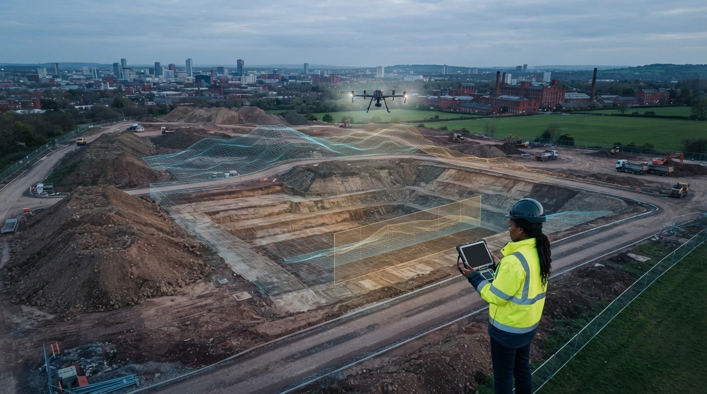
Aerial images alone don’t show how much material has moved. A drone-based earthworks volume calculation in the UK uses site surface data to measure cut, fill or stockpile volume, while the average end-area method estimates volume by comparing cross-sectional areas along the site. With RTK hardware and ground control points, drone calculations are typically within 1% to 2% of actual scale weights.
Reliable volume figures help track earth movement, plan material needs and compare progress between survey stages. The calculation method and quality of ground control both affect how useful the results are.
This guide explains what a volumetric survey measures, what affects drone calculation accuracy and how the average end-area method works. It also covers how repeat surveys can help monitor changes during a construction project.
Key Takeaways
- Use orthophotos and 3D models to interpret site conditions and track earth movement, not just to view aerial imagery.
- Ground control and consistent survey procedures are central to producing dependable drone volume measurements.
- The average end-area method estimates volume from cross-sections; the spacing between sections affects the level of detail in the calculation.
- Learn how to compare drone survey outputs with traditional ground surveying and decide which information best supports your project workflow.
How accurate are drone volumetric calculations?
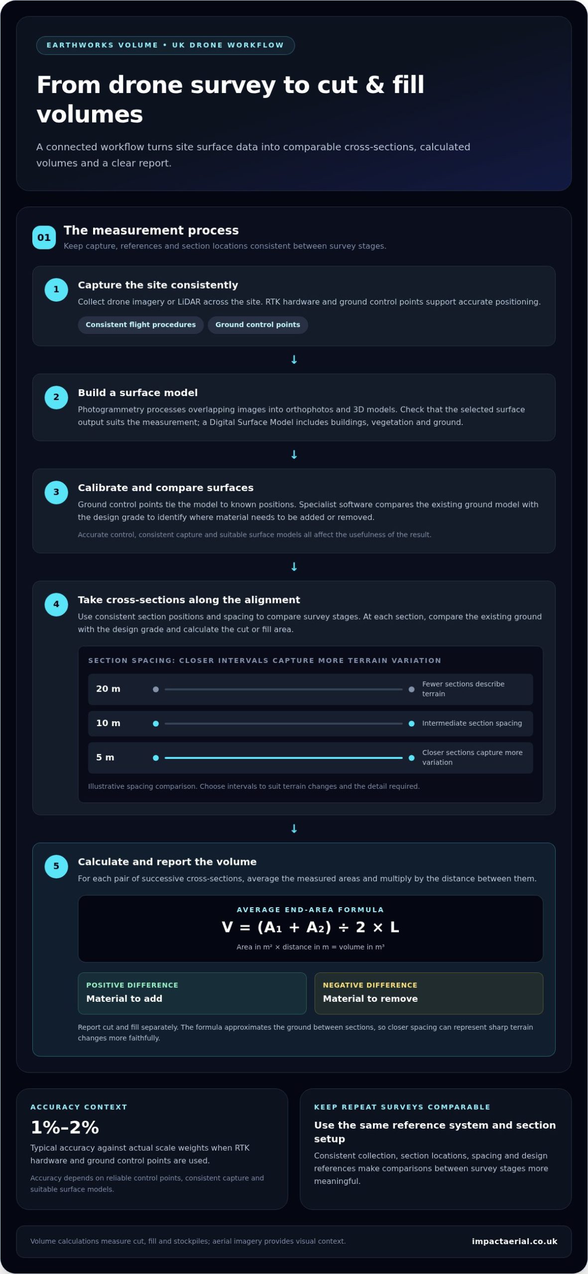
With RTK hardware and ground control points, drone volume calculations are typically within 1% to 2% of actual scale weights. That accuracy depends on reliable control points, consistent capture and suitable surface models.
Drone and Traditional Survey Comparisons
Drone surveying captures aerial images or LiDAR across a construction site, then processes them into terrain data. Traditional ground surveying and manual measurements use tools such as tapes or machinery, measuring selected points rather than the full surface.
For stockpile volume measurement, compare coverage, access and repeatability. Drone surveys can map irregular shapes, while repeated surveys every few weeks can help monitor material moved on and off site.
Survey Outputs and Model Calibration
Photogrammetry produces orthophotos and 3D models from overlapping images. A Digital Surface Model represents site topography, including buildings, vegetation and ground, so check whether the chosen output suits the project’s measurements and applications.
Ground control points tie the model to known positions and support calibration. In one test-site example, seven ground control points were used. Accurate control and consistent flight procedures help make later surveys comparable.
Cut and Fill Methods and Software
For cut and fill, drone methods include photogrammetry and LiDAR capture. The resulting surface is compared with the design grade to show where material needs to be added or removed. Commercial drone operations must comply with applicable aviation regulations, and CAA requirements depend on the planned operation.
Specialist software compares design models with the existing ground model to calculate outline earthworks volumes, according to the UK Government. A UK survey workflow can run from consistent flight capture and ground control through image processing and model calibration to software comparison and a volume report.
Average end-area volume calculation
The average end-area method estimates earthworks volume between successive cross-sections. For each pair, add the two measured areas, divide by two, then multiply by the distance between them: V = (A₁ + A₂) ÷ 2 × L. The result is a volume in cubic metres when areas are measured in square metres and distance in metres.
Section spacing affects how well the calculation represents changing ground. A study illustrated chain intervals of 20 m, 10 m and 5 m. At 20 m spacing, fewer sections describe the terrain; closer 5 m sections capture more variation along the alignment. Engineers should use spacing that reflects the site’s changing ground and required detail.
For cut and fill, compare the existing ground with the design grade at each section. Calculate the cut or fill area at each position, then apply the average end-area formula between adjacent sections. Positive differences indicate material to add; negative differences indicate material to remove. Report cut and fill separately to keep totals clear.
For earthworks volume calculation using a drone in the UK, photogrammetry turns aerial images into a ground model, from which sections can be taken along the project alignment. Consistent data collection and a shared reference system help engineers compare survey stages. Keeping section locations, spacing and design references consistent between captures makes those comparisons meaningful.
The formula approximates the ground between sections rather than measuring every point. Where terrain changes sharply, closer spacing can represent those changes more faithfully; broad, even ground may need less section detail. Choose intervals to suit terrain variation, then document them in the volume report.
For separate visual records of project progress, aerial filming and photography can complement engineering measurements without replacing the volume calculation.
Impact Aerial: Aerial Filming and Photography
Impact Aerial provides aerial filming and photography to give project teams a visual record of site conditions and progress. This can complement earthworks data when stakeholders need to review a site visually. Volume calculations, however, remain the basis for measuring cut, fill and stockpiles.
For construction projects, Impact Aerial’s construction site monitoring provides aerial context across survey stages. The visual record helps teams see how site activity changes alongside measured results, without treating imagery as a substitute for calibrated volume data.
Contact Impact Aerial to discuss aerial filming and photography for your project.
Plan Your Next Site Decision
First decide what the survey needs to support: quantity tracking, design decisions or a visual record for project teams. This purpose guides the outputs, survey schedule and how results fit into site reporting. For earthworks volume calculation using a drone in the UK, align deliverables with the decisions engineers need to make, rather than collecting imagery without a defined use.
Impact Aerial also offers Aerial Filming and Photography, PV Solar Farm Thermal Surveys and Drone Commercial Property Surveys. Each serves a different project need, from visual communication to solar or property assessment. Choose the service that matches your objective and the evidence your team needs.
Contact Impact Aerial to discuss the right next step for your project. Clear objectives make it easier to put aerial data to practical use.
Frequently Asked Questions
What is a volumetric survey, and why is it important for my project?
A volumetric survey measures the space occupied by material or the difference between ground surfaces. Project teams can use the results to plan excavation, estimate material handling and reconcile quantities with site records. For example, comparing a measured stockpile with delivery records can help a site manager spot a discrepancy and investigate before it affects the next work stage.
Can you tell me the weight (tonnage) of the stockpile?
A volume survey can support a tonnage estimate when the material’s bulk density factor is available. Multiply the measured volume by that factor to estimate weight. Different materials have different densities, so volume alone cannot establish tonnage. For a mixed or variable stockpile, material composition affects the estimate’s usefulness.
What are the benefits of cut and fill analysis?
Cut and fill analysis shows how existing ground differs from the project’s design levels, helping teams assess where excavation or imported material may be needed. It supports earthworks planning, quantity tracking and decisions about moving material around a site. Comparing results between survey stages also gives engineers a practical record of how ground conditions change as work progresses.
What are the common applications of volumetric surveys in various industries?
Volumetric surveys are used on construction sites to assess earthworks and monitor stockpiles, including at quarry operations. Property and building teams can use drone survey data to document site conditions, while renewable energy projects may need other aerial survey applications. Match the deliverable to the task: volume measurements quantify material, while imagery supports visual inspection and project records.
 2 Norton Drive, Wythall, Birmingham, B47 6HH Company registration number: 11138586. VAT Number: 366 9068 55


