
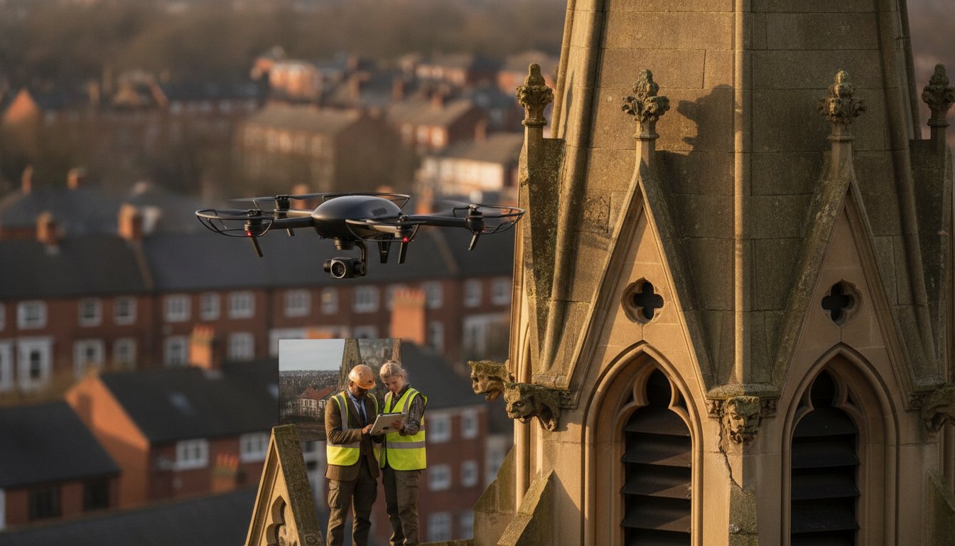
The very scaffolding intended to save a historical building often poses the greatest threat to its structural integrity. For estate managers and conservationists, the traditional approach to maintenance is a high-stakes gamble involving heavy machinery and invasive access methods that can inadvertently damage the delicate fabric of a heritage site. You understand the frustration of paying for extensive access equipment only to receive incomplete data from limited ground-level perspectives.
We agree that protecting the UK’s architectural legacy requires a more sophisticated, lower-risk strategy. This expert guide reveals how drone inspection for historical building preservation delivers high-resolution 4K imagery and comprehensive structural data without a single boot touching the roofline. You’ll discover how to leverage advanced aerial surveys to identify hidden defects early, reducing long-term restoration costs and eliminating many of the health and safety risks associated with working at height. We’ll examine the technical capabilities of modern hardware, the importance of 2026 CAA regulatory compliance, and how precision data serves as the foundation for modern heritage conservation.
Key Takeaways
- Learn how drone inspection for historical building preservation uses UAV technology to capture sub-millimetre structural details without touching sensitive building fabric.
- Understand the technical advantages of using 4K HDR imagery to identify hairline cracks in lime mortar that are invisible from the ground.
- Compare the operational ROI of rapid drone deployments against the high costs and logistical delays of traditional scaffolding.
- Navigate the essential CAA regulatory requirements and safety protocols necessary for operating within heritage-rich Flight Restriction Zones.
- Discover how to convert raw aerial data into actionable insights for architectural conservation reports and contractor briefings.
The Evolution of Heritage Conservation: Why Drones are Essential
Heritage conservation has entered a new era where data replaces guesswork. Traditionally, inspecting the upper reaches of a cathedral or a Grade I listed manor required significant physical intervention and high costs. Today, drone inspection for historical building preservation provides a non-invasive solution that prioritises the safety of the structure. We define this process as the strategic use of UAVs to capture sub-millimetre structural detail from angles that were previously inaccessible. It’s no longer just about taking a photo; it’s about creating a comprehensive digital record of a building’s health.
This technological shift has moved the industry from reactive repairs to a proactive, preventative maintenance model. Instead of waiting for a structural failure to occur, estate managers use regular aerial surveys to spot the earliest signs of decay. This same forward-thinking approach is often applied to the protection of estate grounds; to learn how to manage wildlife humanely, visit Revira. Traditional access methods, such as cherry pickers or reach-and-wash systems, often struggle in the tight, irregular environments typical of UK heritage sites. These machines are bulky, have limited reach, and can’t navigate the complex geometry of gothic or baroque architecture without risking a collision.
To better understand how this technology integrates into a site assessment, watch this video:
The role of high-resolution 4K HDR imagery is central to this evolution. These sensors capture the subtle textures of historic masonry, allowing conservationists to identify hairline cracks in lime mortar or the early stages of stone delamination. By documenting these features with such clarity, we create a baseline for future comparisons. This ensures that every architectural detail is preserved for the next generation with meticulous accuracy.
Overcoming Accessibility Challenges in Historic Architecture
Historic buildings are often surrounded by physical constraints that make ground-based surveys incomplete. Drones easily reach high-level chimney stacks, parapets, and hidden roof valleys without the need for expensive platform hire. They can fly into internal courtyards or hover near delicate spires where ground-based equipment simply cannot go. When combined with 3D laser scanning technology, these aerial platforms provide a 360-degree view of decorative masonry that would otherwise remain hidden from view.
Non-Invasive Surveying: Protecting Fragile Surfaces
The primary concern for any conservation officer is the risk of accidental damage. Traditional ladders and machinery carry the risk of “ladder rash” or stone chipping when equipment makes contact with friable surfaces. Even the process of erecting large-scale scaffolding can introduce harmful vibrations to a fragile structure. Choosing drone inspection for historical building preservation ensures that the building remains undisturbed while the surveyor gathers the high-fidelity data needed for a restoration plan. Because drones are entirely “no-contact,” they are increasingly preferred by national conservation bodies like Historic England.
Technical Capabilities: From 4K HDR to Thermal Masonry Analysis
Modern heritage conservation relies on the precision of high-tier hardware. We utilise DJI Enterprise drones specifically for their stability and redundant safety systems, which allow for controlled, close-proximity flight near sensitive architectural features. These platforms carry sophisticated payloads that go far beyond standard photography. When conducting a drone inspection for historical building preservation, the quality of the sensor is the primary factor in determining the success of the survey. High-resolution 4K HDR video is essential because it captures the necessary dynamic range to reveal hairline cracks in lime mortar or stone that would otherwise be lost in deep shadows or bright highlights.
One of the most significant advantages of professional UAVs is their advanced zoom capability. High-magnification lenses allow specialists to inspect fine details on high-level cornices or chimney stacks from a safe distance, ensuring the aircraft never risks physical contact with the structure. Organizations such as the National Trust and Historic England have increasingly adopted drones for detailed surveys to replace more invasive and costly traditional methods. This data-first approach provides a level of scrutiny that ground-based binoculars simply cannot match.
Thermal Imaging for Hidden Decay Detection
Thermal sensors provide a unique look beneath the surface of ancient buildings. By detecting minute temperature variances, we can identify damp patches and water saturation hidden behind external render or within thick masonry walls. This technology is equally effective for detecting thermal bridging in historic window frames and roofing systems. Thermal sensors identify moisture patterns in ancient stone by detecting the evaporative cooling effect where water is present, allowing for targeted repairs before structural decay sets in. If you’re managing a complex site, our professional property surveys can help identify these invisible risks early.
Photogrammetry and 3D Digital Twins
Beyond static imagery, photogrammetry allows us to create accurate 3D digital twins of historical sites. These models serve as definitive ‘as-built’ documentation, providing a centimetre-perfect record of the building’s current state. Conservationists use these digital twins to track structural movement or erosion over multiple years, comparing different datasets to measure the rate of deterioration. Integrating these outputs with standard drone survey workflows ensures that every architectural detail is mapped into a comprehensive site report, facilitating highly accurate restoration planning.
Drones vs. Scaffolding: A Practical Comparison of ROI and Safety
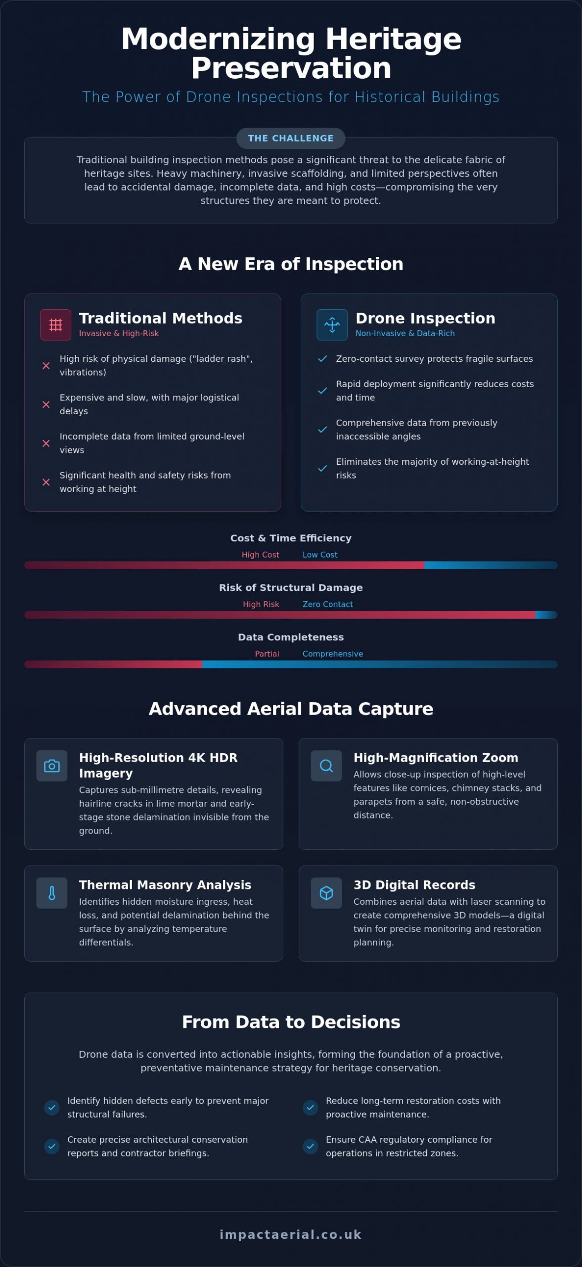
Traditional scaffolding is often the single most expensive line item in a restoration budget. When evaluating the logistics of a drone inspection for historical building preservation against traditional methods, the differences in efficiency are stark. Erecting a scaffold tower for a simple roof survey can take days or even weeks of planning, permitting, and manual labour. In contrast, a professional UAV deployment takes minutes. This rapid response allows estate managers to conduct “health checks” more frequently, ensuring that minor issues are identified before they escalate into major structural failures.
Health and safety remains the primary driver for this shift in methodology. By using aerial technology, we remove the human element from high-risk, at-height environments. There’s no longer a need for surveyors to navigate slippery lead-work or crumbling parapets on a ladder. This reduction in physical risk is matched by a significant reduction in site disruption. For public-facing heritage attractions and museums, the sight of heavy scaffolding can deter visitors and obscure the very architecture they came to see. Drones operate discreetly, allowing the site to remain open and revenue-generating throughout the inspection process.
Cost-Benefit Analysis for Heritage Managers
The financial argument for aerial surveys is compelling. High-resolution data often eliminates the need for “exploratory” scaffolding, which is frequently erected just to find out if a repair is actually necessary. For organisations dependent on external funding, the speed of data turnaround is a critical advantage. We provide the detailed imagery required for urgent grant applications in a fraction of the time it takes to commission a manual survey. This proactive approach leads to substantial long-term savings. Early detection of a slipped slate or a blocked gutter prevents the catastrophic water ingress that often costs tens of thousands of pounds to remediate.
Mitigating Risk in Public Spaces
Operating in busy city centres or popular tourist landmarks requires a meticulous approach to risk management. We conduct our surveys without the need to close sites to pedestrians or visitors, maintaining a safe cordon while the aircraft is in flight. There is a deep psychological reassurance in using professional drone services that carry comprehensive liability insurance and adhere to strict safety protocols. This professional standard reduces the liability footprint on any construction site within heritage grounds. It ensures that the preservation of the building never comes at the expense of public safety or operational continuity. Many estate managers now view the adoption of drone inspection for historical building preservation as a standard first-phase protocol for all maintenance cycles.
Regulatory Compliance: Navigating CAA Rules for Heritage Sites
Flying a drone over a Grade I listed structure or a scheduled monument involves more than just technical skill. It requires a deep understanding of the legal landscape. For any commercial drone inspection for historical building preservation, the operator must hold a valid General Visual Line of Sight Certificate (GVC). This is not optional. It’s a legal requirement that ensures the pilot has undergone rigorous training in air law, meteorology, and operational safety. Compliance is the foundation of every survey we conduct, providing a framework that protects both the heritage asset and the public.
Many of the UK’s most significant heritage assets are located in historic city centres, which often fall within Flight Restriction Zones (FRZs). Operating in these areas requires specific coordination with Air Traffic Control and local authorities. To mitigate the unique risks associated with high-value architectural projects, we maintain £5m in commercial liability insurance. This level of coverage provides the necessary reassurance for estate managers and trustees that their assets are protected. We also implement strict privacy protocols, ensuring that data collection is focused solely on the structural elements of the building while respecting the privacy of the surrounding community.
The Role of the CAA GVC Certified Pilot
A GVC certified pilot is a risk management specialist. They don’t just fly; they conduct detailed pre-flight assessments to identify every potential hazard in complex, high-stakes environments. Staying current with the latest drone license regulations in 2026 is vital. This includes understanding the transition to UK-specific class marks (UK0 to UK6) and the mandatory use of Remote ID for new hardware. Every flight is meticulously logged, ensuring full compliance with national aviation standards and providing a transparent audit trail for conservation stakeholders.
Site-Specific Permissions and Planning
Planning starts weeks before the aircraft leaves the ground. We coordinate with local councils and heritage bodies to secure the necessary permissions for takeoff and landing. A pre-flight site survey is conducted to map out local obstacles such as power lines or nearby nesting birds, which are protected by law. Our operational safety cases are built to be robust enough for the most sensitive Grade I listed environments. This meticulous preparation ensures that our preservation efforts never compromise public safety or operational continuity. If you need a compliant partner for your next project, contact our certified drone team today to discuss your specific site requirements.
Implementing Drone Data into Your Preservation Strategy
The true value of a drone inspection for historical building preservation lies in how the raw data is processed and integrated into a long-term conservation strategy. Capturing high-resolution aerial imagery is only the first step. The utility of this data is maximised when it is translated into actionable architectural reports that guide restoration efforts. We focus on delivering data that doesn’t just show a problem; it provides the specific detail needed for structural engineers and conservation officers to make informed decisions. Our specialised post-production services refine raw footage, enhancing clarity and contrast to ensure that every hairline fracture or failed flashing is unmistakable for the end-user.
Using 4K video and high-fidelity stills allows estate managers to brief restoration contractors with absolute precision. Instead of relying on verbal descriptions or distant ground-level photos, you can provide a clear, high-definition visual of the masonry requirements. This reduces the likelihood of miscommunication and ensures that quotes for repair work are accurate. By incorporating this data into a digital twin or a long-term maintenance log, you create a historical record that allows for the monitoring of structural changes over decades. This data-centric approach is the hallmark of modern heritage management.
For owners of historic residential estates, securing the exterior is often just the first phase of a broader restoration project. Once structural stability is confirmed, the focus often turns to interior aesthetics; bespoke design consultancy from appreciationproject.co.uk can help integrate modern functionality with the timeless character of a heritage property.
From Aerial Imagery to Restoration Plans
Annotating high-resolution photographs allows us to pinpoint specific areas requiring urgent stone masonry work or lead replacement. These annotated datasets are shared across multidisciplinary teams via secure cloud-based platforms, ensuring that architects, contractors, and site managers all work from the same high-fidelity source. This collaborative access speeds up the decision-making process significantly. Beyond technical assessment, this 4K footage serves a dual purpose. It is often incorporated into marketing or educational content, allowing heritage sites to showcase their preservation efforts to the public and potential donors with stunning cinematic perspectives.
Why Impact Aerial is the Trusted Partner for Heritage
Impact Aerial is built on a foundation of technical excellence and strict regulatory compliance. We exclusively use DJI Enterprise hardware to ensure maximum stability and data precision during the most demanding surveys. Operating from our Birmingham base, we provide rapid deployment across the West Midlands and the wider UK, offering the local knowledge and technical expertise required for sensitive Grade I and Grade II* environments. Our team also specialises in high-end visuals. You can learn more about our aerial filming drone capabilities for cinematic heritage documentation. Ready to secure the future of your site? Contact Impact Aerial for a professional heritage drone survey quote today to discuss your specific site assessment needs.
Securing the Future of the UK’s Architectural Heritage
The transition from reactive repairs to data-driven preservation is a vital step for modern estate managers. By adopting drone inspection for historical building preservation, you gain a non-invasive tool that protects fragile masonry while delivering sub-millimetre structural detail. This methodology eliminates the high costs and physical risks associated with traditional scaffolding, replacing guesswork with high-resolution 4K and thermal data. We provide the technical expertise and regulatory security needed to navigate complex heritage environments safely. Our operations are underpinned by CAA GVC Certified Pilots, £5m Commercial Liability Insurance, and the latest commercial-grade DJI Enterprise Hardware. This combination of professional standards and precision technology ensures that your site assessment is thorough, compliant, and cost-effective. Don’t let your building’s health remain a matter of guesswork or high-risk manual surveys. Request a Professional Heritage Drone Survey Quote to begin your site assessment today. It’s time to leverage professional aerial data to ensure your heritage assets stand strong for generations to come.
Frequently Asked Questions
Can drones safely inspect fragile Grade I listed buildings?
Yes, drones are the safest and least invasive method for inspecting fragile Grade I listed buildings. They eliminate the need for any physical contact with the structure, which prevents accidental damage like “ladder rash” or stone chipping. Professional pilots use high-resolution zoom lenses to capture minute details from a safe distance, ensuring the aircraft never risks a collision with sensitive architectural features.
What is the accuracy of a drone-based measured building survey?
Drone surveys provide sub-millimetre precision when using high-resolution sensors and photogrammetry techniques. This level of detail is often superior to ground-based surveys because the aircraft can capture data from roof valleys, parapets, and high-level masonry that are inaccessible from the ground. The resulting 3D models and digital twins provide a perfect “as-built” record for conservation planning.
Do I need to close my heritage site to the public during a drone inspection?
It’s rarely necessary to close a heritage site to the public during an aerial survey. We manage public safety by establishing a small, mobile ground cordon directly beneath the flight path. This allows visitors to continue exploring the site undisturbed. It’s a significant advantage over traditional scaffolding, which often requires closing entire sections of a building for weeks at a time.
How much does a drone survey for a historical building cost compared to scaffolding?
A drone survey is significantly more cost-effective because it removes the massive labour and equipment expenses associated with traditional access towers. While the exact investment depends on the site’s complexity, the ROI is found in the rapid data turnaround and the elimination of “exploratory” scaffolding. You’re paying for high-quality data rather than weeks of bulky equipment hire and logistical planning.
Can drones detect moisture and damp in old stone walls?
Yes, drones equipped with thermal sensors are highly effective at identifying moisture and damp in ancient masonry. This is a vital component of drone inspection for historical building preservation. Thermal imaging identifies temperature variances caused by water saturation or evaporative cooling, revealing hidden damp patches behind external render or stone that would be completely invisible to the naked eye.
What qualifications should a drone pilot have for heritage work in the UK?
A pilot must hold a General Visual Line of Sight Certificate (GVC) from the Civil Aviation Authority to conduct drone inspection for historical building preservation commercially. For heritage work, it’s also essential they carry at least £5m in commercial liability insurance. You should also ensure they use enterprise-grade hardware, such as DJI Enterprise models, which offer the stability and sensor quality required for high-stakes environments.
What happens if a drone crashes into a historic building?
We mitigate this risk through omnidirectional obstacle sensing technology and rigorous pre-flight safety protocols. Modern enterprise drones have redundant systems designed to prevent collisions even in complex environments. In the highly unlikely event of an incident, our £5m commercial liability insurance provides complete financial security for the client, ensuring that your heritage asset is fully protected and surveyed with absolute accountability.
How long does it take to get the results of a drone building inspection?
You can typically expect to receive your processed data and reports within 3 to 5 working days. While the actual flight might take only a few hours, we spend additional time in post-production to ensure the imagery is clear and the data is actionable. This is much faster than traditional manual surveys, which can take weeks to compile into a finished architectural report.
 2 Norton Drive, Wythall, Birmingham, B47 6HH Company registration number: 11138586. VAT Number: 366 9068 55


