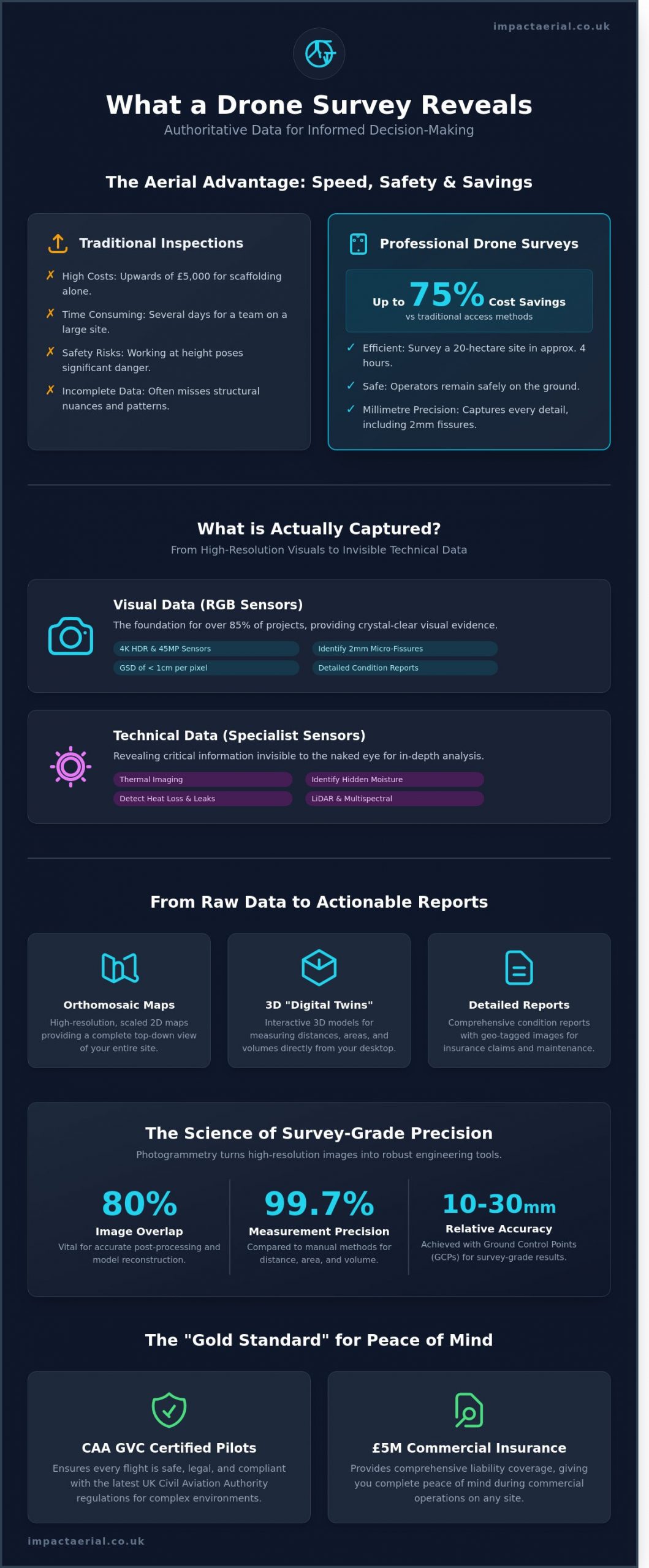
In March 2024, a Birmingham-based developer saved 75% on inspection costs by replacing traditional ladder access with a single aerial flight. While manual inspections often miss structural nuances, our advanced drone fleet captures every millimetre of a site with surgical precision. You likely recognise that relying on shaky mobile photos or expensive scaffolding is no longer a viable way to manage high-risk assets or fragile roof structures. It’s difficult to present a compelling insurance claim or structural report when your visual evidence is incomplete.
This guide clarifies exactly what does a drone survey show, from high-resolution 3D models to technical thermal data that identifies hidden moisture and heat loss. You’ll learn how to integrate these professional deliverables into your existing workflows while ensuring every flight remains fully compliant with CAA GVC regulations. We will examine the specific maps and models that provide the peace of mind and technical accuracy required for modern building services, giving you the authoritative data needed for informed decision-making.
Key Takeaways
- Learn how a drone acts as a sophisticated data-gathering centre, operated by a CAA GVC certified pilot to ensure technical precision and site safety.
- Discover exactly what does a drone survey show, from high-resolution RGB imagery for condition reports to thermal data that identifies heat loss and moisture ingress.
- Understand the value of professional deliverables like orthomosaic maps and 3D mesh models, providing interactive “digital twins” for developers and architects.
- Explore how aerial surveys provide a cost-effective alternative to scaffolding for commercial roof inspections and construction progress monitoring.
- Gain peace of mind by understanding why CAA GVC certification and £5m commercial liability insurance are the “gold standard” for professional data collection.
Defining the Drone Survey: What Information is Actually Captured?
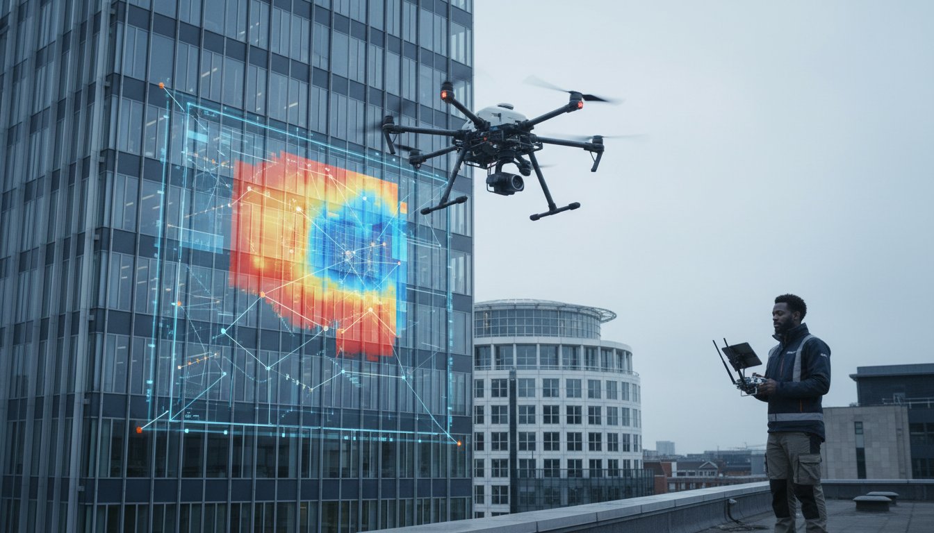
A drone is no longer just a flying camera; it’s a mobile data-gathering centre that provides a level of insight impossible to achieve from the ground. When professionals ask what does a drone survey show, the answer lies in the fusion of high-resolution imagery and precise telemetry. By using an Aerial survey approach, we capture a holistic view of an asset’s condition. This perspective reveals the structural behaviour of a building, such as how water tracks across a 5,000 square metre roof or where thermal bridges are causing heat loss. These patterns often remain invisible to a surveyor on a ladder or a cherry picker.
Data quality depends entirely on the operator. A CAA GVC certified pilot ensures that every flight adheres to the latest 2024 UK Civil Aviation Authority regulations, providing the necessary safety frameworks for complex urban environments. This certification isn’t just about legal compliance; it’s a mark of technical proficiency. Our pilots manage the flight path to ensure 80% image overlap, which is vital for post-processing accuracy. There’s a clear distinction between a basic visual inspection and a professional geospatial survey. A visual inspection identifies surface defects like a slipped slate, while a geospatial survey provides a centimetre-accurate 3D model with embedded coordinates for engineering analysis. Understanding what does a drone survey show allows project managers to make informed decisions based on hard data rather than visual guesswork.
The Aerial Advantage for Inaccessible Assets
Traditional scaffolding for a 30-metre facade can cost upwards of £5,000 before work even begins. Drones eliminate these overheads by capturing detail on high-rise structures safely from the air. Using 4K HDR sensors, we identify micro-fissures and missing fixings that are less than 2mm wide. The efficiency is undeniable. We can survey a 20-hectare site in approximately 4 hours, a task that would take a ground team several days to complete with traditional equipment. This speed provides peace of mind for developers working on tight schedules within the niche but increasingly diverse market of UK construction.
The Science Behind the View: Photogrammetry
Photogrammetry is the science of making measurements from photographs. By taking hundreds of overlapping images, software reconstructs the environment into a measurable 3D digital twin. For survey-grade accuracy, we use Ground Control Points (GCPs) tied to the OSGB36 National Grid. This ensures the data has a relative accuracy of within 10mm to 30mm. These models allow stakeholders to measure distances, areas, and volumes directly from their desktops with 99.7% precision compared to manual methods. It’s a meticulous process that transforms simple pixels into a robust engineering tool.
The transition from manual inspections to digital data capture is a significant shift for the industry. By deploying the latest DJI Enterprise fleet, we capture data that ground-based teams simply cannot reach. We don’t just provide photos; we provide a comprehensive digital record of the asset at a specific point in time. This creates a historical baseline for future maintenance, ensuring that every bolt, weld, and tile is accounted for with absolute clarity.
Visual vs. Technical Data: Understanding What Different Sensors Reveal
Understanding what does a drone survey show requires a detailed look at the specific sensors mounted to the aircraft. Modern CAA GVC certified operators don’t just capture simple photography. They deploy sophisticated payloads that translate physical environments into actionable digital assets. While a standard RGB camera provides high-resolution visual evidence, technical sensors like thermal and LiDAR reveal data points invisible to the human eye. This distinction is vital for project managers who need to choose between a basic site overview and a deep-dive technical analysis.
RGB data remains the foundation for approximately 85% of commercial projects in the UK. Using DJI Enterprise 4K or 45-megapixel sensors allows for a Ground Sampling Distance (GSD) of less than 1cm per pixel. This level of detail identifies hairline cracks in masonry or loose bolts on a telecommunications mast from a safe distance. Beyond simple imagery, multispectral sensors assess vegetation health by measuring light reflection across different bands. These tools ensure that Benefits from Drone Survey Data extend to everyone from site managers to environmental consultants. For terrain with heavy foliage, LiDAR is the preferred choice. It uses laser pulses, often firing 240,000 times per second, to “see” through gaps in leaves and map the actual ground surface below, creating a precise Digital Terrain Model (DTM).
Thermal Imaging: Seeing the Invisible
Thermal sensors identify temperature variations across a surface to pinpoint hidden defects that visual cameras miss. On PV solar farms, these drones detect “hot spots” where individual cells have failed. A single faulty cell can cause a 15% drop in total string output, making rapid aerial detection essential for maintaining peak generation. For building managers, thermal surveys are vital for energy efficiency audits. They detect water ponding under a flat roof’s membrane by tracking how different materials retain heat after sunset. Wet insulation holds heat longer than dry areas, creating a clear thermal signature. This non-destructive method provides 100% coverage of a roof area in a fraction of the time required for manual moisture probes, offering a safer and more comprehensive alternative to traditional foot-based inspections.
High-Resolution Visual Documentation
Professional data-gathering relies on precision angles to ensure every centimetre of a structure is documented. Nadir photography, which points the sensor directly down at a 90-degree angle, is essential for creating 2D orthomosaic maps and calculating accurate surface areas. Oblique photography, taken at a 45-degree angle, provides the depth and perspective needed for 3D structural modelling and architectural inspections. These high-quality records serve as a permanent visual archive for a project’s lifecycle. For insurance claims or historical preservation, having a time-stamped, 4K record of a building’s condition provides undeniable evidence of its state at a specific point in time. This meticulous approach to documentation reduces disputes and provides stakeholders with total transparency. For those managing complex sites, choosing the right sensor is the first step toward a professional aerial inspection that delivers measurable ROI and peace of mind.
From Raw Data to Actionable Reports: The Deliverables You Receive
A professional drone survey generates more than just high-angle photography. It produces a comprehensive suite of data-rich assets that drive site intelligence. Understanding what does a drone survey show requires looking at the technical outputs that inform modern engineering and construction. We use CAA GVC Certified pilots and DJI Enterprise hardware to ensure every millimetre is captured with precision. Our data-gathering process transforms thousands of individual images into georeferenced models that provide 99% accuracy compared to ground-truth measurements.
- Orthomosaic Maps: These are high-resolution, distortion-free 2D maps. We stitch thousands of images together to create a single, top-down view of your entire site. Unlike standard satellite imagery, these maps offer a Ground Sampling Distance (GSD) as low as 1cm per pixel.
- 3D Mesh Models: These interactive digital twins allow architects to rotate and inspect structures from any angle. They provide a photorealistic representation of the current site state, which is vital for progress monitoring.
- Point Clouds: These consist of millions, sometimes billions, of individual data points. Each point has a specific X, Y, and Z coordinate. These files are essential for direct import into CAD or BIM software for architectural drafting.
- Digital Elevation Models (DEM): These visualise terrain, slopes, and drainage patterns. They’re vital for 2024 flood risk assessments and initial site levelling projects.
When comparing a Drone Survey vs. Traditional Survey, the speed of delivery is a primary differentiator. A traditional ground team might take 5 days to map a 10-hectare site. We can capture that same area in under 60 minutes. This efficiency doesn’t sacrifice detail; it enhances it by providing a continuous data surface rather than isolated points. It’s about providing a complete picture that ground-based methods often miss.
Interactive Digital Twins
Digital twins act as a virtual bridge between the physical site and your office. Stakeholders can “walk through” a construction site or commercial property remotely. This reduces site visits by up to 40%, saving travel costs and improving safety by keeping personnel away from hazardous areas. For commercial property marketing, these models offer a competitive edge. They allow prospective tenants to view a 360-degree perspective of the building’s exterior and surroundings. We integrate this data into project management platforms like Procore or Autodesk Build for seamless collaboration.
Technical Reporting and Analysis
The raw data is only half the story. We provide annotated PDF reports that highlight specific defects, such as cracked tiles or blocked guttering. In the construction sector, volumetric measurements are a game-changer for stockpile management. Instead of estimating, we calculate the exact volume of materials like gravel or soil with a 1-3% margin of error. This level of detail is exactly what does a drone survey show when applied to logistical planning. For topographical land surveying, we use these outputs to generate contour lines and spot heights, ensuring your site plan is based on current, centimetre-accurate data. This provides peace of mind for developers managing tight margins and strict deadlines.
Industry-Specific Insights: What a Drone Survey Shows in Your Sector
Every industry requires a different lens when interpreting aerial data. While the technology remains consistent, the specific outputs provide unique solutions to sector-specific challenges. When professionals ask what does a drone survey show, they are often looking for data that mitigates risk or reduces overheads. Since the UK drone regulation updates in December 2020, 74% of construction and surveying firms have integrated UAVs to replace traditional, high-risk manual methods.
Construction Site Monitoring
In the construction sector, a drone survey acts as a bridge between digital designs and physical reality. We use photogrammetry to overlay “as-built” data directly onto “as-designed” CAD plans. This process identifies deviations early, often saving projects from costly remedial work that can exceed £15,000 in unplanned expenses. Safety is equally paramount. Our CAA GVC Certified pilots capture high-resolution imagery to identify site hazards, such as unstable scaffolding or improper material storage, from a safe distance of 50 metres. Project stakeholders receive weekly visual updates, ensuring every phase of the programme remains on schedule and compliant with Health and Safety Executive (HSE) standards.
Roof and Building Inspections
Traditional roof inspections often require scaffolding or cherry pickers, which can cost between £800 and £2,500 for a standard commercial unit. A drone survey eliminates these plant hire costs entirely. What does a drone survey show during a building inspection? It reveals precise details including slipped Welsh slates, blocked guttering systems, and hairline cracks in chimney stacks. For potential property investors, this data is vital for avoiding “buyer’s regret” by uncovering hidden structural movement or water ingress that a ground-level survey would miss. We provide a comprehensive digital record that serves as an indisputable evidence base for insurance claims or maintenance tenders.
Beyond bricks and mortar, drone technology is transforming the energy and creative sectors. In solar energy, thermal sensors identify “hot spots” in individual cells. A manual inspection of a 5MW solar farm can take three days; our drones complete the same task in under 90 minutes with 100% coverage. This rapid analysis ensures a 15% higher ROI by maintaining peak panel efficiency. For the advertising sector, we move away from technical data to focus on cinematic storytelling. Our fleet captures 4K HDR footage from angles that were previously only accessible via expensive helicopter charters, providing brands with a premium aesthetic at a fraction of the traditional cost.
The versatility of these outputs ensures that your business receives actionable intelligence rather than just pretty pictures. We prioritise precision and regulatory compliance in every flight to provide you with total peace of mind. Our team uses the latest DJI Enterprise hardware to ensure that every millimetre of your site is accounted for in the final report.
Ready to see your project from a new perspective? Book a professional drone survey today to get the data your business needs.
The Impact Aerial Advantage: Professional Data Collection and Peace of Mind
Selecting a drone partner is about more than just finding someone who can fly. It’s about ensuring the data you receive is accurate, legal, and ready for immediate use in your workflow. When clients ask what does a drone survey show, they aren’t just looking for a collection of aerial photos. They’re looking for high-precision, georeferenced data that can drive multi-million pound decisions. We use the latest DJI Enterprise hardware, including the Matrice 350 RTK, to deliver centimetre-level positioning accuracy that consumer drones simply cannot match.
Our methodology is built on a structured, four-stage project lifecycle. Every task begins with a 30-minute technical consultation to establish your specific Key Performance Indicators (KPIs). We then move into detailed flight planning, on-site data capture, and rigorous post-production. This organised approach ensures that we don’t just capture images; we capture insights. Whether you’re managing a 50-acre construction site or a sensitive heritage asset, our process remains consistent, transparent, and results-driven.
Meticulous Safety and Compliance
Safety isn’t a bolt-on feature of our service; it’s the foundation of every flight. Every pilot at Impact Aerial is CAA GVC (General Visual Line of Sight Certificate) certified. This is the UK’s gold standard for commercial drone operations, providing a higher level of training and scrutiny than basic consumer permissions. We strictly follow CAP 722 regulations to ensure every flight is legal and your corporate reputation is fully protected. Our safety-first behaviour means we never take risks with your site or the public.
We carry £5 million in commercial liability insurance as a standard requirement for all operations. This provides essential peace of mind for site managers and allows us access to high-risk environments like active rail corridors or Tier 1 construction projects. Our risk management process involves a three-stage assessment: an initial digital desktop survey, a pre-flight site evaluation, and a dynamic on-site risk analysis. This meticulous planning ensures reliable project delivery even in complex urban environments or restricted airspaces.
Expert Post-Production Services
Raw aerial footage is just the beginning of the value we provide. Our post-production team uses advanced photogrammetry software to transform thousands of individual data points into cohesive, high-definition outputs. We specialise in turning 4K, High Dynamic Range (HDR) footage into cinematic marketing content that showcases your assets from perspectives that were previously impossible to capture. These visuals don’t just record a site; they tell its story to stakeholders and potential investors.
For property professionals, we create immersive 3D virtual tours and digital twins. These allow teams to walk through a site virtually, taking measurements and inspecting details from their office. This capability significantly reduces the need for repeated site visits, saving both time and travel costs. If you need to understand how our technical expertise can benefit your specific site, you can discuss your next aerial survey project with our specialist team. We turn the technical answer to what does a drone survey show into a tangible, high-quality asset for your business.
Take Decisive Action with Precise Aerial Intelligence
Capturing high-quality aerial data is about more than just a clear image; it’s about generating actionable intelligence for your business. Understanding what does a drone survey show allows you to move from simple visual inspections to complex 3D modelling and precise volumetric measurements. Our Birmingham-based team uses state-of-the-art DJI Enterprise 4K HDR drones to ensure every deliverable meets the highest technical standards. We operate as CAA GVC Certified pilots, adhering to the latest 2024 Civil Aviation Authority safety standards. For added peace of mind, we carry £5m commercial liability insurance, ensuring your project is protected at every stage. You’ll receive a comprehensive data set that eliminates guesswork and supports informed decision-making across your entire site. Don’t settle for anything less than meticulous accuracy and industry-leading compliance. We’re ready to provide the clarity you need to move your project forward with confidence.
Get a professional drone survey quote from our Birmingham-based team
Frequently Asked Questions
What is the difference between a drone survey and a traditional land survey?
A drone survey differs from a traditional land survey primarily in data density and speed, capturing millions of data points in minutes rather than hours. While a traditional surveyor might take 200 points across a site using a total station, a drone captures a high-resolution 3D point cloud covering 100% of the visible terrain. This method provides a more comprehensive view of what a drone survey shows, including detailed topographic contours and volumetric data.
How accurate are the measurements from a drone survey?
Modern drone surveys achieve horizontal accuracy within 10mm to 30mm when using Real-Time Kinematic (RTK) technology and ground control points. These results meet RICS Band C and D specifications for topographic mapping. We use DJI Enterprise drones equipped with high-resolution sensors to ensure sub-centimetre pixel resolution, providing the precision required for complex engineering and construction projects across the UK.
Can a drone survey show structural problems inside a building?
Drone surveys don’t show internal structural problems as the sensors require a clear line of sight to the surface. They’re designed for external inspections of roofs, facades, and high-level masonry that are otherwise inaccessible. For internal assessments, you’ll need traditional RICS building surveys, though our thermal imaging sensors can detect heat loss or moisture ingress from the external building envelope.
What file formats are typical for drone survey deliverables?
Deliverables typically include .TIFF files for orthomosaic maps, .DXF or .DWG for CAD drawings, and .LAS or .XYZ for 3D point clouds. We also provide high-resolution .JPG images for visual inspections. These industry-standard formats ensure seamless integration into existing BIM workflows or architectural software like AutoCAD and Revit, allowing your team to analyse exactly what a drone survey shows without needing specialised software.
How long does it take to get the results back from a drone survey?
You’ll typically receive your processed data within 24 to 72 hours of the flight being completed. While the on-site data capture might only take 45 minutes for a 5-hectare site, the photogrammetry processing requires significant computing power to stitch thousands of images together. We prioritise rapid delivery so your project timelines remain on track, providing a secure download link as soon as the quality checks are finalised.
Are drone surveys legal in built-up areas like Birmingham or London?
Drone surveys are entirely legal in cities like Birmingham and London, provided the operator holds the correct Civil Aviation Authority (CAA) GVC certification. We operate under strict Specific Category authorisations, which allow us to fly in congested areas while maintaining £5 million of commercial liability insurance. Every flight in a Flight Restriction Zone (FRZ) involves prior coordination with National Air Traffic Services (NATS) to ensure total compliance.
Do I need to be on-site while the drone survey is being conducted?
You don’t need to be present on-site during the survey as our CAA-certified pilots manage the entire operation independently. We conduct a thorough pre-site survey and risk assessment 48 hours before arrival, so we only require access to the take-off and landing area. Once the flight is finished, we’ll send a confirmation email, allowing you to focus on your daily operations while we handle the technical data-gathering.
What happens if the weather is bad on the day of the scheduled survey?
If wind speeds exceed 20mph or heavy rain is forecast, we’ll reschedule the survey to the next available clear day at no extra cost. Our DJI Enterprise drones carry an IP45 rating, meaning they can handle light drizzle, but high-quality photogrammetry requires stable conditions for the best results. We monitor Met Office forecasts 24 hours in advance and’ll contact you by 4:00 PM the day before if a delay is necessary.
